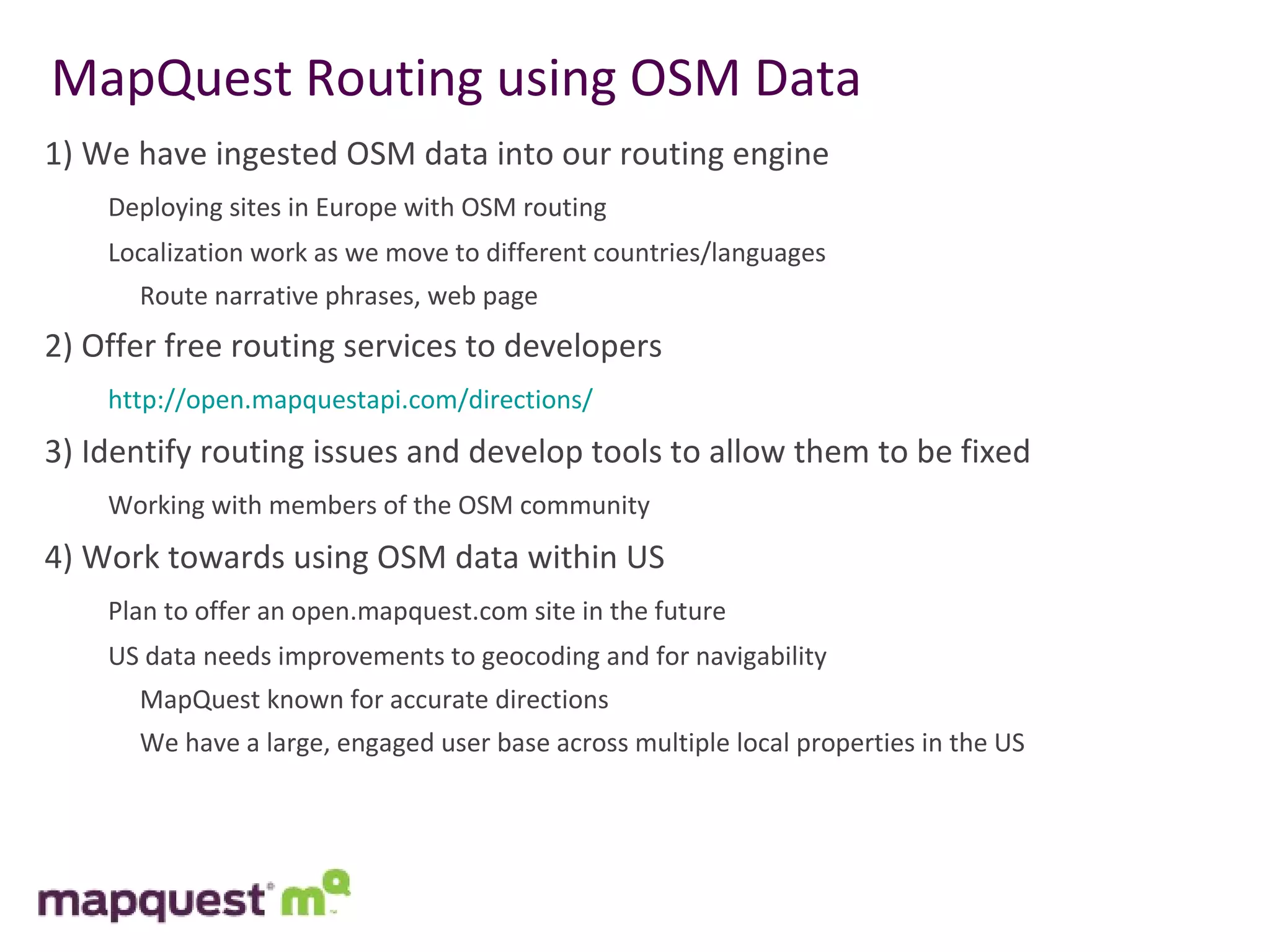
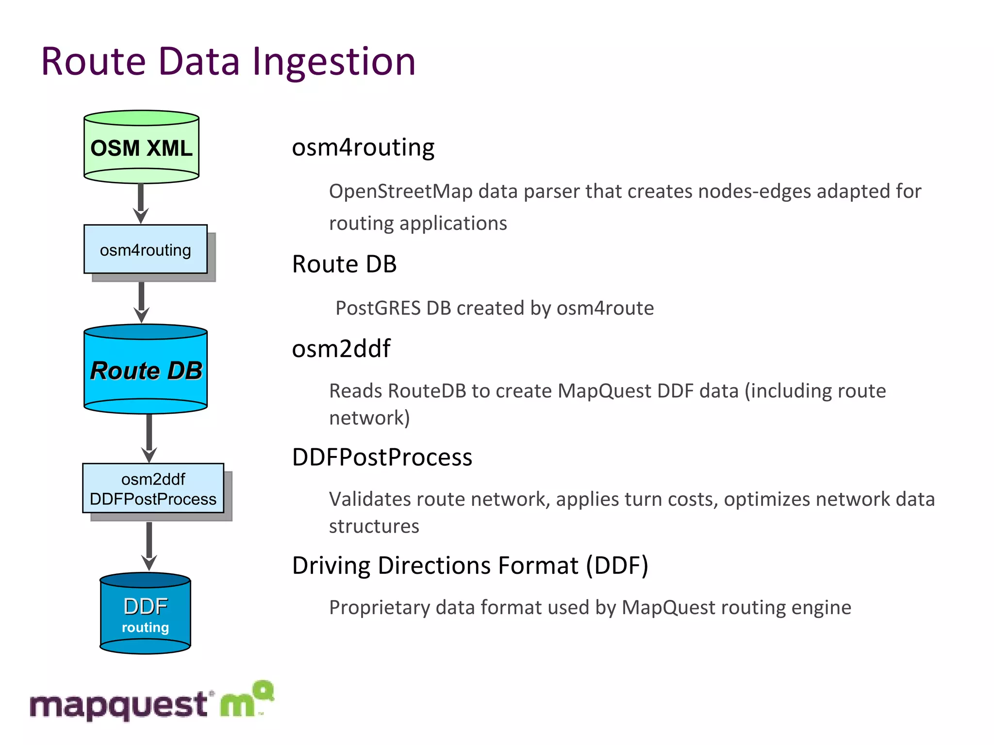
1) MapQuest has ingested OSM data into their routing engine and is deploying sites in Europe using OSM routing data. They plan to offer similar services for routing in the US using OSM data after improvements are made.
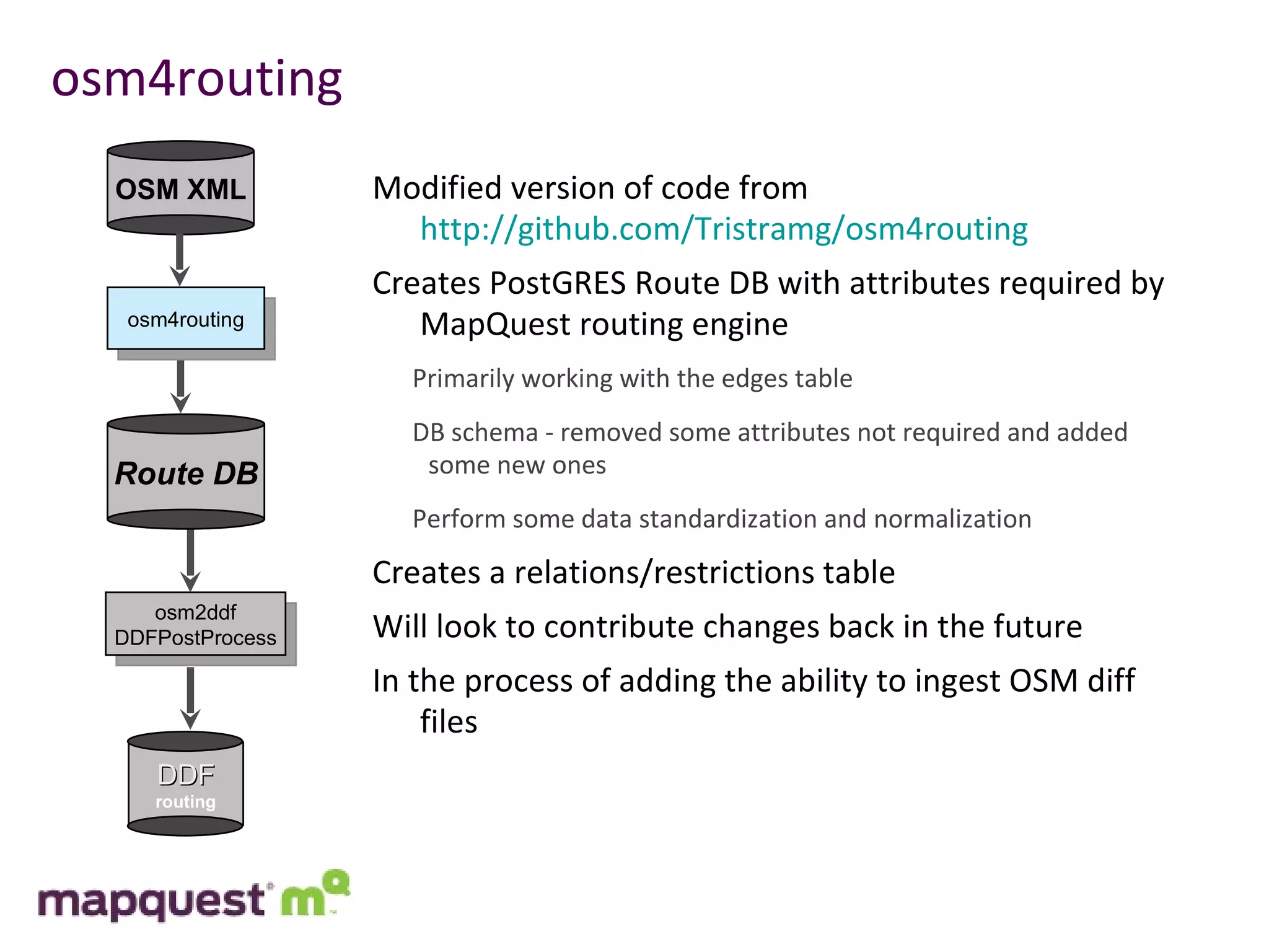
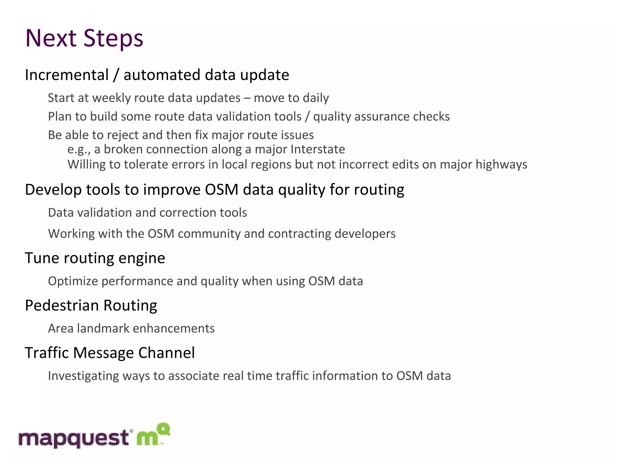
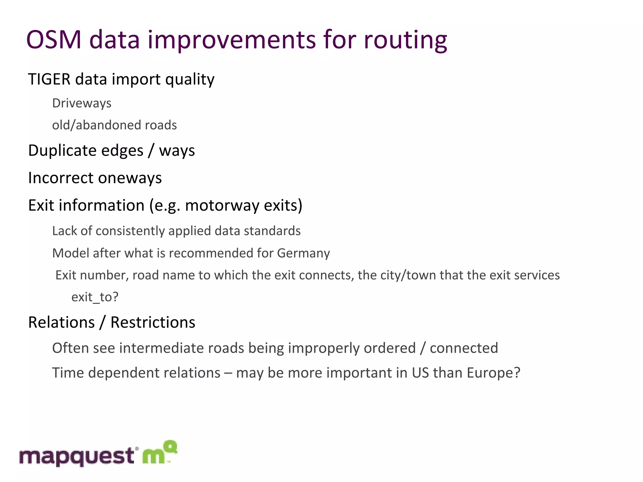
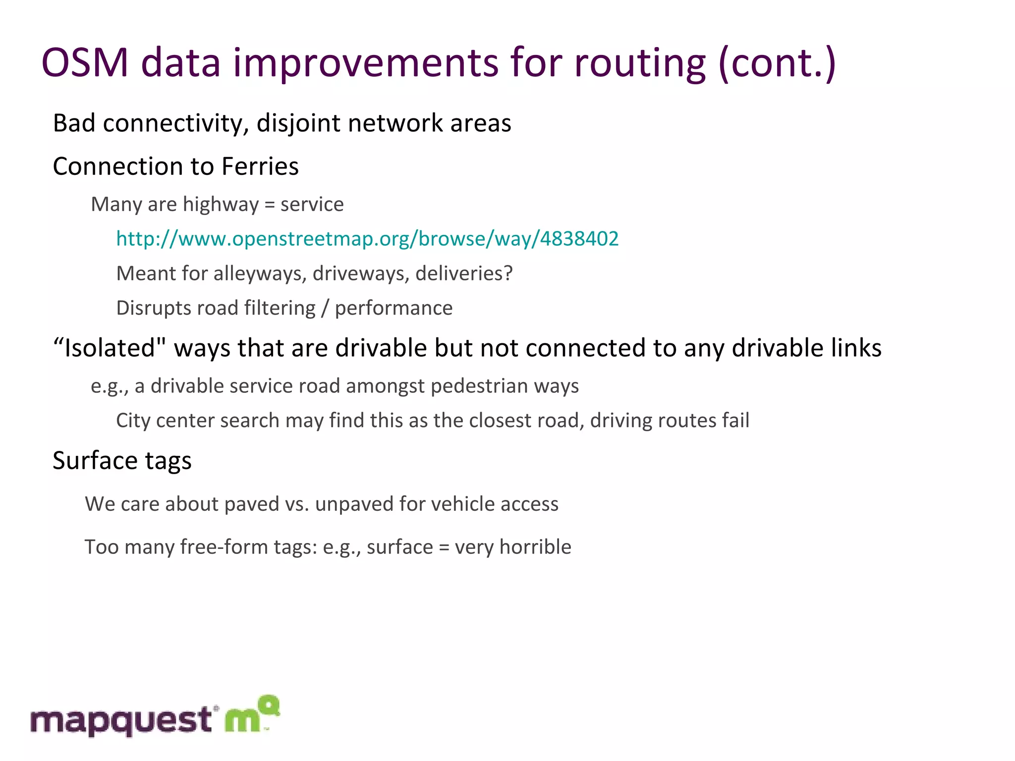
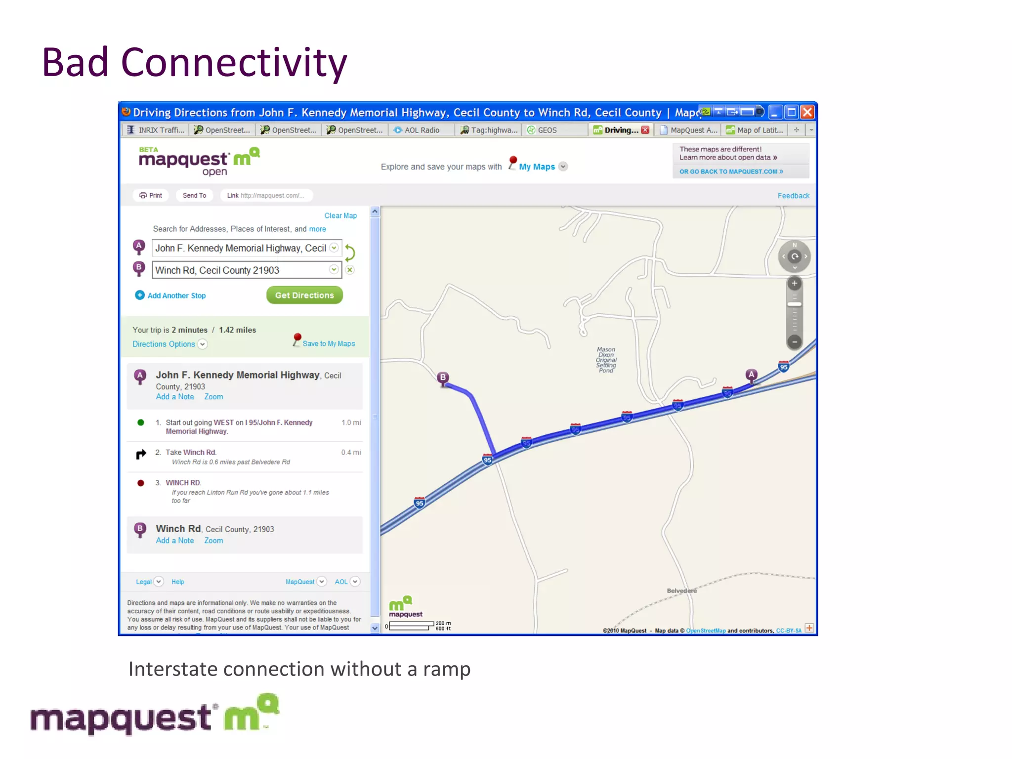
2) MapQuest is working on improving OSM data quality within the US by identifying issues, developing tools for fixing problems, and partnering with OSM contributors.
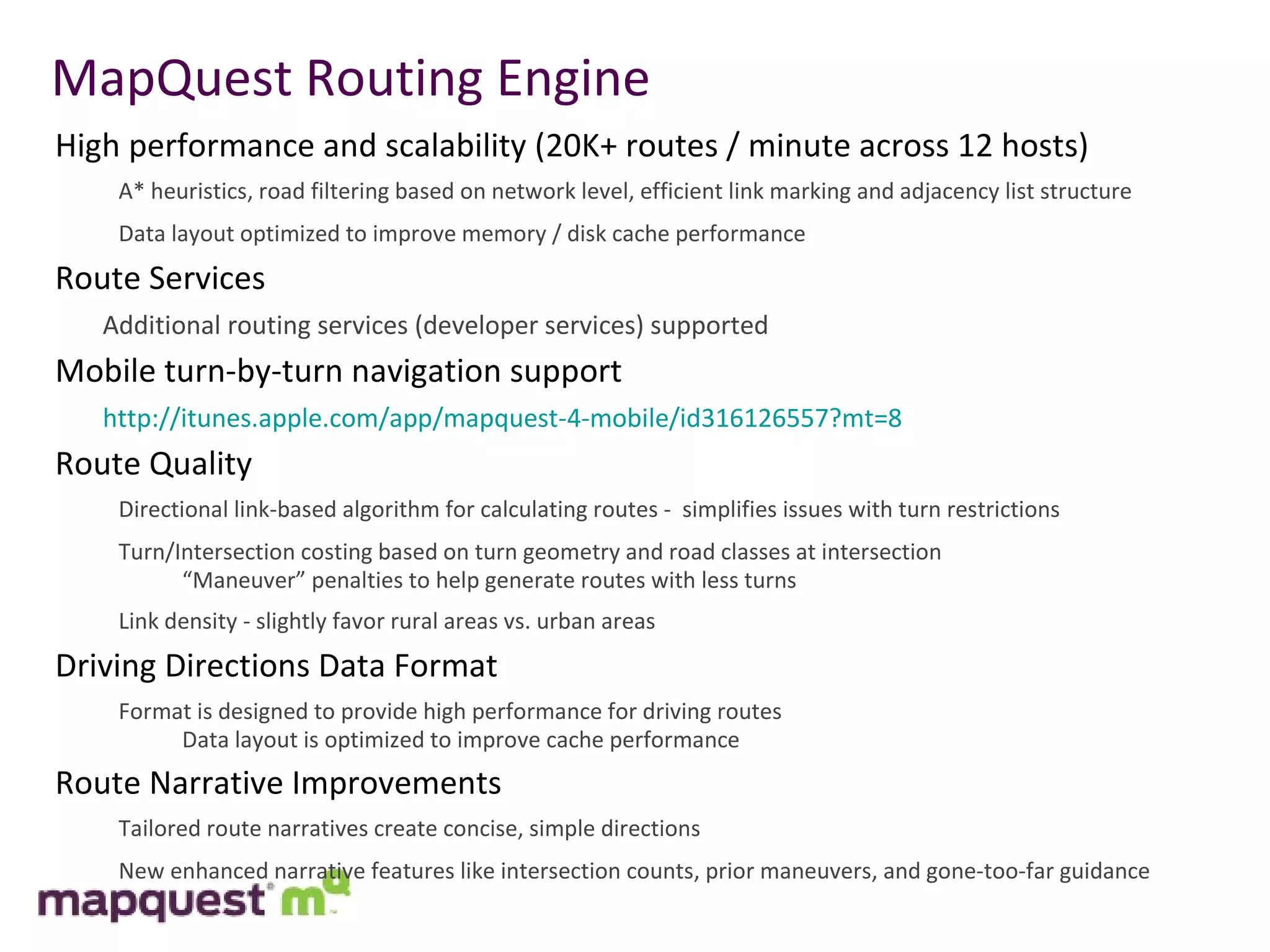
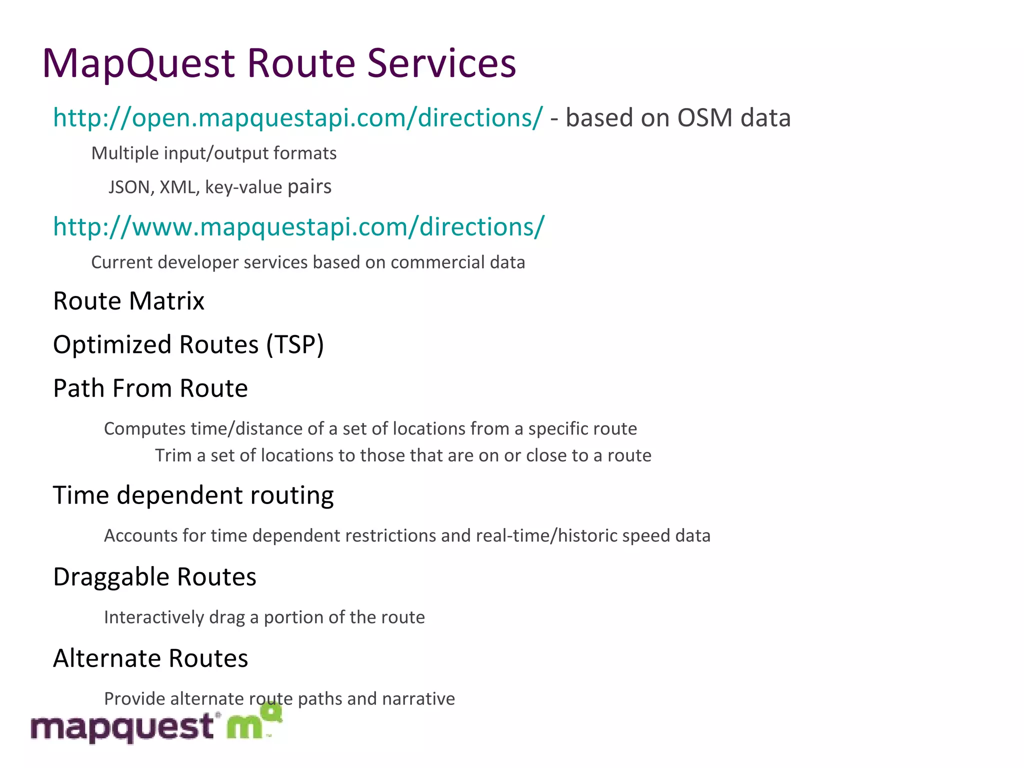
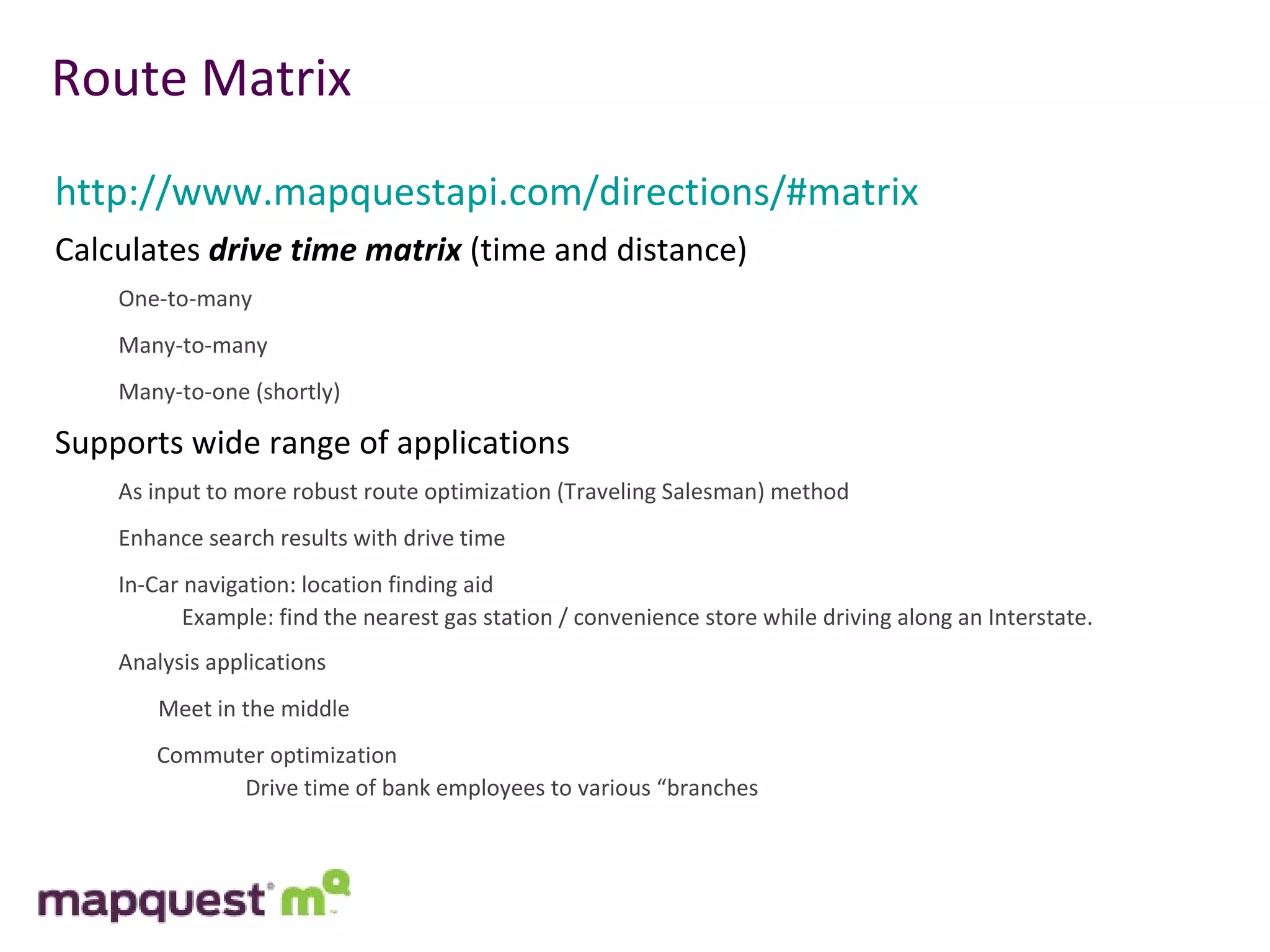
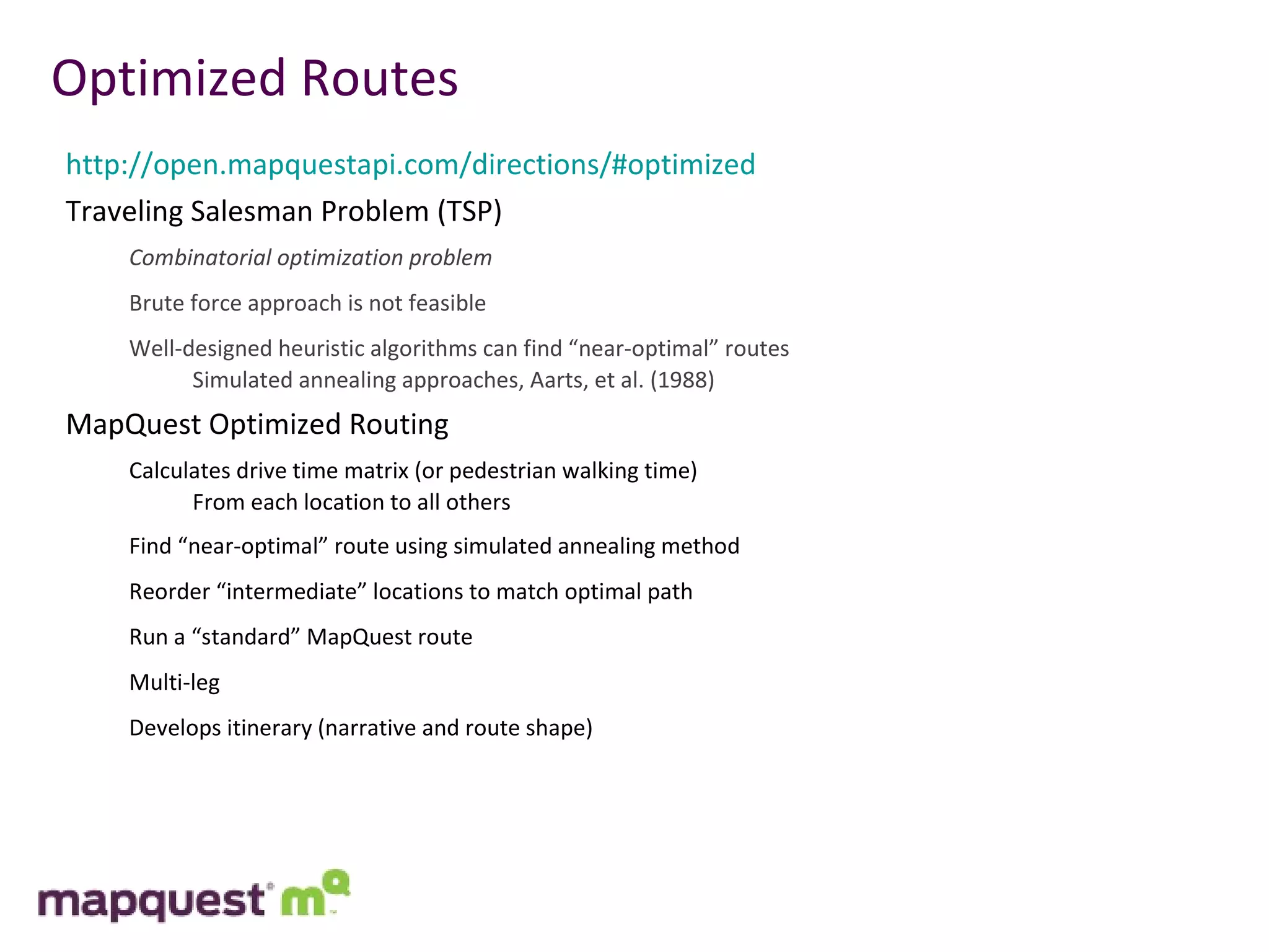
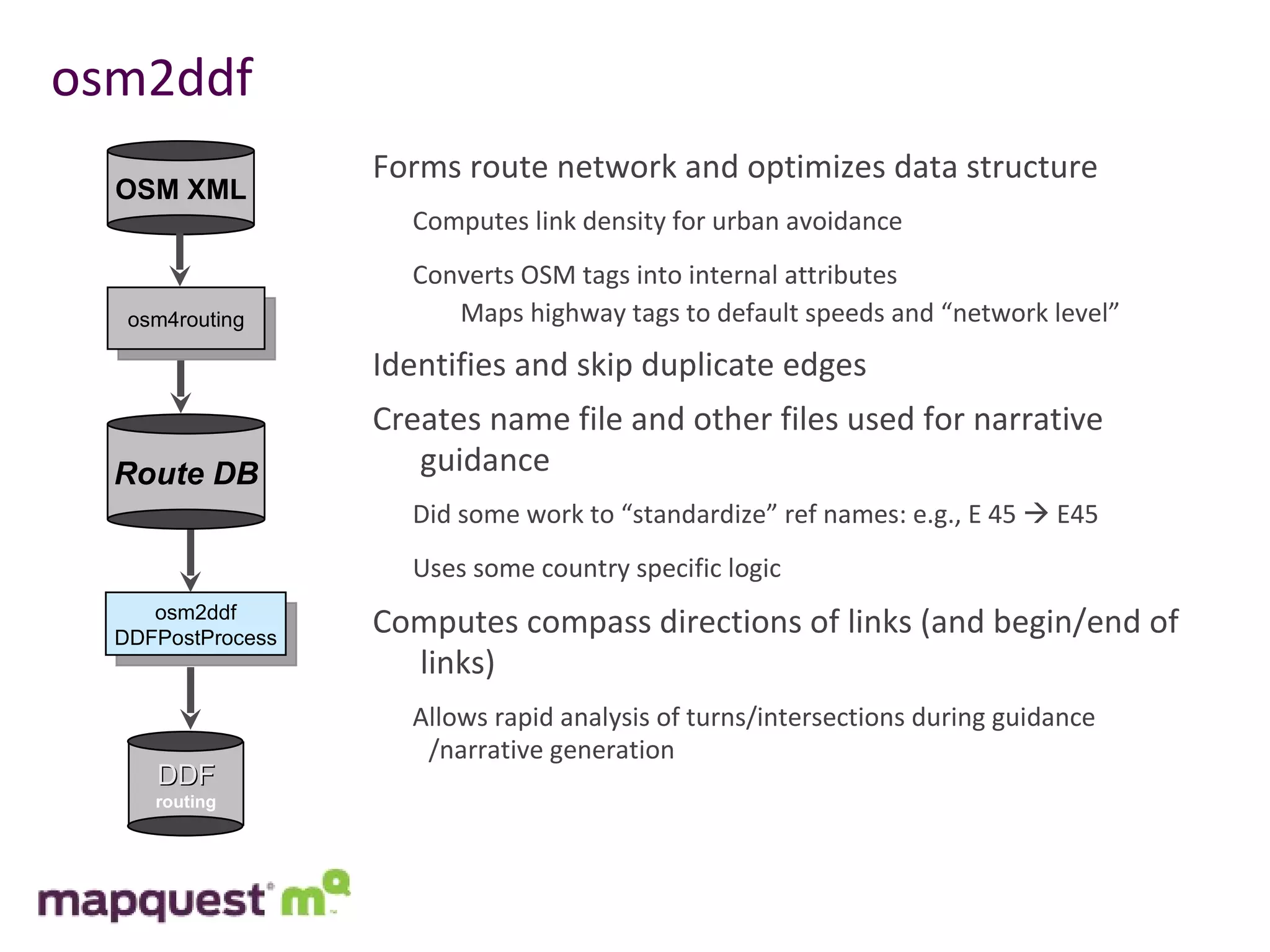
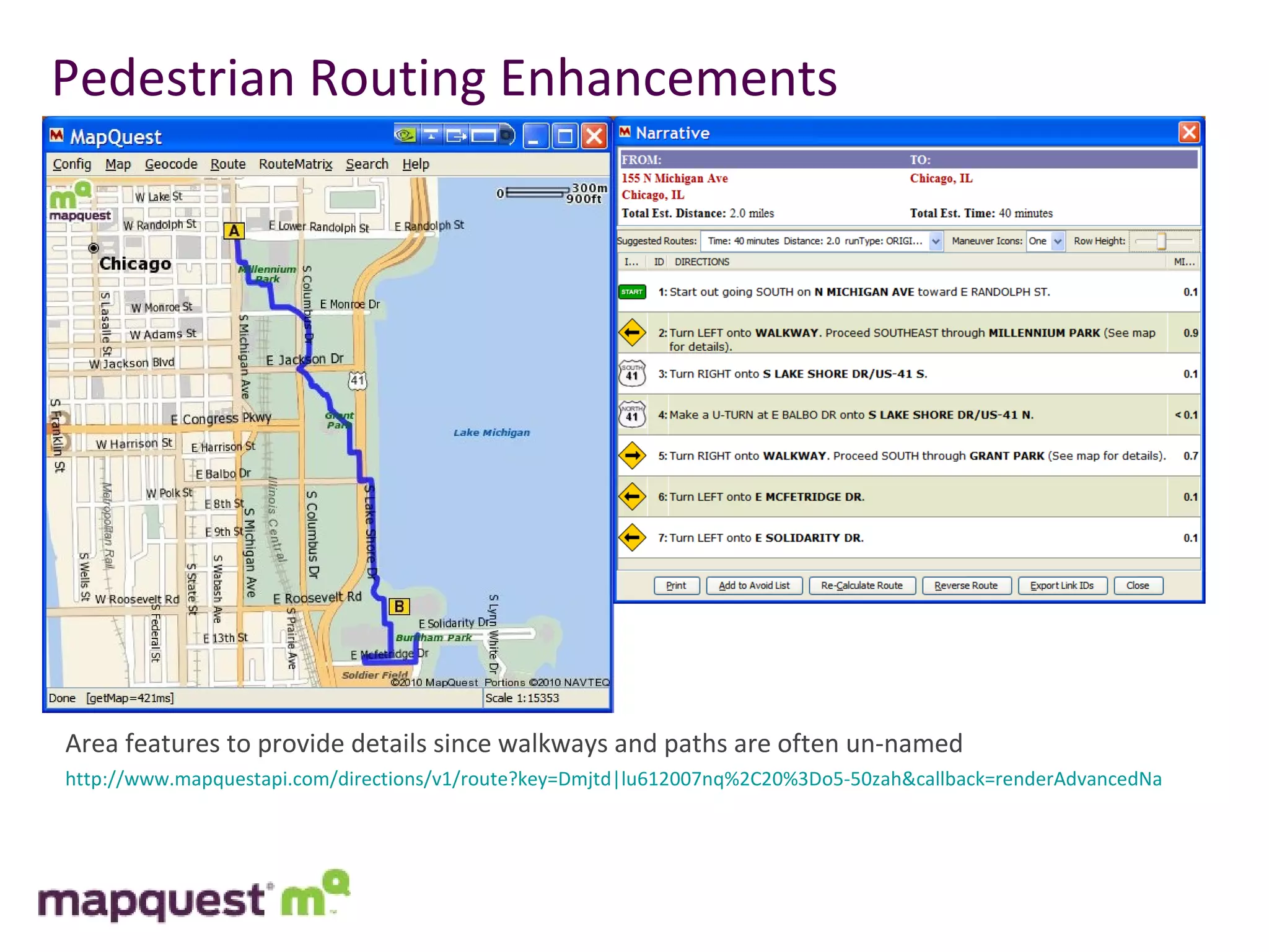
3) Their goals include making pedestrian routing enhancements, associating real-time traffic data with OSM, and continuing to optimize their routing engine for high performance when using OSM data.
![Mapquest and OSM MapQuest UK launched at SOTM in Girona UK site first: http://open.mapquest.co.uk/ Will launch Germany and France shortly MapQuest France is next New technology stack (for MapQuest) Mapnik, TileCache, Nominatim, OSM data Routing still uses proprietary engine Established $1MM internal fund for OpenStreetMap investment Focus: improve data within the United States Use resources from MapQuest and Patch to engage audiences to contribute Paying developers to contribute to open source projects Contact us at [email_address] with questions or comments](https://image.slidesharecdn.com/sotmusrouting-100815094553-phpapp02/75/SoTM-US-Routing-3-2048.jpg)
![Questions? David Nesbitt [email_address] 717-581-4874](https://image.slidesharecdn.com/sotmusrouting-100815094553-phpapp02/75/SoTM-US-Routing-20-2048.jpg)


![Coded Agents – with UiPath SDK + LangGraph [Virtual Hands-on Workshop]](https://cdn.slidesharecdn.com/ss_thumbnails/codedagentsdeck-251215155422-5497c599-thumbnail.jpg?width=640&height=640&fit=bounds)


