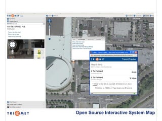
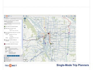
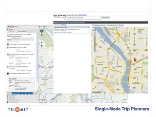
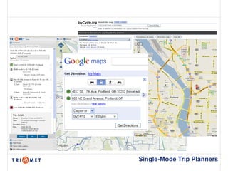
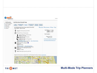
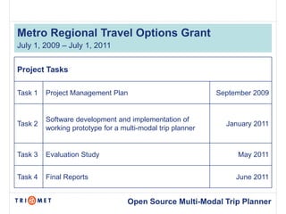
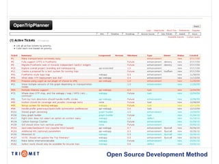
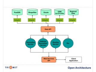
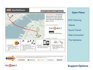
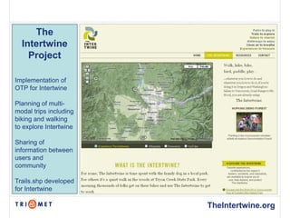
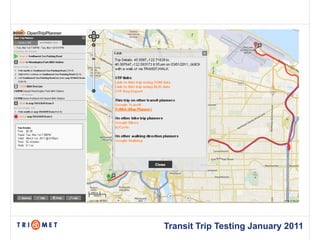
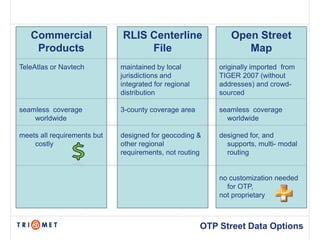
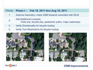
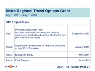
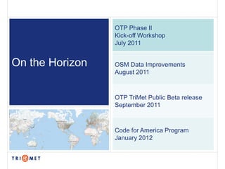
Open Trip Planner Project
C-Tran
March 4, 2011
Presented by Bibiana McHugh, IT Manager of Spatial Technologies
Google Trends – Most Popular Searches by City
Open Source Interactive System Map
Single-Mode Trip Planners
Multi-Mode Trip Planners
Metro Regional Travel Options Grant
July 1, 2009 – July 1, 2011


Project Tasks

Task 1   Project Management Plan                            September 2009


         Software development and implementation of
Task 2                                                        January 2011
         working prototype for a multi-modal trip planner


Task 3   Evaluation Study                                        May 2011


Task 4   Final Reports                                           June 2011


                                   Open Source Multi-Modal Trip Planner
Open Plans
Project Initiation Workshop July 2009
OpenTripPlanner.org
Open Source Development Method
OSM                 Regional
PostGIS     Shapefiles        Oracle
                                             OpenStreetMap            Data


Adapter     Adapter         Adapter            Adapter          Adapter


                                Data API


                          Address
          Geocoding                        Routing
                         Normalizer                          Etc.
           Service                         Service
                          Service


                              Web Services                        Client
                                  API                           Application


                                                              Open Architecture
GTFS Data           USGS National       Street Data
                          Elevation
                           Dataset
Transit Trip Planning                   Routing attributes required


                                                    Open Data
what can OPEN deliver in 9 months?
Demos running in 6 countries
Open Plans


NYC Planning

Atlanta

Sound Transit

Ride Connection

The Intertwine


Support Options
The
  Intertwine
    Project

Implementation of
OTP for Intertwine

Planning of multi-
modal trips including
biking and walking
to explore Intertwine

Sharing of
information between
users and
community

Trails.shp developed
for Intertwine

                        TheIntertwine.org
Transit Trip Testing January 2011
Commercial                RLIS Centerline                  Open Street
    Products                      File                           Map
TeleAtlas or Navtech         maintained by local           originally imported from
                             jurisdictions and             TIGER 2007 (without
                             integrated for regional       addresses) and crowd-
                             distribution                  sourced

seamless coverage            3-county coverage area        seamless coverage
    worldwide                                                worldwide

meets all requirements but   designed for geocoding &      designed for, and
    costly                   other regional                  supports, multi- modal
                             requirements, not routing       routing


                                                           no customization needed
                                                             for OTP,
                                                           not proprietary


                                                       OTP Street Data Options
Priority   Phase I –     Feb 18, 2011 thru Aug 18, 2011
   1       Improve Geometry- make OSM linework coincident with RLIS
           Add Additional Linework:
   2
               Trails.shp, bicycle.shp, pedestrian paths, major waterways
   3       Verify Directionality for bicycle routing
   4       Verify Turn Restrictions for bicycle routing


                                                          OSM Improvements
Metro Regional Travel Options Grant
July 1, 2011 – July 1, 2013

OTP Project Tasks

         Project Management Plan
         work with stakeholders to identify and prioritize
Task 1                                                            September 2011
         requirements and that can be delivered within the two-
         year timeframe and budget


         Application Development of Features prioritized
Task 2                                                              January 2011
         at July 2011 Workshop

Task 3   Evaluation Study                                              May 2011

Task 4   Final Reports                                                 June 2011

                                                     Open Trip Planner Phase II
Features Needed to Replace ATIS
1. Ability to print, email, and SMS output
2. Fare calculations
3. Return and prioritization of multiple trip itineraries
4. Language translation
5. Graph/chart to easily change variables for trip plans
6. Enhancements based on feedback from public beta release
7. Geocoder to locate addresses and landmarks
8. Administrative tools for staff to continue maintenance of the application and
   data, including transfers.
9. Tools for Customer Service staff
10. Improve stability of the API for third-party developers
11. Extend the availability of the service to mobile devices
12. Trip disability options


                                                               Open Trip Planner
OTP Phase II
                 Kick-off Workshop
                 July 2011


On the Horizon   OSM Data Improvements
                 August 2011


                 OTP TriMet Public Beta release
                 September 2011


                 Code for America Program
                 January 2012

Open tripplanner

  • 1.
    Open Trip PlannerProject C-Tran March 4, 2011 Presented by Bibiana McHugh, IT Manager of Spatial Technologies
  • 2.
    Google Trends –Most Popular Searches by City
  • 3.
    Google Trends –Most Popular Searches by City
  • 4.
    Google Trends –Most Popular Searches by City
  • 5.
  • 6.
  • 7.
  • 8.
  • 9.
  • 10.
  • 11.
  • 12.
  • 13.
    Metro Regional TravelOptions Grant July 1, 2009 – July 1, 2011 Project Tasks Task 1 Project Management Plan September 2009 Software development and implementation of Task 2 January 2011 working prototype for a multi-modal trip planner Task 3 Evaluation Study May 2011 Task 4 Final Reports June 2011 Open Source Multi-Modal Trip Planner
  • 14.
  • 15.
  • 16.
  • 17.
  • 18.
    OSM Regional PostGIS Shapefiles Oracle OpenStreetMap Data Adapter Adapter Adapter Adapter Adapter Data API Address Geocoding Routing Normalizer Etc. Service Service Service Web Services Client API Application Open Architecture
  • 19.
    GTFS Data USGS National Street Data Elevation Dataset Transit Trip Planning Routing attributes required Open Data
  • 20.
    what can OPENdeliver in 9 months?
  • 21.
    what can OPENdeliver in 9 months?
  • 22.
    Demos running in6 countries
  • 23.
    Open Plans NYC Planning Atlanta SoundTransit Ride Connection The Intertwine Support Options
  • 24.
    The Intertwine Project Implementation of OTP for Intertwine Planning of multi- modal trips including biking and walking to explore Intertwine Sharing of information between users and community Trails.shp developed for Intertwine TheIntertwine.org
  • 25.
  • 26.
    Commercial RLIS Centerline Open Street Products File Map TeleAtlas or Navtech maintained by local originally imported from jurisdictions and TIGER 2007 (without integrated for regional addresses) and crowd- distribution sourced seamless coverage 3-county coverage area seamless coverage worldwide worldwide meets all requirements but designed for geocoding & designed for, and costly other regional supports, multi- modal requirements, not routing routing no customization needed for OTP, not proprietary OTP Street Data Options
  • 27.
    Priority Phase I – Feb 18, 2011 thru Aug 18, 2011 1 Improve Geometry- make OSM linework coincident with RLIS Add Additional Linework: 2 Trails.shp, bicycle.shp, pedestrian paths, major waterways 3 Verify Directionality for bicycle routing 4 Verify Turn Restrictions for bicycle routing OSM Improvements
  • 28.
    Metro Regional TravelOptions Grant July 1, 2011 – July 1, 2013 OTP Project Tasks Project Management Plan work with stakeholders to identify and prioritize Task 1 September 2011 requirements and that can be delivered within the two- year timeframe and budget Application Development of Features prioritized Task 2 January 2011 at July 2011 Workshop Task 3 Evaluation Study May 2011 Task 4 Final Reports June 2011 Open Trip Planner Phase II
  • 29.
    Features Needed toReplace ATIS 1. Ability to print, email, and SMS output 2. Fare calculations 3. Return and prioritization of multiple trip itineraries 4. Language translation 5. Graph/chart to easily change variables for trip plans 6. Enhancements based on feedback from public beta release 7. Geocoder to locate addresses and landmarks 8. Administrative tools for staff to continue maintenance of the application and data, including transfers. 9. Tools for Customer Service staff 10. Improve stability of the API for third-party developers 11. Extend the availability of the service to mobile devices 12. Trip disability options Open Trip Planner
  • 30.
    OTP Phase II Kick-off Workshop July 2011 On the Horizon OSM Data Improvements August 2011 OTP TriMet Public Beta release September 2011 Code for America Program January 2012