SlideShare a Scribd company logo
1 of 16
Spectral Imagery & Sensory
Data Online Remote Sensing
Explosion
Medicine, Industry, 3-D Printing, Disaster Relief,
Earth Science, Outer Space Virtual In Situ
Exploration from the Office
Satellite Sensory Data collection
DATA VALUE ROWS & COLUMNS
Elevation, Moisture,
Vegetation, Land Cover
Thermal Data
REMOTE SENSING A Top
10 Emerging Online
Technology
• Images are a non invasive tomographic medical examination being broadcast on the internet.
Imagery provides three anatomical aspect views of a tumor. Examination is being done live.
Screenshot are captured by a board of assembled physicians seeking anomalies they feel need
attention. Live internal medical examination for the diagnosis plan and medical treatment
recommendations from a team of specialist on the other side of the planet
WWW.DATA.DISTRIBUTION
Remote Sensing
In Situ is the academic term meaning study in the field. Remote sensing allows all
technological disciplines worldwide in situ data research, 3D Printing, industrial
innovation, medical examination, and disaster evaluation planning from the lab or
office. Remote sensing utilizing airborne, satellite and portable sensor technology isn’t
new. Emerging online technological innovations that allow it’s in the field use thru any
form of cloud collaborative databank or live internet feed advancements; speeding
lifesaving technologies with the increasingly widespread use of sensors observing
passive responses to external stimulus in organic and no organic life forms and strata.
(King, 2013)
Emerging online information transfers that will continue to change the way humanity
respond to the earth’s changing environment, particularly in the area of
health, emergency medical assistance, advanced diagnosis, advance placement of
emergency facilities, and advance warning to communities of impending danger.
Examples include sensors that continually monitor bodily function – such as heart
rate, blood oxygen and blood sugar levels – and, if necessary, trigger a medical
response such as insulin provision. Advances rely on wireless communication between
devices, low power-sensing technologies and, sometimes, active energy harvesting.
Onboard online accessible sensors in family cars can provide vehicle-to-vehicle sensing
for improved safety on highways, increased fuel efficiencies, trip routing, and
geographies friction avoidance delivering economic saving process application across
community neighborhood roads and land use worldwide.(Elshviener: Purdie, 2013)
1933 Fisk Plates Study Area Ancient River Courses
• S
Robert Fisk a geologist for the Army Corp of engineers hand drew excruciatingly
accurate depictions of the entire Mississippi River’s flood plain, ancient routes,
and tributaries history. Fisk mapped the entire ancient river flood plains every
historical twist and bend in the field without an aerial observation or the internet
taking him twelve years. Fisk’s drawing still to this day are relevant because all of
his deducements in river geomorphology are now completely visible a thru
satellite imagery warehoused at the United States Geological Survey Satellite
Imagery Data Center.
Users can request custom views and view earth in real time online. Data
researchers have the power of what took years of in the field expensive research
in momentary uploads processed thru OLAP software’s to Geographic
Information Science civil engineering software. ( FISK USGS 1944) Within the
alluvial valley, Fisk recognized the alluvial plain and several older upland areas.
Online technology now allows 3d data cube statistical evaluation of climate
change, flood basin change, demographics changes, economic changes, land
development changes and infrastructural impact to the ecosystem changes that
can claim variance exactitude based upon these original calculations nearly
instantly anywhere in the world. (Patel, 2013)
Jan 2011
May 2011
Based upon original hand drawn and tabulated data's these ancient
prior to civilization geological formations of alluvial plain were defined as
geological epoch in the Holocene). Amazingly emerging online data mining
and imagery request use these then defined Mississippi River meander
belts to predict when and where communities and infrastructure are
subject to flooding by the rivers in their present modern day flood plain
regime. (Patel, 2013)In situ flood plain history definitions are still valid to
include; Tertiary age braided-stream terraces and those of the Western
Lowlands that date to the last glacial cycle. (FISK USGS, 1789-1944)
Utilizing online Remote Sensing and data warehousing in the cloud
datas are real time analyzed in multi professional collaborative efforts.
Communicative tabulation using detailed registered classified and
unclassified supervised imagery analysis use 1933 original data records as
a bench mark. (Patel, 2013) Prediction of flood crest and affected areas
flooding provide data to Leaders to make property and lifesaving decisions
of how best to effectuate emergency assistance and deploy emergency
remediating infrastructures. These discoveries now aid the Corp of
Engineers in Mississippi Flood plain management (Edwards, 1994)
LANDSAT
TM5
• Flood Crest Square and quadrilateral shapes are farming shaped
for flood control http://earthobservatory.nasa.gov
Societal impact of all of these innovative sensory applications of remote
sensing observation platforms do have CONS. UK bloody old England is awash
with Remote Sensing cameras that monitor and invade the personal privacy
of the English citizenry . (Silva, 2012) Our government now legally by
Executive Action, reserves the right to kill American Citizens with remote
sensing technique driven drones that transmit their data online to our
leaders who give the order to pull the trigger. (Silva, 2012) Citizens get
speeding tickets, red light infraction tickets and traffic reports as well as
environmental air quality reports via online transmitted data streams from
Department of Transportation remote sensing platforms. (Silva, 2012)
Current NSA scandals raise hackles over individual privacy.
REMOTE SENSING SENSORS LINKED
ONLINE for PUBLIC
DATA COLLECTION IN ENGLAND
All of these monitoring advances are remote sensing
online advances using data sensing software and
platform devices. Overall the good these emerging
sensory developments provide outweigh the cons.
Competing with what once took years and entire
office floors of statistical engineers to
tabulate, modern sensory driven data remote sensing
platforms will exponential escalate the observation
data collective research of the human being earth
bound presence; how, why, where, when, how
often, why there and what if in instantaneous data
petaflop infinitum.
Jobs will continue to decrease in number as these sensory revelations
decrease human assistance while sensory observations increase ultimate utility,
and create smaller more efficient economies of scale. American Quality of life
for the average citizen might just continue to erode. “Will our kids have it as
good as us”, is the real dilemma of technological advances visible decreasing
the need for the human labor requirement as real time factors of economic
production.
Works Cited
Edwards, S. R. (1994, December 01). Law, Science & Public Health Program Site Professor
Edwar P Richards J.D.,M.P.H. Retrieved June 05, 2013, from The Coastal Law and
Adaptation to climate Change Project LSU Law Center:
http://biotech.law.lsu.edu/climate/mississippi/sausier/Sausier_Vol_I_text.pdf
Elshviener: Purdie, T. G. (2013, March 31). International Journal of Radiation
Oncology*Biology*Physics. Retrieved June 05, 2012, from Science Direct:
http://www.sciencedirect.com/science/article/pii/S0360301606036571
FISK USGS, 1. (1789-1944, January 01). Lower and Middle Mississippi Valley Engineering
Geology Corp of Enginners Army Corp of Engineers. Retrieved June 05, 2013, from
Geological Investigation of the Alluvial Vallley of the Lower Mississippi River -E Fisj
1944: http://lmvmapping.erdc.usace.army.mil/
King, D. (2013, February 14). Global Agenda Councils Top 10 Emerging Technologies for 2013.
Retrieved June 05, 2013, from World Economic Forum Blog:
http://forumblog.org/2013/02/top-10-emerging-technologies-for-2013/
Patel, S. (2013, January 20). Flood Hazards Mitigation Analusis Using Remote Sensing and GIS:
Correspondence with Town Planning. Retrieved June 05, 2013, from Link Springer.com
Providing Researchers with Acess to Millions of Scientific Documents:
http://link.springer.com/article/10.1007%2Fs11269-013-0291-6#page-1
Robyn, K. (2006, April 1). EMS Magazine's Resource Guide:Technology in EMS-Patient
Tracking Systems. Retrieved June 05, 2013, from EMS WORLD:
http://www.emsworld.com/article/10323022/ems-magazines-resource-guide-technology-
in-ems-patient-tracking-systems
Silva, G. G. (2012, 12 10). National Center for Biotechnolgy Information. Retrieved June 05,
2013, from Sensors Basel Switzewrland Molecular Diversity Preservation International:
http://www.ncbi.nlm.nih.gov/pmc/articles/PMC3545568/
Bibliography
Edwards, S. R. (1994, December 01). Law, Science & Public Health Program Site Professor
Edwar P Richards J.D.,M.P.H. Retrieved June 05, 2013, from The Coastal Law and
Adaptation to climate Change Project LSU Law Center:
http://biotech.law.lsu.edu/climate/mississippi/sausier/Sausier_Vol_I_text.pdf
Elshviener: Purdie, T. G. (2013, March 31). International Journal of Radiation
Oncology*Biology*Physics. Retrieved June 05, 2012, from Science Direct:
http://www.sciencedirect.com/science/article/pii/S0360301606036571
FISK USGS, 1. (1789-1944, January 01). Lower and Middle Mississippi Valley Engineering
Geology Corp of Enginners Army Corp of Engineers. Retrieved June 05, 2013, from
Geological Investigation of the Alluvial Vallley of the Lower Mississippi River -E Fisj
1944: http://lmvmapping.erdc.usace.army.mil/
King, D. (2013, February 14). Global Agenda Councils Top 10 Emerging Technologies for 2013.
Retrieved June 05, 2013, from World Economic Forum Blog:
http://forumblog.org/2013/02/top-10-emerging-technologies-for-2013/
Patel, S. (2013, January 20). Flood Hazards Mitigation Analusis Using Remote Sensing and GIS:
Correspondence with Town Planning. Retrieved June 05, 2013, from Link Springer.com
Providing Researchers with Acess to Millions of Scientific Documents:
http://link.springer.com/article/10.1007%2Fs11269-013-0291-6#page-1
Robyn, K. (2006, April 1). EMS Magazine's Resource Guide:Technology in EMS-Patient
Tracking Systems. Retrieved June 05, 2013, from EMS WORLD:
http://www.emsworld.com/article/10323022/ems-magazines-resource-guide-technology-
in-ems-patient-tracking-systems
Silva, G. G. (2012, 12 10). National Center for Biotechnolgy Information. Retrieved June 05,
2013, from Sensors Basel Switzewrland Molecular Diversity Preservation International:
http://www.ncbi.nlm.nih.gov/pmc/articles/PMC3545568/

More Related Content

What's hot

Data analytics space final
Data analytics  space finalData analytics  space final
Data analytics space finalM S Prasad
 
NASA DEVELOP Waste Tire Pile Maps from Space
NASA DEVELOP Waste Tire Pile Maps from SpaceNASA DEVELOP Waste Tire Pile Maps from Space
NASA DEVELOP Waste Tire Pile Maps from SpaceCatherine L. Burton
 
Soil spectroscopy in the africa soil information service: Getting the best ou...
Soil spectroscopy in the africa soil information service: Getting the best ou...Soil spectroscopy in the africa soil information service: Getting the best ou...
Soil spectroscopy in the africa soil information service: Getting the best ou...Land Health Decisions (SD4) ICRAF
 
Role of IT in environment
Role of IT in environmentRole of IT in environment
Role of IT in environmentMasoomTulsiani
 
yoder_research_interests
yoder_research_interestsyoder_research_interests
yoder_research_interestsMark Yoder
 
The Perils and Promise of Environmental Data Science
The Perils and Promise of Environmental Data ScienceThe Perils and Promise of Environmental Data Science
The Perils and Promise of Environmental Data ScienceDawn Wright
 
Geospatial as an Accelerator of Impact: Already Converging!
Geospatial as an Accelerator of Impact: Already Converging!Geospatial as an Accelerator of Impact: Already Converging!
Geospatial as an Accelerator of Impact: Already Converging!Dawn Wright
 
Geographic Sources Dillman And O Malley
Geographic Sources  Dillman And O MalleyGeographic Sources  Dillman And O Malley
Geographic Sources Dillman And O MalleyGeographicsources
 
GEO-N-VIRON webinar talk on Geospatial Technology in Sustainable Environment
GEO-N-VIRON webinar talk on Geospatial Technology in Sustainable EnvironmentGEO-N-VIRON webinar talk on Geospatial Technology in Sustainable Environment
GEO-N-VIRON webinar talk on Geospatial Technology in Sustainable EnvironmentAdityaAllamraju1
 
The NASA Western Water Applications Office - Indrani C. Graczyk
The NASA Western Water Applications Office - Indrani C. GraczykThe NASA Western Water Applications Office - Indrani C. Graczyk
The NASA Western Water Applications Office - Indrani C. GraczykTWCA
 
An Ocean of Story Maps
An Ocean of Story MapsAn Ocean of Story Maps
An Ocean of Story MapsDawn Wright
 
INFRARISK. Novel Indicators for identifying critical INFRAstructure at RISK f...
INFRARISK. Novel Indicators for identifying critical INFRAstructure at RISK f...INFRARISK. Novel Indicators for identifying critical INFRAstructure at RISK f...
INFRARISK. Novel Indicators for identifying critical INFRAstructure at RISK f...Infra Risk
 
Assessment of landslide susceptibility using geospatial analysis and interfer...
Assessment of landslide susceptibility using geospatial analysis and interfer...Assessment of landslide susceptibility using geospatial analysis and interfer...
Assessment of landslide susceptibility using geospatial analysis and interfer...Pavlos Krassakis
 
remote sensing and (GIS)
remote sensing and (GIS) remote sensing and (GIS)
remote sensing and (GIS) Anshul Phaugat
 

What's hot (20)

Data analytics space final
Data analytics  space finalData analytics  space final
Data analytics space final
 
Geospatial_Center_Brochure_2016
Geospatial_Center_Brochure_2016Geospatial_Center_Brochure_2016
Geospatial_Center_Brochure_2016
 
NASA DEVELOP Waste Tire Pile Maps from Space
NASA DEVELOP Waste Tire Pile Maps from SpaceNASA DEVELOP Waste Tire Pile Maps from Space
NASA DEVELOP Waste Tire Pile Maps from Space
 
Soil spectroscopy in the africa soil information service: Getting the best ou...
Soil spectroscopy in the africa soil information service: Getting the best ou...Soil spectroscopy in the africa soil information service: Getting the best ou...
Soil spectroscopy in the africa soil information service: Getting the best ou...
 
Role of IT in environment
Role of IT in environmentRole of IT in environment
Role of IT in environment
 
yoder_research_interests
yoder_research_interestsyoder_research_interests
yoder_research_interests
 
Sensor Journalism: tools and tricks
Sensor Journalism: tools and tricksSensor Journalism: tools and tricks
Sensor Journalism: tools and tricks
 
Research Frontiers in Space Weather, Part II
Research Frontiers in Space Weather, Part IIResearch Frontiers in Space Weather, Part II
Research Frontiers in Space Weather, Part II
 
The Perils and Promise of Environmental Data Science
The Perils and Promise of Environmental Data ScienceThe Perils and Promise of Environmental Data Science
The Perils and Promise of Environmental Data Science
 
Geospatial as an Accelerator of Impact: Already Converging!
Geospatial as an Accelerator of Impact: Already Converging!Geospatial as an Accelerator of Impact: Already Converging!
Geospatial as an Accelerator of Impact: Already Converging!
 
Geographic Sources Dillman And O Malley
Geographic Sources  Dillman And O MalleyGeographic Sources  Dillman And O Malley
Geographic Sources Dillman And O Malley
 
GEO-N-VIRON webinar talk on Geospatial Technology in Sustainable Environment
GEO-N-VIRON webinar talk on Geospatial Technology in Sustainable EnvironmentGEO-N-VIRON webinar talk on Geospatial Technology in Sustainable Environment
GEO-N-VIRON webinar talk on Geospatial Technology in Sustainable Environment
 
The NASA Western Water Applications Office - Indrani C. Graczyk
The NASA Western Water Applications Office - Indrani C. GraczykThe NASA Western Water Applications Office - Indrani C. Graczyk
The NASA Western Water Applications Office - Indrani C. Graczyk
 
land health surveillance highlights
land health surveillance highlightsland health surveillance highlights
land health surveillance highlights
 
An Ocean of Story Maps
An Ocean of Story MapsAn Ocean of Story Maps
An Ocean of Story Maps
 
Adams Resume
Adams ResumeAdams Resume
Adams Resume
 
INFRARISK. Novel Indicators for identifying critical INFRAstructure at RISK f...
INFRARISK. Novel Indicators for identifying critical INFRAstructure at RISK f...INFRARISK. Novel Indicators for identifying critical INFRAstructure at RISK f...
INFRARISK. Novel Indicators for identifying critical INFRAstructure at RISK f...
 
FOEposter
FOEposterFOEposter
FOEposter
 
Assessment of landslide susceptibility using geospatial analysis and interfer...
Assessment of landslide susceptibility using geospatial analysis and interfer...Assessment of landslide susceptibility using geospatial analysis and interfer...
Assessment of landslide susceptibility using geospatial analysis and interfer...
 
remote sensing and (GIS)
remote sensing and (GIS) remote sensing and (GIS)
remote sensing and (GIS)
 

Viewers also liked

Assessment of solar energy distribution for installing solar panels using rem...
Assessment of solar energy distribution for installing solar panels using rem...Assessment of solar energy distribution for installing solar panels using rem...
Assessment of solar energy distribution for installing solar panels using rem...IAEME Publication
 
How to use GIS for Projects
How to use GIS for ProjectsHow to use GIS for Projects
How to use GIS for ProjectsPaula Richardson
 
C:\Documents And Settings\Sachink\Desktop\Shilpa Study\Gis Projects Test
C:\Documents And Settings\Sachink\Desktop\Shilpa Study\Gis Projects TestC:\Documents And Settings\Sachink\Desktop\Shilpa Study\Gis Projects Test
C:\Documents And Settings\Sachink\Desktop\Shilpa Study\Gis Projects Testshilpagupta1984
 
Using Geospatial Technology (Gis) In Multiple
Using Geospatial Technology (Gis) In MultipleUsing Geospatial Technology (Gis) In Multiple
Using Geospatial Technology (Gis) In MultipleVince123
 
The GIS for the Solar Projects Development
The GIS for the Solar Projects DevelopmentThe GIS for the Solar Projects Development
The GIS for the Solar Projects DevelopmentEsri
 
Euler Hermes-Webinarpräsentation zum Thema IKV: "Forderungsmanagement für Inv...
Euler Hermes-Webinarpräsentation zum Thema IKV: "Forderungsmanagement für Inv...Euler Hermes-Webinarpräsentation zum Thema IKV: "Forderungsmanagement für Inv...
Euler Hermes-Webinarpräsentation zum Thema IKV: "Forderungsmanagement für Inv...Euler Hermes Deutschland AG
 
Gis project final_presentation
Gis project final_presentationGis project final_presentation
Gis project final_presentationoloofrank
 
Cartography student project_oloobasirhaufe
Cartography student project_oloobasirhaufeCartography student project_oloobasirhaufe
Cartography student project_oloobasirhaufeoloofrank
 
MBA GIS Solar Farm Feasibility Study
MBA GIS Solar Farm Feasibility StudyMBA GIS Solar Farm Feasibility Study
MBA GIS Solar Farm Feasibility StudyEian Ray
 
Saudi arabia solar potential
Saudi arabia solar potentialSaudi arabia solar potential
Saudi arabia solar potentialNadeem Kazmi
 
Brasilia int school_solar_energy_putting_in_place_the_solar_potential_v1
Brasilia int school_solar_energy_putting_in_place_the_solar_potential_v1Brasilia int school_solar_energy_putting_in_place_the_solar_potential_v1
Brasilia int school_solar_energy_putting_in_place_the_solar_potential_v1Jacinto Estima
 
GIS for Urban Planning and Design
GIS for Urban Planning and DesignGIS for Urban Planning and Design
GIS for Urban Planning and DesignAnthony Smith
 
Application of gis & rs in urban planning
Application of gis & rs in urban planning Application of gis & rs in urban planning
Application of gis & rs in urban planning sathish1446
 

Viewers also liked (16)

Assessment of solar energy distribution for installing solar panels using rem...
Assessment of solar energy distribution for installing solar panels using rem...Assessment of solar energy distribution for installing solar panels using rem...
Assessment of solar energy distribution for installing solar panels using rem...
 
Building a water resources geodatabase for the rio grande basin
Building a water resources geodatabase for the rio grande basinBuilding a water resources geodatabase for the rio grande basin
Building a water resources geodatabase for the rio grande basin
 
How to use GIS for Projects
How to use GIS for ProjectsHow to use GIS for Projects
How to use GIS for Projects
 
C:\Documents And Settings\Sachink\Desktop\Shilpa Study\Gis Projects Test
C:\Documents And Settings\Sachink\Desktop\Shilpa Study\Gis Projects TestC:\Documents And Settings\Sachink\Desktop\Shilpa Study\Gis Projects Test
C:\Documents And Settings\Sachink\Desktop\Shilpa Study\Gis Projects Test
 
Using Geospatial Technology (Gis) In Multiple
Using Geospatial Technology (Gis) In MultipleUsing Geospatial Technology (Gis) In Multiple
Using Geospatial Technology (Gis) In Multiple
 
New york city case study lidar and the power of solar
New york city case study   lidar and the power of solarNew york city case study   lidar and the power of solar
New york city case study lidar and the power of solar
 
The GIS for the Solar Projects Development
The GIS for the Solar Projects DevelopmentThe GIS for the Solar Projects Development
The GIS for the Solar Projects Development
 
Euler Hermes-Webinarpräsentation zum Thema IKV: "Forderungsmanagement für Inv...
Euler Hermes-Webinarpräsentation zum Thema IKV: "Forderungsmanagement für Inv...Euler Hermes-Webinarpräsentation zum Thema IKV: "Forderungsmanagement für Inv...
Euler Hermes-Webinarpräsentation zum Thema IKV: "Forderungsmanagement für Inv...
 
Gis project final_presentation
Gis project final_presentationGis project final_presentation
Gis project final_presentation
 
Cartography student project_oloobasirhaufe
Cartography student project_oloobasirhaufeCartography student project_oloobasirhaufe
Cartography student project_oloobasirhaufe
 
MBA GIS Solar Farm Feasibility Study
MBA GIS Solar Farm Feasibility StudyMBA GIS Solar Farm Feasibility Study
MBA GIS Solar Farm Feasibility Study
 
Saudi arabia solar potential
Saudi arabia solar potentialSaudi arabia solar potential
Saudi arabia solar potential
 
Brasilia int school_solar_energy_putting_in_place_the_solar_potential_v1
Brasilia int school_solar_energy_putting_in_place_the_solar_potential_v1Brasilia int school_solar_energy_putting_in_place_the_solar_potential_v1
Brasilia int school_solar_energy_putting_in_place_the_solar_potential_v1
 
My ppt on gis
My ppt on gisMy ppt on gis
My ppt on gis
 
GIS for Urban Planning and Design
GIS for Urban Planning and DesignGIS for Urban Planning and Design
GIS for Urban Planning and Design
 
Application of gis & rs in urban planning
Application of gis & rs in urban planning Application of gis & rs in urban planning
Application of gis & rs in urban planning
 

Similar to Mlhil ljr.web.285

Using Satellite Imagery To Better Plan, Monitor and Measure Interventions
Using Satellite Imagery To Better Plan, Monitor and Measure Interventions Using Satellite Imagery To Better Plan, Monitor and Measure Interventions
Using Satellite Imagery To Better Plan, Monitor and Measure Interventions UN Global Pulse
 
S Ramage WEF Davos 2019
S Ramage WEF Davos 2019S Ramage WEF Davos 2019
S Ramage WEF Davos 2019Steven Ramage
 
2003-12-02 Environmental Information Systems for Monitoring, Assessment, and ...
2003-12-02 Environmental Information Systems for Monitoring, Assessment, and ...2003-12-02 Environmental Information Systems for Monitoring, Assessment, and ...
2003-12-02 Environmental Information Systems for Monitoring, Assessment, and ...Rudolf Husar
 
Identification Of Ground Water Potential Zones In Tamil Nadu By Remote Sensin...
Identification Of Ground Water Potential Zones In Tamil Nadu By Remote Sensin...Identification Of Ground Water Potential Zones In Tamil Nadu By Remote Sensin...
Identification Of Ground Water Potential Zones In Tamil Nadu By Remote Sensin...IJERA Editor
 
Applications of GIS in Public Health Engineering
Applications of GIS in Public Health EngineeringApplications of GIS in Public Health Engineering
Applications of GIS in Public Health EngineeringVignesh Sekar
 
Geospatial Analysis and Internet of Things in Environmental Informatics
Geospatial Analysis and Internet of Things in Environmental InformaticsGeospatial Analysis and Internet of Things in Environmental Informatics
Geospatial Analysis and Internet of Things in Environmental InformaticsAndreas Kamilaris
 
Effectiveness of the telemetric flood monitoring device
Effectiveness of the telemetric flood monitoring deviceEffectiveness of the telemetric flood monitoring device
Effectiveness of the telemetric flood monitoring deviceHarhar Caparida
 
Moderate_resolution_GEC
Moderate_resolution_GECModerate_resolution_GEC
Moderate_resolution_GECKenneth Kay
 
ThompsonMark_CapstoneResearch
ThompsonMark_CapstoneResearchThompsonMark_CapstoneResearch
ThompsonMark_CapstoneResearchMark Thompson
 
National Geospatial Program Presentation - IMIA Asia Pacific Conference
National Geospatial Program Presentation - IMIA Asia Pacific ConferenceNational Geospatial Program Presentation - IMIA Asia Pacific Conference
National Geospatial Program Presentation - IMIA Asia Pacific ConferenceInternational Map Industry Association
 
Intern report final
Intern report finalIntern report final
Intern report finalFazlul wahid
 
IMED 2018: An intro to Remote Sensing and Machine Learning
IMED 2018: An intro to Remote Sensing and Machine LearningIMED 2018: An intro to Remote Sensing and Machine Learning
IMED 2018: An intro to Remote Sensing and Machine LearningLouisa Diggs
 
INTEGRATION OF REMOTE SENSING DATA WITH GEOGRAPHIC INFORMATION SYSTEM (GIS): ...
INTEGRATION OF REMOTE SENSING DATA WITH GEOGRAPHIC INFORMATION SYSTEM (GIS): ...INTEGRATION OF REMOTE SENSING DATA WITH GEOGRAPHIC INFORMATION SYSTEM (GIS): ...
INTEGRATION OF REMOTE SENSING DATA WITH GEOGRAPHIC INFORMATION SYSTEM (GIS): ...ijmpict
 

Similar to Mlhil ljr.web.285 (20)

Future direction of geoinfomatics
Future direction of geoinfomaticsFuture direction of geoinfomatics
Future direction of geoinfomatics
 
Using Satellite Imagery To Better Plan, Monitor and Measure Interventions
Using Satellite Imagery To Better Plan, Monitor and Measure Interventions Using Satellite Imagery To Better Plan, Monitor and Measure Interventions
Using Satellite Imagery To Better Plan, Monitor and Measure Interventions
 
surveying paper
surveying papersurveying paper
surveying paper
 
Trend_sheets_EN.pdf
Trend_sheets_EN.pdfTrend_sheets_EN.pdf
Trend_sheets_EN.pdf
 
S Ramage WEF Davos 2019
S Ramage WEF Davos 2019S Ramage WEF Davos 2019
S Ramage WEF Davos 2019
 
2003-12-02 Environmental Information Systems for Monitoring, Assessment, and ...
2003-12-02 Environmental Information Systems for Monitoring, Assessment, and ...2003-12-02 Environmental Information Systems for Monitoring, Assessment, and ...
2003-12-02 Environmental Information Systems for Monitoring, Assessment, and ...
 
Identification Of Ground Water Potential Zones In Tamil Nadu By Remote Sensin...
Identification Of Ground Water Potential Zones In Tamil Nadu By Remote Sensin...Identification Of Ground Water Potential Zones In Tamil Nadu By Remote Sensin...
Identification Of Ground Water Potential Zones In Tamil Nadu By Remote Sensin...
 
Applications of GIS in Public Health Engineering
Applications of GIS in Public Health EngineeringApplications of GIS in Public Health Engineering
Applications of GIS in Public Health Engineering
 
Geospatial Analysis and Internet of Things in Environmental Informatics
Geospatial Analysis and Internet of Things in Environmental InformaticsGeospatial Analysis and Internet of Things in Environmental Informatics
Geospatial Analysis and Internet of Things in Environmental Informatics
 
Smart management for the public sector
Smart management for the public sectorSmart management for the public sector
Smart management for the public sector
 
Effectiveness of the telemetric flood monitoring device
Effectiveness of the telemetric flood monitoring deviceEffectiveness of the telemetric flood monitoring device
Effectiveness of the telemetric flood monitoring device
 
Moderate_resolution_GEC
Moderate_resolution_GECModerate_resolution_GEC
Moderate_resolution_GEC
 
ThompsonMark_CapstoneResearch
ThompsonMark_CapstoneResearchThompsonMark_CapstoneResearch
ThompsonMark_CapstoneResearch
 
National Geospatial Program Presentation - IMIA Asia Pacific Conference
National Geospatial Program Presentation - IMIA Asia Pacific ConferenceNational Geospatial Program Presentation - IMIA Asia Pacific Conference
National Geospatial Program Presentation - IMIA Asia Pacific Conference
 
AlfredoConetta_EGM712_GIS_Project
AlfredoConetta_EGM712_GIS_ProjectAlfredoConetta_EGM712_GIS_Project
AlfredoConetta_EGM712_GIS_Project
 
Intern report final
Intern report finalIntern report final
Intern report final
 
Lect 4
Lect 4Lect 4
Lect 4
 
IMED 2018: An intro to Remote Sensing and Machine Learning
IMED 2018: An intro to Remote Sensing and Machine LearningIMED 2018: An intro to Remote Sensing and Machine Learning
IMED 2018: An intro to Remote Sensing and Machine Learning
 
INTEGRATION OF REMOTE SENSING DATA WITH GEOGRAPHIC INFORMATION SYSTEM (GIS): ...
INTEGRATION OF REMOTE SENSING DATA WITH GEOGRAPHIC INFORMATION SYSTEM (GIS): ...INTEGRATION OF REMOTE SENSING DATA WITH GEOGRAPHIC INFORMATION SYSTEM (GIS): ...
INTEGRATION OF REMOTE SENSING DATA WITH GEOGRAPHIC INFORMATION SYSTEM (GIS): ...
 
Presentation Template
Presentation TemplatePresentation Template
Presentation Template
 

Recently uploaded

Story boards and shot lists for my a level piece
Story boards and shot lists for my a level pieceStory boards and shot lists for my a level piece
Story boards and shot lists for my a level piececharlottematthew16
 
SIP trunking in Janus @ Kamailio World 2024
SIP trunking in Janus @ Kamailio World 2024SIP trunking in Janus @ Kamailio World 2024
SIP trunking in Janus @ Kamailio World 2024Lorenzo Miniero
 
What's New in Teams Calling, Meetings and Devices March 2024
What's New in Teams Calling, Meetings and Devices March 2024What's New in Teams Calling, Meetings and Devices March 2024
What's New in Teams Calling, Meetings and Devices March 2024Stephanie Beckett
 
Install Stable Diffusion in windows machine
Install Stable Diffusion in windows machineInstall Stable Diffusion in windows machine
Install Stable Diffusion in windows machinePadma Pradeep
 
My Hashitalk Indonesia April 2024 Presentation
My Hashitalk Indonesia April 2024 PresentationMy Hashitalk Indonesia April 2024 Presentation
My Hashitalk Indonesia April 2024 PresentationRidwan Fadjar
 
Streamlining Python Development: A Guide to a Modern Project Setup
Streamlining Python Development: A Guide to a Modern Project SetupStreamlining Python Development: A Guide to a Modern Project Setup
Streamlining Python Development: A Guide to a Modern Project SetupFlorian Wilhelm
 
Ensuring Technical Readiness For Copilot in Microsoft 365
Ensuring Technical Readiness For Copilot in Microsoft 365Ensuring Technical Readiness For Copilot in Microsoft 365
Ensuring Technical Readiness For Copilot in Microsoft 3652toLead Limited
 
"ML in Production",Oleksandr Bagan
"ML in Production",Oleksandr Bagan"ML in Production",Oleksandr Bagan
"ML in Production",Oleksandr BaganFwdays
 
Vector Databases 101 - An introduction to the world of Vector Databases
Vector Databases 101 - An introduction to the world of Vector DatabasesVector Databases 101 - An introduction to the world of Vector Databases
Vector Databases 101 - An introduction to the world of Vector DatabasesZilliz
 
Advanced Test Driven-Development @ php[tek] 2024
Advanced Test Driven-Development @ php[tek] 2024Advanced Test Driven-Development @ php[tek] 2024
Advanced Test Driven-Development @ php[tek] 2024Scott Keck-Warren
 
Unleash Your Potential - Namagunga Girls Coding Club
Unleash Your Potential - Namagunga Girls Coding ClubUnleash Your Potential - Namagunga Girls Coding Club
Unleash Your Potential - Namagunga Girls Coding ClubKalema Edgar
 
DevEX - reference for building teams, processes, and platforms
DevEX - reference for building teams, processes, and platformsDevEX - reference for building teams, processes, and platforms
DevEX - reference for building teams, processes, and platformsSergiu Bodiu
 
Unraveling Multimodality with Large Language Models.pdf
Unraveling Multimodality with Large Language Models.pdfUnraveling Multimodality with Large Language Models.pdf
Unraveling Multimodality with Large Language Models.pdfAlex Barbosa Coqueiro
 
Human Factors of XR: Using Human Factors to Design XR Systems
Human Factors of XR: Using Human Factors to Design XR SystemsHuman Factors of XR: Using Human Factors to Design XR Systems
Human Factors of XR: Using Human Factors to Design XR SystemsMark Billinghurst
 
Powerpoint exploring the locations used in television show Time Clash
Powerpoint exploring the locations used in television show Time ClashPowerpoint exploring the locations used in television show Time Clash
Powerpoint exploring the locations used in television show Time Clashcharlottematthew16
 
Artificial intelligence in cctv survelliance.pptx
Artificial intelligence in cctv survelliance.pptxArtificial intelligence in cctv survelliance.pptx
Artificial intelligence in cctv survelliance.pptxhariprasad279825
 
WordPress Websites for Engineers: Elevate Your Brand
WordPress Websites for Engineers: Elevate Your BrandWordPress Websites for Engineers: Elevate Your Brand
WordPress Websites for Engineers: Elevate Your Brandgvaughan
 
Commit 2024 - Secret Management made easy
Commit 2024 - Secret Management made easyCommit 2024 - Secret Management made easy
Commit 2024 - Secret Management made easyAlfredo García Lavilla
 
Search Engine Optimization SEO PDF for 2024.pdf
Search Engine Optimization SEO PDF for 2024.pdfSearch Engine Optimization SEO PDF for 2024.pdf
Search Engine Optimization SEO PDF for 2024.pdfRankYa
 

Recently uploaded (20)

Story boards and shot lists for my a level piece
Story boards and shot lists for my a level pieceStory boards and shot lists for my a level piece
Story boards and shot lists for my a level piece
 
SIP trunking in Janus @ Kamailio World 2024
SIP trunking in Janus @ Kamailio World 2024SIP trunking in Janus @ Kamailio World 2024
SIP trunking in Janus @ Kamailio World 2024
 
What's New in Teams Calling, Meetings and Devices March 2024
What's New in Teams Calling, Meetings and Devices March 2024What's New in Teams Calling, Meetings and Devices March 2024
What's New in Teams Calling, Meetings and Devices March 2024
 
Install Stable Diffusion in windows machine
Install Stable Diffusion in windows machineInstall Stable Diffusion in windows machine
Install Stable Diffusion in windows machine
 
My Hashitalk Indonesia April 2024 Presentation
My Hashitalk Indonesia April 2024 PresentationMy Hashitalk Indonesia April 2024 Presentation
My Hashitalk Indonesia April 2024 Presentation
 
Streamlining Python Development: A Guide to a Modern Project Setup
Streamlining Python Development: A Guide to a Modern Project SetupStreamlining Python Development: A Guide to a Modern Project Setup
Streamlining Python Development: A Guide to a Modern Project Setup
 
Ensuring Technical Readiness For Copilot in Microsoft 365
Ensuring Technical Readiness For Copilot in Microsoft 365Ensuring Technical Readiness For Copilot in Microsoft 365
Ensuring Technical Readiness For Copilot in Microsoft 365
 
"ML in Production",Oleksandr Bagan
"ML in Production",Oleksandr Bagan"ML in Production",Oleksandr Bagan
"ML in Production",Oleksandr Bagan
 
Vector Databases 101 - An introduction to the world of Vector Databases
Vector Databases 101 - An introduction to the world of Vector DatabasesVector Databases 101 - An introduction to the world of Vector Databases
Vector Databases 101 - An introduction to the world of Vector Databases
 
DMCC Future of Trade Web3 - Special Edition
DMCC Future of Trade Web3 - Special EditionDMCC Future of Trade Web3 - Special Edition
DMCC Future of Trade Web3 - Special Edition
 
Advanced Test Driven-Development @ php[tek] 2024
Advanced Test Driven-Development @ php[tek] 2024Advanced Test Driven-Development @ php[tek] 2024
Advanced Test Driven-Development @ php[tek] 2024
 
Unleash Your Potential - Namagunga Girls Coding Club
Unleash Your Potential - Namagunga Girls Coding ClubUnleash Your Potential - Namagunga Girls Coding Club
Unleash Your Potential - Namagunga Girls Coding Club
 
DevEX - reference for building teams, processes, and platforms
DevEX - reference for building teams, processes, and platformsDevEX - reference for building teams, processes, and platforms
DevEX - reference for building teams, processes, and platforms
 
Unraveling Multimodality with Large Language Models.pdf
Unraveling Multimodality with Large Language Models.pdfUnraveling Multimodality with Large Language Models.pdf
Unraveling Multimodality with Large Language Models.pdf
 
Human Factors of XR: Using Human Factors to Design XR Systems
Human Factors of XR: Using Human Factors to Design XR SystemsHuman Factors of XR: Using Human Factors to Design XR Systems
Human Factors of XR: Using Human Factors to Design XR Systems
 
Powerpoint exploring the locations used in television show Time Clash
Powerpoint exploring the locations used in television show Time ClashPowerpoint exploring the locations used in television show Time Clash
Powerpoint exploring the locations used in television show Time Clash
 
Artificial intelligence in cctv survelliance.pptx
Artificial intelligence in cctv survelliance.pptxArtificial intelligence in cctv survelliance.pptx
Artificial intelligence in cctv survelliance.pptx
 
WordPress Websites for Engineers: Elevate Your Brand
WordPress Websites for Engineers: Elevate Your BrandWordPress Websites for Engineers: Elevate Your Brand
WordPress Websites for Engineers: Elevate Your Brand
 
Commit 2024 - Secret Management made easy
Commit 2024 - Secret Management made easyCommit 2024 - Secret Management made easy
Commit 2024 - Secret Management made easy
 
Search Engine Optimization SEO PDF for 2024.pdf
Search Engine Optimization SEO PDF for 2024.pdfSearch Engine Optimization SEO PDF for 2024.pdf
Search Engine Optimization SEO PDF for 2024.pdf
 

Mlhil ljr.web.285

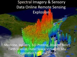
  • 1. Spectral Imagery & Sensory Data Online Remote Sensing Explosion Medicine, Industry, 3-D Printing, Disaster Relief, Earth Science, Outer Space Virtual In Situ Exploration from the Office
  • 2. Satellite Sensory Data collection DATA VALUE ROWS & COLUMNS Elevation, Moisture, Vegetation, Land Cover Thermal Data
  • 3. REMOTE SENSING A Top 10 Emerging Online Technology • Images are a non invasive tomographic medical examination being broadcast on the internet. Imagery provides three anatomical aspect views of a tumor. Examination is being done live. Screenshot are captured by a board of assembled physicians seeking anomalies they feel need attention. Live internal medical examination for the diagnosis plan and medical treatment recommendations from a team of specialist on the other side of the planet
  • 5. Remote Sensing In Situ is the academic term meaning study in the field. Remote sensing allows all technological disciplines worldwide in situ data research, 3D Printing, industrial innovation, medical examination, and disaster evaluation planning from the lab or office. Remote sensing utilizing airborne, satellite and portable sensor technology isn’t new. Emerging online technological innovations that allow it’s in the field use thru any form of cloud collaborative databank or live internet feed advancements; speeding lifesaving technologies with the increasingly widespread use of sensors observing passive responses to external stimulus in organic and no organic life forms and strata. (King, 2013) Emerging online information transfers that will continue to change the way humanity respond to the earth’s changing environment, particularly in the area of health, emergency medical assistance, advanced diagnosis, advance placement of emergency facilities, and advance warning to communities of impending danger. Examples include sensors that continually monitor bodily function – such as heart rate, blood oxygen and blood sugar levels – and, if necessary, trigger a medical response such as insulin provision. Advances rely on wireless communication between devices, low power-sensing technologies and, sometimes, active energy harvesting. Onboard online accessible sensors in family cars can provide vehicle-to-vehicle sensing for improved safety on highways, increased fuel efficiencies, trip routing, and geographies friction avoidance delivering economic saving process application across community neighborhood roads and land use worldwide.(Elshviener: Purdie, 2013)
  • 6. 1933 Fisk Plates Study Area Ancient River Courses • S
  • 7. Robert Fisk a geologist for the Army Corp of engineers hand drew excruciatingly accurate depictions of the entire Mississippi River’s flood plain, ancient routes, and tributaries history. Fisk mapped the entire ancient river flood plains every historical twist and bend in the field without an aerial observation or the internet taking him twelve years. Fisk’s drawing still to this day are relevant because all of his deducements in river geomorphology are now completely visible a thru satellite imagery warehoused at the United States Geological Survey Satellite Imagery Data Center. Users can request custom views and view earth in real time online. Data researchers have the power of what took years of in the field expensive research in momentary uploads processed thru OLAP software’s to Geographic Information Science civil engineering software. ( FISK USGS 1944) Within the alluvial valley, Fisk recognized the alluvial plain and several older upland areas. Online technology now allows 3d data cube statistical evaluation of climate change, flood basin change, demographics changes, economic changes, land development changes and infrastructural impact to the ecosystem changes that can claim variance exactitude based upon these original calculations nearly instantly anywhere in the world. (Patel, 2013)
  • 9. Based upon original hand drawn and tabulated data's these ancient prior to civilization geological formations of alluvial plain were defined as geological epoch in the Holocene). Amazingly emerging online data mining and imagery request use these then defined Mississippi River meander belts to predict when and where communities and infrastructure are subject to flooding by the rivers in their present modern day flood plain regime. (Patel, 2013)In situ flood plain history definitions are still valid to include; Tertiary age braided-stream terraces and those of the Western Lowlands that date to the last glacial cycle. (FISK USGS, 1789-1944) Utilizing online Remote Sensing and data warehousing in the cloud datas are real time analyzed in multi professional collaborative efforts. Communicative tabulation using detailed registered classified and unclassified supervised imagery analysis use 1933 original data records as a bench mark. (Patel, 2013) Prediction of flood crest and affected areas flooding provide data to Leaders to make property and lifesaving decisions of how best to effectuate emergency assistance and deploy emergency remediating infrastructures. These discoveries now aid the Corp of Engineers in Mississippi Flood plain management (Edwards, 1994)
  • 10. LANDSAT TM5 • Flood Crest Square and quadrilateral shapes are farming shaped for flood control http://earthobservatory.nasa.gov
  • 11. Societal impact of all of these innovative sensory applications of remote sensing observation platforms do have CONS. UK bloody old England is awash with Remote Sensing cameras that monitor and invade the personal privacy of the English citizenry . (Silva, 2012) Our government now legally by Executive Action, reserves the right to kill American Citizens with remote sensing technique driven drones that transmit their data online to our leaders who give the order to pull the trigger. (Silva, 2012) Citizens get speeding tickets, red light infraction tickets and traffic reports as well as environmental air quality reports via online transmitted data streams from Department of Transportation remote sensing platforms. (Silva, 2012) Current NSA scandals raise hackles over individual privacy.
  • 12. REMOTE SENSING SENSORS LINKED ONLINE for PUBLIC DATA COLLECTION IN ENGLAND
  • 13. All of these monitoring advances are remote sensing online advances using data sensing software and platform devices. Overall the good these emerging sensory developments provide outweigh the cons. Competing with what once took years and entire office floors of statistical engineers to tabulate, modern sensory driven data remote sensing platforms will exponential escalate the observation data collective research of the human being earth bound presence; how, why, where, when, how often, why there and what if in instantaneous data petaflop infinitum.
  • 14. Jobs will continue to decrease in number as these sensory revelations decrease human assistance while sensory observations increase ultimate utility, and create smaller more efficient economies of scale. American Quality of life for the average citizen might just continue to erode. “Will our kids have it as good as us”, is the real dilemma of technological advances visible decreasing the need for the human labor requirement as real time factors of economic production.
  • 15. Works Cited Edwards, S. R. (1994, December 01). Law, Science & Public Health Program Site Professor Edwar P Richards J.D.,M.P.H. Retrieved June 05, 2013, from The Coastal Law and Adaptation to climate Change Project LSU Law Center: http://biotech.law.lsu.edu/climate/mississippi/sausier/Sausier_Vol_I_text.pdf Elshviener: Purdie, T. G. (2013, March 31). International Journal of Radiation Oncology*Biology*Physics. Retrieved June 05, 2012, from Science Direct: http://www.sciencedirect.com/science/article/pii/S0360301606036571 FISK USGS, 1. (1789-1944, January 01). Lower and Middle Mississippi Valley Engineering Geology Corp of Enginners Army Corp of Engineers. Retrieved June 05, 2013, from Geological Investigation of the Alluvial Vallley of the Lower Mississippi River -E Fisj 1944: http://lmvmapping.erdc.usace.army.mil/ King, D. (2013, February 14). Global Agenda Councils Top 10 Emerging Technologies for 2013. Retrieved June 05, 2013, from World Economic Forum Blog: http://forumblog.org/2013/02/top-10-emerging-technologies-for-2013/ Patel, S. (2013, January 20). Flood Hazards Mitigation Analusis Using Remote Sensing and GIS: Correspondence with Town Planning. Retrieved June 05, 2013, from Link Springer.com Providing Researchers with Acess to Millions of Scientific Documents: http://link.springer.com/article/10.1007%2Fs11269-013-0291-6#page-1 Robyn, K. (2006, April 1). EMS Magazine's Resource Guide:Technology in EMS-Patient Tracking Systems. Retrieved June 05, 2013, from EMS WORLD: http://www.emsworld.com/article/10323022/ems-magazines-resource-guide-technology- in-ems-patient-tracking-systems Silva, G. G. (2012, 12 10). National Center for Biotechnolgy Information. Retrieved June 05, 2013, from Sensors Basel Switzewrland Molecular Diversity Preservation International: http://www.ncbi.nlm.nih.gov/pmc/articles/PMC3545568/
  • 16. Bibliography Edwards, S. R. (1994, December 01). Law, Science & Public Health Program Site Professor Edwar P Richards J.D.,M.P.H. Retrieved June 05, 2013, from The Coastal Law and Adaptation to climate Change Project LSU Law Center: http://biotech.law.lsu.edu/climate/mississippi/sausier/Sausier_Vol_I_text.pdf Elshviener: Purdie, T. G. (2013, March 31). International Journal of Radiation Oncology*Biology*Physics. Retrieved June 05, 2012, from Science Direct: http://www.sciencedirect.com/science/article/pii/S0360301606036571 FISK USGS, 1. (1789-1944, January 01). Lower and Middle Mississippi Valley Engineering Geology Corp of Enginners Army Corp of Engineers. Retrieved June 05, 2013, from Geological Investigation of the Alluvial Vallley of the Lower Mississippi River -E Fisj 1944: http://lmvmapping.erdc.usace.army.mil/ King, D. (2013, February 14). Global Agenda Councils Top 10 Emerging Technologies for 2013. Retrieved June 05, 2013, from World Economic Forum Blog: http://forumblog.org/2013/02/top-10-emerging-technologies-for-2013/ Patel, S. (2013, January 20). Flood Hazards Mitigation Analusis Using Remote Sensing and GIS: Correspondence with Town Planning. Retrieved June 05, 2013, from Link Springer.com Providing Researchers with Acess to Millions of Scientific Documents: http://link.springer.com/article/10.1007%2Fs11269-013-0291-6#page-1 Robyn, K. (2006, April 1). EMS Magazine's Resource Guide:Technology in EMS-Patient Tracking Systems. Retrieved June 05, 2013, from EMS WORLD: http://www.emsworld.com/article/10323022/ems-magazines-resource-guide-technology- in-ems-patient-tracking-systems Silva, G. G. (2012, 12 10). National Center for Biotechnolgy Information. Retrieved June 05, 2013, from Sensors Basel Switzewrland Molecular Diversity Preservation International: http://www.ncbi.nlm.nih.gov/pmc/articles/PMC3545568/