SlideShare a Scribd company logo
1 of 12
Download to read offline
Sustainable resource management and effective risk prevention in the water sector requires a sound informa-
tion base. This, however, is often not available. Satellite-based remote sensing offers new possibilities to bridge
these information gaps.
Read this Trend Sheet to learn about recent and future developments, practical examples and challenges in
making use of remote sensing for water management.
#5
Water viewed from space – remote sensing
for sustainable water management
Content
Why this Trend Sheet?......................................................................................................................................................................................................................... 2
Summary........................................................................................................................................................................................................................................................ 2
Definition of terms................................................................................................................................................................................................................................. 3
Introduction................................................................................................................................................................................................................................................ 4
Recent developments.......................................................................................................................................................................................................................... 5
Opportunities for water resource management............................................................................................................................................................ 6
Example applications.......................................................................................................................................................................................................................... 8
Challenges in making use of remote sensing data................................................................................................................................................... 10
What further developments are to be expected for the future?.................................................................................................................... 11
©
Nasa,
Unsplash
2
What trend do we observe?
For more than 30 years, Earth-observing satellites have been providing a global view that helps to better monitor and understand the
challenges of a rapidly changing world. Along with widespread digitalisation, the potential fields of application for remote sensing data
collection and processing is rapidly evolving.
Why is this trend important for water practitioners in development cooperation?
Relevant data for water management is often scarce, especially in developing countries, as hydro-meteorological networks are often
expensive to establish and maintain. Remote sensing can play a key role in providing critical data to fill existing data gaps for informed
decision making.
What is new?
Over the past five years, a new generation of satellite missions called Sentinel has been launched, providing unprecedented volumes
and quality of data for the management of water and other natural resources. New software applications have been developed that
allow to translate this data into relevant information for decision making - and research is achieving ever more advancements in
putting the satellite data into use.
Latest developments in remote sensing combined with increased computation capacities and enhanced machine learning offer new
prospects for improved monitoring of water resources and related factors such as climate and land use change. Ultimately, such inter-
related remote sensing data can help fill data gaps and support informed decision making towards water security. Concrete applica-
tions range, among others, from flood early warning to irrigation management, enforcement of regulations or planning of water supply
for refugee camps. Major limitations for a wide implementation are the lack of local data required to validate remote sensing informa-
tion and limited local technical and human capacity to process data. Read this Trend Sheet to learn more about opportunities and
challenges as well as practical examples of remote sensing for a more sustainable water management.
Why this Trend Sheet?
Summary
Earth observation“is the gathering of information about planet Earth’s physical, chemical and biological systems. It involves
monitoring and assessing the status of, and changes in, the natural and man-made environment. In recent years, Earth obser-
vation has become more and more sophisticated with the development of remote-sensing satellites and increasingly high-
tech instruments. Today’s Earth observation instruments include floating buoys for monitoring ocean currents, temperature
and salinity; land stations that record air quality and rainwater trends; sonar and radar for estimating fish and bird populations;
seismic and Global Positioning System (GPS) stations; and over 60 high-tech environmental satellites that scan the Earth from
space.”(Group on Earth Observations)
Remote Sensing is“the technology of acquiring data and information about an object or phenomena by a device that is not
in physical contact with it. In other words, remote sensing refers to gathering information about the Earth and its environment
from a distance, a critical capability of the Earth observing System. Global observations from space require remote sensing
from a spacecraft at an altitude well above the mesopause. Some remote-sensing systems encountered in everyday life
include the human eye and brain, and photographic and video cameras.”(NASA Glossary)
Sensor:“Device that produces an output (usually electrical) in response to stimulus such as incident radiation. Sensors aboard
satellites obtain information about features and objects on Earth by detecting radiation reflected or emitted in different bands
of the electromagnetic spectrum. Analysing the transmitted data provides valuable scientific information about Earth.”(NASA
Glossary)
Ground truth, in remote sensing,“refers to information collected on location. Ground truth allows image data to be related to
real features and materials on the ground. The collection of ground truth data enables calibration of remote-sensing data, and
aids in the interpretation and analysis of what is being sensed.”(Wikipedia)
Definition of terms
3
4
Introduction
4
Managing water sustainably and preventing water-related risks
requires a sound information base, including diverse sets of data
e.g. on river flows, extent of surface and groundwater water bodies,
water quality, precipitation, snow cover, soil moisture, crop-water
needs, settlement structure, etc. However, such data is not always
easy to collect. Often the data needed would have to cover large
areas, e.g. to fully understand the river dynamics in a whole basin,
to assess the full extent of flooding and snow cover, or to monitor
water quality in different parts of large lakes. Moreover, critical
areas can be difficult to reach, such as glaciers and water sources in
high mountains, or areas affected by flooding.
Comprehensive traditional hydro-meteorological monitoring
systems are therefore often very costly to set up and difficult to
maintain. They also get easily damaged by floods, animals or
people hoping to make some money from selling the material.
Indeed, the number of hydro-meteorological monitoring stations
has been in decline globally since the 1980s, especially in develop-
ing countries that lack the funds to operate and maintain them.
Another issue with water data relates to the fact that it is not always
openly shared among the different water users, for example, by
riparian countries in transboundary basins or by polluting indus-
tries that are reluctant to disclose what they know.
Satellite-based remote sensing can bridge important information
gaps and address several of the challenges mentioned above.
Satellite missions, with satellites orbiting the Earth for several years
to decades, are permanently observing the Earth’s surface: Sensors
carried by the satellites collect data that can be used to produce
imagery of different features in the landscape. Depending on the
time it takes for the satellite to complete an orbit and revisit the
same observation area, data can be collected e.g. daily, bi-weekly,
or monthly. A single satellite image has the potential to deliver
information on large areas, providing timely and objective moni-
toring of many components of the water cycle. Using the data
collected through satellite images, maps, models and decision
support tools can be developed to provide water managers and
other actors with relevant information (see section on example
applications on page 8).
Watch this short video for an introduction and find the definitions
of earth observation, remote sensing, sensor and ground truth on
page 3.
©
Nasa,
Unsplash
While satellite-based remote sensing is not new, it has been devel-
oping fast over the past years. An increasing number of satellites
are now orbiting Earth, carrying optical, thermal, radar and other
sensors with steadily improving capabilities to collect information
on various features of the Earth’s surface in ever increasing resolu-
tion. The United States’National Aeronautics and Space Administra-
tion (NASA) and the European Space Agency (ESA) are the largest
providers of satellite-based remote sensing data, but a growing
number of states have acquired capacity for space-based observa-
tions. Emerging economies with notable satellite missions include
China, India and Brazil. Most recently, the satellites of the ESA Senti-
nel programme provided next-generation Earth observation that also creates new opportunities for water management.
For example, up to now, data to assess the extent of surface water bodies was only available in a spatial resolution of 30m
from NASA Landsat missions. With this resolution, only a fraction of existing water bodies could be covered. Now, with
Sentinel delivering relevant data with a resolution of 10m, more accurate data on the dynamics of smaller water bodies
can be derived, which provides important information on e.g. water storage capacities within a given basin.
A common challenge in putting satellite derived data into practical use is limited technical capacity to process large
amounts of data. Recent advancements in digitalisation, including increasing computational capabilities, more accessi-
ble cloud computing options, advances in Artificial Intelligence and Machine Learning, now allow to better process the
enormous archives of satellite data that is often freely available. In combination with new sensors and satellite technolo-
gies, this opens up a new era for the systematic mapping and monitoring of surface water resources.
Recent developments
5
The Sentinel missions
With the seven Sentinel missions that were launched from 2014 until 2020, the Earth’s land surface can be captured more accurately
than before: The satellites of the Sentinel programme orbit the Earth rather fast and the high revisit times allow to produce daily/week-
ly/monthly satellite images which are essential for monitoring dynamic changes. The relatively high spatial resolution delivered by the
Sentinel missions’satellites increases the accuracy especially for smaller features. The data collected by the Sentinel missions are open
to the public and freely available from the Copernicus service website with an operational service guarantee for many years to come.
The sentinel missions hence provide long-term access to enhanced high and medium spatial resolution satellite-based remote sensing
data that can form a solid basis for developing decision support. Some of the water relevant features of the Sentinel mission include:
• The radar sensor of the Sentinel-1 mission, in contrast to optical sensors, collects information even in dark and cloudy conditions
and thus provides all-weather and day-and-night satellite imagery. It is powerful when monitoring surface water dynamics, flood
risks, and cropping patterns in cloud prone regions; since the Satellite frequently revisits the same areas, data collected can be
used not only to monitor e.g. flood extent at one point in time but every few days, allowing to calculate flood risks at high resolu-
tion.
• The large coverage area of the Sentinel-2 data along with its frequent revisits over the same area and high spatial resolution allow
precise monitoring of changes in inland water bodies and other land surface features; the novel sensors of the Sentinel-2 mission
can also capture a number of water quality parameters, in higher temporal and spatial solution than before: (i) the concentration
of Chlorophyll a, (ii) the density of cyanobacteria, (iii) turbidity, (iv) coloured dissolved organic matter, (v) dissolved organic carbon,
and (vi) water colour. This has been used for example to assess chlorophyll content in a pollution hotspot in Lake Titicaca.
• The Sentinel-2 mission ideally complements the longest continuously acquired collection of optical observations made by the
family of Landsat missions (operational since 1972) which are freely accessible and offer an opportunity to assess the historical
conditions of surface water resources worldwide;
• In addition to high accuracy optical and thermal sensors, the Sentinel-3 mission carries a radar altimeter which can be used to
estimate the changes in water levels in rivers and lakes.
©
Nasa,
Unsplash
6
Opportunities for water resource
management
Exploiting the recent advancements in sensor and computational capacities,
scientists and managers can now use satellite-based remote sensing to monitor
almost every facet of the water cycle in near real time.
Variables of key relevance to water resources management that can be estimated
with remote sensing include (see Sheffield et al. 2018 for description of variables
and how they can be assessed using remote sensing):
• precipitation,
• evaporation and evapotranspiration,
• soil moisture,
• vegetation and land use and land cover,
• surface water level and extent,
• snow and ice cover,
• some water quality parameters (turbidity, transparency, chlorophyll,
humic substances, cyanobacteria, and water temperature)
• groundwater (with significant limitations)
For each of these variables, various algorithms have been developed in order to retrieve relevant data, using observations from differ-
ent sensors and satellite mission, sometimes in combination and complemented with other than remote sensing data. For example:
• Approaches for assessing precipitation generally measure the reflection of radiation from clouds and raindrops with microwave
sensors and high resolution radars, sometimes combined with infrared sensors, to capture precipitation intensities over larger
areas (spatial resolution about 5-30km). Relevant global data is collected e.g. by NASA’s Global Precipitation Measurement
mission that delivers data on precipitation intensity every 3hr at 10km resolution. This data can be used to calculate total accumu-
lated precipitation for a given period of time, e.g. a heavy rain event at the Australian east coast.
• Evapotranspiration (ET) can be estimated for example by combining remote sensing data on land surface temperature and
land cover with near surface meteorological data, especially air temperature and wind. Several methodologies have been devel-
oped using various satellite observations to estimate ET at different spatial scales, from farm scale to watershed scale. The FAO
WaPOR application, for example, uses a refined approach using input from seven data components to estimate ET.
While satellite estimates will rarely be as accurate as those of an equivalent field measurement, they are an important and sometimes
the only source of data in regions where hydrometeorological monitoring networks are lacking. Moreover, field monitoring networks
are often sparse and do not provide data fast enough for real-time decision-making, for example for flood forecasting, as in the Lower
Mekong case study below. Remote sensing therefore is an important data source, as satellite imagery can provide information with
greater spatial extent, spatial density, and temporal frequency than most field-based monitoring networks.
Even in regions with extensive networks of river gauging stations, remote sensing can fill gaps in less monitored variables, providing
information on e.g. water-related ecosystems, evapotranspiration or snowpack that is necessary to evaluate upstream changes in
resources and land cover. The large coverage (up to global) of satellite data further allows to assess ressources at a regional level, e.g.
water and food security in risk areas such as the Horn of Africa. Another benefit of remote sensing-based data is that it is objective and
freely available to all parties sharing the resources, e.g. in transboundary basins, where the lack of a common data and information base
is sometimes a bone of contention. These advantages also make remote sensing suitable for global monitoring such as under the
Sustainable Development Goals (SDGs), for example monitoring of SDG 6.6.1 on water-related ecosystems (see example applications
on page 8).
©
Nasa,
Unsplash
Field-based Remote sensing-based
Data acquisition
Direct measurement of some variables of
interest (e.g. rain gauge, temperature, water
quality parameter concentrations). Indirect
measurements of other variables: biomass,
evapotranspiration, streamflow.
Measurement of spectral reflectance (water
quality, rainfall), emittance (temperature), or
distance (altimetry), from which variables of
interest are estimated.
Coverage
Local, point measurements. Discontinuous
in space, often not spatially representative.
Remote areas under-represented.
Global, area measurements (integrated over
pixel size, from sub-meter to multiple km).
Spatially continuous.
Technical
Capacity needs
Basic requirements of technical capacity and
training. Usually no extensive pre-process-
ing required.
Higher requirements of technical capacity and
training.
(Pre-) processing required to extract informa-
tion from data, although increasing availability
of analysis-ready data products.
Cost
Cost for the installation, operation and
maintenance of monitoring stations (staff
time and transport to each station). Cost
increases with spatial coverage. If sampling
is not automatic and with tele-transmission,
high data collection costs.
Costs of trained staff and minimal costs of
computing hardware. A wealth of data is
free and publicly available, as is open source
processing software. Increasing availability
of commercial very high-resolution data and
decreasing costs.
Major limitations
Systematic lack of sufficient data and lack
of spatial and temporal representativity.
Difficulty to relate point measurements to
areal averages.
Some sensors are limited by cloud cover.
Even when low, uncertainties are difficult to
quantify due to the challenges of compar-
ing satellite pixel averages with in-situ point
measurements.
Comparison of field-based and remote sensing-based monitoring
Source: World Bank 2019
8
Over the past years, several initiatives have been launched to better exploit satellite-based remote sensing data for water manage-
ment. Recent initiatives include the ESA EO4SD water resources project, the NASA SERVIR initiative, and the Space4water Portal of
the United Nations Office for Outer Space Affairs (UNOOSA). See the section below for some example applications that have been
developed and demonstrated within these and other programmes.
Supporting the enforcement of water licensing
system in Malawi:
Through several reforms of its water policy frameworks Malawi
has introduced a water licensing system in order to better
manage limited water resources, and especially their use for
irrigation. However, enforcing the licensing system and collect-
ing related fees from water users has been lagging behind, due
to difficulties in monitoring water abstraction and use. Within
the ESA-funded project EO4SD, satellite-based remote sens-
ing data has been used to address this implementation gap.
Satellite imagery was used to map and monitor the extent of
irrigation areas in order to compare them with the extent of
issued water licenses. This allowed identifying non-licensed
water usage which could in future support enforcing the
licencing system and collecting related fees to finance water
resources management and services. A preliminary assessment
suggests that income from license fees could be increased by
75%, if all known license holders were charged, resulting in
approx. USD 200,000 additional fees collected per year.
Supporting Better Flood Forecasting and Early
Warning in the Lower Mekong basin (Cambo-
dia, Lao PDR, Thailand and Vietnam):
The irregular distribution of meteorological and hydrological
stations in the Lower Mekong basin creates an information
gap in time and space, which hampers water resource plan-
ning and early warning. In addition, river flow data is not wide-
ly shared among riparian countries in the transboundary basin.
Within the framework of the NASA and USAID funded SERVIR
Initiative, partners developed a web-based tool that provides
satellite-derived near real-time high accuracy rainfall and
stream height data. This allows the Mekong River Commission
(MRC) and national agencies to increase the accuracy of flood
forecasting and to provide fifteen days of lead time for early
warning (as opposed to six days previously), which helps
strengthen the resilience to flood risks of communities in the
basin.
Example applications
©
Nasa,
Unsplash
©
Nasa,
Unsplash
Monitoring SDG 6.6.1 - changes in water-related ecosystems:
SDG target 6.6 seeks to halt the degradation and destruction of water-related ecosystems and to assist the recovery of those already
degraded. Progress is to be measured by SDG indicator 6.6.1, which covers changes in different types of water-related ecosystems.
Since data on water-related ecosystems is very scarce in many countries around the world, methodologies have been developed to
assess relevant variables using satellite-derived data. The SDG661 - App provides information on the extent of permanent and season-
al surface water bodies, reservoirs, wetlands, and mangroves as well as data on water quality. Data can be visualised and downloaded
at national, sub-national and basin levels. Like this, the app supports countries in tracking national progress towards achieving SDG
target 6.6 and helps decision-makers understand dynamic ecosystem changes.
Supporting planning of water supplies in refu-
gee camps.
Planning humanitarian action can be difficult, as refugee
camps may grow very fast in conflict areas. Moreover, it is
challenging to monitor population dynamics over vast areas,
especially if security issues hamper data collection on the
ground. Satellite-derived data can provide humanitarian
actors, such as Non-Governmental Organisations (NGOs), by
collecting information from a safe distance. The initiative
E04Hum, led by the University of Salzburg in collaboration
with Médecins Sans Frontières (MSF) developed approaches
to use satellite imagery to automatically monitor population
movements in refugee camps. This critically helps to estimate
the number and location of people requiring water, sanita-
tion, vaccinations etc. In addition, satellite-derived data was
used to identify potential groundwater extraction sites in the
vicinity of refugee camps in order to plan water supply
systems. The approach has successfully been applied by MSF,
for example, to improve water supplies and sanitation, along-
side nutritional and healthcare support for the Minawo camp
in Cameroon.
9
©
Nasa,
Unsplash
©
Nasa,
Unsplash
10
Challenges in making use of remote
sensing data
Despite the opportunities provided by ever improving remote-sensing data, it is still not widely used in water resource
management. This is due to a number of challenges that still exist in turning remote sensing data into actionable infor-
mation which can easily be used by water managers and other relevant actors. Main challenges are:
• Lack of technical, but more importantly, human capacity to process and meaningfully use remote sensing data.
• Issues of accuracy and need for validation of remote sensing data through on-site field-based measurements.
• A gap between scientists who produce, evaluate, and apply remotely sensed information, and managers and stake-
holders who need this information to make better decisions.
Against the backdrop of these barriers for application, expert advice is usually required to assess the usability of remote
sensing data for a specific water management purpose. Questions to consider are:
• What is the problem to be addressed and how/by whom are decisions taken?
• What are the data needs (incl. spatial and temporal resolution) and when is it needed?
• What are existing and potential data sources (monitoring, modelling, data sharing)?
• Which data should be delivered by remote sensing?
• Can remote sensing provide the data with acceptable levels of uncertainty and accuracy?
• What are related costs and capacity needs?
The World Bank has developed a decision tree and practical guidance for assessing and selecting remote sensing prod-
ucts for addressing given water management challenges. However, since remote sensing applications are developing
rapidly and answering the question whether remote sensing can meet the data requirements in a specific setting is very
complex, involving an expert with up-to-date overview of the state of the art is still necessary.
Main challenges in more detail
• Human and technical capacities: The lack of institutional and human capacity is a key constraint to the uptake of remote sens-
ing information in water management. In addition to lack of technical expertise, a general lack of familiarity and hence sometimes
scepticism towards remote sensing data in the water resource management community has been observed e.g. in the ESA EO4SD
programme. Efforts to introduce the use of remote sensing data should therefore be accompanied by appropriate capacity devel-
opment programs. Building up technical expertise will be essential to allow longer term use of remote sensing information in
decision-making. With regards to technical capacities in term of equipment, there are still challenges related to the storage,
processing, dissemination, and analysis of large amounts of data collected through satellite-based remote sensing. The Sentinel-1
satellite, for example, delivers nearly 1 terabyte of raw data per day. While cloud computing can address parts of this challenge,
limited technical capacities and computational power may still be an issue, especially in developing countries. However, compared
to the required human capacity development, the investment needs to improve technical capacities appear to be rather minor if
not neglectable.
• Issues of accuracy and validation: Meaningful interpretation and analyses of what is being sensed by satellites requires relating
the collected optical, thermal or radar measurements to real features on the ground: In order to turn remotely sensed data into
precise and valuable spatial information, it needs to be compared with field observations and data. Data collected on the ground,
also called“ground truth”, serves to calibrate, verify and validate mapping and monitoring results from remote sensing. Collecting
ground truth requires some effort and budget and where this is not available, information gained from remote sensing will be less
What further developments are to be
expected for the future?
There are a number of planned and proposed remote sensing missions that will provide further opportunities for water resource
management, including six Sentinel Expansion missions. Some of the expected developments include:
• Surface Water and Ocean Topography (SWOT)
mission by NASA and the French space agency
CNES: The SWOT mission to be launched in late 2022
with its wide swath altimetry technology, promises to
provide “the very first comprehensive view of Earth’s
freshwater bodies from space” and “a global inventory
of all terrestrial water bodies (lakes, reservoirs, wetlands)
whose surface area exceeds 250m by 250m and rivers
whose widths exceed 100m”. The data would allow
scientists to determine changing volumes of fresh water
across the globe at an unprecedented resolution.
Combined with bathymetry, i.e. information on the
topography of a lake’s or river’s bottom, the data could
be used to calculate changes in total water volume
over time in a water body as well as discharge varia-
tions in rivers, globally. The SWOT mission could thus
provide crucial information for understanding surface
water availability and for better preparing for floods and
droughts.
11
accurate (or possibly even wrong). Even if data is validated through ground-truthing, some uncertainty will always remain, as it
may also be the case to a lesser extent with ground measurements.
• Science-practice gap: A gap between scientific advancements in interpreting remote sensing data and real-world application
still exists. While new technology provides large amounts of data, water actors need actionable information to generate insight on
water resources and help their day-to-day management decisions. Decision making in water resources management requires data
to be provided at different temporal and spatial scales and with different levels of accuracy for different purposes. For example,
real-time data is required for operational management of infrastructure or early warning of hazards, whereas long-term time series
are necessary for risk assessment, design and planning. While temporal and spatial resolution provided by remote sensing can be
very high for some variables, it may still be suboptimal or not useful for others. For example, information on groundwater from
satellite gravity field mapping is available from the NASA GRACE missions merely with a spatial resolution of around 300km, which
is only useful for assessing groundwater availability on a global or regional scale. However, advanced methods for downscaling
data and combining multiple remotely sensed data sources are currently developed in research. Inadequate spatio-temporal reso-
lution and availability, in some cases, limit practical application of remote sensing data in water resources management. The same
refers to the legacy (the length and continuity of long-term records), and latency (how readily available data are in near real time).
©
Nasa,
Unsplash
12
• Hyperspectral sensors: Several mission including hyperspectral imaging sensors are planned or have been proposed. These
sensors measure electromagnetic radiation across a large spectrum and increase resolution of satellite imagery. The Copernicus
Hyperspectral Imaging Mission for the Environment (CHIME) that is planned by ESA would carry a unique visible to shortwave
infrared spectrometer to support new and enhanced services for sustainable agriculture, water quality and biodiversity manage-
ment, as well as advanced soil property characterisation. The derived data could improve dynamic land-cover mapping, for exam-
ple, and thus provide relevant information on change in cropping patterns for catchment management.
• Higher resolution thermal sensors are currently developed which will help improve assessment of evapotranspiration and
water productivity for agricultural food production. While the current Sentinel 3 sensor measures temperature at a resolution of
1km, the ongoing NASA research mission ECOSTRESS measures surface temperature at a resolution of 70 meters. The main aim of
ECOSTRESS is to measure heat stress on plants and to provide information on the Evaporative Stress Index (ESI), a leading drought
indicator. Similarly, the planned Copernicus Land Surface Temperature Monitoring, LSTM, mission will carry a high resolution
thermal infrared sensor to provide observations of land-surface temperature in order to provide relevant information for improv-
ing sustainable agricultural productivity at field-scale. But the sensed data can also be used to assess other heat-related phenom-
ena, such as heat islands in urban areas.
12
Contact:
SDC - Swiss Agency for Development and Cooperation
Section Water
Freiburgstrasse 130, 3003 Bern
Phone: +41 (0)58 465 04 06
Focal Point Water E-Mail: daniel.maselli@eda.admin.ch
The“Trend Observatory on Water”of the Swiss Agency for Development and Cooperation (SDC) aims at informing the RésEAU, SDC’s
Water Network, and interested parties about relevant emerging trends and innovative approaches for development cooperation in the
water sector. Initiated by SDC’s Water Section and run by adelphi, it analyses how major global trends can affect water resources and
management practices in the future. Through various communication formats and its website https://hazu.swiss/deza/trend-obser-
vatory-on-water it aims to raise awareness of opportunities that arise for more sustainable solutions, but also of the risks and challeng-
es that might come along with them.
Suggest Citation: Kramer, Annika 2022: Water viewed from space - remote sensing for sustainable water management. Bern, Switzer-
land: SDC Trend Observatory on Water.

More Related Content

Similar to Trend_sheets_EN.pdf

NOAA's National Oceanographic Data Center
NOAA's National Oceanographic Data CenterNOAA's National Oceanographic Data Center
NOAA's National Oceanographic Data CenterUserservices
 
Flood Detection Using Empirical Bayesian Networks
Flood Detection Using Empirical Bayesian NetworksFlood Detection Using Empirical Bayesian Networks
Flood Detection Using Empirical Bayesian NetworksIOSRJECE
 
Moderate_resolution_GEC
Moderate_resolution_GECModerate_resolution_GEC
Moderate_resolution_GECKenneth Kay
 
Water-Body Area Extraction From High Resolution Satellite Images-An Introduct...
Water-Body Area Extraction From High Resolution Satellite Images-An Introduct...Water-Body Area Extraction From High Resolution Satellite Images-An Introduct...
Water-Body Area Extraction From High Resolution Satellite Images-An Introduct...CSCJournals
 
geo7_crafting_geoinformation
geo7_crafting_geoinformationgeo7_crafting_geoinformation
geo7_crafting_geoinformationMichael Williams
 
Drought monitoring, Precipitation statistics, and water balance with freely a...
Drought monitoring, Precipitation statistics, and water balance with freely a...Drought monitoring, Precipitation statistics, and water balance with freely a...
Drought monitoring, Precipitation statistics, and water balance with freely a...AngelosAlamanos
 
OECD_PortugalKeynote_SatelliteTechnology_R1r00
OECD_PortugalKeynote_SatelliteTechnology_R1r00OECD_PortugalKeynote_SatelliteTechnology_R1r00
OECD_PortugalKeynote_SatelliteTechnology_R1r00Keiran Millard
 
Information and Communication Technology in Water Management: A Case Study
Information and Communication Technology in Water Management: A Case StudyInformation and Communication Technology in Water Management: A Case Study
Information and Communication Technology in Water Management: A Case StudyBRNSS Publication Hub
 
Article fishing zones
Article fishing zonesArticle fishing zones
Article fishing zonesGopala Reddy
 
About the paper USC CINAPS Builds Bridges Observing and Monitoring the Southe...
About the paper USC CINAPS Builds Bridges Observing and Monitoring the Southe...About the paper USC CINAPS Builds Bridges Observing and Monitoring the Southe...
About the paper USC CINAPS Builds Bridges Observing and Monitoring the Southe...Giovanni Murru
 
April 2010, Tri-State EPSCoR Meeting, Incline Village
April 2010, Tri-State EPSCoR Meeting, Incline VillageApril 2010, Tri-State EPSCoR Meeting, Incline Village
April 2010, Tri-State EPSCoR Meeting, Incline VillageJeff Dozier
 
Identification of Groundwater Potential Survey Using QGIS of DBATU campus, Ma...
Identification of Groundwater Potential Survey Using QGIS of DBATU campus, Ma...Identification of Groundwater Potential Survey Using QGIS of DBATU campus, Ma...
Identification of Groundwater Potential Survey Using QGIS of DBATU campus, Ma...IRJET Journal
 
Effectiveness of the telemetric flood monitoring device
Effectiveness of the telemetric flood monitoring deviceEffectiveness of the telemetric flood monitoring device
Effectiveness of the telemetric flood monitoring deviceHarhar Caparida
 

Similar to Trend_sheets_EN.pdf (20)

lect 1-2.pdf
lect 1-2.pdflect 1-2.pdf
lect 1-2.pdf
 
Flash flood
Flash floodFlash flood
Flash flood
 
NOAA's National Oceanographic Data Center
NOAA's National Oceanographic Data CenterNOAA's National Oceanographic Data Center
NOAA's National Oceanographic Data Center
 
sea water quality
sea water qualitysea water quality
sea water quality
 
Flood Detection Using Empirical Bayesian Networks
Flood Detection Using Empirical Bayesian NetworksFlood Detection Using Empirical Bayesian Networks
Flood Detection Using Empirical Bayesian Networks
 
Mlhil ljr.web.285
Mlhil ljr.web.285Mlhil ljr.web.285
Mlhil ljr.web.285
 
Moderate_resolution_GEC
Moderate_resolution_GECModerate_resolution_GEC
Moderate_resolution_GEC
 
Water-Body Area Extraction From High Resolution Satellite Images-An Introduct...
Water-Body Area Extraction From High Resolution Satellite Images-An Introduct...Water-Body Area Extraction From High Resolution Satellite Images-An Introduct...
Water-Body Area Extraction From High Resolution Satellite Images-An Introduct...
 
geo7_crafting_geoinformation
geo7_crafting_geoinformationgeo7_crafting_geoinformation
geo7_crafting_geoinformation
 
Drought monitoring, Precipitation statistics, and water balance with freely a...
Drought monitoring, Precipitation statistics, and water balance with freely a...Drought monitoring, Precipitation statistics, and water balance with freely a...
Drought monitoring, Precipitation statistics, and water balance with freely a...
 
OECD_PortugalKeynote_SatelliteTechnology_R1r00
OECD_PortugalKeynote_SatelliteTechnology_R1r00OECD_PortugalKeynote_SatelliteTechnology_R1r00
OECD_PortugalKeynote_SatelliteTechnology_R1r00
 
NASA Keynote Presentation - Monday Conservation Forum
NASA Keynote Presentation - Monday Conservation ForumNASA Keynote Presentation - Monday Conservation Forum
NASA Keynote Presentation - Monday Conservation Forum
 
Information and Communication Technology in Water Management: A Case Study
Information and Communication Technology in Water Management: A Case StudyInformation and Communication Technology in Water Management: A Case Study
Information and Communication Technology in Water Management: A Case Study
 
Article fishing zones
Article fishing zonesArticle fishing zones
Article fishing zones
 
Q4103103110
Q4103103110Q4103103110
Q4103103110
 
About the paper USC CINAPS Builds Bridges Observing and Monitoring the Southe...
About the paper USC CINAPS Builds Bridges Observing and Monitoring the Southe...About the paper USC CINAPS Builds Bridges Observing and Monitoring the Southe...
About the paper USC CINAPS Builds Bridges Observing and Monitoring the Southe...
 
surveying paper
surveying papersurveying paper
surveying paper
 
April 2010, Tri-State EPSCoR Meeting, Incline Village
April 2010, Tri-State EPSCoR Meeting, Incline VillageApril 2010, Tri-State EPSCoR Meeting, Incline Village
April 2010, Tri-State EPSCoR Meeting, Incline Village
 
Identification of Groundwater Potential Survey Using QGIS of DBATU campus, Ma...
Identification of Groundwater Potential Survey Using QGIS of DBATU campus, Ma...Identification of Groundwater Potential Survey Using QGIS of DBATU campus, Ma...
Identification of Groundwater Potential Survey Using QGIS of DBATU campus, Ma...
 
Effectiveness of the telemetric flood monitoring device
Effectiveness of the telemetric flood monitoring deviceEffectiveness of the telemetric flood monitoring device
Effectiveness of the telemetric flood monitoring device
 

Recently uploaded

BOOK Call Girls in (Dwarka) CALL | 8377087607 Delhi Escorts Services
BOOK Call Girls in (Dwarka) CALL | 8377087607 Delhi Escorts ServicesBOOK Call Girls in (Dwarka) CALL | 8377087607 Delhi Escorts Services
BOOK Call Girls in (Dwarka) CALL | 8377087607 Delhi Escorts Servicesdollysharma2066
 
Call Girls Budhwar Peth Call Me 7737669865 Budget Friendly No Advance Booking
Call Girls Budhwar Peth Call Me 7737669865 Budget Friendly No Advance BookingCall Girls Budhwar Peth Call Me 7737669865 Budget Friendly No Advance Booking
Call Girls Budhwar Peth Call Me 7737669865 Budget Friendly No Advance Bookingroncy bisnoi
 
Booking open Available Pune Call Girls Budhwar Peth 6297143586 Call Hot Indi...
Booking open Available Pune Call Girls Budhwar Peth  6297143586 Call Hot Indi...Booking open Available Pune Call Girls Budhwar Peth  6297143586 Call Hot Indi...
Booking open Available Pune Call Girls Budhwar Peth 6297143586 Call Hot Indi...Call Girls in Nagpur High Profile
 
Call On 6297143586 Pimpri Chinchwad Call Girls In All Pune 24/7 Provide Call...
Call On 6297143586  Pimpri Chinchwad Call Girls In All Pune 24/7 Provide Call...Call On 6297143586  Pimpri Chinchwad Call Girls In All Pune 24/7 Provide Call...
Call On 6297143586 Pimpri Chinchwad Call Girls In All Pune 24/7 Provide Call...tanu pandey
 
NO1 Verified kala jadu karne wale ka contact number kala jadu karne wale baba...
NO1 Verified kala jadu karne wale ka contact number kala jadu karne wale baba...NO1 Verified kala jadu karne wale ka contact number kala jadu karne wale baba...
NO1 Verified kala jadu karne wale ka contact number kala jadu karne wale baba...Amil baba
 
Freegle User Survey as visual display - BH
Freegle User Survey as visual display - BHFreegle User Survey as visual display - BH
Freegle User Survey as visual display - BHbill846304
 
(ANIKA) Call Girls Wagholi ( 7001035870 ) HI-Fi Pune Escorts Service
(ANIKA) Call Girls Wagholi ( 7001035870 ) HI-Fi Pune Escorts Service(ANIKA) Call Girls Wagholi ( 7001035870 ) HI-Fi Pune Escorts Service
(ANIKA) Call Girls Wagholi ( 7001035870 ) HI-Fi Pune Escorts Serviceranjana rawat
 
VIP Call Girls Moti Ganpur ( Hyderabad ) Phone 8250192130 | ₹5k To 25k With R...
VIP Call Girls Moti Ganpur ( Hyderabad ) Phone 8250192130 | ₹5k To 25k With R...VIP Call Girls Moti Ganpur ( Hyderabad ) Phone 8250192130 | ₹5k To 25k With R...
VIP Call Girls Moti Ganpur ( Hyderabad ) Phone 8250192130 | ₹5k To 25k With R...Suhani Kapoor
 
Horizon Net Zero Dawn – keynote slides by Ben Abraham
Horizon Net Zero Dawn – keynote slides by Ben AbrahamHorizon Net Zero Dawn – keynote slides by Ben Abraham
Horizon Net Zero Dawn – keynote slides by Ben Abrahamssuserbb03ff
 
Proposed Amendments to Chapter 15, Article X: Wetland Conservation Areas
Proposed Amendments to Chapter 15, Article X: Wetland Conservation AreasProposed Amendments to Chapter 15, Article X: Wetland Conservation Areas
Proposed Amendments to Chapter 15, Article X: Wetland Conservation Areas💥Victoria K. Colangelo
 
Sustainable Clothing Strategies and Challenges
Sustainable Clothing Strategies and ChallengesSustainable Clothing Strategies and Challenges
Sustainable Clothing Strategies and ChallengesDr. Salem Baidas
 
(PARI) Viman Nagar Call Girls Just Call 7001035870 [ Cash on Delivery ] Pune ...
(PARI) Viman Nagar Call Girls Just Call 7001035870 [ Cash on Delivery ] Pune ...(PARI) Viman Nagar Call Girls Just Call 7001035870 [ Cash on Delivery ] Pune ...
(PARI) Viman Nagar Call Girls Just Call 7001035870 [ Cash on Delivery ] Pune ...ranjana rawat
 
VIP Model Call Girls Chakan ( Pune ) Call ON 8005736733 Starting From 5K to 2...
VIP Model Call Girls Chakan ( Pune ) Call ON 8005736733 Starting From 5K to 2...VIP Model Call Girls Chakan ( Pune ) Call ON 8005736733 Starting From 5K to 2...
VIP Model Call Girls Chakan ( Pune ) Call ON 8005736733 Starting From 5K to 2...SUHANI PANDEY
 
Call Girls In Okhla DELHI ~9654467111~ Short 1500 Night 6000
Call Girls In Okhla DELHI ~9654467111~ Short 1500 Night 6000Call Girls In Okhla DELHI ~9654467111~ Short 1500 Night 6000
Call Girls In Okhla DELHI ~9654467111~ Short 1500 Night 6000Sapana Sha
 
Verified Trusted Kalyani Nagar Call Girls 8005736733 𝐈𝐍𝐃𝐄𝐏𝐄𝐍𝐃𝐄𝐍𝐓 Call 𝐆𝐈𝐑𝐋 𝐕...
Verified Trusted Kalyani Nagar Call Girls  8005736733 𝐈𝐍𝐃𝐄𝐏𝐄𝐍𝐃𝐄𝐍𝐓 Call 𝐆𝐈𝐑𝐋 𝐕...Verified Trusted Kalyani Nagar Call Girls  8005736733 𝐈𝐍𝐃𝐄𝐏𝐄𝐍𝐃𝐄𝐍𝐓 Call 𝐆𝐈𝐑𝐋 𝐕...
Verified Trusted Kalyani Nagar Call Girls 8005736733 𝐈𝐍𝐃𝐄𝐏𝐄𝐍𝐃𝐄𝐍𝐓 Call 𝐆𝐈𝐑𝐋 𝐕...tanu pandey
 
CSR_Tested activities in the classroom -EN
CSR_Tested activities in the classroom -ENCSR_Tested activities in the classroom -EN
CSR_Tested activities in the classroom -ENGeorgeDiamandis11
 

Recently uploaded (20)

Call Girls In Yamuna Vihar꧁❤ 🔝 9953056974🔝❤꧂ Escort ServiCe
Call Girls In Yamuna Vihar꧁❤ 🔝 9953056974🔝❤꧂ Escort ServiCeCall Girls In Yamuna Vihar꧁❤ 🔝 9953056974🔝❤꧂ Escort ServiCe
Call Girls In Yamuna Vihar꧁❤ 🔝 9953056974🔝❤꧂ Escort ServiCe
 
BOOK Call Girls in (Dwarka) CALL | 8377087607 Delhi Escorts Services
BOOK Call Girls in (Dwarka) CALL | 8377087607 Delhi Escorts ServicesBOOK Call Girls in (Dwarka) CALL | 8377087607 Delhi Escorts Services
BOOK Call Girls in (Dwarka) CALL | 8377087607 Delhi Escorts Services
 
Call Girls Budhwar Peth Call Me 7737669865 Budget Friendly No Advance Booking
Call Girls Budhwar Peth Call Me 7737669865 Budget Friendly No Advance BookingCall Girls Budhwar Peth Call Me 7737669865 Budget Friendly No Advance Booking
Call Girls Budhwar Peth Call Me 7737669865 Budget Friendly No Advance Booking
 
Booking open Available Pune Call Girls Budhwar Peth 6297143586 Call Hot Indi...
Booking open Available Pune Call Girls Budhwar Peth  6297143586 Call Hot Indi...Booking open Available Pune Call Girls Budhwar Peth  6297143586 Call Hot Indi...
Booking open Available Pune Call Girls Budhwar Peth 6297143586 Call Hot Indi...
 
young Whatsapp Call Girls in Delhi Cantt🔝 9953056974 🔝 escort service
young Whatsapp Call Girls in Delhi Cantt🔝 9953056974 🔝 escort serviceyoung Whatsapp Call Girls in Delhi Cantt🔝 9953056974 🔝 escort service
young Whatsapp Call Girls in Delhi Cantt🔝 9953056974 🔝 escort service
 
Call On 6297143586 Pimpri Chinchwad Call Girls In All Pune 24/7 Provide Call...
Call On 6297143586  Pimpri Chinchwad Call Girls In All Pune 24/7 Provide Call...Call On 6297143586  Pimpri Chinchwad Call Girls In All Pune 24/7 Provide Call...
Call On 6297143586 Pimpri Chinchwad Call Girls In All Pune 24/7 Provide Call...
 
NO1 Verified kala jadu karne wale ka contact number kala jadu karne wale baba...
NO1 Verified kala jadu karne wale ka contact number kala jadu karne wale baba...NO1 Verified kala jadu karne wale ka contact number kala jadu karne wale baba...
NO1 Verified kala jadu karne wale ka contact number kala jadu karne wale baba...
 
Freegle User Survey as visual display - BH
Freegle User Survey as visual display - BHFreegle User Survey as visual display - BH
Freegle User Survey as visual display - BH
 
(ANIKA) Call Girls Wagholi ( 7001035870 ) HI-Fi Pune Escorts Service
(ANIKA) Call Girls Wagholi ( 7001035870 ) HI-Fi Pune Escorts Service(ANIKA) Call Girls Wagholi ( 7001035870 ) HI-Fi Pune Escorts Service
(ANIKA) Call Girls Wagholi ( 7001035870 ) HI-Fi Pune Escorts Service
 
VIP Call Girls Moti Ganpur ( Hyderabad ) Phone 8250192130 | ₹5k To 25k With R...
VIP Call Girls Moti Ganpur ( Hyderabad ) Phone 8250192130 | ₹5k To 25k With R...VIP Call Girls Moti Ganpur ( Hyderabad ) Phone 8250192130 | ₹5k To 25k With R...
VIP Call Girls Moti Ganpur ( Hyderabad ) Phone 8250192130 | ₹5k To 25k With R...
 
Horizon Net Zero Dawn – keynote slides by Ben Abraham
Horizon Net Zero Dawn – keynote slides by Ben AbrahamHorizon Net Zero Dawn – keynote slides by Ben Abraham
Horizon Net Zero Dawn – keynote slides by Ben Abraham
 
(NEHA) Call Girls Navi Mumbai Call Now 8250077686 Navi Mumbai Escorts 24x7
(NEHA) Call Girls Navi Mumbai Call Now 8250077686 Navi Mumbai Escorts 24x7(NEHA) Call Girls Navi Mumbai Call Now 8250077686 Navi Mumbai Escorts 24x7
(NEHA) Call Girls Navi Mumbai Call Now 8250077686 Navi Mumbai Escorts 24x7
 
Proposed Amendments to Chapter 15, Article X: Wetland Conservation Areas
Proposed Amendments to Chapter 15, Article X: Wetland Conservation AreasProposed Amendments to Chapter 15, Article X: Wetland Conservation Areas
Proposed Amendments to Chapter 15, Article X: Wetland Conservation Areas
 
Sustainable Clothing Strategies and Challenges
Sustainable Clothing Strategies and ChallengesSustainable Clothing Strategies and Challenges
Sustainable Clothing Strategies and Challenges
 
(PARI) Viman Nagar Call Girls Just Call 7001035870 [ Cash on Delivery ] Pune ...
(PARI) Viman Nagar Call Girls Just Call 7001035870 [ Cash on Delivery ] Pune ...(PARI) Viman Nagar Call Girls Just Call 7001035870 [ Cash on Delivery ] Pune ...
(PARI) Viman Nagar Call Girls Just Call 7001035870 [ Cash on Delivery ] Pune ...
 
VIP Model Call Girls Chakan ( Pune ) Call ON 8005736733 Starting From 5K to 2...
VIP Model Call Girls Chakan ( Pune ) Call ON 8005736733 Starting From 5K to 2...VIP Model Call Girls Chakan ( Pune ) Call ON 8005736733 Starting From 5K to 2...
VIP Model Call Girls Chakan ( Pune ) Call ON 8005736733 Starting From 5K to 2...
 
Call Girls In Okhla DELHI ~9654467111~ Short 1500 Night 6000
Call Girls In Okhla DELHI ~9654467111~ Short 1500 Night 6000Call Girls In Okhla DELHI ~9654467111~ Short 1500 Night 6000
Call Girls In Okhla DELHI ~9654467111~ Short 1500 Night 6000
 
Verified Trusted Kalyani Nagar Call Girls 8005736733 𝐈𝐍𝐃𝐄𝐏𝐄𝐍𝐃𝐄𝐍𝐓 Call 𝐆𝐈𝐑𝐋 𝐕...
Verified Trusted Kalyani Nagar Call Girls  8005736733 𝐈𝐍𝐃𝐄𝐏𝐄𝐍𝐃𝐄𝐍𝐓 Call 𝐆𝐈𝐑𝐋 𝐕...Verified Trusted Kalyani Nagar Call Girls  8005736733 𝐈𝐍𝐃𝐄𝐏𝐄𝐍𝐃𝐄𝐍𝐓 Call 𝐆𝐈𝐑𝐋 𝐕...
Verified Trusted Kalyani Nagar Call Girls 8005736733 𝐈𝐍𝐃𝐄𝐏𝐄𝐍𝐃𝐄𝐍𝐓 Call 𝐆𝐈𝐑𝐋 𝐕...
 
CSR_Tested activities in the classroom -EN
CSR_Tested activities in the classroom -ENCSR_Tested activities in the classroom -EN
CSR_Tested activities in the classroom -EN
 
Sustainable Packaging
Sustainable PackagingSustainable Packaging
Sustainable Packaging
 

Trend_sheets_EN.pdf

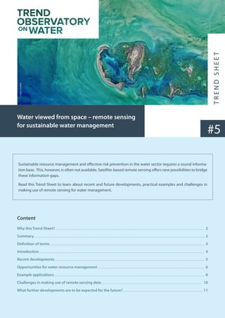
  • 1. Sustainable resource management and effective risk prevention in the water sector requires a sound informa- tion base. This, however, is often not available. Satellite-based remote sensing offers new possibilities to bridge these information gaps. Read this Trend Sheet to learn about recent and future developments, practical examples and challenges in making use of remote sensing for water management. #5 Water viewed from space – remote sensing for sustainable water management Content Why this Trend Sheet?......................................................................................................................................................................................................................... 2 Summary........................................................................................................................................................................................................................................................ 2 Definition of terms................................................................................................................................................................................................................................. 3 Introduction................................................................................................................................................................................................................................................ 4 Recent developments.......................................................................................................................................................................................................................... 5 Opportunities for water resource management............................................................................................................................................................ 6 Example applications.......................................................................................................................................................................................................................... 8 Challenges in making use of remote sensing data................................................................................................................................................... 10 What further developments are to be expected for the future?.................................................................................................................... 11 © Nasa, Unsplash
  • 2. 2 What trend do we observe? For more than 30 years, Earth-observing satellites have been providing a global view that helps to better monitor and understand the challenges of a rapidly changing world. Along with widespread digitalisation, the potential fields of application for remote sensing data collection and processing is rapidly evolving. Why is this trend important for water practitioners in development cooperation? Relevant data for water management is often scarce, especially in developing countries, as hydro-meteorological networks are often expensive to establish and maintain. Remote sensing can play a key role in providing critical data to fill existing data gaps for informed decision making. What is new? Over the past five years, a new generation of satellite missions called Sentinel has been launched, providing unprecedented volumes and quality of data for the management of water and other natural resources. New software applications have been developed that allow to translate this data into relevant information for decision making - and research is achieving ever more advancements in putting the satellite data into use. Latest developments in remote sensing combined with increased computation capacities and enhanced machine learning offer new prospects for improved monitoring of water resources and related factors such as climate and land use change. Ultimately, such inter- related remote sensing data can help fill data gaps and support informed decision making towards water security. Concrete applica- tions range, among others, from flood early warning to irrigation management, enforcement of regulations or planning of water supply for refugee camps. Major limitations for a wide implementation are the lack of local data required to validate remote sensing informa- tion and limited local technical and human capacity to process data. Read this Trend Sheet to learn more about opportunities and challenges as well as practical examples of remote sensing for a more sustainable water management. Why this Trend Sheet? Summary
  • 3. Earth observation“is the gathering of information about planet Earth’s physical, chemical and biological systems. It involves monitoring and assessing the status of, and changes in, the natural and man-made environment. In recent years, Earth obser- vation has become more and more sophisticated with the development of remote-sensing satellites and increasingly high- tech instruments. Today’s Earth observation instruments include floating buoys for monitoring ocean currents, temperature and salinity; land stations that record air quality and rainwater trends; sonar and radar for estimating fish and bird populations; seismic and Global Positioning System (GPS) stations; and over 60 high-tech environmental satellites that scan the Earth from space.”(Group on Earth Observations) Remote Sensing is“the technology of acquiring data and information about an object or phenomena by a device that is not in physical contact with it. In other words, remote sensing refers to gathering information about the Earth and its environment from a distance, a critical capability of the Earth observing System. Global observations from space require remote sensing from a spacecraft at an altitude well above the mesopause. Some remote-sensing systems encountered in everyday life include the human eye and brain, and photographic and video cameras.”(NASA Glossary) Sensor:“Device that produces an output (usually electrical) in response to stimulus such as incident radiation. Sensors aboard satellites obtain information about features and objects on Earth by detecting radiation reflected or emitted in different bands of the electromagnetic spectrum. Analysing the transmitted data provides valuable scientific information about Earth.”(NASA Glossary) Ground truth, in remote sensing,“refers to information collected on location. Ground truth allows image data to be related to real features and materials on the ground. The collection of ground truth data enables calibration of remote-sensing data, and aids in the interpretation and analysis of what is being sensed.”(Wikipedia) Definition of terms 3
  • 4. 4 Introduction 4 Managing water sustainably and preventing water-related risks requires a sound information base, including diverse sets of data e.g. on river flows, extent of surface and groundwater water bodies, water quality, precipitation, snow cover, soil moisture, crop-water needs, settlement structure, etc. However, such data is not always easy to collect. Often the data needed would have to cover large areas, e.g. to fully understand the river dynamics in a whole basin, to assess the full extent of flooding and snow cover, or to monitor water quality in different parts of large lakes. Moreover, critical areas can be difficult to reach, such as glaciers and water sources in high mountains, or areas affected by flooding. Comprehensive traditional hydro-meteorological monitoring systems are therefore often very costly to set up and difficult to maintain. They also get easily damaged by floods, animals or people hoping to make some money from selling the material. Indeed, the number of hydro-meteorological monitoring stations has been in decline globally since the 1980s, especially in develop- ing countries that lack the funds to operate and maintain them. Another issue with water data relates to the fact that it is not always openly shared among the different water users, for example, by riparian countries in transboundary basins or by polluting indus- tries that are reluctant to disclose what they know. Satellite-based remote sensing can bridge important information gaps and address several of the challenges mentioned above. Satellite missions, with satellites orbiting the Earth for several years to decades, are permanently observing the Earth’s surface: Sensors carried by the satellites collect data that can be used to produce imagery of different features in the landscape. Depending on the time it takes for the satellite to complete an orbit and revisit the same observation area, data can be collected e.g. daily, bi-weekly, or monthly. A single satellite image has the potential to deliver information on large areas, providing timely and objective moni- toring of many components of the water cycle. Using the data collected through satellite images, maps, models and decision support tools can be developed to provide water managers and other actors with relevant information (see section on example applications on page 8). Watch this short video for an introduction and find the definitions of earth observation, remote sensing, sensor and ground truth on page 3. © Nasa, Unsplash
  • 5. While satellite-based remote sensing is not new, it has been devel- oping fast over the past years. An increasing number of satellites are now orbiting Earth, carrying optical, thermal, radar and other sensors with steadily improving capabilities to collect information on various features of the Earth’s surface in ever increasing resolu- tion. The United States’National Aeronautics and Space Administra- tion (NASA) and the European Space Agency (ESA) are the largest providers of satellite-based remote sensing data, but a growing number of states have acquired capacity for space-based observa- tions. Emerging economies with notable satellite missions include China, India and Brazil. Most recently, the satellites of the ESA Senti- nel programme provided next-generation Earth observation that also creates new opportunities for water management. For example, up to now, data to assess the extent of surface water bodies was only available in a spatial resolution of 30m from NASA Landsat missions. With this resolution, only a fraction of existing water bodies could be covered. Now, with Sentinel delivering relevant data with a resolution of 10m, more accurate data on the dynamics of smaller water bodies can be derived, which provides important information on e.g. water storage capacities within a given basin. A common challenge in putting satellite derived data into practical use is limited technical capacity to process large amounts of data. Recent advancements in digitalisation, including increasing computational capabilities, more accessi- ble cloud computing options, advances in Artificial Intelligence and Machine Learning, now allow to better process the enormous archives of satellite data that is often freely available. In combination with new sensors and satellite technolo- gies, this opens up a new era for the systematic mapping and monitoring of surface water resources. Recent developments 5 The Sentinel missions With the seven Sentinel missions that were launched from 2014 until 2020, the Earth’s land surface can be captured more accurately than before: The satellites of the Sentinel programme orbit the Earth rather fast and the high revisit times allow to produce daily/week- ly/monthly satellite images which are essential for monitoring dynamic changes. The relatively high spatial resolution delivered by the Sentinel missions’satellites increases the accuracy especially for smaller features. The data collected by the Sentinel missions are open to the public and freely available from the Copernicus service website with an operational service guarantee for many years to come. The sentinel missions hence provide long-term access to enhanced high and medium spatial resolution satellite-based remote sensing data that can form a solid basis for developing decision support. Some of the water relevant features of the Sentinel mission include: • The radar sensor of the Sentinel-1 mission, in contrast to optical sensors, collects information even in dark and cloudy conditions and thus provides all-weather and day-and-night satellite imagery. It is powerful when monitoring surface water dynamics, flood risks, and cropping patterns in cloud prone regions; since the Satellite frequently revisits the same areas, data collected can be used not only to monitor e.g. flood extent at one point in time but every few days, allowing to calculate flood risks at high resolu- tion. • The large coverage area of the Sentinel-2 data along with its frequent revisits over the same area and high spatial resolution allow precise monitoring of changes in inland water bodies and other land surface features; the novel sensors of the Sentinel-2 mission can also capture a number of water quality parameters, in higher temporal and spatial solution than before: (i) the concentration of Chlorophyll a, (ii) the density of cyanobacteria, (iii) turbidity, (iv) coloured dissolved organic matter, (v) dissolved organic carbon, and (vi) water colour. This has been used for example to assess chlorophyll content in a pollution hotspot in Lake Titicaca. • The Sentinel-2 mission ideally complements the longest continuously acquired collection of optical observations made by the family of Landsat missions (operational since 1972) which are freely accessible and offer an opportunity to assess the historical conditions of surface water resources worldwide; • In addition to high accuracy optical and thermal sensors, the Sentinel-3 mission carries a radar altimeter which can be used to estimate the changes in water levels in rivers and lakes. © Nasa, Unsplash
  • 6. 6 Opportunities for water resource management Exploiting the recent advancements in sensor and computational capacities, scientists and managers can now use satellite-based remote sensing to monitor almost every facet of the water cycle in near real time. Variables of key relevance to water resources management that can be estimated with remote sensing include (see Sheffield et al. 2018 for description of variables and how they can be assessed using remote sensing): • precipitation, • evaporation and evapotranspiration, • soil moisture, • vegetation and land use and land cover, • surface water level and extent, • snow and ice cover, • some water quality parameters (turbidity, transparency, chlorophyll, humic substances, cyanobacteria, and water temperature) • groundwater (with significant limitations) For each of these variables, various algorithms have been developed in order to retrieve relevant data, using observations from differ- ent sensors and satellite mission, sometimes in combination and complemented with other than remote sensing data. For example: • Approaches for assessing precipitation generally measure the reflection of radiation from clouds and raindrops with microwave sensors and high resolution radars, sometimes combined with infrared sensors, to capture precipitation intensities over larger areas (spatial resolution about 5-30km). Relevant global data is collected e.g. by NASA’s Global Precipitation Measurement mission that delivers data on precipitation intensity every 3hr at 10km resolution. This data can be used to calculate total accumu- lated precipitation for a given period of time, e.g. a heavy rain event at the Australian east coast. • Evapotranspiration (ET) can be estimated for example by combining remote sensing data on land surface temperature and land cover with near surface meteorological data, especially air temperature and wind. Several methodologies have been devel- oped using various satellite observations to estimate ET at different spatial scales, from farm scale to watershed scale. The FAO WaPOR application, for example, uses a refined approach using input from seven data components to estimate ET. While satellite estimates will rarely be as accurate as those of an equivalent field measurement, they are an important and sometimes the only source of data in regions where hydrometeorological monitoring networks are lacking. Moreover, field monitoring networks are often sparse and do not provide data fast enough for real-time decision-making, for example for flood forecasting, as in the Lower Mekong case study below. Remote sensing therefore is an important data source, as satellite imagery can provide information with greater spatial extent, spatial density, and temporal frequency than most field-based monitoring networks. Even in regions with extensive networks of river gauging stations, remote sensing can fill gaps in less monitored variables, providing information on e.g. water-related ecosystems, evapotranspiration or snowpack that is necessary to evaluate upstream changes in resources and land cover. The large coverage (up to global) of satellite data further allows to assess ressources at a regional level, e.g. water and food security in risk areas such as the Horn of Africa. Another benefit of remote sensing-based data is that it is objective and freely available to all parties sharing the resources, e.g. in transboundary basins, where the lack of a common data and information base is sometimes a bone of contention. These advantages also make remote sensing suitable for global monitoring such as under the Sustainable Development Goals (SDGs), for example monitoring of SDG 6.6.1 on water-related ecosystems (see example applications on page 8). © Nasa, Unsplash
  • 7. Field-based Remote sensing-based Data acquisition Direct measurement of some variables of interest (e.g. rain gauge, temperature, water quality parameter concentrations). Indirect measurements of other variables: biomass, evapotranspiration, streamflow. Measurement of spectral reflectance (water quality, rainfall), emittance (temperature), or distance (altimetry), from which variables of interest are estimated. Coverage Local, point measurements. Discontinuous in space, often not spatially representative. Remote areas under-represented. Global, area measurements (integrated over pixel size, from sub-meter to multiple km). Spatially continuous. Technical Capacity needs Basic requirements of technical capacity and training. Usually no extensive pre-process- ing required. Higher requirements of technical capacity and training. (Pre-) processing required to extract informa- tion from data, although increasing availability of analysis-ready data products. Cost Cost for the installation, operation and maintenance of monitoring stations (staff time and transport to each station). Cost increases with spatial coverage. If sampling is not automatic and with tele-transmission, high data collection costs. Costs of trained staff and minimal costs of computing hardware. A wealth of data is free and publicly available, as is open source processing software. Increasing availability of commercial very high-resolution data and decreasing costs. Major limitations Systematic lack of sufficient data and lack of spatial and temporal representativity. Difficulty to relate point measurements to areal averages. Some sensors are limited by cloud cover. Even when low, uncertainties are difficult to quantify due to the challenges of compar- ing satellite pixel averages with in-situ point measurements. Comparison of field-based and remote sensing-based monitoring Source: World Bank 2019
  • 8. 8 Over the past years, several initiatives have been launched to better exploit satellite-based remote sensing data for water manage- ment. Recent initiatives include the ESA EO4SD water resources project, the NASA SERVIR initiative, and the Space4water Portal of the United Nations Office for Outer Space Affairs (UNOOSA). See the section below for some example applications that have been developed and demonstrated within these and other programmes. Supporting the enforcement of water licensing system in Malawi: Through several reforms of its water policy frameworks Malawi has introduced a water licensing system in order to better manage limited water resources, and especially their use for irrigation. However, enforcing the licensing system and collect- ing related fees from water users has been lagging behind, due to difficulties in monitoring water abstraction and use. Within the ESA-funded project EO4SD, satellite-based remote sens- ing data has been used to address this implementation gap. Satellite imagery was used to map and monitor the extent of irrigation areas in order to compare them with the extent of issued water licenses. This allowed identifying non-licensed water usage which could in future support enforcing the licencing system and collecting related fees to finance water resources management and services. A preliminary assessment suggests that income from license fees could be increased by 75%, if all known license holders were charged, resulting in approx. USD 200,000 additional fees collected per year. Supporting Better Flood Forecasting and Early Warning in the Lower Mekong basin (Cambo- dia, Lao PDR, Thailand and Vietnam): The irregular distribution of meteorological and hydrological stations in the Lower Mekong basin creates an information gap in time and space, which hampers water resource plan- ning and early warning. In addition, river flow data is not wide- ly shared among riparian countries in the transboundary basin. Within the framework of the NASA and USAID funded SERVIR Initiative, partners developed a web-based tool that provides satellite-derived near real-time high accuracy rainfall and stream height data. This allows the Mekong River Commission (MRC) and national agencies to increase the accuracy of flood forecasting and to provide fifteen days of lead time for early warning (as opposed to six days previously), which helps strengthen the resilience to flood risks of communities in the basin. Example applications © Nasa, Unsplash © Nasa, Unsplash
  • 9. Monitoring SDG 6.6.1 - changes in water-related ecosystems: SDG target 6.6 seeks to halt the degradation and destruction of water-related ecosystems and to assist the recovery of those already degraded. Progress is to be measured by SDG indicator 6.6.1, which covers changes in different types of water-related ecosystems. Since data on water-related ecosystems is very scarce in many countries around the world, methodologies have been developed to assess relevant variables using satellite-derived data. The SDG661 - App provides information on the extent of permanent and season- al surface water bodies, reservoirs, wetlands, and mangroves as well as data on water quality. Data can be visualised and downloaded at national, sub-national and basin levels. Like this, the app supports countries in tracking national progress towards achieving SDG target 6.6 and helps decision-makers understand dynamic ecosystem changes. Supporting planning of water supplies in refu- gee camps. Planning humanitarian action can be difficult, as refugee camps may grow very fast in conflict areas. Moreover, it is challenging to monitor population dynamics over vast areas, especially if security issues hamper data collection on the ground. Satellite-derived data can provide humanitarian actors, such as Non-Governmental Organisations (NGOs), by collecting information from a safe distance. The initiative E04Hum, led by the University of Salzburg in collaboration with Médecins Sans Frontières (MSF) developed approaches to use satellite imagery to automatically monitor population movements in refugee camps. This critically helps to estimate the number and location of people requiring water, sanita- tion, vaccinations etc. In addition, satellite-derived data was used to identify potential groundwater extraction sites in the vicinity of refugee camps in order to plan water supply systems. The approach has successfully been applied by MSF, for example, to improve water supplies and sanitation, along- side nutritional and healthcare support for the Minawo camp in Cameroon. 9 © Nasa, Unsplash © Nasa, Unsplash
  • 10. 10 Challenges in making use of remote sensing data Despite the opportunities provided by ever improving remote-sensing data, it is still not widely used in water resource management. This is due to a number of challenges that still exist in turning remote sensing data into actionable infor- mation which can easily be used by water managers and other relevant actors. Main challenges are: • Lack of technical, but more importantly, human capacity to process and meaningfully use remote sensing data. • Issues of accuracy and need for validation of remote sensing data through on-site field-based measurements. • A gap between scientists who produce, evaluate, and apply remotely sensed information, and managers and stake- holders who need this information to make better decisions. Against the backdrop of these barriers for application, expert advice is usually required to assess the usability of remote sensing data for a specific water management purpose. Questions to consider are: • What is the problem to be addressed and how/by whom are decisions taken? • What are the data needs (incl. spatial and temporal resolution) and when is it needed? • What are existing and potential data sources (monitoring, modelling, data sharing)? • Which data should be delivered by remote sensing? • Can remote sensing provide the data with acceptable levels of uncertainty and accuracy? • What are related costs and capacity needs? The World Bank has developed a decision tree and practical guidance for assessing and selecting remote sensing prod- ucts for addressing given water management challenges. However, since remote sensing applications are developing rapidly and answering the question whether remote sensing can meet the data requirements in a specific setting is very complex, involving an expert with up-to-date overview of the state of the art is still necessary. Main challenges in more detail • Human and technical capacities: The lack of institutional and human capacity is a key constraint to the uptake of remote sens- ing information in water management. In addition to lack of technical expertise, a general lack of familiarity and hence sometimes scepticism towards remote sensing data in the water resource management community has been observed e.g. in the ESA EO4SD programme. Efforts to introduce the use of remote sensing data should therefore be accompanied by appropriate capacity devel- opment programs. Building up technical expertise will be essential to allow longer term use of remote sensing information in decision-making. With regards to technical capacities in term of equipment, there are still challenges related to the storage, processing, dissemination, and analysis of large amounts of data collected through satellite-based remote sensing. The Sentinel-1 satellite, for example, delivers nearly 1 terabyte of raw data per day. While cloud computing can address parts of this challenge, limited technical capacities and computational power may still be an issue, especially in developing countries. However, compared to the required human capacity development, the investment needs to improve technical capacities appear to be rather minor if not neglectable. • Issues of accuracy and validation: Meaningful interpretation and analyses of what is being sensed by satellites requires relating the collected optical, thermal or radar measurements to real features on the ground: In order to turn remotely sensed data into precise and valuable spatial information, it needs to be compared with field observations and data. Data collected on the ground, also called“ground truth”, serves to calibrate, verify and validate mapping and monitoring results from remote sensing. Collecting ground truth requires some effort and budget and where this is not available, information gained from remote sensing will be less
  • 11. What further developments are to be expected for the future? There are a number of planned and proposed remote sensing missions that will provide further opportunities for water resource management, including six Sentinel Expansion missions. Some of the expected developments include: • Surface Water and Ocean Topography (SWOT) mission by NASA and the French space agency CNES: The SWOT mission to be launched in late 2022 with its wide swath altimetry technology, promises to provide “the very first comprehensive view of Earth’s freshwater bodies from space” and “a global inventory of all terrestrial water bodies (lakes, reservoirs, wetlands) whose surface area exceeds 250m by 250m and rivers whose widths exceed 100m”. The data would allow scientists to determine changing volumes of fresh water across the globe at an unprecedented resolution. Combined with bathymetry, i.e. information on the topography of a lake’s or river’s bottom, the data could be used to calculate changes in total water volume over time in a water body as well as discharge varia- tions in rivers, globally. The SWOT mission could thus provide crucial information for understanding surface water availability and for better preparing for floods and droughts. 11 accurate (or possibly even wrong). Even if data is validated through ground-truthing, some uncertainty will always remain, as it may also be the case to a lesser extent with ground measurements. • Science-practice gap: A gap between scientific advancements in interpreting remote sensing data and real-world application still exists. While new technology provides large amounts of data, water actors need actionable information to generate insight on water resources and help their day-to-day management decisions. Decision making in water resources management requires data to be provided at different temporal and spatial scales and with different levels of accuracy for different purposes. For example, real-time data is required for operational management of infrastructure or early warning of hazards, whereas long-term time series are necessary for risk assessment, design and planning. While temporal and spatial resolution provided by remote sensing can be very high for some variables, it may still be suboptimal or not useful for others. For example, information on groundwater from satellite gravity field mapping is available from the NASA GRACE missions merely with a spatial resolution of around 300km, which is only useful for assessing groundwater availability on a global or regional scale. However, advanced methods for downscaling data and combining multiple remotely sensed data sources are currently developed in research. Inadequate spatio-temporal reso- lution and availability, in some cases, limit practical application of remote sensing data in water resources management. The same refers to the legacy (the length and continuity of long-term records), and latency (how readily available data are in near real time). © Nasa, Unsplash
  • 12. 12 • Hyperspectral sensors: Several mission including hyperspectral imaging sensors are planned or have been proposed. These sensors measure electromagnetic radiation across a large spectrum and increase resolution of satellite imagery. The Copernicus Hyperspectral Imaging Mission for the Environment (CHIME) that is planned by ESA would carry a unique visible to shortwave infrared spectrometer to support new and enhanced services for sustainable agriculture, water quality and biodiversity manage- ment, as well as advanced soil property characterisation. The derived data could improve dynamic land-cover mapping, for exam- ple, and thus provide relevant information on change in cropping patterns for catchment management. • Higher resolution thermal sensors are currently developed which will help improve assessment of evapotranspiration and water productivity for agricultural food production. While the current Sentinel 3 sensor measures temperature at a resolution of 1km, the ongoing NASA research mission ECOSTRESS measures surface temperature at a resolution of 70 meters. The main aim of ECOSTRESS is to measure heat stress on plants and to provide information on the Evaporative Stress Index (ESI), a leading drought indicator. Similarly, the planned Copernicus Land Surface Temperature Monitoring, LSTM, mission will carry a high resolution thermal infrared sensor to provide observations of land-surface temperature in order to provide relevant information for improv- ing sustainable agricultural productivity at field-scale. But the sensed data can also be used to assess other heat-related phenom- ena, such as heat islands in urban areas. 12 Contact: SDC - Swiss Agency for Development and Cooperation Section Water Freiburgstrasse 130, 3003 Bern Phone: +41 (0)58 465 04 06 Focal Point Water E-Mail: daniel.maselli@eda.admin.ch The“Trend Observatory on Water”of the Swiss Agency for Development and Cooperation (SDC) aims at informing the RésEAU, SDC’s Water Network, and interested parties about relevant emerging trends and innovative approaches for development cooperation in the water sector. Initiated by SDC’s Water Section and run by adelphi, it analyses how major global trends can affect water resources and management practices in the future. Through various communication formats and its website https://hazu.swiss/deza/trend-obser- vatory-on-water it aims to raise awareness of opportunities that arise for more sustainable solutions, but also of the risks and challeng- es that might come along with them. Suggest Citation: Kramer, Annika 2022: Water viewed from space - remote sensing for sustainable water management. Bern, Switzer- land: SDC Trend Observatory on Water.