Active RFID Indoor Positioning Using Trilateration
•
1 like•491 views

This document discusses using active RFID trilateration for indoor positioning. It begins with background on active RFID and positioning concepts such as cell-based positioning and trilateration. It then describes how signal strength measured from RFID tags can be converted to distance using a polynomial model. Field tests were conducted installing RFID tags in indoor areas near a university. In static tests, positions were determined with average radial errors of 0.32m, while kinematic tests achieved accuracy of 2-3m. The trends of moving users were correctly determined.
![To employ RFID for positioning and tracking of objects, one strategy is to install RFID readers at certain
waypoints (e.g. entrances of buildings, storage rooms, shops, etc.) to detect an object when passing by. For
that purpose an RFID tag is attached to or incoporated in the object. This concept is employed for example in
theft protection of goods in shops and in warehouse management and logistics. A second approach for using
RFID in positioning would be to install RFID tags at known locations (e.g. at active landmarks) especially in
areas without GPS visibility (e.g. in tunnels, under bridges, indoor environments, etc.) and have a reader and
antenna installed in the mobile device carried by the user. When the user passes by the tag the RFID reader
retrieves its ID and other information (e.g. the location).
In the case of cell-based positioning, i.e., Cell of Origin (CoO), the maximumrange of the RFID tag defines a
cell of circular shape in which a data exchange between the tag and the reader is possible. Using active RFID
tags the positioning accuracy therefore ranges between a few meters up to tens of meters. In our approach
the maximum range of the signal can then be set at around 20 m. Higher positioning accuracies can be
obtained using trilateration if the ranges to several tags are determined and are used for intersection. For 3-
D positioning range measurements to at least three tags are necessary. The ranges from the antenna of the
reader to the antenna of the tag is deduced from the conversion of signal power levels into distances.
Signal strength to distance conversion for RFID range deduction in trilateration
To transform the measured signal strength from the RFID tag into a range between the tag and the reader a
conversion model has to be employed. This conversion can be performed using a radio wave propagation
model. Such a model is an empirical mathematical formulation for the characterization of radio wave
propagation as a function of frequency, distance and other conditions. Such models typically predict the path
loss along a link or the effective coverage area of a transmitter. For indoor environments one usable model is
the ITU (International Telecommunication Union) Indoor Location Model (Wikipedia, 2008) that estimates the
path loss inside a room or a closed area inside a building delimited by walls of any form. It assumes a
logarithmic relationship between the measured RSSI and the range from the transmitter. Mathematically the
ITU-R model (Ranvier, 2004) can be described by
where
sT is the total signal strength in [dBm], fc is the carrier frequency in [MHz], n is the signal strength exponent,
d is the range between the RFID tag and the RFID reader in [m] and
s f (n f ) is the floor penetration factor of the signal strength which depends on the number of floors between
the RFID tag and RFID reader in the building. In the case of RFID the used parameters might be different to
those in equation (1). In order to find out the suitable parameters for a RFID system, a new simplified equation
using 3 fixed parameters as given in equation (2) can be employed:
where
0 a and 1 a are coefficients found during calibration using measurements on a known baseline.](data:image/gif;base64,R0lGODlhAQABAIAAAAAAAP///yH5BAEAAAAALAAAAAABAAEAAAIBRAA7)
Recommended
Recommended
More Related Content
What's hot
What's hot (17)
Viewers also liked
Similar to Active RFID Indoor Positioning Using Trilateration
Similar to Active RFID Indoor Positioning Using Trilateration (20)
More from JOSE ESPEJO VASQUEZ
More from JOSE ESPEJO VASQUEZ (20)
Active RFID Indoor Positioning Using Trilateration
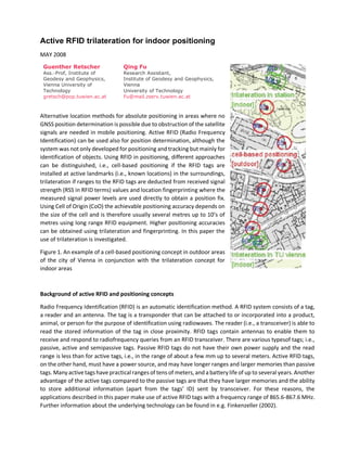
- 1. Active RFID trilateration for indoor positioning MAY 2008 Guenther Retscher Ass.-Prof, Institute of Geodesy and Geophysics, Vienna University of Technology gretsch@pop.tuwien.ac.at Qing Fu Research Assistant, Institute of Geodesy and Geophysics, Vienna University of Technology Fu@mail.zserv.tuwien.ac.at Alternative location methods for absolute positioning in areas where no GNSS position determination is possible due to obstruction of the satellite signals are needed in mobile positioning. Active RFID (Radio Frequency Identification) can be used also for position determination, although the system was not only developed for positioning and tracking but mainly for identification of objects. Using RFID in positioning, different approaches can be distinguished, i.e., cell-based positioning if the RFID tags are installed at active landmarks (i.e., known locations) in the surroundings, trilateration if ranges to the RFID tags are deducted from received signal strength (RSS in RFID terms) values and location fingerprinting where the measured signal power levels are used directly to obtain a position fix. Using Cell of Origin (CoO) the achievable positioning accuracy depends on the size of the cell and is therefore usually several metres up to 10’s of metres using long range RFID equipment. Higher positioning accuracies can be obtained using trilateration and fingerprinting. In this paper the use of trilateration is investigated. Figure 1. An example of a cell-based positioning concept in outdoor areas of the city of Vienna in conjunction with the trilateration concept for indoor areas Background of active RFID and positioning concepts Radio Frequency Identification (RFID) is an automatic identification method. A RFID system consists of a tag, a reader and an antenna. The tag is a transponder that can be attached to or incorporated into a product, animal, or person for the purpose of identification using radiowaves. The reader (i.e., a transceiver) is able to read the stored information of the tag in close proximity. RFID tags contain antennas to enable them to receive and respond to radiofrequency queries from an RFID transceiver. There are various typesof tags; i.e., passive, active and semipassive tags. Passive RFID tags do not have their own power supply and the read range is less than for active tags, i.e., in the range of about a few mm up to several meters. Active RFID tags, on the other hand, must have a power source, and may have longer ranges and larger memories than passive tags. Many active tags have practical ranges of tens of meters,and a battery life of up to several years. Another advantage of the active tags compared to the passive tags are that they have larger memories and the ability to store additional information (apart from the tags’ ID) sent by transceiver. For these reasons, the applications described in this paper make use of active RFID tags with a frequency range of 865.6-867.6 MHz. Further information about the underlying technology can be found in e.g. Finkenzeller (2002).
- 2. To employ RFID for positioning and tracking of objects, one strategy is to install RFID readers at certain waypoints (e.g. entrances of buildings, storage rooms, shops, etc.) to detect an object when passing by. For that purpose an RFID tag is attached to or incoporated in the object. This concept is employed for example in theft protection of goods in shops and in warehouse management and logistics. A second approach for using RFID in positioning would be to install RFID tags at known locations (e.g. at active landmarks) especially in areas without GPS visibility (e.g. in tunnels, under bridges, indoor environments, etc.) and have a reader and antenna installed in the mobile device carried by the user. When the user passes by the tag the RFID reader retrieves its ID and other information (e.g. the location). In the case of cell-based positioning, i.e., Cell of Origin (CoO), the maximumrange of the RFID tag defines a cell of circular shape in which a data exchange between the tag and the reader is possible. Using active RFID tags the positioning accuracy therefore ranges between a few meters up to tens of meters. In our approach the maximum range of the signal can then be set at around 20 m. Higher positioning accuracies can be obtained using trilateration if the ranges to several tags are determined and are used for intersection. For 3- D positioning range measurements to at least three tags are necessary. The ranges from the antenna of the reader to the antenna of the tag is deduced from the conversion of signal power levels into distances. Signal strength to distance conversion for RFID range deduction in trilateration To transform the measured signal strength from the RFID tag into a range between the tag and the reader a conversion model has to be employed. This conversion can be performed using a radio wave propagation model. Such a model is an empirical mathematical formulation for the characterization of radio wave propagation as a function of frequency, distance and other conditions. Such models typically predict the path loss along a link or the effective coverage area of a transmitter. For indoor environments one usable model is the ITU (International Telecommunication Union) Indoor Location Model (Wikipedia, 2008) that estimates the path loss inside a room or a closed area inside a building delimited by walls of any form. It assumes a logarithmic relationship between the measured RSSI and the range from the transmitter. Mathematically the ITU-R model (Ranvier, 2004) can be described by where sT is the total signal strength in [dBm], fc is the carrier frequency in [MHz], n is the signal strength exponent, d is the range between the RFID tag and the RFID reader in [m] and s f (n f ) is the floor penetration factor of the signal strength which depends on the number of floors between the RFID tag and RFID reader in the building. In the case of RFID the used parameters might be different to those in equation (1). In order to find out the suitable parameters for a RFID system, a new simplified equation using 3 fixed parameters as given in equation (2) can be employed: where 0 a and 1 a are coefficients found during calibration using measurements on a known baseline.
- 3. Then the parameter is an unknown coefficient that includes the fixed carrier frequency and the number of floors in the building and is the range power loss coefficient. These unknown paramters can be determined using a calibration on a known baseline inside the building. Then the distance d between the RFID tag and the RFID reader can be obtained from equation (3): with the coefficients For further improvement of the accuracy of the logarithmic approximation, the exponent in equation (3) can be extended by a polynomial function of order p as described in the following equation: where unknowns (where n must be > p + 1). The possible order p of the polynomial function depends on the number of available signal strength observations n and the desired level of approximation. From previously conducted tests (see Retscher and Fu, 2007a) it could be seen that the mean of the residuals is larger using the logarithmic model than for the simple polynomial fit for the signal strength to distance conversion in trilateration. For this reason, the simple polynomial model provides a more accurate fit to the distance data as the logarithmic model. If several RFID tags are located in thesurrounding environment the current position of the RFID reader can be obtained using trilateration. Then the deduced distances to at least three RFID tags are needed to calculate a 2-D position fix with intersection and an unknown scale factor which takes the difference between the deduced ranges to the RFID tags and the reference point system into account. If more than three distances are available, the position fix can be calculated using a least squares adjustment (see Retscher and Fu, 2008). Field test setups and results For testing our approach the path from a public transport stop (i.e., underground station ‘Karlsplatz’) to an University building was selected (see Figure 1). Three RFID tags were installed at the entrance of the underground station ‘Karlsplatz’ (indoor area). Along a road between the underground station and the university building (‘TU Vienna’ in Figure 1; outdoor area) seven tags were installed on buildings along the way. Additionally, three tags were installed at the building’s entrance (indoor area). Each circle indicates a different cell. In the experiment cell-based positioning has been applied in outdoor areas as an alternative to GPS positioning. As the accuracy of cell-based positioning generally depends on the size of the distinguishable
- 4. cells, the achievable positioning accuracies might not be sufficient for indoor areas. Ranges from the RFID tags location have been achieved up to around 20 m. In the indoor area mostly higher positioning accuracies are required. Therefore several RFID tags have been installed in the transition zones between outdoor to indoor to be able to locate the user with a higher precision. For a conversion of the measured signal strength into a range a so called calibration was carried out in the indoor environments in order to get the coefficients of the polynomial model described in equation (5). Figure 2 shows the installation of the tags in the entrance of the underground station ‘Karlsplatz’ as an example. For the conversion of the signal strength into a range a calibration along three baselines from the RFID tags has been performed to obtain calibration parameters of a characteristic curve for each line. Figure 3 shows the polynomial model approximation with an order of p = 3 and their resulting coefficients for one of the three baselines in the underground station ‘Karlsplatz’. For each baseline different coefficients are obtained, because the signal strengths of different tags were influenced differently by the objects in their surroundings. The mean values of the residuals of all the polynomial approximations are nearly zero and their standard deviations are also almost zero. This means that a good approximation with the used polynomial model is achieved. The trend of the polynomial fit is very similar. The measurements have been performed at night with no people walking around. Two sorts of test were carried out in total. In the first test the signal strength measurements were performed static over a time span of around one minute on the same points used in the calibration, since we know the true location of these points. In the second test the user was walking continuously inside the test area either from the entrance to the center of the test area or vice versa. The positioning results of the static test for the entrance of the underground station ‘Karlsplatz’ are shown in Figure 4. Table 1 shows the deviations in the X- and Y-coordinates (dX and dY) from their true location and the radial deviation dr for all test points. In average the radial deviation is only 0.32 m with a standard deviation of ± 0.40 m. The maximum deviation of one point was 0.34 m in the X-coordinates and -1.44 m in the Y-coordinates. This pointcan be considered as an outlier as the deviations of the other points are much smaller.w In the second kinematic test the reader was carried from the middle of the entrance of the underground station ‘Karlsplatz’ to the middle of tag 50 and 51 (from right to left in Figure 2) over a distance of around 14 m. Unlike the measurements in the first test, in this test every point was measured only for a few seconds. Figures 5 shows the positioning results. It can be seen that the trend of the trajectory can correctly determined. The positioning be accuracy was in the range of ± 2 to 3 m.
- 5. Conclusion and outlook This paper addresses the investigation of RFID trilateration for indoor positioning. At first some background of RFID was introduced. On this basis it was deduced how the measured signal strength can be converted into a distance. The converted distances could be used for determining the position of the reader by means of trilateration. Finally, the approach was tested in a test environment near the Vienna University of Technology. This paper addresses the investigation of RFID trilateration for indoor positioning. At first some background of RFID was introduced. On this basis it was deduced how the measured signal strength can be converted into a distance. The converted distances could be used for determining the position of the reader by means of trilateration. Finally, the approach was tested in a test environment near the Vienna University of Technology. For the signal strength to distance conversion a polynomial model was employed. Signal strength measurements were performed on baselines with a point interval of 2 m. The resulting mean value of the residuals in the conversion of the signal strength into a distance is nearly zero (i.e., below ± 2*10-11 m) using a polynomial model with an order of p = 3. These polynomial models were then used for the deduction of ranges to the tags for the location of points in static and kinematic tests. In the static test the test points were located with an accuracy of better than ± 0.35 m in X-direction and ± 1.44 m in Y-direction. In the kinematic tests lower accuracies in the range of ± 2 to 3 m were achieved, but the trend of the moving user was always determined correctly. The achieved positioning accuracies have proven that RFID trilateration can be successfully employed in a small range to the tags. In the future, we will perform more experiments to improve the polynomial models for signal strength to distance conversion. At the same time the algorithms will be tested in a larger and complicated environment and with more tags. Acknowledgements This research is supported by the research project P19210-N15 “Ubiquitous Carthograpy for Pedestrian Navigation (UCPNAVI)” founded by the Austrian Science Fund (Fonds zur Förderung wissenschaftlicher Forschung FWF). References * Fu Q., 2008. Active RFID for Positioning Using Trilateration and Location Fingerprinting Based on RSSI. in: Papers presented at the ION GNSS 2008 Conference, September 16-19, 2008, Savannah, Georgia, USA, CD- Rom Proceedings. * Ranvier S., 2004. Path Loss Models, S-72.333 Physical Layer Methods in Wireless Communication Systems, Postgraduate Course on Radiocommuications, Helsinki University of Technology, SMRAD Centre of Excellence, http://www. comlab.hut.fi/opetus/333/ 2004_2005_ slides/Path_loss_models.pdf (Last date accessed: April 2008). * Retscher G., Q. Fu, 2007a. Integration of RFID, GNSS and DR for Ubiquitous Positioning in Pedestrian Navigation. in: Papers presented at the ION GNSS 2007 Conference, September 25-28, 2007, Fort Worth, Texas, USA, CD-Rom Proceedings.