Why are Dams Built?
•Download as PPT, PDF•
1 like•412 views

The document discusses multi-purpose river projects and integrated water resources management in India. It provides background on the Bhakra Dam project in 1963, which was dedicated by Prime Minister Nehru and called "Temples of modern India." It then describes the classification, purposes and examples of multi-purpose river projects in India, including addressing water supply, irrigation, hydropower, flood control, and more. However, it also notes there are significant social and environmental impacts of dams like displacement of people, loss of biodiversity, and downstream effects.

Recommended
More Related Content
What's hot
What's hot (17)
Similar to Why are Dams Built?
Similar to Why are Dams Built? (20)
More from Teachers of India
More from Teachers of India (20)
Recently uploaded
Recently uploaded (20)
Why are Dams Built?
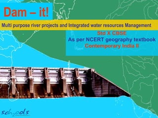
- 1. Multi purpose river projects and Integrated water resources Management Std X CBSE As per NCERT geography textbook Contemporary India II Dam – it!
- 2. Villagers downstream celebrated and set off fireworks October 1963 Dakotas of the Indian Air Force dipped their wings overhead. Pundit Nehru flicked on the switch of the powerhouse and opened the sluice gates of the dam. In his speech dedicating the dam to the nation, he called dams as the ‘Temple of modern India’
- 3. Bhakra Dam Which project are we talking about?
- 4. Was this the first water regulating structure to be built in India? Photo by Claire Arni and Oriole Henri The Grand Anicut was built during the Chola Dynasty in the 1st / 2nd century A.D. to harness the waters of the river Cauvery. Made of stone, it is as long as 3 football fieldsIt is the oldest water regulating structure and is still very much in use.
- 5. A dam is a barrier across flowing water It obstructs, directs, or retards the flow of water. It usually creates a reservoir Surplus water flows out over spillways Sluice / Radial Gates control the flow of water downstream (most gates today are radial gates) Power House Long Distance Power Lines Generator Intake Gate Spillways River River Reservoir Turbine
- 6. Based on size – Large dams (>15 meters) Major dams (over 150 meters in height) Sometimes also classified as low, medium and high. Based on structure and material used – Timber dams, Arch gravity dams, Embankment dams or Masonry dams, with several sub types. Based on purpose - Saddle dam, Dry dam, Diversion dam Classification of Dams Why do you think dams are broader at the bottom than at the top?
- 7. Multi-purpose river projects Earlier water regulating structures impounded water for irrigation Today, as the name suggests – they are
- 8. Tehri Power Irrigation Domestic Water Supply Flood Control 1204 MW 1181MW 815.6 MW 1920 MW Kutch ,Saurashtra 10 million acres in Punjab, Himachal Pradesh, Delhi, Haryana and Rajasthan 270 million gallons of drinking water per day to the industrialized areas of Delhi, Uttar Pradesh and Uttarakhand controls flooding of the lower delta region by the Mahanadi river
- 9. Tehri Inland Navigation Recreation Fish Breeding diverts water from the Ganga into the Hoogly during the dry season to flush out accumulated silt and allow navigation through the Hoogly into the port of Kolkata water-skiing, sailing, kayaking, speed boating and water scooter racing fifty one species and sub species of fish. Also a water fowl refuge
- 10. Temples of modern India industries hydropower for electricity livelihood + fishing irrigation water supply Inland Navigation Flood Control
- 11. Temples of modern India? Evaporation, Green House Gas emission Displacement of local tribes Destruction of historical and archaeological sites Loss of natural biodiversity Loss of Livelihood
- 12. Fragmentation of river ecosystems and Impacts biodiversity • Barrier for movement of migratory fish like the salmon, thereby affecting its population • Reduction in natural biodiversity along riverbanks due to reduced natural flooding • Alters water temperature downstream, affecting plant and animal life in the reservoir and the river Temples of modern India?
- 13. Reservoir Sedimentation Sediments that naturally flow in a river are blocked Reservoir storage capacity reduces Power generation and water availability reduces Downstream erosion Lesser sediments reach downstream Water flow eats into riverbed and shore (erosion) affects biodiversity in and along the river and increases coastal erosion
- 14. Temples of modern India? Cropping patterns changed to more water intensive crops – affects soil quality • Inter-state water disputes Maharastra vs. Karnataka and AP Karnataka vs. TN • Between farmers and urban areas Sabarmati basin Cauvery basin Water disputes Other social and ecological impacts: But are water disputes caused by a mismatch in demand and supply? Do dams actually ease disputes by providing water during lean periods? Debate this in class.
- 15. the disputes. Let’s play a game
- 16. • Divide the class into 5 teams • Draw as many dashes as in the name of a dam / reservoir / barrage. _ _ _ _ _ _ _ _ • Team A starts. They guess a letter. The teacher puts in the letter at the correct place, if it is there in the name of the dam. Else, the letter is written down on one side. • A maximum of 10 wrong guesses are allowed. • The team gets as many points as letters on the side (maximum of 10). • The team with the lowest number of points wins Hangman
- 17. Source: Maps of India Point the correct position of the dam/ reservoir / barrage on the map and get 2 points reduced from your points tally
- 18. Role play Activity 1 • A bench of 5 Supreme Court Judges • A person who will lose his home and lands by construction of a dam • A passionate environmentalist • A farmer downstream, plagued by seasonal floods and drought • An industrialist • A politician from a nearby urban constituency Assign the following roles to students
- 19. Activity 1 • Select a river in your state • Let each party put forward their views on the construction of a multi-purpose river project that will directly affect them • Let each party also put forth solutions for opposing factions • The judges can take a decision on the project depending on the case put forth Role Play
- 20. Activity 2 • Divide the class into 2 teams • Discuss the pros and cons of the dam built at Tehri or Koyna (let the students research the facts before the classroom discussion) Discussion
Editor's Notes
- The Grand Anicut was built by King Karikalan or Karikal Peruvalathan of the Chola dynaasty. It is also called Kallanai. The main purpose of building Kallanai was to divert water from the Cauvery for irrigation in the Tanjavur delta. The earliest known dam is situated in Jawa, Jordan, 100 km northeast of the capital Amman. It is dated 3000 BC. The oldest surviving and standing dam in the world is believed to be the Quatinah barrage in modern-day Syria. The dam is assumed to date back to the reign of the Egyptian pharao, Sethi (1319–1304 BC), and was enlarged in the Roman period and between 1934-38. It still supplies the city of Homs with water. Source: Wikipedia
- A spillway is a structure that allows excess water from a reservoir of a dammed river to flow downstream. Spillways prevent damage to the dam during heavy monsoons by releasing flood waters. Except during flood periods, water does not normally flow through the spillway. An intake is the place from which water flows down a penstock and reaches the power generating station. The force of the water flowing down the penstock turns a turbine. When a turbine rotates in a magnetic field, electricity is generated. After passing through the turbine, the water flows downstream to join the river.
- Timber dams are rare since they are not long lasting and cannot be built very high. They may be built in places/countries where timber is available in plenty. Arch gravity dams, such as the Hoover Dam, are massive dams made of reinforced concrete. They have a curved design and typically built in narrow gorges, which have sides of hard rock. An embankment dam is created by compaction of various compositions of soil, sand, clay and/or rock. A cross-section of an embankment dam shows a shape like a hill. Most have a central section or core composed of an impermeable material like clay or concrete. This prevents water from seeping through the dam. The Aswan High dam is an embankment dam. Masonry dams are built using bricks/stone, bound together with mortar. Nagarjuna Sagar Dam across the Krishna river is the world’s tallest masonry dam. A diversion dam is one that diverts all or a portion of the flow of a river from its natural course into a canal for irrigation or generation of hydroelectricity. Diversion dams do not generally impound water in a reservoir. Farakka Barrage is an example of a diversion dam. A dry dam is a dam constructed for the purpose of flood control. Dry dams typically contain no gates and are not used for hydroelectricity generation. They allow the water to flow freely during normal conditions but hold back excess water during periods of heavy rainfall thereby preventing floods. Floodwaters are released downstream at a controlled rate. Source: Wikipedia
- Electricity generation Bhakra Nangal Project (Punjab, Haryana, Rajasthan) - 1204 MW electricity Damodar Valley Project (Jharkhand, West Bengal) - 1181MW Nagarjuna Sagar Project (Andhra Pradesh) - 815.6 MW Koyna Dam (Maharashtra) – 1920 MW …and many others Irrigation Sardar Sarovar project: irrigates drought prone areas like Kutch, Saurashtra. Bhakra dam provides irrigation to 10 million acres of fields in Punjab, Himachal Pradesh, Delhi, Haryana, and Rajasthan. Water Supply for domestic and industrial use Krishna Raja Sagara dam ensures water supply for Mysore. Tehri dam supplies 270 million gallons of drinking water per day to the industrialized areas of Delhi, Uttar Pradesh, and Uttarakhand. Flood control Hirakud Dam controls flooding of the lower delta region by the Mahanadi river. Bhakra dam prevents floods in the Sutlej – Beas river valley.
- Inland navigation Farakka Barrage is a dam on the Ganga. It diverts water from the Ganga into the Hoogly river during the dry season to flush out accumulated silt and allow navigation through the Hoogly into the port of Kolkata. Recreation Gobind Sagar reservoir created by Bhakra dam is used for water-skiing, sailing, kayaking, speed boating, and water scooter racing. Fish breeding Gobind Sagar was declared as a water fowl refuge in 1962. Fishing is commonly practiced here. It has about fifty one species and sub species.
- The damming of a river creates a reservoir upstream from the dam. The reservoir waters spill out into the surrounding environments, flooding the natural habitats that existed before the dam’s construction. To date, over 400,000 square kilometres of the earth have been flooded due to damming. The newly created reservoir has more surface area than the river would have had, and therefore more evaporation occurs than is normal. According to recent studies, reservoirs contribute to greenhouse gas emissions as well. The initial filling of a reservoir floods the existing plant material, leading to the death and decomposition of the carbon-rich plants and trees. The rotting organic matter releases large amounts of carbon into the atmosphere. The decaying plant matter itself settles to the non-oxygenated bottom of the stagnant reservoir, and the decomposition--unmitigated by a flow pattern that would oxygenate the water--produces and eventually releases dissolved methane. Source: Wikipedia
- Salmon is a salt water fish but is born in freshwater. After hatching, young salmon migrate to the ocean but return to the place they were born to spawn. Dams block their migration to the ocean and back and salmon populations are being affected. Newer dams include artificial fish ladders to allow for upstream migration and salmon needs to find its way to the spillway when going downstream. The areas surrounding riverbanks are particularly rich in bio-diversity, supported by the natural flooding of a dam-free river. Dammed rivers reduce flood rates, and this has negative consequences on the floodplains downstream that depend on seasonal waters for survival. The comparatively invariable ecosystem created by a reservoir-river supports a far-reduced range of wildlife. The water of a reservoir is usually warmer in winter and cooler in the summer than it would be without a dam. As this water flows into its river, the altered temperature also affects the temperature of the river in question. This impacts the plant and animal life present in both the reservoir and the river, often creating environments that are unnatural to the endemic species.
- Rivers carry four different types of sediment down their riverbeds, allowing for the formation of riverbanks, deltas, alluvial fans, coastal shores, etc. The construction of a dam blocks the flow of sediment downstream, leading to downstream erosion of these depositional environments, and increased sediment build-up in the reservoir. While the rate of sedimentation varies for each dam and each river, eventually all reservoirs develop a reduced water-storage capacity due to the exchange of storage space for sediment. Diminished storage capacity results in decreased ability to produce hydroelectric power, reduced availability of water for irrigation, and if left unaddressed, may ultimately result in the expiration of the dam and river. As all dams result in reduced sediment load downstream, a dammed river is said to be “hungry” for sediment. Because the rate of deposition of sediment is greatly reduced since there is less to deposit but the rate of erosion remains nearly constant, the water flow eats away at the river shores and riverbed, threatening shoreline ecosystems, deepening the riverbed, and narrowing the river over time. This leads to a compromised water table, reduced water levels, and reduced amount of sediment reaching coastal plains and deltas. This prompts coastal erosion, as beaches are unable to replenish what waves erode without the sediment deposition of supporting river systems. Channel erosion of rivers has its own set of consequences. River silt is a natural fertilizer. Reduced silt downstream of the dam, affects agriculture and natural biodiversity. Source: Wikipedia
- Increased irrigation is causing farmers to move towards commercial crops that are highly water intensive. Since the soil may not be suitable for such crops, the salinity of the soil may be affected. Farmers may also need to use excessive fertilizers to improve crop yields in soils that are not conducive to growing such crops. Fertilizer and pesticide runoff flows back into the river and groundwater, causing water pollution. When a dam is constructed on a free-flowing river in one state, that state can control the outflow of water downstream. Rivers flow across state boundaries and places downstream can be affected by this action. This can lead to inter-state water disputes, which are becoming very common in some parts of our country. Students can be asked to collect data on any one inter-state water dispute and display their findings on a bulletin board. Riots have also broken out when, during the summer months, water has been diverted to important urban centres, depriving farmers in the vicinity of the river with water required for irrigation. An example is rioting and protests by farmers in Mandya district of Karnataka against water being supplied to Bangalore or by farmers in the Sabarmati basin against water supplied to growing urban areas. But according to another school of thought, water disputes result because demand exceeds supply. Dams will in fact solve or at least reduce the intensity of disputes, by making more water available during lean season. What do you think?