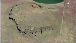
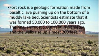
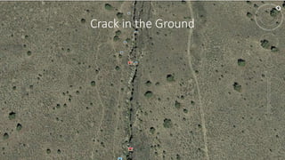
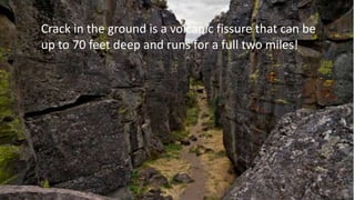
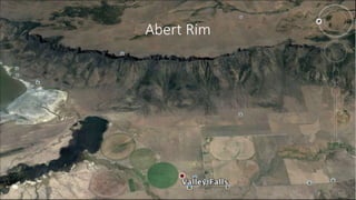
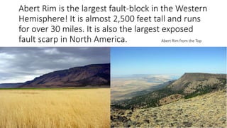
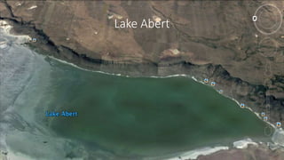
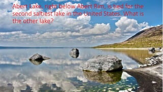
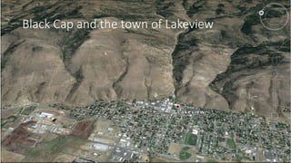
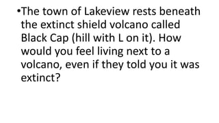
Places to see in Lake County
Oregon!
Virtual Tour
This is a tour of cool places to visit within Lake
County, Oregon. This is in the southeastern part of
the state, east of Klamath Falls. I am from the
town of Lakeview and I think that this area is
pretty cool.
Fort Rock
Based on the Google Earth
photo, are the walls of Fort
Rock small, medium, or large?
•Fort rock is a geologic formation made from
basaltic lava pushing up on the bottom of a
muddy lake bed. Scientists estimate that it
was formed 50,000 to 100,000 years ago.
The ring is almost 5,000 feet in diameter
and the walls rise up almost 200 feet.
Crack in the Ground
•In relation to the road on the right,
about how wide is Crack in the
Ground? Smaller than the road,
bigger than the road, or about the
same size?
Crack in the ground is a volcanic fissure that can be
up to 70 feet deep and runs for a full two miles!
Abert Rim
•Based on the surrounding crop
circles, is Abert Rim very large?
Is it very tall?
Abert Rim is the largest fault-block in the Western
Hemisphere! It is almost 2,500 feet tall and runs
for over 30 miles. It is also the largest exposed
fault scarp in North America. Abert Rim from the Top
Lake Abert
•What is significant about Abert Lake,
besides the fact that it is a body of
water?
Abert Lake, right below Abert Rim, is tied for the
second saltiest lake in the United States. What is
the other lake?
Black Cap and the town of Lakeview
•The town of Lakeview rests beneath
the extinct shield volcano called
Black Cap (hill with L on it). How
would you feel living next to a
volcano, even if they told you it was
extinct?
A countryside view of some buildings and the
surrounding mountains.
• (All pictures in this powerpoint came from Google Earth)

Virtual tour

  • 1.
    Places to seein Lake County Oregon! Virtual Tour
  • 2.
    This is atour of cool places to visit within Lake County, Oregon. This is in the southeastern part of the state, east of Klamath Falls. I am from the town of Lakeview and I think that this area is pretty cool.
  • 3.
  • 4.
    Based on theGoogle Earth photo, are the walls of Fort Rock small, medium, or large?
  • 5.
    •Fort rock isa geologic formation made from basaltic lava pushing up on the bottom of a muddy lake bed. Scientists estimate that it was formed 50,000 to 100,000 years ago. The ring is almost 5,000 feet in diameter and the walls rise up almost 200 feet.
  • 6.
  • 7.
    •In relation tothe road on the right, about how wide is Crack in the Ground? Smaller than the road, bigger than the road, or about the same size?
  • 8.
    Crack in theground is a volcanic fissure that can be up to 70 feet deep and runs for a full two miles!
  • 9.
  • 10.
    •Based on thesurrounding crop circles, is Abert Rim very large? Is it very tall?
  • 11.
    Abert Rim isthe largest fault-block in the Western Hemisphere! It is almost 2,500 feet tall and runs for over 30 miles. It is also the largest exposed fault scarp in North America. Abert Rim from the Top
  • 12.
  • 13.
    •What is significantabout Abert Lake, besides the fact that it is a body of water?
  • 14.
    Abert Lake, rightbelow Abert Rim, is tied for the second saltiest lake in the United States. What is the other lake?
  • 15.
    Black Cap andthe town of Lakeview
  • 16.
    •The town ofLakeview rests beneath the extinct shield volcano called Black Cap (hill with L on it). How would you feel living next to a volcano, even if they told you it was extinct?
  • 17.
    A countryside viewof some buildings and the surrounding mountains.
  • 18.
    • (All picturesin this powerpoint came from Google Earth)