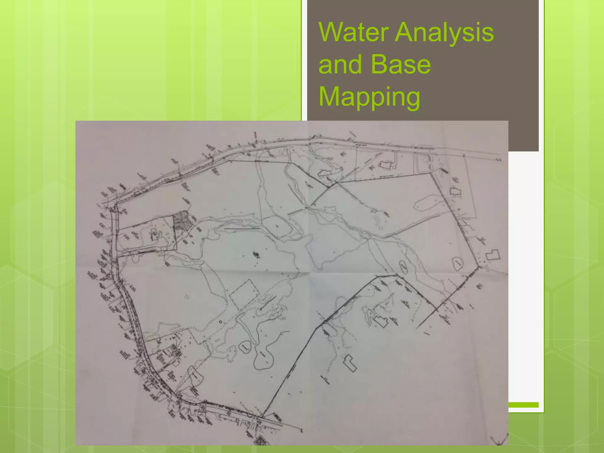
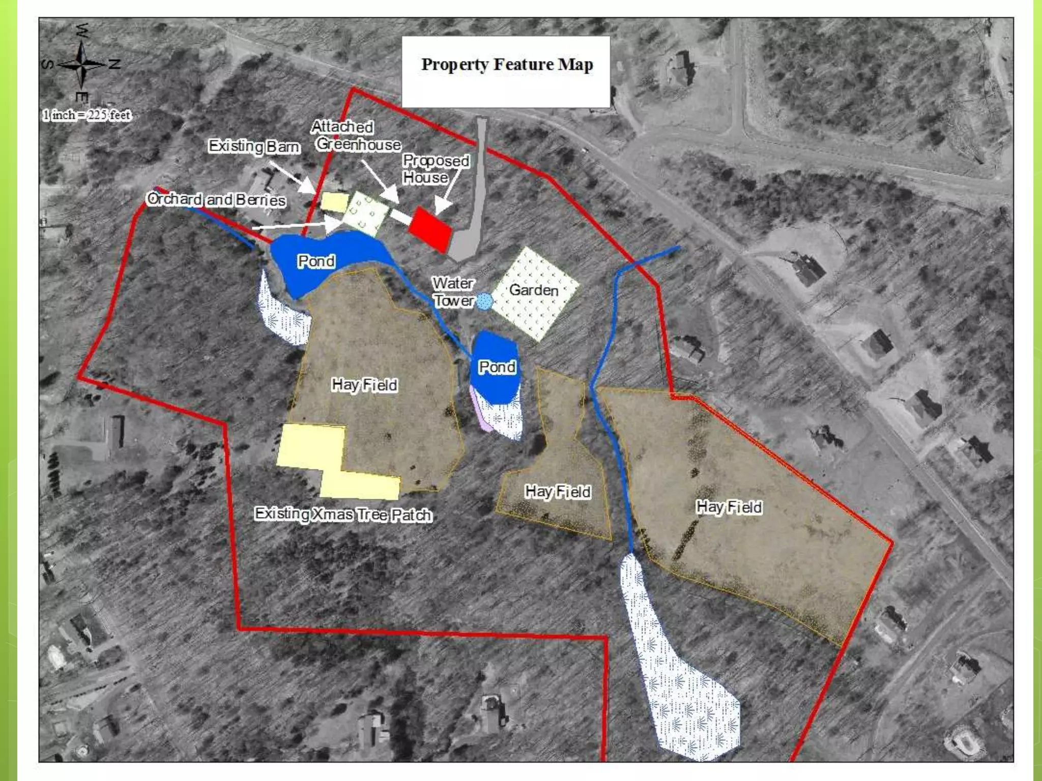
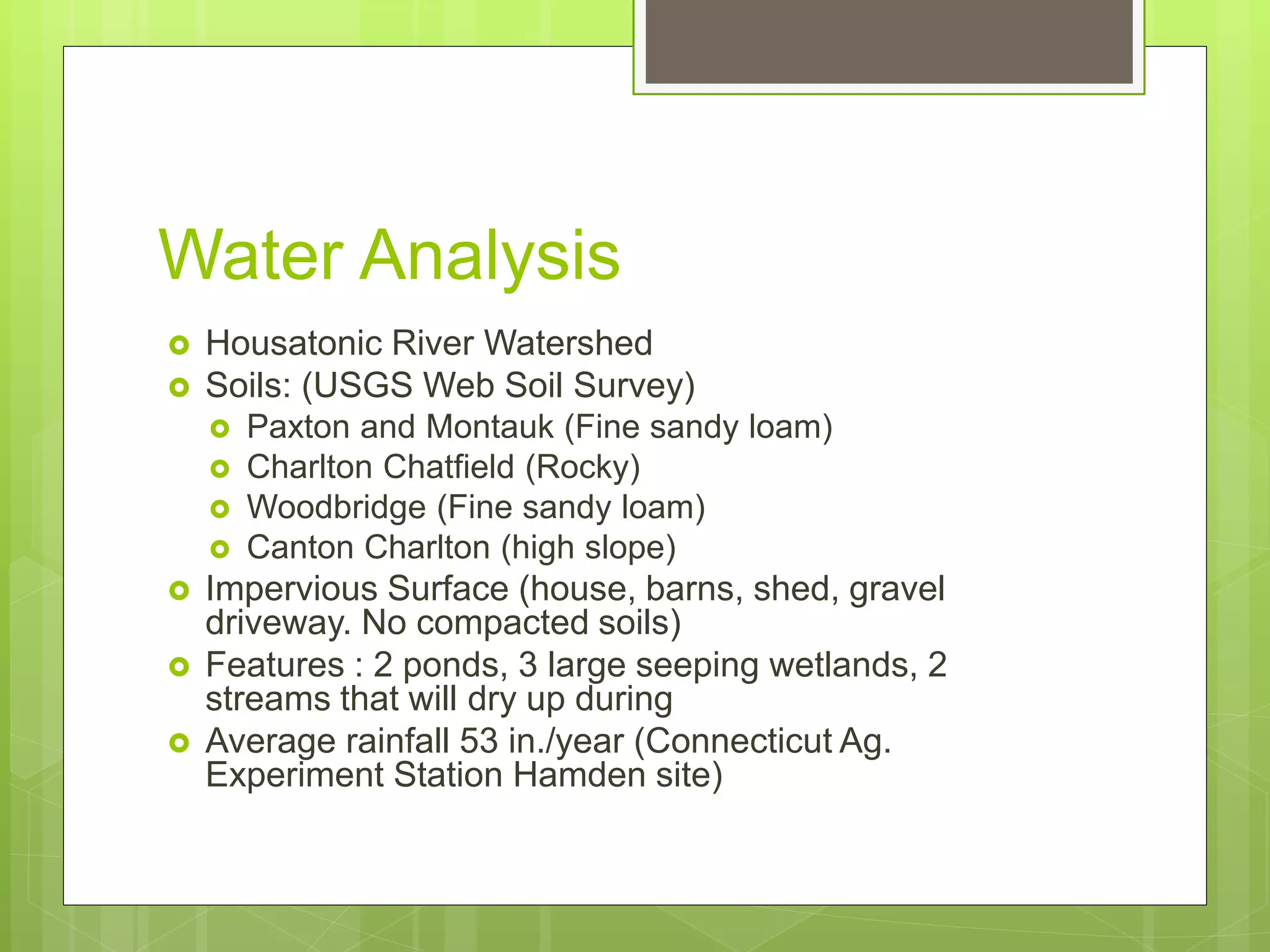
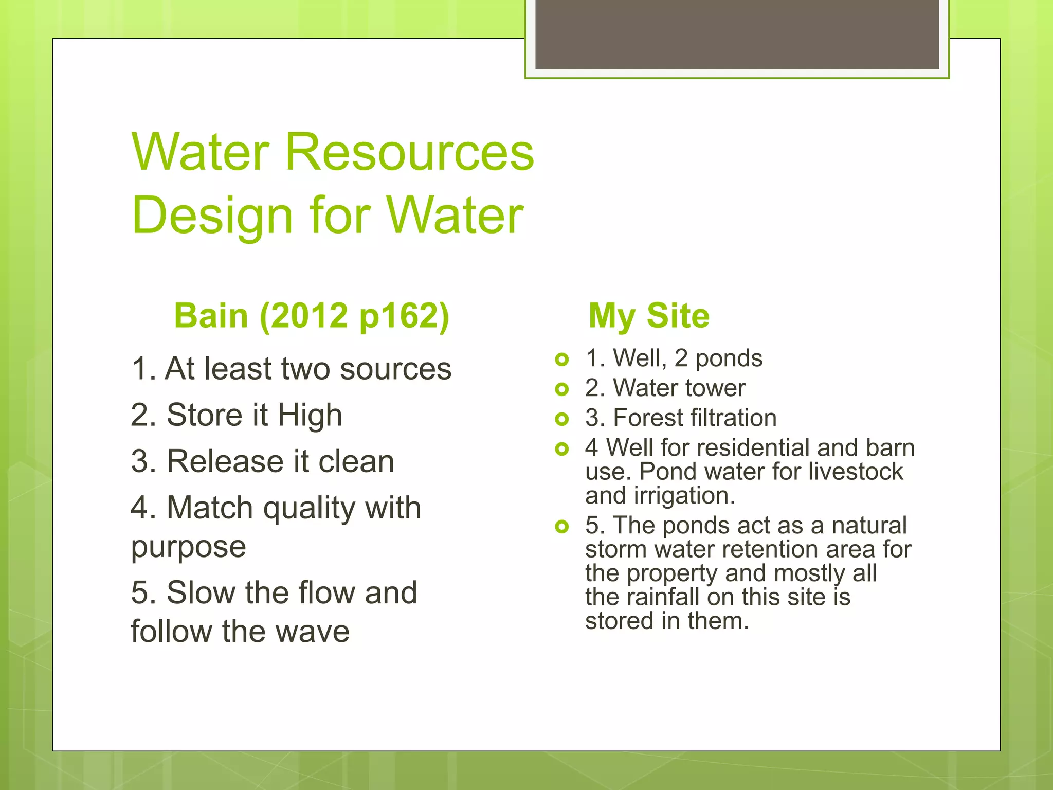
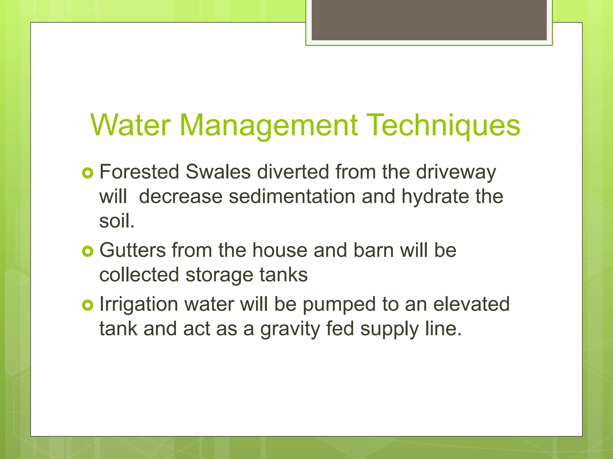
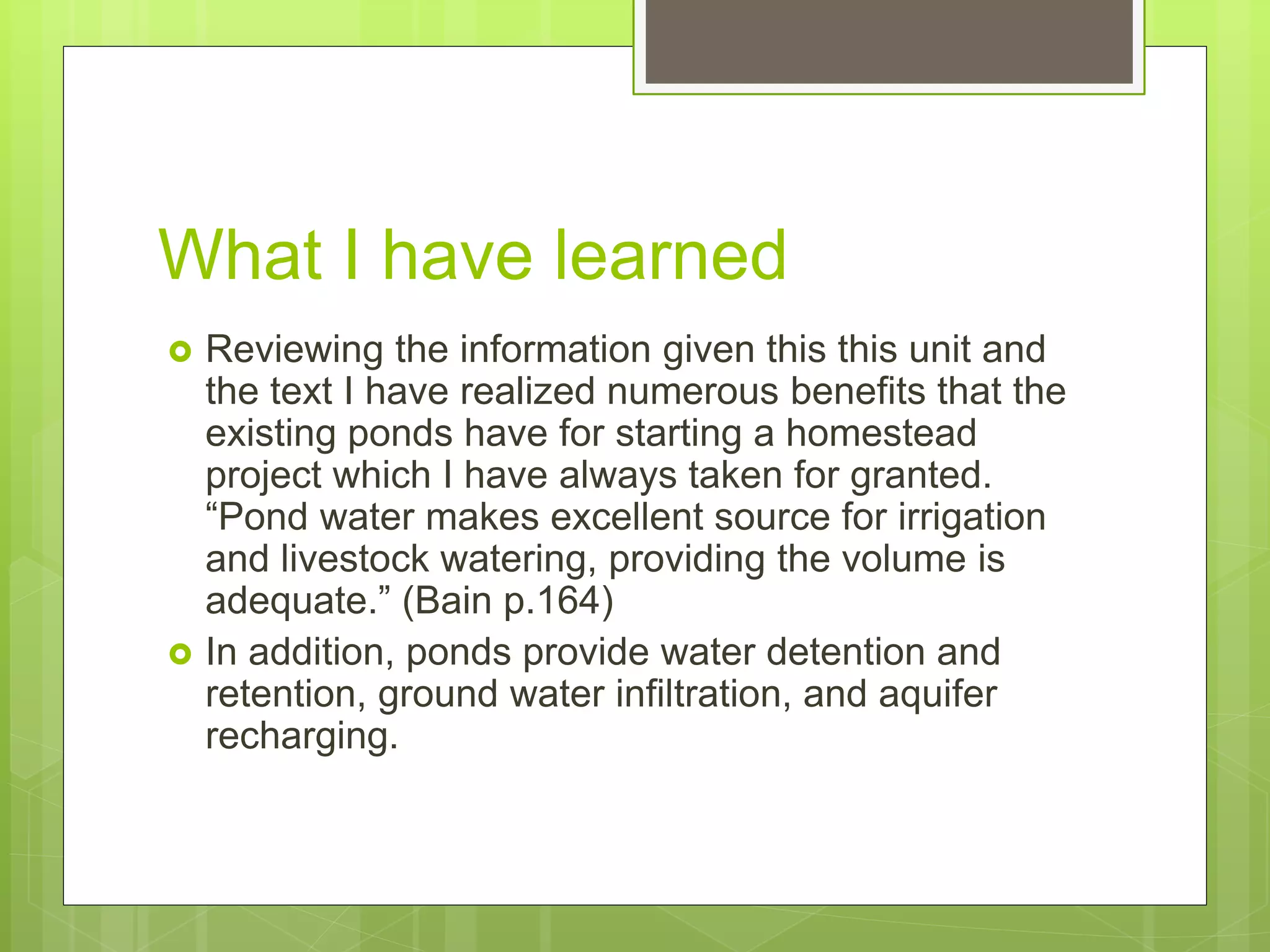
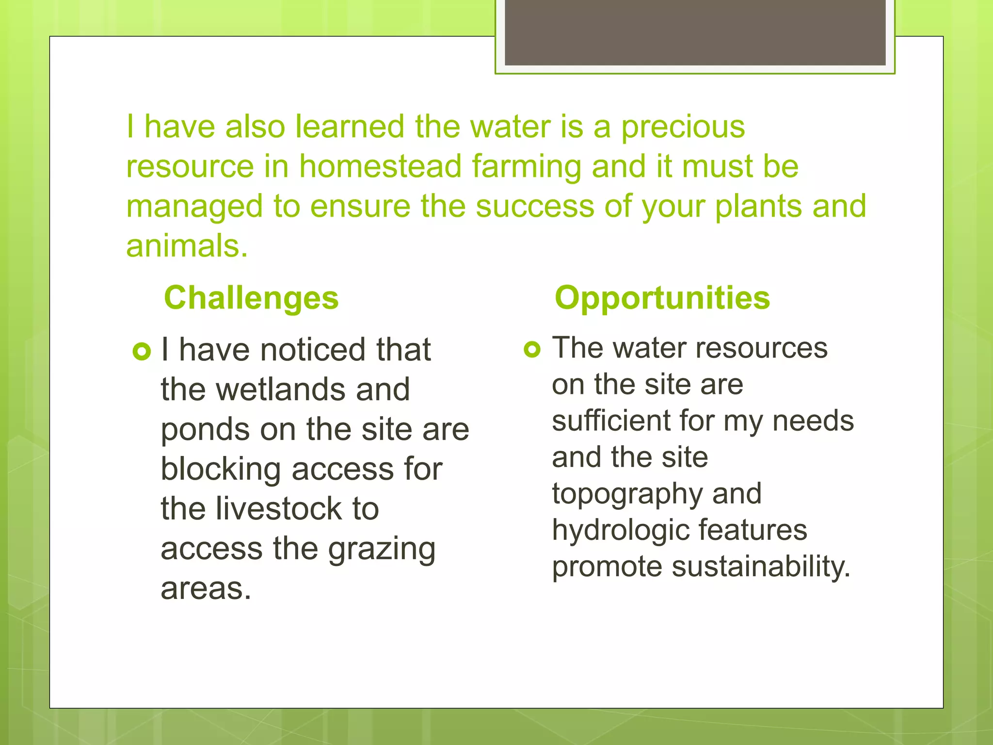
Water Analysis
and Base
Mapping
Ed Belinsky
Base Mapping
 As recommended to Bain, I researched the property
maps at the Town Hall and have recovered engineering
maps of the property with included wetland delineation
mapping
 Instead of hand drawing my plan I have used Arc GIS a
program much like Google Maps to compile data. To
make it easier to visual I have placed the engineering
drawings over a aerial photo.
 Soils, drainage basins, surficial geology, FEMA Flood
Zones, and surficial hydrology here all suppled by the
CT Dept. of Environmental and Energy Protection
through GIS shapefiles.
Water Analysis
 Housatonic River Watershed
 Soils: (USGS Web Soil Survey)
 Paxton and Montauk (Fine sandy loam)
 Charlton Chatfield (Rocky)
 Woodbridge (Fine sandy loam)
 Canton Charlton (high slope)
 Impervious Surface (house, barns, shed, gravel
driveway. No compacted soils)
 Features : 2 ponds, 3 large seeping wetlands, 2
streams that will dry up during
 Average rainfall 53 in./year (Connecticut Ag.
Experiment Station Hamden site)
Water Resources
Design for Water
Bain (2012 p162)
1. At least two sources
2. Store it High
3. Release it clean
4. Match quality with
purpose
5. Slow the flow and
follow the wave
My Site
 1. Well, 2 ponds
 2. Water tower
 3. Forest filtration
 4 Well for residential and barn
use. Pond water for livestock
and irrigation.
 5. The ponds act as a natural
storm water retention area for
the property and mostly all
the rainfall on this site is
stored in them.
Water Management Techniques
 Forested Swales diverted from the driveway
will decrease sedimentation and hydrate the
soil.
 Gutters from the house and barn will be
collected storage tanks
 Irrigation water will be pumped to an elevated
tank and act as a gravity fed supply line.
What I have learned
 Reviewing the information given this this unit and
the text I have realized numerous benefits that the
existing ponds have for starting a homestead
project which I have always taken for granted.
“Pond water makes excellent source for irrigation
and livestock watering, providing the volume is
adequate.” (Bain p.164)
 In addition, ponds provide water detention and
retention, ground water infiltration, and aquifer
recharging.
I have also learned the water is a precious
resource in homestead farming and it must be
managed to ensure the success of your plants and
animals.
Challenges
 I have noticed that
the wetlands and
ponds on the site are
blocking access for
the livestock to
access the grazing
areas.
Opportunities
 The water resources
on the site are
sufficient for my needs
and the site
topography and
hydrologic features
promote sustainability.

Unit 2 water analysis and base mapping

  • 1.
  • 2.
    Base Mapping  Asrecommended to Bain, I researched the property maps at the Town Hall and have recovered engineering maps of the property with included wetland delineation mapping  Instead of hand drawing my plan I have used Arc GIS a program much like Google Maps to compile data. To make it easier to visual I have placed the engineering drawings over a aerial photo.  Soils, drainage basins, surficial geology, FEMA Flood Zones, and surficial hydrology here all suppled by the CT Dept. of Environmental and Energy Protection through GIS shapefiles.
  • 4.
    Water Analysis  HousatonicRiver Watershed  Soils: (USGS Web Soil Survey)  Paxton and Montauk (Fine sandy loam)  Charlton Chatfield (Rocky)  Woodbridge (Fine sandy loam)  Canton Charlton (high slope)  Impervious Surface (house, barns, shed, gravel driveway. No compacted soils)  Features : 2 ponds, 3 large seeping wetlands, 2 streams that will dry up during  Average rainfall 53 in./year (Connecticut Ag. Experiment Station Hamden site)
  • 5.
    Water Resources Design forWater Bain (2012 p162) 1. At least two sources 2. Store it High 3. Release it clean 4. Match quality with purpose 5. Slow the flow and follow the wave My Site  1. Well, 2 ponds  2. Water tower  3. Forest filtration  4 Well for residential and barn use. Pond water for livestock and irrigation.  5. The ponds act as a natural storm water retention area for the property and mostly all the rainfall on this site is stored in them.
  • 6.
    Water Management Techniques Forested Swales diverted from the driveway will decrease sedimentation and hydrate the soil.  Gutters from the house and barn will be collected storage tanks  Irrigation water will be pumped to an elevated tank and act as a gravity fed supply line.
  • 7.
    What I havelearned  Reviewing the information given this this unit and the text I have realized numerous benefits that the existing ponds have for starting a homestead project which I have always taken for granted. “Pond water makes excellent source for irrigation and livestock watering, providing the volume is adequate.” (Bain p.164)  In addition, ponds provide water detention and retention, ground water infiltration, and aquifer recharging.
  • 8.
    I have alsolearned the water is a precious resource in homestead farming and it must be managed to ensure the success of your plants and animals. Challenges  I have noticed that the wetlands and ponds on the site are blocking access for the livestock to access the grazing areas. Opportunities  The water resources on the site are sufficient for my needs and the site topography and hydrologic features promote sustainability.