QGIS UK User Group - QGIS and Cartography (Ordnance Survey)
•
1 like•4,637 views
A showcase from Charley Glynn of Ordnance Survey of how the Cartographic Design team is using QGIS to design and style OS vector and raster products.
Report
Share
Report
Share
Download to read offline

Recommended
QGIS UK: QGIS Evangelism (thinkWhere)
An introduction to QGIS including a short history of the development of the software. Highlights of the benefits of using open source software and a top ten of the most requested features when switching from a proprietary GIS to open source QGIS.
QGIS and Altas: Automatic map generation
Talk given by David McDermott of Surrey Health BC at the South-East QGIS user group meeting 2nd April 2014
QGIS UK: QGIS and Cartography (OS)
A showcase from Ordnance Survey of how the Cartographic Design team is using QGIS to design and style OS vector and raster products.
QGIS UK: Developing with QGIS - What is possible (Lutra Consulting)
QGIS is a modular and extensible open source geographic information system. It has a Python API that allows developers to build plugins that interact with QGIS functionality and libraries. Plugins can be built with C++ or Python and interface with QGIS through the QgisInterface class. Example plugins include InaSAFE for hazard impact scenarios and Crayfish for visualizing flood modeling results. Developers can also create standalone applications using the QGIS libraries for tasks like automating GIS processes, building custom editing tools, or developing specialized mapping applications.
QGIS UK: QGIS Performance Enhancements (Lutra Consulting)
Martin Dobias of Lutra Consulting explaining some of the performance enhancements coming in the next releases of QGIS including multi-threaded processing.
QGIS - Free alternative to ArcMap
QGIS is a free and open source geographic information system (GIS) software that can perform many common GIS tasks like ArcMap such as viewing shapefiles and rasters, georeferencing images, and geoprocessing. It has a clean interface and is faster than ArcMap. While it supports fewer file types than ArcMap, it is cross-platform and free compared to ArcMap's licensing costs. The presentation provides an example of using QGIS to create a map from a CSV file with location data and export it.
Analysing Web GIS apps
This document discusses integrating web GIS applications with monitoring tools for analysis and reporting. It provides an overview of GIS applications and web GIS, demonstrates a web GIS map application, and discusses monitoring the availability, performance, and usage of GIS services. The architecture of monitoring tools is explained, including data collection from GIS servers, windows performance counters, and log files. Examples of dashboard reports on summary data, uptime, usage, and performance from the monitoring tools are also shown.
CartoDB Inside Out
Technical overview of the CartoDB platform, describing the most important pieces of an architecture that serves millions of maps every day.
Designing and Using Cached Map
This document provides an overview of designing and publishing cached map services to ArcGIS Server. It discusses:
- What cached maps are and their primary purpose of pre-rendering map images for fast display and reducing server load.
- The key steps for publishing an image service to ArcGIS Server, including designing data, creating a file geodatabase and mosaic dataset, publishing the image service, and creating a cache at various scales and formats.
- Designing mosaic datasets to manage and serve large image collections while reducing processing time and storage needs.
- Using ArcGIS Desktop and Server software to author image services from desktop data and publish them to ArcGIS Server with caches for improved performance.
LSIVIEWER 2.0-A CLIENT-ORIENTED ONLINE VISUALIZATION TOOL FOR GEOSPATIAL VECT...
Visualize Geospatial vector data with a single click.
http://lsi.iiit.ac.in/lsiviewer
Published in ISPRS Archives: https://doi.org/10.5194/isprs-archives-XLII-2-W7-107-2017
Presented at ISPRS Geospatial Week - WebMGS 2017 held in Wuhan, China.
For more information:
Lab for Spatial Informatics
B2-213, Vindhya Building
International Institute of Information Technology(IIIT-H)
Hyderabad, India
Phone : (+91-40)2300 1967, 1969 Ext.276
Google cloud infrastructure workshop
This document outlines an agenda for a Google Cloud Infrastructure workshop. The workshop will provide an overview of Google Cloud Platform, including its core computing and storage services. It will also cover hands-on labs and quests using Qwiklabs to practice deploying and developing applications on Google Cloud. The instructor, Akash Agrawal, will discuss his background and provide resources for learning more about Google Cloud Platform.
Crossrail - Big Maps for a Big Project - Smart Infrastructure - Esri UK Annua...
Crossrail is a major infrastructure project building a new railway line across London. GIS plays a key role in managing the large amount of spatial data and sharing information across the many stakeholders. The GIS system uses a federated database architecture to integrate data from various systems. Crossrail shares information publicly and internally which provides benefits like reduced costs and improved collaboration. Lessons from Crossrail can help future large infrastructure projects.
Intro to Quantum GIS Desktop GIS
A quick guide to the basic capabilities of the Quantum GIS dekstop GIS package. Just an emergency set of screenshots in case my live demo didn't work!
Integrating PostGIS in Web Applications
Leo Hsu and Regina Obe
We'll demonstrate integrating PostGIS in both PHP and ASP.NET applications.
We'll demonstrate using the new PostGIS 1.5 geography offering to extend existing web applications with proximity analysis.
More advanced use to display maps and stats using OpenLayers, WMS/WFS services and roll your own WFS like service using the PostGIS KML/GML/and or GeoJSON output functions.
Go implementation for Flatdata
Once in the past, routing team at HERE Technologies was in the situation when routing backend was in danger of failing SLA. It’s triggered a massive work to improve its performance. As a side effect of this work, https://github.com/heremaps/flatdata was born: zero-copy memory-mapped data storage.
This talk will be about sharing an experience of creation of Go implementation for Flatdata: zero-copy memory-mapped data storage.
We will compare Go implementation with implementations for other languages. I will show in which cases Go has advantages compared to other languages and opposite cases (hi, generics!). We will look also at the performance aspect of different implementations.
KDOT Aviation Portal Update: Cesium, FME
The KDOT Aviation Portal (AP) is an evolution of the popular Airspace Awareness Tool (AAT) released in 2013. This talk will highlight the process used in the migration of the Google Earth Plugin based AAT to the new Cesium based AP as well as how FME Server is used in the delivery FAA provided content.
Arc2Earth FedGeoDay - MapBox and TileMill
This document discusses how to publish ArcGIS maps to TileMill and MapBox. It provides steps for using Arc2Earth to export tiles from an MXD file and sync it with a TileMill project to maintain the look and feel of the ArcGIS map. The document also demonstrates exporting tiles directly from ArcGIS to serve as a tile cache, and using Arc2Earth as a bridge to bring an MXD into TileMill for tile-based map rendering and publishing to MapBox.
QWC2 - modern web maps with QGIS Server
- QWC II is a new web-based client for QGIS being developed as an update to the aging QWC I using modern frameworks like AngularJS and ReactJS.
- It will have responsive design, support for QGIS server extensions, and improved usability over QWC I.
- The city of Kristianstad is partnering on QWC II to replace their existing web maps with a solution more tightly integrated with their QGIS desktop and server setup.
Cloud Native and CNCF
The document discusses Cloud Native computing and the Cloud Native Computing Foundation (CNCF). It defines Cloud Native as a new paradigm for developing, deploying, and running applications using open source software like microservices, containers, and container orchestration. The CNCF is responsible for building sustainable ecosystems of Cloud Native software and serves as the home for many fastest-growing open source projects like Kubernetes, Prometheus, and Envoy. The CNCF landscape includes graduated, incubated, and sandbox projects and drives adoption of the Cloud Native paradigm.
Grafana selectel
Grafana is an open source analytics and monitoring solution that allows users to visualize data and metrics from various sources. It provides a flexible dashboard interface that supports creating and sharing visualizations, alerting, and templating. Grafana has evolved over several major versions to support more data sources, improved UX, alerting capabilities, and a plugin system. It aims to continue expanding supported data sources and features like reporting, live data streaming, and clustering.
Implementing INSPIRE services for Dutch provinces
IDgis, a small Dutch company, won the tender to implement INSPIRE services for the 12 independent provinces in the Netherlands. They developed an architecture that merges the provinces' data by harvesting their WFS services, transforming and loading the data into a centralized database. This database feeds national discovery and view services that provide harmonized, INSPIRE-compliant access to the provinces' environmental data. The implementation was organized with a central team managing the work of the provinces and IDgis developing ETL, deegree, and testing components. Knowledge and open source components were shared and can be reused by other organizations.
3D Solution Templates - Making the World 3D
3D Solution Templates are a collection of Workspace templates for processing 3D data with a special focus on how to handle the OGC standard CityGML available (soon) on FME Hub. OGC CityGML is a exchange and storage format for 3D geoinformation that describes the geometry, semantics, appearance and topology of complex 3D features. It is used as a national 3D GIS standard in many countries, e.g. Germany, Netherlands, and Singapore. The 3D Solution Templates have been developed in a cooperation between con terra and virtualcitySYSTEMS. Attendees will gain insights in the Workspace templates which cover topics such as reading, writing and validation of CityGML, related datamodels like INSPIRE and also a various number of 3D formats like 3D PDF and Sketchup.
Esri Scotland Conf 2016 Forestry Commission
This document outlines the challenges faced by the Forestry Commission in facilitating collaboration among staff. It describes the evolution of their platforms from individual PCs in district offices in the 1990s to a modern "Forester" platform that allows all staff access to content from any device. The vision is for Forester to be a centralized hub containing all spatial data, enabling easy search, sharing and updating of content to support collaboration. It provides configurable collaboration tools to streamline the process and aims to make data accessible everywhere by everyone on the Forestry Commission team.
NDGeospatialSummit2019 - Everything You Need to Know About ArcGIS Vector Tiles
Vector tile layers contain indexed data, styles, and fonts for different scale levels that conform to open source standards. They provide tile layer performance for vector data by using client-side rendering to match display resolution and allow dynamic labeling and re-styling. Vector tiles take less server resources and time to produce than raster tiles, are easier to update, and do not use credits for storage. Customizing and updating vector tiles is supported in ArcGIS Online and JavaScript API.
Application and integration of Python in the geodata management of a local go...
The document discusses the use of Python in managing geospatial data for a local government office in Basel-Stadt, Switzerland. The office manages geospatial data infrastructure and applications, develops GIS services, and maintains key geospatial datasets. Python is used to synchronize attribute data between applications and geospatial databases, and to migrate interfaces like the Bluebox interface for exchanging data between geospatial and cadastral systems from Java to Python. Python tools like SQLAlchemy are used for communicating with databases.
Esri Scotland Conf 2016 City of Edinburgh
The document summarizes a project conducted by Edinburgh Council to survey dropped kerbs using ESRI's Collector application. The survey gathered data on dropped kerbs, raised tables, guardrails, and residential crossovers across the city. While the Collector worked well for gathering the data, some issues arose around labeling, syncing large amounts of data, and downloading data with geometry errors. The collected data will now be added to the Roads Services asset management system and used to prioritize accessibility improvements through smaller streetworks projects and larger capital renewal schemes.
Grafana
This document provides an overview of Grafana, an open source metrics dashboard and graph editor for Graphite, InfluxDB and OpenTSDB. It discusses Grafana's features such as rich graphing, time series querying, templated queries, annotations, dashboard search and export/import. The document also covers Grafana's history and alternatives. It positions Grafana as providing richer features than Graphite Web and highlights features like multiple y-axes, unit formats, mixing graph types, thresholds and tooltips.
Scalable Data Analytics and Visualization with Cloud Optimized Services
This document discusses scalable data analytics and visualization using cloud optimized services. It provides examples of leveraging cloud technologies like AWS and Azure to build scalable implementations for processing and serving large geospatial and earth observation datasets. This includes architectures for hosting high resolution raster data and services, global hydrologic modeling, and near real-time flood forecasting using NOAA's National Water Model.
QGIS UK User Group - QGIS Evangelism (thinkWhere)
An introduction to QGIS from Neil Benny of thinkWhere including a short history of the development of the software. Highlights of the benefits of using open source software and a top ten of the most requested features when switching from a proprietary GIS to open source QGIS.
QGIS UK User Group - Introduction and Feedback
This document summarizes the notes from a UK QGIS User Group meeting in Scotland on March 19th, 2014. It discusses setting up a UK QGIS user group, connecting members through online platforms, the day's presentations on QGIS evangelism, performance enhancements, and data connections. A poll found most members were willing to pay for workshops and a subscription. There was also discussion on raising funds and how to apportion them between the core QGIS project and the UK user group.
More Related Content
What's hot
Designing and Using Cached Map
This document provides an overview of designing and publishing cached map services to ArcGIS Server. It discusses:
- What cached maps are and their primary purpose of pre-rendering map images for fast display and reducing server load.
- The key steps for publishing an image service to ArcGIS Server, including designing data, creating a file geodatabase and mosaic dataset, publishing the image service, and creating a cache at various scales and formats.
- Designing mosaic datasets to manage and serve large image collections while reducing processing time and storage needs.
- Using ArcGIS Desktop and Server software to author image services from desktop data and publish them to ArcGIS Server with caches for improved performance.
LSIVIEWER 2.0-A CLIENT-ORIENTED ONLINE VISUALIZATION TOOL FOR GEOSPATIAL VECT...
Visualize Geospatial vector data with a single click.
http://lsi.iiit.ac.in/lsiviewer
Published in ISPRS Archives: https://doi.org/10.5194/isprs-archives-XLII-2-W7-107-2017
Presented at ISPRS Geospatial Week - WebMGS 2017 held in Wuhan, China.
For more information:
Lab for Spatial Informatics
B2-213, Vindhya Building
International Institute of Information Technology(IIIT-H)
Hyderabad, India
Phone : (+91-40)2300 1967, 1969 Ext.276
Google cloud infrastructure workshop
This document outlines an agenda for a Google Cloud Infrastructure workshop. The workshop will provide an overview of Google Cloud Platform, including its core computing and storage services. It will also cover hands-on labs and quests using Qwiklabs to practice deploying and developing applications on Google Cloud. The instructor, Akash Agrawal, will discuss his background and provide resources for learning more about Google Cloud Platform.
Crossrail - Big Maps for a Big Project - Smart Infrastructure - Esri UK Annua...
Crossrail is a major infrastructure project building a new railway line across London. GIS plays a key role in managing the large amount of spatial data and sharing information across the many stakeholders. The GIS system uses a federated database architecture to integrate data from various systems. Crossrail shares information publicly and internally which provides benefits like reduced costs and improved collaboration. Lessons from Crossrail can help future large infrastructure projects.
Intro to Quantum GIS Desktop GIS
A quick guide to the basic capabilities of the Quantum GIS dekstop GIS package. Just an emergency set of screenshots in case my live demo didn't work!
Integrating PostGIS in Web Applications
Leo Hsu and Regina Obe
We'll demonstrate integrating PostGIS in both PHP and ASP.NET applications.
We'll demonstrate using the new PostGIS 1.5 geography offering to extend existing web applications with proximity analysis.
More advanced use to display maps and stats using OpenLayers, WMS/WFS services and roll your own WFS like service using the PostGIS KML/GML/and or GeoJSON output functions.
Go implementation for Flatdata
Once in the past, routing team at HERE Technologies was in the situation when routing backend was in danger of failing SLA. It’s triggered a massive work to improve its performance. As a side effect of this work, https://github.com/heremaps/flatdata was born: zero-copy memory-mapped data storage.
This talk will be about sharing an experience of creation of Go implementation for Flatdata: zero-copy memory-mapped data storage.
We will compare Go implementation with implementations for other languages. I will show in which cases Go has advantages compared to other languages and opposite cases (hi, generics!). We will look also at the performance aspect of different implementations.
KDOT Aviation Portal Update: Cesium, FME
The KDOT Aviation Portal (AP) is an evolution of the popular Airspace Awareness Tool (AAT) released in 2013. This talk will highlight the process used in the migration of the Google Earth Plugin based AAT to the new Cesium based AP as well as how FME Server is used in the delivery FAA provided content.
Arc2Earth FedGeoDay - MapBox and TileMill
This document discusses how to publish ArcGIS maps to TileMill and MapBox. It provides steps for using Arc2Earth to export tiles from an MXD file and sync it with a TileMill project to maintain the look and feel of the ArcGIS map. The document also demonstrates exporting tiles directly from ArcGIS to serve as a tile cache, and using Arc2Earth as a bridge to bring an MXD into TileMill for tile-based map rendering and publishing to MapBox.
QWC2 - modern web maps with QGIS Server
- QWC II is a new web-based client for QGIS being developed as an update to the aging QWC I using modern frameworks like AngularJS and ReactJS.
- It will have responsive design, support for QGIS server extensions, and improved usability over QWC I.
- The city of Kristianstad is partnering on QWC II to replace their existing web maps with a solution more tightly integrated with their QGIS desktop and server setup.
Cloud Native and CNCF
The document discusses Cloud Native computing and the Cloud Native Computing Foundation (CNCF). It defines Cloud Native as a new paradigm for developing, deploying, and running applications using open source software like microservices, containers, and container orchestration. The CNCF is responsible for building sustainable ecosystems of Cloud Native software and serves as the home for many fastest-growing open source projects like Kubernetes, Prometheus, and Envoy. The CNCF landscape includes graduated, incubated, and sandbox projects and drives adoption of the Cloud Native paradigm.
Grafana selectel
Grafana is an open source analytics and monitoring solution that allows users to visualize data and metrics from various sources. It provides a flexible dashboard interface that supports creating and sharing visualizations, alerting, and templating. Grafana has evolved over several major versions to support more data sources, improved UX, alerting capabilities, and a plugin system. It aims to continue expanding supported data sources and features like reporting, live data streaming, and clustering.
Implementing INSPIRE services for Dutch provinces
IDgis, a small Dutch company, won the tender to implement INSPIRE services for the 12 independent provinces in the Netherlands. They developed an architecture that merges the provinces' data by harvesting their WFS services, transforming and loading the data into a centralized database. This database feeds national discovery and view services that provide harmonized, INSPIRE-compliant access to the provinces' environmental data. The implementation was organized with a central team managing the work of the provinces and IDgis developing ETL, deegree, and testing components. Knowledge and open source components were shared and can be reused by other organizations.
3D Solution Templates - Making the World 3D
3D Solution Templates are a collection of Workspace templates for processing 3D data with a special focus on how to handle the OGC standard CityGML available (soon) on FME Hub. OGC CityGML is a exchange and storage format for 3D geoinformation that describes the geometry, semantics, appearance and topology of complex 3D features. It is used as a national 3D GIS standard in many countries, e.g. Germany, Netherlands, and Singapore. The 3D Solution Templates have been developed in a cooperation between con terra and virtualcitySYSTEMS. Attendees will gain insights in the Workspace templates which cover topics such as reading, writing and validation of CityGML, related datamodels like INSPIRE and also a various number of 3D formats like 3D PDF and Sketchup.
Esri Scotland Conf 2016 Forestry Commission
This document outlines the challenges faced by the Forestry Commission in facilitating collaboration among staff. It describes the evolution of their platforms from individual PCs in district offices in the 1990s to a modern "Forester" platform that allows all staff access to content from any device. The vision is for Forester to be a centralized hub containing all spatial data, enabling easy search, sharing and updating of content to support collaboration. It provides configurable collaboration tools to streamline the process and aims to make data accessible everywhere by everyone on the Forestry Commission team.
NDGeospatialSummit2019 - Everything You Need to Know About ArcGIS Vector Tiles
Vector tile layers contain indexed data, styles, and fonts for different scale levels that conform to open source standards. They provide tile layer performance for vector data by using client-side rendering to match display resolution and allow dynamic labeling and re-styling. Vector tiles take less server resources and time to produce than raster tiles, are easier to update, and do not use credits for storage. Customizing and updating vector tiles is supported in ArcGIS Online and JavaScript API.
Application and integration of Python in the geodata management of a local go...
The document discusses the use of Python in managing geospatial data for a local government office in Basel-Stadt, Switzerland. The office manages geospatial data infrastructure and applications, develops GIS services, and maintains key geospatial datasets. Python is used to synchronize attribute data between applications and geospatial databases, and to migrate interfaces like the Bluebox interface for exchanging data between geospatial and cadastral systems from Java to Python. Python tools like SQLAlchemy are used for communicating with databases.
Esri Scotland Conf 2016 City of Edinburgh
The document summarizes a project conducted by Edinburgh Council to survey dropped kerbs using ESRI's Collector application. The survey gathered data on dropped kerbs, raised tables, guardrails, and residential crossovers across the city. While the Collector worked well for gathering the data, some issues arose around labeling, syncing large amounts of data, and downloading data with geometry errors. The collected data will now be added to the Roads Services asset management system and used to prioritize accessibility improvements through smaller streetworks projects and larger capital renewal schemes.
Grafana
This document provides an overview of Grafana, an open source metrics dashboard and graph editor for Graphite, InfluxDB and OpenTSDB. It discusses Grafana's features such as rich graphing, time series querying, templated queries, annotations, dashboard search and export/import. The document also covers Grafana's history and alternatives. It positions Grafana as providing richer features than Graphite Web and highlights features like multiple y-axes, unit formats, mixing graph types, thresholds and tooltips.
Scalable Data Analytics and Visualization with Cloud Optimized Services
This document discusses scalable data analytics and visualization using cloud optimized services. It provides examples of leveraging cloud technologies like AWS and Azure to build scalable implementations for processing and serving large geospatial and earth observation datasets. This includes architectures for hosting high resolution raster data and services, global hydrologic modeling, and near real-time flood forecasting using NOAA's National Water Model.
What's hot (20)
LSIVIEWER 2.0-A CLIENT-ORIENTED ONLINE VISUALIZATION TOOL FOR GEOSPATIAL VECT...
LSIVIEWER 2.0-A CLIENT-ORIENTED ONLINE VISUALIZATION TOOL FOR GEOSPATIAL VECT...
Crossrail - Big Maps for a Big Project - Smart Infrastructure - Esri UK Annua...
Crossrail - Big Maps for a Big Project - Smart Infrastructure - Esri UK Annua...
NDGeospatialSummit2019 - Everything You Need to Know About ArcGIS Vector Tiles
NDGeospatialSummit2019 - Everything You Need to Know About ArcGIS Vector Tiles
Application and integration of Python in the geodata management of a local go...
Application and integration of Python in the geodata management of a local go...
Scalable Data Analytics and Visualization with Cloud Optimized Services
Scalable Data Analytics and Visualization with Cloud Optimized Services
Viewers also liked
QGIS UK User Group - QGIS Evangelism (thinkWhere)
An introduction to QGIS from Neil Benny of thinkWhere including a short history of the development of the software. Highlights of the benefits of using open source software and a top ten of the most requested features when switching from a proprietary GIS to open source QGIS.
QGIS UK User Group - Introduction and Feedback
This document summarizes the notes from a UK QGIS User Group meeting in Scotland on March 19th, 2014. It discusses setting up a UK QGIS user group, connecting members through online platforms, the day's presentations on QGIS evangelism, performance enhancements, and data connections. A poll found most members were willing to pay for workshops and a subscription. There was also discussion on raising funds and how to apportion them between the core QGIS project and the UK user group.
QGIS UK User Group - QGIS Performance Enhancements (Lutra)
Martin Dobias of Lutra Consulting explaining some of the performance enhancements coming in the next releases of QGIS including multi-core, multi-threaded processing.
QGIS UK User Group - Developing with QGIS (Lutra)
QGIS is a modular and extensible open source geographic information system. It exposes functionality through Python bindings, allowing plugins and standalone applications to be developed. Plugins interact with QGIS through the QgisInterface class, which provides access to core functionality like layers, features, and geometry. Example plugins are InaSAFE for hazard impact scenarios and Crayfish for flood modeling results. Standalone applications can be built with the QGIS libraries for tasks like automating processing, data collection, or specialized navigation tools.
Opening slides - South-East UK QGIS user group meeting
This document summarizes the agenda for the UK QGIS user group meeting on April 2nd, 2014. It introduces the regional leads who helped establish the UK QGIS user group. It describes that the group has a Google+ community of 131 members and a WordPress site. It outlines that several collaborations between members led to the development of new plugins. The agenda then lists presentations on topics like GIS, map production, QGIS with PostGIS, and QGIS with OpenStreetMap. Workshops on Python and QGIS and an intro to QGIS were also scheduled. The document closes by thanking Imperial College, Ordnance Survey, and attendees for their participation.
Going Enterprise QGIS and PostGIS
This document summarizes a presentation about making QGIS more enterprise-ready. It discusses simplifying the QGIS interface for non-GIS users, managing styles and data across an organization, auditing data for changes and compliance through PostgreSQL triggers, and providing dynamic feedback on invalid data entry to improve data quality. The presentation includes demos of these concepts.
OSM and QGIS
Jerry Clough presents techniques for analyzing OpenStreetMap data using QGIS. He discusses using OSM data to simulate the European Urban Atlas project and mapping retail locations. Case studies include analyzing pub density in Britain, simulating land use classification, and tracking street light and retail mappings. Challenges with OSM data like polygon overlaps and tagging variations are also covered.
Viewers also liked (7)
QGIS UK User Group - QGIS Performance Enhancements (Lutra)
QGIS UK User Group - QGIS Performance Enhancements (Lutra)
Opening slides - South-East UK QGIS user group meeting
Opening slides - South-East UK QGIS user group meeting
Similar to QGIS UK User Group - QGIS and Cartography (Ordnance Survey)
QGIS Open Source Desktop GIS
Dave Murray presented on QGIS, an open source desktop GIS. He discussed why users should consider QGIS, its benefits, and limitations compared to commercial GIS software. Training materials and resources for learning QGIS were provided, including online courses, tutorials, and documentation. While QGIS is limited in some areas like advanced editing and cartography, it was positioned as a valuable free tool worth learning to expand one's GIS skills and have an alternative to expensive commercial software.
2018 - Grupo QGIS Brasil e o lançamento do QGIS 3.4 LTR (Versão de Longo Prazo)
2018 - Grupo QGIS Brasil e o lançamento do QGIS 3.4 LTR (Versão de Longo Prazo)George Porto Ferreira
This document summarizes QGIS, an open source geographic information system (GIS) software. It discusses QGIS's 15-year history of development, governance structure, and key contributors from around the world. New features are highlighted for the desktop application, server capabilities, and mobile integration. Guidance is provided on migrating from previous QGIS versions and how to get involved in the project through development, documentation, or other support.GEOGRAPHICAL INFORMATION SYSTEM (GIS)
This document provides an overview of geographic information systems (GIS). It defines GIS and lists its main components and functions for supporting decision making about land use, natural resources, and other planning areas. The document outlines the history of GIS, why it is needed, technologies that support it like remote sensing and cartography, and common applications in areas like natural resource management and emergency response. It also discusses GIS software, data, users, methods, benefits, and functions like data capture, compilation, and storage. Finally, it provides lists of common commercial and open source GIS software options as well as advantages, disadvantages, and potential of GIS technology.
QGIS Module 1
This document provides an overview of a GIS workshop that teaches important GIS concepts and how to use Quantum GIS (QGIS) open source software. The goal is for participants to understand basic GIS concepts, navigate the QGIS interface, add and prepare vector data, create thematic maps, and demonstrate competency with QGIS. The workshop covers installing and navigating QGIS, loading shapefiles, defining key GIS terms like layers and vectors/rasters, and downloading necessary plugins. Participants will learn how to load pre-existing shapefiles from sources like DIVA-GIS and explore the QGIS interface.
Q GIS Training Presentation
This document provides an introduction to Geographic Information Systems (GIS) and the open-source GIS software Quantum GIS (QGIS). It discusses what GIS is, its components and uses, and gives an overview of QGIS's interface and functions. The document then demonstrates how to load shapefiles and join CSV files in QGIS, and provides examples of creating graduated, hot spot and density maps. Finally, it discusses QGIS installation, documentation, file formats and a practical assignment on mapping immunization data.
CyberGIS Architectures for Collaborative Problem Solving - OGC perspective
The document discusses CyberGIS architectures for collaborative problem solving. It states that the geospatial interoperability plumbing is in place through standards like OGC web services. However, improvements are still needed for big data applications and discrete global grid systems. It also notes that conceptual models and implementations are needed for knowledge objects like decisions and hypotheses to fully enable collaborative knowledge environments.
Edina Geoservices Review - Emma Diffley
Presentation given as part of the EDINA Digimap GeoForum 2013 on Thursday 20th June 2013 at the Congress Centre, London.
My experience and suggestions as a web-GIS developer
This slide is presented on the NGES Geoseries episode #3. Full video recording is available here: https://youtube.com/live/NQIsMc3oEBg
GeoPackage SWG Overview
Jeff Yutzler presents an update of the GeoPackage Standards Working Group to the OGC Technical Committee.
FOSS4G 2017 Spatial Sql for Rookies
The document discusses spatial SQL and databases. It provides an agenda for installing software, building a database, importing shapefiles, and writing queries. It then defines spatial SQL, discusses drivers for increased use of location data, and lists databases that support spatial SQL like Oracle, MySQL, SQL Server, Spatial Lite, and PostGIS. Finally, it covers functionality of spatial databases and shapefiles, and capabilities of PostGIS like spatial indexing.
"Open Source and Open Data creating possibilities for location intelligence b...
Track | the Future of Open Source Business
Sanna Jokela, CEO, Gispo Ltd
Mindtrek Conference
15th of November 2022.
Tampere, Finland
www.mindtrek.org
Making beautiful maps with Mapbox Studio by Charley Glynn
This document summarizes a presentation about making maps with Mapbox Studio. It discusses cartography principles, using QGIS at Ordnance Survey, OS OpenData products, the Mapbox stack including Studio, loading data as sources, styling with CartoCSS, and advanced cartography techniques. Workshop materials and a guide for loading OS Map Local data into Studio are provided at a given link.
Final map server
This is a class presentation on MapServer...
The facts and figures explained here are somebody else's work. The author has just accumulated and presented them.
Next Generation Open Data Platforms | AWS Public Sector Summit 2016
The document discusses the evolution and future of open data platforms like GeoPlatform.gov, which implements goals of the National Spatial Data Infrastructure Strategic Plan. Key points include:
- GeoPlatform.gov provides a consistent portal for open geospatial data and services, and shared hosting of these resources.
- Recent improvements include new map viewers, analytics dashboards, and tools for data discovery, sharing, and collaboration.
- Future plans include expanding data registries, monitoring service quality, and providing more open APIs to developers.
- The overall aim is to advance open data sharing and make national geospatial resources more accessible, interoperable, and usable.
OGC standards relevant to ISPRS
Presentation to for the ISPRS Congress 2012, Melbourne
Over the last decade, standards have played a key role in the expansion of the market for Earth Observation (EO) products and services. Standards become increasingly important as geospatial technologies and markets continue to evolve in an increasingly complex technology ecosystem. OGC and ISPRS work jointly to further the development of this vital information industry.
We continue to see global growth in the supply of geometrically controlled image-based geodata. On the data supplier side, most end-use EO information products use data from multiple EO sources (aerial and satellite) as well as from ground-based sources. On the customer side, customers’ business models involving EO data require easy connections between multiple data suppliers and multiple technology platforms. Typically, new markets create stovepiped, proprietary solutions that persist until market forces create demand for standards that in turn enhance market opportunity. The OGC’s standards meet this demand in the geospatial markets.
OGC leads worldwide in the creation and establishment of standards that allow geospatial content and services to be seamlessly integrated into business and civic processes, the spatial web and enterprise computing. OGC accelerates market assimilation of interoperability research through collaborative consortium processes.
OGC has both domain focused and technology focused activities. For example, the Meteorology & Oceanography Domain Working Group ensures that OGC standards and profiles allow the meteorological community to develop effective interoperability for web services and content across the wider geospatial domain. These needs are met for example by the technology of standards such as netCDF which was brought into the OGC to encourage broader international use and greater interoperability among clients and servers interchanging data in binary form.
Most OGC standards specify open interfaces or encodings that apply to imagery. Some of these are:
o Web Coverage Service (WCS)
o Web Coverage Processing Service (WCPS)
o Web Map Service (WMS)
o Geography Markup Language (GML)
o GML in JPEG 2000 Encoding
o OGC Network Common Data Form (NetCDF)
o Sensor Observation Service (SOS)
o Sensor Planning Service (SPS)
o Sensor Model Language Encoding Standard (SensorML).
o Catalogue Service for the WEB (CSW)
Whitebox GAT - an introduction by its developer
John Lindsay, the main developer of the little known but extremely powerful GIS program Whitebox Geospatial Analysis Tools, describes his software at GISRUK 2014 in Glasgow.
GIS Standards and Interoperability
This document discusses standards and interoperability in geographic information systems (GIS). It emphasizes that standards are important for sharing data between government departments and making location-based data accessible to citizens. It outlines some relevant technical standards like OGC, ISO, and OpenLS. The document also discusses challenges around reading, displaying, and editing spatial data from different sources and solutions like spatial databases and web services. Finally, it provides details on how standards will be implemented for a GIS project in Madinah, Saudi Arabia, including the use of Oracle, Envinsa, web services, and OGC standards.
Managing Spatial Information and Services with Drupal: the GEO-MOOD approach
Web-based Geographical Information System technology has been evolved from sharing maps and spatial information to a collaborative geospatial Content Management System (CMS). Spatial-CMS is one of the latest trends in the CMS world and Drupal is already playing an important role.
Va - GloSIS - Design and Spatial Data Infrastructure
INSII | International Network of Soil Information Institutions - 5th working session. 21 - 23 Oct 2019 | FAO headquarters, Rome, Italy.
Postgis for Enterprise
This document provides an introduction to PostGIS, an open source spatial database extender for PostgreSQL object-relational database. It discusses PostGIS' support for spatial data types, indexing, and functions. PostGIS allows for storage and query of spatial data in PostgreSQL for use in enterprise mapping, GIS, and location-based applications and services.
Similar to QGIS UK User Group - QGIS and Cartography (Ordnance Survey) (20)
2018 - Grupo QGIS Brasil e o lançamento do QGIS 3.4 LTR (Versão de Longo Prazo)
2018 - Grupo QGIS Brasil e o lançamento do QGIS 3.4 LTR (Versão de Longo Prazo)
CyberGIS Architectures for Collaborative Problem Solving - OGC perspective
CyberGIS Architectures for Collaborative Problem Solving - OGC perspective
My experience and suggestions as a web-GIS developer
My experience and suggestions as a web-GIS developer
"Open Source and Open Data creating possibilities for location intelligence b...
"Open Source and Open Data creating possibilities for location intelligence b...
Making beautiful maps with Mapbox Studio by Charley Glynn
Making beautiful maps with Mapbox Studio by Charley Glynn
Next Generation Open Data Platforms | AWS Public Sector Summit 2016
Next Generation Open Data Platforms | AWS Public Sector Summit 2016
Managing Spatial Information and Services with Drupal: the GEO-MOOD approach
Managing Spatial Information and Services with Drupal: the GEO-MOOD approach
Va - GloSIS - Design and Spatial Data Infrastructure
Va - GloSIS - Design and Spatial Data Infrastructure
Recently uploaded
Artificial Intelligence for XMLDevelopment
In the rapidly evolving landscape of technologies, XML continues to play a vital role in structuring, storing, and transporting data across diverse systems. The recent advancements in artificial intelligence (AI) present new methodologies for enhancing XML development workflows, introducing efficiency, automation, and intelligent capabilities. This presentation will outline the scope and perspective of utilizing AI in XML development. The potential benefits and the possible pitfalls will be highlighted, providing a balanced view of the subject.
We will explore the capabilities of AI in understanding XML markup languages and autonomously creating structured XML content. Additionally, we will examine the capacity of AI to enrich plain text with appropriate XML markup. Practical examples and methodological guidelines will be provided to elucidate how AI can be effectively prompted to interpret and generate accurate XML markup.
Further emphasis will be placed on the role of AI in developing XSLT, or schemas such as XSD and Schematron. We will address the techniques and strategies adopted to create prompts for generating code, explaining code, or refactoring the code, and the results achieved.
The discussion will extend to how AI can be used to transform XML content. In particular, the focus will be on the use of AI XPath extension functions in XSLT, Schematron, Schematron Quick Fixes, or for XML content refactoring.
The presentation aims to deliver a comprehensive overview of AI usage in XML development, providing attendees with the necessary knowledge to make informed decisions. Whether you’re at the early stages of adopting AI or considering integrating it in advanced XML development, this presentation will cover all levels of expertise.
By highlighting the potential advantages and challenges of integrating AI with XML development tools and languages, the presentation seeks to inspire thoughtful conversation around the future of XML development. We’ll not only delve into the technical aspects of AI-powered XML development but also discuss practical implications and possible future directions.
Removing Uninteresting Bytes in Software Fuzzing
Imagine a world where software fuzzing, the process of mutating bytes in test seeds to uncover hidden and erroneous program behaviors, becomes faster and more effective. A lot depends on the initial seeds, which can significantly dictate the trajectory of a fuzzing campaign, particularly in terms of how long it takes to uncover interesting behaviour in your code. We introduce DIAR, a technique designed to speedup fuzzing campaigns by pinpointing and eliminating those uninteresting bytes in the seeds. Picture this: instead of wasting valuable resources on meaningless mutations in large, bloated seeds, DIAR removes the unnecessary bytes, streamlining the entire process.
In this work, we equipped AFL, a popular fuzzer, with DIAR and examined two critical Linux libraries -- Libxml's xmllint, a tool for parsing xml documents, and Binutil's readelf, an essential debugging and security analysis command-line tool used to display detailed information about ELF (Executable and Linkable Format). Our preliminary results show that AFL+DIAR does not only discover new paths more quickly but also achieves higher coverage overall. This work thus showcases how starting with lean and optimized seeds can lead to faster, more comprehensive fuzzing campaigns -- and DIAR helps you find such seeds.
- These are slides of the talk given at IEEE International Conference on Software Testing Verification and Validation Workshop, ICSTW 2022.
Enchancing adoption of Open Source Libraries. A case study on Albumentations.AI
Enchancing adoption of Open Source Libraries. A case study on Albumentations.AIVladimir Iglovikov, Ph.D.
Presented by Vladimir Iglovikov:
- https://www.linkedin.com/in/iglovikov/
- https://x.com/viglovikov
- https://www.instagram.com/ternaus/
This presentation delves into the journey of Albumentations.ai, a highly successful open-source library for data augmentation.
Created out of a necessity for superior performance in Kaggle competitions, Albumentations has grown to become a widely used tool among data scientists and machine learning practitioners.
This case study covers various aspects, including:
People: The contributors and community that have supported Albumentations.
Metrics: The success indicators such as downloads, daily active users, GitHub stars, and financial contributions.
Challenges: The hurdles in monetizing open-source projects and measuring user engagement.
Development Practices: Best practices for creating, maintaining, and scaling open-source libraries, including code hygiene, CI/CD, and fast iteration.
Community Building: Strategies for making adoption easy, iterating quickly, and fostering a vibrant, engaged community.
Marketing: Both online and offline marketing tactics, focusing on real, impactful interactions and collaborations.
Mental Health: Maintaining balance and not feeling pressured by user demands.
Key insights include the importance of automation, making the adoption process seamless, and leveraging offline interactions for marketing. The presentation also emphasizes the need for continuous small improvements and building a friendly, inclusive community that contributes to the project's growth.
Vladimir Iglovikov brings his extensive experience as a Kaggle Grandmaster, ex-Staff ML Engineer at Lyft, sharing valuable lessons and practical advice for anyone looking to enhance the adoption of their open-source projects.
Explore more about Albumentations and join the community at:
GitHub: https://github.com/albumentations-team/albumentations
Website: https://albumentations.ai/
LinkedIn: https://www.linkedin.com/company/100504475
Twitter: https://x.com/albumentationsIntroducing Milvus Lite: Easy-to-Install, Easy-to-Use vector database for you...
Join us to introduce Milvus Lite, a vector database that can run on notebooks and laptops, share the same API with Milvus, and integrate with every popular GenAI framework. This webinar is perfect for developers seeking easy-to-use, well-integrated vector databases for their GenAI apps.
20240609 QFM020 Irresponsible AI Reading List May 2024
Everything I found interesting about the irresponsible use of machine intelligence in May 2024
Uni Systems Copilot event_05062024_C.Vlachos.pdf
Unlocking Productivity: Leveraging the Potential of Copilot in Microsoft 365, a presentation by Christoforos Vlachos, Senior Solutions Manager – Modern Workplace, Uni Systems
Microsoft - Power Platform_G.Aspiotis.pdf
Revolutionizing Application Development
with AI-powered low-code, presentation by George Aspiotis, Sr. Partner Development Manager, Microsoft
TrustArc Webinar - 2024 Global Privacy Survey
How does your privacy program stack up against your peers? What challenges are privacy teams tackling and prioritizing in 2024?
In the fifth annual Global Privacy Benchmarks Survey, we asked over 1,800 global privacy professionals and business executives to share their perspectives on the current state of privacy inside and outside of their organizations. This year’s report focused on emerging areas of importance for privacy and compliance professionals, including considerations and implications of Artificial Intelligence (AI) technologies, building brand trust, and different approaches for achieving higher privacy competence scores.
See how organizational priorities and strategic approaches to data security and privacy are evolving around the globe.
This webinar will review:
- The top 10 privacy insights from the fifth annual Global Privacy Benchmarks Survey
- The top challenges for privacy leaders, practitioners, and organizations in 2024
- Key themes to consider in developing and maintaining your privacy program
Large Language Model (LLM) and it’s Geospatial Applications
Large Language Model (LLM) and it’s Geospatial Applications.
GraphSummit Singapore | Graphing Success: Revolutionising Organisational Stru...
Sudheer Mechineni, Head of Application Frameworks, Standard Chartered Bank
Discover how Standard Chartered Bank harnessed the power of Neo4j to transform complex data access challenges into a dynamic, scalable graph database solution. This keynote will cover their journey from initial adoption to deploying a fully automated, enterprise-grade causal cluster, highlighting key strategies for modelling organisational changes and ensuring robust disaster recovery. Learn how these innovations have not only enhanced Standard Chartered Bank’s data infrastructure but also positioned them as pioneers in the banking sector’s adoption of graph technology.
GraphSummit Singapore | The Future of Agility: Supercharging Digital Transfor...
Leonard Jayamohan, Partner & Generative AI Lead, Deloitte
This keynote will reveal how Deloitte leverages Neo4j’s graph power for groundbreaking digital twin solutions, achieving a staggering 100x performance boost. Discover the essential role knowledge graphs play in successful generative AI implementations. Plus, get an exclusive look at an innovative Neo4j + Generative AI solution Deloitte is developing in-house.
Goodbye Windows 11: Make Way for Nitrux Linux 3.5.0!
As the digital landscape continually evolves, operating systems play a critical role in shaping user experiences and productivity. The launch of Nitrux Linux 3.5.0 marks a significant milestone, offering a robust alternative to traditional systems such as Windows 11. This article delves into the essence of Nitrux Linux 3.5.0, exploring its unique features, advantages, and how it stands as a compelling choice for both casual users and tech enthusiasts.
National Security Agency - NSA mobile device best practices
Threats to mobile devices are more prevalent and increasing in scope and complexity. Users of mobile devices desire to take full advantage of the features
available on those devices, but many of the features provide convenience and capability but sacrifice security. This best practices guide outlines steps the users can take to better protect personal devices and information.
Why You Should Replace Windows 11 with Nitrux Linux 3.5.0 for enhanced perfor...
The choice of an operating system plays a pivotal role in shaping our computing experience. For decades, Microsoft's Windows has dominated the market, offering a familiar and widely adopted platform for personal and professional use. However, as technological advancements continue to push the boundaries of innovation, alternative operating systems have emerged, challenging the status quo and offering users a fresh perspective on computing.
One such alternative that has garnered significant attention and acclaim is Nitrux Linux 3.5.0, a sleek, powerful, and user-friendly Linux distribution that promises to redefine the way we interact with our devices. With its focus on performance, security, and customization, Nitrux Linux presents a compelling case for those seeking to break free from the constraints of proprietary software and embrace the freedom and flexibility of open-source computing.
Cosa hanno in comune un mattoncino Lego e la backdoor XZ?
ABSTRACT: A prima vista, un mattoncino Lego e la backdoor XZ potrebbero avere in comune il fatto di essere entrambi blocchi di costruzione, o dipendenze di progetti creativi e software. La realtà è che un mattoncino Lego e il caso della backdoor XZ hanno molto di più di tutto ciò in comune.
Partecipate alla presentazione per immergervi in una storia di interoperabilità, standard e formati aperti, per poi discutere del ruolo importante che i contributori hanno in una comunità open source sostenibile.
BIO: Sostenitrice del software libero e dei formati standard e aperti. È stata un membro attivo dei progetti Fedora e openSUSE e ha co-fondato l'Associazione LibreItalia dove è stata coinvolta in diversi eventi, migrazioni e formazione relativi a LibreOffice. In precedenza ha lavorato a migrazioni e corsi di formazione su LibreOffice per diverse amministrazioni pubbliche e privati. Da gennaio 2020 lavora in SUSE come Software Release Engineer per Uyuni e SUSE Manager e quando non segue la sua passione per i computer e per Geeko coltiva la sua curiosità per l'astronomia (da cui deriva il suo nickname deneb_alpha).
Pushing the limits of ePRTC: 100ns holdover for 100 days
At WSTS 2024, Alon Stern explored the topic of parametric holdover and explained how recent research findings can be implemented in real-world PNT networks to achieve 100 nanoseconds of accuracy for up to 100 days.
A tale of scale & speed: How the US Navy is enabling software delivery from l...
Rapid and secure feature delivery is a goal across every application team and every branch of the DoD. The Navy’s DevSecOps platform, Party Barge, has achieved:
- Reduction in onboarding time from 5 weeks to 1 day
- Improved developer experience and productivity through actionable findings and reduction of false positives
- Maintenance of superior security standards and inherent policy enforcement with Authorization to Operate (ATO)
Development teams can ship efficiently and ensure applications are cyber ready for Navy Authorizing Officials (AOs). In this webinar, Sigma Defense and Anchore will give attendees a look behind the scenes and demo secure pipeline automation and security artifacts that speed up application ATO and time to production.
We will cover:
- How to remove silos in DevSecOps
- How to build efficient development pipeline roles and component templates
- How to deliver security artifacts that matter for ATO’s (SBOMs, vulnerability reports, and policy evidence)
- How to streamline operations with automated policy checks on container images
Building RAG with self-deployed Milvus vector database and Snowpark Container...
This talk will give hands-on advice on building RAG applications with an open-source Milvus database deployed as a docker container. We will also introduce the integration of Milvus with Snowpark Container Services.
Recently uploaded (20)
Enchancing adoption of Open Source Libraries. A case study on Albumentations.AI
Enchancing adoption of Open Source Libraries. A case study on Albumentations.AI
Introducing Milvus Lite: Easy-to-Install, Easy-to-Use vector database for you...
Introducing Milvus Lite: Easy-to-Install, Easy-to-Use vector database for you...
20240609 QFM020 Irresponsible AI Reading List May 2024
20240609 QFM020 Irresponsible AI Reading List May 2024
Large Language Model (LLM) and it’s Geospatial Applications
Large Language Model (LLM) and it’s Geospatial Applications
GraphSummit Singapore | Graphing Success: Revolutionising Organisational Stru...
GraphSummit Singapore | Graphing Success: Revolutionising Organisational Stru...
GraphSummit Singapore | The Future of Agility: Supercharging Digital Transfor...
GraphSummit Singapore | The Future of Agility: Supercharging Digital Transfor...
Goodbye Windows 11: Make Way for Nitrux Linux 3.5.0!
Goodbye Windows 11: Make Way for Nitrux Linux 3.5.0!
National Security Agency - NSA mobile device best practices
National Security Agency - NSA mobile device best practices
Why You Should Replace Windows 11 with Nitrux Linux 3.5.0 for enhanced perfor...
Why You Should Replace Windows 11 with Nitrux Linux 3.5.0 for enhanced perfor...
Cosa hanno in comune un mattoncino Lego e la backdoor XZ?
Cosa hanno in comune un mattoncino Lego e la backdoor XZ?
Pushing the limits of ePRTC: 100ns holdover for 100 days
Pushing the limits of ePRTC: 100ns holdover for 100 days
A tale of scale & speed: How the US Navy is enabling software delivery from l...
A tale of scale & speed: How the US Navy is enabling software delivery from l...
Building RAG with self-deployed Milvus vector database and Snowpark Container...
Building RAG with self-deployed Milvus vector database and Snowpark Container...
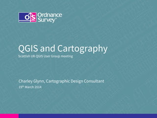
QGIS UK User Group - QGIS and Cartography (Ordnance Survey)
- 1. QGIS and Cartography Scottish UK QGIS User Group meeting Charley Glynn, Cartographic Design Consultant 19th March 2014
- 2. OS and OS Our Chief Architect, Ian James keynoted at FOSS4G 2013 “…a bias towards open source” Credit: Jody Garnett (CC BY) image from flick
- 3. OS and QGIS • Case study on the UK QGIS User Group blog • OS OnDemand WMS • OS OpenData Masterclasses • User Guides (incl. Building Height Attribution)
- 4. OS and QGIS • Education team encourage teachers to use QGIS in the classroom • QGIS used to demo Digimap for Schools WMS • Becoming the ‘go to’ tool for viewing datasets (e.g. QML, GZ) • Used frequently to answer customer queries “In most instances it is much quicker to use than other GIS applications and it is very intuitive ”
- 5. QGIS and Cartography • Makes good cartography simple • Smooth rendering • Support for lots of data formats • Raster and vector styling • Data-defined styling • Ability to request/contribute new features • Save styles into PostgreSQL/PostGIS • Embed styles in datasets (incl. MapInfo TAB) • Plug-ins Some highlights…
- 7. Blend modes Credit: UnderdarkGIS (CC BY-SA) image
- 11. Print composer Credit: jad99 (CC BY-SA) image from
- 12. Qgis2threejs
- 13. Launching QGIS stylesheets • QML stylesheets • OS OpenData • All on GitHub (quick download also available) • User guides • Free to use, customise, share All things open
- 14. Launching QGIS stylesheets Make the maps that you want github.com/OrdnanceSurvey
- 20. Cartographic design resources • Stylesheets • Carto Design Principles • Resources and data • Map showcase • Blog posts • BCS OS OpenData Award www.ordnancesurvey.co.uk/resources/carto-design
- 21. Lots more to come • More stylesheets (including OSMM Topo and VML) Please use them and feedback to us • Gazetteer search plug-in • We will continue to play an active role in the User Group