TRB_Pedestrian Behavior Modeling_Lee Kim_Jan 2015
•
1 like•442 views

This document summarizes research on modeling pedestrian behavior in New York City. It discusses: - When pedestrian modeling is needed, such as for environmental assessments or safety projects where pedestrian volumes will increase. - Key findings from Phase 1 of the research, including developing a methodology to estimate pedestrian saturation flow rates based on NYC conditions. Field observations were made at a Manhattan intersection to study factors like pedestrian speeds and reaction times. - Next steps involve using new technologies to further study pedestrian behavior and revisiting modeling methodologies to better reflect conditions in high-density NYC areas.

Recommended
Recommended
More Related Content
Similar to TRB_Pedestrian Behavior Modeling_Lee Kim_Jan 2015
Similar to TRB_Pedestrian Behavior Modeling_Lee Kim_Jan 2015 (20)
TRB_Pedestrian Behavior Modeling_Lee Kim_Jan 2015
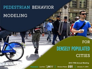
- 1. 2015 TRB Annual Meeting Presenters: Lee Kim Diniece Peters January 11, 2015
- 2. When do we model pedestrians? Where are the pedestrians? Pedestrian Modeling in New York City What are the findings of our research?
- 3. Where are the pedestrians? Pedestrian Modeling in New York City
- 4. Transit Hubs
- 6. Crosswalks
- 8. Pedestrian Modeling in New York City When do we model pedestrians?
- 9. Environmental Assessments (EAs) • Model anticipated future capacities and Levels of Service (LOS) at key pedestrian elements where project-generated pedestrian volumes would be added Safety Improvement Projects • Model existing and future conditions at locations where safety improvements are being made that would affect pedestrian capacity and LOS When Do We Model Pedestrian Behaviors in New York City?
- 10. Analysis locations defined by where project-generated pedestrian volumes are being added Pedestrian Analysis in Environmental Assessments Grand Central Terminal 41ST ST. 42ND ST. 43RD ST. MADISONAVE.
- 11. Pedestrian Analysis For Safety Improvement Projects Analysis locations defined by where safety improvements are proposed Sidewalk Widening Corner Extension
- 12. New York City Pedestrian Modeling Methodology The 2014 City Environmental Quality Review (CEQR) Technical Manual includes an LOS analysis based on HCM 2000 and HCM 2010. We analyze: • Sidewalks • Corners • Crosswalks
- 14. Proposed minimum effective width: Average human shoulder breadth = 2’ (or width of sidewalk if less than 2’) WE= WT - WO ≥ 0.0 6’ 1’ 9” 2’ EXAMPLE: Total sidewalk width = 6’ Narrowest path = 1’ 9” Calculated effective width (HCM 2010): 1.75’ – 1.5’ (buffer from fence) = 3” CEQR Methodology: Sidewalks
- 18. NOT THE CASE FOR NYC HCM 2010 Source:
- 19. HCM 2010 Methodology Can it be readily adopted in New York City?
- 20. Pedestrian Behavior in New York City What are the findings of our research?
- 21. Phase 1: Project Goals & Objectives Goal • Verify HCM pedestrian LOS crosswalk methodology for high-density NYC conditions Objectives • Develop a methodology for estimating the pedestrian saturation flow rate based on NYC conditions • Assess distribution of pedestrians speeds along the travel path in the crosswalk • Estimate pedestrian saturation flow rate and crosswalk capacity • Determine LOS
- 22. Phase 1: Concept of SFR For Pedestrian Crosswalks Concept: Develop a base saturation flow rate for pedestrians Where: • 𝑺 𝒑: 𝑷𝒆𝒅𝒆𝒔𝒕𝒓𝒊𝒂𝒏 𝑺𝒂𝒕𝒖𝒓𝒂𝒕𝒊𝒐𝒏 𝑭𝒍𝒐𝒘 𝑹𝒂𝒕𝒆 (ped/ft of width per minute of effective WALK time) • 𝑺 𝒑 𝟎 : 𝑰𝒅𝒆𝒂𝒍 𝑷𝒆𝒅𝒆𝒔𝒕𝒓𝒊𝒂𝒏 𝑺𝒂𝒕𝒖𝒓𝒂𝒕𝒊𝒐𝒏 𝑭𝒍𝒐𝒘 𝑹𝒂𝒕𝒆 (ped/ft of width per minute of effective WALK time) • 𝒇𝒊: 𝑨𝒅𝒋𝒖𝒔𝒕𝒎𝒆𝒏𝒕 𝑭𝒂𝒄𝒕𝒐𝒓𝒔 𝒕𝒐 𝒂𝒄𝒄𝒐𝒖𝒏𝒕 𝒇𝒐𝒓 𝒏𝒐𝒏-𝒊𝒅𝒆𝒂𝒍 𝒄𝒂𝒔𝒆𝒔
- 23. Phase 1: Factors Affecting SFR Determine the significance of: • Area/pedestrian type (CBD, age/gender, commuters) • Conflicting turning vehicles • Opposing pedestrian flow (impedance) • Pedestrian arrival during a cycle (%WK,%FDW,%DW) • Distracted pedestrians • Crosswalk blockage (by encroaching vehicles) • Platooning and crowding • Corner pedestrian density • Pedestrians with bags/luggage/strollers
- 24. Phase 1: Estimating Pedestrian Crosswalk Capacity Similar to roadway capacity calculations for lane group, once the pedestrian saturation flow rate is estimated, we can theoretically determine the pedestrian facility’s capacity, which can then be compared with flows to determine LOS. Where: • 𝒄 𝒑: 𝑪𝒓𝒐𝒔𝒔𝒘𝒂𝒍𝒌 𝑪𝒂𝒑𝒂𝒄𝒊𝒕𝒚 • 𝑺 𝒑: 𝑷𝒆𝒅𝒆𝒔𝒕𝒓𝒊𝒂𝒏 𝑺𝒂𝒕𝒖𝒓𝒂𝒕𝒊𝒐𝒏 𝑭𝒍𝒐𝒘 𝑹𝒂𝒕𝒆 • 𝒕 𝒑𝒆𝒅: 𝑬𝒇𝒇𝒆𝒄𝒕𝒊𝒗𝒆 𝑷𝒆𝒅𝒆𝒔𝒕𝒓𝒊𝒂𝒏 𝑾𝒂𝒍𝒌𝒕𝒊𝒎𝒆 • 𝑪: 𝑪𝒚𝒄𝒍𝒆 𝑳𝒆𝒏𝒈𝒕𝒉
- 25. Phase 1: Study Locations
- 26. 23rd Street & 6th Avenue Field Observations How different pedestrians cross the street
- 27. Field Observations Presence of parking lane affects use of corner area 23rd Street & 6th Avenue
- 28. Mean Average: 0.51 sec Mean Average: 0.23 sec Phase 1 Study Results: Reaction Time 0% 20% 40% 60% 80% 100% 0 2 4 6 8 10 12 14 16 -4 -3 -2 -1 0 1 2 3 4 5 Frequency Reaction Time (s) Distribution of Reaction Time for Pedestrians Waiting on the Crosswalk 0% 20% 40% 60% 80% 100% 0 5 10 15 20 25 -5 -4 -3 -2 -1 0 1 2 3 4 5 6 7 Frequency Reaction Time (s) Distribution of Reaction Time for Pedestrians Waiting on the Sidewalk
- 29. 0% 10% 20% 30% 40% 50% 60% 70% 80% 90% 100% 0 2 4 6 8 10 Speed (ft/s) Speed by Pedestrian Arrival WALK FDW DW 0% 10% 20% 30% 40% 50% 60% 70% 80% 90% 100% 0 2 4 6 8 10 Speed (ft/s) Speed by Gender Male Female 0% 10% 20% 30% 40% 50% 60% 70% 80% 90% 100% 0 2 4 6 8 10 Speed (ft/s) Speed by Time of Day AM PM 0% 10% 20% 30% 40% 50% 60% 70% 80% 90% 100% 0 2 4 6 8 10 Speed (ft/s) Speed by Group Group Individual Phase 1 Study Results: Walking Speed
- 30. Future Of Pedestrian Modeling in New York City Use new technology to study pedestrian behavior Revisit pedestrian modeling methodologies
- 31. Lee Kim, AKRF lkim@akrf.com Diniece Peters, NYCDOT dpeters@dot.nyc.gov THANK YOU!