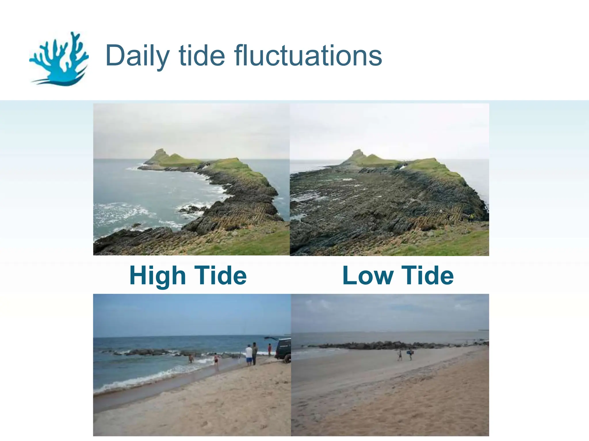
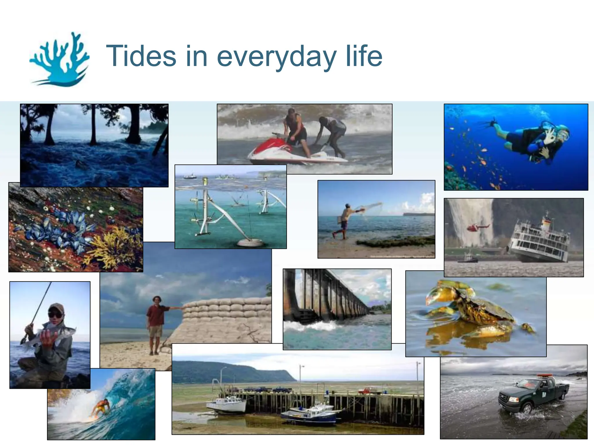
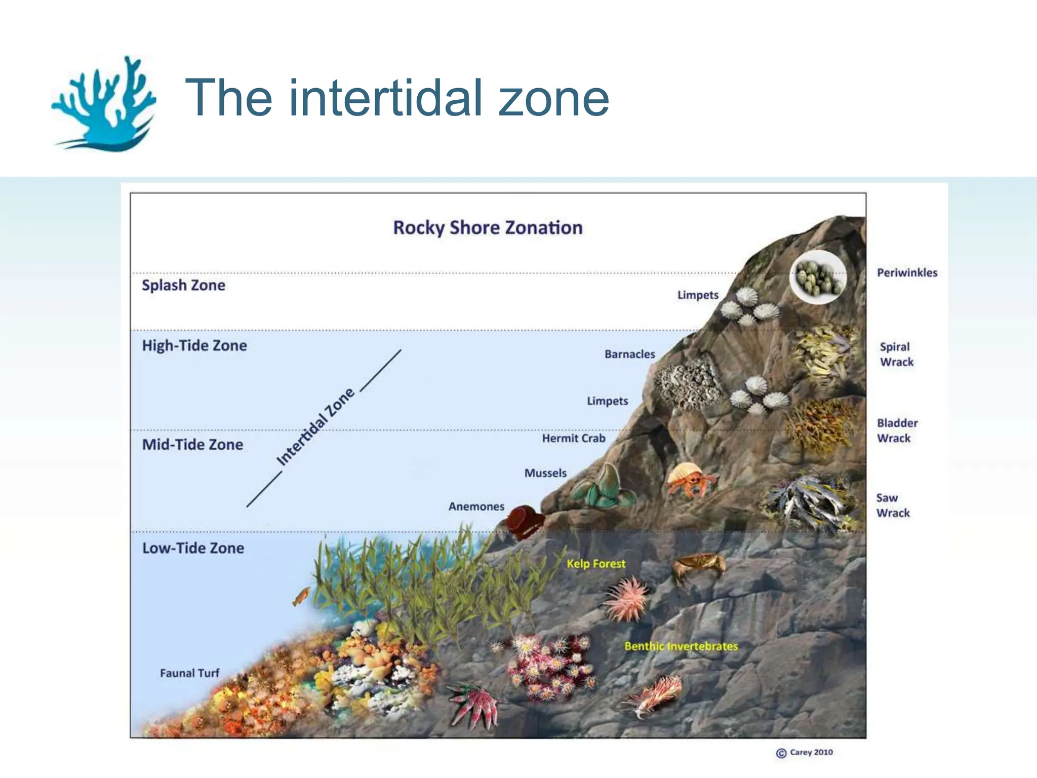
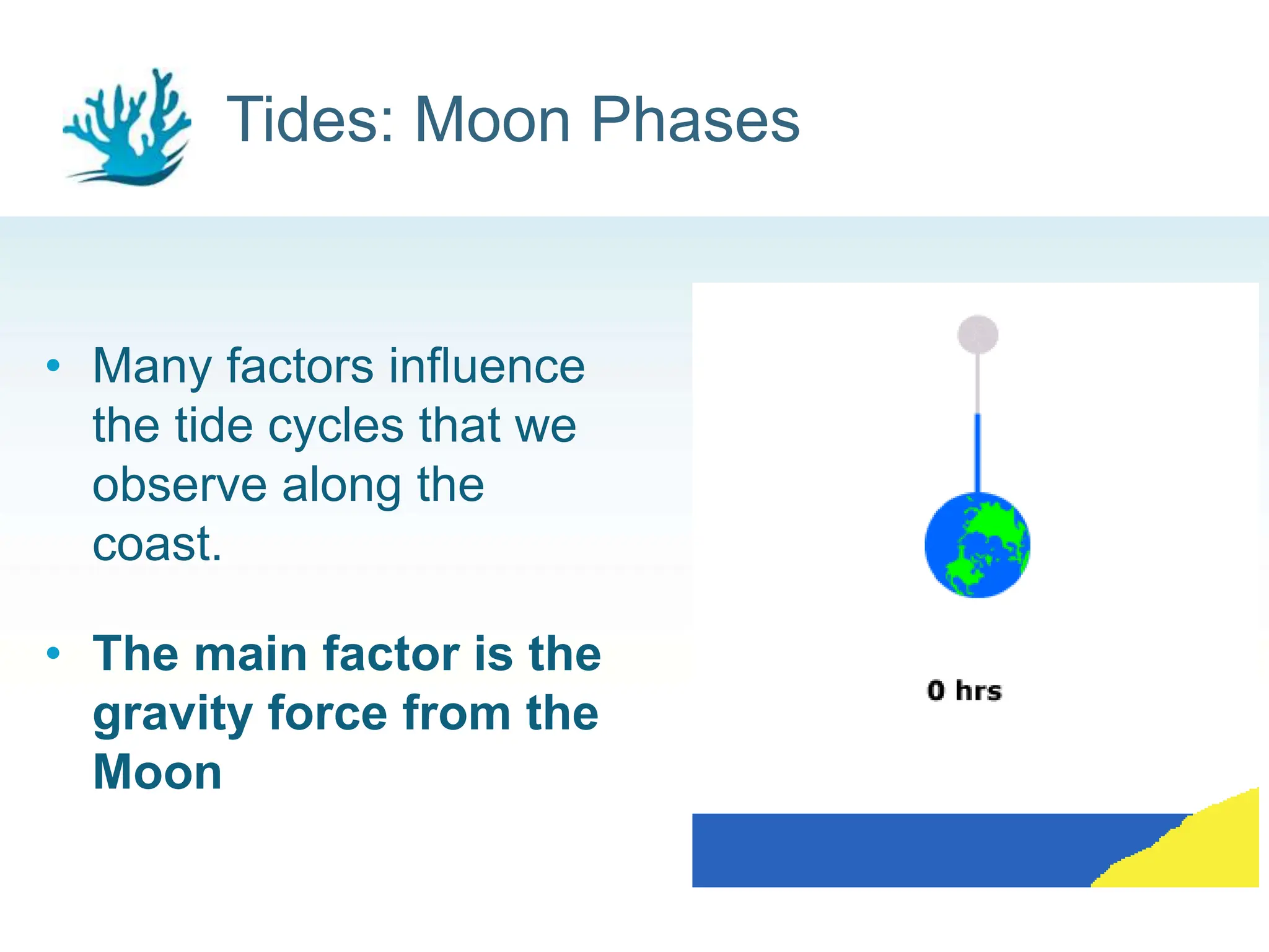
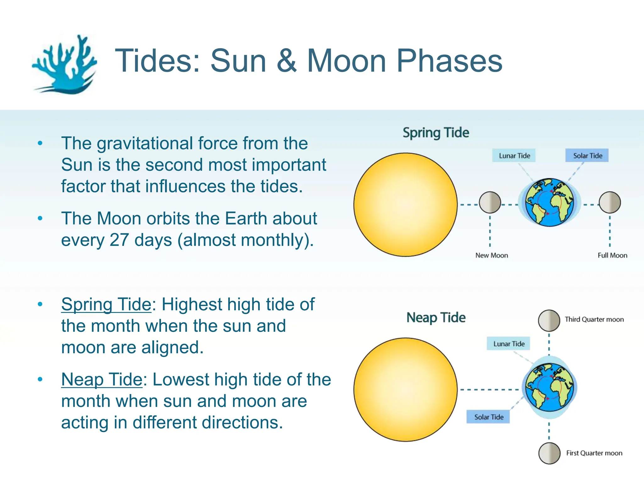
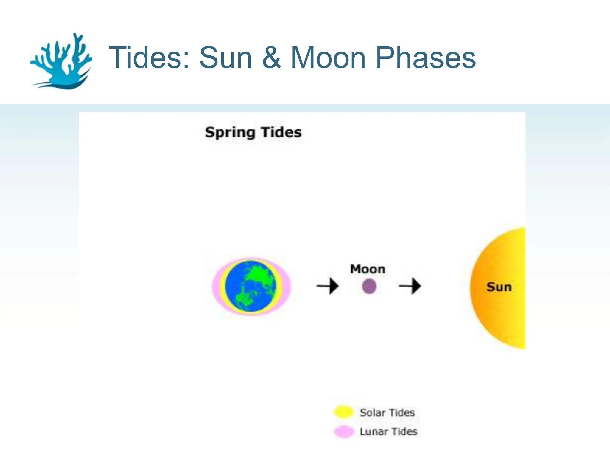
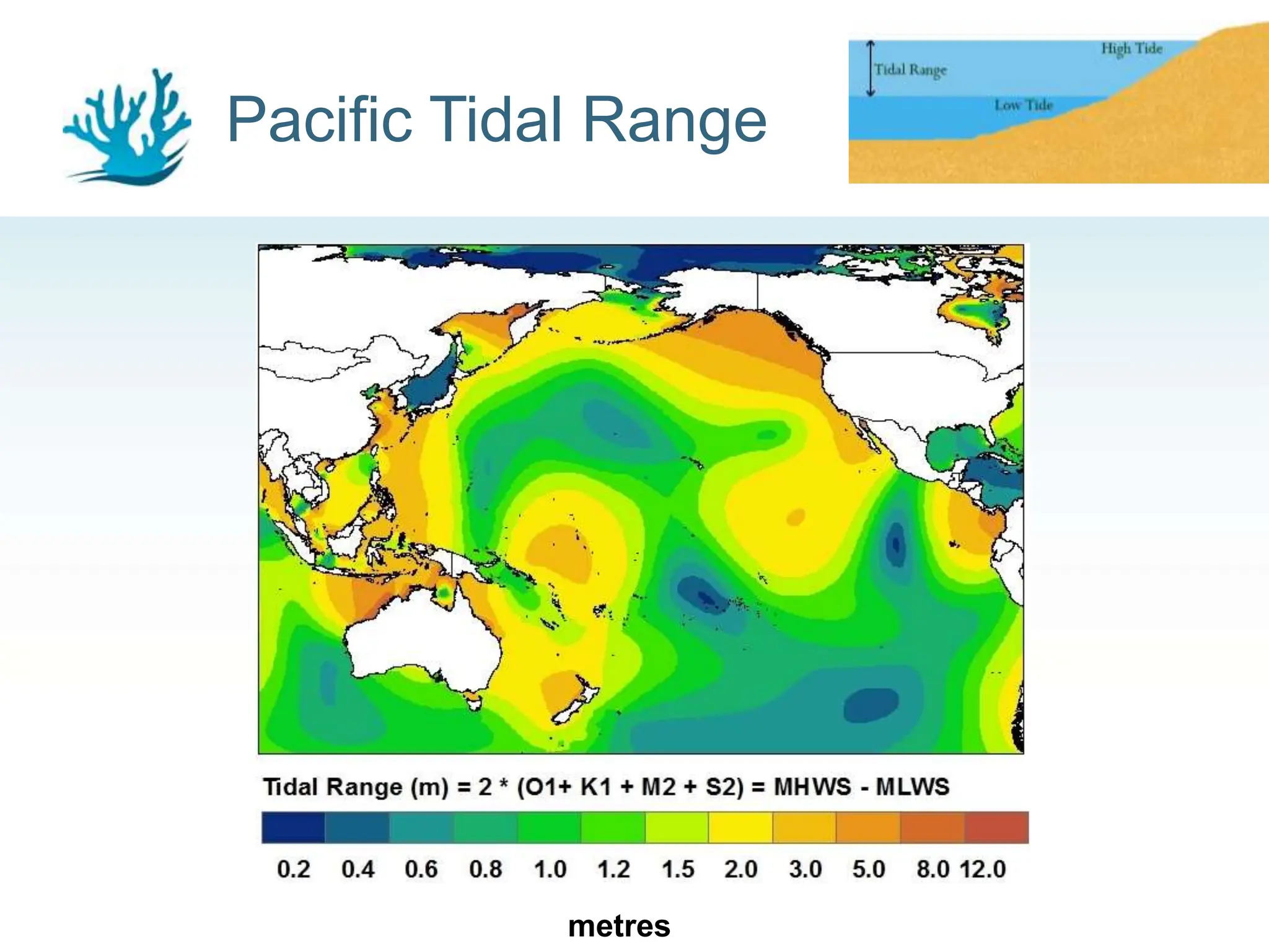
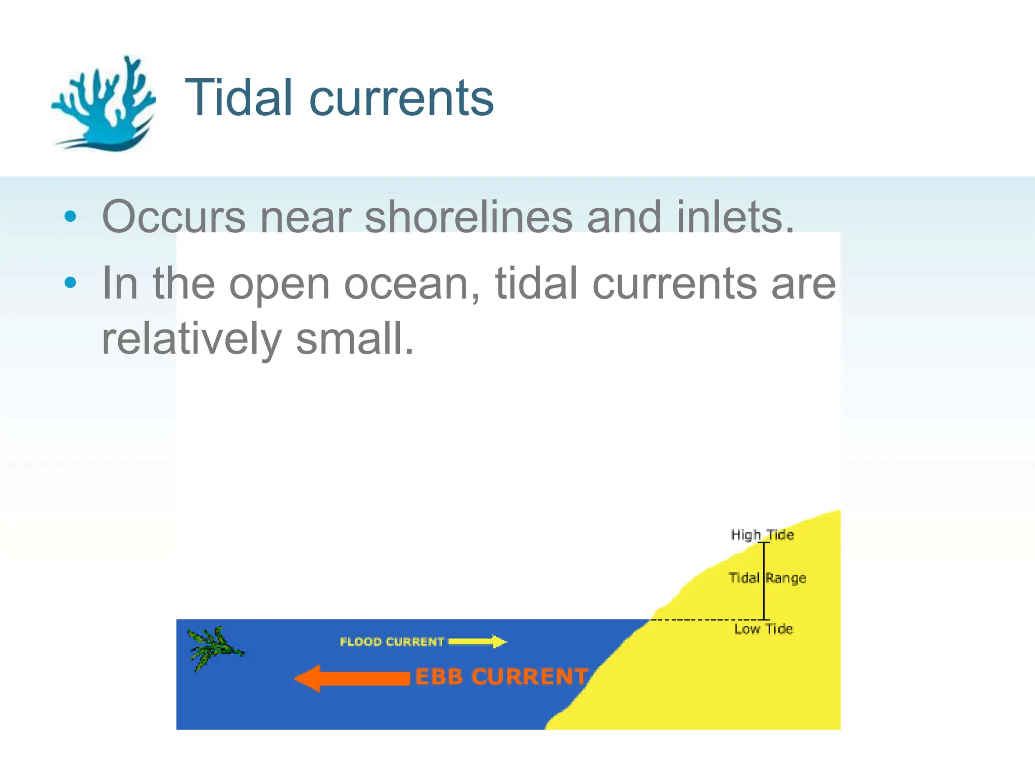
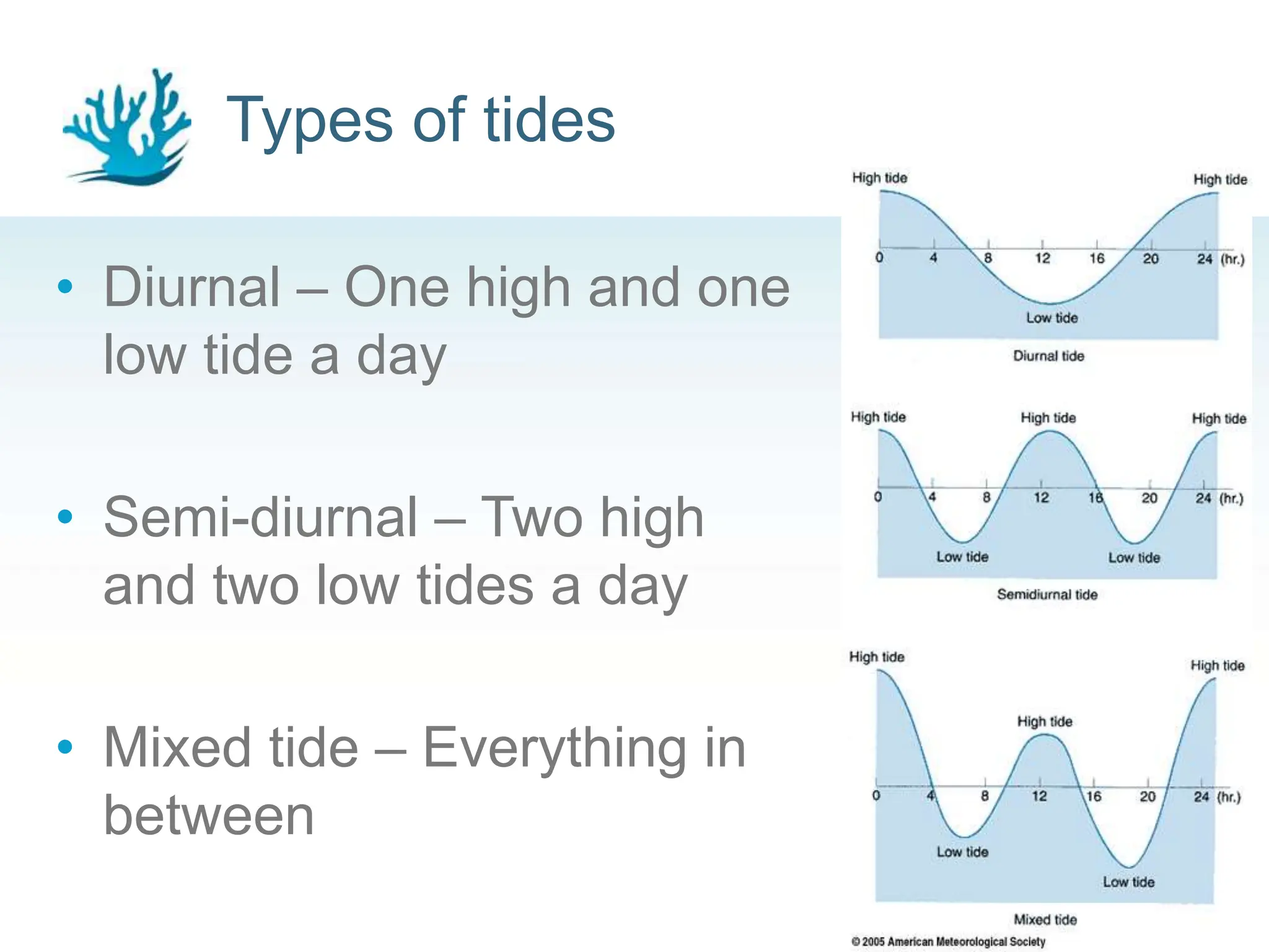
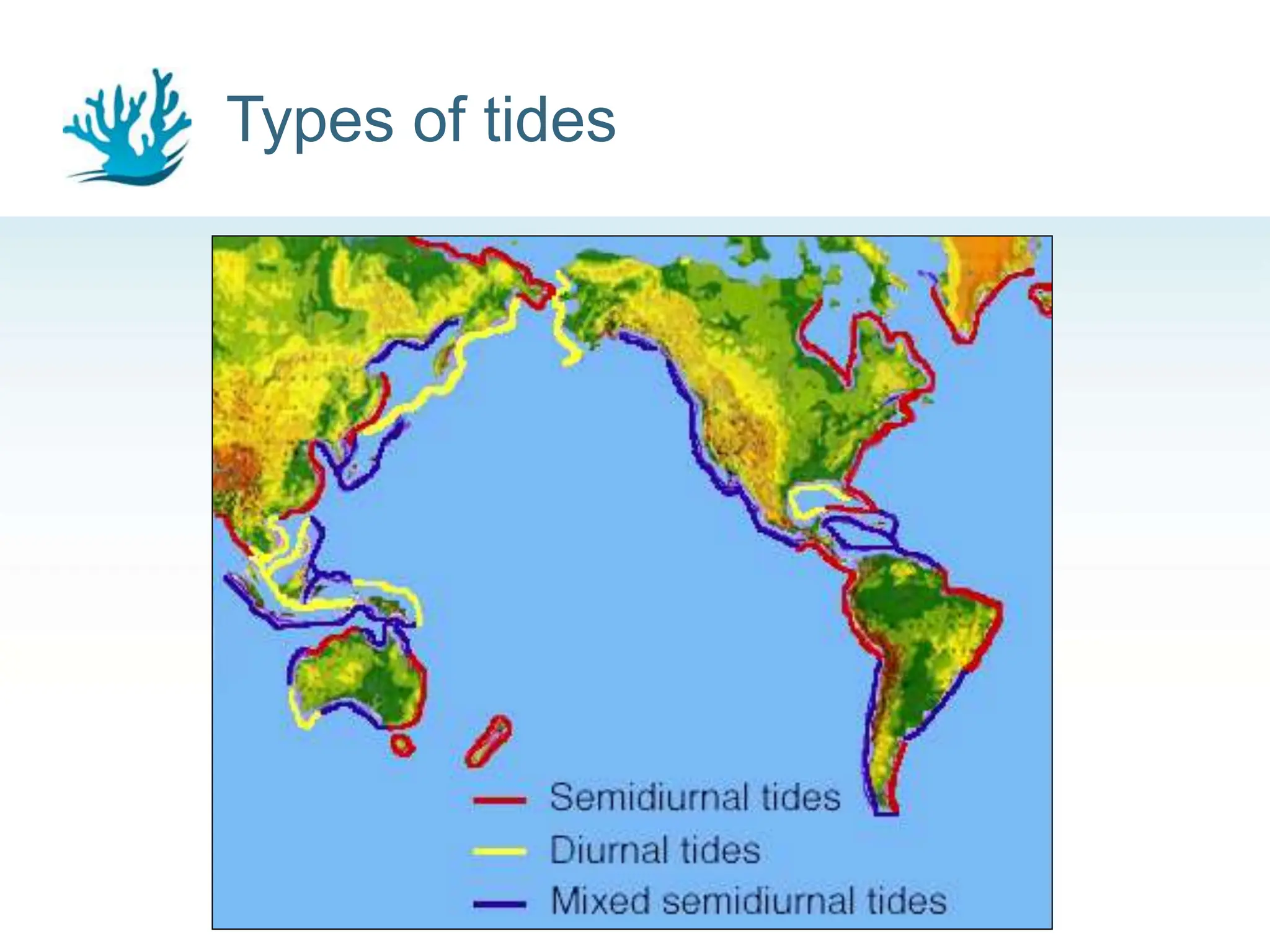
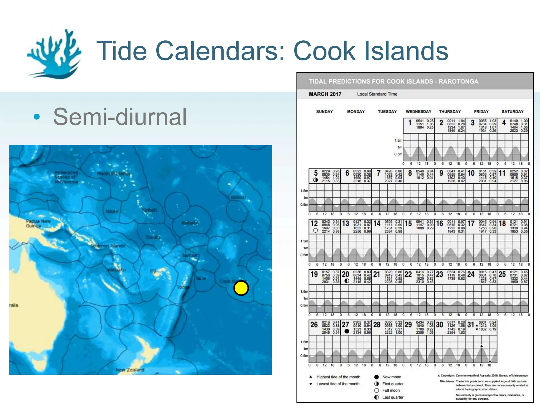
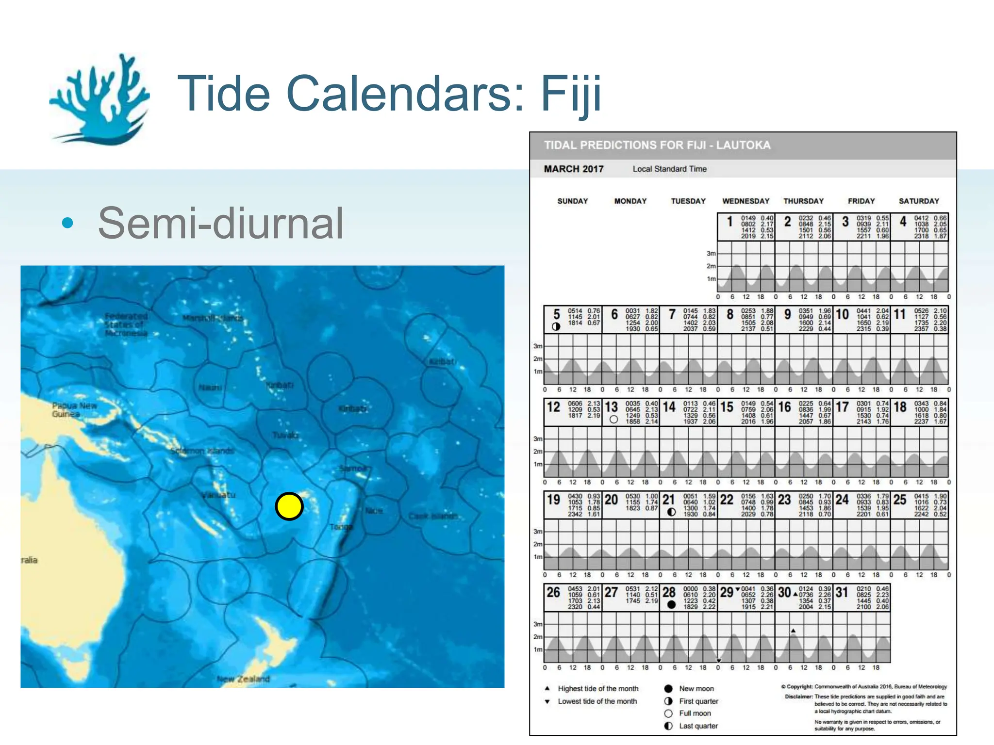
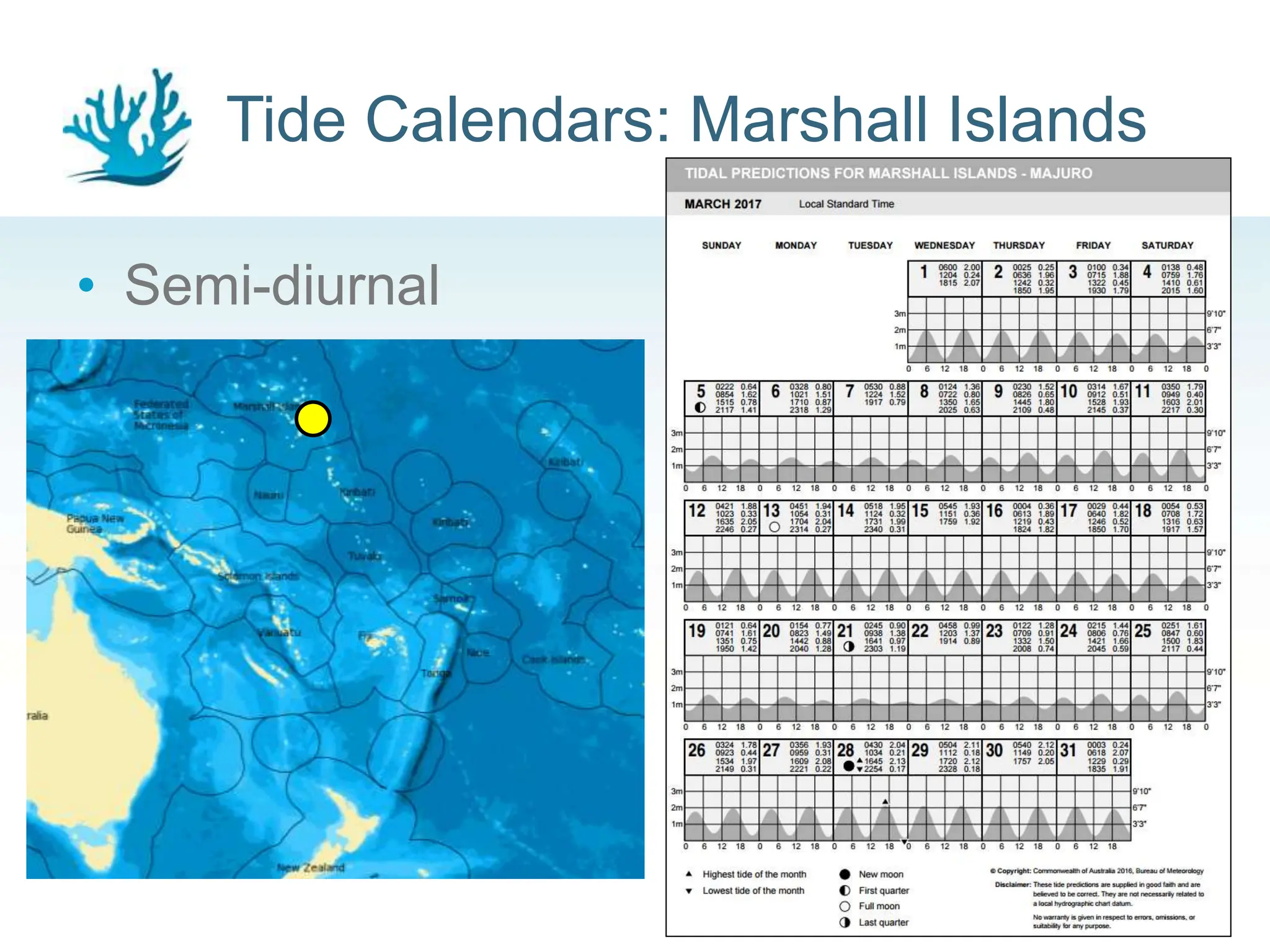
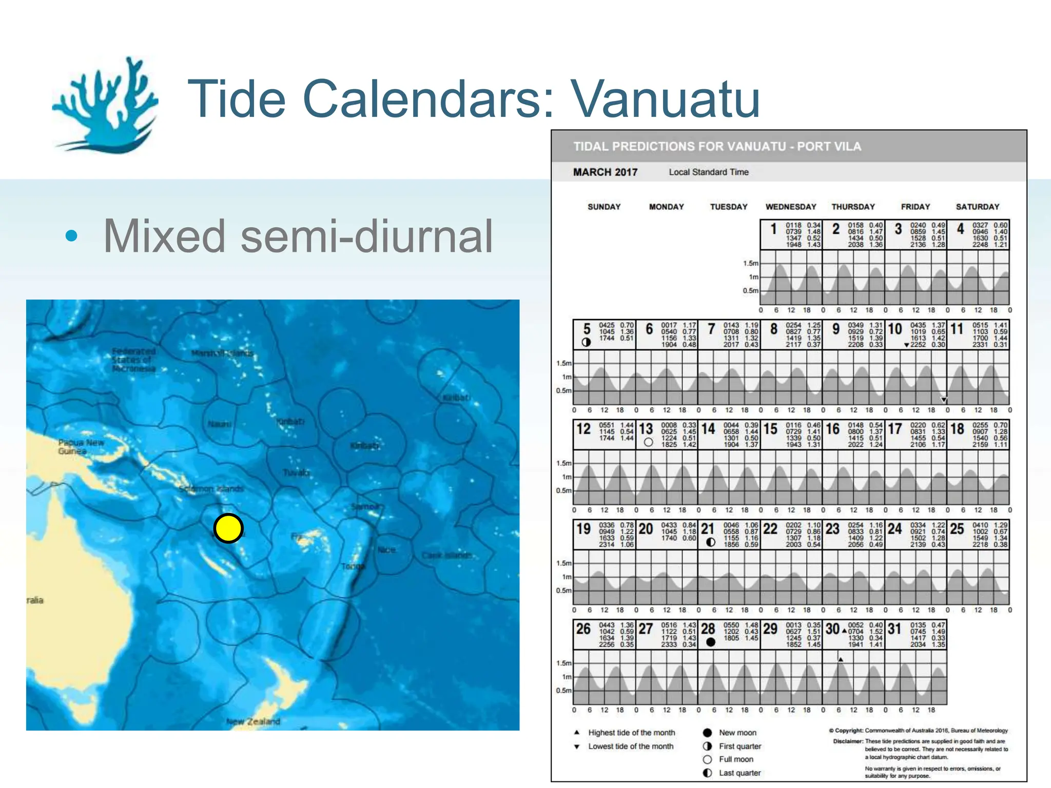
Climate and Oceans Support
Program in the Pacific
Tides
Oceans & Tides Regional Workshop
Daily tide fluctuations
2
High Tide Low Tide
Tides in everyday life
3
The intertidal zone
4
Tides: Moon Phases
• Many factors influence
the tide cycles that we
observe along the
coast.
• The main factor is the
gravity force from the
Moon
5
Tides: Sun & Moon Phases
• The gravitational force from the
Sun is the second most important
factor that influences the tides.
• The Moon orbits the Earth about
every 27 days (almost monthly).
• Spring Tide: Highest high tide of
the month when the sun and
moon are aligned.
• Neap Tide: Lowest high tide of the
month when sun and moon are
acting in different directions.
6
Tides: Sun & Moon Phases
7
Climate and Oceans Support
Program in the Pacific
Activity Time:
Make your own Sun/Moon/Earth tidal
system
Pacific Tidal Range
9
metres
Tidal currents
10
• Occurs near shorelines and inlets.
• In the open ocean, tidal currents are
relatively small.
Types of tides
• Diurnal – One high and one
low tide a day
• Semi-diurnal – Two high
and two low tides a day
• Mixed tide – Everything in
between
11
Types of tides
12
Tide Calendars: Cook Islands
• Semi-diurnal
13
Tide Calendars: Fiji
• Semi-diurnal
14
Tide Calendars: Marshall Islands
• Semi-diurnal
15
Tide Calendars: Vanuatu
• Mixed semi-diurnal
16
Tide Calendars: Solomon Islands
• Diurnal
17
Tide Calendars: PNG
• Diurnal
18
Climate and Oceans Support
Program in the Pacific
Practical Exercise:
Module A – Tide Calendars

Tides in the Pacific - Tide Calendars and how to read them

Editor's Notes

  • #3 Tides characteristics are highly dependent on where the beach is located on Earth, and the local bathymetry. In any given region, flatter beaches result in further distances that the tide will come in and go back out compared to large sloping coastlines or cliffs.
  • #5 The intertidal zone, also known as the foreshore and seashore and sometimes referred to as the littoral zone, is the area that is above water at low tide and under water at high tide (in other words, the area between tide marks). This zone alternately covered by the sea and exposed to the air. Any creatures living in this environment must have adaptions for both wet and dry conditions. Hazards include being disturbed by rough waves, exposure to high temperatures, and drying out (desiccation). Typical inhabitants of the intertidal rocky shore include urchins, sea anemones, barnacles, chitons, crabs, isopods, mussels, starfish, and many marine gastropod molluscs.
  • #8 Notice that the biggest tidal bulges (when the thicker pink bulge is on top of the thickest part of the yellow bulge) occurs when the sun, earth, and moon are all aligned.
  • #11 The water movement associated with tides induces relatively small tidal currents in the open oceans, but these currents can be substantially magnified by shallow water at coastal locations. Flood tide: Water moves towards land Ebb tide: Water moves away from land Slack water – still water between flood and ebb tides
  • #12 Three basic tidal patterns occur along the Earth’s major shorelines. In general, most areas have two high tides and two low tides each day. When the two highs and the two lows are about the same height, the pattern is called a semidiurnal tide. If the high and low tides differ in height, the pattern is called a mixed semidiurnal tide.
  • #13 If there were no major land masses or changes in bathymetry, all areas would experience two equally proportioned high and low tides each day. If the Earth were a perfect sphere without large continents, all areas on the planet would experience two equally proportioned high and low tides every lunar day. The large continents on the planet, however, block the westward passage of the tidal bulges as the Earth rotates. Unable to move freely around the globe, these tides establish complex patterns within each ocean basin that often differ greatly from tidal patterns of adjacent ocean basins or other regions of the same ocean basin.
  • #14 Tide Calendars are our best tool for telling us what the sea level height will be in the future. The grey shaded area on the calendar show the changes in sea level. You can see that the highest tides occur near when there is a full moon and new moon, and the lowest high tides are during first and last quarter. http://www.bom.gov.au/oceanography/projects/spslcmp/tidecalendars.shtml
  • #15 http://www.bom.gov.au/oceanography/projects/spslcmp/tidecalendars.shtml
  • #16 http://www.bom.gov.au/oceanography/projects/spslcmp/tidecalendars.shtml
  • #17 http://www.bom.gov.au/oceanography/projects/spslcmp/tidecalendars.shtml
  • #18 The closer we get to the maritime continent, the more diurnal the tide becomes. This is due to the complexity created by the many island land bodies and the continental shelf impeding the movement of water from the open ocean. http://www.bom.gov.au/oceanography/projects/spslcmp/tidecalendars.shtml
  • #19 http://www.bom.gov.au/oceanography/projects/spslcmp/tidecalendars.shtml