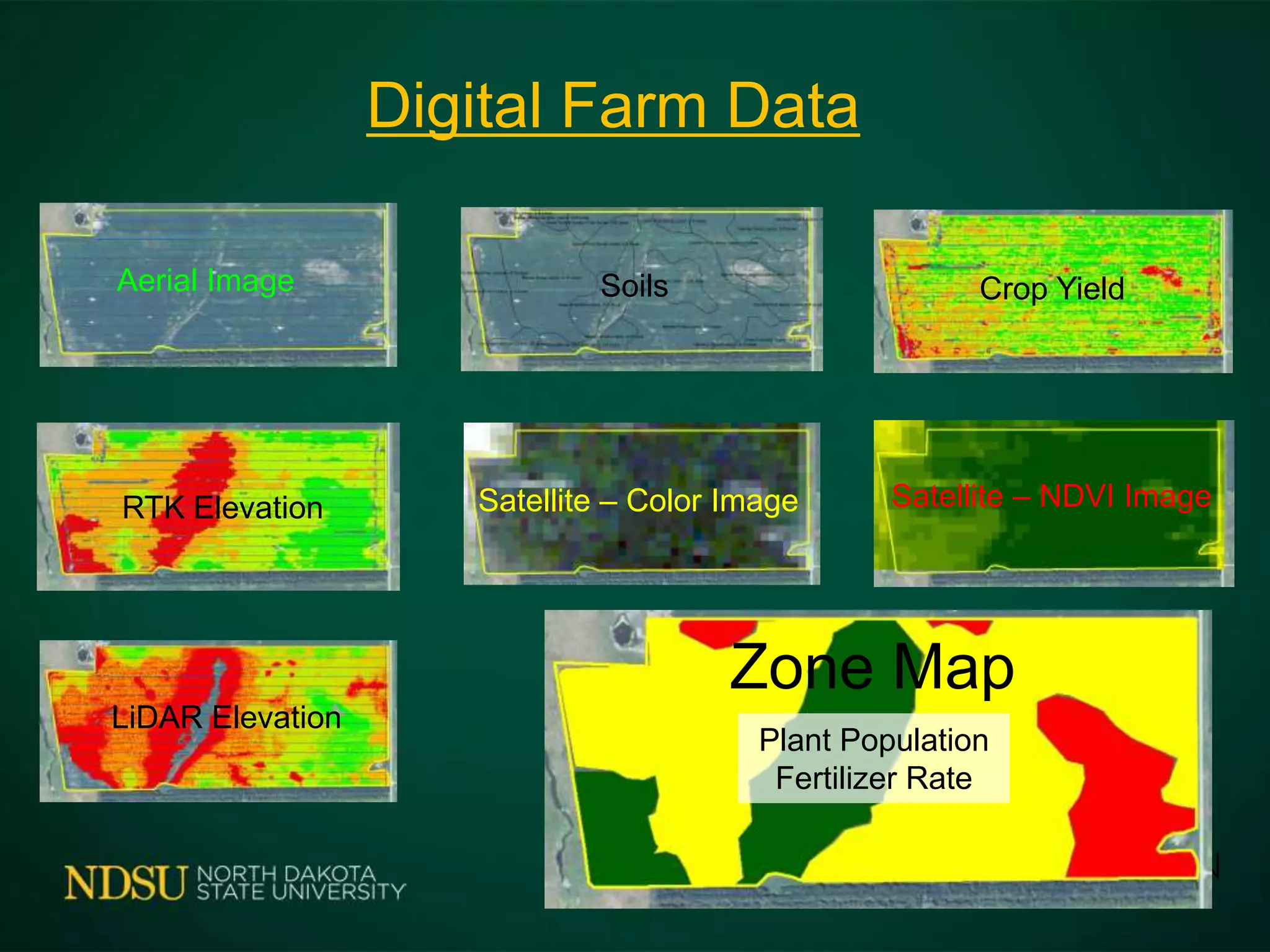
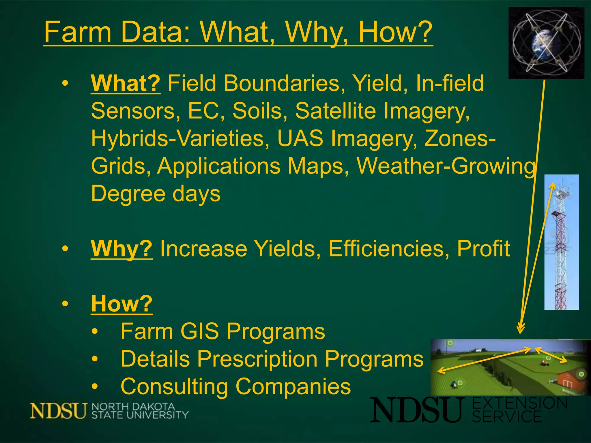
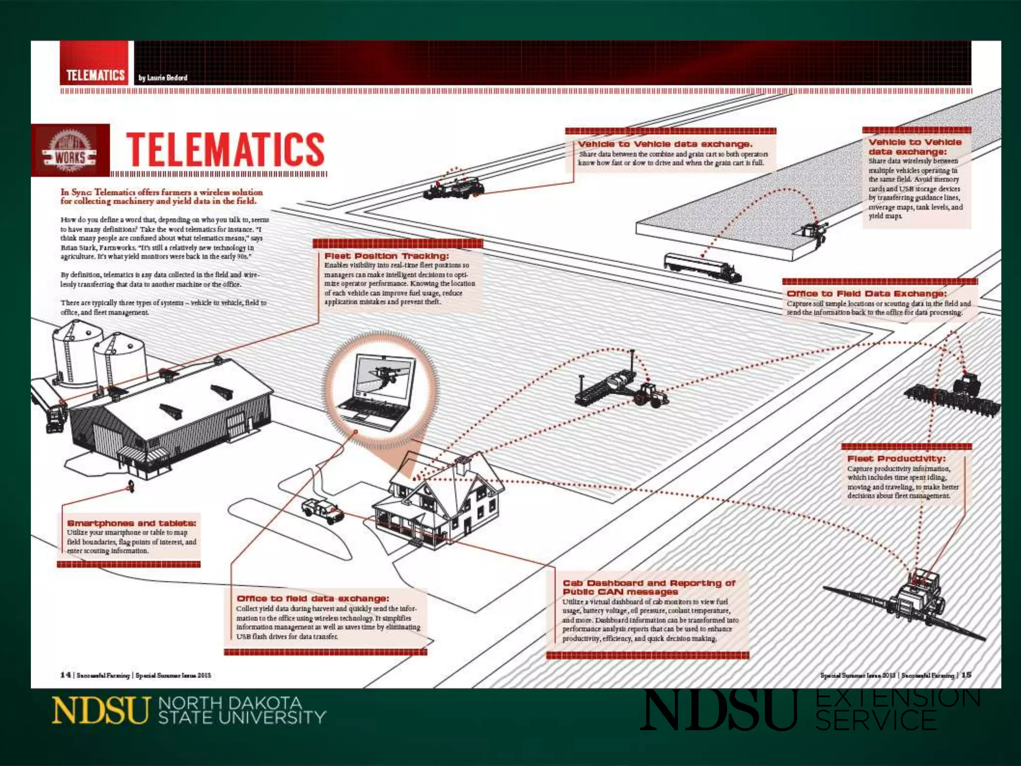
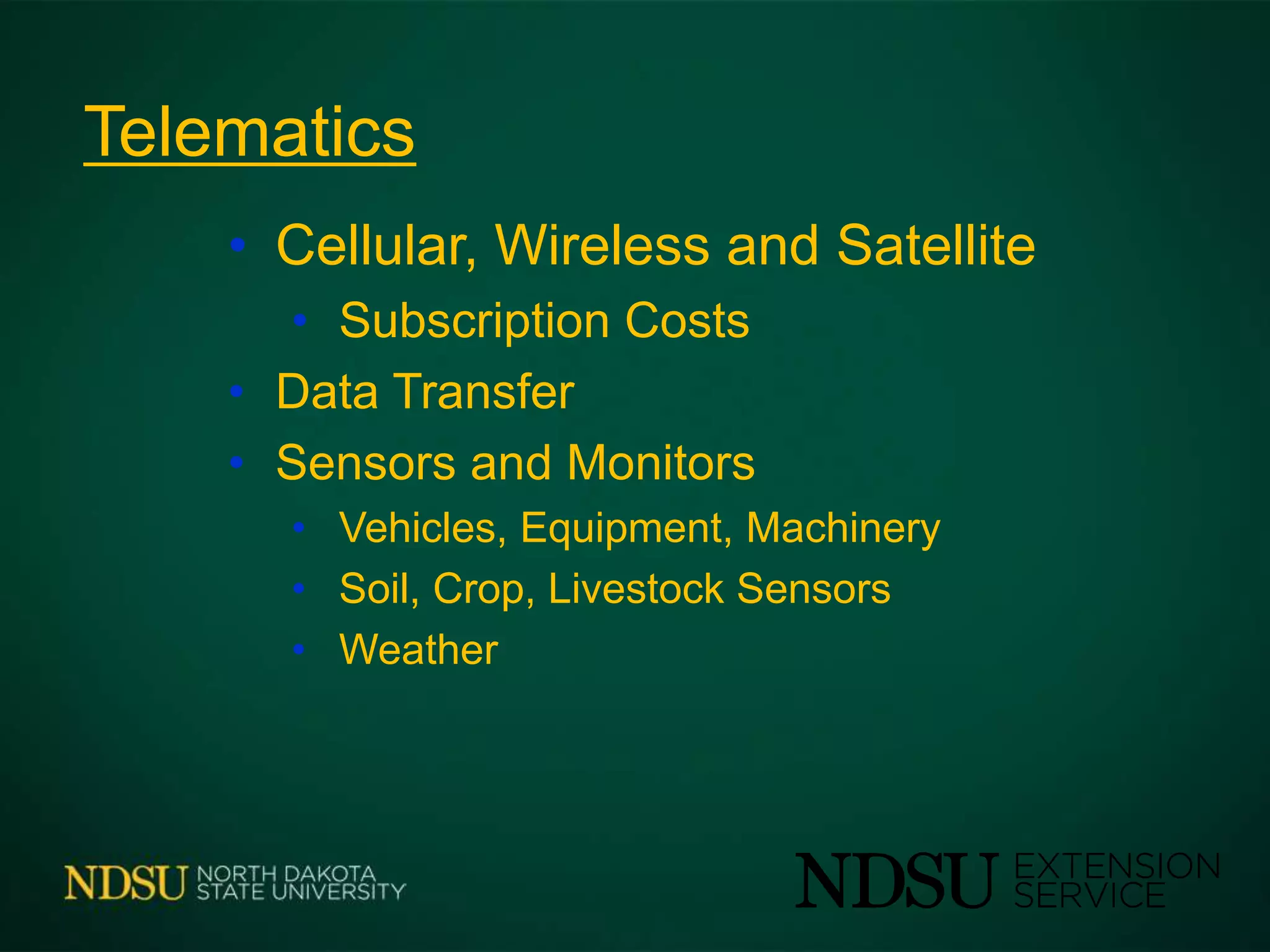
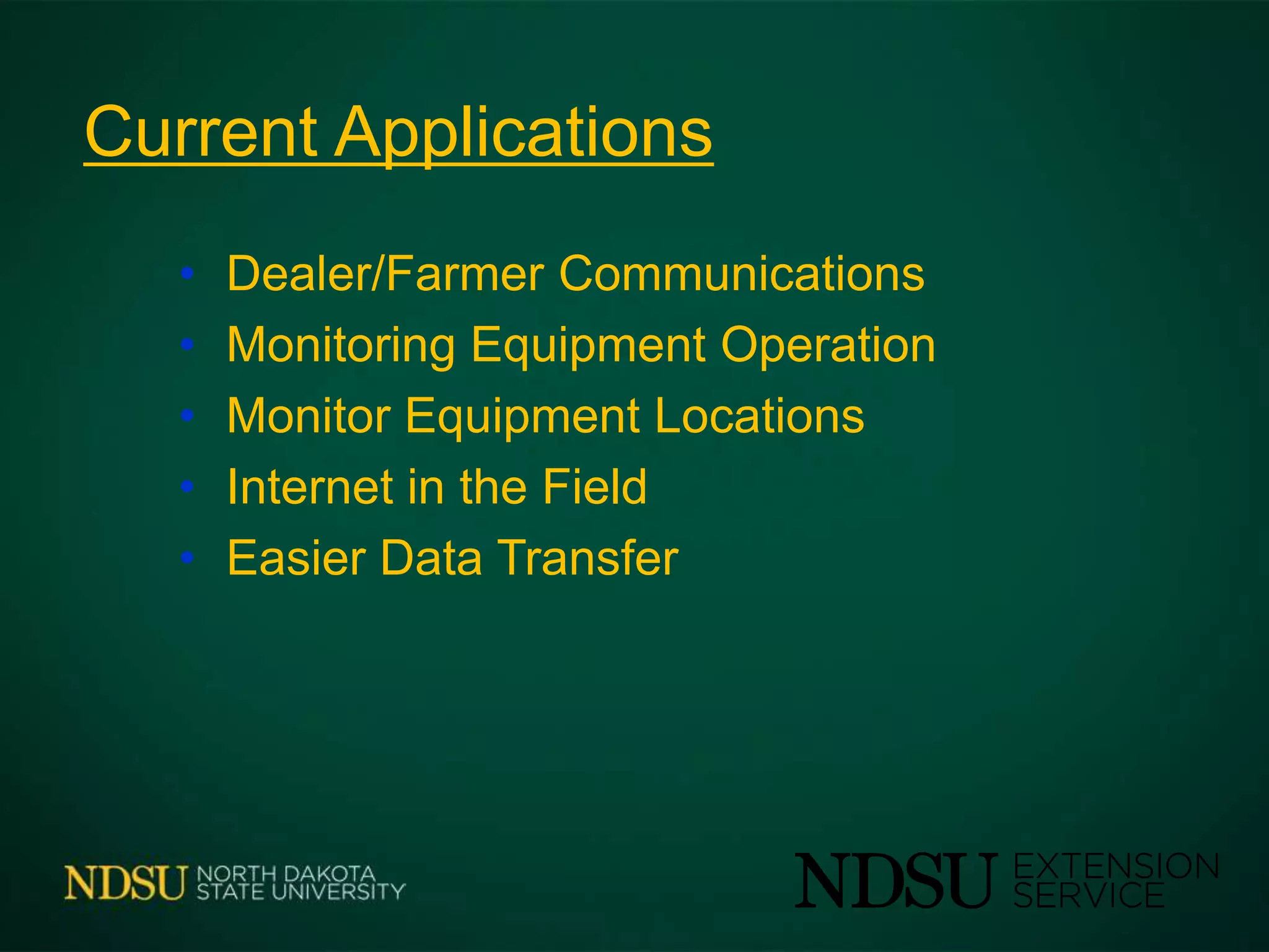
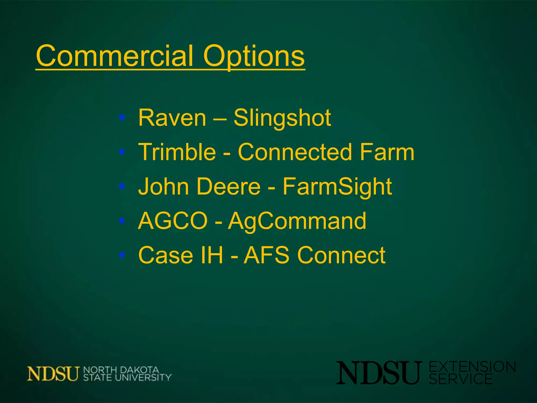
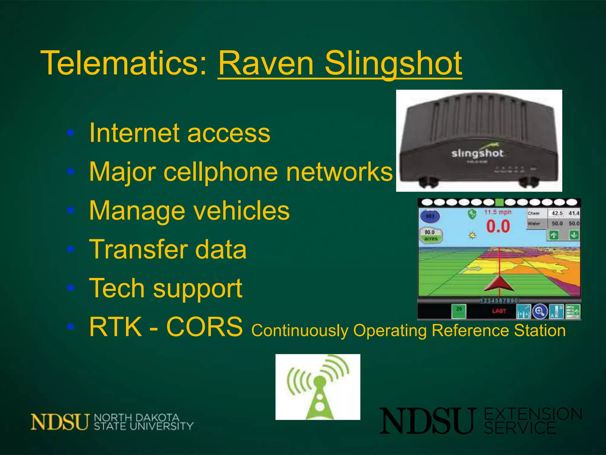
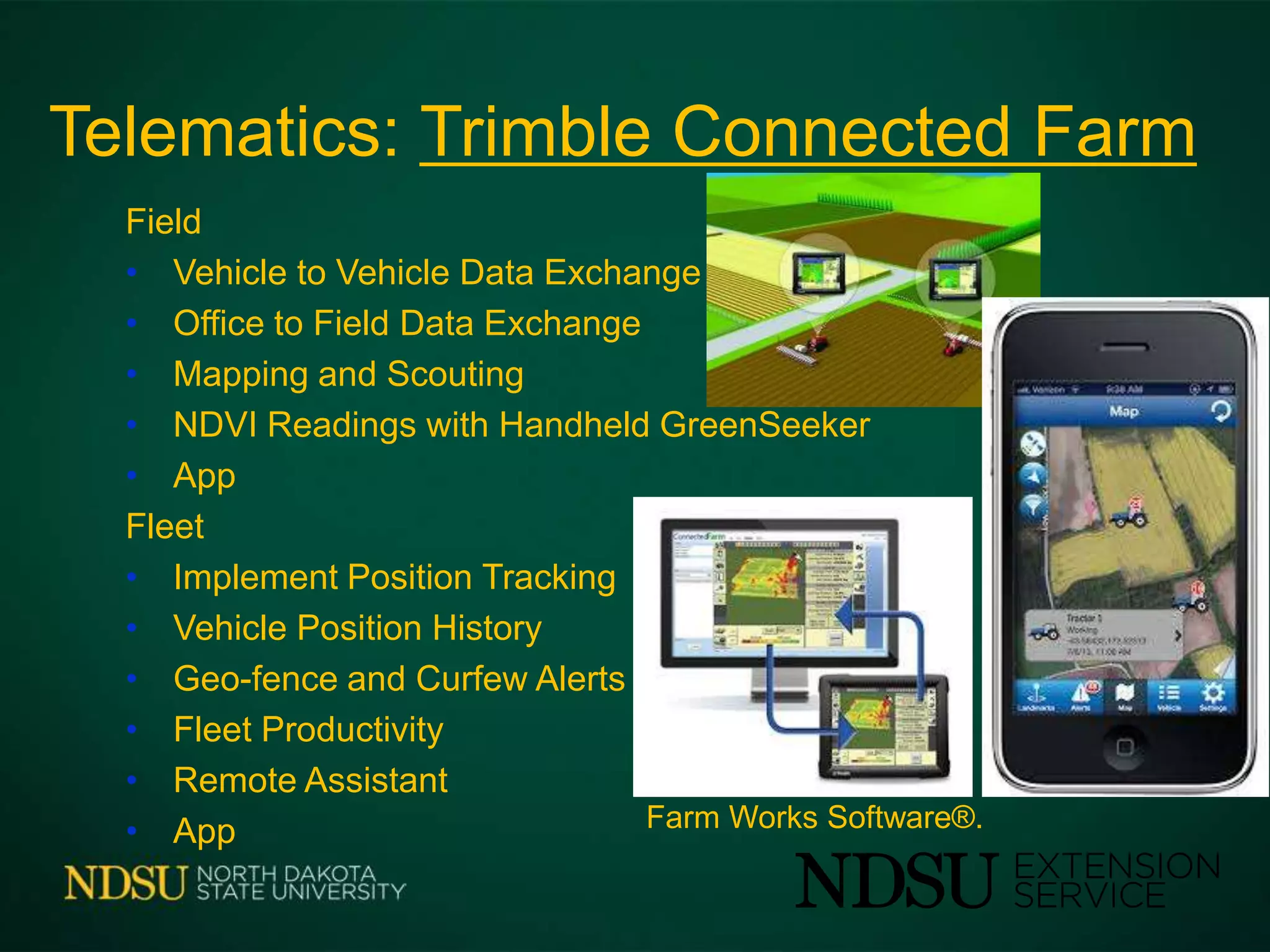
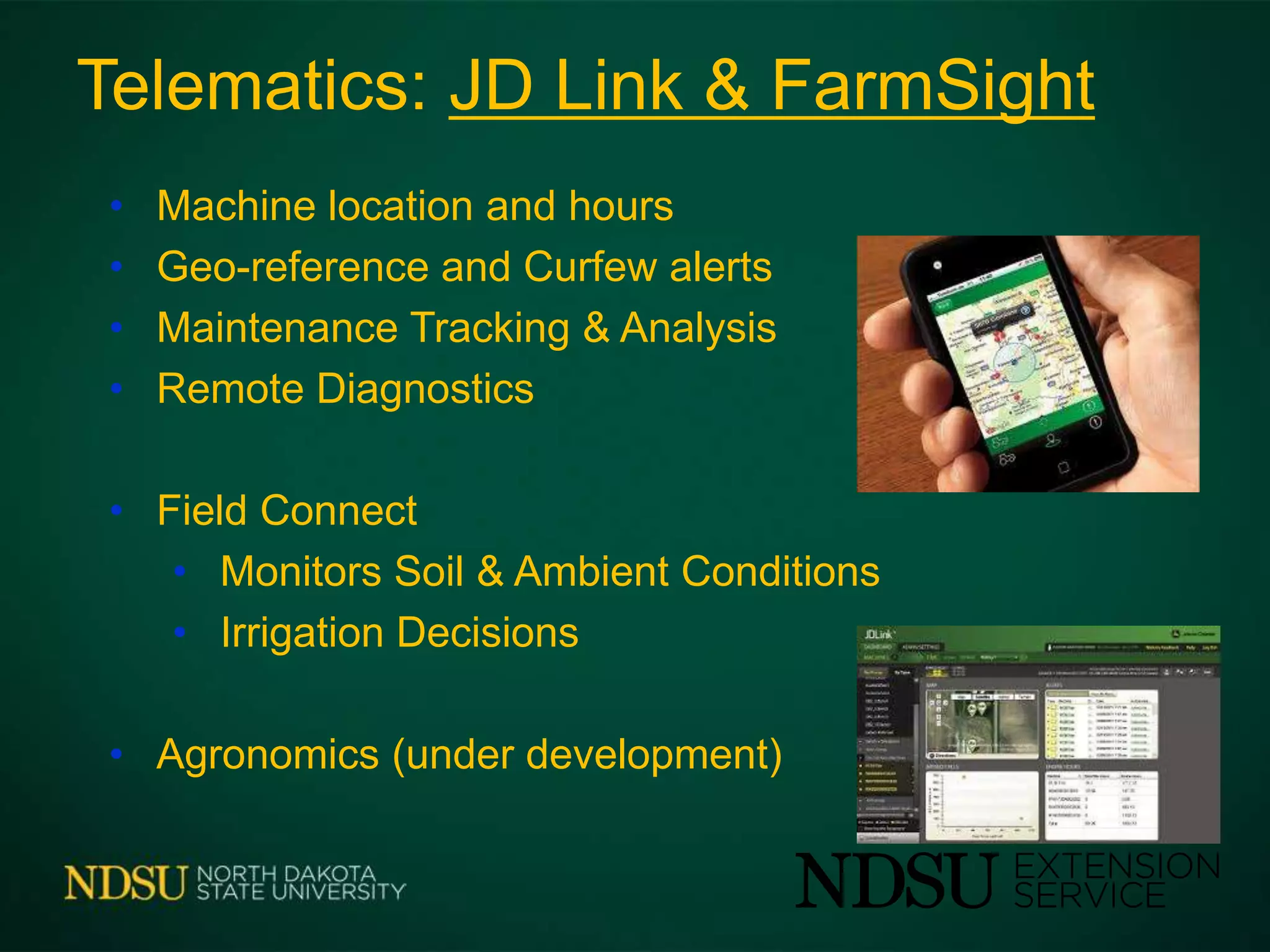
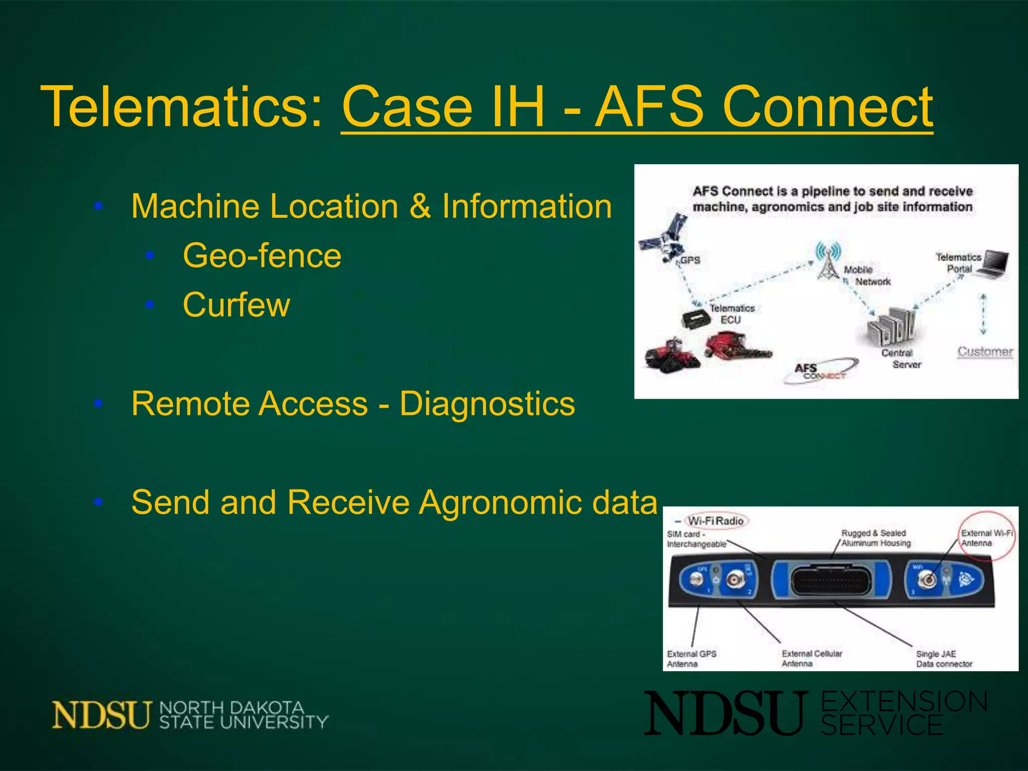
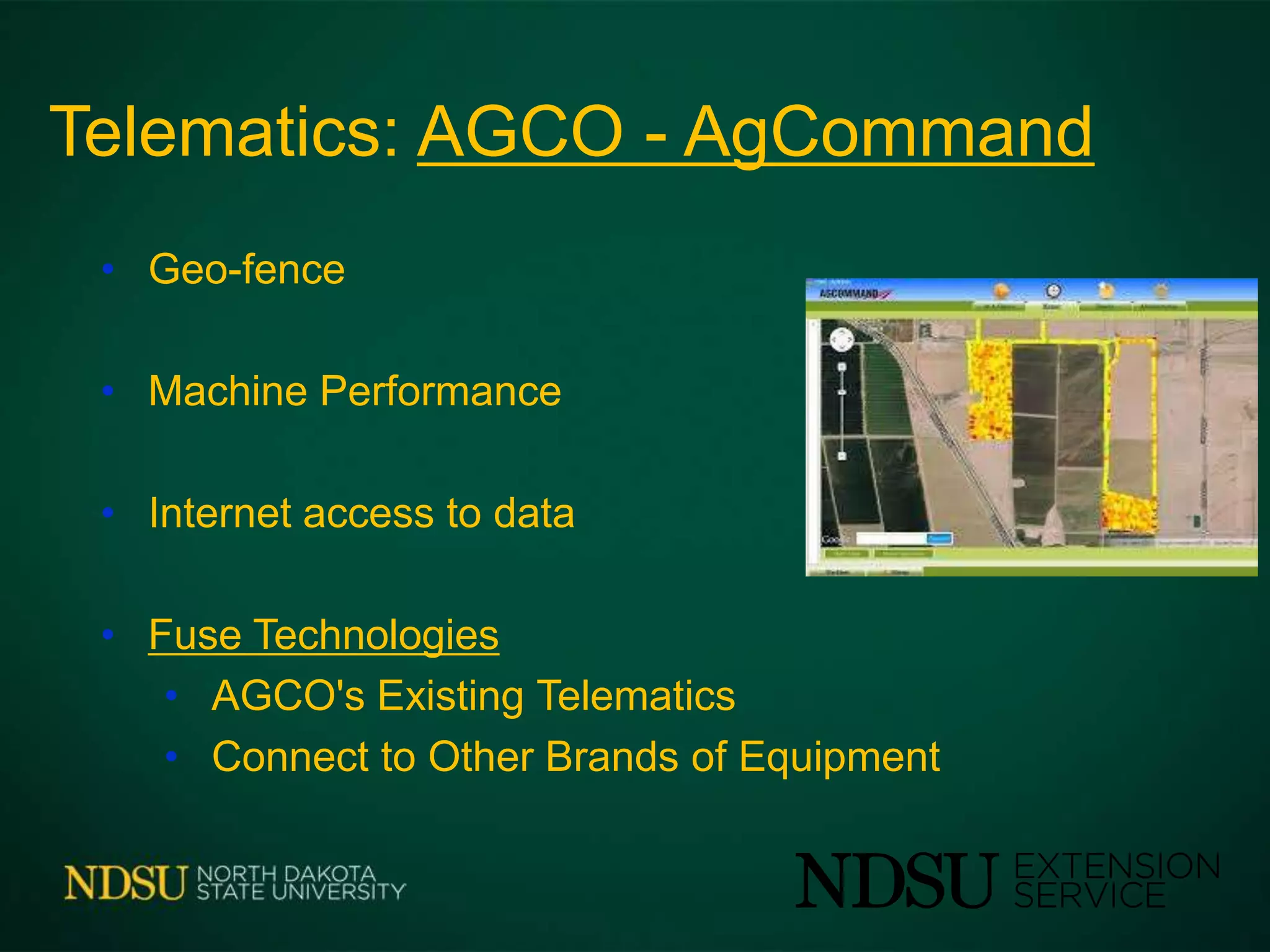
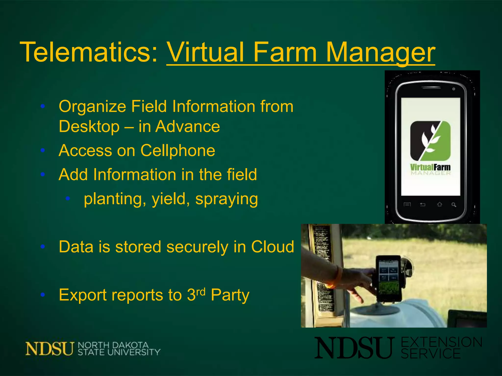
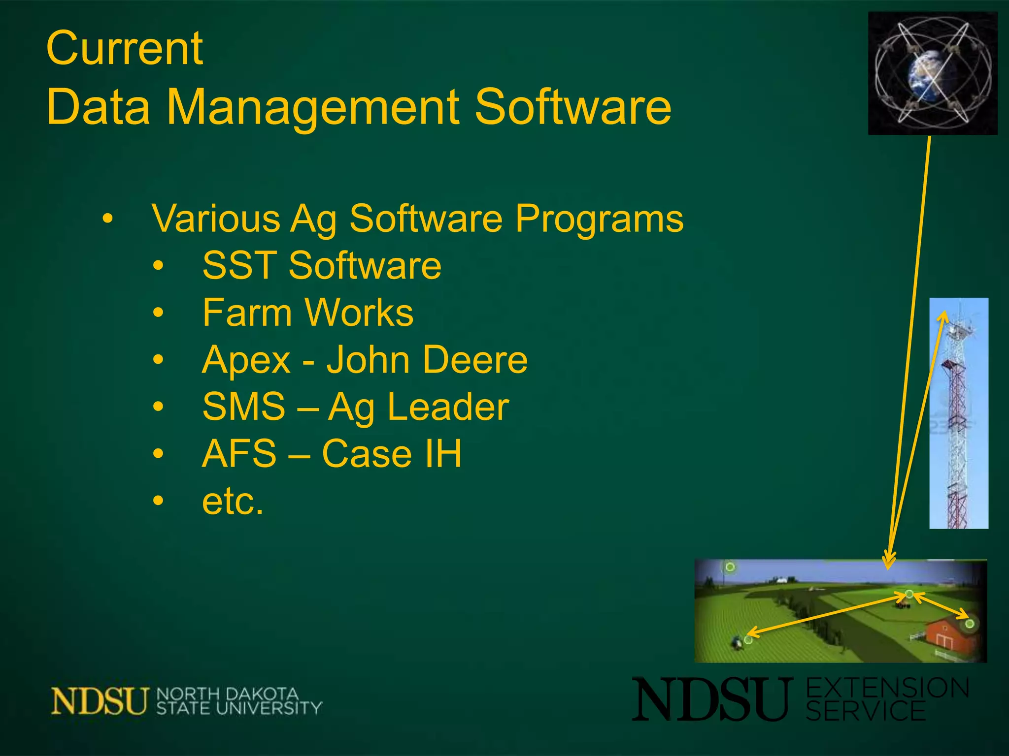
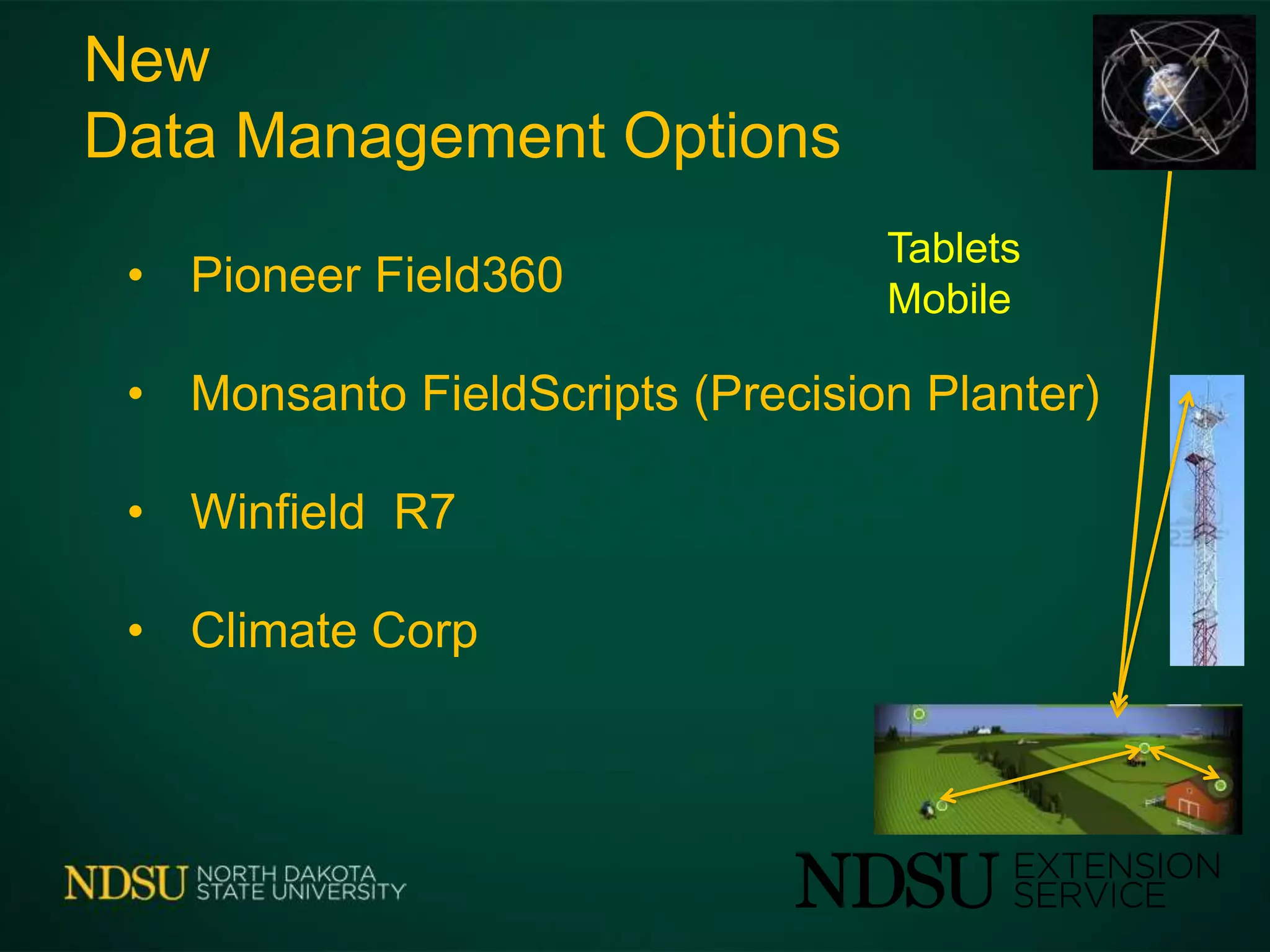
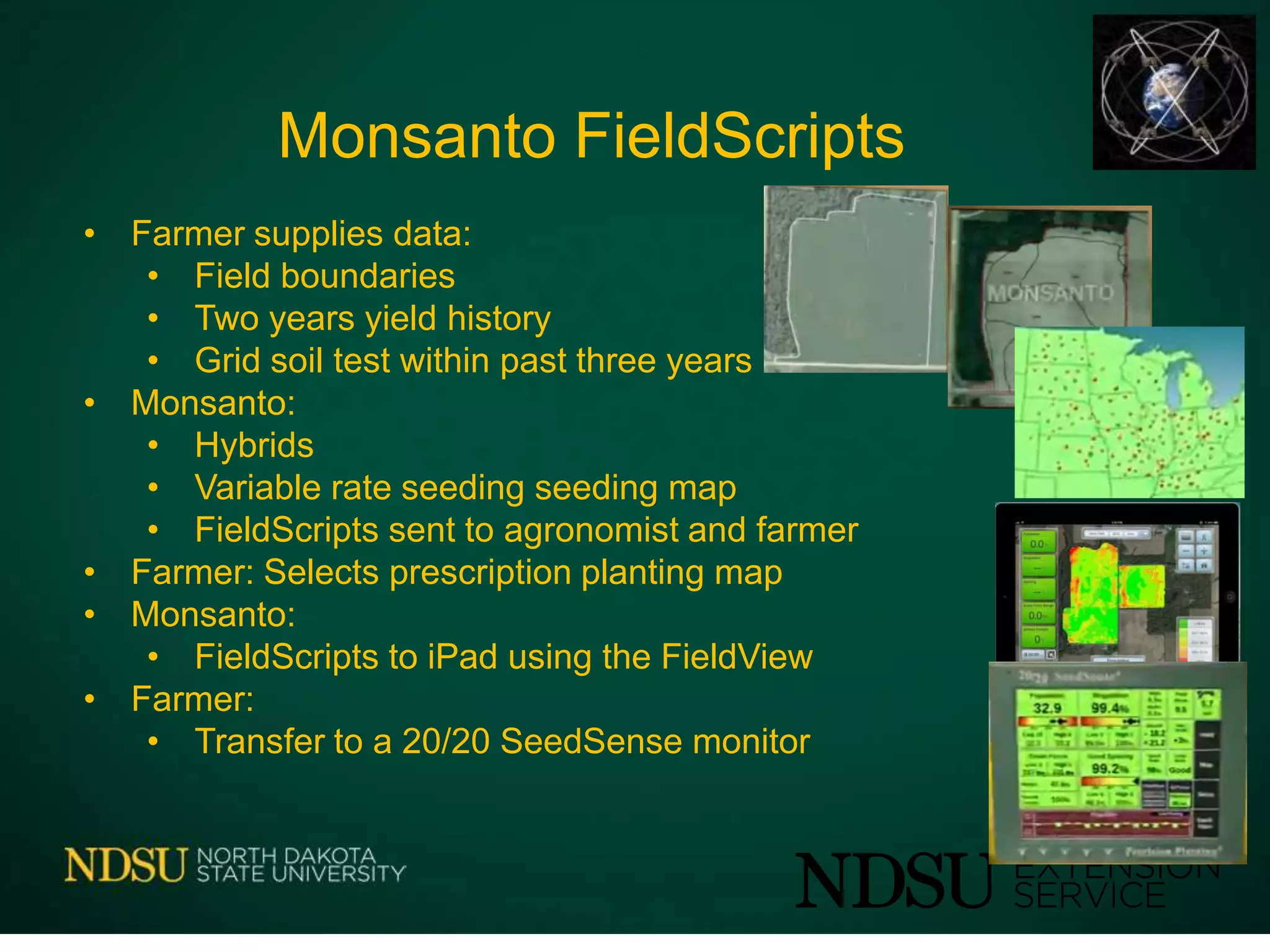
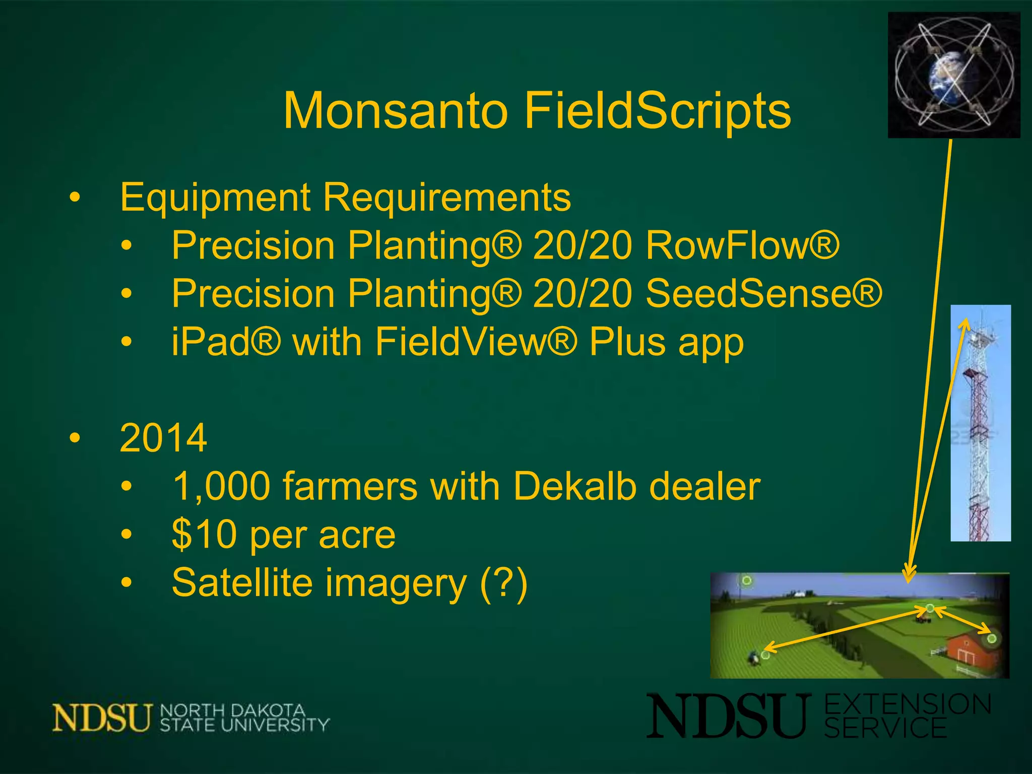
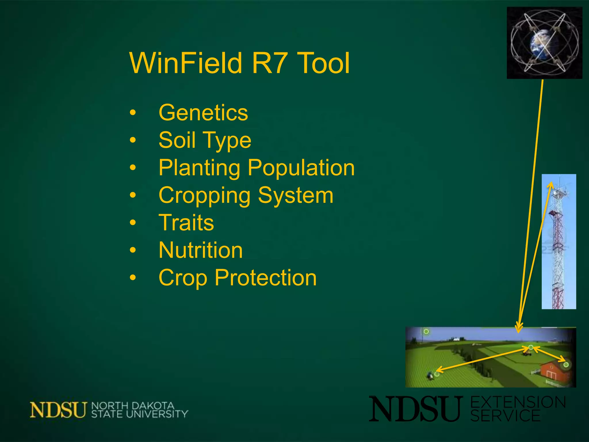
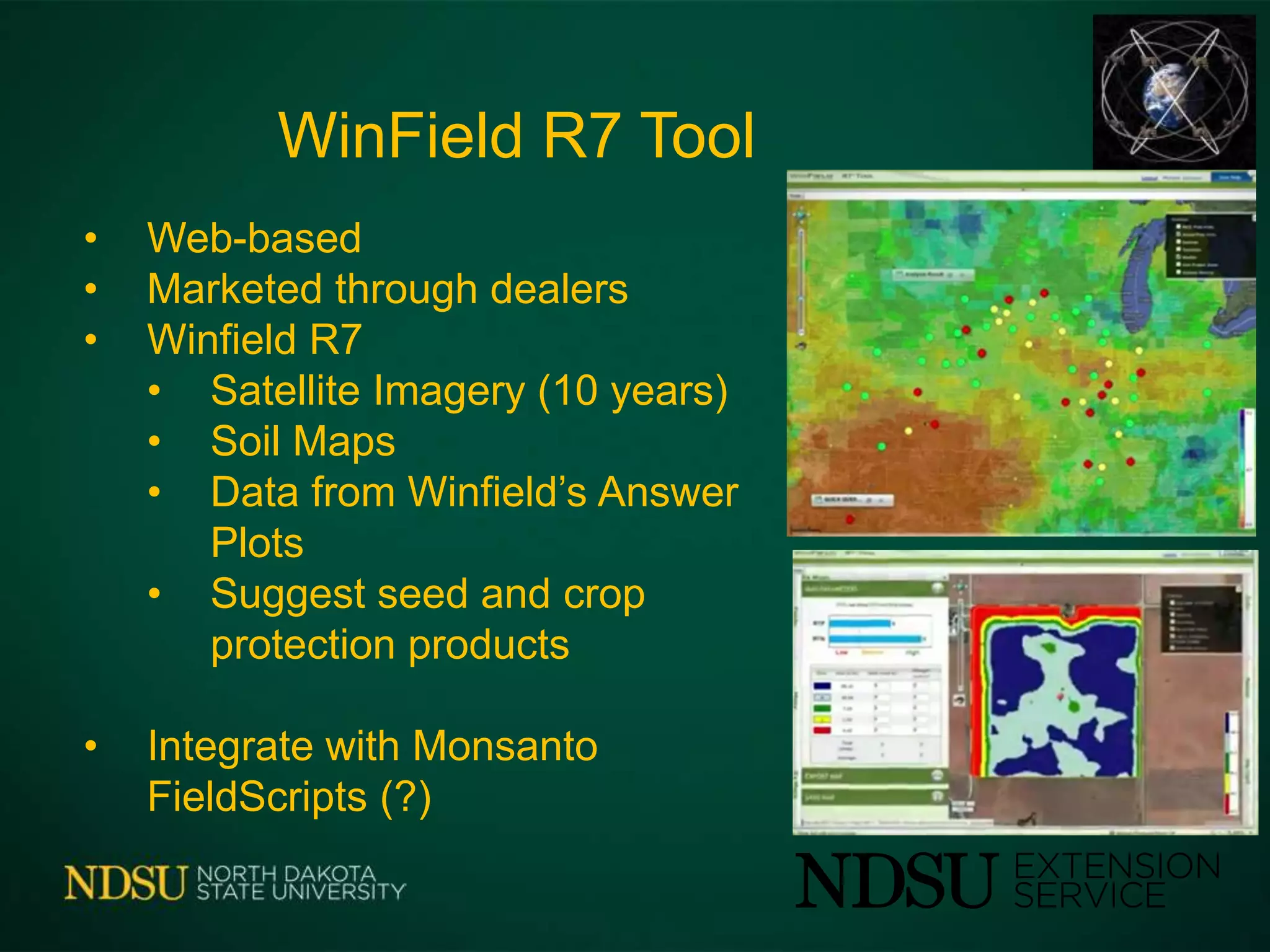
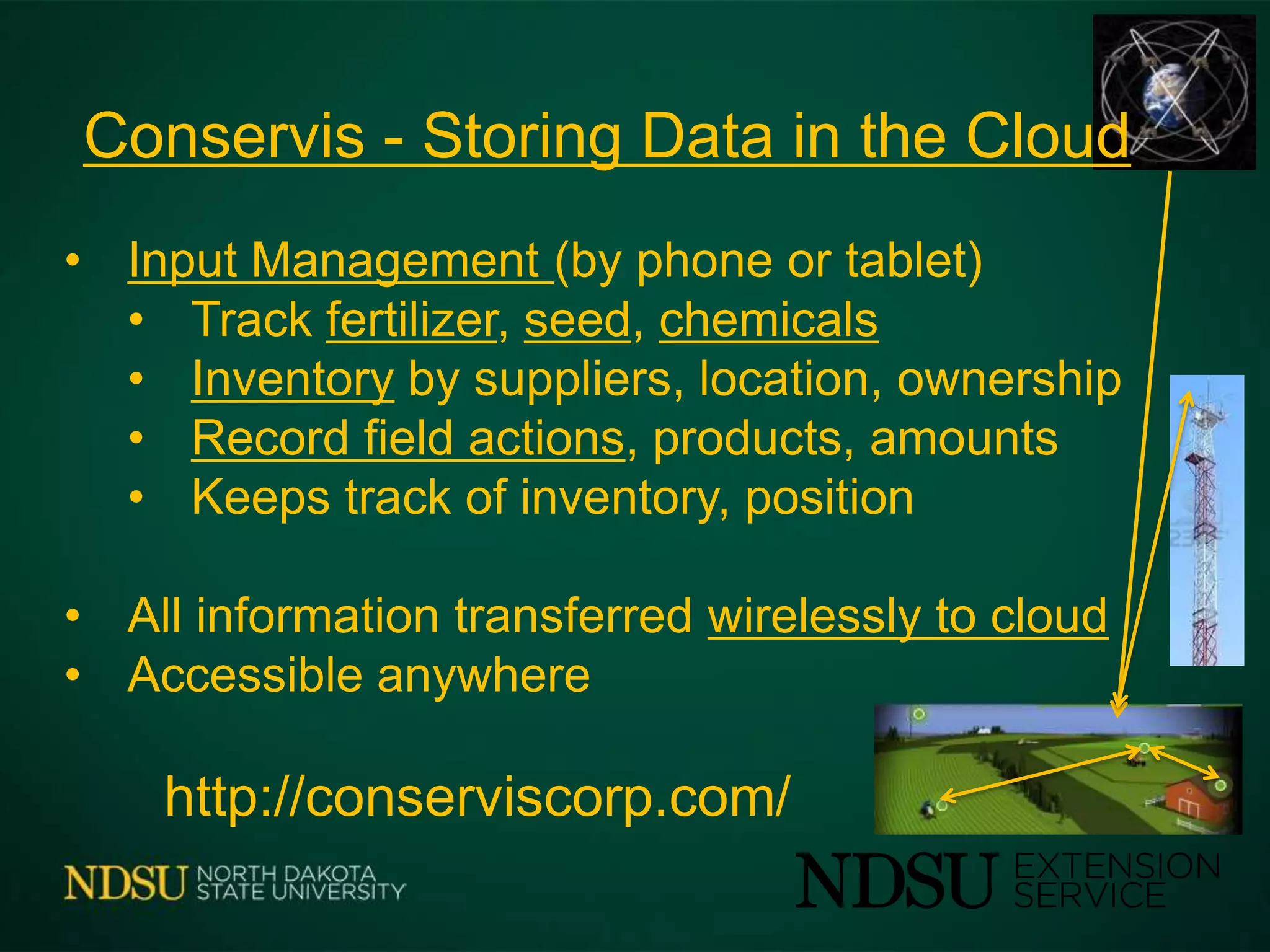
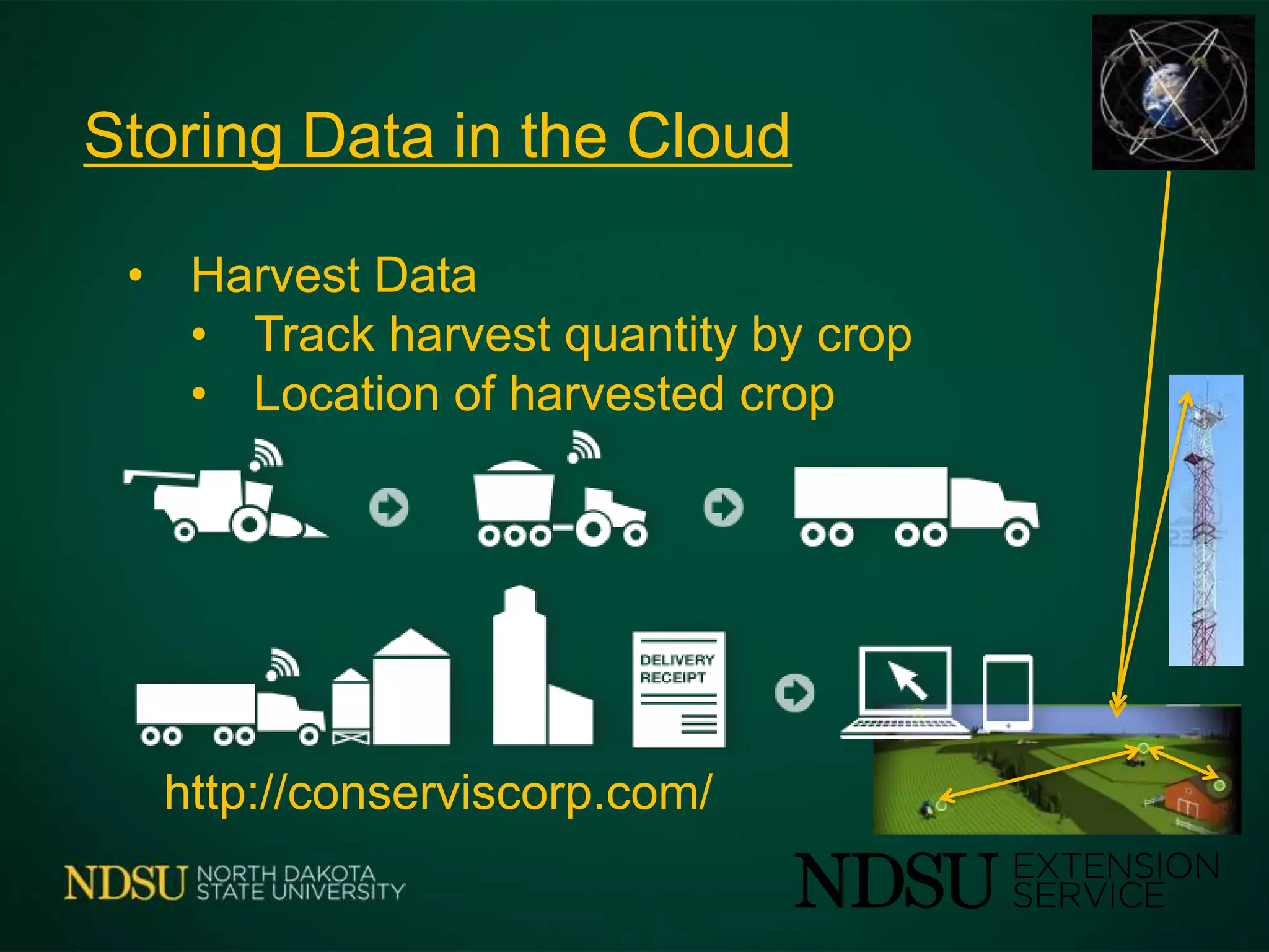
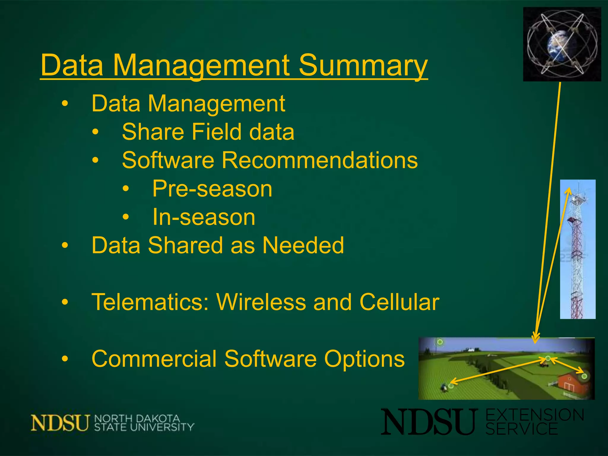
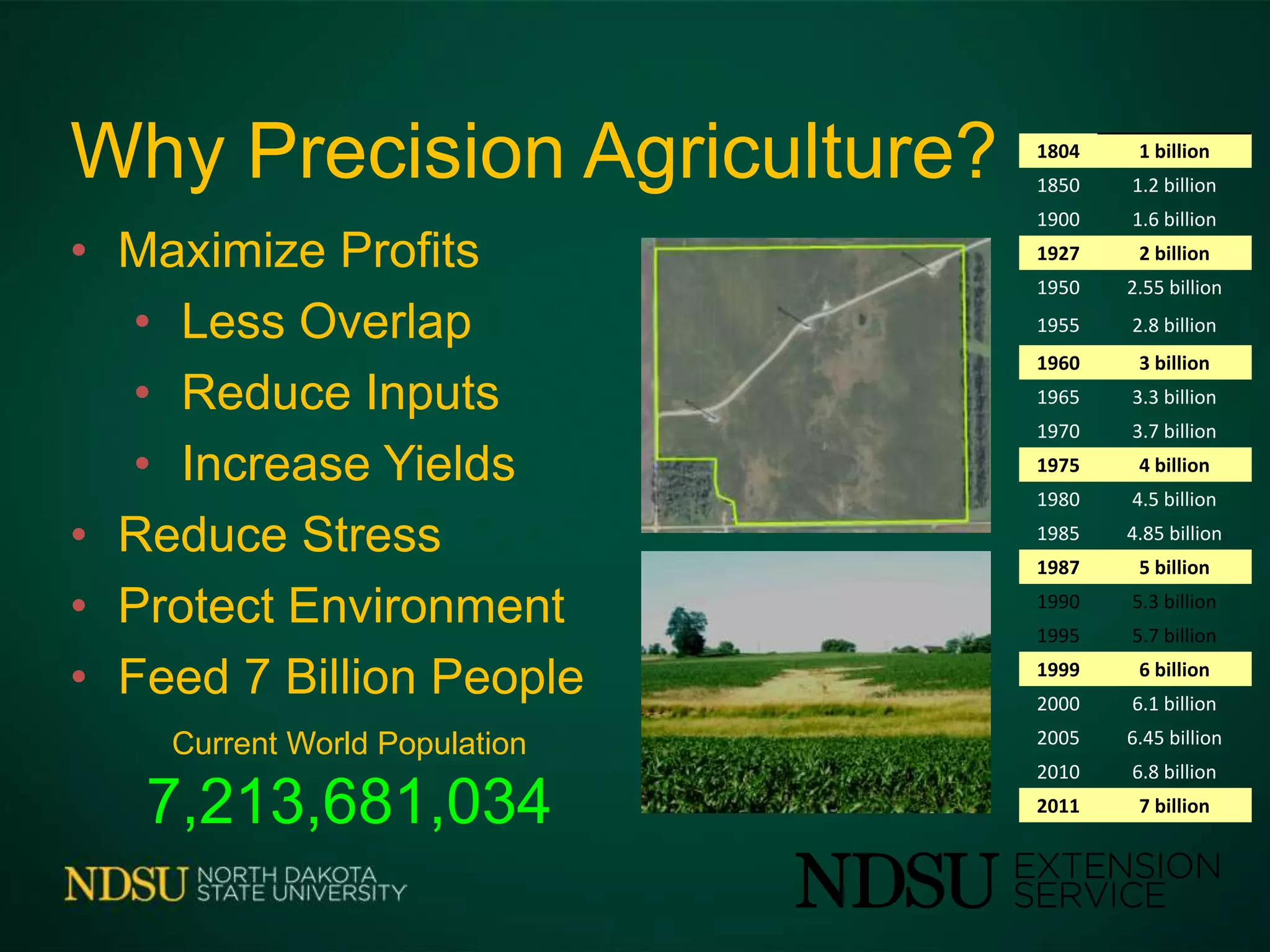
Data Management
for Precision Applications
John Nowatzki
Extension Ag Machine Systems Specialist
Data Management for Precision Ag
• Farm Data: What – Why - How?
• Telematics
• Data Management
• Commercial Software Options
• Storing Data in the Cloud
Digital Farm Data
Aerial Image Soils Crop Yield
RTK Elevation
LiDAR Elevation
Satellite – Color Image Satellite – NDVI Image
Zone Map
Plant Population
Fertilizer Rate
Farm Data: What, Why, How?
• What? Field Boundaries, Yield, In-field
Sensors, EC, Soils, Satellite Imagery,
Hybrids-Varieties, UAS Imagery, Zones-
Grids, Applications Maps, Weather-Growing
Degree days
• Why? Increase Yields, Efficiencies, Profit
• How?
• Farm GIS Programs
• Details Prescription Programs
• Consulting Companies
Telematics in Farming
• What
Telematics
• Cellular, Wireless and Satellite
• Subscription Costs
• Data Transfer
• Sensors and Monitors
• Vehicles, Equipment, Machinery
• Soil, Crop, Livestock Sensors
• Weather
Current Applications
• Dealer/Farmer Communications
• Monitoring Equipment Operation
• Monitor Equipment Locations
• Internet in the Field
• Easier Data Transfer
Commercial Options
• Raven – Slingshot
• Trimble - Connected Farm
• John Deere - FarmSight
• AGCO - AgCommand
• Case IH - AFS Connect
Telematics: Raven Slingshot
• Internet access
• Major cellphone networks
• Manage vehicles
• Transfer data
• Tech support
• RTK - CORS Continuously Operating Reference Station
Telematics: Trimble Connected Farm
Field
• Vehicle to Vehicle Data Exchange
• Office to Field Data Exchange
• Mapping and Scouting
• NDVI Readings with Handheld GreenSeeker
• App
Fleet
• Implement Position Tracking
• Vehicle Position History
• Geo-fence and Curfew Alerts
• Fleet Productivity
• Remote Assistant
• App Farm Works Software®.
Telematics: JD Link & FarmSight
• Machine location and hours
• Geo-reference and Curfew alerts
• Maintenance Tracking & Analysis
• Remote Diagnostics
• Field Connect
• Monitors Soil & Ambient Conditions
• Irrigation Decisions
• Agronomics (under development)
Telematics: Case IH - AFS Connect
• Machine Location & Information
• Geo-fence
• Curfew
• Remote Access - Diagnostics
• Send and Receive Agronomic data
Telematics: AGCO - AgCommand
• Geo-fence
• Machine Performance
• Internet access to data
• Fuse Technologies
• AGCO's Existing Telematics
• Connect to Other Brands of Equipment
Telematics: Virtual Farm Manager
• Organize Field Information from
Desktop – in Advance
• Access on Cellphone
• Add Information in the field
• planting, yield, spraying
• Data is stored securely in Cloud
• Export reports to 3rd Party
Current
Data Management Software
• Various Ag Software Programs
• SST Software
• Farm Works
• Apex - John Deere
• SMS – Ag Leader
• AFS – Case IH
• etc.
• Pioneer Field360
• Monsanto FieldScripts (Precision Planter)
• Winfield R7
• Climate Corp
Tablets
Mobile
New
Data Management Options
Data Management – Field Software
• Farmer Shares Field data
• Soil Tests
• EC (Electrical Conductivity)
• Elevation & Topography
• Historical Uses
• Production Data
• Previous Crops
• Yield Maps
Data Management – Field Software
• Initial Company Recommendations
• Hybrid & Fertilizer Recommendations
• Prescription Maps (directly to controller)
• Use Weather Data
• Planting Date
• Growing Degree Days
• In-season Recommendations
• Fertilizer
• Pesticides
• Data Shared with Consultants
Pioneer’s Field360
Field360 Notes (Free app for cellphone, share with others)
• Record notes with cellphone
• Take pictures and record locations
• Synchs between operation employees
Pioneer’s Field360
Field360 Select ($500 annually)
• Web-based
• John Deere now, others later
• Crop development using growing-degree-day
• Monitor rainfall by field (radar)
• Monitor degree days (DTN Weather)
• Document seeding maps, soil types, as-planted
and yield maps
• Others can access online
Monsanto FieldScripts
• Farmer supplies data:
• Field boundaries
• Two years yield history
• Grid soil test within past three years
• Monsanto:
• Hybrids
• Variable rate seeding seeding map
• FieldScripts sent to agronomist and farmer
• Farmer: Selects prescription planting map
• Monsanto:
• FieldScripts to iPad using the FieldView
• Farmer:
• Transfer to a 20/20 SeedSense monitor
Monsanto FieldScripts
• Equipment Requirements
• Precision Planting® 20/20 RowFlow®
• Precision Planting® 20/20 SeedSense®
• iPad® with FieldView® Plus app
• 2014
• 1,000 farmers with Dekalb dealer
• $10 per acre
• Satellite imagery (?)
WinField R7 Tool
• Genetics
• Soil Type
• Planting Population
• Cropping System
• Traits
• Nutrition
• Crop Protection
WinField R7 Tool
• Web-based
• Marketed through dealers
• Winfield R7
• Satellite Imagery (10 years)
• Soil Maps
• Data from Winfield’s Answer
Plots
• Suggest seed and crop
protection products
• Integrate with Monsanto
FieldScripts (?)
Climate Corp
• Climate Basic - Free
• Local weather monitoring - precipitation, humidity,
wind speed, radar, field workability and growth stage
• Automated tracking of crop growth stages
• Alerts delivered via text, email
• Log of scouting notes
Climate Corp
• Climate Pro
• Planting Advisor
• Nitrogen Advisor
• Pest & Disease Advisor
• Harvest Advisor
• Variable Rate Advisor
Climate Corp
Weather, soil and crop data at a field level
Climate Corp
24-hour Precipitation Map
• Input Management (by phone or tablet)
• Track fertilizer, seed, chemicals
• Inventory by suppliers, location, ownership
• Record field actions, products, amounts
• Keeps track of inventory, position
• All information transferred wirelessly to cloud
• Accessible anywhere
http://conserviscorp.com/
Conservis - Storing Data in the Cloud
Storing Data in the Cloud
• Harvest Data
• Track harvest quantity by crop
• Location of harvested crop
http://conserviscorp.com/
Data Management Summary
• Data Management
• Share Field data
• Software Recommendations
• Pre-season
• In-season
• Data Shared as Needed
• Telematics: Wireless and Cellular
• Commercial Software Options
Why Precision Agriculture?
• Maximize Profits
• Less Overlap
• Reduce Inputs
• Increase Yields
• Reduce Stress
• Protect Environment
• Feed 7 Billion People
1804 1 billion
1850 1.2 billion
1900 1.6 billion
1927 2 billion
1950 2.55 billion
1955 2.8 billion
1960 3 billion
1965 3.3 billion
1970 3.7 billion
1975 4 billion
1980 4.5 billion
1985 4.85 billion
1987 5 billion
1990 5.3 billion
1995 5.7 billion
1999 6 billion
2000 6.1 billion
2005 6.45 billion
2010 6.8 billion
2011 7 billion
Current World Population
7,213,681,034
Questions - Comments
Office 701-231-8213 Cell 701-261-9842
John.Nowatzki@ndsu.edu
http://www.ag.ndsu.edu/agmachinery

Telematics, automation, control systems in precision ag 2014

  • 1.
    Data Management for PrecisionApplications John Nowatzki Extension Ag Machine Systems Specialist
  • 2.
    Data Management forPrecision Ag • Farm Data: What – Why - How? • Telematics • Data Management • Commercial Software Options • Storing Data in the Cloud
  • 3.
    Digital Farm Data AerialImage Soils Crop Yield RTK Elevation LiDAR Elevation Satellite – Color Image Satellite – NDVI Image Zone Map Plant Population Fertilizer Rate
  • 4.
    Farm Data: What,Why, How? • What? Field Boundaries, Yield, In-field Sensors, EC, Soils, Satellite Imagery, Hybrids-Varieties, UAS Imagery, Zones- Grids, Applications Maps, Weather-Growing Degree days • Why? Increase Yields, Efficiencies, Profit • How? • Farm GIS Programs • Details Prescription Programs • Consulting Companies
  • 5.
  • 6.
    Telematics • Cellular, Wirelessand Satellite • Subscription Costs • Data Transfer • Sensors and Monitors • Vehicles, Equipment, Machinery • Soil, Crop, Livestock Sensors • Weather
  • 7.
    Current Applications • Dealer/FarmerCommunications • Monitoring Equipment Operation • Monitor Equipment Locations • Internet in the Field • Easier Data Transfer
  • 8.
    Commercial Options • Raven– Slingshot • Trimble - Connected Farm • John Deere - FarmSight • AGCO - AgCommand • Case IH - AFS Connect
  • 9.
    Telematics: Raven Slingshot •Internet access • Major cellphone networks • Manage vehicles • Transfer data • Tech support • RTK - CORS Continuously Operating Reference Station
  • 10.
    Telematics: Trimble ConnectedFarm Field • Vehicle to Vehicle Data Exchange • Office to Field Data Exchange • Mapping and Scouting • NDVI Readings with Handheld GreenSeeker • App Fleet • Implement Position Tracking • Vehicle Position History • Geo-fence and Curfew Alerts • Fleet Productivity • Remote Assistant • App Farm Works Software®.
  • 11.
    Telematics: JD Link& FarmSight • Machine location and hours • Geo-reference and Curfew alerts • Maintenance Tracking & Analysis • Remote Diagnostics • Field Connect • Monitors Soil & Ambient Conditions • Irrigation Decisions • Agronomics (under development)
  • 12.
    Telematics: Case IH- AFS Connect • Machine Location & Information • Geo-fence • Curfew • Remote Access - Diagnostics • Send and Receive Agronomic data
  • 13.
    Telematics: AGCO -AgCommand • Geo-fence • Machine Performance • Internet access to data • Fuse Technologies • AGCO's Existing Telematics • Connect to Other Brands of Equipment
  • 14.
    Telematics: Virtual FarmManager • Organize Field Information from Desktop – in Advance • Access on Cellphone • Add Information in the field • planting, yield, spraying • Data is stored securely in Cloud • Export reports to 3rd Party
  • 15.
    Current Data Management Software •Various Ag Software Programs • SST Software • Farm Works • Apex - John Deere • SMS – Ag Leader • AFS – Case IH • etc.
  • 16.
    • Pioneer Field360 •Monsanto FieldScripts (Precision Planter) • Winfield R7 • Climate Corp Tablets Mobile New Data Management Options
  • 17.
    Data Management –Field Software • Farmer Shares Field data • Soil Tests • EC (Electrical Conductivity) • Elevation & Topography • Historical Uses • Production Data • Previous Crops • Yield Maps
  • 18.
    Data Management –Field Software • Initial Company Recommendations • Hybrid & Fertilizer Recommendations • Prescription Maps (directly to controller) • Use Weather Data • Planting Date • Growing Degree Days • In-season Recommendations • Fertilizer • Pesticides • Data Shared with Consultants
  • 19.
    Pioneer’s Field360 Field360 Notes(Free app for cellphone, share with others) • Record notes with cellphone • Take pictures and record locations • Synchs between operation employees
  • 20.
    Pioneer’s Field360 Field360 Select($500 annually) • Web-based • John Deere now, others later • Crop development using growing-degree-day • Monitor rainfall by field (radar) • Monitor degree days (DTN Weather) • Document seeding maps, soil types, as-planted and yield maps • Others can access online
  • 21.
    Monsanto FieldScripts • Farmersupplies data: • Field boundaries • Two years yield history • Grid soil test within past three years • Monsanto: • Hybrids • Variable rate seeding seeding map • FieldScripts sent to agronomist and farmer • Farmer: Selects prescription planting map • Monsanto: • FieldScripts to iPad using the FieldView • Farmer: • Transfer to a 20/20 SeedSense monitor
  • 22.
    Monsanto FieldScripts • EquipmentRequirements • Precision Planting® 20/20 RowFlow® • Precision Planting® 20/20 SeedSense® • iPad® with FieldView® Plus app • 2014 • 1,000 farmers with Dekalb dealer • $10 per acre • Satellite imagery (?)
  • 23.
    WinField R7 Tool •Genetics • Soil Type • Planting Population • Cropping System • Traits • Nutrition • Crop Protection
  • 24.
    WinField R7 Tool •Web-based • Marketed through dealers • Winfield R7 • Satellite Imagery (10 years) • Soil Maps • Data from Winfield’s Answer Plots • Suggest seed and crop protection products • Integrate with Monsanto FieldScripts (?)
  • 25.
    Climate Corp • ClimateBasic - Free • Local weather monitoring - precipitation, humidity, wind speed, radar, field workability and growth stage • Automated tracking of crop growth stages • Alerts delivered via text, email • Log of scouting notes
  • 26.
    Climate Corp • ClimatePro • Planting Advisor • Nitrogen Advisor • Pest & Disease Advisor • Harvest Advisor • Variable Rate Advisor
  • 27.
    Climate Corp Weather, soiland crop data at a field level
  • 28.
  • 29.
    • Input Management(by phone or tablet) • Track fertilizer, seed, chemicals • Inventory by suppliers, location, ownership • Record field actions, products, amounts • Keeps track of inventory, position • All information transferred wirelessly to cloud • Accessible anywhere http://conserviscorp.com/ Conservis - Storing Data in the Cloud
  • 30.
    Storing Data inthe Cloud • Harvest Data • Track harvest quantity by crop • Location of harvested crop http://conserviscorp.com/
  • 31.
    Data Management Summary •Data Management • Share Field data • Software Recommendations • Pre-season • In-season • Data Shared as Needed • Telematics: Wireless and Cellular • Commercial Software Options
  • 32.
    Why Precision Agriculture? •Maximize Profits • Less Overlap • Reduce Inputs • Increase Yields • Reduce Stress • Protect Environment • Feed 7 Billion People 1804 1 billion 1850 1.2 billion 1900 1.6 billion 1927 2 billion 1950 2.55 billion 1955 2.8 billion 1960 3 billion 1965 3.3 billion 1970 3.7 billion 1975 4 billion 1980 4.5 billion 1985 4.85 billion 1987 5 billion 1990 5.3 billion 1995 5.7 billion 1999 6 billion 2000 6.1 billion 2005 6.45 billion 2010 6.8 billion 2011 7 billion Current World Population 7,213,681,034
  • 33.
    Questions - Comments Office701-231-8213 Cell 701-261-9842 John.Nowatzki@ndsu.edu http://www.ag.ndsu.edu/agmachinery