Download as PDF, PPTX
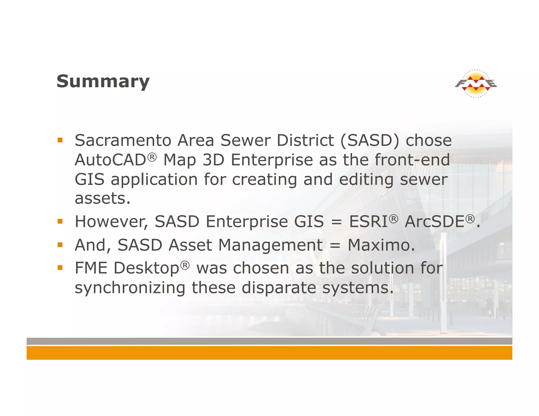

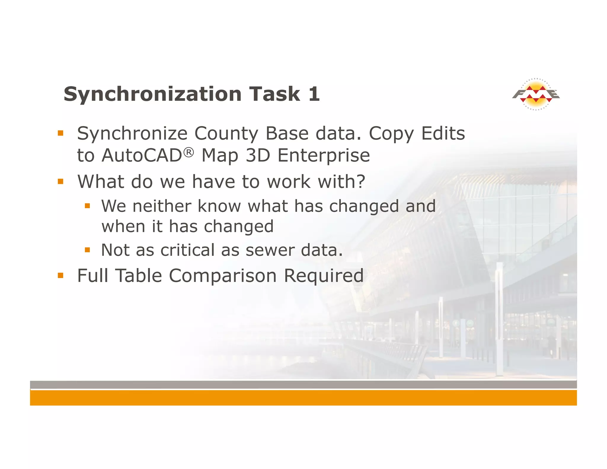
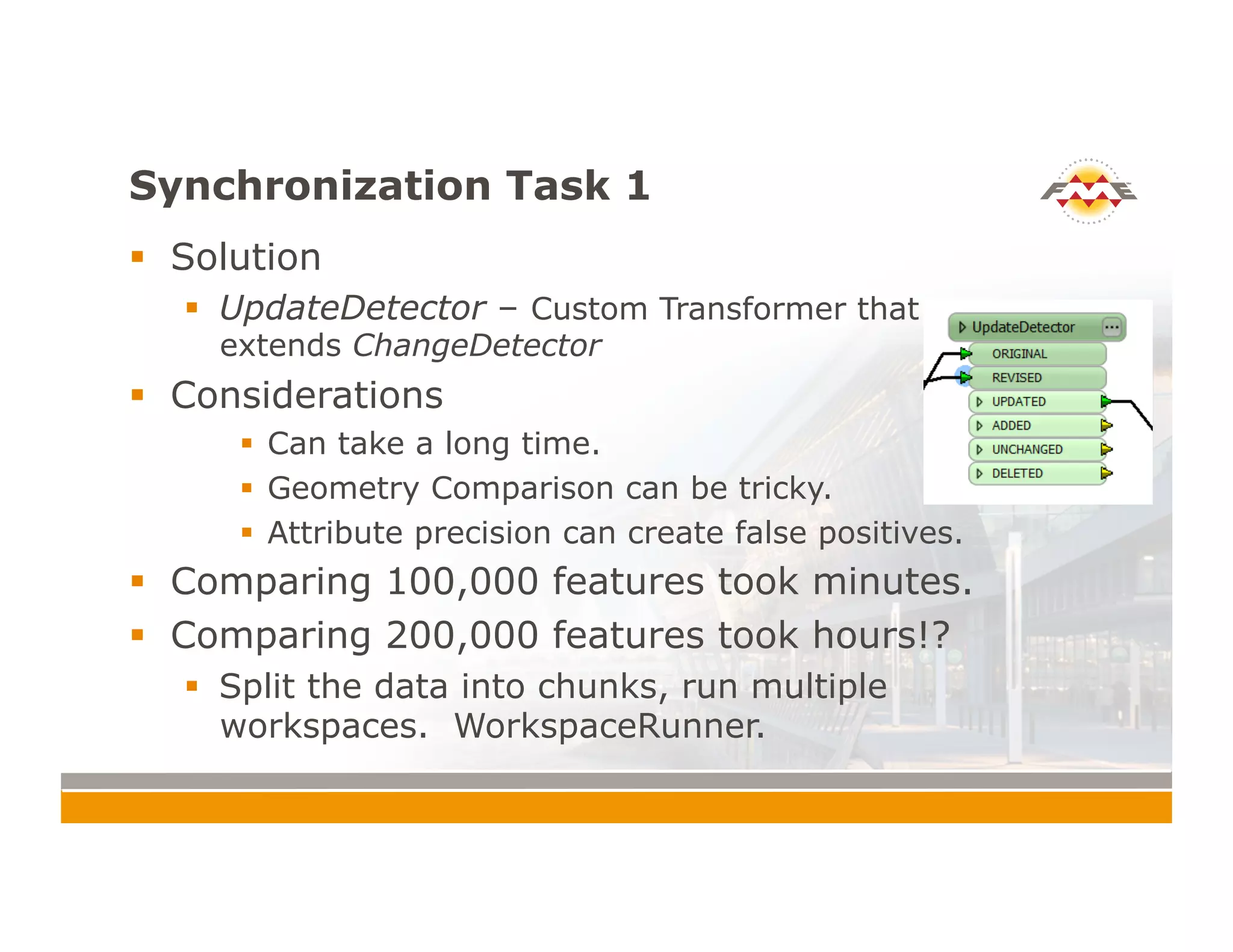
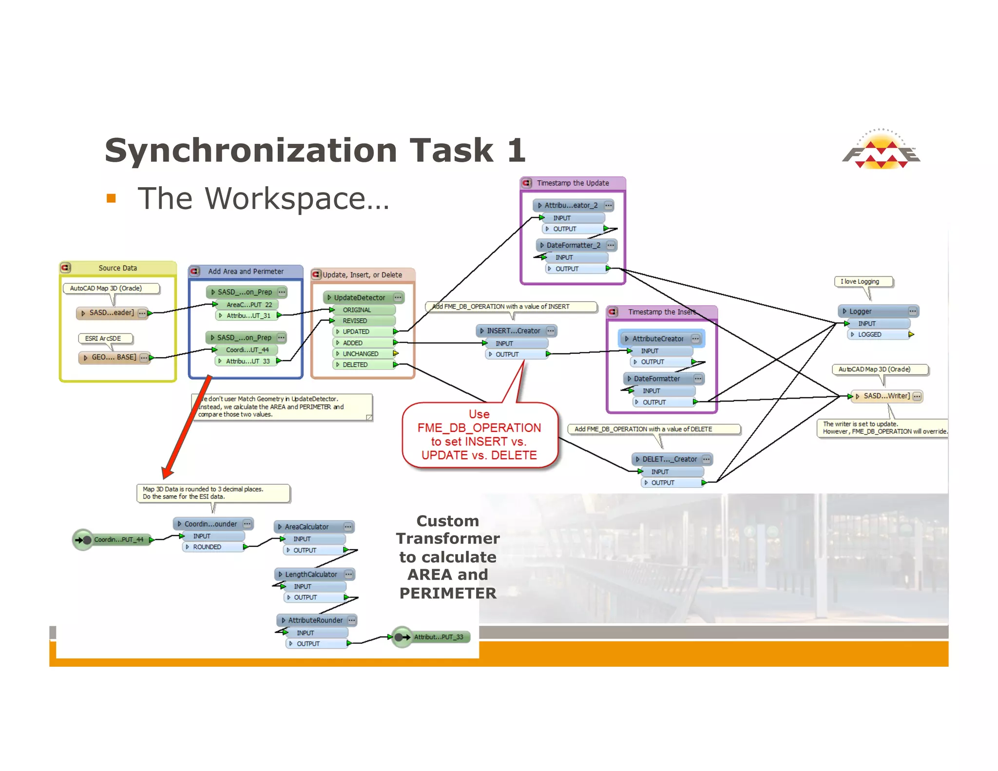
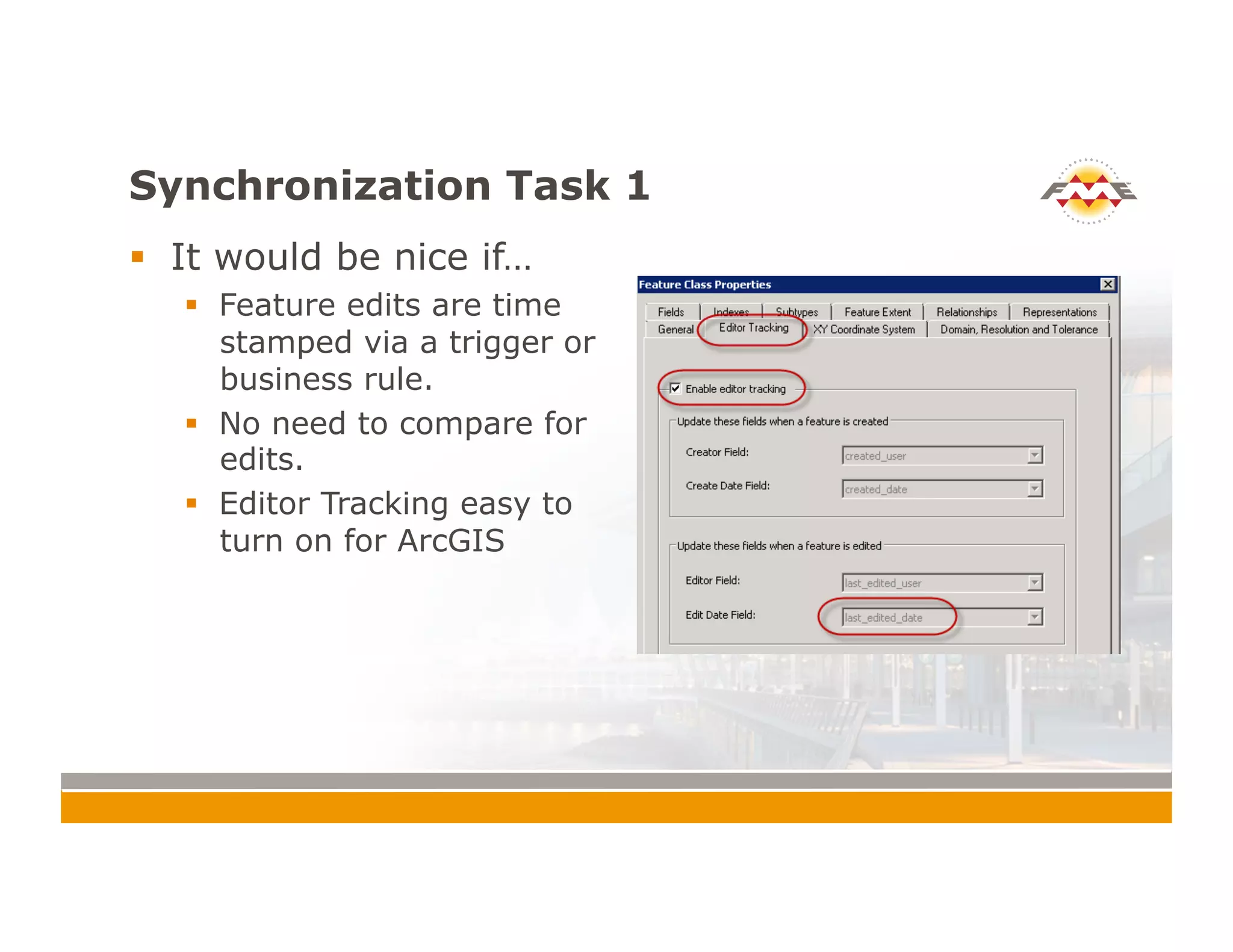

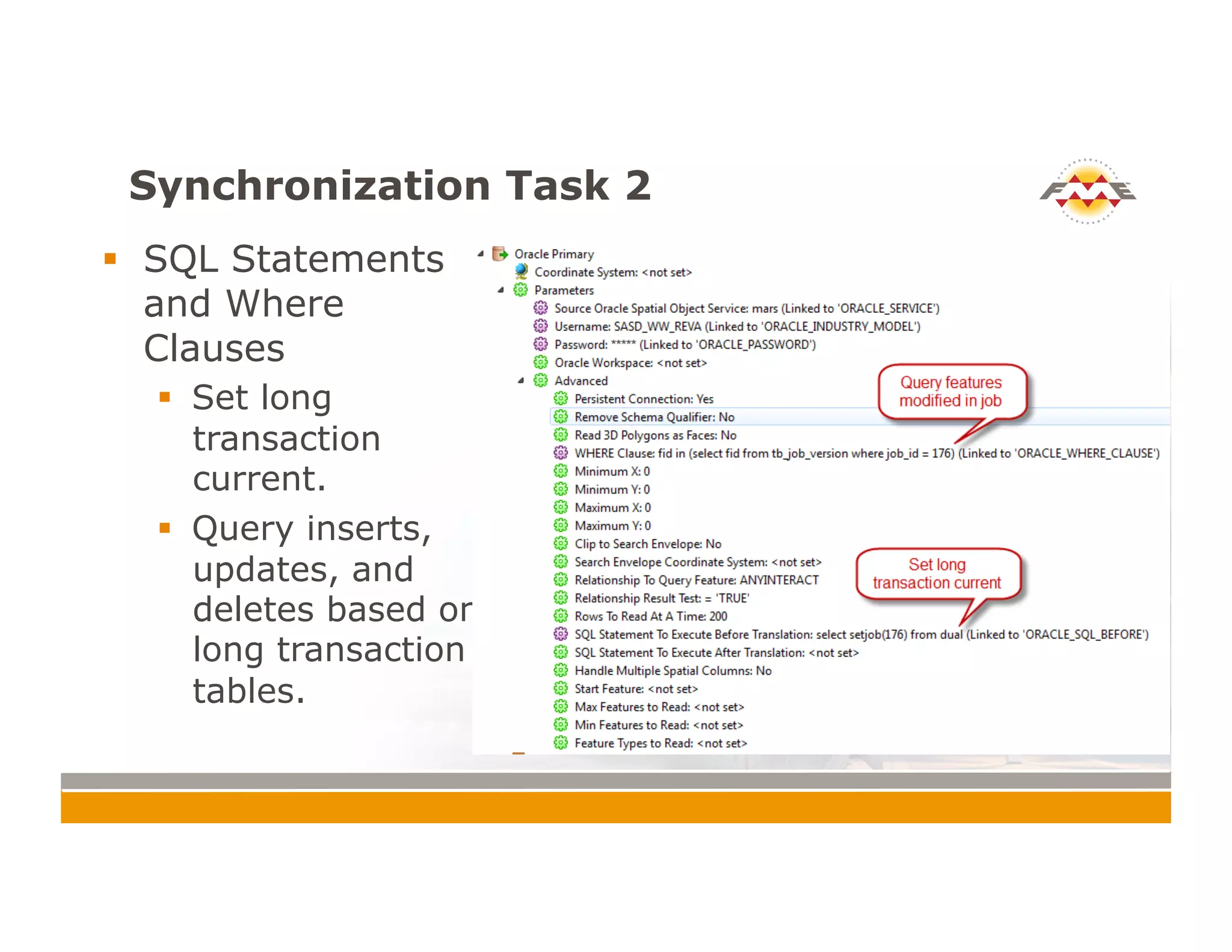
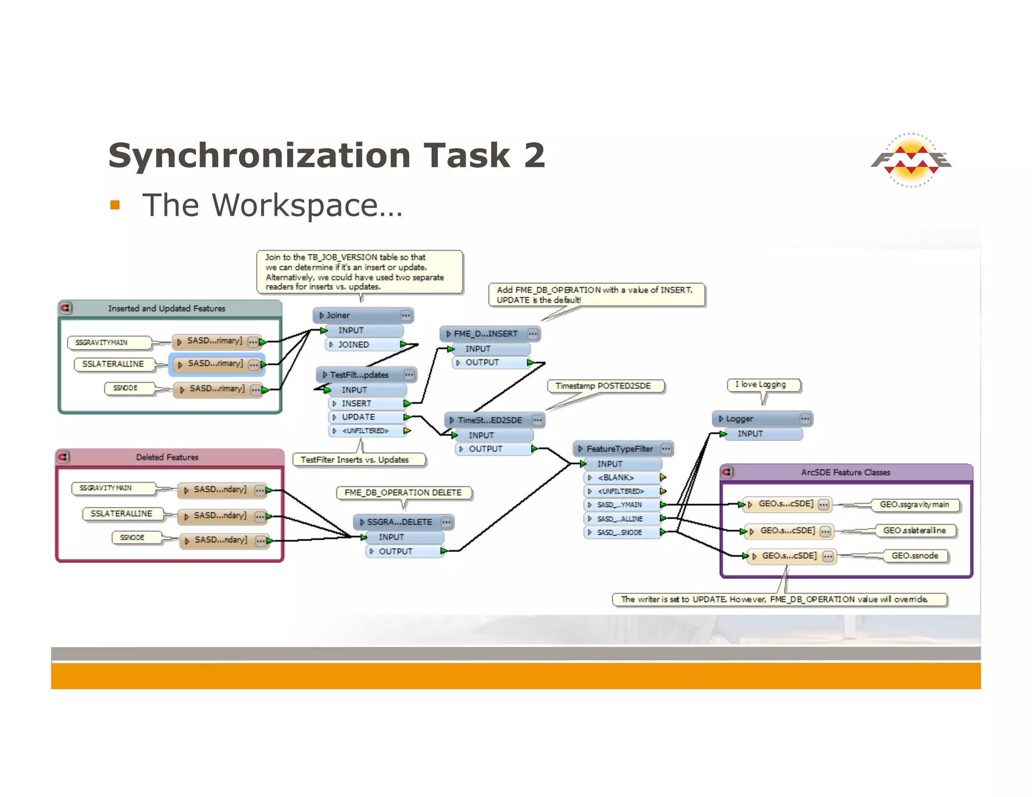
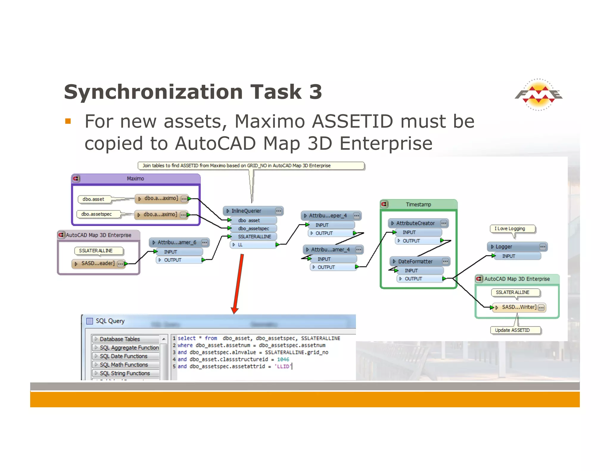

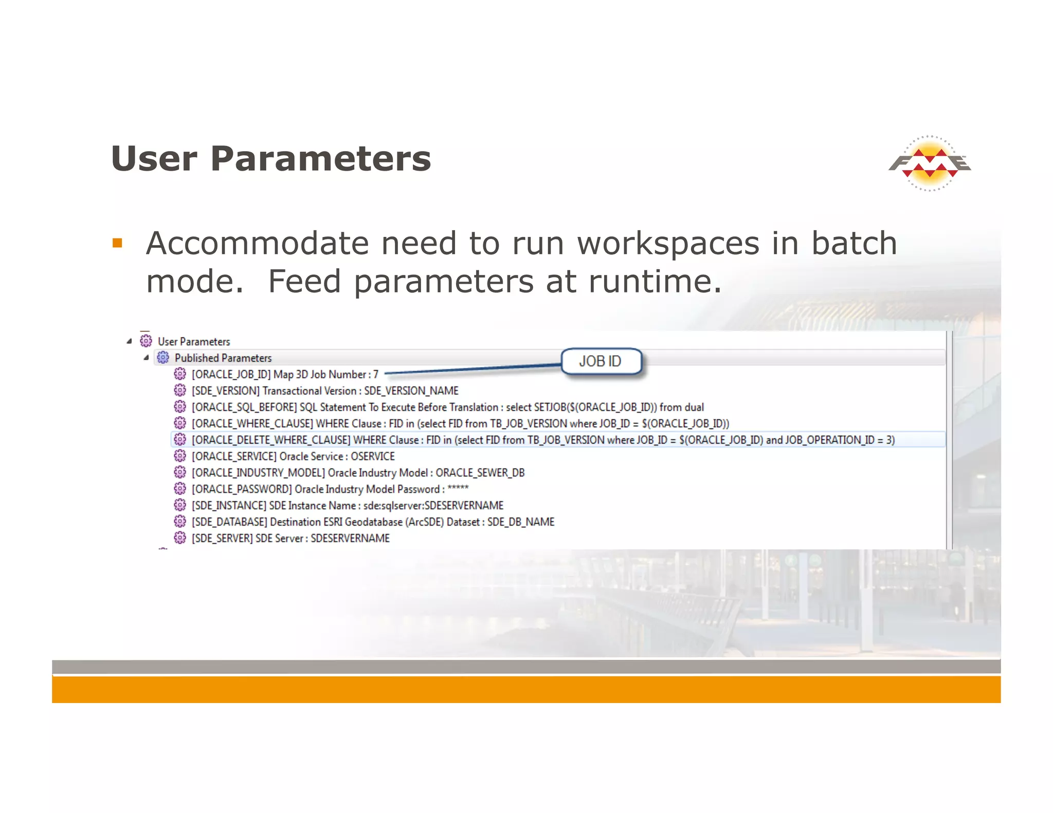
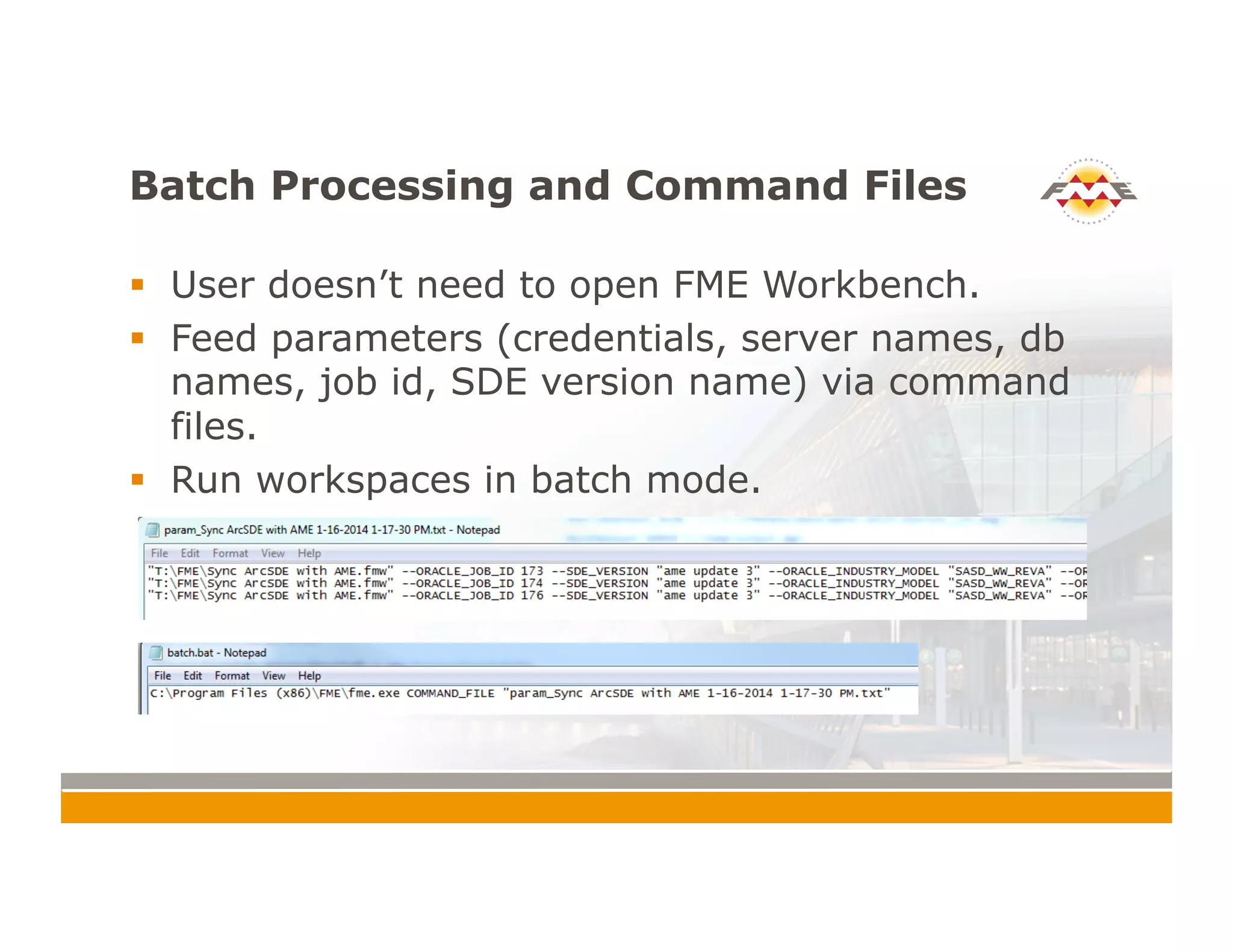


The document outlines the synchronization of AutoCAD® Map 3D Enterprise with ESRI® ArcSDE® and Maximo asset management for the Sacramento Area Sewer District. It describes various synchronization tasks, techniques using custom transformers, and the importance of using long transactions for efficient updates. The document emphasizes the significance of handling null attribute values and the advantages of using FME Desktop® 2014 for improved synchronization processes.


