Presentation #8 of 9: Steniar Eldoy of Statoil from Ecofys shares Netherlands experience in environmental impact monitoring , lessons learned and future perspective
Baltic SCOPE kick-off - Cross-Border cooperation in the North sea by Leo de Vrees, Netherlands Ministry of Infrastructure and the Environment
* The information presented is the working exercise of the cross-border maritime spatial planning discussions and can not be treated as the official opinion of the European Commission and the Member States involved in the consortium of the Baltic SCOPE project.
Combining earth observations and statistics for evidence based policy making ...Bente Lilja Bye
Arctic Frontiers 2019
Abstract
Looking at climate change, development of activities like fishing, shipping, tourism etc together with the history of policies in the polar region in and around Svalbard applying an holistic approach, can result in new information that will help us make better decisions for the Arctic area in the future.
3 different H2020 projects INTAROS, NextGEOSS, and DataBio join forces to provide new information using the latest in big data and cloud technology, access to Copernicus data and services, and user requirements from social scientists. Through analysis of different types of met-ocean data ((e.g. ice edge, SST) and fishery statistics to investigate potential links between climate change and activity in the polar region in and around Svalbard. We evaluate if the FAIR principles are met for the chosen variables, using Copernicus, BarentsWatch and other open data resources. Accessibility and functionality of the related APIs will be assessed, and whether the chosen APIs can jointly provide new information.
We will also present how one can combine available information from existing sources, such as catch reports, oceanographic measurements, oceanographic simulations, stock simulations and stock observations, can be used for improving assessment of fish stocks and their distribution. Part of these data will be derived from remote sensing, while others will be collected using vessels equipped with appropriate sensors and communication and communication tools.
Together this combinations of data will provide new information that will be useful for policy making in polar regions and that take into account the different sectors and actors involved.
C1.05: Sustained observations for many users - a perspective from Australia’s...Blue Planet Symposium
Australia is a ‘marine nation’ – an island continent with the third largest ocean territory on the ‘Blue Planet’. Our borders are maritime and we generate massive wealth from marine industries. Most of our population lives in highly urbanised centres on or near the coast, and we are extremely sensitive to ocean-influenced climate and weather, through drought, flood, and tropical cyclones. Our ocean territory contains marine biodiversity of globally significant conservation and tourism value, ranging from the high tropics to Antarctica. These factors combine to establish the need for sustained ocean observing in the Australian context, for many uses and users.
Despite this clear, national need, responsibility for ocean observing and management is fragmented and dispersed. A National Oceans Policy and independent National Oceans Office were established in 1998, but were subsumed into the Federal Environment portfolio by 2005. The Bureau of Meteorology is Australia's national weather agency, and while its role has expanded to encompass climate and water services over the last decade, it is only now beginning to consider an expanded role in marine services. Jurisdiction of the marine environment, including responsibility for marine monitoring, is shared across Federal, State and Territory Governments, across different Departments within those various Governments, and between industrial users and regulators in areas like offshore oil and gas and commercial fishing. It is also significant to note that Australia has no earth observation from space (EOS) capability of its own.
Since 2006, Australia has put in place a national Integrated Marine Observing System (IMOS). Established as a research infrastructure, IMOS routinely operates a wide range of observing equipment, making all of its data openly accessible to the marine and climate science community, other stakeholders and users, and international collaborators. It is integrated from open-ocean to coast, and across physical, chemical and biological ocean variables.
This talk will focus on what has been learnt through the experience of building IMOS as a research infrastructure in a context where sustained ocean observations are needed by many users.
Greetings all,
Once a year in April, the Mercator Ocean Forecasting Center in Toulouse and the Coriolis Infrastructure in Brest publish a common newsletter. Papers are dedicated to observations only.
• The first paper introducing this issue is presenting the Coriolis 2014-2020 framework which was renewed in 2014 in order to go on integrating in-situ ocean observation infrastructure for operational oceanography and ocean/climate research.
• Next paper by Poffa et al. describes how some Argo floats are deployed by the sailing community, through ship-based non-governmental organization or trans-oceanic races. It allows Argo floats to be deployed in poorly sampled areas where there is no regular shipping. Sailors got also involved in oceanographic science activities. An example of float deployment is given in the case of the Barcelona World Race.
• Next paper by Pouliquen et al. describes the EURO-ARGO ERIC infrastructure which is now officially set-up since May 2014. The objective of the Euro-Argo ERIC is to organize a long term European contribution to the international Argo array of profiling floats.
• Le Traon et al. are then presenting how the assessment of the impact of ARGO in Ocean models and satellite validation is conducted in the context of E-AIMS (Euro-Argo improvements for the GMES/Copernicus Marine Service) FP7 project. Observing System Evaluations and Observing System Simulation Experiments have been conducted to quantify the contribution of Argo to constrain global and regional monitoring and forecasting centers and validate satellite observations. Recommendations for the new phase of Argo are also elaborated.
• Kolodziejczyk et al. follow with the presentation of the complementarity of ARGO and SMOS Sea Surface Salinity (SSS) observations to help monitoring SSS variability from basin to meso scale. Using a 4-year time-series of SMOS SSS data and the global Argo array of in situ measurements, a statistical approach and an optimal interpolation method are used to characterize biases and reduce noises. Results are promising and show strong complementarity between SMOS and Argo data.
• Herbert et al. then describe Shipboard Acoustic Doppler Current Profilers (SADCP) observations which are carried out in the Tropical Atlantic during yearly cruises in the framework of the PIRATA program. The present note displays the SADCP data processing methodology applied for 8 PIRATA cruises by using CASCADE software.
• Cravatte et al. follow with a paper presenting the new international TPOS2020 project (2014-2020). The project objective is to build a renewed, integrated, internationally-coordinated and sustainable observing system in the Tropical Pacific, meeting both the needs of climate research and operational forecasting systems and learning lessons from the great success-and finally partial collapse- of the TAO/TRITON array.
• Saout-Grit et al. next present an updated procedure for CTD-oxygen calibration along with new
Jasper dalhuisen infrastructures pilot action presentation jpio2015 conferencejpioceans
JPI Oceans pilot action
Multi-use of infrastructures for monitoring in the North Sea
Jasper Dalhuisen, Senior Policy Adviser, Ministry of Economic Affairs, The Netherlands
Cross-border cooperation in the Celtic Sea area and intended activities of the SIMCelt project by Joseph Ansong Onwona and Celia Le Lievre, Marine and Renewable Energy Ireland Centre, University College Cork at the workshop 'Past two years all over the Europe: case studies (part 2)' at the 2nd Baltic Maritime Spatial Planning Forum in Riga, Latvia on 23-24 November 2016 (the final conference of the Baltic SCOPE collaboration).
Video and other presentations - www.balticscope.eu
www.vasab.org
The Cool Route Project: Coastal Tourism Development Giancarlo Fedeli
Arctic Circle Conference 2019 Panelist
EU Interreg Funded Project 2015-2018
Giancarlo Fedeli: Principal Investigator for the Cool Route at Glasgow Caledonian University
#3/9 Ornithology monitoring on offshore windfarmsNaturalEngland
Presentation #3 of 9: Mark Trinder of MacArthur Green highlighting issues to do with ornithological monitoring at offshore windfarms, survey design and inference
#6/9 Marine ecological monitoring at UK OSWFNaturalEngland
Presention #6 of 9: Kevin Linnane of RPS sharing case studies of marine ecological monitoring , lessons learned and rationale for future monitoring of fish
Presentation #7 of 9: Huygen van Steen from Ecofys shares Netherland's experience in environmental impact monitoring, lessons learned and future perspective.
NE Mosaic approach: Managing habitats for species - introductionNaturalEngland
Introduction to the Mosaic approach: A series of visual, interactive guides designed to help land managers manage habitats in a way that supports multiple species by developing “mosaics” of different environmental features at a landscape scale, within a range of habitat types.
8 Steve Bellew GoBe offshore wind seminar 18 19 march 2014NaturalEngland
Looking at Natural England's experiences in the PINs process, covering pre-application advice, examination, Statements of Common Ground, post consent and Natural England charging
6 Crown Estate's Jessica Orr Developing an offshore windfarm into the futureNaturalEngland
Ever wondered what the landlord of the sea bed does? How they promote the sustainable use for energy and infrastructure? And how much it's worth to the UK economy? Read on
5 Chris Gibson Natural England offshore wind seminar 18 19 march 2014 Why are...NaturalEngland
Why are birds so important in the UK? Did you know that almost 8 million seabirds from 25 species breed in Britain and Ireland inc 90% of the world's Manx shearwaters, 68% of northern gannets and 60% of great skuas.Why? It's all about location, location, location - extensive coastline, rich and diverse marine environment and a ready supply of food. Find out more about the need for renewables to take account of bird life
4 sarah nightingale decc offshore wind seminar 18 19 march 2014NaturalEngland
Offshore wind is already a major part of our energy supply, and key to our future – with huge potential for deployment, cost reduction, and economic benefit
UK market is the largest in the world - and will remain so to 2020 and beyond
We have a strong framework to drive investment in offshore wind – delivered through Electricity Market Reform
We are already securing the economic benefits – and the potential is huge
The UK is at the forefront of delivering cost reductions in offshore wind – reflected in reduced “strike prices” over the decade
Some rationalisation of the “pipeline” of projects is to be expected – a sign of the sector maturing
Presentation given by Jim Smyllie, Natural England's Executive Director of People, Landscape and Biodiversity at the Protecting and Enhancing the Urban and Natural Environment event in London on Tuesday 12th November 2013.
Characterization and the Kinetics of drying at the drying oven and with micro...Open Access Research Paper
The objective of this work is to contribute to valorization de Nephelium lappaceum by the characterization of kinetics of drying of seeds of Nephelium lappaceum. The seeds were dehydrated until a constant mass respectively in a drying oven and a microwawe oven. The temperatures and the powers of drying are respectively: 50, 60 and 70°C and 140, 280 and 420 W. The results show that the curves of drying of seeds of Nephelium lappaceum do not present a phase of constant kinetics. The coefficients of diffusion vary between 2.09.10-8 to 2.98. 10-8m-2/s in the interval of 50°C at 70°C and between 4.83×10-07 at 9.04×10-07 m-8/s for the powers going of 140 W with 420 W the relation between Arrhenius and a value of energy of activation of 16.49 kJ. mol-1 expressed the effect of the temperature on effective diffusivity.
UNDERSTANDING WHAT GREEN WASHING IS!.pdfJulietMogola
Many companies today use green washing to lure the public into thinking they are conserving the environment but in real sense they are doing more harm. There have been such several cases from very big companies here in Kenya and also globally. This ranges from various sectors from manufacturing and goes to consumer products. Educating people on greenwashing will enable people to make better choices based on their analysis and not on what they see on marketing sites.
"Understanding the Carbon Cycle: Processes, Human Impacts, and Strategies for...MMariSelvam4
The carbon cycle is a critical component of Earth's environmental system, governing the movement and transformation of carbon through various reservoirs, including the atmosphere, oceans, soil, and living organisms. This complex cycle involves several key processes such as photosynthesis, respiration, decomposition, and carbon sequestration, each contributing to the regulation of carbon levels on the planet.
Human activities, particularly fossil fuel combustion and deforestation, have significantly altered the natural carbon cycle, leading to increased atmospheric carbon dioxide concentrations and driving climate change. Understanding the intricacies of the carbon cycle is essential for assessing the impacts of these changes and developing effective mitigation strategies.
By studying the carbon cycle, scientists can identify carbon sources and sinks, measure carbon fluxes, and predict future trends. This knowledge is crucial for crafting policies aimed at reducing carbon emissions, enhancing carbon storage, and promoting sustainable practices. The carbon cycle's interplay with climate systems, ecosystems, and human activities underscores its importance in maintaining a stable and healthy planet.
In-depth exploration of the carbon cycle reveals the delicate balance required to sustain life and the urgent need to address anthropogenic influences. Through research, education, and policy, we can work towards restoring equilibrium in the carbon cycle and ensuring a sustainable future for generations to come.
Natural farming @ Dr. Siddhartha S. Jena.pptxsidjena70
A brief about organic farming/ Natural farming/ Zero budget natural farming/ Subash Palekar Natural farming which keeps us and environment safe and healthy. Next gen Agricultural practices of chemical free farming.
WRI’s brand new “Food Service Playbook for Promoting Sustainable Food Choices” gives food service operators the very latest strategies for creating dining environments that empower consumers to choose sustainable, plant-rich dishes. This research builds off our first guide for food service, now with industry experience and insights from nearly 350 academic trials.
1. Bird monitoring at Dudgeon Offshore Windfarm
– building on experience from Norway and elsewhere
Steinar Eldøy, Statoil
2015-03-16Classification: Internal
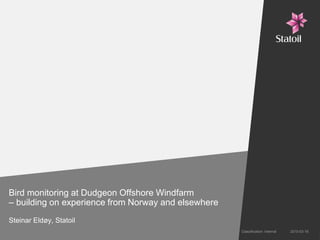
2. DOW Ornithological Monitoring Programme (OMP)
Initial Marine Licence conditions
• Species mentioned as being of paricular importance:
− Sandwich Tern [Sterna sandvicensis], [Northern] Gannet [Morus bassanus], Lesser
Black-backed Gull [Larus fuscus] and [Northern] Fulmar [Fulmarus glacialis]
• Timing of the studies
− Pre-construction – one year
− Construction – over as many years as undertaken
− Post-construction – three years
Initial proposal
Duplicate studies at Sherringham Shoal (traditional boat based surveys + visual tracking by ribs)
(Licence condition now amended to focus on Sandwich Terns)
Classification: Internal 2013-03-112
3. Key principles and questions to consider
• The OMP should apply methods that are sufficiently scientifically robust to detect
and understand potential impacts, and differentiate changes from spatial and
temporal natural variations.
• Reliable data for validation of collision risk modelling – are technologies for
assessing actual collision rates available?
• Could coordinated efforts with other projects and scientific entities contribute
more to increased knowledge on actual impacts from offshore wind than
independent project specific studies?
• Are spatial and temporal population data and their natural variations sufficiently
known?
• Would a SEAPOP/SEATRACK approach benefit the offshore wind industry?
• Could new technologies for tracking movements/migration of birds add value?
• Cost effectiveness – value for money (knowledge for money)
2013-11-053 Classification: Internal
4. Preliminary evaluation
• It is highly questionable whether the approach using boat based surveys (or aerial
surveys) provide a scientifically solid basis for evaluating actual impacts, at least
impacts on population level. Changes in at sea densities may not be attributed to
the presence of the windfarm.
• Validation of collision modelling based on density figures alone questionable –
tracking of individual birds and their flight pattern may be helpful.
• Lack of information/knowledge on where (which colonies) birds at sea are comming
from (perhaps with the exception of Sandwhich Tern) makes any evaluation of
impacts on populations impossible.
• Surveys of fish (acoustic methods and demersal trawling) as a means to linking
results of ornithological monitoring, with monitoring of their prey, questionable.
• Costs are high (value/knowledge for money low).
2013-11-054 Classification: Internal
5. Possible use of new tracking technologies?
New and improved technologies for geo-location provide opportunities for
significantly improved understanding of bird movements and migration, including the
connectivity between breeding colonies and feeding grounds.
• Satellite transmitters –
provide real time data transmission.
• GLS loggers - suitable for determining large scale
movements and population/colony connectivity,
limited accuracy (± 180 km).
• GPS loggers – give accurate location (± 1 m) data,
which are stored and need to be down loaded onshore.
2013-11-055 Classification: Internal
6. The Norwegian seabird program - SEAPOP
• Updating sebird baseline data repetedly requested (late 1990ies) when the oil
industry was preparing environmental risk assessments and impact assessments
for different exploration and development plans
• Seabird data old and outdated (10-15+ years)
• Limitation in knowledge of seabird ecology, in particular
− Populations
− Dynamics
− Causes for changes (impact mechanisms)
• Different seabird mapping, monitoring and research activities lacked coordination
• Difficulties in accessing data on seabirds
2015-03-166 Classification: Internal
7. Statoil’s initiative
• Statoil engaged NINA (the Norwegian Institute for Nature Research) to develop a
proposal for a national seabird programme in 1999 (as a part of the preparations for
the 16. offshore oil and gas consession round in Norway) aiming at
− Developing a consept for filling knowledge gaps
− Improve the understanding of natural variability and improve the basis for
distinguishing between natural variations and impacts of oil spills and other
anthropogenic factors
− Coordinate efforts related to seabird mapping, monitoring and research within
the industry
− Highlight possible synergies in joining efforts between the industry,
environmental authorities and research
− Improve accessability to data and knowledge on seabirds
2015-03-167 Classification: Internal
8. SEAPOP consept development and implementation
• A first consept report titled SEAPOP – Seabird Population Management and
Petroleum Operations (Seabird Population Management and Petroleum
Operations) 2001
• Dialogue with environmental authorities resulted in the consepc proposal being
adopted as an idea for a joint effort between authorities, industry and research – a
national Norwegian seabird programme
• Implementation started 2005, funded by the Norwegian Oil and Gas Assossiation
• The authorities joined from 2006, and has since then covered approximately 85%
of the costs (Ministry of Environment and Climate + Ministry of Oil and Energy)
• Steering committee apponted by the Ministry of Environment (differents authority
agencies and the Norwegian Oil and Gas Assossiation)
• Implemented jointly by NINA, Norwegian Polar Research Institute, Tromsø
Museum)
2015-03-168 Classification: Internal
18. SEAPOP and SEATRACK
• SEAPOP is national Norwegian programme for mapping and monitoring of seabird
populations, originally initiated by Statoil in cooperation with NINA (the Norwegian
Intitute for Nature Research) http://www.seapop.no/no/
• SEATRAK is an addition intending to track movements of seabirds at sea outside
the breeding season (funing from the Ministry of Environments, the Foreign Ministry
and industry)
− Started 2014
− Include one UK colony (Isle of May),
where 7 species will be equiped with GLS
loggers (Guillemot, Puffin, Kittiwake, Lesser
Black-backed Gull, Fulmar, Herring Gull
and Shag)
2013-11-0518 Classification: Internal
32. Chukchi Sea Environmental Studies Program
• Initiated by ConocoPhillips and Shell in
2008. Statoil joined since in 2010.
• Multi-year scientific study following an
ecosystem approach.
• Most comprehensive science program
in the Arctic.
• More than 145 people are working on
this program from 10 different
universities and companies.
• Data shared with NOAA and other
agencies.
.
34. Main Findings
• Chukchi not homogeneous & highly variable
between study areas, seasonally and inter-
annually.
• It all starts with currents, bathymetry and ice.
• Plankton highly variable between year,
influenced by inflow from the Pacific.
• No large fish collected.
• Seabirds as other groups – highly variable
34 -Classifi
cation:
Zooplankton Ecology
Arctic Cod
Hamecon
35. Classification: Internal
Europipe Gas Pipeline – Landfall North Germany
• Extensive tidal mud flats
• Sensitive breeding habitats for birds
• Important areas for seals