The document discusses strategies for creating car-lite streets and precincts to promote sustainable mobility and public transport. It defines walkability and transit-oriented development, and outlines various models that promote pedestrian environments like Clarence Perry's neighborhood unit and Jane Jacobs' concept of vibrant streets. The document then describes different typologies for pedestrian schemes, including full-time pedestrian zones, part-time closures, and traffic calming measures. It provides examples of these approaches and discusses how to integrate pedestrian access with public transportation.
The TOD Study presented yesterday looked carefully at land use and transportation patterns, and then suggested the general contours for a reshaped downtown. Six potential development clusters were identified, including: the North Avenue Gateway (between Memorial Circle and I-95), the Central Corridor (between I-95 and the Metro-North tracks), Crossroads (the heart of the downtown, near the intersection of Huguenot and North), the West Gateway (where Huguenot and Main meet near Pintard), the East Gateway (around Echo Bay and Faneuil Park), and the I-95 Gateway (near the end of Palmer Avenue.)
The New Jersey Department of Transportation instituted a “Complete Streets” policy in 2009, joining a handful of other states that have adopted policies to plan, design and build state roads that are accessible to all users, not just cars. More than a dozen New Jersey local governments have followed suit, implementing policies that apply to local roads and streets. The city of Hoboken has been an early leader, becoming one of the first municipalities on the East Coast with a public bike repair facility and has doubled the number of bike racks near transit and striped its first “buffered” bike lane. Jersey City also has a Complete Streets policy and the city’s Route 440 boulevard project may serve as a valuable case study in renovating state highway corridors. Complete Streets policies have multiple benefits and have recently been identified as an obesity prevention tool by Shaping New Jersey and the New Jersey Partnership for Healthy Kids.
2020 Karol Bagh Pedestrianization & Parking ManagementTOD India
The Pedestrianization and Parking Management project of Karol Bagh was approve by Governing Body of UTTIPEC in 2010 and initiated for implementation by North Delhi Municipal Corporation in 2019. The project was awarded as the best Non-Motorist Transport project by the Urban Mobility India in 2019.
The aim of this project was to improve the Mobility and accessibility of Karol Bagh and was planned in line with National Urban Transport Policy to prioritize mobility of people and encouragement of active modes. The project included improvement in pedestrian & NMT amenities and facilities, parking management, traffic management and circulation. The objectives of this project are:
• Prioritizing walking and other active modes (NMT, Rickshaw) and facilitating improved walking environment by providing comfortable and safe walking zone.
• Segregation of long term and short term parkers by creating off street and limited on street spaces
• Develop and organize on-street parking and off-street parking locations.
• Dynamic parking charges with costly on street parking and less costly differential off street parking to encourage long term parkers to use off street parking spaces.
• Provide public amenities such as public toilets, dustbins, benches etc.
• Revitalize the existing parks and integrate them with the shopping streets.
• Improve traffic circulation by creating one way loops and reducing conflicts at intersections. Improving pedestrian crossing facilities along streets, traffic calming facilities for safe movement.
• Organizing and managing spaces for hawkers
• Clear segregation of spaces with road marking.
• Improve wayfinding.
Title: Level of Service F for Grade A Streets
Track: Prosper
Format: 90 minute panel
Abstract: Relying solely on Level of Service criteria for street design, which evaluates vehicle congestion, leads to poor outcomes on many of our roadways. LOS F, far from a failure, creates opportunities to reallocate roadway space for more livable street designs. In this session, learn about projects in Cambridge and San Francisco that overcame opposition and generated community support in prioritizing better bicycling and walking over vehicle capacity during the peak hour of travel.
Presenters:
Presenter: Michael Sallaberry San Francisco Municipal Transportation Agency
Co-Presenter: Jeffrey Rosenblum City of Cambridge, MA
Transit Oriented Development (TOD) results in the creation of compact, walkable and liveable communities with access to amenities built around high quality mass transit stations. However, the discourse around TODs in India is more of a densification and value capture approach, which is necessary, but yet an incomplete conversation for the Indian context. This webinar, presented by Todd Litman, Himadri Das and Lubaina Rangwala addresses the major challenges and learnings from the ‘implementation’ of a TOD.
The webinar recording can be seen here - https://www2.gotomeeting.com/register/335456930
Related Research - http://embarqindiahub.org/reports/towards-walkable-sustainable-bengaluru-accessibility-project-indiranagar-metro-station
Related webinar - http://embarqindiahub.org/webinars/parking-effective-tool-manage-travel-demand-transit-oriented-developments
Kim DeLaney
Lynda Westin
Jennifer Willman
Transit Oriented Development (TOD) has enormous potential to help us rethink the transportation-land use connection and reinvest in communities to become more economically vibrant, sustainable and livable. New regional and statewide tools are being created to help plan for TOD by pooling our knowledge to reduce the burden on local governments. Statewide TOD
design guidelines, the Tri-Rail Station Evaluation Project, and a TOD Resource Guide for Tampa Bay are helping us do more with less. Learn about how these collaborative efforts promote an urban development paradigm shift that optimizes return on our investments.
Presentación durante el evento de BRT2TOD de 2013 de la Universidad de los Andes, sobre cómo se puede planear, pagar y pensar el desarrollo orientado al transporte público en una ciudad.
Fecha: 11 de Julio de 2013
Lugar: Bogotá
This presentation highlights the importance of Roadspace Allocation within transport planning and illustrates how to develop a successful Roadspace Allocation Framework. Further to this the presentation gives an insight to understanding and meeting user requirements. It then progresses to utilise various case studies in Birmingham to further demonstrate how these frameworks can be put into practice.
Designing & Planning for Cycling, Phil Jones & Adrian LordDesign South East
Presentation on Design and Planning for cycling from the Designing and Planning for Cycling workshop at MADE on 19th May 2015. Presentation by Phil Jones and Adrian Lord, Phil Jones Associates.
Urban Design and Street Typology: Do They Matter?William Riggs
Despite a growing body of work defining the benefits and methods to encourage multi-modal travel, only a small body of research has worked to fuse urban design and complete street philosophies. Based on work recently published in the Journal of Planning Education and Research on street design and two-way street conversions, Dr. William Riggs will discuss how street typologies and complete streets dialogues are linked, and how urban design policies might be advanced to facilitate safer and more livable streets.
As communities turn from sprawl and work to retrofit existing districts and corridors, misfits between street and land use types often compromise livability, sustainability, and economic development. We’ll look at how some cities have responded by designing streets that go beyond the conventional arterial-collector-local street classification system and have implemented innovative streets with flexible spaces and uses - often overlapping the single-use functions of typical street "zoning." Presentation delivered at CNU 17, Denver, CO on June 12, 2009.
Transit-oriented development (TOD): Integrating rail and commercial developme...Atkins
Atkins' technical director Jason Hutchings explores the ways in which cities across the world can gain maximum benefit from their investment in transport, commercial and civic projects through transit oriented development (TOD). TOD facilitates and encourages the use of public transport and provides alternative revenue streams for transport providers and operators, reducing their reliance on state funding for capital investment and operation/maintenance costs. It means transit systems are more popular, accessible and better connected for the commuting population, and commercial property development can be integrated and benefit from such a holistic approach to critical city centre locations. But TOD is not without its challenges. Atkins illustrates the issues and solutions across a range of international projects.
This presentation was first delivered in May 2013 at the 3rd Annual Modern Railways Conference, Singapore.
Interactive Walkthrough in Virtual Cities and its Applications in Urban Design - Master's Thesis Defense Presentation - 2009 November 9 - Khaled Mohamed Ahmed Abd El Gawad - University of Alexandria - Institute of Graduate Studies and Research - Department of Information Technology
Presentation by Dr. Jill Robinson from Creative Metropoles on Public Strategies (help or hindrance?) given at the Experience exchange event in Warsaw, October 2009
The Big City Plan is the most ambitious, far-reaching development project in the UK, and seeks to define how more than 800 hectares of land in the city centre will be developed and used for generations to come.
As well as outlining specific areas where the council will concentrate its resources in the future, Stage Two of the plan also highlights individual projects, schemes and infrastructure which it plans to develop and defines specialist quarters/areas where particular types of investment and development will be encouraged.
More information: http://bigcityplan.birmingham.gov.uk
Plenary session on strategies for town centre regeneration, from Future of London's 23 June conference.
Speaking in this sessions were:
* Daniel Moylan, Chair, Mayor’s Design Advisory Group, Greater London Authority
* Sue Foster OBE, Strategic Director for Delivery, LB Lambeth
* Jerome Frost OBE, Global Planning Director and Leader of Consulting (UKMEA), Arup
* Victoria Hills, Chief Executive Officer, Old Oak & Park Royal Development Corporation
* Gerry Hughes, Senior Director and National Head of Planning, Development & Regeneration, Bilfinger GVA
www.futureoflondon.org.uk
In the master thesis ‘A Project for Valencia’ I observed the strategic spatial planning changes and a vast development of Valencian large urban projects in the last 20 years. Subsequently I estimated the effects of such processes in the current times of economy recession and real estate development stagnation and from my findings and observations I identified two main problems, which I have researched in my thesis:
- Unequal distribution of public gains from the large urban projects in Valencia.
- Emerging spatial problems of social vulnerability.
In order to cope with the mentioned main problems, I developed a strategy which reveals the possibilities of stimulating the stagnant real estate development and proposes intervention projects in order to capture the synergy of the existing and future large urban projects. In addition, these interventions improve the spatial conditions of socially vulnerable areas and directly benefit the locals and their living quality. Two key intervention projects were studied in more detail and a design proposal for them was proposed. This made it possible to open up a discussion of the actual development possibilities even in the times of the economic scarcity and real estate market stagnation. Participation and cooperation of the local public authorities, third party investors and local inhabitants was engaged towards the processes of urban growth.
Improving city centre experience. Kortrijk, Belgium.Wonderfull
Design Thinking training was organized by “Flanders Inshape” and “Wonderfull” design thinking and creative intelligence lab as an open event for creative practitioners and experts. 30 participants - 1 day challenge for improving city centre planning - 8 hours of intense research and idea generation.
�
Conservation – Restoration of Exposed Concrete Façade of Heritage Buildings i...Malkit Singh
Presentation on Conservation – Restoration of Exposed Concrete Façade of Heritage Buildings in City Centre, Sector-17, Chandigarh prepared by Prof. Jagjit Singh Ghuman, Formerly Chief Town Planner and Head T&CP Deptt., Govt. of Punjab in the Heritage Conservation Committee 4th Meeting on 22nd May, 2014 organised by Chandigarh UT Administration.
Forward Thinking: A Study In Transportation, Land Use And Urban Design In Nag...Willy Prilles
Presentation of the University of British Columbia (UBC) Transportation and Land Use Group on June 7, 2007 at the Bicol Science and Technology Centrum, Naga City, in conjunction with their Naga Planning Studio Course.
In a world of rapidly increasing urbanization, striving to develop more livable cities, the city’s streets designing and planning should be high on the agenda for policymakers, city planners and other practitioners, as well as researchers. Designing streets is not as easy as it might originally seem, however, done correctly it means that one third of the city was designed successfully with an immense impact on the rest of the city. The key challenge in developing sustainable and fulfilling streets is to develop an integrated approach in planning them, where it is necessary to consider all aspects involved. Meanwhile, efforts devoted to this topic vary considerably from place to place. Thus, this paper aims at discussing the main elements involved in designing streets for a livable city, in a comprehensive approach including pedestrians, vehicles, and parking areas.
Istanbul IETT Professional Development Workshop, #4 of 6_Transit & Land UseVTPI
Istanbul IETT Professional Development Workshop, #4 of 6, Transit & Land Use
Presenter: Todd Litman, Victoria Transport Policy Institute
Assistant: Aysha Cohen, UCLA Institute of Transportation Studies Scholar
Presentation Date: June 15, 2015
Land Use & Transport Planning_Istanbul IETT Workshop 4_15 June 2015VTPI
Istanbul IETT Professional Development Workshop, #4 of 6
- Presenter: Todd Litman, Victoria Transport Policy Institute
- Assistant: Aysha Cohen, UCLA Institute of Transportation Studies Scholar
- Presentation Date: June 16, 2015
This presentation was delivered by Peter Jones from University College London on 2nd October 2015 and highlighted the importance of considering Link and Place when improving street design.
City Speak XI - Is transport the solution or the enemy? Chapman Lam of MVADesigningHongKong
Development and transport are closely related, but how do we connect the dots and guarantee a livable city for future generations?
Lifting the moratorium in Mid-levels, reducing the threshold for redevelopment and the constant pressure to increase density are all choking the older parts of Hong Kong with more traffic and roadside air pollution.
How do we deal with the increased traffic on new roads to the Mainland? How many more roads are we planning to build on our waterfront? Is there too much public transport clogging up our roads? Is replacing pedestrian crossings with subways and footbridges a good thing?
What plans are there for environmentally friendly transport and aesthetically more pleasing transport infrastructure in Hong Kong? Where are the hopes for making our city more pedestrian-friendly? Can new engine technology solve our problems? Could electronic road pricing help? Will the new rail lines be enough? Do we have a sustainable (transport) plan for our city?
Planners, engineers, academics and officials will discuss whether transport is our solution or our enemy.
Designing Hong Kong is a not-for-profit organisation focused on sustainable urban planning. See: www.designinghongkong.com
KAJANG LOCAL PLAN PROPOSAL/RESHMINDER KAURReshmi Kaur
Final Project under Sustainable Urban Design Course,4th Year Civil Engineering at UKM.Comprimising of sustainable development principles that can implemented or improved in Kajang for a better quality of life in Kajang.
significance of design strategies and guidlines.pptx
SITCE_v10
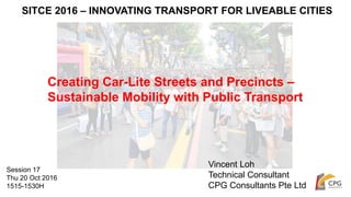
1. SITCE 2016 – INNOVATING TRANSPORT FOR LIVEABLE CITIES
Creating Car-Lite Streets and Precincts –
Sustainable Mobility with Public Transport
Vincent Loh
Technical Consultant
CPG Consultants Pte Ltd
Session 17
Thu 20 Oct 2016
1515-1530H
2. Outline
A. Definition and Scope
B. Models and Principles
C. Typologies and Features
D. Potential Applications
E. Conclusion
3. Outline
A. Definition and Scope
B. Models and Principles
C. Typologies and Features
D. Potential Applications
E. Conclusion
4. Enhancing pedestrian environment for greater mobility & accessibility
to public transport
A. Definition and Scope
• Walkability or walking accessibility relates
to how inviting and safe is the
neighbourhood for walking
• Walkability promotes urban sustainability
with its triple bottom line (TBL) of social,
environmental and economic benefits
• Good and safe accessibility to transit
services is key to mode choice, over other
aspects like cost, travel time, crowding etc.
• Health
SOCIAL
ENVIRONMENTAL ECONOMIC
• Active Lifestyle
• Community Building
• Local Identity
• Place Making
etc.
• Use of Public
Transport
• Reduce Carbon
Emission (Car
Usage Restriction)
etc.
• Shops and
Businesses in
Pedestrian Zone
• Employment and
Tourism
• New transit trips
generated
etc.
5. What makes streets appealing to walk? How far can one walk if
pedestrian-friendly? Studies indicated about 800m or 10 mins average
Criteria for pedestrian friendly streets include:
• Appropriate paths to destinations
• Proximity to attractions and PT
• Walking priority over other road users
• Interesting street scape
• Wide footpaths
• Safe and fewer road crossings
• Adequate lighting
• Good land use mix & variety
• Nice pavements
• Sheltered from harsh weather
• Shady trees and greenery
• Food outlets, kiosks and cafes
• External stimulus and activities like
street art/sculpture and buskers
• Sitting places and rest areas
• People (attracts people) Ameyoko-cho shopping street, Tokyo, Japan
Street art/furniture at Wangfujing
pedestrian street, Beijing, China
Købmagergade Street, Copenhagen, Denmark
Widened
sidewalk at
Queen’s
Road Central,
Hong Kong
A. Definition and Scope
6. • TOD is transit station communities or
mixed use activity areas, centred
around stations, that encourage
residents, workers and shoppers to
walk and ride transit
• Four key features of TOD are mixed
use and high density development,
public transport centric and walkability
• Urban design factors and a pedestrian
friendly design are positive planning
factors in reducing automobile use
Transit-oriented developments (TOD) generate more pedestrian and
transit trips
Features, benefits and issues of TOD
Source: by author
A. Definition and Scope
7. Outline
A. Definition and Scope
B. Models and Principles
C. Typologies and Features
D. Potential Applications
E. Conclusion
8. Walking streets to improve pedestrian environment & accessibility are
still influenced by early planning models and concepts
Some models and principles being:
• Le Corbusier’s Contemporary City concept
- city centre design with high rise office and residential towers;
subterranean transport systems; elevated pedestrian plazas
and walklinks
- segregating cars from pedestrians for speed and safety
Clarence Perry’s
Neighbourhood Unit
(1929)
• Clarence Perry’s Neighbourhood Unit for
walkability
- emphasises walkability within the layout and
design of a neighbourhood > residential
segregated from surrounding arterial roads
but connected internally by walking routes
- system of urban spaces and parks in a
precinct
- configuration of streets, walkways and
structure encourages community interaction
B. Models and Principles
Harvey Corbet’s
City of Future
(1913)
Le Corbusier’s
Contemporary City
(1922)
9. B. Models and Principles
Models advocate active, lively and safe pedestrian streets and urban
spaces for better social life and city liveability
• Jane Jacob’s Social Capital of vibrant
streets
- generate social capital or value of
community development arising from vibrant
streets that engage people
- people activities make lively and safe streets
- social life of urban spaces need mixed land
use for mixed users at all times of the day
- liveliness and variety attract more liveliness;
deadness and monotony repel life
- create “eyes on the street” or natural
surveillance in the urban environment
Avenida Ámsterdam, a median linear park in
Mexico City, influenced by Garden City concept
• Ebenezer Howard’s Garden City planning
- decentralised towns and inner city sub-divisions
- new town set in greenery and surrounded by a perpetual
greenbelt; a compact, efficient, healthy and beautiful approach
- ample parks and public spaces e.g. park island or linear park
along road avenues
Ebenezer Howard’s
Garden City
(1922)
Jane Jacob’s vibrant streets (1961)
10. Outline
A. Definition and Scope
B. Models and Principles
C. Typologies and Features
D. Potential Applications
E. Conclusion
11. C. Typologies and Features
Pedestrian schemes can be classified into full-time, part-time, traffic
calming etc. that in turn have different variations and forms
Full-time Schemes
Pedestrians have exclusivity, priority or right-of-
way or shared space; vehicular access where
applicable is restricted altogether or to service
vehicles only at specific times. Examples:
• purpose-built underground / at grade /
elevated walkways; where such facilities
are integrated with land use development,
then becomes horizontal walk connections
and vertical pedestrian circulation
• single pedestrian-only street or whole
precinct of several streets (all formerly
trafficked)
• disused infrastructures like railway lines and
corridors
Elevated pedestrian network to development & MTR stations, Central, Hong Kong
Smith St
(permanent
pedestrian
food street),
Chinatown,
Singapore
High Line Park
(2.3km of former
elevated railway
line transformed to
a pedestrian
parkway), New York
City, USA
Pedestrianised street,
Sapporo, Japan
12. Web of elevated walklinks and at grade thoroughfares in Jurong East
connecting buildings and MRT for safe and convenient access
C. Typologies and Features
1
3
56
7
8
Jem
Westgate
JCube
HDB
shophouses
2
Big Box
MRT
Ng Teng Fong
Hospital
hotels
JTC
Summit
4
1
MRT concourse at level 2
22
At grade pedestrian thoroughfare to MRT
6
Elevated walklink to MRT Station
55Elevated walklink – Jem to Big Box
667
4
Elevated walklink – Westgate
to NTF Hospital
5
3At grade pedestrian
thoroughfare to MRT
4
5
Elevated walklink –
Westgate to Jem
Elevated connector –
Westgate to MRT Station
8
13. The interplay between pedestrians and public transport (PT) is a key
consideration for car-free or car-lite approach
• new infrastructures like road expressways
designed with walking and cycling
holistically
• pedestrian streets co-shared with public
transport modes like trams and buses
(electric for environmentally friendly)
• TODs urban designed for walkability;
enhances land value capture as well
• integrated land use development with
urban spaces and plazas (together with
walking access to PT)
• town centres designed with walk only shop-
fronted streets; also a “walking town” with
intra-town pedestrian / cycling network
C. Typologies and Features
Shared precinct, Angers, France
Tung Chung TOD, Hong Kong
Walking & Cycling Town, Ang Mo Kio,
Singapore
Proposed North-South Expressway
designed with walking & cycling paths
above, Singapore (Source: Straits Times)
14. Singapore town centres now designed car-lite with pedestrian only
streets and going forward car-free altogether
C. Typologies and Features
Planned Tengah New Town’s car-free
town centre (artist impression)
Source: Straits Times, 9 Sep 16
Toa Payoh Town Centre (pedestrian street / plaza
above underground car park)
Toa Payoh
Town Centre
(pedestrian street)
Bedok
Town Centre
(pedestrian street)
Clementi Town Centre (pedestrian street)
15. C. Typologies and Features
Part-time closure reclaims road space to bring or add further life, events
and activities to the business/civic districts and shopping belts
Part-time Schemes
Pedestrians can enjoy more urban space in a
car-free environment. Either pedestrians or
vehicles allowed only at specific times. No on-
street parking to discourage car access.
Different scale for different target. Examples:
• Business and civic districts – inject life into
areas that are quiet after office hours e.g.
Car-Free Sundays@SG
• Shopping belts – expand walking cum
human interaction and activity space;
generate more commercial opportunities
e.g. Sai Yeung Choi Street (Hong Kong),
Orchard Rd (Singapore), Kaminarimon-
dōri (Tokyo, Japan)
Car-Free Sunday (Business/Civic
District), Singapore
Sai Yeung Choi Street South,
Mong Kok, Hong Kong
Kaminarimon-dori, Tokyo, Japan
Orchard Rd Pedestrian Night,
Singapore
16. C. Typologies and Features
Smaller scale neighbourhood roads and laneways scope for similar
part-time pedestrian streets for specific uses and amenities
• Neighbourhood roads – these have specific uses e.g.
food/drinks street after dark or bazaar/market street
during the day; pop-ups like tables/chairs and stall
extensions could occupy the sidewalks or roads; creates
rich pedestrian experience
Tai Yuen Street, Hong Kong
Haji Lane, Singapore
Centre Place, Melbourne, Australia
• Laneways – enhance walkability with a
safe and interesting through passage of
an otherwise indirect walk around blocks
Boon Tat Street, Singapore
17. C. Typologies and Features
Measures to slow street traffic for pedestrian priority and safety include
speed tables, chicanes, speed humps/strips, curb bulb outs etc.
Traffic Calming Schemes
Pedestrians co-share road space with
motorists but have priority and more
space. Examples:
• Road narrowing/sidewalk widening –
on-street parking removed or reduced
• Urban design for seamless
pavements and roads – street design
and use of materials to intentionally
blur separation of footpaths and roads
• Living street (woonerf) – pedestrians
and cyclists have priority over
vehicles to walk and play the entire
road space; cars are “guests” at
“walking pace”
Pedestrian friendly street (intentional unclear road
markings or separation), Copenhagen, Denmark
Russell St (narrowed road & widened sidewalk),
Hong Kong
Motomachi (narrowed road & widened
sidewalk), Tokyo, Japan
Living street (woonerf), St Paul Minneapolis, USA
18. Outline
A. Definition and Scope
B. Models and Principles
C. Typologies and Features
D. Potential Applications
E. Conclusion
19. D. Impact and Case Studies
Case Study 1: Little India, Singapore
20. D. Impact and Case Studies
Case Issues:
• Enhance the Little India precinct which is a tourism attraction and
popular destination for locals alike (particularly the Indian community)
• Reclaim from motorised vehicles more streets for walking for
pedestrian safety and comfort
• Inject greater street vibrancy, human interaction, economic benefits
and linkages to public transport
• Allow train commuters to interchange between nearby MRT stations
than only at interchange MRT stations
21. D. Impact and Case Studies
Sri Veeramakaliamman
Temple (estd 1881)
Indian
Cultural
Centre
Indian cuisine
Kg Kapor Methodist
Church (estd 1929)
Tekka Centre
Church of the True
Light (estd 1952)
Abdul Gafoor Mosque
(estd 1907)
Little India is rich in sights, sounds, smell and savoury; a place of
various ethnic trades and wares, and cultural and heritage buildings
Residence of Tan Teng Niah
(estd 1900)
22. D. Impact and Case Studies
Area is well served by public buses and 2 MRT stations on 2 lines;
another station expected in 2017 thereby enhancing accessibility further
DT22
Little India
Station
Rochor
Station
Jalan
Besar
Station
Little
India
500m
330m
380m
• Public buses ply along the one-way pair of Serangoon Rd and
Jalan Besar, at 380m apart (traditional links)
• Existing Little India Station (NEL/DTL) and Rochor Station
(DTL); 500m in between
• In 2017, new Jalan Besar Station, 330m from Rochor Station
NEL – North East Line; DTL – Downtown Line
Source: Google Map
23. D. Impact and Case Studies
Source: Land Transport Authority (LTA)
With DTL3, train trips from the suburbs expected to do a loop-the-loop
within the city centre enroute; changes in train transfer pattern
• Downtown Line loop-the-loop (LL) will not have
interchange station at the “cross over” or track
spurs to skip the LL
• Train commuters heading east will incur about
18 mins or more from Rochor to Jalan Besar
Stations
• Alternatively, walk transfer from Rochor to Jalan
Besar Stations (akin to bus passengers
transferring not at the same bus stop)
• With higher station
density, transfer
could be at non-
interchange stations
• Review of transfer
rule?
24. Besides fares and travel time, walking accessibility to transit another
key factor that hinges on inviting and safe pedestrian environment
DT22
Jalan
Besar
D. Impact and Case Studies
Legend
Existing pedestrian street
permanent
part-time
Suggested pedestrian streets
Suggested pedestrian-friendly
walkways
MRT station access
Signalised pedestrian
Crossing
Pedestrian flows
Source: Google Map
25. Commerce a key reason for pedestrianisation; to draw the most
discretionary and social activities
• Existing permanent walking
streets within the covered
Little India Arcade and an
open stretch of Campbell
Lane
• Commercial development
including ethnic trades and
wares offers visitors an
attractive and sensory
pedestrian environment
• Better access to public
transport encourages
higher levels of walking
traffic and reasons for more
pedestrianisation
Looking into
covered
pedestrian
street of Little
India Arcade
Covered
pedestrian
street of Little
India Arcade
Pedestrianised
sector of Campbell
Lane – image 1
Pedestrianised
sector of Campbell
Lane – image 2
D. Impact and Case Studies
26. D. Impact and Case Studies
Areas with good land use mix and public demand particularly on
weekends and public holidays are scope for part-time walking streets
• Part-time pedestrian streets to cater to larger weekend crowd e.g. closure of Dunlop Street
every Sunday from 12pm to 12am
• Cars do not add to street vibrancy but people do; local shops benefit from pedestrianisation
as cars are merely passing through while people are presented with purchase options
Part-time pedestrianised Dunlop St (looking in
from Clive St) – waste bins used to mark closure
Part-time pedestrianised Dunlop
St (towards Serangoon Road)
27. Besides fares and travel time, walking accessibility to transit another
key factor that hinges on inviting and safe pedestrian environment
DT22
Jalan
Besar
D. Impact and Case Studies
Legend
Existing pedestrian street
permanent
part-time
Suggested pedestrian streets
Suggested pedestrian-friendly
walkways
MRT station access
Signalised pedestrian
Crossing
Pedestrian flows
Source: Google Map
28. High passenger flow from Little India Station access to Tekka Centre and
precinct; urban design would further enhance pedestrian experience
Little India Station access to Tekka
Centre and gateway to the precinct
Main walking thoroughfare to Little
India and for transit transfer, skirting
Bt Timah Rd
Major
connecting
bus stop along
Serangoon Rd
outside Tekka
Centre
D. Impact and Case Studies
NOW
POSSIBLE FUTURE
NOW
POSSIBLE FUTURE
NOW
POSSIBLE
FUTURE
29. Besides fares and travel time, walking accessibility to transit another
key factor that hinges on inviting and safe pedestrian environment
DT22
Jalan
Besar
D. Impact and Case Studies
Legend
Existing pedestrian street
permanent
part-time
Suggested pedestrian streets
Suggested pedestrian-friendly
walkways
MRT station access
Signalised pedestrian
Crossing
Pedestrian flows
Source: Google Map
30. Extend pedestrianisation to the entire Campbell Lane with seamless
walking priority across junction with Clive Street
Campbell Lane Campbell LaneExamples of un-signalised pedestrian
friendly seamless junction crossing
Potential pedestrianised
sector
Cross junction connecting these 2 sectors of Campbell Lane
Asahikawa, Japan
Queen Street, Singapore
Bordeaux, France
D. Impact and Case Studies
Existing pedestrianised
sector
31. D. Impact and Case Studies
Traffic limiting approach reclaims space for pedestrians and human
activities, to improve the urban realm and social life
• Co-shared walking, cycling, PMD
and cars, with enlarged pedestrian
space
• Traffic calming with single lane only
but no restriction to vehicle access
• Pedestrians have
exclusivity
• Vehicular access
limited to
emergencies and
deliveries at
specific times
Car-Free
Car-Lite
PMD – Personal Mobility Device
Madras St between
Campbell Lane and
Dunlop St
NOW
POSSIBLE FUTURE
POSSIBLE FUTURE
32. D. Impact and Case Studies
Good accessibility to public transport is a fundamental input for a
high level of transit ridership
Examples of wide sidewalks and
traffic calming in pedestrian streets
Upper Weld Rd between
Perak Rd and Jalan Besar
Dunlop St between Perak
Rd and Madras St
Perak Rd
Perak Rd
Source: Google Map
Otaru, Japan
Causeway Bay, Hong Kong
POSSIBLE FUTURE NOW
33. Besides fares and travel time, walking accessibility to transit another
key factor that hinges on inviting and safe pedestrian environment
DT22
Jalan
Besar
D. Impact and Case Studies
Legend
Existing pedestrian street
permanent
part-time
Suggested pedestrian streets
Suggested pedestrian-friendly
walkways
MRT station access
Signalised pedestrian
Crossing
Pedestrian flows
Source: Google Map
34. Laneways off the main pedestrian streets can be invigorated with F&B
and retail to add more diversity and also as places of interest
Haji Lane, Singapore
Centre Place, Melbourne
Degraves St, Melbourne Laneway off Upp Weld Rd, Singapore
Potential
Potential
Laneway off Dickson Rd, Singapore
Laneway off Perak Rd, Singapore
Chiu Lung St,
Hong Kong D. Impact and Case Studies
Haji Lane, Singapore
35. D. Impact and Case Studies
Case Study 2: Rochor Canal, Singapore
36. D. Impact and Case Studies
Case Issues:
• Provide more public spaces and parks for leisure/healthy lifestyle and
segregated (from vehicular traffic) pedestrian accessibility in very
built-up CBD and city fringe areas
• Enhance pedestrian connectivity to MRT stations near Rochor Canal
(distances ranging from 25m to 330m away)
• Promote greater community interaction and social life (space for
grassroots, cultural and ethnic events and activities e.g. Deepavali
celebrations, temporary bazaars and flea markets etc.)
37. With the revitalised Rochor Canal (in 2015), adding a linear park could
offer a “continuous” 2.3km of urban walking adventure and accessibility
D. Impact and Case Studies
900m
1400mIndian Heritage Precinct
(Little India)
Malay Heritage Precinct
(Kampong Glam)
Source: OneMap
A 900m stretch of Rochor Canal
has been diverted and infilled
Another 1.4km of
Rochor Canal has
been improved and
beautified as active
public space (2015)
Rochor Canal at streel level with broad
walkways landscaped with attractive pavements,
rest stops (including bulge-out), pavilion, street
art and furniture.
Canal between Victoria St
and Crawford St
38. Creating a 900m linear park, an opportunity for sustainable connectivity
with no change to road space, hence net gain to the overall community
D. Impact and Case Studies
Examples………
• Suggested Rochor Canal linear park at
900m similar in scale to Jozenji-dori and
Wakamiya Oji in Japan
• People attracting features like street
art/furniture e.g. seats; shade trees; food
e.g. outdoor kioks; water features;
landscaping e.g. pavements, add to
quality of walk
• People watching add to city culture
Before: Rochor Canal flanked
by grown trees next to Sungei
Rd and Rochor Canal Rd
NYC – New York City
After: Covered up Rochor Canal
(a very wide road divider with
saplings and an uncovered drain)
Jozenji-dori linear park (700m), Sendai, Japan
Wakamiya Oji linear park (500m),
Kamakura, Japan
POSSIBLE FUTURE
NOW
39. D. Impact and Case Studies
Case Study 3: New Downtown @
Marina Bay, Singapore
40. D. Impact and Case Studies
Case Issues:
• Inject more vitality and activities in the CBD across all hours of the
day including zoning and mixed land use
• Promote better walkability in the CBD to support the urban plans
including a comprehensive pedestrian network well connected to
public transport nodes and hubs for buses and MRT
• Create environmentally friendly, well landscaped and designed, and
car-lite public space and streets
• Enhance the CBD’s overall attractiveness to work, play, shop and
connect (via public transport)
41. D. Impact and Case Studies
Reclaimed greenfield land at Marina South scope for car-lite, walking and
cycling oriented, accessible to new MRT stations and potentially PMS
• Marina South is reclaimed
land; thus a more defined
grid road network
• Plot size less narrow and
longish frontage; suitable
for integrated development
e.g. MBFC, Marina One
• More open and public
spaces e.g. linear park
holistically planned
• PMS e.g. tram can add to
at grade connectivity and
street vibrancy and social
interaction; also short links
to MRT stations of different
lines
Note
• MBFC – Marina Bay Financial Centre
• PMS – People Mover System
• possible PMS route(s) Source: Urban Redevelopment Authority (URA) Master Plan 2014
42. D. Impact and Case Studies
Underground Pedestrian Links
Pedestrian Overhead Bridges
Pedestrian network in the CBD connects underground, at grade and
elevated; often integrated with commercial establishments
• Underground pedestrian
network (see map), about
20% progressively
completed
• Underground and sheltered
above or ground level walk
links also due to tropical
heat and monsoon
thunderstorms
• Vertical pedestrian
circulation with integrated
land use development
• CBD MRT stations’ neighbourhoods are characterised transit-oriented developments (TOD) given their
density, diversity and design and all within walking distance from the stations
• With greater CBD station densification and hence closer proximity to each other, the need for pedestrian
inter-station connectivity increases for better and more progressive travel options
Underground Pedestrian
Network
Source: URA
43. More urban space and parks planned as an integrated whole with other
land use and development in Marina Bay
• Studies suggest that a favourable
walking environment is a
necessary condition to
encourage walking and social life
• Visually and functionally
appealing urban design offers
public space opportunities for
people to chat, linger and mingle
• In agglomerated economies with
localisation of industries e.g.
financial services in the CBD,
urban space are opportunities for
knowledge spill-overs & sharing
• Street corners are places of
chance encounters and quick
chats, and likewise public space
D. Impact and Case Studies
Promenade by the bay – wide paths for
walking, cycling and activities/events
Covered public space/square and surface thoroughfares
connecting adjacent buildings/precincts; also linked by
underpasses to below ground MRT stations and shopping mall
Green and shady walk paths
Separate
cycling and
walking
paths
Building courtyards blending
into pedestrain footpaths
44. D. Impact and Case Studies
Scope for PMS for intra-CBD travel, complementing the MRT and offering
a “first and last mile” connectivity choice
• Pedestrianised streets co-shared with PMS like trams / LRT enhance
connectivity; generate more transit and pedestrian trips
• Position as short intra-CBD travel akin to feeder and short bus services
offering “first and last mile” connections
• Rail transport mode and stops more identifiable than buses
• Offer CBD views
while riding at
grade or elevated
trams / LRT
Pedestrian street
co-shared with
Transmilenio Bus
Rapid Transit
(BRT), Bogota,
Colombia
Tram and water features to manage
pedestrian crossing points in walking
street downtown, Houston, United States
Trams and people sharing the
pedestrainised Bourke Street,
Melbourne, Australia
Seated pedestrians watching other people
and trams in Bourke St, Melbourne, Australia
45. D. Impact and Case Studies
• Trams / LRT enjoy
dedicated lane and traffic
calming measures at
commuter stops
• Complements MRT with
trams / LRT providing as
its feeder network in the
CBD
• Not inconsistent with
walkability for CBD by
offering pedestrians a
choice of “hop on and off”
short rides if time is the
essence e.g. a meeting
down the road
PMS sharing vehicular road space gets traffic calming and passenger
priority; trams convenient “hop on and off” for short rides within the CBD
Traffic calming & commuter crossing at tram
stop along Collins St, Melbourne, Australia
Raised tram stop platform for level boarding
along Collins St, Melbourne, Australia
Shared walking and cycling space with trams
along Swanston St, Melbourne, Australia
More space for trams / bicycles less for cars, Gold Coast, Australia
46. Outline
A. Definition and Scope
B. Models and Principles
C. Typologies and Features
D. Potential Applications
E. Conclusion
47. E. Conclusion
• Tropical heat discourages walking distance; mitigate with greenery
and trees, design and technology, shelter and shade etc. to provide
comfortable and cooler ambience
• Develop a culture of sharing public space and priority to pedestrians;
cars don’t always have right of way just because it’s a road – design
and code of conduct with legislation and education
• Additional to car ownership / usage restraint measures, public
transport and its eco-system like walking access need further
enhancements to lessen desire of young people to own cars (66% of
respondents 18-35 years old - Sunday Times Car Ownership Survey
2016)
• Besides PCN (now 300km), new walking and cycling infrastructure
progressively added to existing satellite towns / CBD and integrated
pedestrian spaces holistically designed in new towns – a review of
design criteria needed to widen the rest of walkways to better and
safely accommodate cycling/PMDs and pedestrians together
Challenges for pedestrianisation in Singapore going forward…..(1)
PCN – Park Connector Network; PMD – Personal Mobility Device
Wider
common
space for
walking &
cycling
Boon Keng Station crossing from housing
flats to station access (example of
inadequate priority for pedestrians)
48. E. Conclusion
What pedestrians fear and think of co-sharing space with cyclists/PMDs
“Cycling side by side with fast-moving motor vehicles is
dangerous…would require cycling infrastructure…separated
from the pedestrian footpath and moving vehicles…follow
traffic rules and regulations…if the Government is serious
about looking into promoting cycling as a way of life”
Forum writer in Straits Times dated 16 May 2016
49. Challenges for pedestrianisation in Singapore going forward…..(2)
• Ageing population and inclusive society – urban design
important to cater to seniors and physically challenged; ramps,
lifts and escalators for horizontal and vertical movements, road
crossings with braille push buttons etc.
• More pedestrian-centric facilities, design and approach to
enhance walkability at public transport hubs and TODs; even
more car-lite or car-free areas e.g. further segregation of
pedestrians from vehicles like subterranean through roads and
car parking
• Connecting housing, amenities and destinations with
convenient, comfortable, sheltered and safe walk links to public
transport nodes like MRT stations and bus stops especially in
suburban areas
• Rail network to reach 360 km by 2030 up from today’s 200 km;
target of 80% of households within 10-minute walk of a rail
station – challenge is the actual and quality of walk
Road crossings – availability,
waiting time, distance between
crossings, crowds crossing,
adequate crossing time etc. impact
walkability
Lifts for seniors and physically challenged at
overhead pedestrian crossings and connectors
to elevated rail stations
E. Conclusion
50. References:
• Adams, G (1985), “Denmark’s Pedestrian Precinct”, The Globe and Mail, Canada, 9 Mar 1985
• Department of Transport, Hong Kong, http://www.td.gov.hk/en/transport_in_hong_kong/pedestrianisation/pedestrianisation/,
viewed on 1 Aug 2016
• Fishman, R (1977), “Urban Utopias: Ebenezer Howard, Frank Lloyd Wright, and Le Corbusier”, taken from Campbell &
Fainstein (eds) (2003), Readings in Planning Theory, Blackwell Publishers, Malden, pp. 21-60
• Gihring, T (2001), “Applying Value Capture in the Seattle Region”, Planning Practice & Research, Vol. 16, Nos. 3/4, pp. 307-320
• Gori, S; Nigro, M & Petrelli, M (2014), “Walkability Indicators for Pedestrian-Friendly Design”, Transportation Research Record:
Journal of the Transportation Research Board, No. 2464, pp. 38-45
• Jacobs, J (1961), The Death and Life of Great American Cities, Vintage Books, Random House, New York, Dec 1992
• Leather, J; Fabian, H; Gota, S & Meija, A (2011), “Walkability and Pedestrian Facilities in Asian Cities”, Asian Development
Bank (ADB) Sustainable Development Working Paper Series, No. 17
• Perry, C (1929), The Neighbourhood Unit, Reprinted Routledge/Thoemmes, London, 1998, pp. 25-44
• Spiller, M (2011), “Place making, inclusion and governance in the suburban city – a case study of Melbourne, Australia”, in
Chisholm, S (ed.) Investing in better places: international perspectives, The Smith Institute, London
• Wey, W M & Chiu, Y H (2013), “Assessing the walkability of pedestrian environment under the transit-oriented development”,
Habitat International, Vol 38, p. 106-118
• Yuen, B & Chin, H C (1998), “Pedestrian Streets in Singapore”, Transportation, No. 25, p.225-242