Download as PDF, PPTX

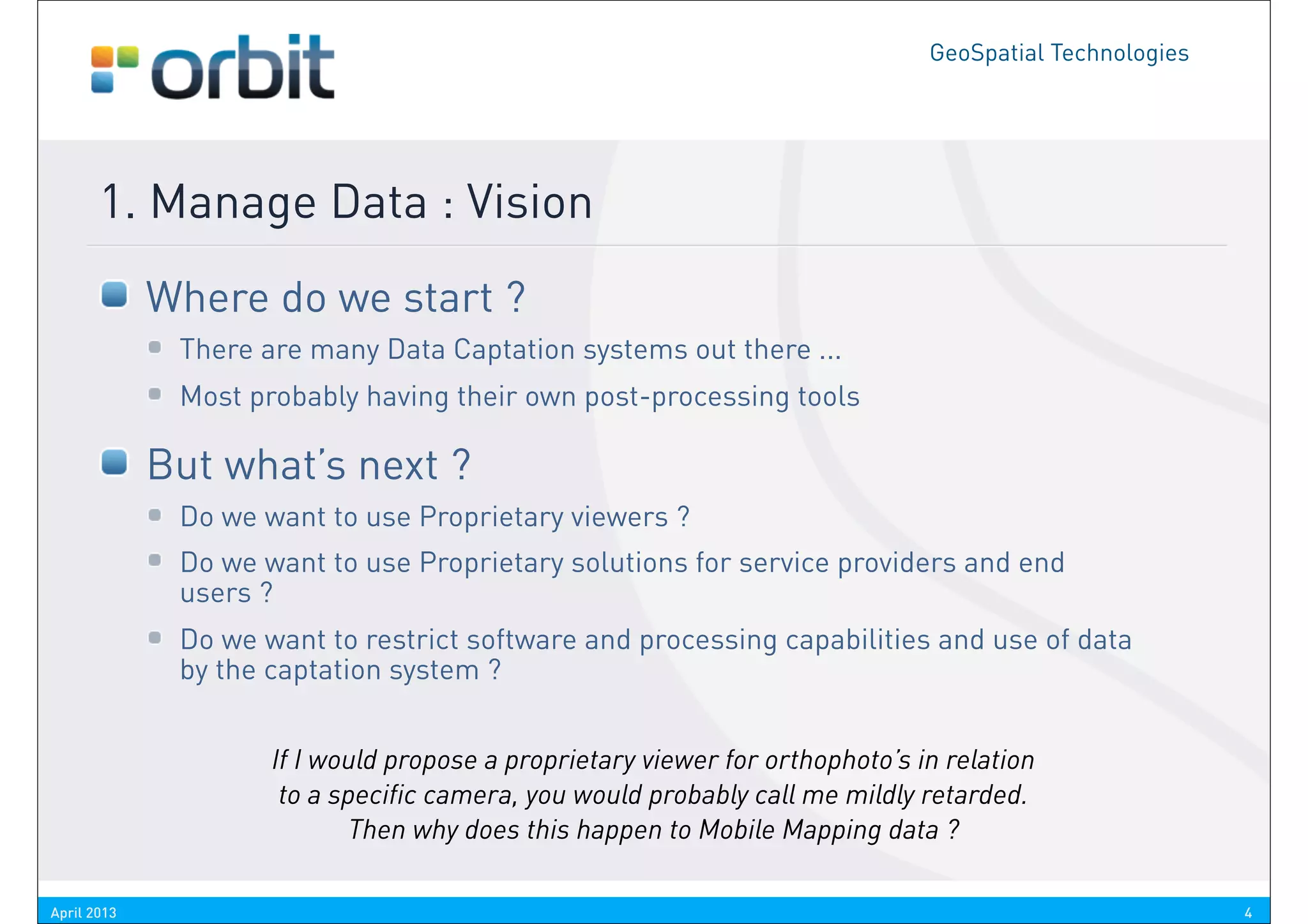
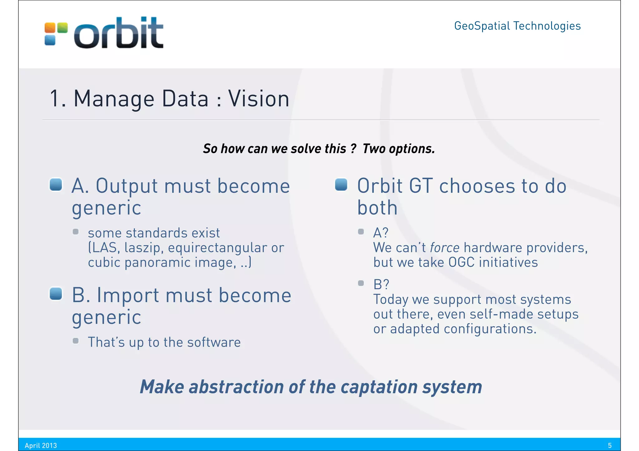

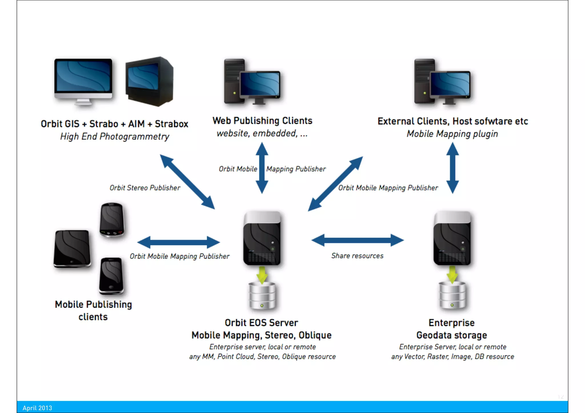
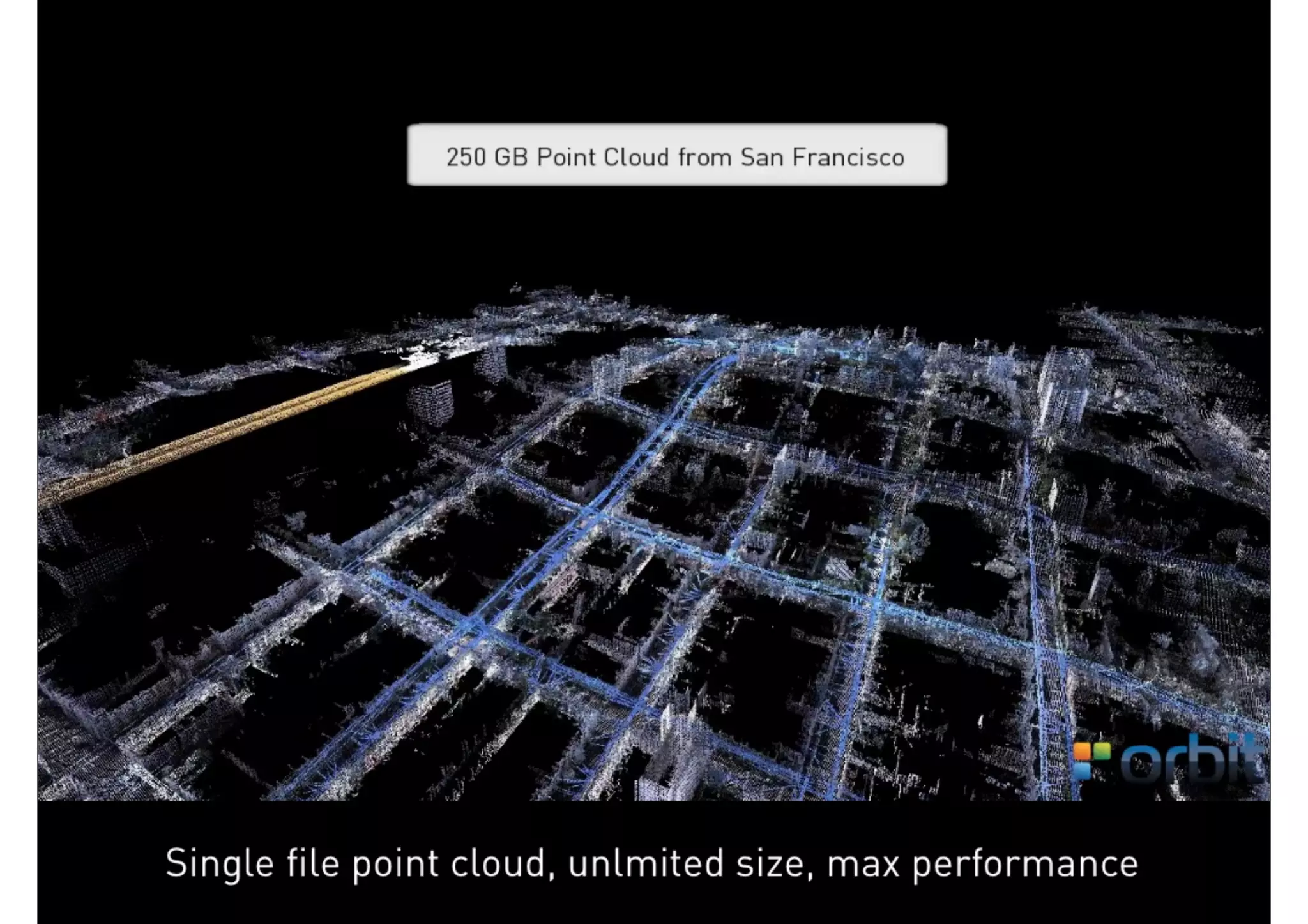
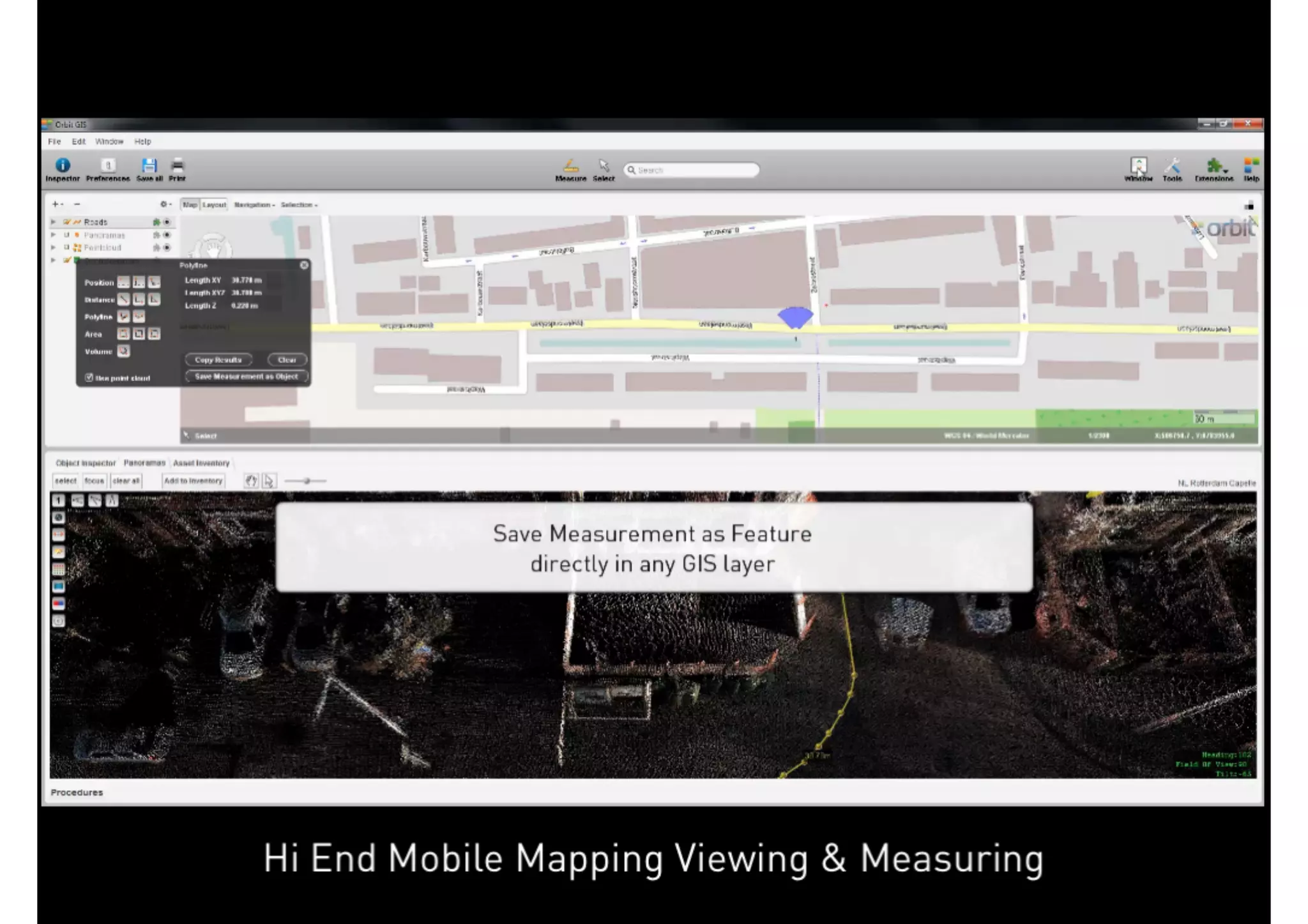
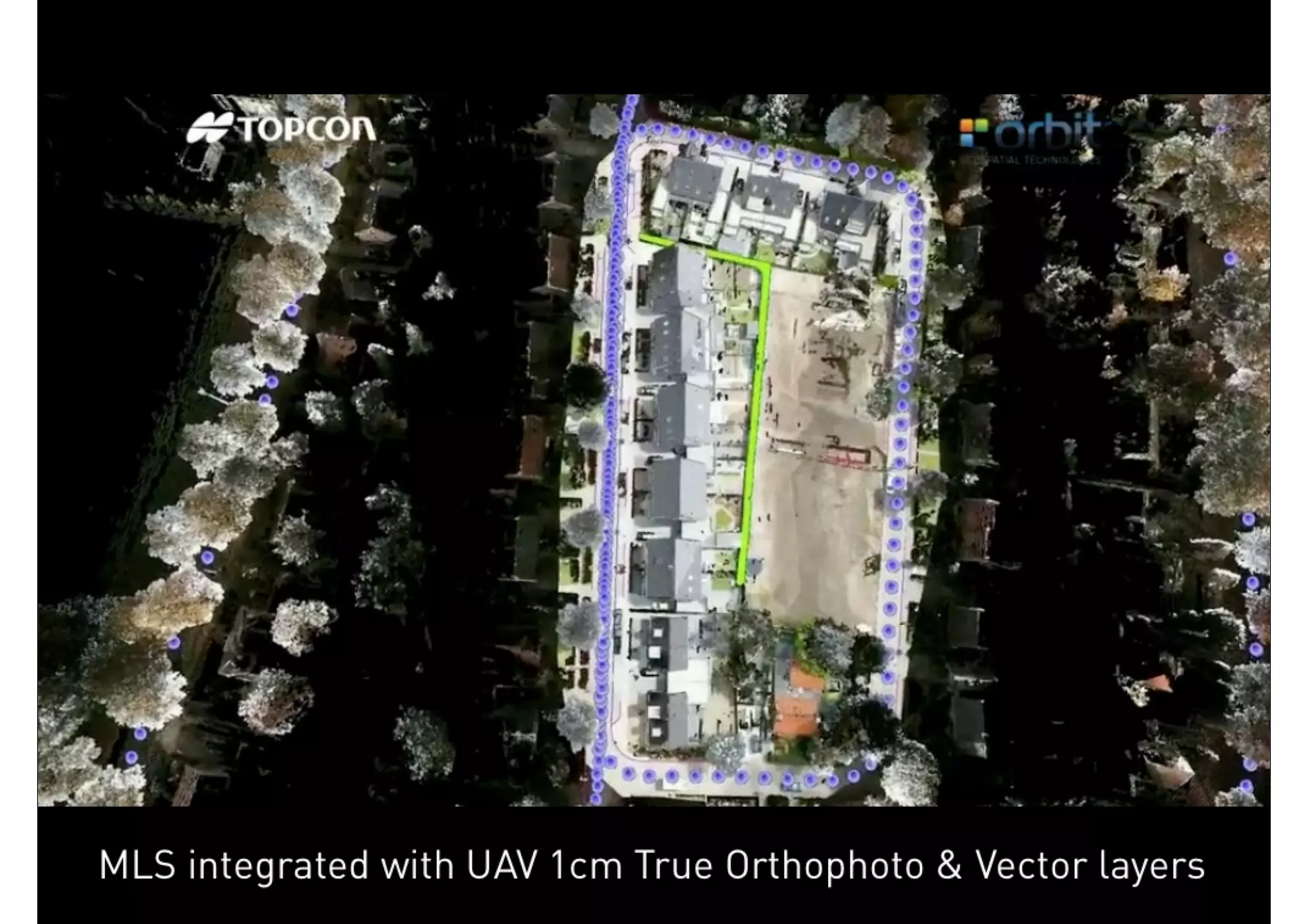
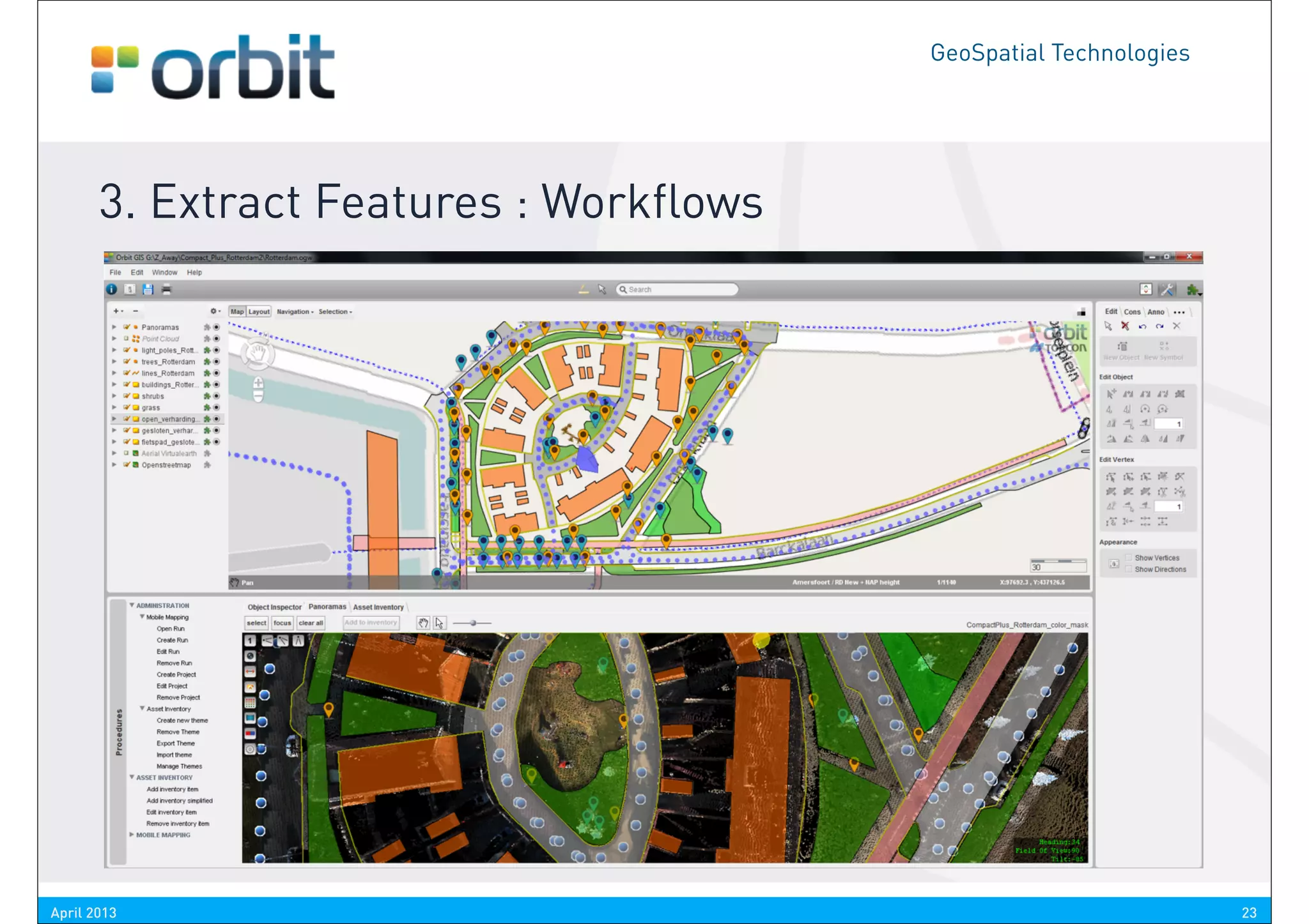

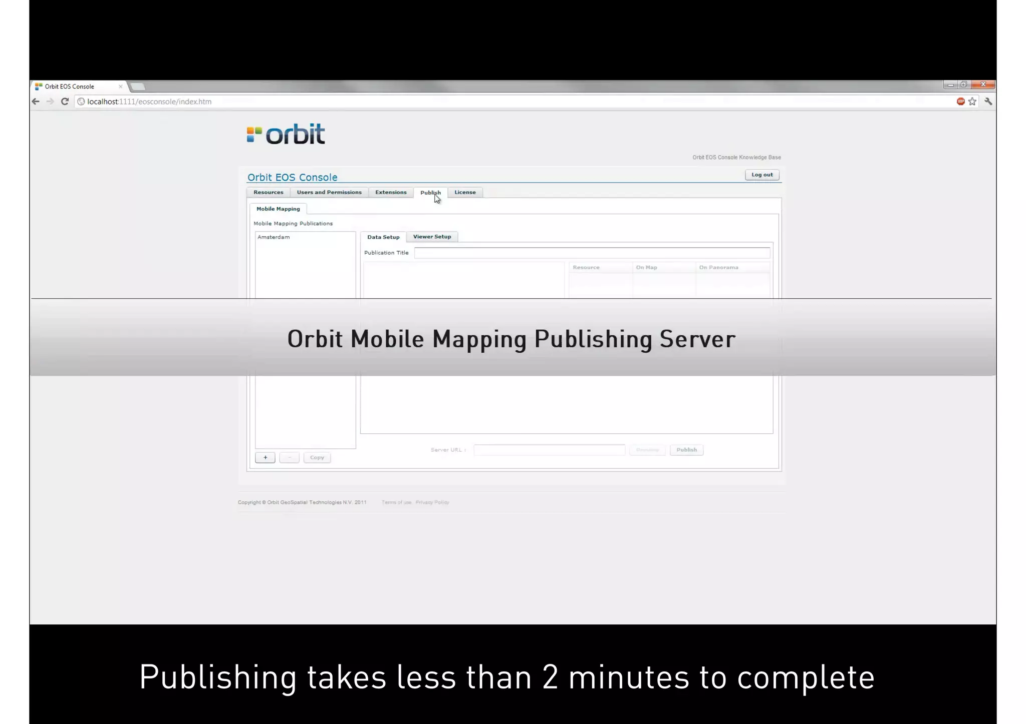
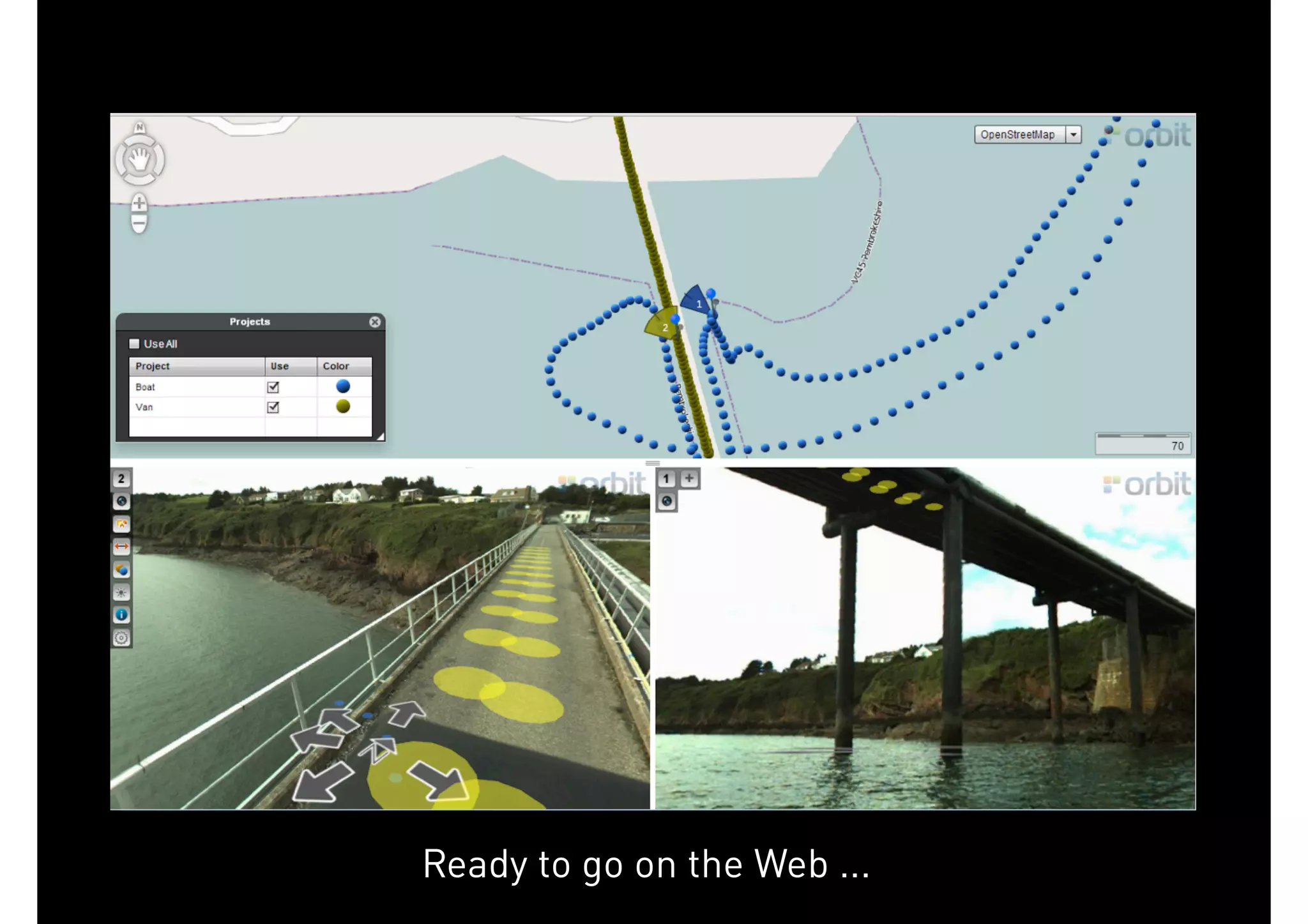
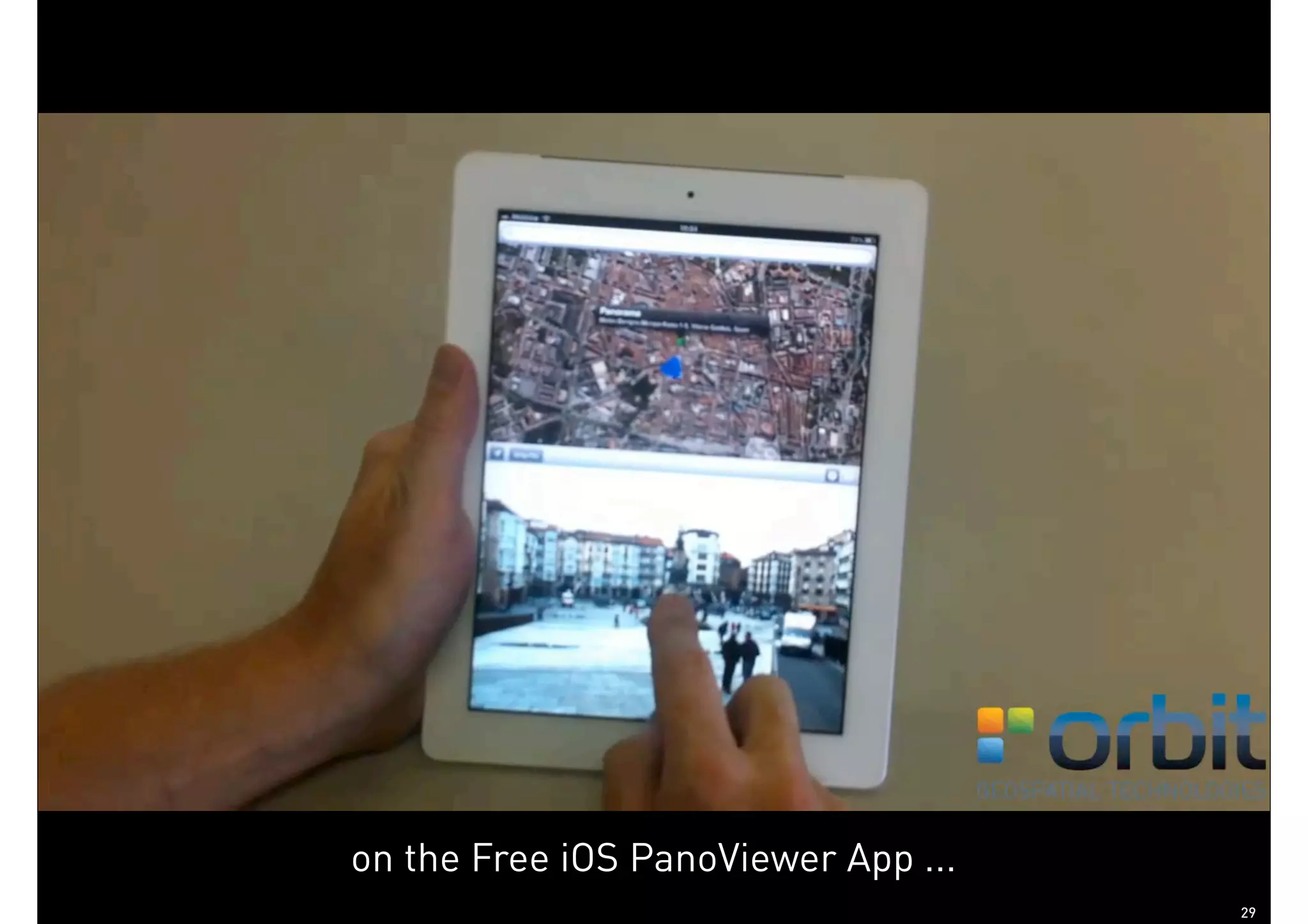
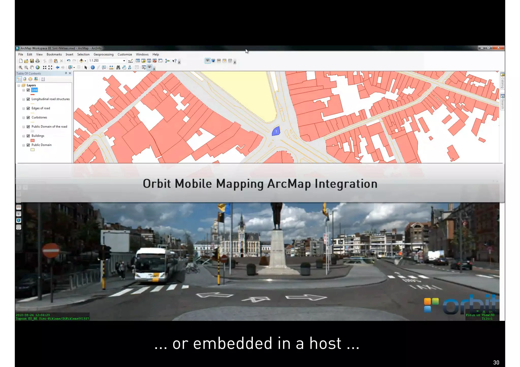


The document discusses the Orbit GT approach to mobile mapping software solutions, outlining challenges such as data management, access, feature extraction, and sharing/publishing of geospatial data. It emphasizes the need for interoperability of data sources, efficient workflows for feature extraction, and robust architecture for data access across various platforms. Additionally, it highlights the importance of utilizing existing data effectively while simplifying user experience through integrated tools and publishing solutions.