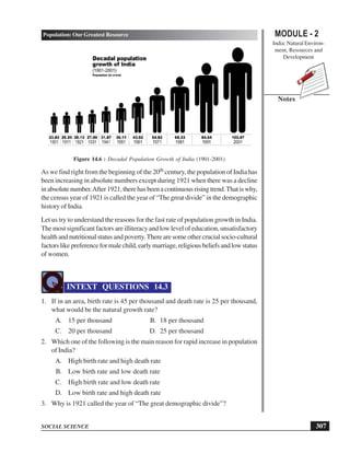
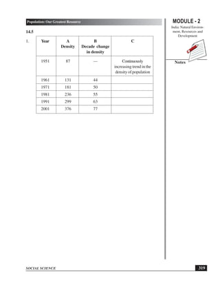
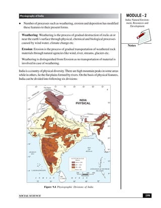
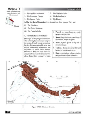
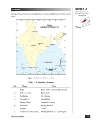
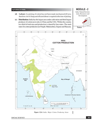
This document provides information about the physiography and physical divisions of India. It discusses six main physical divisions: 1) the Northern Mountains, 2) the Northern Plains, 3) the Peninsular Plateau, 4) the Indian Desert, 5) the Coastal Plains, and 6) the Islands. The Northern Mountains are further divided into the Himalayas, Trans-Himalayas, and Puranchal hills. The Himalayas contain the highest peaks in India and are formed by the collision of the Indian and Eurasian tectonic plates. The document also discusses the location of India in terms of latitude, longitude, and neighboring countries, as well as the states and union territories that make up India


![SOCIAL SCIENCE
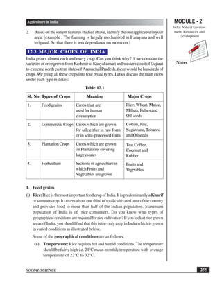
MODULE - 2 TransportandCommunication
India: Natural Environ-
ment, Resources and
Development
278
Notes
National HighwayAuthority of India constructs and maintains the National
Highways [NH], important roads linking different parts of the country and
connecting state capitals to the main cities of India. They constitute only 2% of
the total road length but carry 40% of the road traffic. The government has
launched a major road development project linking north, south, east and west
India.This will reduce time and fuel. Then it will also help to maintain fast flow
of traffic between mega cities of India. It is implemented by National Highway
Authority of India. The major super highways are:
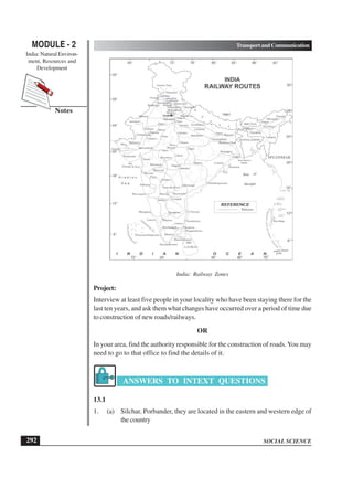
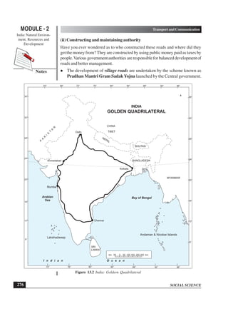
(a) Golden Quadrilateral connects Delhi, Mumbai, Chennai and Kolkata
which forms a geometrical figure of Quadrangle.
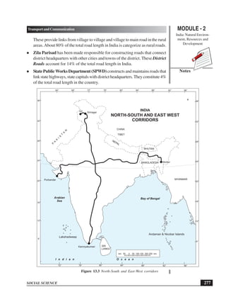
(b) North-South Corridor links Srinagar to Kanyakumari.
(c) East-West Corridor connecting Silchar in the east to Porbandar in the
west.
Border Roads are constructed along the bordering areas of the country for easy
accessibility of goods and other requirements of defence personnels during the
time of war and emergency and for the benefit of people living in those areas.
They are constructed and maintained by Border Road Organization (BRO).
The oldest and the longest road in India was built across Gangetic plain from the
north-west to the east on orders of Pashtun emperor, Sher Shah Suri in 16th
century which was renamed as GrandTrunk Road. It is presently divided into
NH-1(AmritsartoDelhi)andNH-2(DelhitoKolkata).TodayIndiahasabout330
lakh kms of road network whereas in 1947 it was only 4 lakh kms.
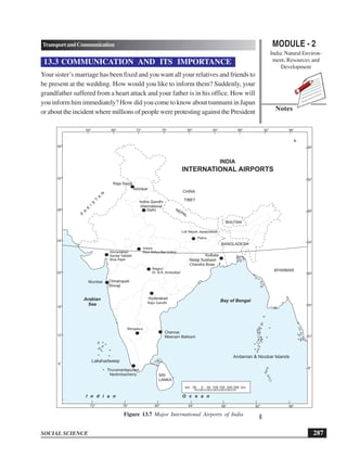
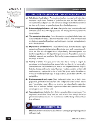
ACTIVITY 13.3
Look at the maps (Fig. 13.2 and 13.3) and find out which super highway is nearest
to your home and which organization maintains it.
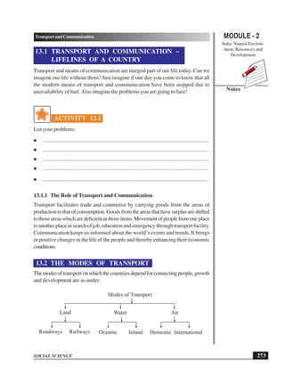
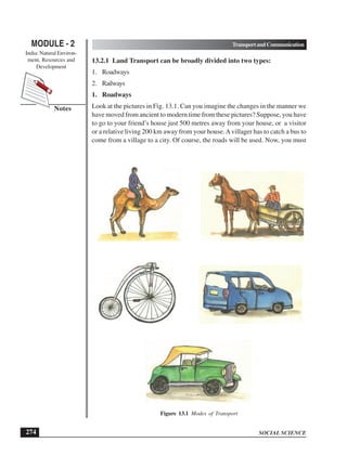
2. Railways
“This has become an easy way to place their demands and there is no strict
punishment” saidAnu’s father while reading the newspaper. Anu asked, “what had
happened”. Father replied, “Nothing new, a group of protestors have blocked the](https://image.slidesharecdn.com/secondarygeography-230831102920-1c9671f9/85/secondary-geography-pdf-86-320.jpg)