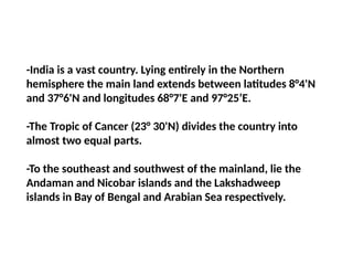
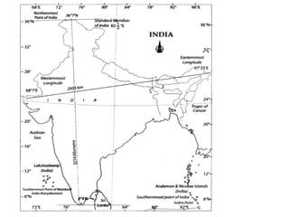
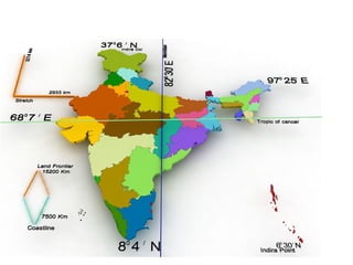
-India is avast country. Lying entirely in the Northern
hemisphere the main land extends between latitudes 8°4'N
and 37°6'N and longitudes 68°7'E and 97°25’E.
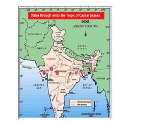
-The Tropic of Cancer (23° 30'N) divides the country into
almost two equal parts.
-To the southeast and southwest of the mainland, lie the
Andaman and Nicobar islands and the Lakshadweep
islands in Bay of Bengal and Arabian Sea respectively.
6.
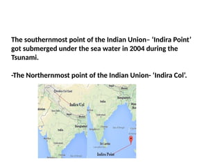
The southernmost pointof the Indian Union– ‘Indira Point’
got submerged under the sea water in 2004 during the
Tsunami.
-The Northernmost point of the Indian Union- ‘Indira Col’.
7.
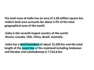
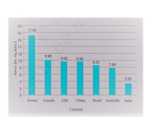
The land massof India has an area of 3.28 million square km.
-India’s total area accounts for about 2.4% of the total
geographical area of the world.
-India is the seventh largest country of the world.
-Russia, Canada, USA, China, Brazil, Australia.
-India has a land boundary of about 15,200 km and the total
length of the coast line of the mainland including Andaman
and Nicobar and Lakshadweep is 7,516.6 km.
10.
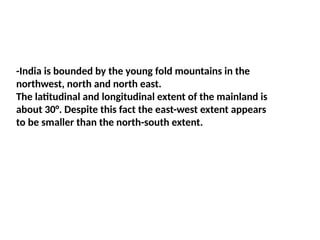
-India is boundedby the young fold mountains in the
northwest, north and north east.
The latitudinal and longitudinal extent of the mainland is
about 30°. Despite this fact the east-west extent appears
to be smaller than the north-south extent.
11.
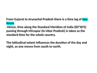
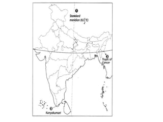
From Gujarat toArunachal Pradesh there is a time lag of two
hours.
-Hence, time along the Standard Meridian of India (82°30'E)
passing through Mirzapur (in Uttar Pradesh) is taken as the
standard time for the whole country.
The latitudinal extent influences the duration of the day and
night, as one moves from south to north.
13.
The Indian landmasshas a central location between the East
and the West Asia. India is a southward extension of the
Asian Continent.
The trans Indian Ocean routes which connect the countries of
Europe in the West and the countries of East Asia provide a
strategic central location to India.
-The Deccan Peninsula protrudes into the Indian Ocean, thus
helping India to establish close contact with West Asia, Africa
and Europe from the western coast and with Southeast and
East Asia from the eastern coast.
-No other country has a long coastline on the Indian Ocean as
India has and indeed, it is India’s eminent position in the
14.
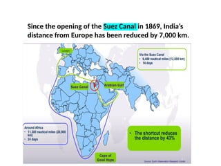
Since the openingof the Suez Canal in 1869, India’s
distance from Europe has been reduced by 7,000 km.
15.
India’s contacts withthe World have continued through the
ages but her relationships through the land routes are much
older than her maritime contacts.
-The various passes across the mountains in the north have
provided passages to the ancient travelers, while the oceans
restricted such interaction for a long time.
-These routes have contributed in the exchange of ideas and
commodities since ancient times. The ideas of the Upanishads
and the Ramayana, the stories of Panchatantra, the Indian
numerals and the decimal system thus could reach many parts
of the world.
-The spices, muslin and other merchandise were taken from
India to different countries.
16.
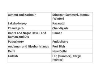
Jammu and KashmirSrinagar (Summer), Jammu
(Winter)
Lakshadweep Kavaratti
Chandigarh Chandigarh
Dadra and Nagar Haveli and
Daman and Diu
Daman
Puducherry Puducherry
Andaman and Nicobar Islands Port Blair
Delhi New Delhi
Ladakh Leh (summer), Kargil
(winter)
17.
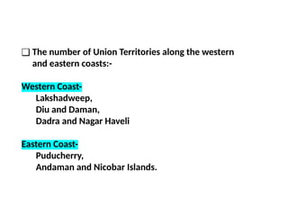
❑ The numberof Union Territories along the western
and eastern coasts:-
Western Coast-
Lakshadweep,
Diu and Daman,
Dadra and Nagar Haveli
Eastern Coast-
Puducherry,
Andaman and Nicobar Islands.
18.
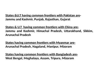
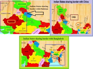
States &U.T havingcommon frontiers with Pakistan are-
Jammu and Kashmir, Punjab, Rajasthan, Gujarat
States & U.T having common frontiers with China are-
Jammu and Kashmir, Himachal Pradesh, Uttarakhand, Sikkim,
Arunachal Pradesh
States having common frontiers with Myanmar are-
Arunachal Pradesh, Nagaland, Manipur, Mizoram
States having common frontiers with Bangladesh are-
West Bengal, Meghalaya, Assam, Tripura, Mizoram
20.
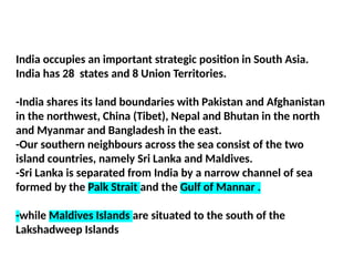
India occupies animportant strategic position in South Asia.
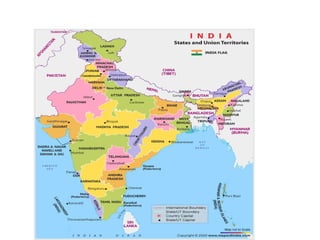
India has 28 states and 8 Union Territories.
-India shares its land boundaries with Pakistan and Afghanistan
in the northwest, China (Tibet), Nepal and Bhutan in the north
and Myanmar and Bangladesh in the east.
-Our southern neighbours across the sea consist of the two
island countries, namely Sri Lanka and Maldives.
-Sri Lanka is separated from India by a narrow channel of sea
formed by the Palk Strait and the Gulf of Mannar .
-while Maldives Islands are situated to the south of the
Lakshadweep Islands
21.
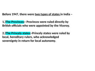
Before 1947, therewere two types of states in India –
1.)The Provinces:- Provinces were ruled directly by
British officials who were appointed by the Viceroy.
2.)The Princely states:-Princely states were ruled by
local, hereditary rulers, who acknowledged
sovereignty in return for local autonomy.