Download as PDF, PPTX

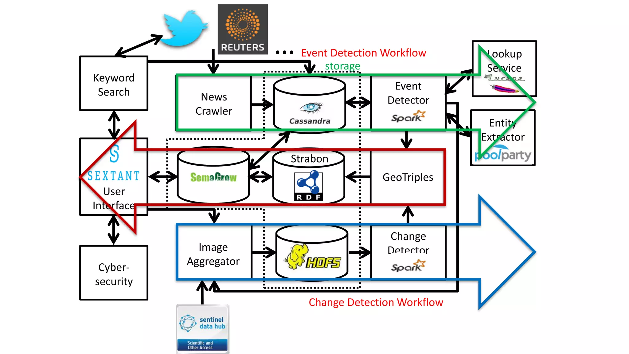
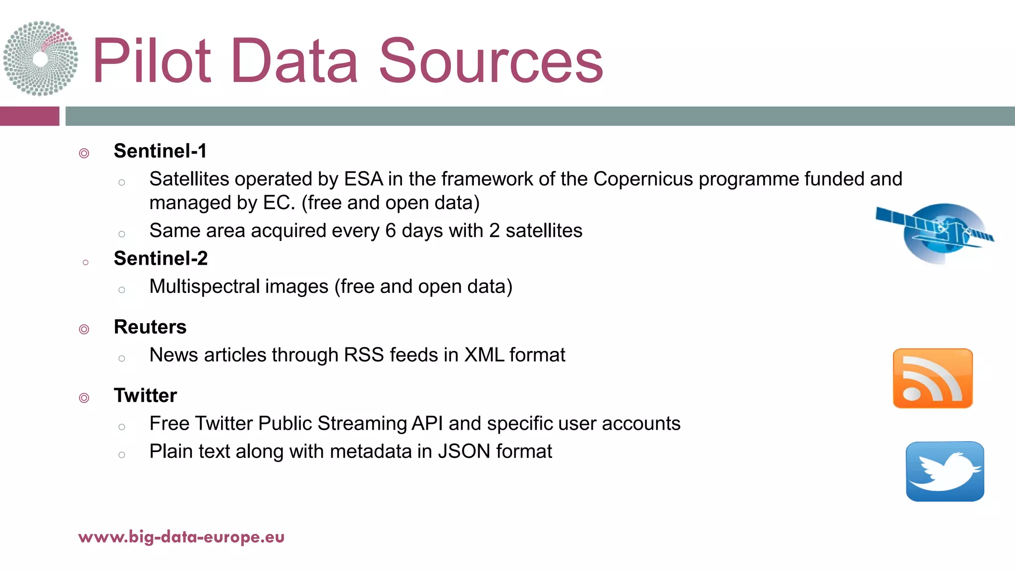
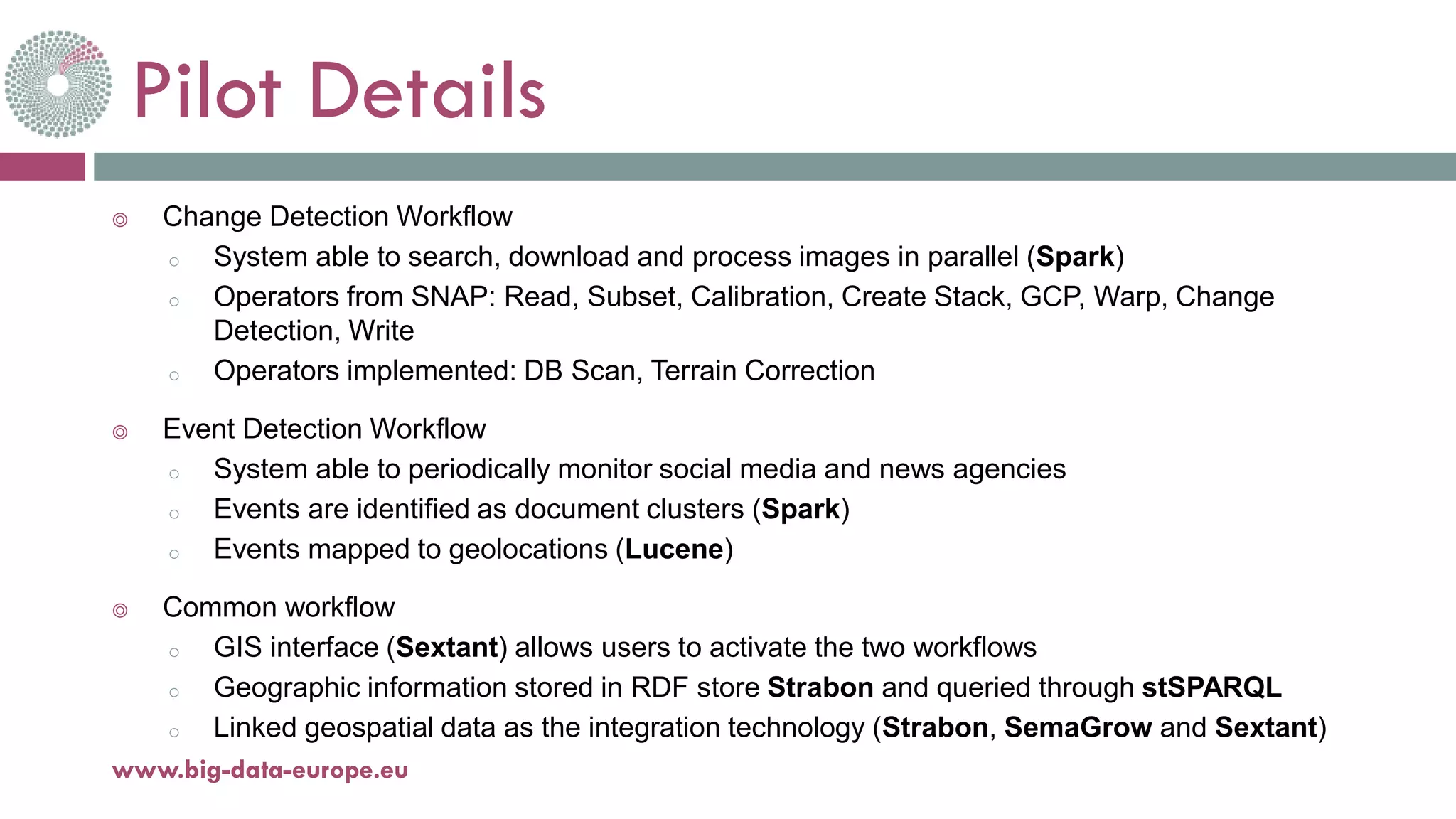
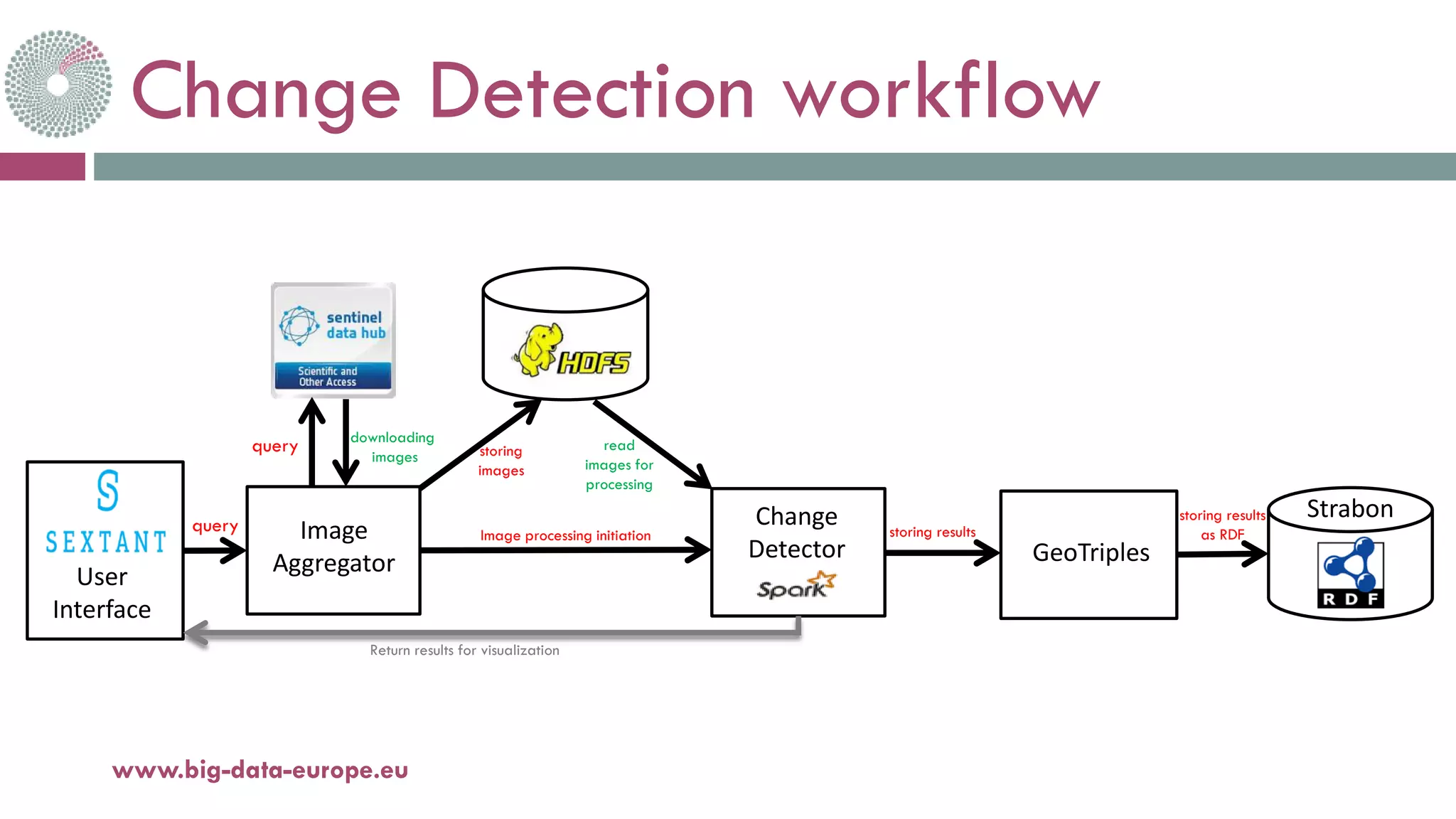

This document summarizes the technical aspects of the third Secure Societies pilot project. The pilot uses multiple data sources including satellite imagery, news articles, and Twitter posts. It has two main workflows: a change detection workflow that analyzes satellite images to detect changes over time using image processing techniques, and an event detection workflow that monitors social media and news to cluster events. Both workflows store results as linked geospatial data for visualization and querying through an interface. The change detector component parallelizes change detection algorithms on images using Spark.


![Coded Agents – with UiPath SDK + LangGraph [Virtual Hands-on Workshop]](https://cdn.slidesharecdn.com/ss_thumbnails/codedagentsdeck-251215155422-5497c599-thumbnail.jpg?width=640&height=640&fit=bounds)


