
Recommended
More Related Content
Viewers also liked
Viewers also liked (20)
Similar to An Interview with Cris Benton, author of Saltscapes: The Kite Aerial Photography
Similar to An Interview with Cris Benton, author of Saltscapes: The Kite Aerial Photography (20)
Recently uploaded
Recently uploaded (20)
An Interview with Cris Benton, author of Saltscapes: The Kite Aerial Photography
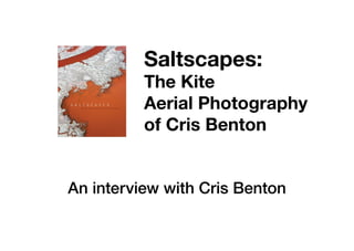
- 1. Saltscapes: The Kite Aerial Photography of Cris Benton An interview with Cris Benton
- 2. Acclaimed by Hey Day Books as “exuberant, otherworldly”, Cris Benton captures South Bay salt ponds and marshes in various states of restoration. “The intimate views afforded by Cris’s kite photography wonderfully portray the essence of the landscape and convey both the beauty and the scale of the largest tidal wetland restoration project on the West Coast.” — John Bourgeois, executive project manager, South Bay Salt Pond Restoration Project
- 4. Can you describe a little bit about the methods involved in kite aerial photography (KAP)? Cris Benton: The idea is to lift a camera from somewhere around head height to altitudes of up to 400 ft above the ground. You launch the kite and fly it up to steady air. After the kite reaches steady air, you fly it for about 10 minutes to satisfy yourself that the wind is reliable and the kite is performing well. And then, while the kite flies above, you attach a little string and pulley suspension to the kite line. To the pulley system, you attach the camera, which is held in a small robotic cradle. Using radio control the cradle can point the camera in any compass direction, tilt it from the horizon to straight down, and with the flip of a switch change from portrait to landscape format. The radio control also fires the camera when you want to take the photograph.
- 6. Can you see what the camera sees? Cris Benton: In theory, yes. Being gadget prone I had fun making systems to show real time video which were transmitted to an electronic viewfinder; but, I found that I never used them. In large part this is because what I really enjoy is watching the camera, imagining being there, thinking about the field of view the camera enjoys from 100 feet or 200 feet above the Earth. As I compose the image in absentia, it involves forming a visual hypothesis. Later, when I get the photograph back, I get to compare my mind’s eye view with what the camera captured.
- 8. How do you think kite-aerial photography could help conservation practitioners with either restoration or land stewardship work? Cris Benton: You could document site conditions before and after interventions such as attempts to control non-native vegetation. You could document a transitional landscape at regular intervals, say yearly, to gauge change over time as might occur after a creek restoration or the breaching of salt pond levees. Since you are in the field with the aerial camera, you can have a broader “ground truth” view.
- 10. How did you come to establish a relationship with Cargill? Cris Benton: My South Bay photography began during a stint as Artistin-Residence at the Exploratorium in San Francisco. There I collaborated with a microbiologist to document several sites along the edge of San Francisco Bay. From these the salt ponds emerged as particularly interesting and I was fortunate to get permits from the Don Edwards National Wildlife Refuge and California Fish & Wildlife to expand my South Bay photography. After a few years I had covered much of the refuge holdings and was eager to photograph the neighboring Cargill operations to complete my South Bay portfolio. Happily, the refuge had a close working relationship with Cargill. They provided introductions that led to discussions with managers at Cargill Salt and eventually permission to photograph. My relationship with Cargill has been an extraordinary source of knowledge about the South Bay and welcome encouragement for my work. We share an affection for the landscape and its history.
- 12. Why were you interested in completing such a large photography project of the South Bay landscape? Cris Benton: When I started to photograph the South Bay landscape I realized there were layers in the images, very much like layers of architectural tracing paper. As a professor of architecture, this similarity drew me in. In the layers one sees tracings of cultural geography and the presence of wildlife. Flood control projects and infrastructure crisscrossing the landscape appear as other layers. It became an interesting project to try to decipher and document the landscape. I used the photography to document changes in the landscape during the South Bay Salt Pond Restoration Project as they occur year to year. While at the same time one of my favorite South Bay subjects for aerial photography are traces of old salt works that date back to the 19th Century, for in our day these traces are becoming quite dim. It’s just fun to capture these fading geometries as a reading of the place and its history.
- 14. How do you think the restoration of these wetlands will impact or add value for coming generations? Cris Benton: The Bay Area is such an interesting place for its juxaposition of dense urban culture to large tracts of adjacent open space. Our open space, and the connections to nature it affords, provides a relief valve of sorts by allowing escape from the city bustle through hikes or even just a distant vista. The bay and its wetlands serve as a geographic and spiritual centerpiece of our open space system. They buffer our connection to the ocean with the fecund richness common to all healthy estuaries. Here marine life prospers and courtesy of the Pacific Flyway we witness annual cycles of avian migration. Restoring the wetlands – the “wild heart of San Francisco Bay” – preserves this natural centerpiece for our progeny while providing the practical benefits of recreation and flood control.
- 16. About the Author Cris Benton is a retired professor of architecture and former department chair at the University of California, Berkeley, where he was engaged in teaching and research in the Building Science Laboratory as well as a program of post-occupancy building case studies. His kite aerial photography in the South Bay began during a sabbatical year spent as artist in residence at the Exploratorium in San Francisco, and it has continued under special use permits from the Don Edwards National Wildlife Refuge and the California Department of Fish and Wildlife. The resulting images documenting the salt ponds have been shown at the Cooper-Hewitt Museum, the Exploratorium, and the Coyote Point Museum, as well as conferences and art galleries. Benton’s aerial images have been used by over one hundred nonprofit agencies.
- 17. To purchase Saltscapes visit: heydaybooks.com/book/saltscapes/