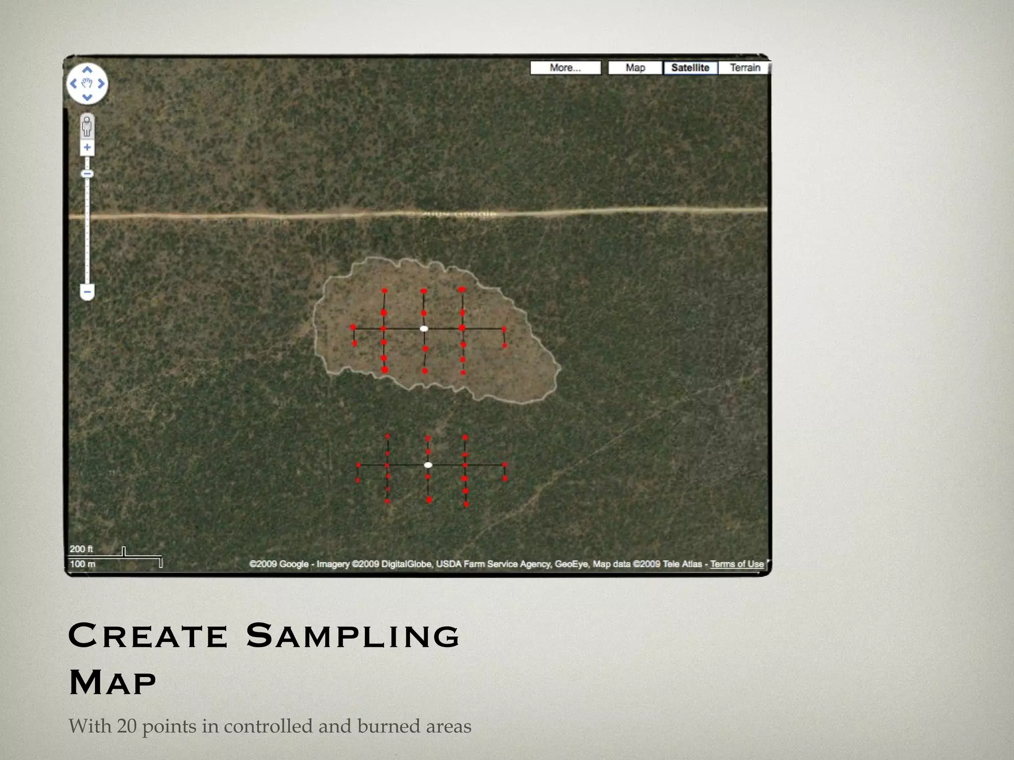
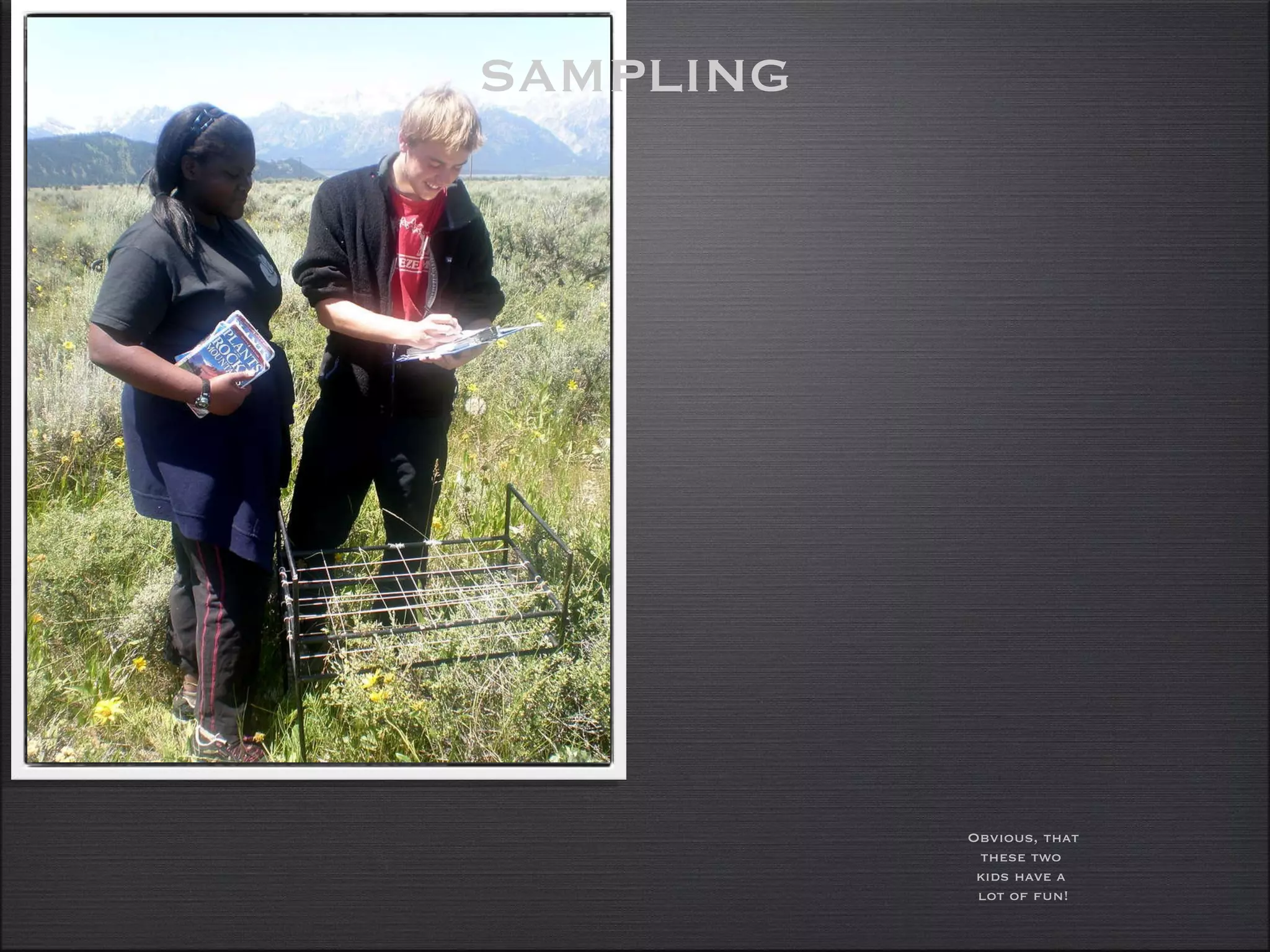
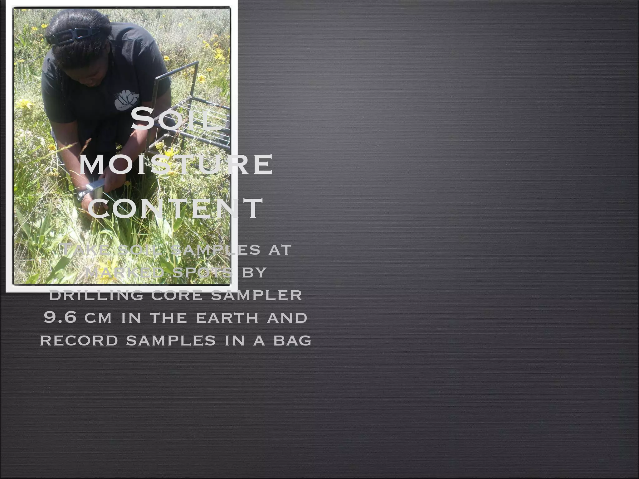
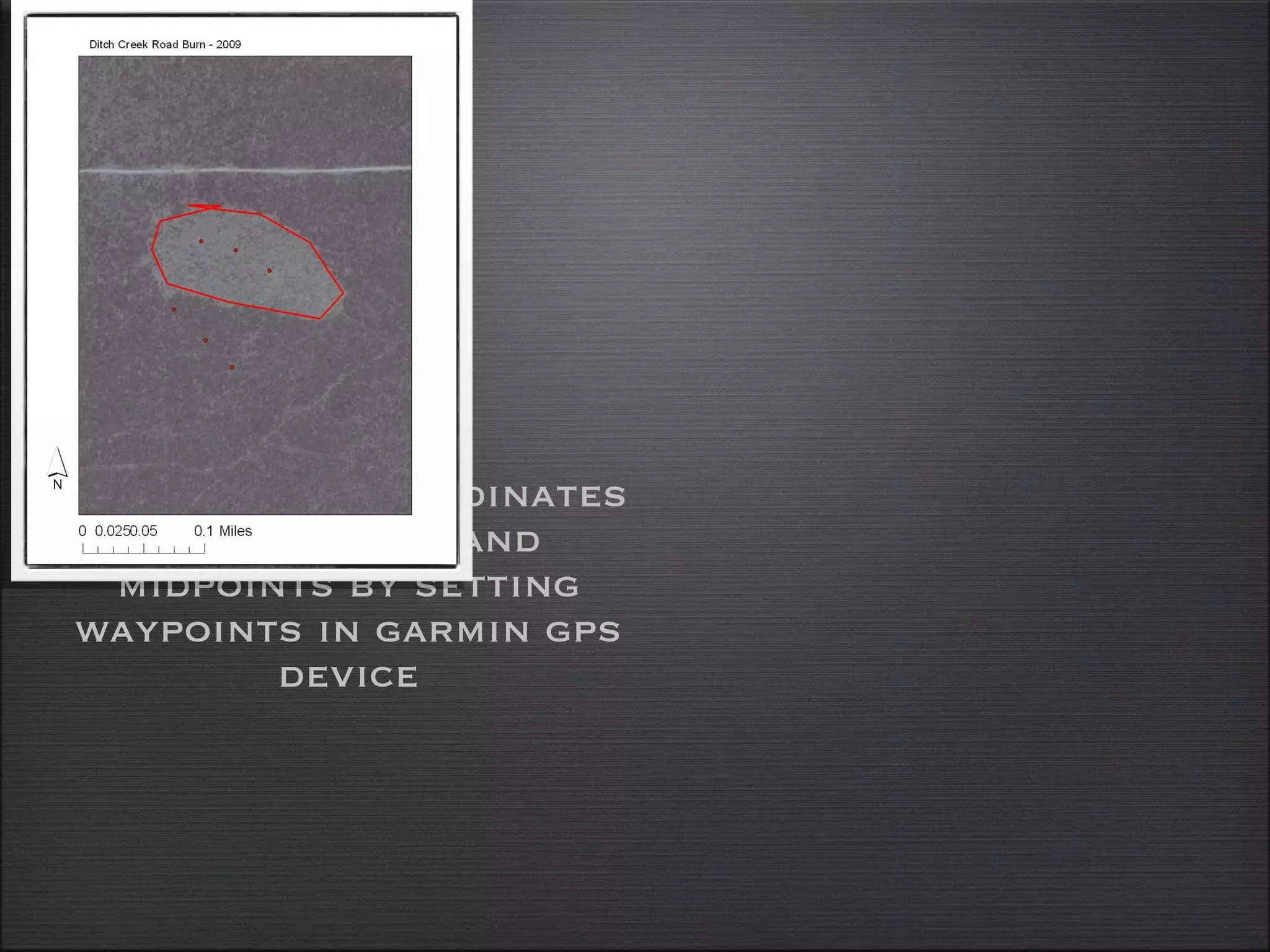
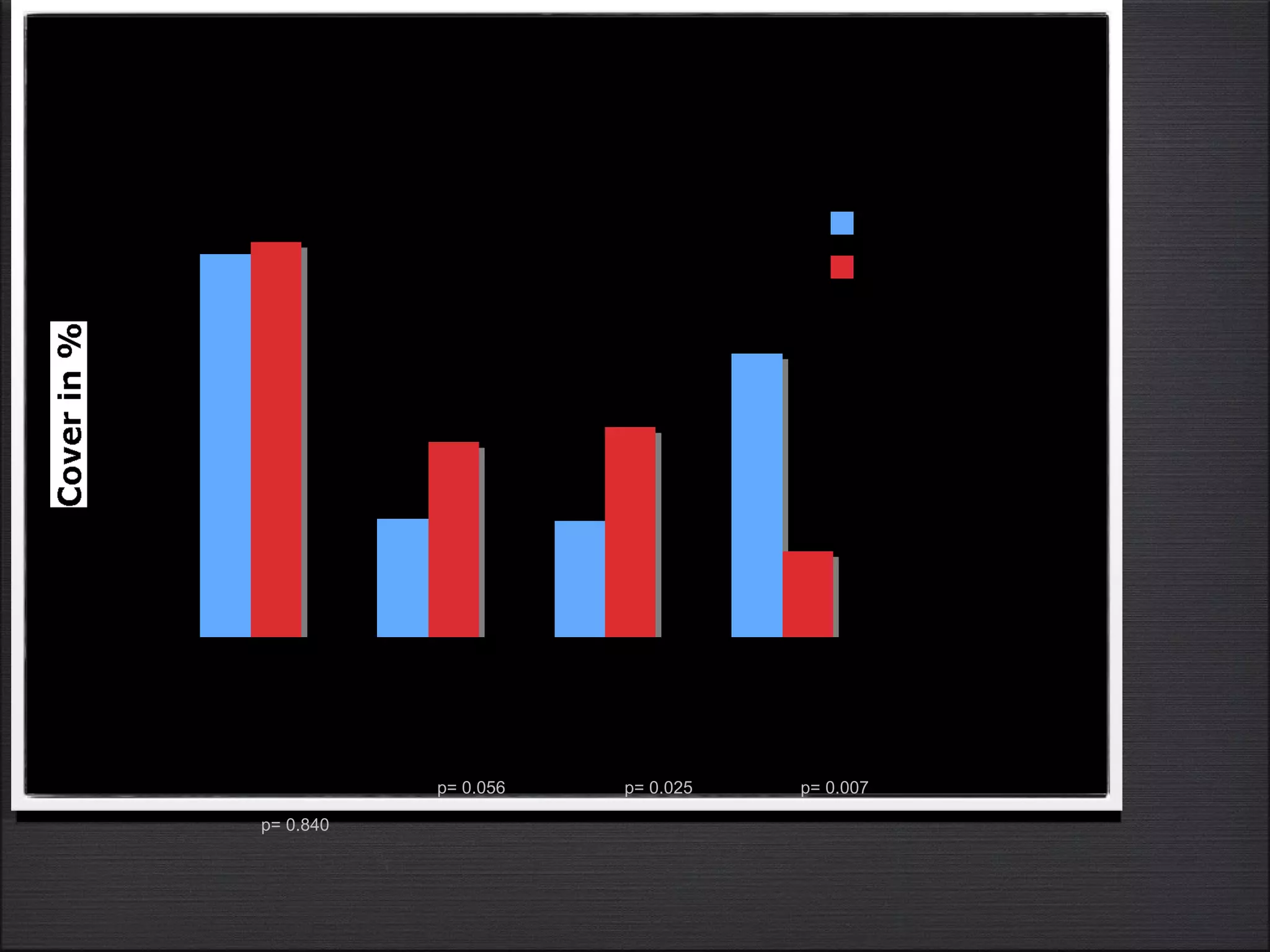
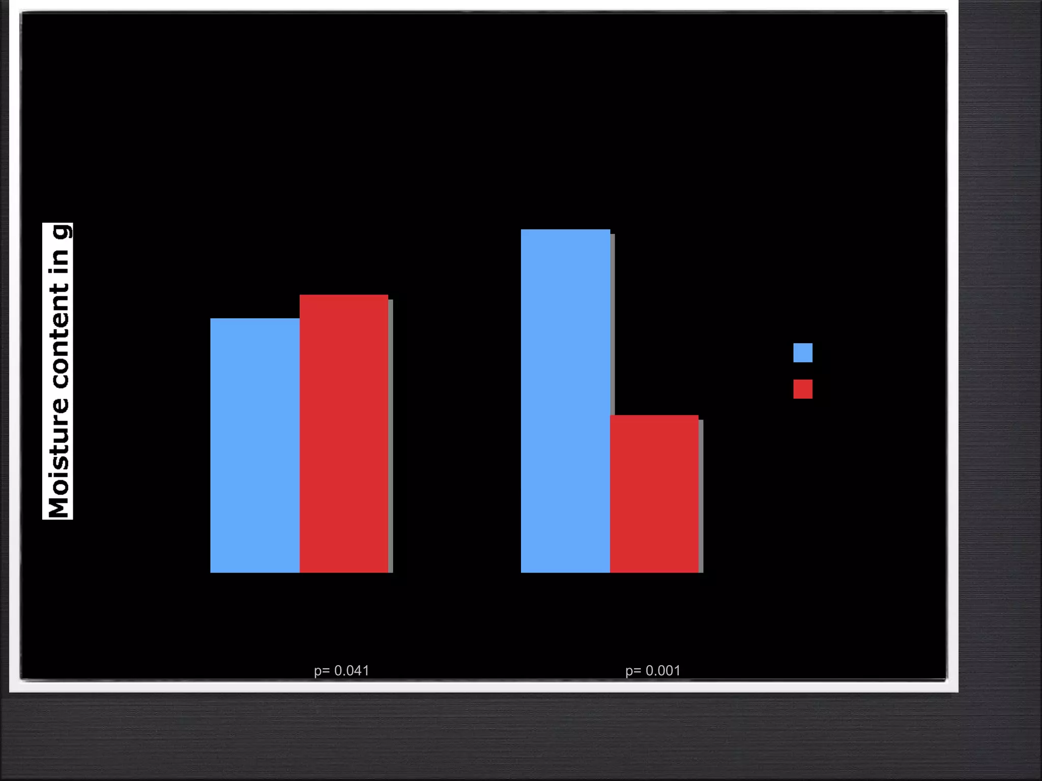
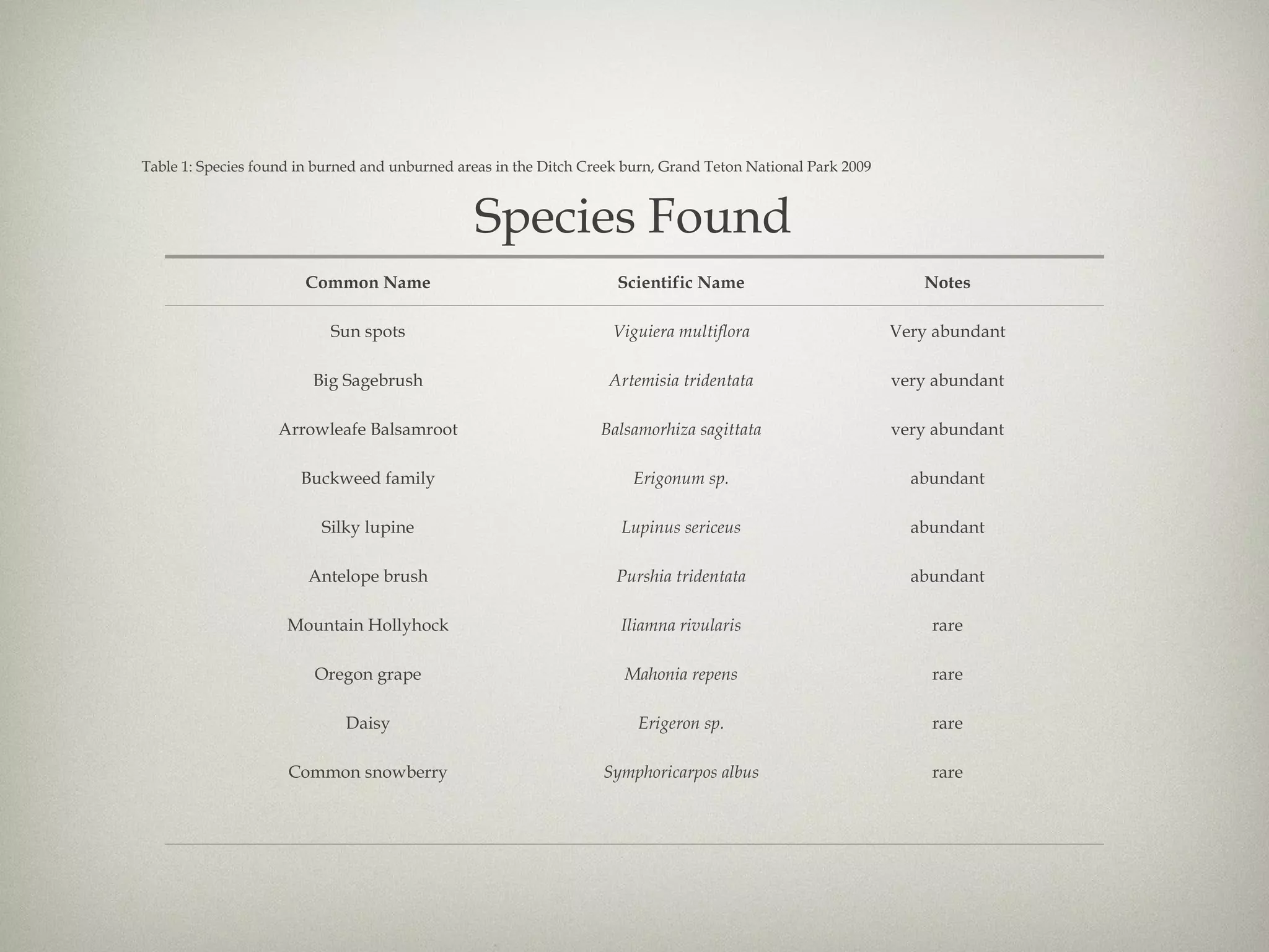
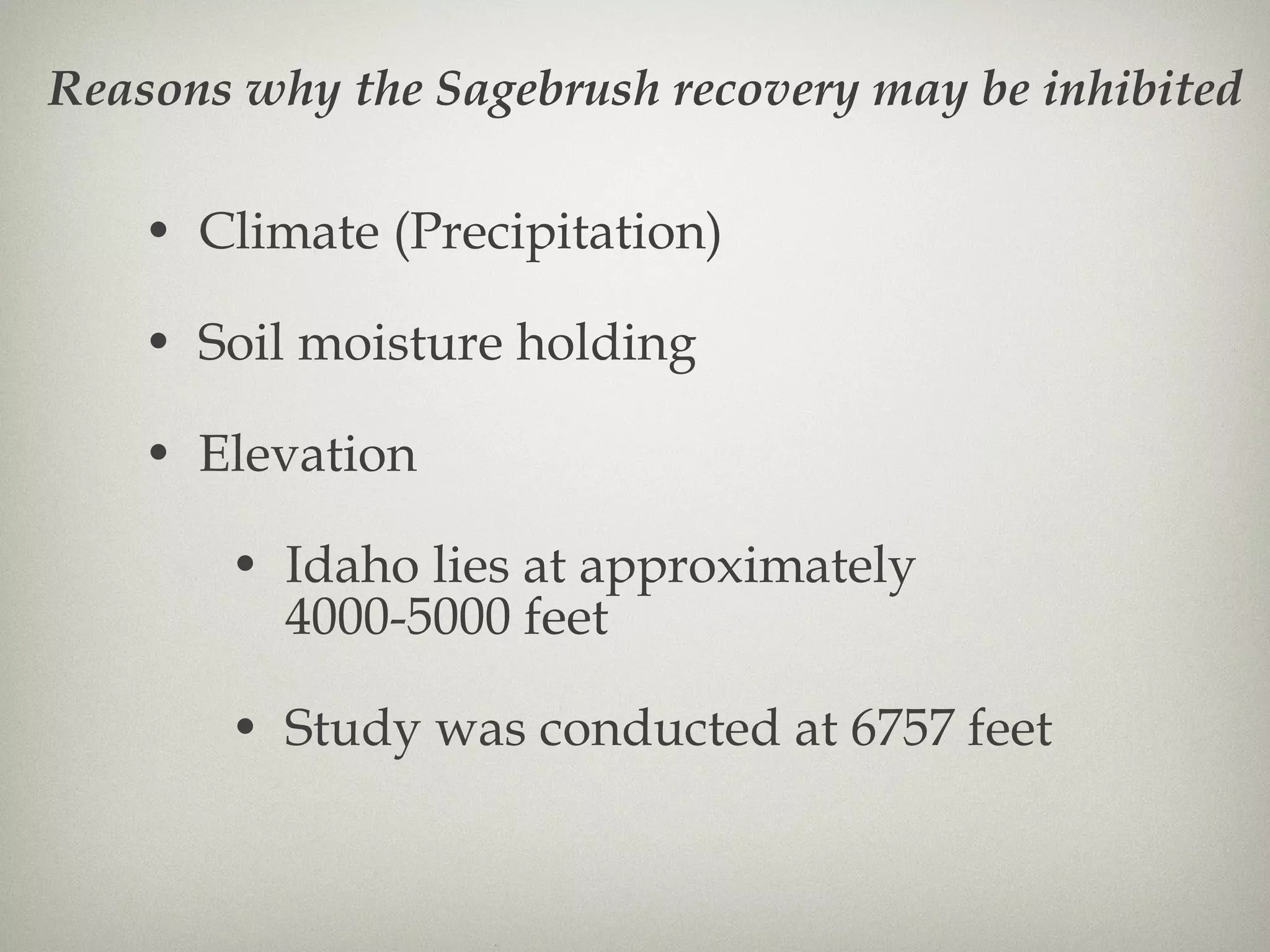
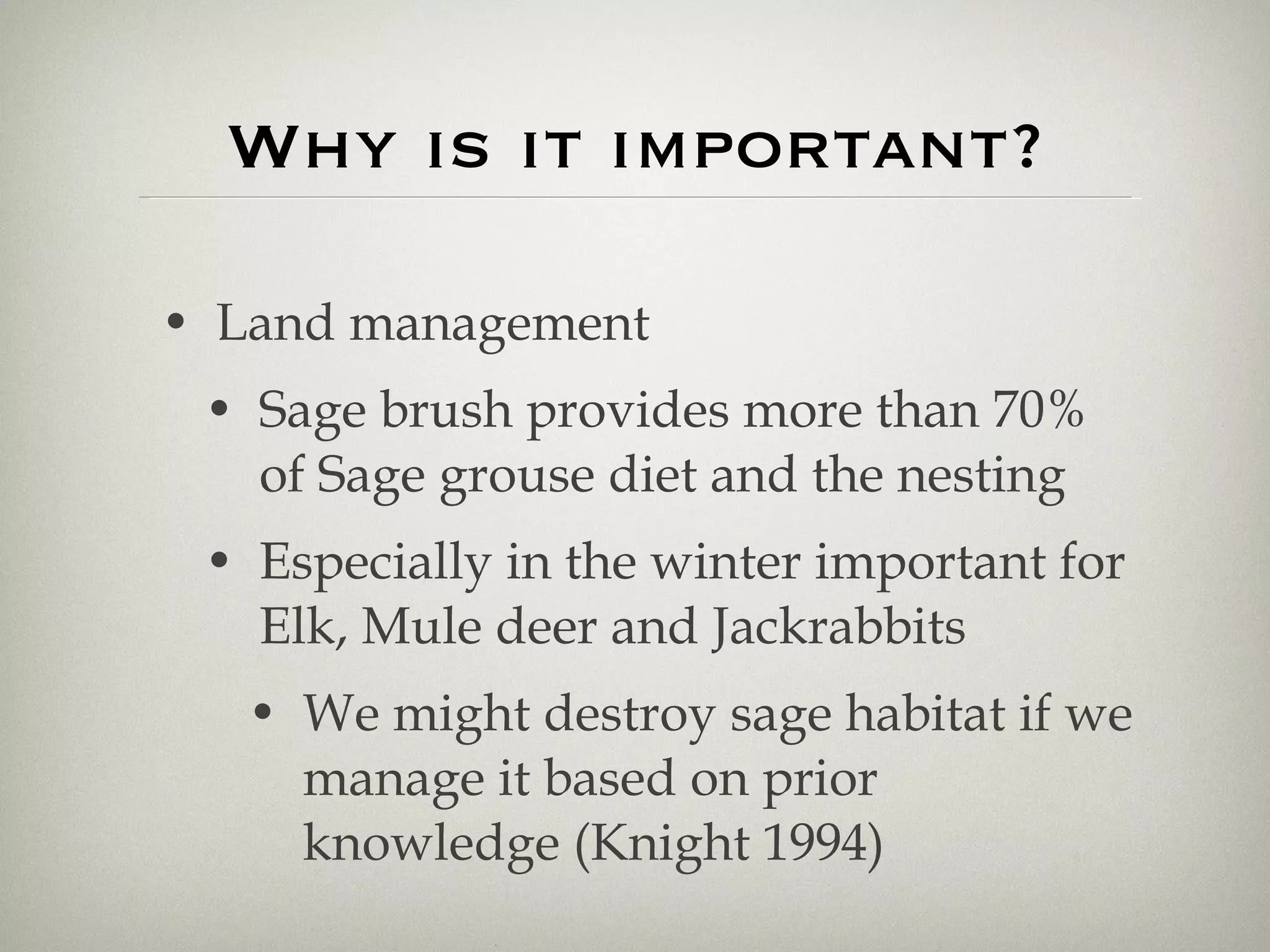
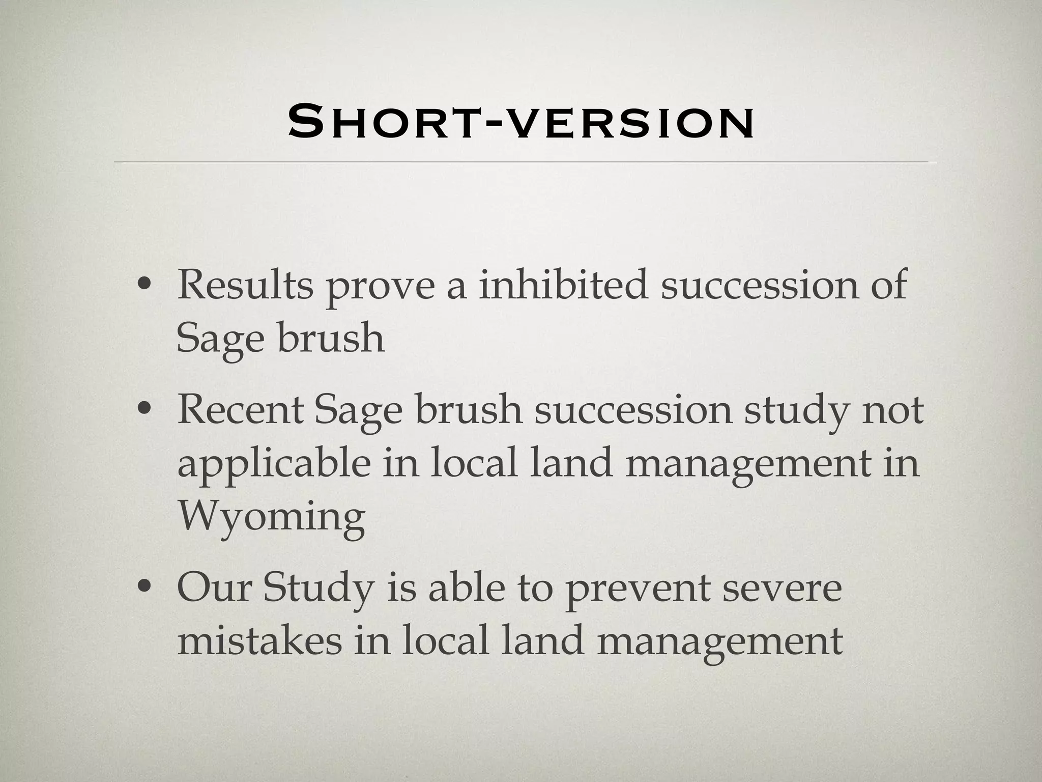
35 Year Ditch-Creek Burn study Robin Castell, Sara Koffi
Question? A Discussion with Mike Posthumus brought up the topic of the Ditch Creek Fire in 1974 Has the sagebrush/bitterbrush community affected by the Ditch Creek Fire of ’74 fully recovered?
Introduction August 13th, 1974: Ditch Creek Fire occurs 1974-1979: Teton Science Schools performed a 5 year continued study of the burn; it was revisited in 1988 2009: 35 years later the Ditch Creek Fire study was reopened to record the long-term effects on its surroundings
Hypothesis A study, conducted in Clark Country, Idaho suggests a 30 year recovery rate for Sage brush (Harniss and Robert, 1973) - As a result, our hypothesis is the following: The sagebrush/bitterbrush affected by the Ditch Creek Fire of ‘74 has reached climax community.
Methods How did we do it?
Prepare data sheet with placeholders for percentages of bare ground, grasses, Forbes and Shrubs and the height of the highest shrub
Prepare Daubenmire Frame Length: 61 cm; Width: 37.8 cm Divide it into 30 ca. equal quadrates New Frame size allowed more area to be sampled TOTAL AREA: 532m²
Taking Pictures from Midpoint Take pictures from average eye level in all points of the compass (real directions) with the horizon in the upper third of the picture North West East South
Create Sampling Map With 20 points in controlled and burned areas
SAMPLING Obvious, that these two  kids have a  lot of fun!
Place Daubenmire frame on the sampling point so that the sampling point Is in the middle of the daubenmire frame 1
Align Daubenmire frame real south 2
Look from above straight down to the frame and estimate independently the percent covers of forbes, shrubs, grasses and bare ground 3
Take the middle value of both estimates and record it on the previously created data sheet 4
If there was shrub (Sagebrush/bitterbrush), measure the height of the highest shrub of connected brush 5
Weight Soil Samples in package. After drying them weight again. the difference minus 2g (Zip-bag) is the Soil moisture content. 6
Soil moisture content Take soil samples at marked spots by drilling core sampler 9.6 cm in the earth and record samples in a bag
GPS Record GPS coordinates of perimeter and midpoints by setting waypoints in garmin gps device
Don’t forget to journal Record all other observations in journal Such as Elevation, general vegetation cover and Signs of animals
Results
p= 0.840 p= 0.056 p= 0.025 p= 0.007
p= 0.357 p= 0.343 p= 0.320 p= 0.051
 
p= 0.041 p= 0.001
p= 0.025 p= 0.080
Table 1: Species found in burned and unburned areas in the Ditch Creek burn, Grand Teton National Park 2009 Species Found Common Name Scientific Name Notes Sun spots Viguiera multiflora Very abundant Big Sagebrush Artemisia tridentata very abundant Arrowleafe Balsamroot Balsamorhiza sagittata very abundant Buckweed family Erigonum sp. abundant Silky lupine Lupinus sericeus abundant Antelope brush Purshia tridentata abundant Mountain Hollyhock Iliamna rivularis rare Oregon grape Mahonia repens rare Daisy Erigeron sp. rare Common snowberry Symphoricarpos albus rare
DISCUSSION Why is that and what does it mean?
Climate (Precipitation) Soil moisture holding Elevation Idaho lies at approximately 4000-5000 feet Study was conducted at 6757 feet Reasons why the Sagebrush recovery may be inhibited
Why is it important? Land management Sage brush provides more than 70% of Sage grouse diet and the nesting Especially in the winter important for Elk, Mule deer and Jackrabbits We might destroy sage habitat if we manage it based on prior knowledge (Knight 1994)
Conclusion
Short-version Results prove a inhibited succession of Sage brush Recent Sage brush succession study not applicable in local land management in Wyoming Our Study is able to prevent severe mistakes in local land management
Uncertainties We were not able to use the results of the very early studies because of major inaccuracies and therefore used the 1979 study results Dobenmeir method is not recommended instead we would use a line intersect method in future studies Some forbes couldn’t be identified because they have their flower,in another season of the year
Further research What is the most important cause for the inhibited succession? Go to the idaho field and sample there in a 30 years study and see what is the most important part? Climate, elevation or moisture?
Bibliography Kershaw, L, MacKinnon, A, & Pojar, J (1998). Plants of the Rovky Mountains. Edmonton: Lone Pine Publishing.  Wingate, J (1990). Rocky Mountain Flower Finder. Rochester: New York.  Knight, D (1983). Mountains and Plains : The ecology of Wyoming. Yale: Louis Stern Memorial Fund.  Harniss, R, & Murray, R (1973). 30 Years of Vegetal Change following Burning of Sagebrush-Grass Range. Journal of Range Management, 26, 322-325.  USDA NRCS Plant Materials Program, (2002). Big Sagebrush. Retrieved July 23, 2009, from United States Department of Agriculture Natural Ressources Conservation Service Web site: plants.usda.gov/factsheet/pdf/fs_artr2.pdf
Acknowledgements Thanks a lot to Dr. Dale and Mr. Mike for guidance and supervision

Sage study

  • 1.
    35 Year Ditch-CreekBurn study Robin Castell, Sara Koffi
  • 2.
    Question? A Discussionwith Mike Posthumus brought up the topic of the Ditch Creek Fire in 1974 Has the sagebrush/bitterbrush community affected by the Ditch Creek Fire of ’74 fully recovered?
  • 3.
    Introduction August 13th,1974: Ditch Creek Fire occurs 1974-1979: Teton Science Schools performed a 5 year continued study of the burn; it was revisited in 1988 2009: 35 years later the Ditch Creek Fire study was reopened to record the long-term effects on its surroundings
  • 4.
    Hypothesis A study,conducted in Clark Country, Idaho suggests a 30 year recovery rate for Sage brush (Harniss and Robert, 1973) - As a result, our hypothesis is the following: The sagebrush/bitterbrush affected by the Ditch Creek Fire of ‘74 has reached climax community.
  • 5.
    Methods How didwe do it?
  • 6.
    Prepare data sheetwith placeholders for percentages of bare ground, grasses, Forbes and Shrubs and the height of the highest shrub
  • 7.
    Prepare Daubenmire FrameLength: 61 cm; Width: 37.8 cm Divide it into 30 ca. equal quadrates New Frame size allowed more area to be sampled TOTAL AREA: 532m²
  • 8.
    Taking Pictures fromMidpoint Take pictures from average eye level in all points of the compass (real directions) with the horizon in the upper third of the picture North West East South
  • 9.
    Create Sampling MapWith 20 points in controlled and burned areas
  • 10.
    SAMPLING Obvious, thatthese two kids have a lot of fun!
  • 11.
    Place Daubenmire frameon the sampling point so that the sampling point Is in the middle of the daubenmire frame 1
  • 12.
  • 13.
    Look from abovestraight down to the frame and estimate independently the percent covers of forbes, shrubs, grasses and bare ground 3
  • 14.
    Take the middlevalue of both estimates and record it on the previously created data sheet 4
  • 15.
    If there wasshrub (Sagebrush/bitterbrush), measure the height of the highest shrub of connected brush 5
  • 16.
    Weight Soil Samplesin package. After drying them weight again. the difference minus 2g (Zip-bag) is the Soil moisture content. 6
  • 17.
    Soil moisture contentTake soil samples at marked spots by drilling core sampler 9.6 cm in the earth and record samples in a bag
  • 18.
    GPS Record GPScoordinates of perimeter and midpoints by setting waypoints in garmin gps device
  • 19.
    Don’t forget tojournal Record all other observations in journal Such as Elevation, general vegetation cover and Signs of animals
  • 20.
  • 21.
    p= 0.840 p=0.056 p= 0.025 p= 0.007
  • 22.
    p= 0.357 p=0.343 p= 0.320 p= 0.051
  • 23.
  • 24.
  • 25.
  • 26.
    Table 1: Speciesfound in burned and unburned areas in the Ditch Creek burn, Grand Teton National Park 2009 Species Found Common Name Scientific Name Notes Sun spots Viguiera multiflora Very abundant Big Sagebrush Artemisia tridentata very abundant Arrowleafe Balsamroot Balsamorhiza sagittata very abundant Buckweed family Erigonum sp. abundant Silky lupine Lupinus sericeus abundant Antelope brush Purshia tridentata abundant Mountain Hollyhock Iliamna rivularis rare Oregon grape Mahonia repens rare Daisy Erigeron sp. rare Common snowberry Symphoricarpos albus rare
  • 27.
    DISCUSSION Why isthat and what does it mean?
  • 28.
    Climate (Precipitation) Soilmoisture holding Elevation Idaho lies at approximately 4000-5000 feet Study was conducted at 6757 feet Reasons why the Sagebrush recovery may be inhibited
  • 29.
    Why is itimportant? Land management Sage brush provides more than 70% of Sage grouse diet and the nesting Especially in the winter important for Elk, Mule deer and Jackrabbits We might destroy sage habitat if we manage it based on prior knowledge (Knight 1994)
  • 30.
  • 31.
    Short-version Results provea inhibited succession of Sage brush Recent Sage brush succession study not applicable in local land management in Wyoming Our Study is able to prevent severe mistakes in local land management
  • 32.
    Uncertainties We werenot able to use the results of the very early studies because of major inaccuracies and therefore used the 1979 study results Dobenmeir method is not recommended instead we would use a line intersect method in future studies Some forbes couldn’t be identified because they have their flower,in another season of the year
  • 33.
    Further research Whatis the most important cause for the inhibited succession? Go to the idaho field and sample there in a 30 years study and see what is the most important part? Climate, elevation or moisture?
  • 34.
    Bibliography Kershaw, L,MacKinnon, A, & Pojar, J (1998). Plants of the Rovky Mountains. Edmonton: Lone Pine Publishing. Wingate, J (1990). Rocky Mountain Flower Finder. Rochester: New York. Knight, D (1983). Mountains and Plains : The ecology of Wyoming. Yale: Louis Stern Memorial Fund. Harniss, R, & Murray, R (1973). 30 Years of Vegetal Change following Burning of Sagebrush-Grass Range. Journal of Range Management, 26, 322-325. USDA NRCS Plant Materials Program, (2002). Big Sagebrush. Retrieved July 23, 2009, from United States Department of Agriculture Natural Ressources Conservation Service Web site: plants.usda.gov/factsheet/pdf/fs_artr2.pdf
  • 35.
    Acknowledgements Thanks alot to Dr. Dale and Mr. Mike for guidance and supervision