River Stour Project - Bowland Award Nominee - Landscapes for Life Conference 2015
•Download as PPT, PDF•
1 like•487 views

Landscapes for Life - Conference 2015 Sharing, Learning, Inspiring Tuesday 30th June - Thursday 2nd July 2015 - Winchester, Hampshire

Recommended
More Related Content
Similar to River Stour Project - Bowland Award Nominee - Landscapes for Life Conference 2015
Similar to River Stour Project - Bowland Award Nominee - Landscapes for Life Conference 2015 (20)
More from NAAONB landscapesforlife
More from NAAONB landscapesforlife (20)
Recently uploaded
Recently uploaded (20)
River Stour Project - Bowland Award Nominee - Landscapes for Life Conference 2015
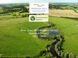
- 1. River Stour WFD Walkover Survey Volunteer Project 2012 - 2015
- 2. River Stour WFD Walkover Survey Aim: To identify what the existing habitat is like, where there are potential point and diffuse pollution sources and whether there is any need/opportunity for river enhancement works to address WFD objectives This included recording: •River and riparian habitat features •Potential diffuse and point source pollution inputs •Non-native invasive plants •Dominant in-channel and riverside vegetation •Protected species such as water vole and otter
- 7. • 455 survey sections completed in from 2012 – 2015 • 245km of the River Stour and tributaries surveyed (of 262km) • 22 volunteers involved with the project • 600 volunteer days • 9500 recorded river features from riffles to field drains • In 2014 the River Stour Walkover Survey Volunteers were runners up at the Greenest County Awards • 4 river habitat enhancement projects The River Stour Walkover Survey in numbers
- 8. From survey………. To database……….. To habitat restoration………..
- 9. • Using the survey data to guide riparian tree planting across the catchment with opportunities to work with the Woodland Trust and National Trust • Informing future river habitat restoration projects, with two river restoration projects already in the pipeline for delivery in 2015 • Prioritising action on water quality issues, identifying opportunities for working with landowners to better protect their watercourses • Improving understanding of Invasive Non-Native Species distribution and enabling targeted control strategies Exciting opportunities for the future
- 10. Using the river survey data…. E.g. Identifying sections with <30% shade for targeted tree planting project
Editor's Notes
- Purpose: To obtain a snap shot of the health of the river and to obtain data to help inform and prioritise river habitat and water quality enhancement projects. Linked to aims of EA under the Water Framework Directive. It involved walking a stretch of river and recording habitat features, river channel and riparian land characteristics, point or diffuse pollution sources, invasive non-native species and signs of protected species such as otter and water vole. Whilst the EA do biological and chemical surveys of the rivers their resources are limited and it is evident in the Stour Valley that there can be large distances between survey points. This means there are long lengths of the river that are relatively unknown from a habitat perspective. We are also unaware of these issues that could perhaps be adversely impacting the water quality in these areas. This survey has given us an improved picture of the main pressures on the catchment, areas of good and poor river habitat and has already started to enable the delivery of tangible river habitat enhancement projects.
- This shows the main rivers in the Stour catchment, that were part of the survey, totalling 262km in length. From the source to the estuary and its main tributaries the volunteers have conducted a significant amount of survey work. Battling through nettles, jumping ditches, clambering through scrub and trudging through snow! Whilst the EA do biological and chemical surveys of the rivers their resources are limited and it is evident in the Stour Valley that there can be large distances between survey points. This means there are long lengths of the river that are relatively unknown with regards to the quality of their physical habitat and whether there could be things adversely impacting water quality.
- We have managed to fill the gaps in recording of physical river habitat features, channel characteristics, riparian land use and potential water quality issues or risks. This map shows the vast number (9500) features recorded throughout the project which range from in-channel rubbish (the odd tyre for eg) through to brilliant habitat features such as riffles, pools, berms and bars. This survey has been supported by the vast majority of landowners (over 170 in total) in the Valley and has given us an improved picture of the main pressures on the catchment, areas of good and poor river habitat and has already started to enable the delivery of tangible river habitat enhancement projects.
- ………………..if we zoom into this we can see the features running through the town of Hadleigh on the River Brett. It shows the GIS layer of the information which has been uploaded via a Microsoft Access Database, designed and built by Suffolk Biological Centre. This is the only example locally we know of WFD walkover survey data having been used in this way (i.e. made easily accessible via GIS) and makes interpretation of the data considerably easier. The map shows the range of features recorded from man-made infrastructure like wiers and sluices which pose a significant barrier for eel and fish, through to habitat features such as riffles and woody debris both important for fish and invertebrates, through the drainage ditches and drainage pipes which, particularly in an urban environment like this, could introduce road or industrial run-off into the river. Having it all on GIS has enabled easier viewing of the data, has allowed us to identify areas rich in habitat and lacking habitat and has made it possible to start to prioritise projects. At the simplest level this information is important as knowing what habitat is there or importantly is not there allows us to infer what wildlife might be supported along that stretch of river. E.g…………..
- E.g……..habitat features such as cliffs can be really important for nesting kingfisher, woody debris can be a critically important habitat (particularly in heavily modified rivers) as a refuge for fish and invertebrates as well as increasing flow diversity and well oxygenated, clean gravel riffle areas are brilliant habitat for a range of sensitive species from niche mayflies through to this caseless caddisfly larvae (Hydrophyche sp.). Riffles also present important habitat for spawning fish such as brown trout, chub and dace.
- So in numbers then, the River Stour WFD Walkover Survey has been a great success……….. But its not the end, the intention was never to just collect data and for it to sit on the shelf, from the start of the project is had and will continue to be used to guide action to enhance the AONB and extended Stour Valley Project area for wildlife………
- ….we have been able to go from survey…..to database (where we have identified gaps in habitat and opportunities for enhancement) right through to restoration!!! With 3 major river restoration projects taking place to improve spawning habitat for fish through the creation of riffles, enhance the marginal habitat for riparian and wetland plants, provide woody brash and backwater refuge for fish and invertebrates and ultimately increase the diversity of previously degraded sections of river. Whilst some of these projects were also informed by previous works, the river walkover survey directly contributed to the River Brett projects and has lead to some great dialogue with numerous landowners in the valley about river management for wildlife and how they too could deliver river restoration works.
- To name a few there are some existing opportunities that not just the AONB are keen to work on but obviously the EA as well as other partners too such as local wildlife trusts, Woodland Trust and National Trust (interested in riparian tree planting project), Catchment Sensitive Farming etc One of its greatest benefits is allow us to prioritise and justify action and we very much hope it will assist in securing future funding for the delivery of river restoration works in the Stour Valley in the future!
- Note this is not a complete data map – but was complete later last year before completion of the project. It provides an example of how we can go about using the data however. The green lengths of river are shown where there is shading than over &gt;30% of the 500m section. The red show areas with &lt;30% of the shading. The grey = where at that time the survey data was not loaded to the database. The importance of this is that it allows us to target tree planting works. Trees on river banks are important for a number of key reasons and the figure of 30-50% dappled shade of a channel is thought to be extremely important in reducing water temperatures in the channel. Too high temperatures can be devastating for some species and the higher the temperature the lower the dissolved oxygen – so again it can have knock on effects. Trees can provide: Shade Shelter for riparian species A buffer from agricultural operations and the water course Woody debris in the river Habitat for a range of different species They are also a very important habitat feature.
- So we have had a wail of a time since 2012 delivering this project and we have been humbled by the incredible enthusiasm, passion and determination of our River Stour Survey Volunteers. The volunteers have been a pleasure to work with and their sense of humour has been brilliant.