Pyconmini Hiroshima 2018
•Download as ODP, PDF•
2 likes•460 views

This document provides an introduction and overview of using data science and visualization techniques in Python. It discusses analyzing geographic data using Folium and developing interactive web applications using Plotly and Dash. Specifically, it demonstrates how to easily create web maps and data-driven apps with Python tools for visualizing geographic and time series data. Interactive examples are provided on a Jupyter notebook platform.

Recommended
More Related Content
Similar to Pyconmini Hiroshima 2018
Similar to Pyconmini Hiroshima 2018 (20)
Recently uploaded
Recently uploaded (20)
Pyconmini Hiroshima 2018
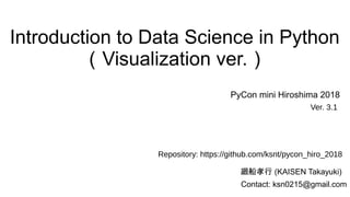
- 1. Introduction to Data Science in Python (Visualization ver.) 廻船孝行 (KAISEN Takayuki) PyCon mini Hiroshima 2018 Contact: ksn0215@gmail.com Ver. 3.1 Repository: https://github.com/ksnt/pycon_hiro_2018
- 2. Overview 1. Geographic Data Analysis 2. Interactive Graph and Application 3. Discussion Python 3.6.3 Pip 10.0.1 Development Environment Ubuntu 17.10
- 3. ・ Injury due to an accident Notice ・ Hard to pronounce some words ・ Appreciate for your cooperation in advance!
- 4. 0. WHO ARE YOU? ⚫ Favorite Languages ⚪ Python, R, Scala ⚫ Interests ⚪SNA, CSS, CMC, ABM, Complex Systems, Data Science, ... ⚫ Python Conference Attendance ⚪PyCon mini JP (2010?) ⚪PyConJP 2011 ⚪Tokyo.Scipy (2011?) ⚫ Love Online Learning ⚫ Oct 2017 - HiroshimaFreeman, L. (2004). The development of social network analysis. A Study in the Sociology of Science, 1. 1. Social network analysis is motivated by a structural in- tuition based on ties linking social actors, 2. It is grounded in systematic empirical data, 3. It draws heavily on graphic imagery, and 4. It relies on the use of mathematical and/or computation- al models.
- 5. Takeaways: All I am Talking to You 1. It is incredibly easy to make use of geographic data with Python (Folium) 2. It is incredibly easy to develop data driven web application with Python (Plotly and Dash)
- 6. 1. Geographic Data Analysis 2. Interactive Graph and Application 3. Discussion
- 7. How to use geographic data GIS = Geographic Information System “A geographic information system (GIS) is a system designed to capture, store, manipulate, analyze, manage, and present spatial or geographic data. “ Wikipedia YOU DON’T HAVE TO USE GIS! Reference: “Python Geospatial Development – Third Edition” Chapter2
- 8. How to make use of Geographic data in Python ・ArcGIS, QGIS (PyQGIS) ・Geopandas ・Folium (Leaflet) ・Geopy ・And so forth… (reference) https://qiita.com/aimof/items/b4e4551d27abaf5bb258 ⚪ Do not need knowledge on GIS ⚪ Can easily create Web map
- 9. How to install folium $ pip install folium $ conda install -c conda-forge folium or
- 11. Data & Visualization(2) df = pd.Dataframe() df = df.attend(crime_data[‘LAT’]) df = df.attend(crime_data[‘LON’]) df = df.T df = df.reset_index(drop=True) df[‘LAT’] = round(df[‘LAT’],3) df[‘LON’] = round(df[‘LON’],3) df.head()
- 12. Data & Visualization(3) from folium.plugins import HeatMap from IPython.display import HTML import folium map_detroit = folium.Map(location=(42.40,-83.01)) data = [] for i in range(len(df)): data.append((df['LAT'][i],df['LON'][i])) HeatMap(data,radius=9).add_to(map_detroit) map_detroit.save('crimes.html') HTML(r'<iframe width="800" height="500" frameborder="0" allowfullscreen src="./crimes.html"></iframe>') https://nbviewer.jupyter.org/github/ksnt/Predictor-of-blights-in- Detroit/blob/master/Final_Report_1.1.ipynb
- 13. Data & Visualization(4) How to visualize geographical data with folium 1. Data cleaning 2. Create map 3. Put the data into the map! (4. Save the map as a HTML file ) (5. Draw the HTML file ) HeatMap(data,radius=9).add_to(map_detroit)
- 14. 1. Geographic Data Analysis 2. Interactive Graph and Application 3. Discussion
- 15. Data Visualization in Python ⚫ seaborn: cool ⚫ bokeh: cool, interactive ⚫ plotly: cool, interactive, reactive ⚫ matplotlib: standard ⚫ PixieDust (IBM?): interactive, …? >>> plotly.__version__ '2.4.1' >>> dash.__version__ '0.21.0' ⚫ mpld3: cool, interactive
- 16. How to Use Plotly and Dash $ pip install plotly $ pip install dash $ python >>> import plotly >>> import dash
- 17. Interactive Graph For Scatter Plot (Optional) https://nbviewer.jupyter.org/gist/ksnt/340910aae39670202e4f790213e7afdc
- 18. Interactive Graph for Bar Plot import pandas as pd import plotly import plotly.graph_objs as go df2 = pd.read_excel('globalterrorismdb_0616dist.xlsx',header=0) data = [go.Bar( x=df2["country_txt"].value_counts()[:20].index, y=df2["country_txt"].value_counts()[:20] )] layout = go.Layout( title="Top 20 Frequency of Terrorism Incidents 1970 - 2015", xaxis={"title":"Country"}, yaxis={"title":"Occurence of terrorism"}, ) fig = go.Figure(data=data, layout=layout) # Preparation of plot by Plotly plotly.offline.iplot(fig, filename='basic-bar') # not online figure You have to prepare for this data! https://nbviewer.jupyter.org/gist/ksnt/eb8ac99dd69ecc5dc5774bf673977ceb
- 19. Interactive Graph for Time Series Plot layout = plotly.graph_objs.Layout( title="Occurence of Terrorism Incidents", xaxis={"title":"Year"}, yaxis={"title":"Occurence of terrorism"}, ) iraq_incidents = df2[df2["country_txt"] == "Iraq"] iraq_incidents_count = iraq_incidents['iyear'].value_counts() iraq_incidents_count = iraq_incidents_count.sort_index() iraq = go.Scatter( x=iraq_incidents_count.index, y=iraq_incidents_count, name = "Iraq", line = dict(color="black"), Opacity = 0.8) year = [i for i in range(1970,2016)] data = [iraq,us,pakistan,india,afghanistan,colombia,peru,phil,el,uk,turkey,spain,sri,somalia,nigeria,algeria, france,yemen,lebanon] fig = plotly.graph_objs.Figure(data=data, layout=layout) plotly.offline.iplot(fig, show_link=False,config={"displaylogo":False, "modeBarButtonsToRemove": ["sendDataToCloud"]}) https://nbviewer.jupyter.org/gist/ksnt/eb8ac99dd69ecc5dc5774bf673977ceb
- 20. Additional Example – MonteCarlo Simulation (Optional) https://nbviewer.jupyter.org/gist/ksnt/101a44cc21b0eb990f96dc1d640dbd42
- 21. Plotly Dash “”” Dash is Shiny for Python “”” ― Chris Parmer, Dash: Shiny for Python https://youtu.be/5BAthiN0htc “ Dash is a Python framework for building web application” ・ Flask ・ React.js ・ Ideal for building data visualization apps
- 22. Monte Carlo Simulator (1) https://montecarlo-dash-app.herokuapp.com/
- 23. Monte Carlo Simulator (2) Krauth, W. (2006). Statistical mechanics: algorithms and computations (Vol. 13). OUP Oxford. Covered by points Num of all points →S(□) = 4 r=1 r=1 Num of point in the circle → S(○) = π Num of all points Num of point in the circle S(○) S(□) = 4 π Count up these points! Points = {x,y}, x,y 〜 U(-1,1) Useful article about Monte Carlo Simulation in Japanese is: —モンテカルロ法の前線 サイコロを振って積分する方法 福島 孝治 https://www.smapip.is.tohoku.ac.jp/~smapip/2003/tutorial/presentation/koji-hukushima.pdf Institution
- 24. Monte Carlo Simulator (3) https://montecarlo-dash-app.herokuapp.com/
- 25. Monte Carlo Simulator (4) https://gist.github.com/ksnt/ccd88b6f63081e6d2d11f0daf6d0bc4e ⚫ Import libraries ⚫ app = dash.Dash() server=app.server server.secret_key = os.environ.get('secret_key', 'secret') ⚫ app.layout = html.Div( # WRITE LAYOUT) ⚫ @app.callback( #WRITE OPERATION) ⚫ if __name__ == '__main__': app.run_server(debug=True) View Controller
- 26. Python vs R as Data Visualization Tool Speed Extensibility Price Packages/ Libraries (for Data Analysis) Python ○ ◎ Free ML R △ △ OOP (S3,S4,R5(>=2.12)) Free Statistics Tableau ? △? For EDA? ¥18000/year ¥51000/year ¥102000/year ¥0/year students and teachers ? Kibana, Superset, Redash, Metabase, Splunk, KNIME, Google Charts, etc… Julia, Matlab, Scilab, Octave, etc...
- 27. 3 – 2ε. Welcome to Plotly Dash Document Translation Project! https://goo.gl/wnjHA6 HERE!
- 28. 3 – ε. I am looking for new opportunities! ・ Places: Anywhere ・ Salary & Benefits: Negotiable ・ Feel free to talk to me! ・ Like: International, Diverse, Python, Data analysis
- 29. 1. Geographic Data Analysis 2. Interactive Graph and Application 3. Discussion
- 30. Discussion
Editor's Notes
- 1.RはOOPで書きづらい ※ただし私が知っているのはS3クラスというものを使うやりかたで、S4やR5といった別のものを使えばそこまで書きづらくもないのかもしれない 参考: https://sites.google.com/site/scriptofbioinformatics/r-tong-ji-guan-xi/rnoobujekuto-zhi-xiangnitsuite-r 2. Rでオレオレグラフを作るのがしんどかった経験 ggplot2を拡張するコードを書いたことがあるがしんどすぎてメゲそうになった。実際に作者であるWickham自身もggplot2の作りについて反省している。 参考:http://yutannihilation.github.io/ggplot2-vignette-ja/extending-ggplot2.html ただ、一方で例えばPythonmatplotlibを拡張しようとしたときに簡単にできるのかという疑問はある。