Producir conocimiento espacial - Sesión teórica 1

This document discusses producing spatial knowledge through advanced spatial analysis. It defines spatial knowledge as a methodology based on geographic contributions and digital techniques to represent the physical, perceived, and symbolic dimensions of space. Producing spatial knowledge involves mapping and interpreting spatial information to show realities, transformations over time, and possible scenarios. Advanced spatial analysis uses data from sources like Sensible City Lab to understand how spaces function and support decision-making, though it faces challenges in selecting phenomena to study, integrating different data sources and scales, and accounting for the variable of time. The overall goal is to develop useful and scalable representations of how socio-economic and technological changes influence contemporary cities and territories.

Recommended
More Related Content
Similar to Producir conocimiento espacial - Sesión teórica 1
Similar to Producir conocimiento espacial - Sesión teórica 1 (20)
More from Instituto Universitario de Urbanística
More from Instituto Universitario de Urbanística (20)
Recently uploaded
Recently uploaded (20)
Producir conocimiento espacial - Sesión teórica 1
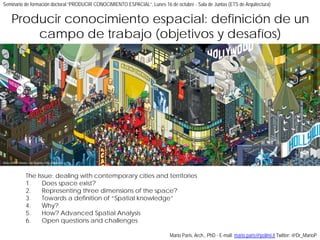
- 1. The Issue: dealing with contemporary cities and territories 1. Does space exist? 2. Representing three dimensions of the space? 3. Towards a definition of “Spatial knowledge” 4. Why? 5. How? Advanced Spatial Analysis 6. Open questions and challenges Eboy (2009) Oscars, Los Angeles Time magazine Mario Paris, Arch., PhD - E-mail: mario.paris@polimi.it Twitter: @Dr_MarioP Producir conocimiento espacial: definición de un campo de trabajo (objetivos y desafíos) Seminario de formación doctoral “PRODUCIR CONOCIMIENTO ESPACIAL”, Lunes 16 de octubre - Sala de Juntas (ETS de Arquitectura)
- 2. The Issue Dealing with contemporary cities and territories
- 3. There is no city, only urban ways of life (M. Cacciari, 2004) Are we prepared for this change? Are our disciplinary tools still useful to describe current territory? Milano, strategie del Documento di Piano: Metrogramma, 2008
- 4. Need of a coherent representations of the contemporary build environment Understanding the (post-) metropolitan territory (its dimension, its landscape, its carachters) C. Price, The city as an egg, 1992 ?
- 5. An heterogeneous catalog of different situations in which we research we design we contribute we operate Compact urban space (centre and different peripheries) The role of spatial representation!
- 6. “He (H. Lefebvre) cautiously called his spatial perspective transdisciplinary as a strategy to prevent spatial knowledge and praxis from being fragmented and compartmentalized (again) as a disciplinary specialty. Space was too important to be left only to the specialized spatial disciplines (Geography, Architecture, Urban Studies) or merely added on as a gap-filler or factual background for historians, social scientists, or Marxist sociologists. The spatiality of human life, like its historicality and sociality, infused every discipline and discourse”. E.W. Soja (1996) Thirdspace. Oxford, Blackwell Publishing p. 47 Space
- 8. Ryoji Ikeda, datamatics [ver 2.0] photo Ryuchi Maruo, courtesy Yamaguchi Centre for Arts and Media (YCAM) Yes From classic Greece (Euclid, Descartes): Abstract concept Defined by postulates and properties
- 9. ARC 482 MASTER M.ARCH. II Post-Graduate Program, The Cooper Union, Professor Pablo Lorenzo-Eiroa Yes From modern approach: Geometry as a language Geometry as a tool
- 10. No G.W. Liebniz: Appearance of reality Void where relationships between objects take place SPACE SYNTAX Centrality as a process. accounting for attraction inequalities in deformed grids, B. Hillier, 1999
- 11. No J. Locke: Vacuum occupied by solids Without bodies, space does not exist Giorgio de Chirico Le rêve transformé, 1913 Saint Louis, Saint Louis Art Museum
- 12. It depends… A. Einstein: Space exists in our perception It is a part of our subjective experience Boamistura (2012) Luz na veilas. Rio de Janeiro, Vila Brasilia
- 13. It depends… a matter of perspective Personal and collective values Practices Time, rhythms, cyclesBoamistura (2012) Luz na veilas. Rio de Janeiro, Vila Brasilia
- 14. Space admits and allows relationship and social (?) interactions A tension between space and place
- 15. 2. Why should we describe the space? How to represent its different dimensions?
- 16. From accurate to narrative representations Precision (detail, functioning schemes, different layers) Perception Interest on the objects Physical dimension (1)
- 17. From accurate to narrative representations How the space looks/should look like Kizo & Arcom Studio (2014) Cas Quinta by Macio Kogan. www.harscom.hr Perceived dimension (2)
- 18. From static to dynamic representations Introducing time in spatial representations (as cubism)
- 19. From subjective to the multiplicity Multiples/moving points of view G. Cullen, Townscape, 1971 – p. 8
- 20. From subjective to the multiplicity Multiples eyes (overlapping information) Kevin Lynch (1960) The image of the city. Cambridge (Mass.), MIT University Press
- 21. Provincia di Leòn (E), area sud: Google Earth, 2014 Circumstances matter! Two key words: Context and constraints (the role of the close geography: topography, climatology, etc.)
- 22. We represent spaces where people act as inhabitants Public space as an interactive area: different uses for Casa da Musica Square (2012) – Oporto, publicspaces.org Simbolic dimension (3)
- 23. Taking in account relationships Understand diversity and complexity Work with alternatives Avoid assumptions and prejudices Eboy (2013) Exhibition in Marseille.
- 24. Taking in account Social, Economic and Technologic changes
- 25. Representing is the way to understand and explain the space - Not an univocal result - Interaction between different representations (scales, tools, approaches) - It depends on specific and oriented strategies Through the representation we focus on circumstances and specificities Arenas Basabe Palacios (2012) Wildgarten
- 26. “Behind every description, there is a project”(G. Dematteis, 2002) “Progetto implicito” (implicit project) Esquema de ordenación del parque de la desembocadura del río Imera, al Este de Palermo. Fuente: Elaboración original de Vittoria Calzolari.
- 27. 3. How we comprehend these dimensions? An operative definition of spatial knowledge
- 28. “A methodology based on geographic contributions, processual approaches (Kitchin et al., 2012; Kitchin et al., 2009), digital techniques and performative readings (Perkins, 2009)”. A stock of alternative maps, diagrams and schemes, in which the space is represented re-combining sectoral-thematic information, statistical models and geographic data (De las Rivas et al., 2014). This different approach depends on a double process of mapping and interpreting spatial information, in which – through a ‘transductive process’ (Lefebvre, 1973: 11) – images show together “realities and transformations, different times (past, present and scenarios), what exists and what is possible”. Producing spatial knowledge
- 29. 4. Why?
- 30. Information often are out of date (useless) for our aim Involving data and maps to explain current realities, based on recent transformations/changes
- 31. Information often are insufficient Exploring non-administrative scales, in order to discover new dynamics
- 32. Information simply doesn't exist Understandig the prevasivness of current phenomena, when institutional map-producers are not able to represent them
- 33. Understanding how a space works Involving data and maps to explain current realities, based on recent transformations/changes
- 35. Dealing with politics and practitioners
- 37. Sensible city lab (MIT) Spring Spree Spending patterns in Spain during Easter 2011 Source: Sensible city lab (2011) ; Data: BBVA banking Network (4 mlns of transactions)
- 38. Accurat (IT/US) Global Report on Urban Health Deconstructing the complex challenges of health and health inequity in cities everywhere in a forward-looking print and interactive report for the World Health Organization and UN Habitat (2016) Source: Accurat (2016) https://www.accurat.it/works/urban-health/; Data: UN Habitat
- 39. Sensible city lab (MIT) Cityways Unveiling Recreational Movement in Urban Areas (2017) Source: Sensible city lab (2017)
- 40. But…
- 41. 5.b How? Advanced Spatial Analysis without founds, data, tools/technology and a team
- 42. Creating figures
- 43. Institutional data/open data A transversal and official base Scaling and replicability
- 44. Thematic data Insights about specific topics Looking for opportunities and needs
- 45. Alternative data Surveys and field works Volunteer Geographic Information and collaborative map projects
- 46. BIG data Data mining and data collection Discovering alternative sources (Google places,…)
- 47. A process based on 3 steps Pointing out phenomena and their spatial impacts Representing geographies and spatial distributions through data Understanding how spaces react to Specific phenomena
- 49. About targets - Which phenomena? - How socio-economic and technologic transformations influence contemporary cities? About methodologies - Which data? Institutional and non institutional sources - Which scale? - How can we involve the variable “time”? About outputs - What is an useful map? - How we can scale this process? (towards a protocol?) Dealing with a difficult process