
Recommended
More Related Content
Similar to Presentation: Mapping for Results by Hanif Anilmohamed Rahemtulla, World Bank
Similar to Presentation: Mapping for Results by Hanif Anilmohamed Rahemtulla, World Bank (20)
More from Comm Phil
More from Comm Phil (10)
Recently uploaded
Recently uploaded (20)
Presentation: Mapping for Results by Hanif Anilmohamed Rahemtulla, World Bank
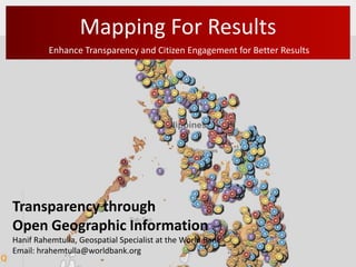
- 1. Mapping For Results Enhance Transparency and Citizen Engagement for Better Results Transparency through Open Geographic Information Hanif Rahemtulla, Geospatial Specialist at the World Bank Email: hrahemtulla@worldbank.org
- 2. The Importance of Geography Open geospatial data is critical to making effective use of public sector information - everything happens somewhere; to find data, and analyse it, location is invaluable context (Rahemtulla, 2009, 2012).
- 3. The Geography of Language Diversity
- 4. Opening Our Minds by Opening Our Eyes
- 6. Mapping for Results Initiative Key Objectives of the Initiative Incorporating geography to visualizes the sub-national location of World Bank projects to: • better monitor impact on people; • improve aid effectiveness and coordination; • enhance transparency and social accountability; and • enable citizens and other stakeholders to provide direct feedback on project results.
- 7. All Bank-financed projects are mapped • More than 30,000 locations mapped for over 2,500 active Bank projects • For all 143 IBRD and IDA countries • Indicator data on infant mortality, maternal health, malnutrition for 43 countries; • Sub-national poverty data for 30 countries • Population density data for 107 countries
- 8. How to find a country map? Number of locations of Bank projects Number of Bank projects Choose Country maps.worldbank.org
- 9. Overview of all projects by sector ? Choose view by sector 1. Select activities by count Pie chart shows investment in sector by volume 2. Clicking on a Bubble provides the number of The symbol/color project per indicates the largest district sector by location
- 10. Select by Specific Sectors? maps.worldbank.org
- 11. Are projects located in areas with highest poverty? Select poverty as base map The darker the background the higher the poverty maps.worldbank.org
- 12. Better Targeting of Projects Select by Sector: Water and Health Select infant mortality as base map maps.worldbank.org
- 13. Are you interested in a certain project? Choose a project … … and locations are highlighted on the map
- 14. Map Data: Download & Share Download Data & Share Map maps.worldbank.org/sa/nepal
- 15. Geo-enabling WB: Is Only the First Step!
- 16. The Road Ahead: Local Geography Informs Project Implementation Nepal – Poverty Alleviation Fund Targets Development Intervention Global Agricultural Food Security Project (GAFSP) Effectively Communicates Gaps and Overlaps Open Aid Partnership Identifies Strengths and Weaknesses OnTrack – Citizen Engagement & Participation
- 17. Local Geography: Informs Project Implementation
- 18. Local Geography: Informs Project Implementation Data available Number of districts 75 Total observations 4,161 Health center Mapping location at VDC Source Bert Mismatched 62 VDCs
- 19. Local Geography: Informs Project Implementation
- 20. Local Geography: Identify Gaps and Overlaps 27 Donors AFDB, AusAid, BADEA, Canada, CDC, DFID, EU, FAO, FICA, GTZ, ICEIDA, IFAD, Ireland, Japan, JICA, KFW, Kuwait Fund, Norway, OPEU Fund, People’s Republic of China, UNDP, UNESCO, UNHCR, UNIDO, USAID, WFP, World Bank
- 21. Improve Aid Transparency and Coordination
- 22. Open Aid Partnership Foundation Center/World Bank: IATI Collaborative Mapping & Data Sharing
- 23. More Social & Interactive: Geostories
- 24. Indonesia: PNPM Citizen Feedback Pilot
- 25. OnTrack: A Hybrid Citizen Feedback Pilot
- 26. Geo-Enabling the World Bank Where do we stand? Reporting on Geographic Location Mandatory First Administrative Level Priority Geographic Platform for Reporting is Operational Transitioning to More Sustainable Reporting Methods Working Across the Bank Groups, Sectors, Operations etc. Collaborating with Other Donors PUSHING FOR MORE GEOGRAPHIC ACCOUNABILITY THE ROAD AHEAD
- 27. Open Data Knowledge Reports http://www.scribd.com/collections/3389411/Open- Development-Technology-Alliance
- 28. www.worldbank.org Hanif Rahemtulla, World Bank hrahemtulla@worldbank.org