A new paradigm for Development Economics?
•Download as PPTX, PDF•
0 likes•45 views

Presentation by Bjorn- Soren Gigler on Opening Up Development: Can Open Development enhance the effectiveness, responsiveness and inclusiveness of development programs.

Recommended
Recommended
More Related Content
Similar to A new paradigm for Development Economics?
Similar to A new paradigm for Development Economics? (20)
More from Soren Gigler
More from Soren Gigler (20)
Recently uploaded
Recently uploaded (20)
A new paradigm for Development Economics?
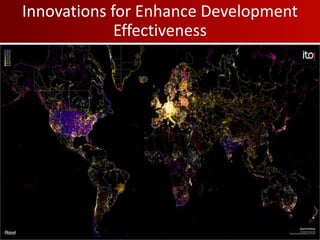
- 1. Innovations for Enhance Development Effectiveness
- 2. Mapping For Results Enhance Transparency and Citizen Engagement for Better Results Soren Gigler Innovation Practice World Bank Institute bgigler@worldbank.org
- 3. Poverty Reduction at the National Level
- 4. Achieving the MDGs- Geography Matters! Subnationally, high concentration of poverty in the west
- 6. Sub-national Poverty Trends are critical
- 7. Number of World Bank-Financed Projects
- 8. Crowdsourcing has changed disaster relief
- 9. Mapping for Results Results data: available for the first time Transparency: Access to Information and Open Data Technology: geo-coding, visualizations Leveraging Innovations for Enhanced Results
- 10. Main Objectives • Enhance Monitoring of Results: Better monitor, track and report results • Improve Transparency and Social Accountability: increase transparency through Open Data on aid flows and public service delivery • Establish Feedback Loop: Empower citizens and CSOs to provide direct feedback on project outcomes Increase Aid Transparency and Citizen Engagement for Better Results
- 11. National: Where do we target our projects?
- 12. Are health projects in areas with the highest infant mortality?
- 14. Project Level Approach Benefits - Target activities to regions with most need - Promote synergies between components (Electrification and Telecomms) - Verify that services were provided - Monitor project results and impact - Transparency and social accountability Bolivia: Decentralized Infrastructure for Rural Transformation Project
- 15. Local Open Data is Key Better targeting of schools based on needs
- 16. Challenges • Lack of Access to Data • Limited Resources and Budget • Small Core Team • Concerns about enhanced transparency
- 17. October 2010 Bolivia – Haiti – Philippines – Kenya
- 20. September 2011 All IBRD – IDA
- 21. Institutionalize across the WB Group Switch to map view to show the project locations on a map of Africa.
- 22. Results • Maps for all 143 IBRD and IDA countries developed • More than 30,000 project locations mapped combined with sub-national MDG indictors (poverty, infant mortality, malnutrition) • Visualized geographic locations for 2,500 active Bank projects • Institutionalized Geo-coding of all WB operations • Open Aid Pilots for Malawi and Nepal
- 23. Poverty and WB projects WB and USAID projects Public Expenditures Feedback Loop Nepal Country Platform Pilot
- 25. More Local: Nepal Health Centers Data available Number of districts 75 Total observations 4,161 Mapping Health center location at VDC Source Bert Mismatched 62 VDCs
- 26. Open Aid Partnership • Open Aid Map to show locations of donor activities • Country Platforms for open geographic data of public service delivery • Citizen Feedback • Capacity Building for civil society and citizens
Editor's Notes
- Poverty Trend from 1992- 2001 Unsatisfied Basic Needs
- Ushahidi –Crisis map of Haiti Mapping the majority of the reports submitted to Ushahidi in near real-time. The volunteers then identify GPS coordinates for the reports and geo-tag the reports on the Ushahidi map. Each report is first read at least once by Situation Room before being published on the map.
- Sector level
- Community-level
- 79 countries (IDA+China+Philippines)
- 144 countries (ID+IBRD) More than 30,000 locations mapped for over 2,500 active Bank projects Indicator data on infant mortality, maternal health, malnutrition for 43 countries; Sub-national poverty data for 30 countries Population density data for 107 countries
- Integrated into the ISR > Results section
- All Bank-financed projects are mapped