Download to read offline

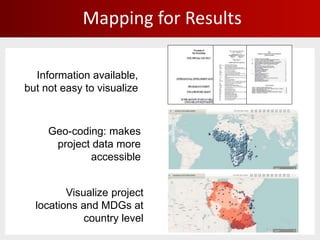


This document discusses mapping World Bank projects and development indicators at sub-national levels to enhance transparency, citizen engagement, and monitoring of results. It aims to visualize whether health projects target areas with high infant mortality and establish a feedback loop. So far, over 30,000 project locations have been mapped and 2,500 active projects geocoded. Challenges include institutional culture change and limited sub-national data. The goals are to institutionalize geocoding across the World Bank and ensure long-term sustainability.