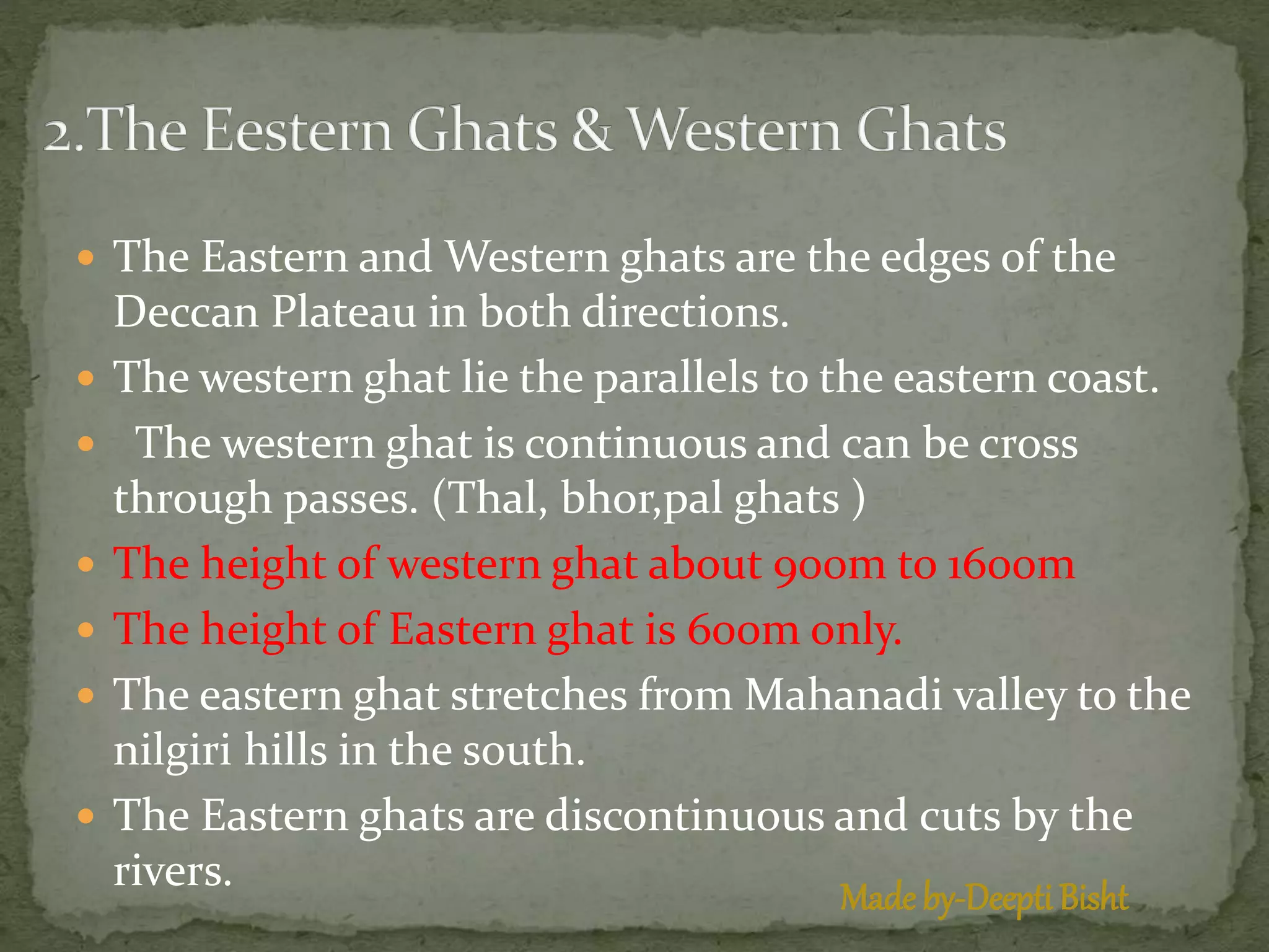
The Andaman and Nicobar Islands are an Indian union territory located in the Bay of Bengal. The islands comprise two main island groups - the Andaman Islands and the Nicobar Islands. The earliest inhabitants were the indigenous Andamanese people, who have lived isolated on the islands for over 2,200 years. During colonial times, the islands were controlled by Denmark, Britain, Japan, and the Azad Hind government. After Indian independence in 1947, the islands became a union territory of India.
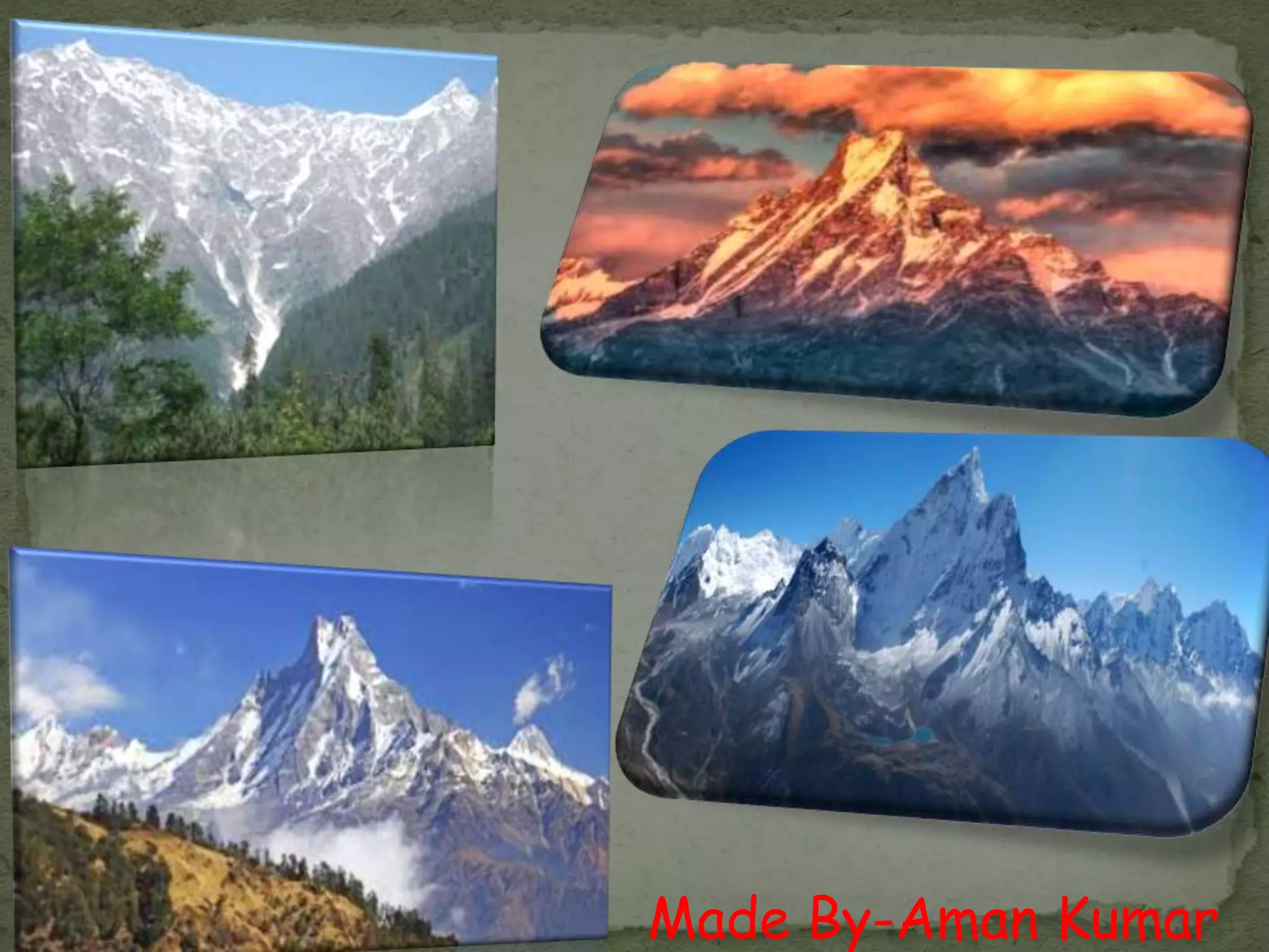
The Himalayas Mountain Range - Breathtaking BeautyUtsav Patel
This presentation is on the Himalayas mountain range. It includes its beauty, its wonder, its wildlife, its people, its greatness, everything within it is beautiful. I love the Himalayas. This was my first ever non-technical presentation.
Means of Transportations
Roadways
Golden Quadrilateral Super Highways
• National Highways
State Highways:
District Roads
Other Roads
Border Road
Railways
Pipelines
Waterways
Major Sea Ports
Airways
Communication
International Trade
Tourism as a Trade
Chapter - 2, Physical Features of India, Geography, Social Science, Class 9Shivam Parmar
I have expertise in making educational and other PPTs. Email me for more PPTs at a very reasonable price that perfectly fits in your budget.
Email: parmarshivam105@gmail.com
Chapter - 2, Physical Features of India, Geography, Social Science, Class 9
INTRODUCTION
THEORY OF PLATE TECTONICS
THE HIMALAYAN MOUNTAINS
1. HIMADRI
2. HIMACHAL
3. SHIVALIK
DIVISION OF HIMALAYAS FROM WEST TO EAST
THE NORTHERN PLAIN
THE INDIAN DESERT
THE ISLAND GROUP
Every topic of this chapter is well written concisely and visuals will help you in understanding and imagining the practicality of all the topics.
By Shivam Parmar (PPT Designer)
SLIDE 1- FORMATION OF INDIAN LANDFORMS
SLIDE 2 – THE PENINSULAR PLATEAU
SLIDE 3 – INRTRODUCTION
SLIDE 4 – DIVISIONS OF PENINSULAR PLATEAU
SLIDE 5 – THE DECCAN PLATEAU
SLIDE 6 – THE DECCAN TRAPS
SLIDE 7- THE CENTAL HIGHGHLANDS
SLIDE 8- THE CENTAL HIGHGHLANDS WILDLIFE
SLIDE 9- THE NORTHEREN PLAINS {2ND{ SUB TOPIC}
SLIDE 10 – HOW ARE NORTHEREN PLAINS FORMED
SLIDE 11 – SOME PICS
SLIDE 12- DOMINATING RIVERS
SLIDE 13- HOW THE PLAINS ARE DIVIDED?
SLIDE 14- WHERE ARE NORTHEREN PLAINS LOCATED ?
SLIDE 15- FORMATION OF HIMLAYAS { 3RD SUB TOPIC}
SLIDE 16- HOW WERE HIMALAYAS FORMED?
SLIDE 17- SOME PICS
SLIDE 18- DO YOU WANT TO KNOW MORE ABOUT HIMALAYAS?
SLIDE 19- FORMATION OF HIMALAYAS VIDEO
SLIDE 20 – THANK YOU
The Cherry Blossom season in Hunza begins in the second week of March and lasts until the end of April, varying with altitude. During this enchanting period, tourists from around the world flock to Hunza Valley to witness its transformation into a vibrant tapestry of white, pink, and green. The valley comes alive with cherry blossoms, creating a picturesque and mesmerizing landscape that captivates visitors.
About the Company:
The Cherry Blossom season in Hunza starts in the second week of March and extends until the end of April, depending on the altitude. During this enchanting period, tourists from around the globe travel to Hunza Valley to witness its transformation into a vibrant tapestry of white, pink, and green. The valley comes alive with cherry blossoms, creating a picturesque and mesmerizing landscape that captivates all who visit. For the best experience, join Hunza Adventure Tours, the top tour company in Pakistan, and immerse yourself in this breathtaking seasonal spectacle.
4 DAYS MASAI MARA WILDEBEEST MIGRATION SAFARI TOUR PACKAGE KENYABush Troop Safari
Join our 4-day Masai Mara Wildebeest Migration Safari in Kenya. Witness the incredible wildebeest migration, enjoy exciting game drives, and stay in comfortable lodges. Get up close and personal with one of nature's most amazing exhibits! Book Your Safari Today at - https://bushtroop-safaris.com/
How To Talk To a Live Person at American Airlinesflyn goo
This page by FlynGoo can become your ultimate guide to connecting with a live person at American Airlines. Have you ever felt lost in the automated maze of customer service menus? FlynGoo is here to rescue you from endless phone trees and automated responses. With just a click or a call to a specific number, we ensure you get the human touch you deserve. No more frustration, no more waiting on hold - we simplify the process, making your travel experience smoother and more enjoyable.
LUXURY TRAVEL THE ULTIMATE TOKYO EXPERIENCE FROM SINGAPORE.pdfDiper Tour
Get off on the most luxurious Tokyo itinerary from Singapore. Experience Tokyo’s sophisticated modernism and rich tradition with first-class travel, sumptuous lodging, fine food, and special tours. Savor the finest that this energetic city has to offer for an experience that will never be forgotten.
London Country Tours, the foremost travel partner offers customized Stonehenge tours from London coming with private tour guides and direct access to the inner circles. Visit: https://www.londoncountrytours.co.uk/tour/tours-to-stonehenge-oxford/
Exploring Montreal's Artistic Heritage Top Art Galleries and Museums to VisitSpade & Palacio Tours
Montreal boasts a vibrant artistic heritage, showcased in its top art galleries and museums. From the expansive collections at the Montreal Museum of Fine Arts to the cutting-edge exhibits at the Musée d'art contemporain, discover the city's rich cultural landscape. Experience dynamic street art, indigenous works, and contemporary pieces, reflecting Montreal's diverse and innovative art scene.
Its running cost is among the diverse vital aspects you must consider before buying an electric scooter. Calculate the cost of getting e-scooter charge for your regular usage to calculate its economic efficiency, similar to people who investigate the mileage of petrol or diesel-driven scooters.
During the coldest months, Italy transforms into a winter wonderland, providing visitors with a very unique experience. From the Settimana Bianca ski event to the lively Carnevale celebrations, Italy's winter festivities provide something for everyone. Enjoy hot cocoa, eat hearty comfort foods, and buy during winter deals. Explore the country's rich cultural past by participating in Settimana Bianca, and Carnevale, sipping hot chocolate, shopping during winter deals, and indulging in winter comfort foods. Visit our website https://timeforsicily.com/ for more information.
BTW UK Visa Application Process, Uk Visa complete guide, Uk Visa fees, requirements and application process. Know all about uk visa and best way to apply for the uk visa. Get to know about the requirements that allows you for the faster visa appliaction. BTW UK Visa Application Process, Uk Visa complete guide, Uk Visa fees, requirements and application process. Know all about uk visa and best way to apply for the uk visa. Get to know about the requirements that allows you for the faster visa appliaction. BTW UK Visa Application Process, Uk Visa complete guide, Uk Visa fees, requirements and application process. Know all about uk visa and best way to apply for the uk visa. Get to know about the requirements that allows you for the faster visa appliaction. BTW UK Visa Application Process, Uk Visa complete guide, Uk Visa fees, requirements and application process. Know all about uk visa and best way to apply for the uk visa. Get to know about the requirements that allows you for the faster visa appliaction. BTW UK Visa Application Process, Uk Visa complete guide, Uk Visa fees, requirements and application process. Know all about uk visa and best way to apply for the uk visa. Get to know about the requirements that allows you for the faster visa appliaction. BTW UK Visa Application Process, Uk Visa complete guide, Uk Visa fees, requirements and application process. Know all about uk visa and best way to apply for the uk visa. Get to know about the requirements that allows you for the faster visa appliaction. BTW UK Visa Application Process, Uk Visa complete guide, Uk Visa fees, requirements and application process. Know all about uk visa and best way to apply for the uk visa. Get to know about the requirements that allows you for the faster visa appliaction. BTW UK Visa Application Process, Uk Visa complete guide, Uk Visa fees, requirements and application process. Know all about uk visa and best way to apply for the uk visa. Get to know about the requirements that allows you for the faster visa appliaction. Get information in this PDF and simplyfy your visa process.
MC INTERNATIONALS | TRAVEL COMPANY IN JHANGAshBhatt4
Experience the world with MC Internationals travel and tourism. From foreign getways to cultural concentration, we tailor unforgettable journeys for every traveler. Let us turn your dream into reality and create lasting memories. Explore with us today. #TRAVEL,COMPANY #BEST,TRAVEL,COMPANY #VISIT,VISA #EMPLOYMENT,VISA #STUDY,VISA #HAJJ,AND,UMRAH
Discover Palmer, Puerto Rico, through an immersive cultural tour that unveils its rich history and vibrant traditions. Experience lively festivals, savor authentic cuisine, and explore local markets. Visit historical landmarks, museums, and stunning colonial architecture. Engage with friendly locals, enjoy live music, and hike scenic nature trails, all while participating in cultural workshops and discovering unique artisan crafts.
The Power of a Glamping Go-To-Market Accelerator Plan.pptxRezStream
Unlock the secrets to success with our comprehensive 8-Step Glamping Accelerator Go-To-Market Plan! Watch our FREE webinar, where you'll receive expert guidance and invaluable insights on every aspect of launching and growing your glamping business.
How To Change Name On Volaris Ticket.pdfnamechange763
How to change name on Volaris ticket? This is one of the most common questions asked by travelers flying with Volaris Airlines. The mentioned details can help you with your name rectification on the airline ticket. If you are still facing difficulties call the consolidation desk at +1-800-865-1848.
Antarctica- Icy wilderness of extremes and wondertahreemzahra82
In this presentation, we delve into the captivating realm of Antarctica, Earth's southernmost continent. This icy wilderness stands as a testament to extremes, with record-breaking cold temperatures and vast expanses of pristine ice. Antarctica's landscape is dominated by towering glaciers, colossal icebergs, and expansive ice shelves. Yet, amidst this frozen expanse, a rich tapestry of unique wildlife thrives, including penguins, seals, and seabirds, all finely attuned to survive in this harsh environment. Beyond its natural wonders, Antarctica also serves as a vital hub for scientific exploration, providing invaluable insights into climate change and the Earth's history
Discover the wonders of the Wenatchee River with a variety of river tours in Monitor, WA. Whether you're seeking thrilling whitewater rafting, peaceful kayaking, family-friendly float trips, or scenic sunset cruises, there's something for everyone. Enjoy fishing, wildlife spotting, bird watching, and more in this beautiful natural setting, perfect for outdoor enthusiasts and families alike.
3. 1.Vishesh Punia(Island Groups Of India)
2. Aman Kumar(Himalayas)
3.Tushar Rawat(Northern Plains)
4.Tarun Phogat(Costal Plains)
5. Deepti(Peninsular Pleatue)
6. Shaweta(Desert)
4. Himalayas
The Himalayas, or Himalaya is
a mountain range in South Asia which
separates the Indo-Gangetic Plain from
the Tibetan Plateau. This range is home
to nine of the ten highest peaks on Earth,
including the highest, Mount Everest. The
Himalayas have profoundly shaped the
cultures of South Asia. Many Himalayan
peaks are sacred in
both Buddhism and Hinduism.
5. The Himalayas are bordered on the north by the Tibetan Plateau, on the south by
the Indo-Gangetic Plain, on the northwest by the Karakoram and Hindu
Kushranges, and on the east by the Indian states of Assam and Arunachal
Pradesh. The western anchor of the Himalayas — Nanga Parbat — lies just south
of the northernmost bend of the Indus River, while the eastern anchor — Namcha
Barwa — is situated just west of the great bend of the Yarlung Tsangpo River. The
Himalayas span five countries: India, Nepal, Bhutan, China (Tibet), and Pakistan,
with the first three countries having sovereignty over most of the range.
Lifted by the collision of the Indian tectonic plate with the Eurasian Plate, the
Himalayan range runs northwest to southeast in a 2,400 kilometres (1,500 mi) long
arc. The range varies in width from 400 kilometres (250 mi) in the west to 150
kilometres (93 mi) in the east. Besides the Greater Himalayas, there are several
parallel lower ranges. The southernmost of these, located along the northern edge
of the Indian plains and reaching about a thousand meters in altitude, are called
the Sivalik Hills. Further north is a higher range, reaching two to three thousand
meters, known as the Lower Himalayan Range.
Three of the world's major rivers — the Indus, the Ganges and the Brahmaputra —
arise in the Himalayas. While the Indus and the Brahmaputra rise near Mount
Kailash in Tibet, the Ganges rises in the Indian state of Uttarakhand. Their
combined drainage basin is home to some 600 million people.
6. ecology
Main article: Ecology of the Himalaya
The flora and fauna of the Himalayas vary with climate, rainfall,
altitude, and soils. The climate ranges from tropical at the base of
the mountains to permanent ice and snow at the highest elevations.
The amount of yearly rainfall increases from west to east along the
southern front of the range. This diversity of altitude, rainfall and soil
conditions combined with the very high snow line supports a variety
of distinct plant and animal communities. For example the extremes
of high altitude (low atmospheric pressure) combined with extreme
cold allow extremophile organisms to survive.
The unique floral and faunal wealth of the Himalayas is undergoing
structural and compositional changes due to climate change. The
increase in temperature may shift various species to higher
elevations. The oak forest is being invaded by pine forests in the
Garhwal Himalayan region. There are reports of early flowering and
fruiting in some tree species, especially rhododendron, apple
and box myrtle. The highest known tree species in the Himalayas
is Juniperus tibetica located at 4,900 metres (16,080 ft) in
Southeastern Tibet.
9. The Himalaya are among the youngest mountain ranges on the planet
and consist mostly of uplifted sedimentary and metamorphic rock.
According to the modern theory ofplate tectonics, their formation is a
result of a continental collision or orogeny along the convergent
boundary between the Indo-Australian Plate and the Eurasian Plate.
TheArakanYoma highlands in Myanmar and the Andaman and Nicobar
Islands in the Bay of Bengal were also formed as a result of this collision.
During the Upper Cretaceous, about 70 million years ago, the north-
moving Indo-Australian plate (which has subsequently broken into
the Indian Plate and the Australian plate) was moving at about 15 cm per
year. About 50 million years ago this fast moving Indo-Australian plate
had completely closed theTethys Ocean, the existence of which has
been determined by sedimentary rocks settled on the ocean floor, and
the volcanoes that fringed its edges. Since both plates were composed
of low density continental crust, they were thrust faulted and folded into
mountain ranges rather than subducting into the mantle along
an oceanic trench. An often-cited fact used to illustrate this process is
that the summit of Mount Everest is made of marine limestone from this
ancient ocean.
10. Today, the Indian plate continues to be driven horizontally below the
Tibetan Plateau, which forces the plateau to continue to move upwards.
The Indian plate is still moving at 67 mm per year, and over the next 10
million years it will travel about 1,500 km into Asia. About 20 mm per year of
the India-Asia convergence is absorbed by thrusting along the Himalaya
southern front.This leads to the Himalayas rising by about 5 mm per year,
making them geologically active.The movement of the Indian plate into the
Asian plate also makes this region seismically active, leading to earthquakes
from time to time.
During the last ice age, there was a connected ice stream
of glaciers between Kangchenjunga in the east and Nanga Parbat in the
west. In the west, the glaciers joined with the ice stream network in
the Karakoram, and in the north, joined with the formerTibetan inland ice.
To the south, outflow glaciers came to an end below an elevation of 1,000–
2,000 metres (3,300–6,600 ft).While the current valley glaciers of the
Himalaya reach at most 20 to 32 kilometres (12 to 20 mi) in length, several
of the main valley glaciers were 60 to 112 kilometres (37 to 70 mi) long
during the ice age.The glacier snowline (the altitude where accumulation
and ablation of a glacier are balanced) was about 1,400–1,660 metres
(4,590–5,450 ft) lower than it is today.Thus, the climate was at least 7.0 to
8.3 °C (12.6 to 14.9 °F) colder than it is today.
12. The Himalayas have the third largest deposit of ice and
snow in the world, after Antarctica and the Arctic.[12] The
Himalayan range encompasses about 15,000 glaciers,
which store about 12,000 km3 (3,000 cubic miles) of
fresh water.[13] Its glaciers include
the Gangotri and Yamunotri (Uttarakhand)
and Khumbu glaciers (Mount
Everest region),Langtang glacier (Langtang region)
and Zemu (Sikkim).
Owing to the mountains' latitude near the Tropic of
Cancer, the permanent snow line is among the highest
in the world at typically around 5,500 metres
(18,000 ft).[14] In contrast, equatorial mountains in New
Guinea, the Rwenzoris and Colombia have a snow line
some 900 metres (2,950 ft) lower.[15] The higher regions
of the Himalayas are snowbound throughout the year, in
spite of their proximity to the tropics, and they form the
sources of several large perennial rivers, most of which
combine into two large river systems:
13. The western rivers combine into the Indus Basin, of
which the Indus River is the largest. The Indus begins in
Tibet at the confluence of Sengge and Gar rivers and
flows southwest through India and then through
Pakistan to the Arabian Sea. It is fed by the Jhelum,
the Chenab, the Ravi, the Beas, and the Sutlej rivers,
among others.
Most of the other Himalayan rivers drain the Ganges-
Brahmaputra Basin. Its main rivers are the Ganges,
the Brahmaputra and the Yamuna, as well as other
tributaries. The Brahmaputra originates as the Yarlung
Tsangpo River in western Tibet, and flows east through
Tibet and west through the plains of Assam. The
Ganges and the Brahmaputra meet in Bangladesh, and
drain into the Bay of Bengal through the world's
largest river delta,the Sunderbans.
14. The easternmost Himalayan rivers feed the Ayeyarwady River,
which originates in eastern Tibet and flows south through
Myanmar to drain into the Andaman Sea.
The Salween, Mekong, Yangtze and Huang He (Yellow River)
all originate from parts of the Tibetan Plateau that are
geologically distinct from the Himalaya mountains, and are
therefore not considered true Himalayan rivers. Some
geologists refer to all the rivers collectively as the circum-
Himalayan rivers. In recent years, scientists have monitored a
notable increase in the rate of glacier retreat across the region
as a result of global climate change. For example, Glacial lakes
have been forming rapidly on the surface of the debris-covered
glaciers in the Bhutan Himalaya during the last few decades.
Although the effect of this will not be known for many years, it
potentially could mean disaster for the hundreds of millions of
people who rely on the glaciers to feed the rivers of northern
India during the dry seasons.
16. The Himalayan region is dotted with hundreds of lakes. Most lakes
are found at altitudes of less than 5,000 m, with the size of the lakes
diminishing with altitude. Tilicho Lake in Nepal in the Annapurna
massif is one of the highest lakes in the world. Pangong Tso, which
is spread across the border between India and China, and Yamdrok
Tso, located in central Tibet, are amongst the largest with surface
areas of 700 km², and 638 km², respectively. Other notable lakes
include She-Phoksundo Lake in the Shey Phoksundo National
Park of Nepal, Gurudongmar Lake, in North Sikkim, Gokyo
Lakes in Solukhumbu district of Nepal and Lake Tsongmo, near the
Indo-China border in Sikkim.
Some of the lakes present a danger of a glacial lake outburst flood.
The Tsho Rolpa glacier lake in the Rowaling Valley, in the Dolakha
District of Nepal, is rated as the most dangerous. The lake, which is
located at an altitude of 4,580 metres (15,030 ft) has grown
considerably over the last 50 years due to glacial melting.
The mountain lakes are known to geographers as tarns if they are
caused by glacial activity. Tarns are found mostly in the upper
reaches of the Himalaya, above 5,500 metres.
17. Impact on climate
The Himalayas have a profound effect on the climate of
the Indian subcontinent and theTibetan Plateau.They
prevent frigid, dry winds from blowing south into the
subcontinent, which keeps South Asia much warmer
than corresponding temperate regions in the other
continents. It also forms a barrier for
the monsoon winds, keeping them from traveling
northwards, and causing heavy rainfall in
theTerai region.The Himalayas are also believed to play
an important part in the formation of Central Asian
deserts, such as theTaklamakan and Gobi.
19. The Taktsang Monastery, also known as the "Tiger's Nest"
In Hinduism, the Himalayas have been personified as the
god Himavat, father of Ganga and Parvati.
Several places in the Himalayas are of religious significance
in Buddhism, Hinduism, Jainism and Sikhism. A notable
example of a religious site is Paro Taktsang,
wherePadmasambhava is said to have founded Buddhism in
Bhutan.
A number of Tibetan Buddhist sites are situated in the
Himalayas, including the residence of the Dalai Lama.
There were over 6,000 monasteries in Tibet. The Tibetan
Muslims had their own mosques in Lhasa and Shigatse.
24. The Andaman and Nicobar Islands are a group of islands at
the juncture of the Bay of Bengal and Andaman Sea, and
are a Union Territory of India .The territory is 150 km
(93 mi) north of Aceh in Indonesia and separated
from Thailand and Myanmar by the Andaman Sea. It
comprises two island groups, the Andaman Islands and
the Nicobar Islands, separated by the 10°N parallel, with
the Andaman's to the north of this latitude, and the
Microbars to the south. The Andaman Sea lies to the east
and the Bay of Bengal to the west
25. First inhabitant:
The earliest archaeological evidence yet documented goes back some
2,200 years. However, genetic and cultural studies suggest that the
indigenous Andamanese people may have been isolated from other
populations since the Middle Paleolithic. In that time, the Andamanese
have diversified into distinct linguistic, cultural and territorial groups.
The Nicobar Islands appear to have been populated by people of
various backgrounds. At the time of the European contact, the
indigenous inhabitants were the Nicobarese people, speaking a Mon-
Khmer language; and the Shompen, whose language is of uncertain
affiliation. Both are unrelated to the Andamanese.
Pre-colonial era:
Rajendra Chola I (1014 to 1042 CE), one of the
Tamil Choladynasty kings, conquered the Andaman and Nicobar
Islands to use them as a strategic naval base to launch a naval
expedition against the Sriwijaya Empire (a Hindu empire based on
the island of Sumatra, Indonesia). They called the
islands Tinmaittivu ("impure islands" in Tamil)
26. Colonial period:
The history of organized European colonisation on the islands began
when the Danish settlers of the Danish East India Company arrived in the
Nicobar Islands on 12 December 1755. On 1 January 1756, the Nicobar
Islands were made a Danish colony, first named New Denmark, and later
(December 1756) Frederick's Islands . During 1754–1756 they were
administrated from Tranquebar (in continental Danish India). The islands
were repeatedly abandoned due to outbreaks of malaria between 14
April 1759 and 19 August 1768, from 1787 to 1807/05, 1814 to 1831, 1830
to 1834 and gradually from 1848 for good.
From 1 June 1778 to 1784, Austria mistakenly assumed that Denmark had
abandoned its claims to the Nicobar Islands and attempted to establish a
colony on them,renaming them Theresia Islands. In 1789 the British set
up a naval base and penal colony on Chatham Island next to Great
Andaman, where now lies the town of Port Blair. Two years later the
colony was moved to Port Cornwallis on Great Andaman, but it was
abandoned in 1796 due to disease.
Denmark's presence in the territory ended formally on 16 October 1868
when it sold the rights to the Nicobar Islands to Britain, which made
them part of British Indiaian1869.
27. WORLD WAR II:
During World War II, the islands were practically under Japanese
control, only nominally under the authority of the Arzi Hukumate Azad
Hind of Netaji Subhas Chandra Bose. Bose visited the islands during the
war, and renamed them as "Shaheed-dweep" (Martyr Island) and
"Swaraj-dweep" (Self-rule Island).
General Loganathan, of the Indian National Army was made the
Governor of the Andaman and Nicobar Islands. On 22 February 1944 he
along with four INA officers — Major Mansoor Ali Alvi, Sub. Lt. Md.
Iqbal, Lt. Suba Singh and stenographer Srinivasan—arrived at Lambaline
Airport in Port Blair. On 21 March 1944 the Headquarters of the Civil
Administration was established near the Gurudwara at Aberdeen
Bazaar. On 2 October 1944, Col. Loganathan handed over the charge to
Maj. Alvi and left Port Blair, never to return. The islands were
reoccupied by British and Indian troops of the 116th Indian Infantry
Brigade on 7 October 1945, to whom the remaining Japanese garrison
surrendered.
28. Indian Territory:
During the independence of both India and Burma , the departing British
announced their intention to resettle all Anglo-Indians and Anglo-Burmese on
these islands to form their own nation, although this never materialized. It
became part of the Indian country in 1950 and was also declared as a union
territory in 1956.India has been developing defence facilities on the islands
since the 1980s.The islands now have a key position in India's strategic role
in the Bay of Bengal and the Malacca Strait.
The 2004 Tsunami:
On 26 December 2004 the coasts of the Andaman and Nicobar Islands were
devastated by a 10 m (33 ft) high tsunami following the 2004 Indian Ocean
earthquake. More than 2,000 people lost their lives, more than 4,000
children were orphaned or suffered the loss of one parent, and a minimum of
40,000 people were rendered homeless. The worst affected Nicobar islands
were Katchal and Indira Point; the latter subsided 4.25 metres and was
partially submerged in the ocean. The lighthouse at Indira Point was
damaged but has been repaired since then. The territory lost a large amount
of area which is now submerged. The territory which was at
8,073 km2 (3,117 sq mi) is now merely at 7,950 km2 (3,070 sq mi).
While newer settlers of the islands suffered the greatest casualties from the
tsunami, most of the aboriginal people survived because oral traditions
passed down from generations ago warned them to evacuate from large
waves that follow large earthquakes
29. GEOGRAPHY:
There are 572 islands in the territory having an area of
8,073 km2 (3,117 sq mi). Of these, about 34 are permanently inhabited. The
islands extend from 6° to 14° North latitudes and from 92° to 94° East
longitudes. The Andamans are separated from the Nicobar group by a
channel (the Ten Degree Channel) some 150 km (93 mi) wide. The highest
point is located in North Andaman Island (Saddle Peak at 732 m (2,402 ft)).
The Andaman group has 325 islands which cover an area of
6,170 km2 (2,382 sq mi) while the Nicobar group has only 24 islands with an
area of 1,765 km2 (681 sq mi).
The capital of the union territory, Port Blair, is located 1,255 km (780 mi)
from Kolkata, 1,200 km (750 mi) from Visakhapatnam and 1,190 km (740 mi)
from Chennai. The northernmost point of the Andaman and Nicobars group is
901 km (560 mi) away from the mouth of the Hooghly River and 190 km
(120 mi) from Burma. Indira Point at 6°45’10″N and 93°49’36″E at the
southern tip of the southernmost island, Great Nicobar, is the southernmost
point of India and lies only 150 km (93 mi) from Sumatra in Indonesia.
The Sentinelese population cannot be officially counted. They are
an uncontacted people and current government policy is not to attempt
contact. The population estimation is
30. ECONOMIC:
Industry:
There are 1,374 registered small-scale, village and handicrafts units. Two
units are export-oriented in the line of fish processing activity. Apart from
this, there are shell and wood based handicraft units. There are also four
medium-sized industrial units. SSI units are engaged in the production of
polythene bags, PVC conduit pipes and fittings, paints and varnished, fibre
glass and mini flour mills, soft drinks and beverages, etc. Small scale and
handicraft units are also engaged in shell crafts, bakery products, rice
milling, furniture making, etc.
Agriculture:
A total of 48,675 hectares (120,280 acres) of land is used for agriculture
purposes. Paddy, the main food crop, is mostly cultivated in Andaman group
of islands, whereas coconut and arecanut are the cash crops of Nicobar
group of islands. Field crops, namely pulses, oilseeds and vegetables are
grown, followed by paddy during Rabi season. Different kinds of fruits such
as mango, sapota, orange, banana, papaya, pineapple and root crops are
grown on hilly land owned by farmers. Spices such as pepper, clove ,nutmeg,
and cinnamon are grown under a multi-tier cropping system. Rubber, red
oil, palm, noni and cashew are grown on a limited scale in these islands.
31. TOURISM:
Andaman & Nicobar Islands are developing into a major Tourism hub with
its exotic looking beaches and pristine islands having equally exotic
names, wonderful opportunities for adventure sports like snorkeling and
sea-walking.In Port Blair, the main places to visit are Cellular Jail,
Mahatma Gandhi Marine National Park, Andaman Water sports complex,
Chatham Saw Mill, Mini Zoo, Corbyn's cove, Chidiya Tapu, Wandoor
Beach, Forest Museum, Anthropological Museum, Fisheries Museum,
Naval Museum (Samudrika), Ross Island and Viper Island. Other places
include Havelock island famous for Radhanagar Beach, Neil Island for
Scuba diving/snorkelling, Cinque island, Saddle peak, Mt Harriet and Mud
Volcano. The southern group(Nicobar islands) is mostly inaccessible to
tourists.
Indian tourists do not require a permit to visit the Andaman islands but if
they wish to visit any tribal areas they need a special permit from the
Deputy Commissioner, Port Blair. Permits are required for foreign
nationals. For foreign nationals arriving by air, these are granted upon
arrival at Port Blair.
According to official estimates, the flow of tourists doubled to nearly
300,000 in 2012 from 130,000 in 2008-09. The Radha Nagar beach of
Andamans was chosen as Asia’s best Beach in 2004.
32.
33. INTRODUCTION:
Lakshadweep formerly known as the Laccadive, Minicoy, and Aminidivi
Islands is a group of islands in the Laccadive Sea, 200 to 440 kilometres (120 to
270 mi) off the south western coast of India. The archipelago is a Union Territory and
is governed by the Union Government of India. They were also known as Laccadive
Islands, although geographically this is only the name of the central subgroup of the
group. Lakshadweep comes from "Lakshadweepa", which means "one hundred
thousand islands" in Sanskrit as well as many Indian languages like Telugu,
Malayalam, Tulu, Kannada, Hindi, Tamil and others The islands form the
smallest Union Territory of India: their total surface area is just 32 square kilometres
(12 sq mi).2 The lagoon area covers about 4,200 square kilometres (1,600 sq mi),
the territorial waters area 20,000 square kilometres (7,700 sq mi) and the exclusive
economic zone area 400,000 square kilometres (150,000 sq mi). The region forms a
single Indian district with ten sub divisions. Kavaratti serves as the capital of the
Union Territory and the region comes under the jurisdiction of Kerala High Court. The
islands are the northernmost of the Lakshadweep-Maldives-Chagos group of
islands, which are the tops of a vast undersea mountain range, the Chagos-
Laccadive Ridge. As the islands do not have any aboriginal groups, different views
have been postulated by the scholars about the history of habitation on these
islands. Archaeological evidence support the existence of human settlement in the
region around 1500 BC.
34. HISTORY:
Several views have been postulated about the history of the habitation of the
islands as they do not have any aboriginal groups. A mention of the region in the
Periplus of the Erythraean Sea, by an anonymous author, is one of the earliest
references. There are references to the control of the islands by the Cheras in
the Sangamliterature Pathitruppaththu. A Pallava inscription of 7th century AD
refers to the islands as Dveepa Laksham and lists them as part of the Pallava
domain. Local traditions and legends attribute the first settlement on these islands
to the period of Cheraman Perumal, the last Chera king of Kerala. The oldest
inhabited islands in the group are Amini, Kalpeni Andrott, Kavaratti and Agatti.
Archaeological evidence suggests that Buddhism prevailed in the region during
the 5th-6th century .According to popular tradition, Islam was brought to
Lakshadweep by an Arab named Ubaidulla in 661 CE. His grave is located in the
island of Andrott. During the 11th century, the islands came under the rule of the
Late Cholas. The region then came under the Kingdom of Cannanore.In the 16th
century the Portuguese ruled the seas between Ormuz and the Malabar Coast -
and down to Ceylon. As early as 1498 they took control of the archipelago (called
Laquedivas by them), later on to exploit coir production, until the islanders
expelled them in 1545. In the 17th century, the islands came under the rule of Ali
Rajahs/Arakkal Bheevi of Kannur, who received them as a gift from the Kolathiris.
The islands are also mentioned in great detail in the stories of the Arab
35. INDEPENDENT INDIA:
In 1956, during the reorganization of Indian states, the Lakshadweep
islands were organized into a separate union territory for administrative
purposes.
To safeguard India's vital shipping lanes to the Middle East, and the
growing relevance of the islands in security considerations, an Indian
Navy base, INS Dweeprakshak, was commissioned on Kavaratti island.
36. GEOGRAPHY:
Lakshadweep is an archipelago of twelve atolls, three reefs and five
submerged banks, with a total of about thirty-nine islands and islets. The reefs
are in fact also atolls, although mostly submerged, with only small unvegetated
sand cays above the high-water mark. The submerged banks are sunken atolls.
Almost all the atolls have a northeast-southwest orientation with the islands lying
on the eastern rim, and a mostly submerged reef on the western rim, enclosing a
lagoon. It has 10 inhabited islands, 17 uninhabited islands, attached islets, 4
newly formed islets and 5 submerged reefs.
The main islands are Kavaratti, Agatti, Minicoy, and Amini. The total population of
the territory is 60,595 according to the 2001 census. Agatti has an airport with
direct flights from Kochi.
India's Coral Islands:
The Aminidivi group of islands (consisting of Amini, Keltan, Chetlat, Kadamat,
Bitra and Perumal Par) and the Laccadive group of islands (comprising mainly
Androth, Kalpeni, Kavaratti, Pitti and Suheli Par), both have a submarine
connection between them. Together with Minicoy Island, located at the southern
end of the 200 km broad Nine Degree Channel, they form the Coral Islands of
India in the Arabian Sea. All these islands have been built up by corals and have
fringing coral reefs very close to their shores
37. Languages:
The principal languages of Lakshadweep are Malayalam, Jeseri (Dweep Bhasha)
and Mahl. The people of all the northern islands speak a dialect of Malayalam
with Tamil andArabic similar to Arwi influenced by extensive trade activities of these
people. The people of Minicoy, the southernmost atoll, speak Mahl, a variant of Divehi
language spoken in the Maldives.
Malayalam with Malayalam script was introduced as the official language of
Lakshadweep during the British raj. Previously a type of Arabic script (Arabi Malayalam)
was used for the language. The policy was continued by the Indian government.
Malayalam serves as a link language on the islands including on the Mahl dominated
Minicoy Island. The dances here include:-Lava Dance,Kolkali dance & Parichakli Dance.
Religion:
The inhabitants of Lakshadweep are known to practice different religious customs that
were once propounded by the Saint Ubaidullah who is believed to be the propagator of
Islam religion in Lakshadweep.There are several festivals that have originated in the
island of Lakshadweep to mark the eminence of Islam. Eid-Ul-Fitr, Muharram, Bakra Eid
and Milad-Un-Nabi are the prominent occasions when the people of the island gather in
various mosques to commemorate the holy sermons of the various prophets.Religion of
Lakshadweep is characterized by certain unusual festivals too that are found in the core
ethnic groups of the place. Moulood is one such religious event when the islanders offer
prayers to the divine power and eat in groups. The festival of Ratheeb is another
uncommon occasion which originated in the Kavaratti region of Lakshadweep. The
grave of Sheikh Kasim, one of the respected saints of Islam is praised during Ratheeb
by the people of the island to gather his holy blessings.The Sunni branch of Islam is the
38. ECONOMIC :
Lakshadweep's gross state domestic product for 2004 is estimated at US $ 60 million at
current prices. There is little economic inequality in Lakshadweep and the poverty index
is low. Coconut fibre extraction and production of fibre products is Lakshadweep's main
industry. There are five coir fibre factories, five production demonstration centres and
seven fibre curling units run by the government of India. These units produce coir fibre,
coir yarn, curled fibre and corridor mattings.
Fisheries:
Lakshadweep comprises the only coral atolls of the country. With a vast lagoon of
4,200 km2, it has territorial waters of 20,000 km2, Exclusive Economic Zone (EEZ) of
4,00,000 Lakhs km2 and coastal line of about 132 km. There is an estimation of about
one lakh tonnes of tuna and tuna like fishes and about an equal quantity of shark in the
sea around Lakshadweep. Fishing is the main livelihood of the islanders. Freshly caught
tuna is processed by drying it in the sun after cooking and smoking. The resultant
product, known as `mas`, are popular products exported from these islands to southeast
Asian countries. Eleven workshops in islands and two boat building yards cater to the
needs of fishermen. There are 375 boats in operation in Lakshadweep
39. Tourism:
Due to its isolation and scenic appeal, Lakshadweep was already known as a tourist
attraction for Indians since 1974. This brings in significant revenue, which is likely to
increase. Since such a small region cannot support industries, the government is
actively promoting tourism as a means of income in Bangaram and Kadmat islands.
Bangaram is projected as a major destination for international tourism. Marine fauna are
plentiful. Water sports activities such as scuba
diving, windsurfing, snorkelling,surfing, kayaking, canoeing, waterskiing, sportfishing,
yachting and night-voyages into the sea are quite popular activities among tourists.
Tourists flock to these islands throughout the year except during the South-west
monsoon months when seas are extremely rough
Desalination:
A low-temperature thermal desalination plant opened on Kavaratti in 2005, at a cost
of ₹50 million (€922,000). The experimental plant, which uses the temperature difference
between warm surface seawater and much colder seawater at 500m depth to generate
potable water as well as energy, was slated to produce 100,000 litres/day of potable
water from seawater. Production costs in 2005 were ₹220-250/m³ (€4.1-4.6/m³); the cost
was supposed to drop to ₹30-60/m³ (€0.55-1.11/m³) with increased capacity.The
technology was developed by the National Institute of Ocean Technology. It can be used
to produce drinking water and also for power generation and air conditioning. In addition,
the deep seawater contains extra nutrients for fish, an important source of food and
income for the local population. The government plans to set up desalination plants with
a capacity of 10 million litres/per day on all islands and coastal areas. In 2009, the NIOT
announced plans to build plants on Minicoy, Agatti and Andrott
40. Transport and Tourism:
Agatti Aerodrome on Agatti Island is the only airport in Lakshadweep. Air India Regional,
a subsidiary of the state-owned carrier, serves Agatti and flies to Kochi on the
mainland. Kingfisher Airlines, had flights connecting Kochi and Bangalore to Agatti
before the airline ceased operations. The other islands are linked by the Pawan Hans
helicopter or boat service. Six ships connect Kochi and Lakshadweep, they are M.V
Kavaratti, M.V Aminidivi, M.V Minicoy, M.V Arabian Sea, M.V Lakshadweep Sea and
M.V Bharath Seema. Tourists need a permit to visit the islands; foreign nationals are not
permitted to visit certain islands. According to the current alcohol laws of India, alcoholic
beverage consumption is not permitted in the Lakshadweep Archipelago except
on Bangaram Island.
Made By-VISHESH PUNIA
41. The Indian deserts The Indian Deserts lies
towards the western margins of the Aravali
hills . It is an undulating sandy plain covered
with sandunes this region receives very low
rainfall below 150 mm per year . It has arid
climate with low vegetation cover . Streams
appear during the rainy season .
42. Soon after they disappear into the sand as they do not
have enough water to reach the sea . Luni is the only
large river in this region . Barchans cover larger areas
but longitudinal dunes become more prominent near
the indo – Pakistan boundary .
Made by : SHWETA
43.
44. The Northern Fertile Plain lies to the south of Himalayan
Region. It is also called the Gangetic Plain. It is a vast plain and
level land between the Himalayas in the North and Deccan
Plateau in the South. From Punjab in the West to Assam in the
East, this plain is about 2400 km. long and its width varies from
150 km. in the East to about 300 km. in the West. It includes the
States of Punjab, Haryana, Uttar Pradesh, Bihar, West Bengal,
some parts of Assam and the Union Territory of Delhi.
The soil of this plain is built of the sediments brought down by
the rivers from Himalayas. Such plain is called an alluvial plain
and is very fertile. This plain is one of the largest and most fertile
plains of the World. It is the most thickly populated plain. This is
also the major crop growing area in India. This plain is drained
by Sutlej, Ganga, Brahmaputra and their tributaries. The slope
of this plain in the West is South-west and in the East is South-
east.
45. Three main rivers, the Sutlej, Ganga, Brahmaputra and their
tributaries flow through this plain. So this plain can be divided into
three parts namely : 1. The Sutlej Basin 2. The Ganga Basin and 3.
The Brahmaputra Basin. An area through which a river and its
tributaries flow is called its basin:
1. The Sutlej Basin :
The Sutlej Basin lies in the Western part of the Northern plain.
River Sutlej and its tributary Beas flows in this part. Beas joins
Sutlej at Harike before the Sutlej enters Pakistan. Two
important States of this basin are Punjab and Haryana. The
Union Territory of Chandigarh also falls in this basin. This part
does not get sufficient rain therefore wells, tube-wells and
canals are also used for irrigation. Wheat is the main crop of
Sutlej Basin. Other crops like rice, sugarcane, cotton, gram
and oil seeds are also produced in large quantity. Sutlej Basin
is a granary of the country which supplies wheat and rice to
other parts of the country.
46. 2. The Ganga Basin :
The Ganga Basin lies to the East of the Sutlej Basin. It is the
largest part of this fertile Northern Plain. Therefore, this plain is
also called Gangetic Plain. The States of Uttar Pradesh, Bihar,
West Bengal and the Union Territory of Delhi lie in the Ganga
Basin. The rivers Ganga, Yamuna and their tributaries flow
through this part. The Ganga rises in the Himalayas in the glacier
known as Gangotri. The Yamuna rises in a nearby glacier called
Yamunotri. Bhagirathi, Mandakini, Alaknanda and some other
streams join Ganga before it reaches Haridwar. It becomes quite a
big river and at Haridwar the Ganga enters the plains. Haridwar is
considered to be the most sacred place.
47. 3. The Brahmaputra Basin:
The Brahmaputra Basin is the Eastern-most part of- the fertile
Northern plain. The Brahmaputra rises in the Mansarovar lake in
Tibet, in Tibet it is known as Tsang-Po. It turns to the South and
enters India through the Eastern end of the Himalayas. Turning to
the West it enters the plain through long valley in Assam and then
the Brahmaputra turns to the South and enters Bangla Desh. Here
it joins Padma and ends in the Sunderbans delta. Brahmaputra
Basin is a narrow plain in the Assam State. This basin is
surrounded by hills and mountains on three sides. Khasi, Garo,
Jaintia and Naga Hills are on its Southern side.
48. Importance of the Northern Plain
This plain is very important to India in many ways:
1. This plain is made up of the alluvial soil brought down by the
rivers. This soil is very soft and fertile. Major crops such as wheat,
rice, sugarcane, pulses, oil seeds and jute are grown here. This
plain is the 'food bowl1 of India.
2. The land of this plain is soft, level and flat. Therefore wells,
tube-wells and canals can be dug for irrigation. Due to proper
irrigation it is the largest producer of food grains in India.
3. This plain gets sufficient rainfall. There are many rivers,
streams and lakes. There is also rich vegetation. These factors
affect the climate and make it tolerable. The climate of the
Northern Plain is very cold in winter and very hot in summer.
49. 4. This is one of the most thickly populated plain of the world. The
most thickly populated States of India — Uttar Pradesh and Bihar
lie in this plain.
5. This plain is very important for the economic development of
India. The land being even, the transportation and communication
is easy. This plain has a network of railways and roads. Some
important industries like iron and steel, jute, cement, sugar and
textile are spread evenly over the whole region.
TARUN PHOGAT
51. Further, there are numerous estuaries in the Indian Coastal Plains. Among
these, the major ones are Narmada River and Tapi River in the state of Gujarat.
The plain is also blessed with natural harbors such as Marmagao and Mumbai.
In the south, the coastal plains get combined with the salt water lakes also
known as lagoons. Spits and sand bars can be found at their mouths. The coast
is popular for the serene backwaters. The coastal plains alongside the Bay of
Bengal are very extensive and also differ from the plains in the western strip.
Fast flowing, small rivers cut part the rocky coastal strip.
Coastal plains of India are the waved platforms and the raised beaches above the
water mark. These are mainly the emerged floors from the seas that are adjacent
to the land. The Peninsular India plateau is bordered by the narrow Coastal Plains.
Following the surfacing of these lowlands, the sea level fluctuations have brought
some important changes in the surface features of the sea shores. The Deccan
plateau in India is also surrounded by the coastal plains in the west and the east.
The Coastal plains that surround the Palghat town in the southern region of Kerala
are comparatively broad. In some places the width of the plains get extended to
about 96km. The off-shore bars are enclosed with lagoons running parallel to the
coastal plains in the south of Kerala. Also referred as Kayals, the lagoons receive
water from numerous rivers, to which these are linked through narrow openings.
The coastal zone located in the western part alongside the Arabian Sea is known in
the south of Goa, as Malabar, while in the north of Goa, it is called Konkan.
52. That what separates the coastal plains in India from the interior is a large land of
mass characterized by unique features. Though having limited vegetation, yet the
coastal plains in India significantly contributes to the geography of the
country. Coastal plains of India: An Amazing Geologic Feature can be found both on
the eastern as well the western coasts of the country. Hence the Coastal Plains in
India can be divided into 2 basic types, namely, the Eastern Coastal Plains and
the Western Coastal Plains.
The Eastern Coastal Plains
Nestled within the Bay of Bengal and the Eastern Ghats, is the eastern coastal
plains, a wide stretch of land having a width of about 120km. The plains extend from
the state of Tamil Nadu in the southern part to the state of West Bengal in the northern
region of India. There are several rivers that drain the eastern coastal plains of India.
There are few river deltas as well that occupy these valleys.
These plains experience a temperature of over 30 degrees Celsius, characterized by
high humidity level. Abundant rainfall is received by this region that amounts in
between 1000mm to 3000mm annually. The plains are subject to southwest as well as
northeast monsoon rains.
The peninsulas of Kutch and Kathiawar, the Rann of Kutch, and the Gujarat Plain
serve as the important physiographic regions. Lying north of the Kutch is presently a
huge desolate plain that got formed by the deposition of silt. Kutch that lies on the
southern side of the Rann of Kutch was previously an island. Now it happens to be a
sandy terrain alongside the coastal plains. On the south of the Kutch is Kathiawar.
53. Western Coastal Plains
In contrast to the eastern coastal plains, the western coastal plain of India is
situated on a thin strip of land. The plains are nestled with the Arabian Sea and the
Western Ghats. Having a length of about 1,400 kilometer and a breadth of 10-80
kilometer, the western coastal plans cover an area of about 64,284 square
kilometer. Extending from the state of Gujarat, in the northern side to the south in
the state of Kerala, the western coastal plains are characterized by many rivers
and backwaters and rivers that drain into this area. The rivers that flow through
this region, results in the formation of many estuaries in the western coastal
plains.
Made by-TUSHAR RAWAT
57. It was formed due to the
breaking and drifting of
the Gondwana land.
Hence, it is a part of the
oldest landmass.
58. It is a tableland made up of the old crystalline, igneous
and metamorphic rocks.
The plateau has broad and shallow valleys and rounded
hills.
59. The Peninsular Plateau is flanked by the Aravallis on
the northwest, the Western Ghats in the west and the
dissected Eastern Ghats in the east.
60. Many rift valleys such as Narmada, Tapi, Mahanadi,
Godawari, and Damodar have been formed due to
faulting and vertical movements.
61. The Deccan Trap is famous for black
soils.
The Peninsular Plateau is rich in
valuable minerals such as
manganese, iron, mica, coal,
bauxite, gold and copper.
62. Divisions of the Peninsular Plateau
A)The Central Highlands B)The Deccan Plateau
1.The Malwa Plateau 1.The Deccan Trap
2.The Bundelkhand 2.The Western Ghats
3.The Baghelkhand 3.The Eastern Ghats
4.The Chotanagpur 4.The North – East plateau
extension
63. The northern part of the Peninsula, north of the
Vindhyas, is known as the Central Highlands.
64. The flow of the rivers of this region is from southwest
to northeast.
65. The Central Highlands are bounded by Aravali range on the
northwest, Ganga plains on the north and Vindhya range
on the south.
The Central Highlands are wider in the west but narrower
in the east.
66. Malwa Plateau, plateau region in north-central India.
It is bounded by the Madhya Bharat Plateau and
Bundelkhand Upland to the north, the Vindhya Range
to the east and south, and the Gujarat Plains to the
west. Of volcanic origin, the plateau comprises central
Madhya Pradesh state and southeastern Rajasthan
state. The name Malwa is derived from the Sanskrit
malav (part of the abode of Laksmi [goddess of
wealth]).
67. The Malwa Plateau ranges in elevation from about 1,650 to
2,000 feet (500 to 600 meters); erosion has carved the ancient
lava flows into isolated mesas found throughout the plateau,
together with an occasional sandstone hill. The western part of
the region is drained by the Mahi River, the middle section by
the Chambal River, and the eastern part by the Betwa River and
the headwaters of the Dhasan and Ken rivers. Other rivers
include the Parbati, Sipra, Gambhir, and Choti Kali Sindh, their
valleys flanked by terraced slopes. Vegetation is of the savanna
type with scattered teak and sal (Shorea robusta) forests.
68. Location: North east of Arrvalli ranges.
It is spread up to the great bend of the Ganges river.
Many important minerals such as iron, manganese ,
copper, lead, zinc, and gold.
69. Total area :127,700sq miles
The rest of the southern India is a signal plateau unit.
Height:900m in west &300m in east
It has slope south eastward. north western part
covered with lava .River Krishna and Penne flow
towards andhra .
Importance for minerals like
Coal,iron,Gold,manganese
70. The Eastern and Western ghats are the edges of the
Deccan Plateau in both directions.
The western ghat lie the parallels to the eastern coast.
The western ghat is continuous and can be cross
through passes. (Thal, bhor,pal ghats )
The height of western ghat about 900m to 1600m
The height of Eastern ghat is 600m only.
The eastern ghat stretches from Mahanadi valley to the
nilgiri hills in the south.
The Eastern ghats are discontinuous and cuts by the
rivers.
Made by-Deepti Bisht