Download to read offline


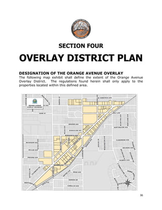

This document provides background information on the creation of the Orange Avenue Overlay District in Winter Park, Florida. It discusses the history of Orange Avenue and goals for revitalizing the area. These include encouraging mixed-use development, enhancing connectivity, and creating a walkable district that promotes arts, culture, and local businesses. The document outlines how an overlay district will modify zoning to achieve this vision. It also discusses how the overlay aligns with the community's Vision Winter Park plan and comprehensive plan goals around maintaining character, economic vitality, and a balanced transportation system.


