Download to read offline
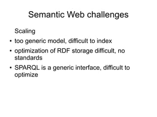
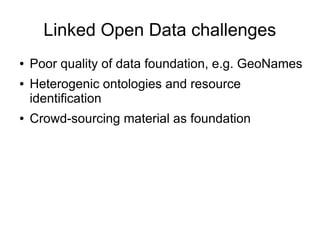
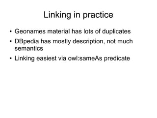
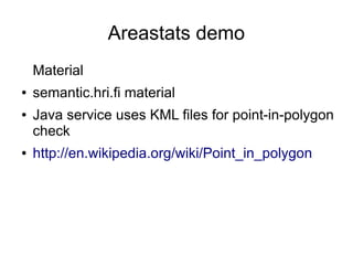
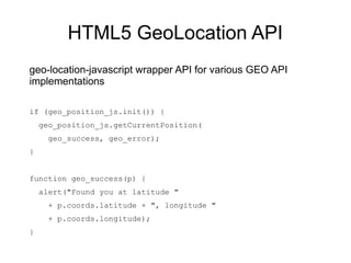


This document discusses open location data and linked open data. It describes a faceted search interface and SPARQL form for accessing semantic data about the capital region. It also notes challenges in scaling semantic web data due to generic data models and ontologies. Linking data is discussed, noting issues with duplicate and heterogeneous data from sources like Geonames and DBpedia. An Areastats demo is described that uses KML files and point-in-polygon checks to visualize location data. Lastly, the HTML5 GeoLocation API for accessing location via JavaScript is briefly outlined.