Download to read offline
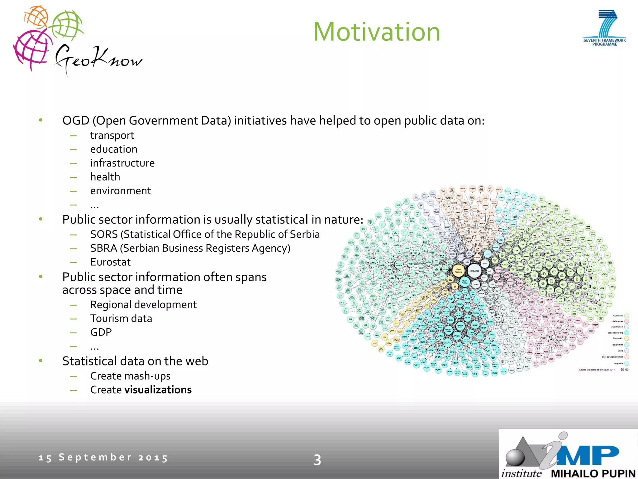
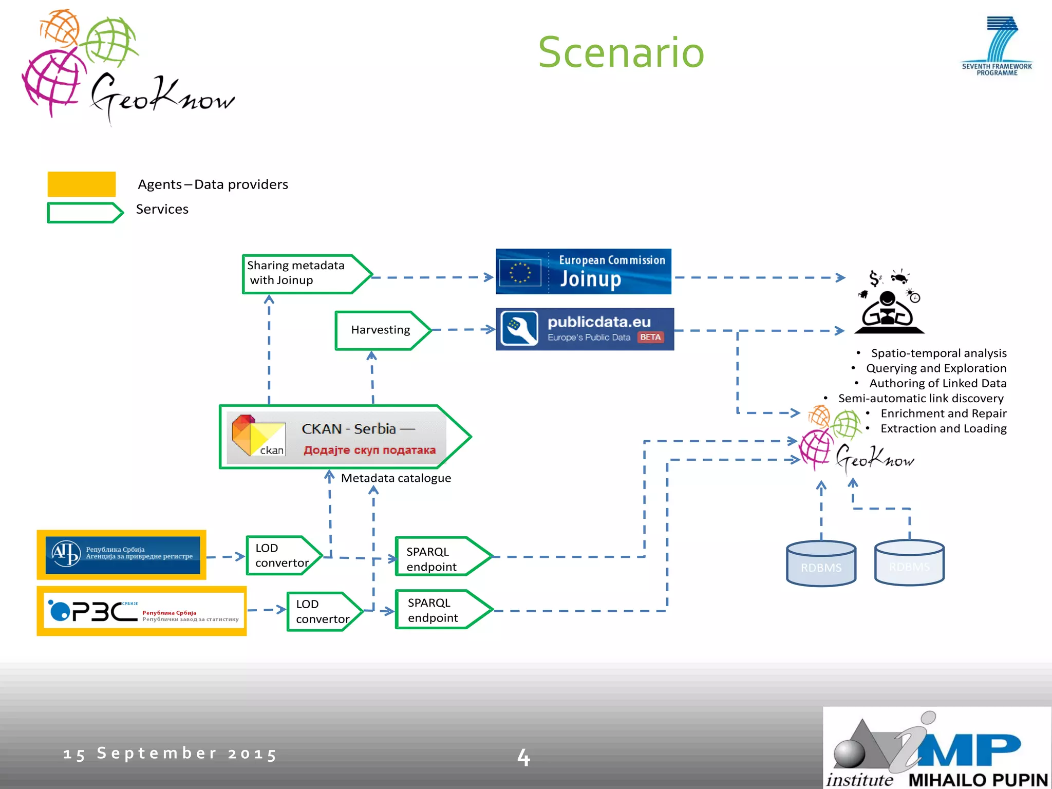
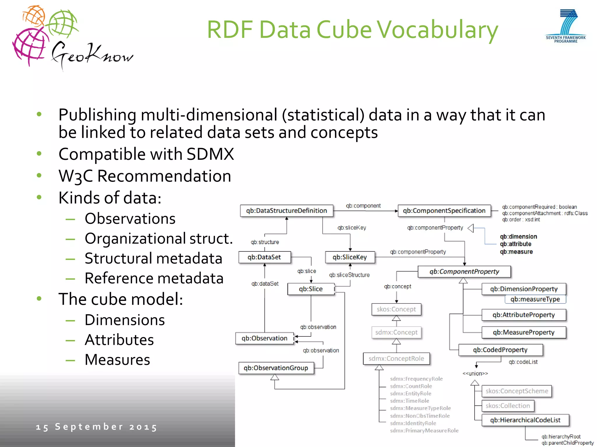
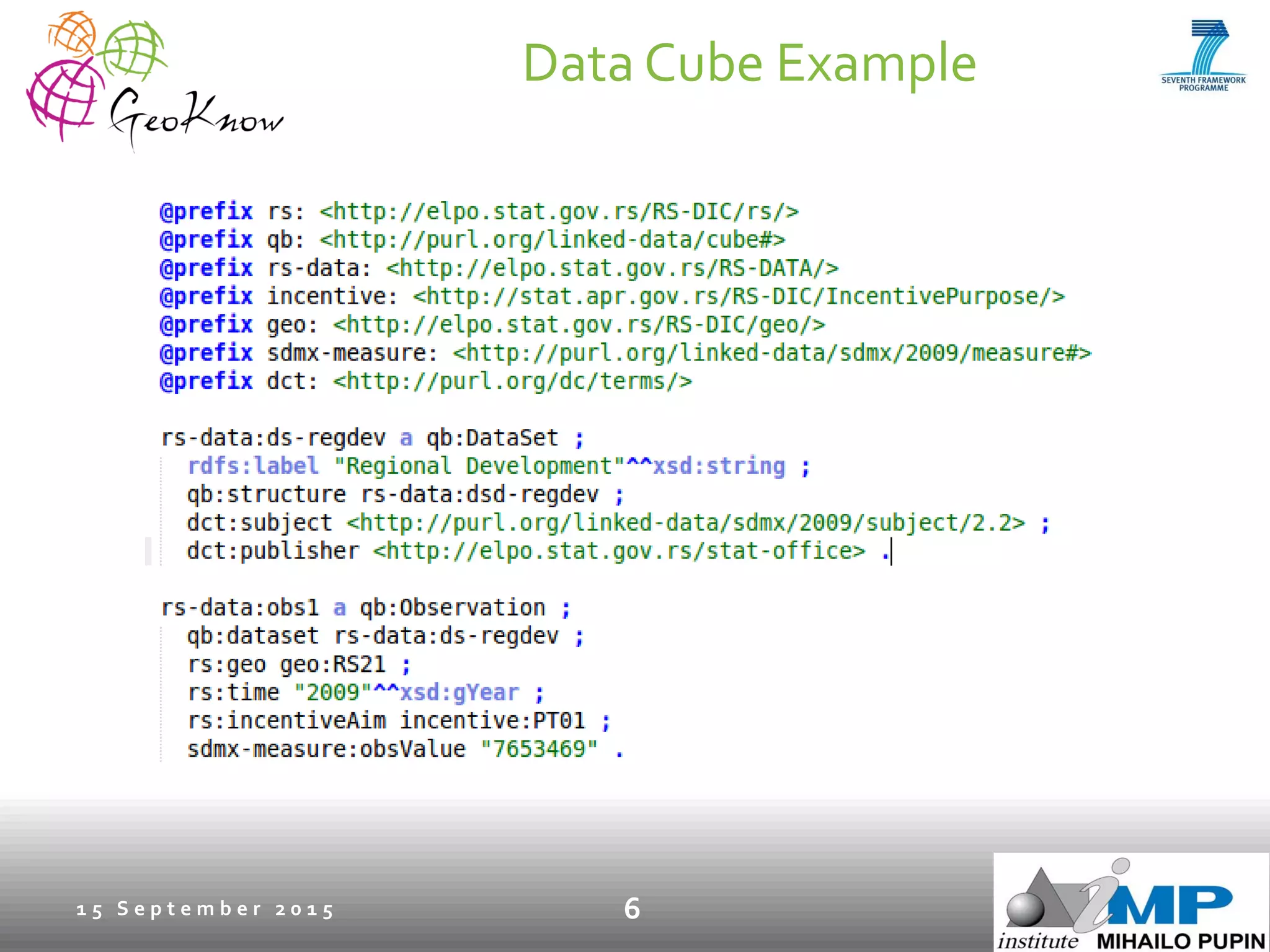
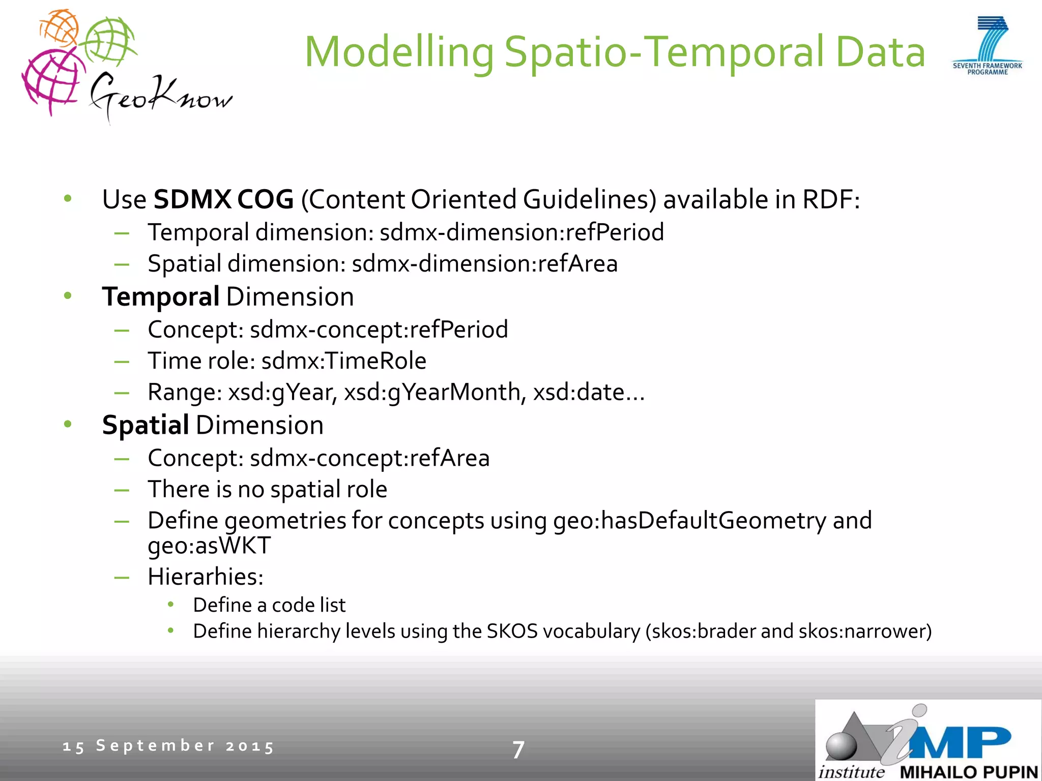
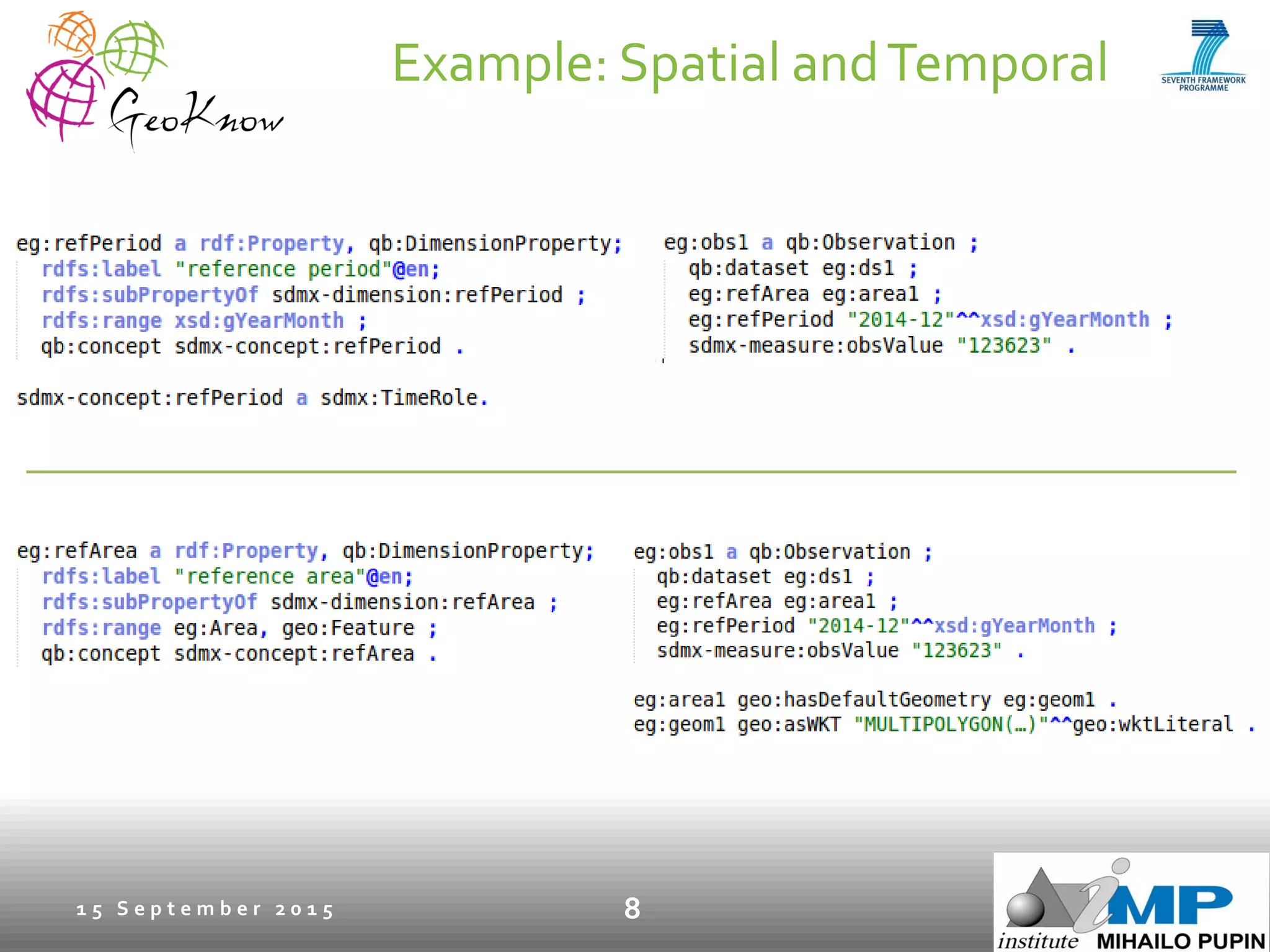
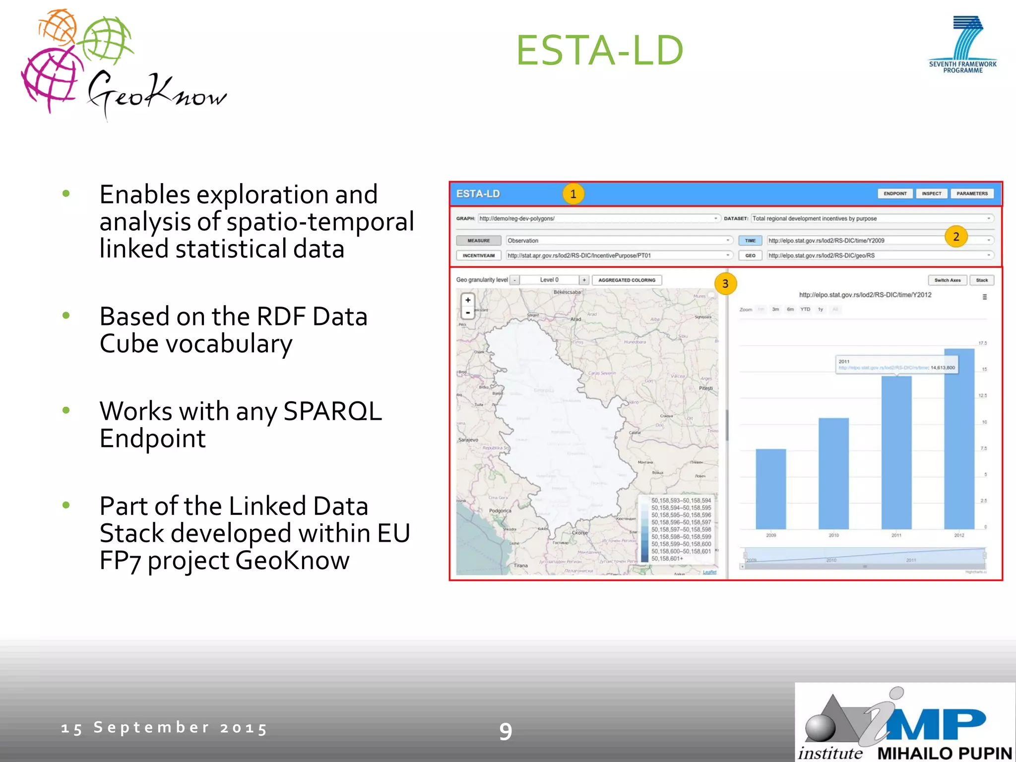
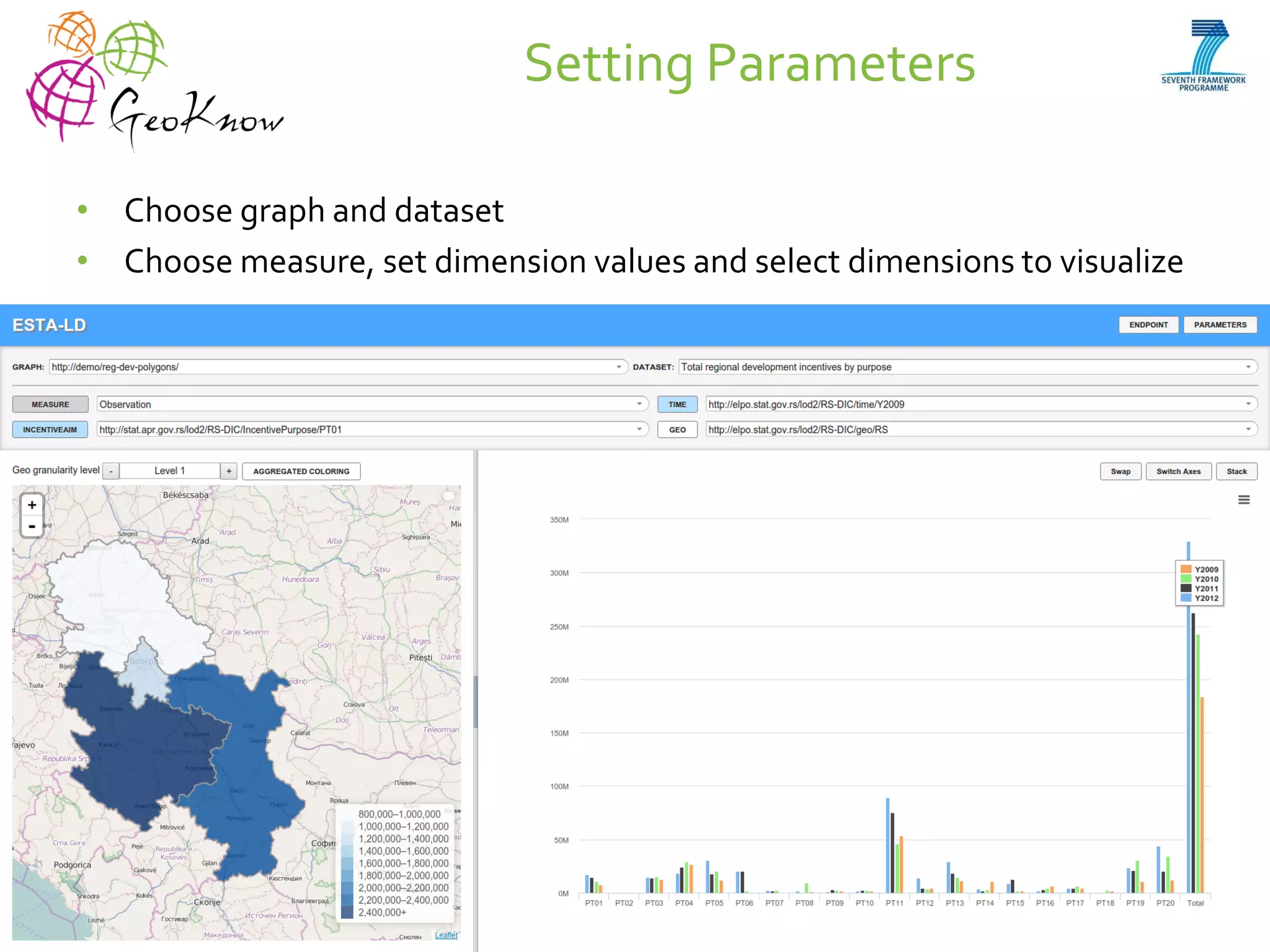
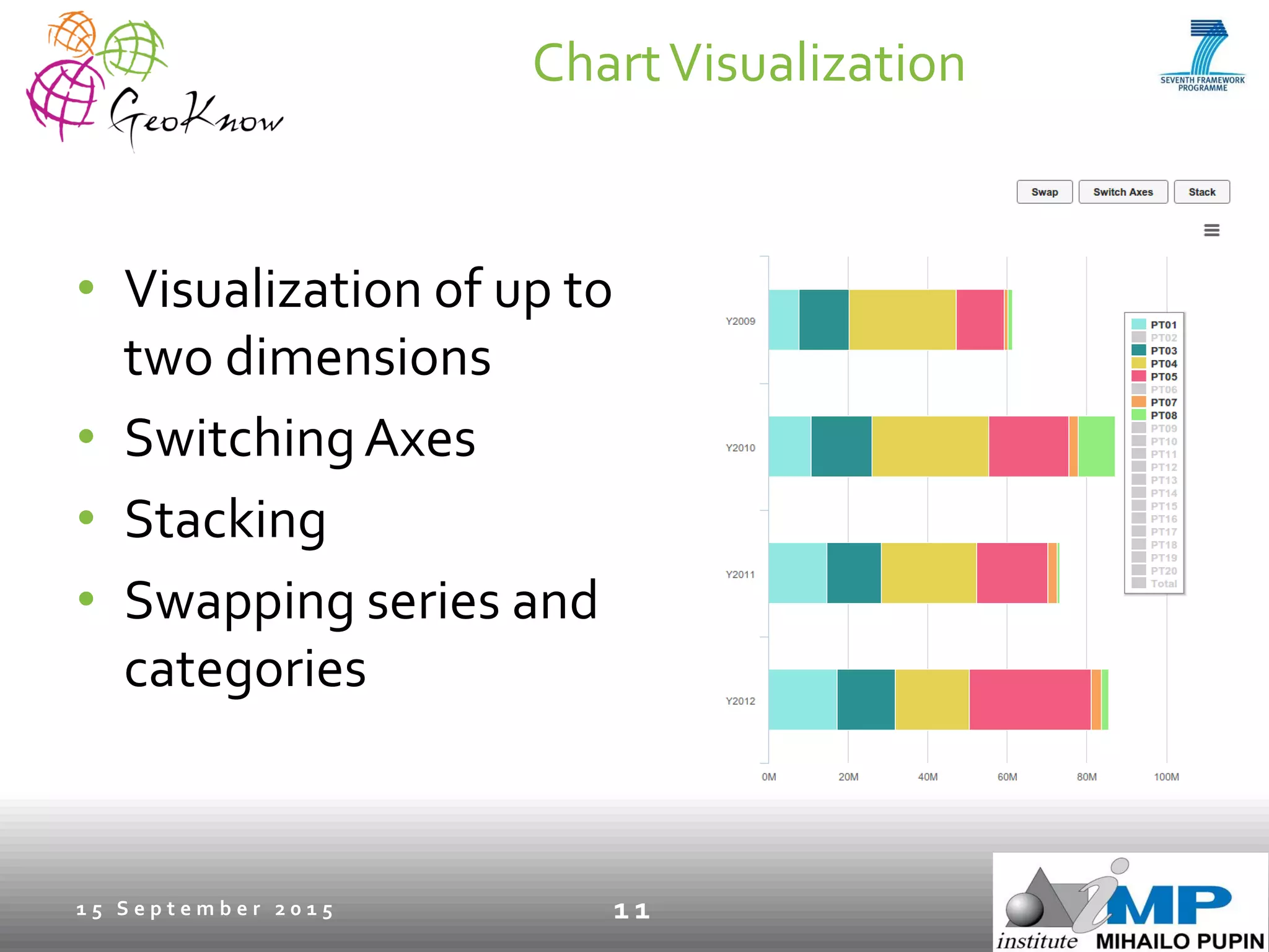
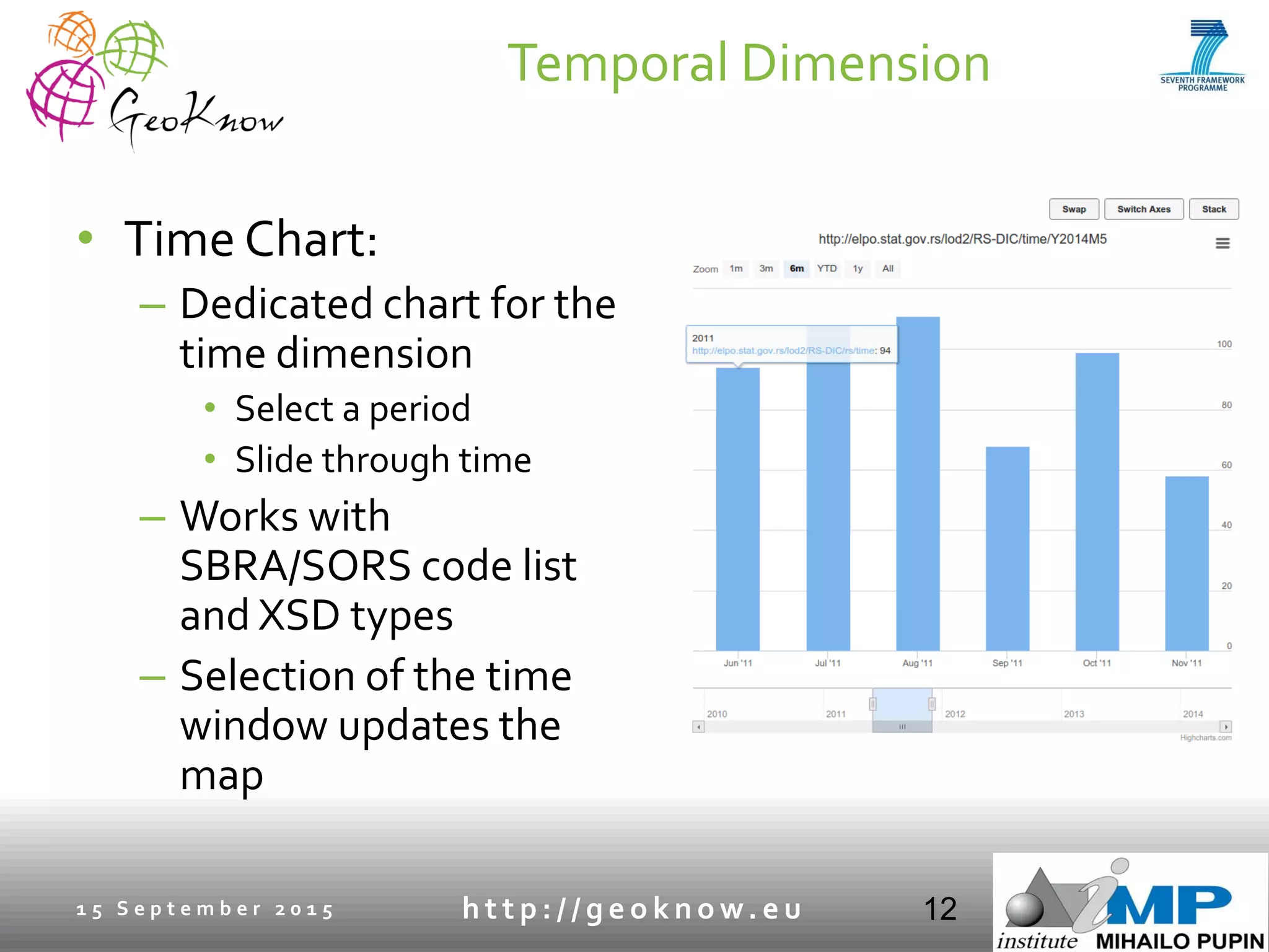
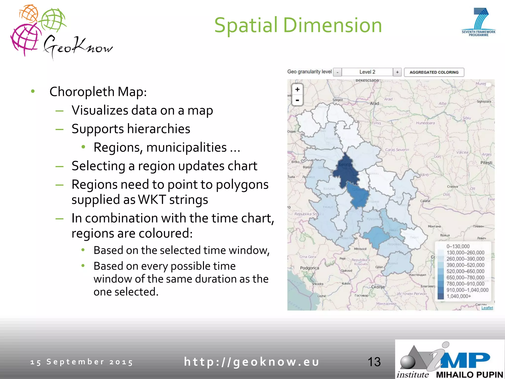
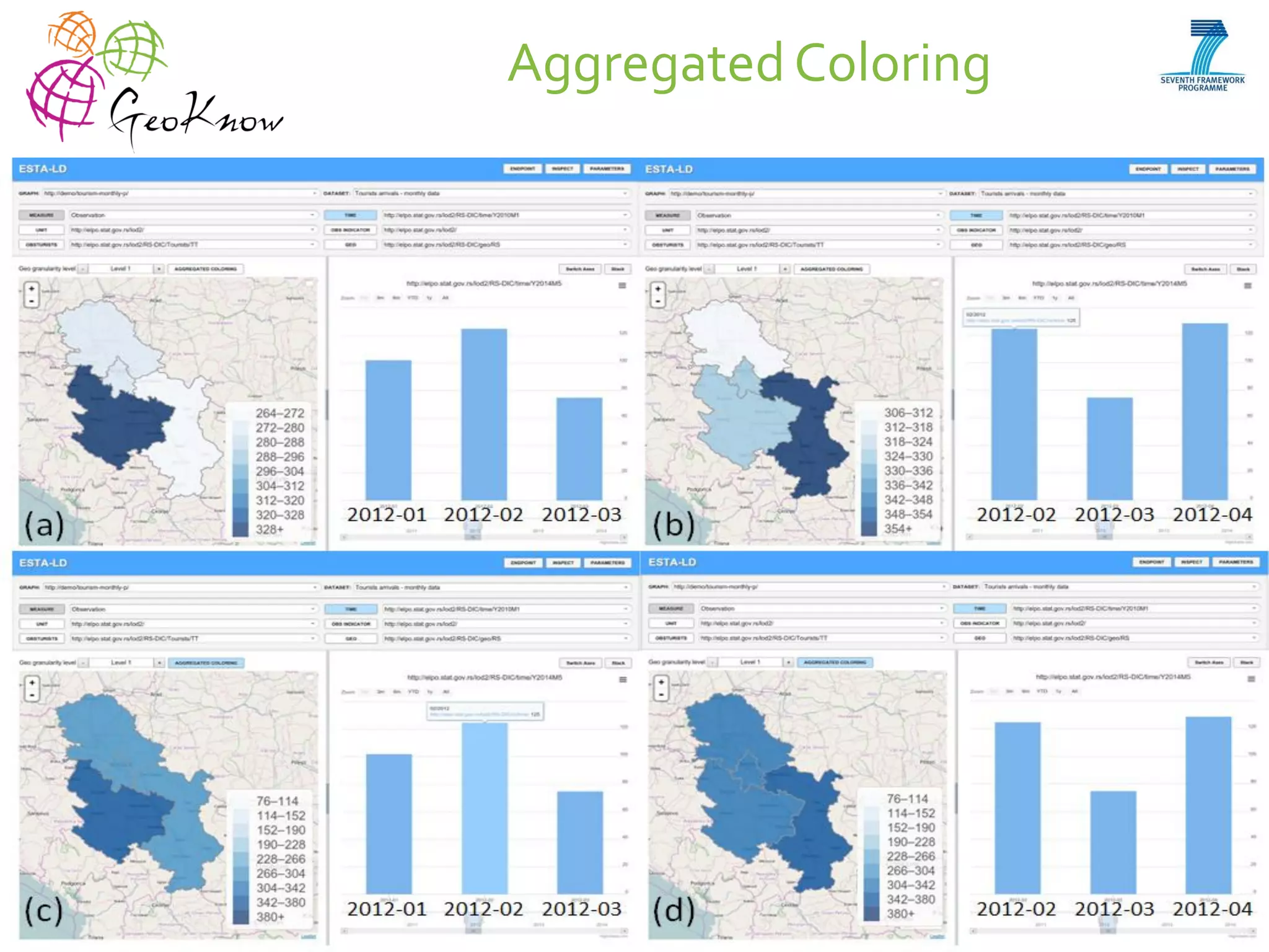
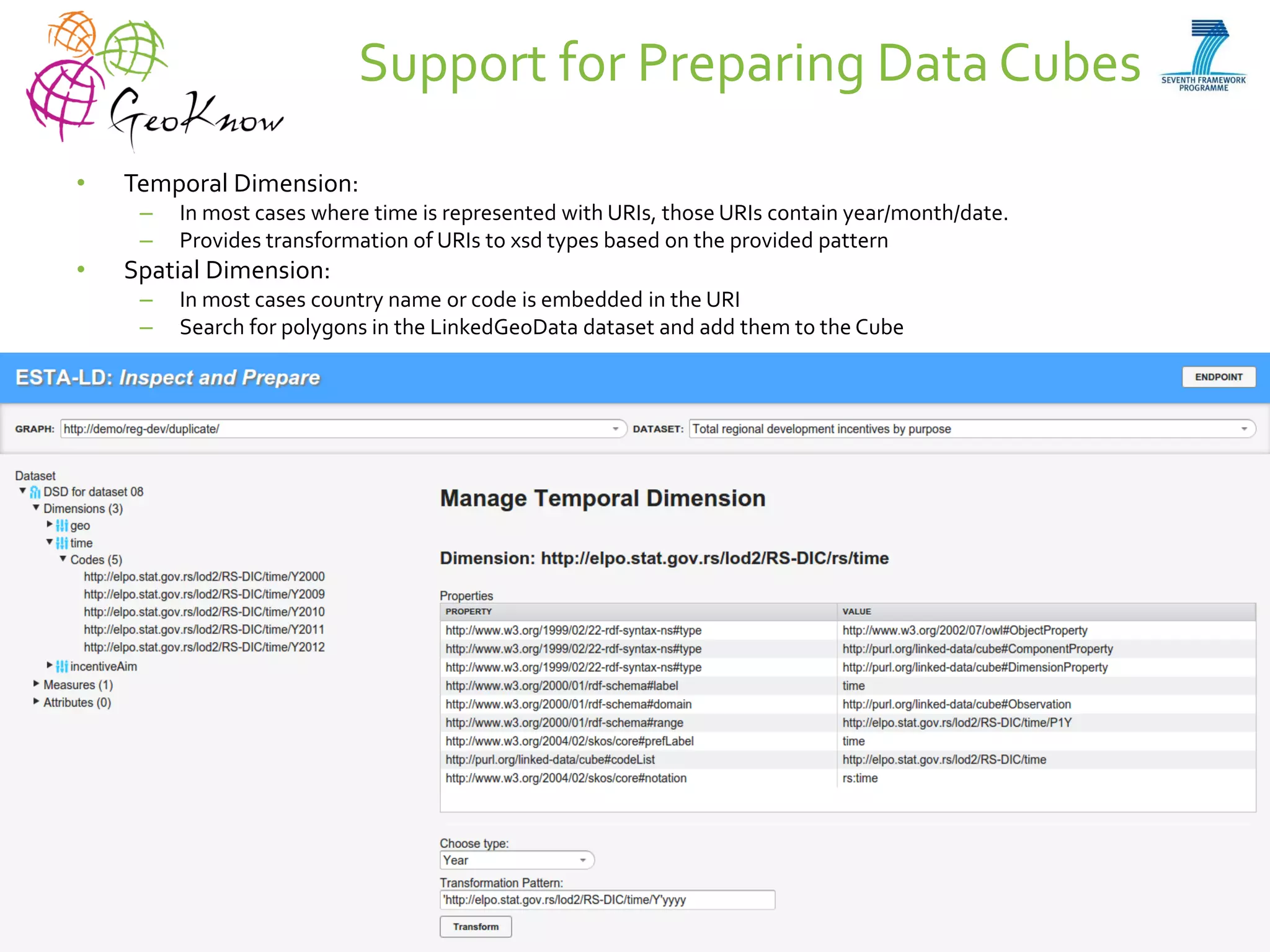

This document introduces ESTA-LD, a tool for exploring and analyzing spatio-temporal linked statistical data on the web. It summarizes ESTA-LD's key capabilities, which include visualizing statistical data on charts and maps, filtering and selecting dimensions like time and location, and aggregating data. The document also discusses how ESTA-LD models spatio-temporal data using the RDF Data Cube vocabulary and SDMX standards. Future work aims to expand ESTA-LD's chart types, analysis functions, and reduce data replication across datasets.


![[Databeers] 06/05/2014 - Boris Villazon: “Data Integration - A Linked Data ap...](https://cdn.slidesharecdn.com/ss_thumbnails/ld-databeers-140508020333-phpapp02-thumbnail.jpg?width=640&height=640&fit=bounds)


![Vibe Coding vs. Spec-Driven Development [Free Meetup]](https://cdn.slidesharecdn.com/ss_thumbnails/vibecodingvsspecdrivendevelopment-251209105622-43f455e7-thumbnail.jpg?width=640&height=640&fit=bounds)


