SlideShare a Scribd company logo
1 of 26
“Old-school hydro”:
coastal charting with traditional tools
S. Max Edelson
Department of History
University of Virginia
A field study conducted from the NOAA Ship Thomas Jefferson
US Coast Guard Key West Station at Trumbo Point
July 21-23, 2010
A plane table needs:
a tripod
a level
a writing surface
a sight fixed to a straight
edge (alidade)
The table is moved
directly above a known
point, and from this
position, an unknown
point is sighted. A line is
drawn along the sighted
angle toward the distant
point on the paper
attached to the table.
When another line is
drawn to this distant
point from another
known point, the two
lines intersect, and its
position can be
established.
Alidade
Real alidades have
telescopic sights
and can adjust
sights for altitude.
Lenses scored with
stadia marks allow
for estimating
distance when
stadia marks on a
distant rod are
sighted.
Point A established
at the position of
the plane table
The first point: A
From A, a line parallel to
the edge is sighted, and
then we measured 100
feet along it to establish
point B.
A
B
This created the survey’s
only measured segment
of 1 inch, which gave our
map a scale of 1” = 100
ft.
B
C
From A and B,
we sighted
several points
and drew them
on the paper,
creating a
network of
angles
corner
cleatlamppost
C
B
A
From the other side of the
harbor, we shot the angles the
other way to establish position
(although we might have used
our bearing)
Where A and B
intersected, we located
the lamppost point
lamppost
corner cleat
Sounding
To measure the depth of a
channel, we launched a small
boat and dropped a lead line
to the bottom. To locate the
position of the sounding, we
used sextants to measure the
angles to points we had
already fixed on our coastal
chart.
With these angles measured,
we recreated the position
of the boat at two points
and used the station
pointer to locate these on
the chart.
31.2
32.8
32.2
32.5
31.5
32.5
33.5
32.8
33.5
34.4
Old school hydro

More Related Content

What's hot

Surveying and levelling
Surveying and levellingSurveying and levelling
Surveying and levellingKishor Ade
 
Hydrography documents
Hydrography documentsHydrography documents
Hydrography documentsHafez Ahmad
 
Maps as Models of Earth
Maps as Models of EarthMaps as Models of Earth
Maps as Models of Earthmlong24
 
Geographic coordinate system & map projection
Geographic coordinate system & map projectionGeographic coordinate system & map projection
Geographic coordinate system & map projectionvishalkedia119
 
7 8.math projection (2)
7 8.math projection (2)7 8.math projection (2)
7 8.math projection (2)Riya Gupta
 
Earth Coordinate Systems
Earth Coordinate Systems Earth Coordinate Systems
Earth Coordinate Systems Sheikh Maryam
 
Models of the Earth - Mapping
Models of the Earth - MappingModels of the Earth - Mapping
Models of the Earth - Mappingmkeller1977
 
Geodetic systems (earth, ellipsoid)
Geodetic systems (earth, ellipsoid)Geodetic systems (earth, ellipsoid)
Geodetic systems (earth, ellipsoid)Md. Tamim Haider
 
Geodesy University Course
Geodesy University CourseGeodesy University Course
Geodesy University CourseNettlemanU
 
Geospatial reference-systems
Geospatial reference-systemsGeospatial reference-systems
Geospatial reference-systemsStephen
 
International spheroid[1]
International spheroid[1]International spheroid[1]
International spheroid[1]Waleed Liaqat
 
Introduction to Surveying under ECE
Introduction to Surveying under ECEIntroduction to Surveying under ECE
Introduction to Surveying under ECERakesh Verma
 

What's hot (20)

Surveying and levelling
Surveying and levellingSurveying and levelling
Surveying and levelling
 
Hydrography documents
Hydrography documentsHydrography documents
Hydrography documents
 
Module 1 part 1
Module 1 part 1Module 1 part 1
Module 1 part 1
 
Maps as Models of Earth
Maps as Models of EarthMaps as Models of Earth
Maps as Models of Earth
 
Geographic coordinate system & map projection
Geographic coordinate system & map projectionGeographic coordinate system & map projection
Geographic coordinate system & map projection
 
7 8.math projection (2)
7 8.math projection (2)7 8.math projection (2)
7 8.math projection (2)
 
Earth Coordinate Systems
Earth Coordinate Systems Earth Coordinate Systems
Earth Coordinate Systems
 
Models of the Earth - Mapping
Models of the Earth - MappingModels of the Earth - Mapping
Models of the Earth - Mapping
 
Geodetic systems (earth, ellipsoid)
Geodetic systems (earth, ellipsoid)Geodetic systems (earth, ellipsoid)
Geodetic systems (earth, ellipsoid)
 
Basics of geodesy
Basics of geodesyBasics of geodesy
Basics of geodesy
 
Basic of Geodesy
Basic of GeodesyBasic of Geodesy
Basic of Geodesy
 
Maps and globes
Maps and globesMaps and globes
Maps and globes
 
Geodesy University Course
Geodesy University CourseGeodesy University Course
Geodesy University Course
 
Geospatial reference-systems
Geospatial reference-systemsGeospatial reference-systems
Geospatial reference-systems
 
International spheroid[1]
International spheroid[1]International spheroid[1]
International spheroid[1]
 
Introduction to Surveying under ECE
Introduction to Surveying under ECEIntroduction to Surveying under ECE
Introduction to Surveying under ECE
 
Earths dimension sci 8 ppt np1
Earths dimension sci 8 ppt np1Earths dimension sci 8 ppt np1
Earths dimension sci 8 ppt np1
 
Globe
GlobeGlobe
Globe
 
Hydrography
Hydrography Hydrography
Hydrography
 
Earths dimension ppt np1
Earths dimension ppt np1Earths dimension ppt np1
Earths dimension ppt np1
 

Viewers also liked

Slavery sc uva_2011
Slavery sc uva_2011Slavery sc uva_2011
Slavery sc uva_2011maxedelson
 
Edelson oldschool
Edelson oldschoolEdelson oldschool
Edelson oldschoolmaxedelson
 
Lindsey meeder extra credit 3
Lindsey meeder extra credit 3Lindsey meeder extra credit 3
Lindsey meeder extra credit 3lindseymeeder
 
Twitter Basics
Twitter BasicsTwitter Basics
Twitter BasicsACRheum
 
MLeads Consulting Corporate Profile
MLeads Consulting Corporate ProfileMLeads Consulting Corporate Profile
MLeads Consulting Corporate ProfileXoriant
 
Sportmarketing vs. Internet
Sportmarketing vs. InternetSportmarketing vs. Internet
Sportmarketing vs. InternetFrank van Berlo
 
The importance of technology
The importance of technologyThe importance of technology
The importance of technologyedtingle
 
Easton’s resident project
Easton’s resident projectEaston’s resident project
Easton’s resident projectRosina Mak
 
การออกกำลังกายเพื่อสุขภาพ
การออกกำลังกายเพื่อสุขภาพการออกกำลังกายเพื่อสุขภาพ
การออกกำลังกายเพื่อสุขภาพaalisaa
 
Plane table presentation 1
Plane table presentation 1Plane table presentation 1
Plane table presentation 1AnanthP123
 
3 maps & plane table surveying. plane table surveying
3 maps & plane table surveying. plane table surveying3 maps & plane table surveying. plane table surveying
3 maps & plane table surveying. plane table surveyingvigyanashram
 
Band baaja baaraat slideshare
Band baaja baaraat slideshareBand baaja baaraat slideshare
Band baaja baaraat slidesharebandbaajabaaraat
 
Toastmasters speech 2 - organize your speech - she knows how to move her bod...
Toastmasters speech 2  - organize your speech - she knows how to move her bod...Toastmasters speech 2  - organize your speech - she knows how to move her bod...
Toastmasters speech 2 - organize your speech - she knows how to move her bod...KevinKane
 

Viewers also liked (20)

Plane Table Mapping
Plane Table MappingPlane Table Mapping
Plane Table Mapping
 
Slavery sc uva_2011
Slavery sc uva_2011Slavery sc uva_2011
Slavery sc uva_2011
 
Edelson oldschool
Edelson oldschoolEdelson oldschool
Edelson oldschool
 
Lindsey meeder extra credit 3
Lindsey meeder extra credit 3Lindsey meeder extra credit 3
Lindsey meeder extra credit 3
 
Twitter Basics
Twitter BasicsTwitter Basics
Twitter Basics
 
MLeads Consulting Corporate Profile
MLeads Consulting Corporate ProfileMLeads Consulting Corporate Profile
MLeads Consulting Corporate Profile
 
Sportmarketing vs. Internet
Sportmarketing vs. InternetSportmarketing vs. Internet
Sportmarketing vs. Internet
 
Europa
EuropaEuropa
Europa
 
The importance of technology
The importance of technologyThe importance of technology
The importance of technology
 
Easton’s resident project
Easton’s resident projectEaston’s resident project
Easton’s resident project
 
การออกกำลังกายเพื่อสุขภาพ
การออกกำลังกายเพื่อสุขภาพการออกกำลังกายเพื่อสุขภาพ
การออกกำลังกายเพื่อสุขภาพ
 
Plane table presentation 1
Plane table presentation 1Plane table presentation 1
Plane table presentation 1
 
3 maps & plane table surveying. plane table surveying
3 maps & plane table surveying. plane table surveying3 maps & plane table surveying. plane table surveying
3 maps & plane table surveying. plane table surveying
 
Band baaja baaraat slideshare
Band baaja baaraat slideshareBand baaja baaraat slideshare
Band baaja baaraat slideshare
 
surveying contouring
surveying contouring surveying contouring
surveying contouring
 
Tennis
TennisTennis
Tennis
 
Adam Fendrych "Remote Testing"
Adam Fendrych "Remote Testing"Adam Fendrych "Remote Testing"
Adam Fendrych "Remote Testing"
 
The Bird Bowl
The Bird Bowl The Bird Bowl
The Bird Bowl
 
Toastmasters speech 2 - organize your speech - she knows how to move her bod...
Toastmasters speech 2  - organize your speech - she knows how to move her bod...Toastmasters speech 2  - organize your speech - she knows how to move her bod...
Toastmasters speech 2 - organize your speech - she knows how to move her bod...
 
Plane Table Surveying
Plane Table SurveyingPlane Table Surveying
Plane Table Surveying
 

Old school hydro

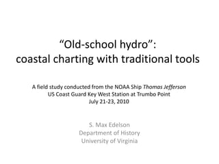
  • 1. “Old-school hydro”: coastal charting with traditional tools S. Max Edelson Department of History University of Virginia A field study conducted from the NOAA Ship Thomas Jefferson US Coast Guard Key West Station at Trumbo Point July 21-23, 2010
  • 2. A plane table needs: a tripod a level a writing surface a sight fixed to a straight edge (alidade)
  • 3. The table is moved directly above a known point, and from this position, an unknown point is sighted. A line is drawn along the sighted angle toward the distant point on the paper attached to the table. When another line is drawn to this distant point from another known point, the two lines intersect, and its position can be established.
  • 4.
  • 5. Alidade Real alidades have telescopic sights and can adjust sights for altitude. Lenses scored with stadia marks allow for estimating distance when stadia marks on a distant rod are sighted.
  • 6.
  • 7. Point A established at the position of the plane table The first point: A
  • 8. From A, a line parallel to the edge is sighted, and then we measured 100 feet along it to establish point B. A B This created the survey’s only measured segment of 1 inch, which gave our map a scale of 1” = 100 ft.
  • 9. B C From A and B, we sighted several points and drew them on the paper, creating a network of angles
  • 10.
  • 12. From the other side of the harbor, we shot the angles the other way to establish position (although we might have used our bearing) Where A and B intersected, we located the lamppost point lamppost
  • 14.
  • 15.
  • 16.
  • 17.
  • 18. Sounding To measure the depth of a channel, we launched a small boat and dropped a lead line to the bottom. To locate the position of the sounding, we used sextants to measure the angles to points we had already fixed on our coastal chart.
  • 19.
  • 20.
  • 21.
  • 22. With these angles measured, we recreated the position of the boat at two points and used the station pointer to locate these on the chart.
  • 23.
  • 24.

Editor's Notes

  1. More advanced versions mounted the table on a tripod—allowing it to be horizontal to the terrain. An alidade is fixed to a straight edge so that when the distant object is sighted, a corresponding line can be drawn on the paper. Training the alidade on a graduated stadia rod some distance away allowed the surveyor to estimate distance by counting the number of stadia hairs he could see through the sight with the gradations visible on the stick. This allowed for distances over inaccessible terrain to be measure using only a single known point. As the rod-holder walked along the high water mark on the shore, the surveyor marked a dot on the paper that recorded the observed distance from each measurement. After the survey, a line drawn through these points established the contour of the coastline. After moving the table to another location, this process began again; sightings of the rods made it possible to sketch the positions of visible structures and roads as well. These separate sheets, one for each position, were synthesized into an integrated image. (Monmonier, Coastlines, 51-53)
  2. Beginning from two accessible point whose distance is known, the surveyor sights and draws the unknown (inaccessible) point from each corner, calculating the distance using the known side of the triangle and two of its angles. (Monmonier, Coastlines, 50-51)