Downloaded 30 times


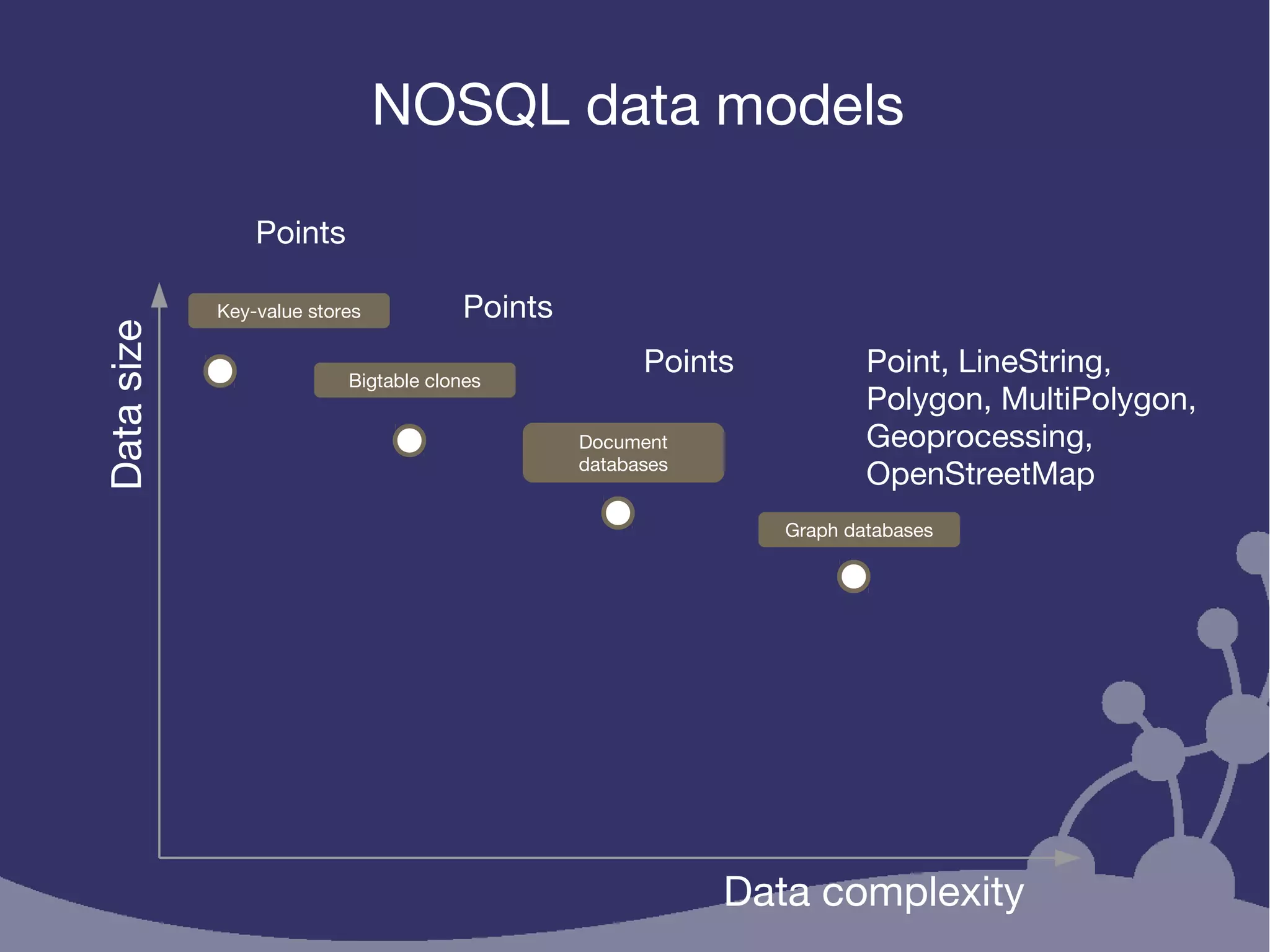

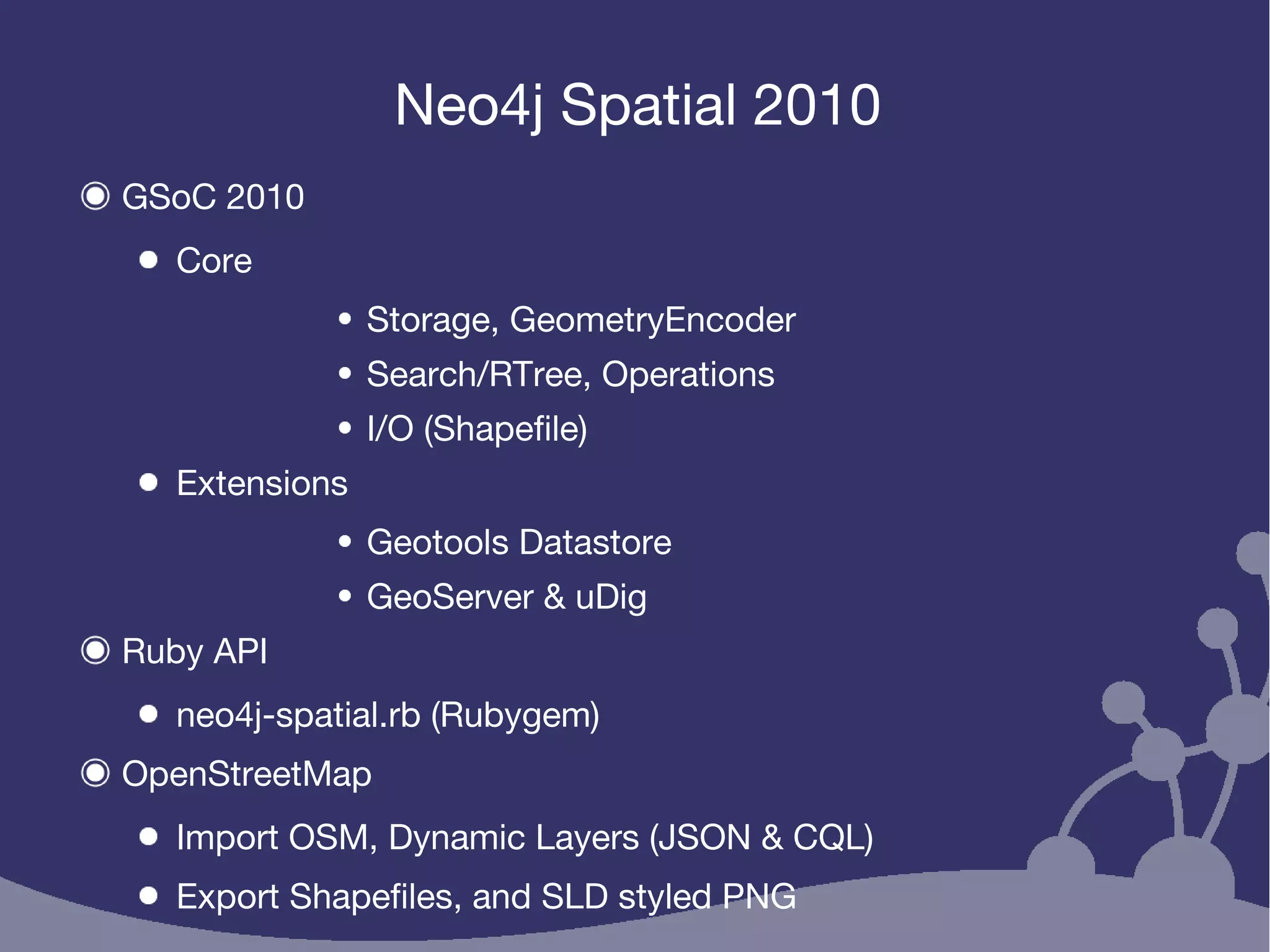
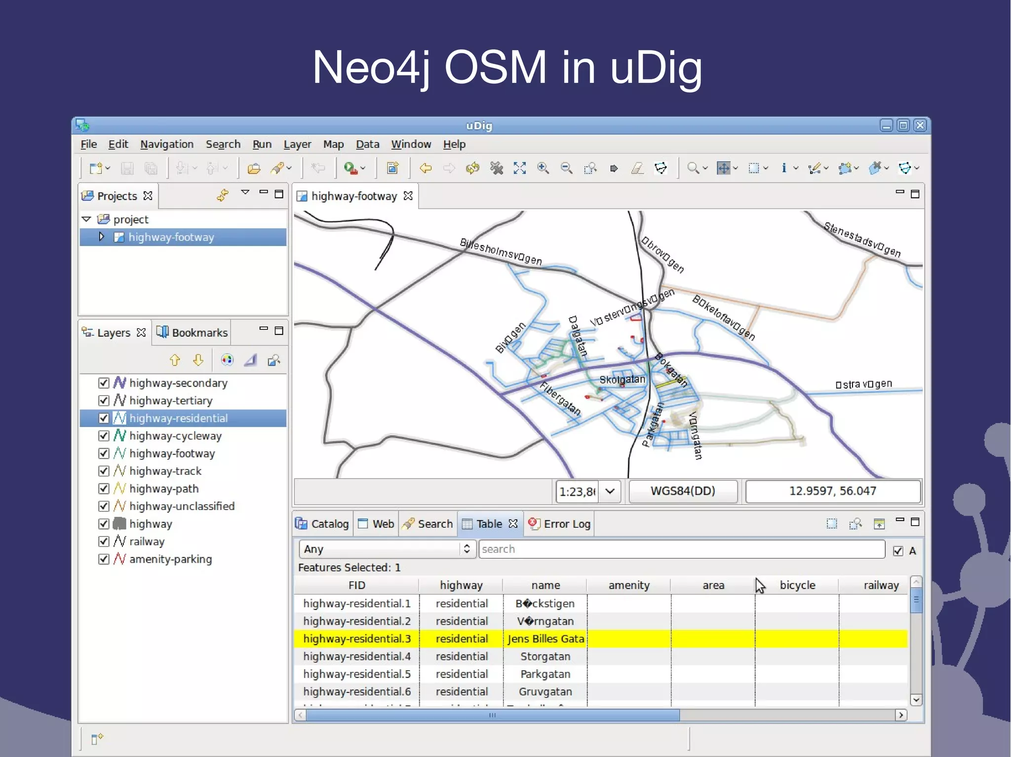
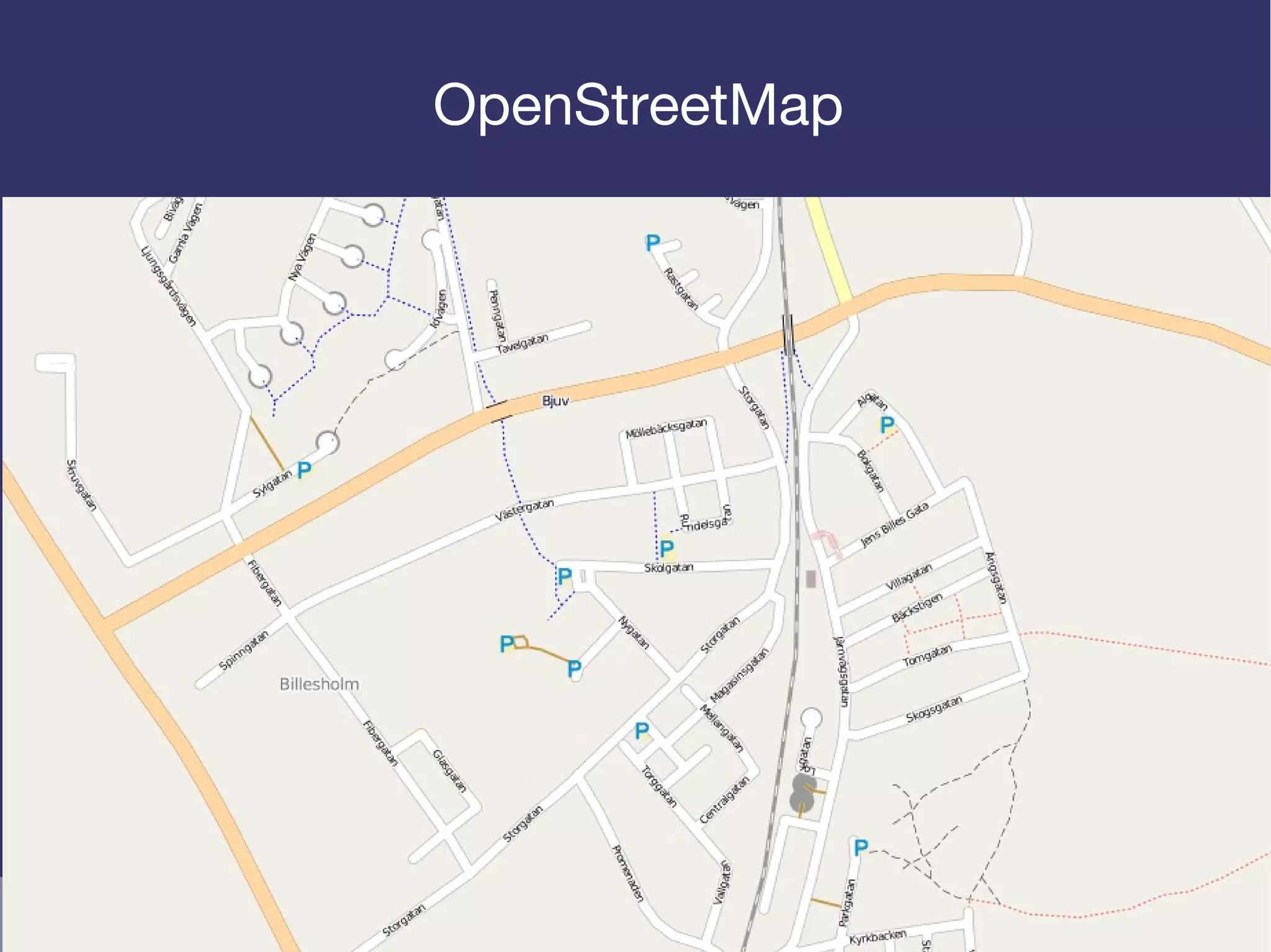
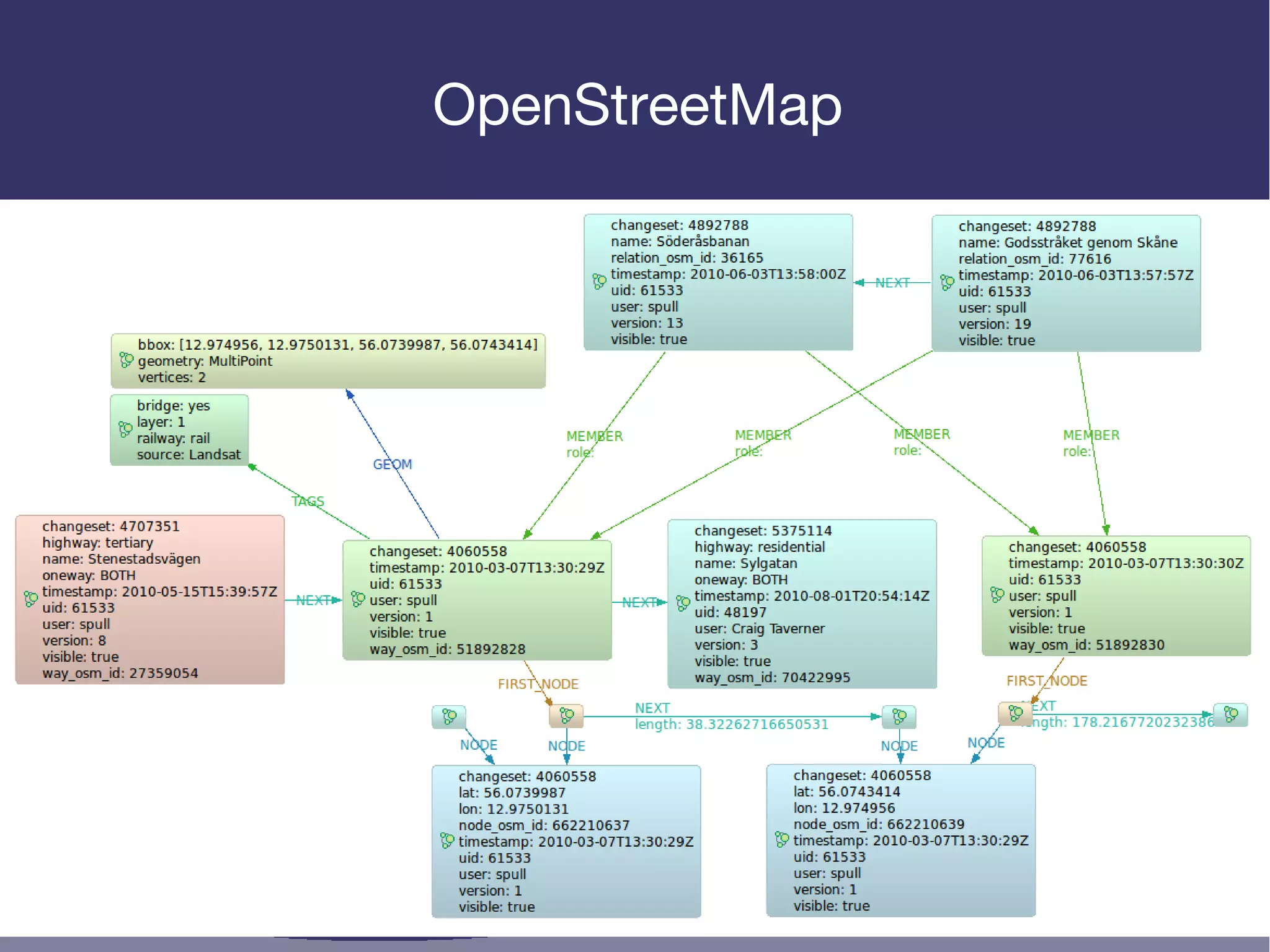
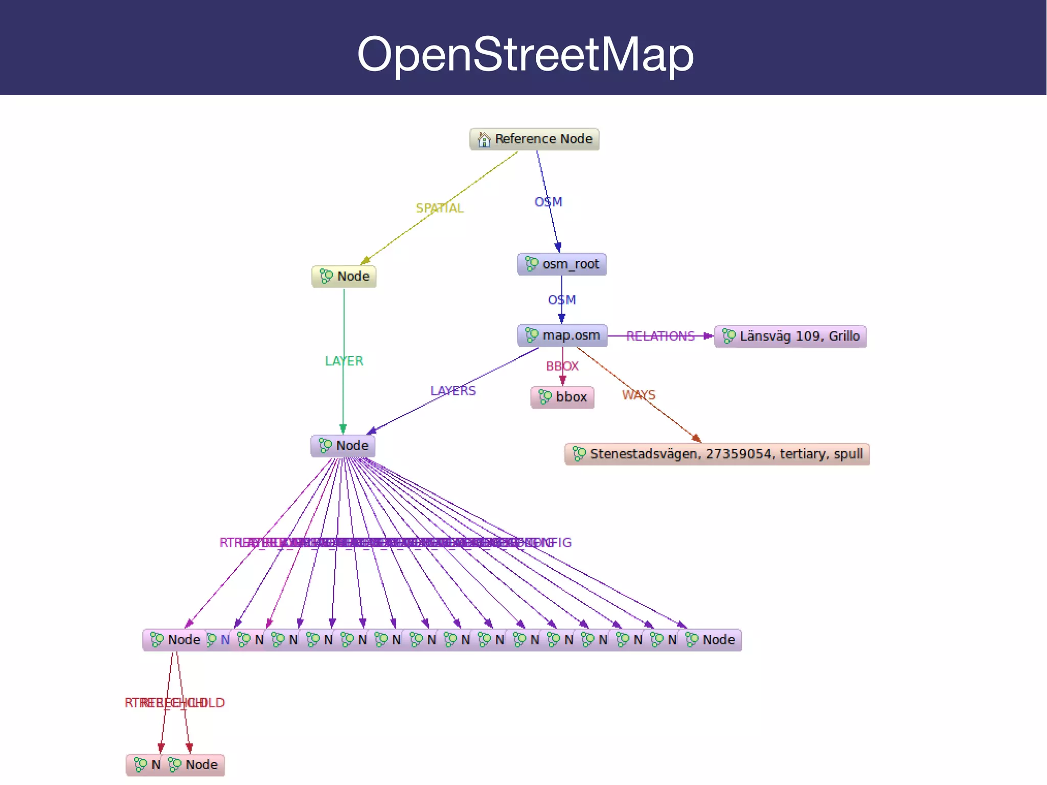
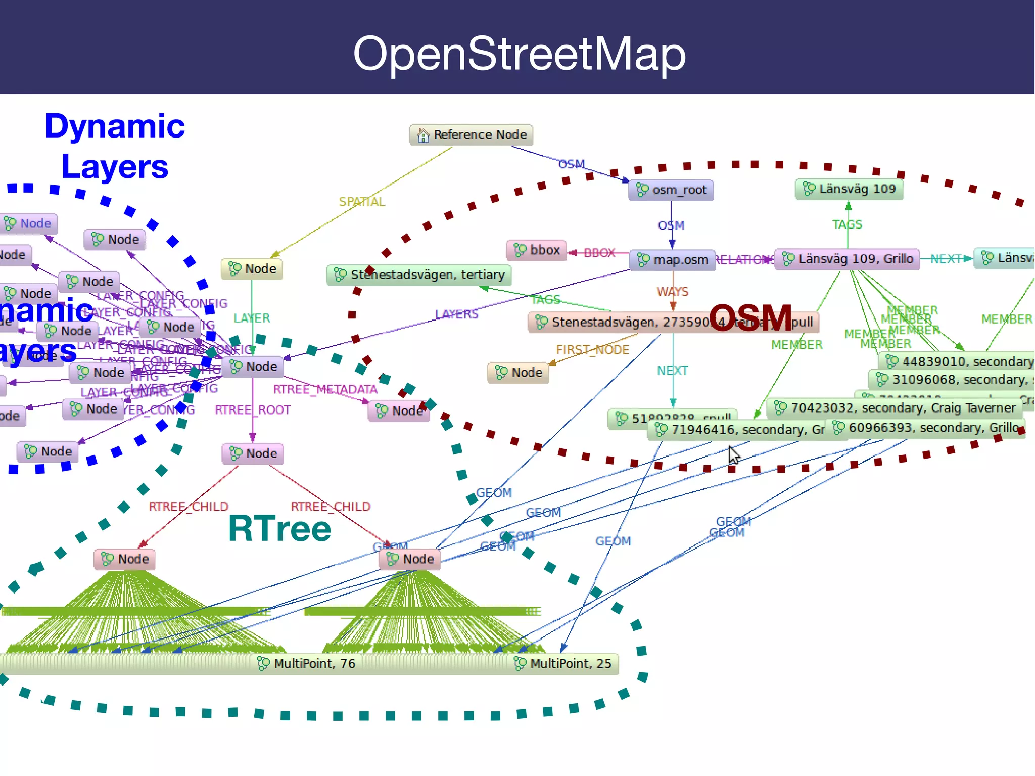
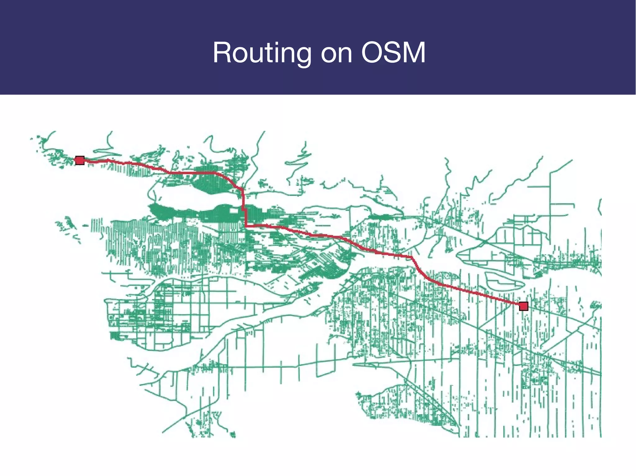
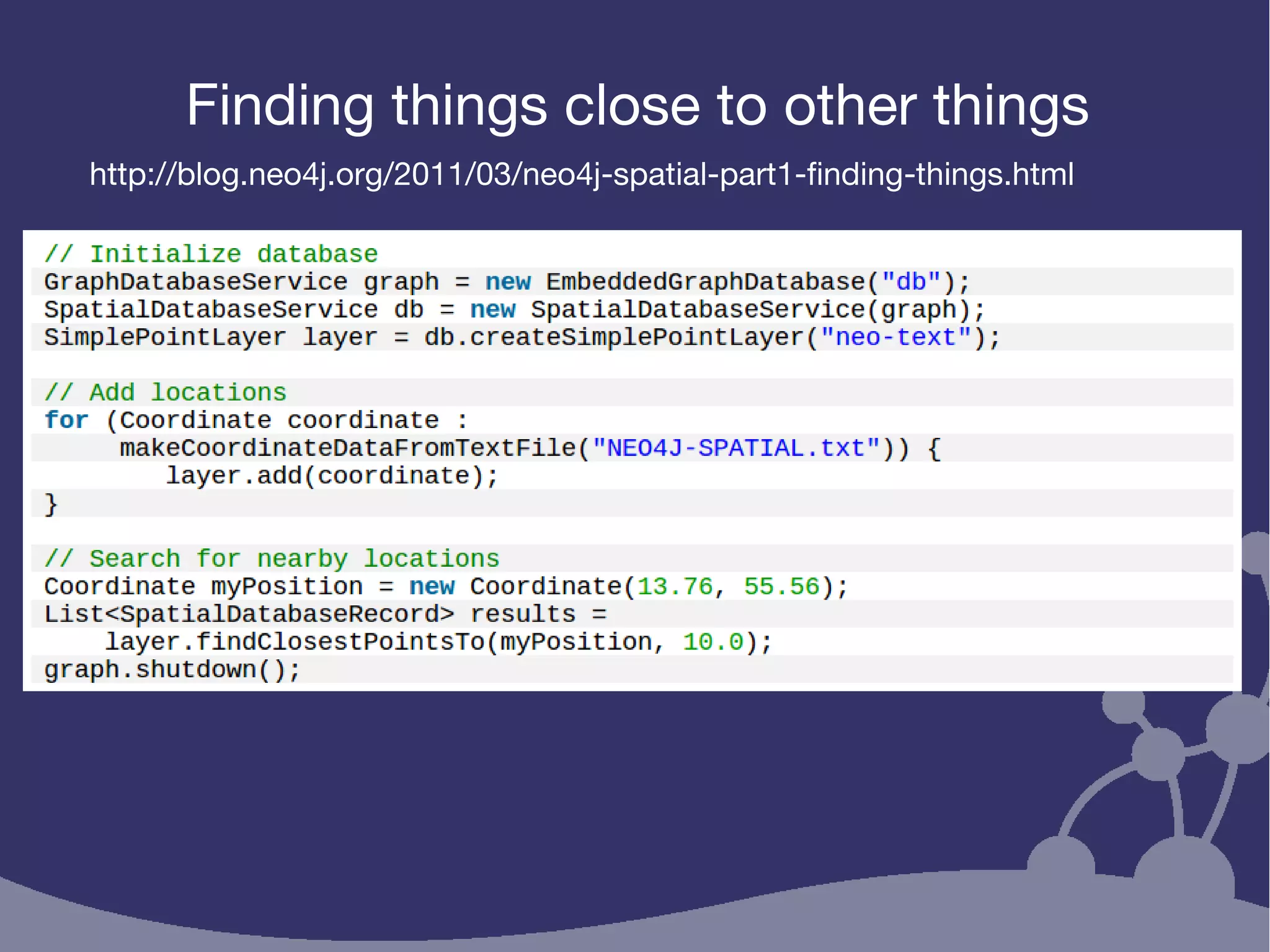
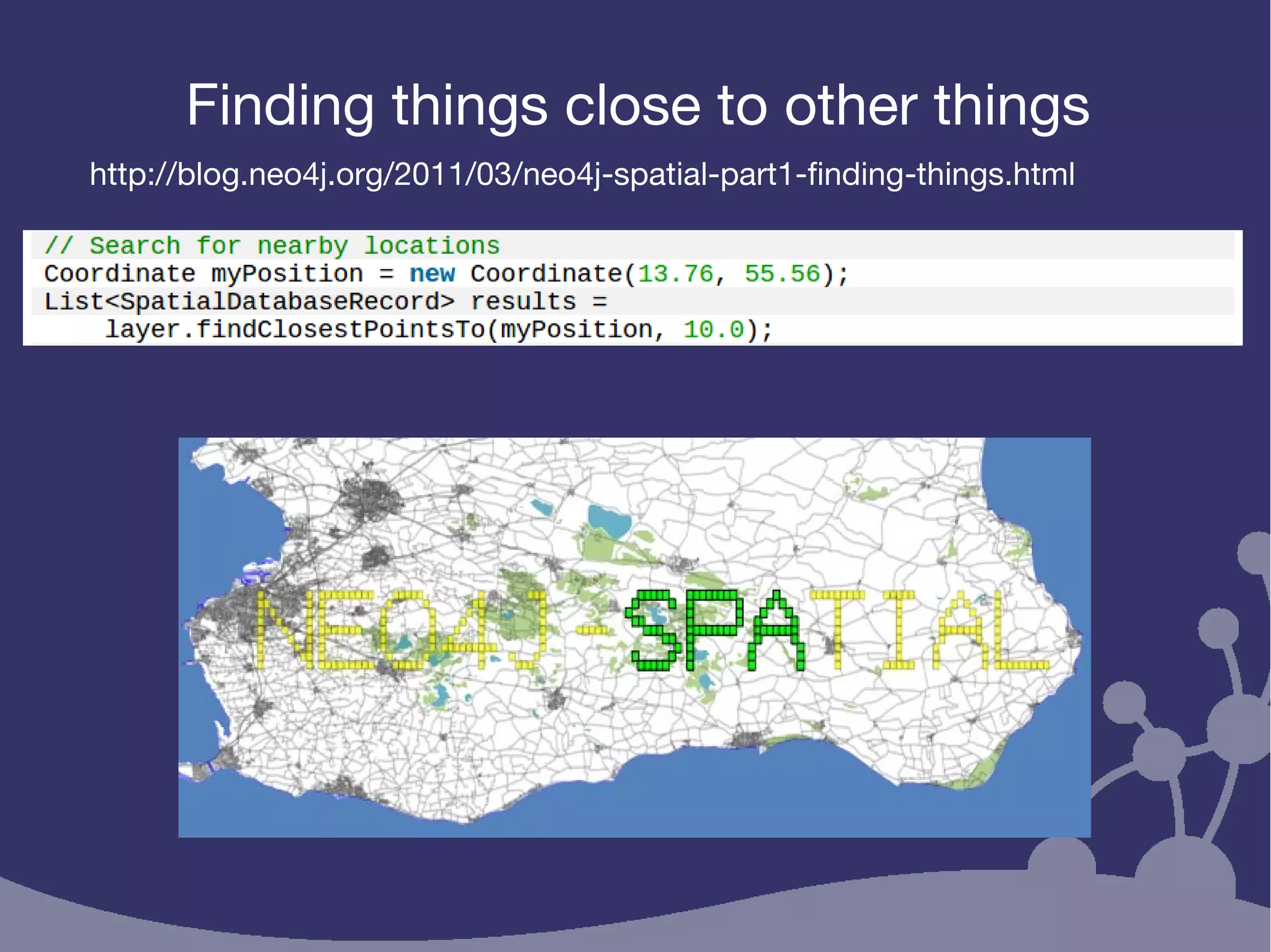
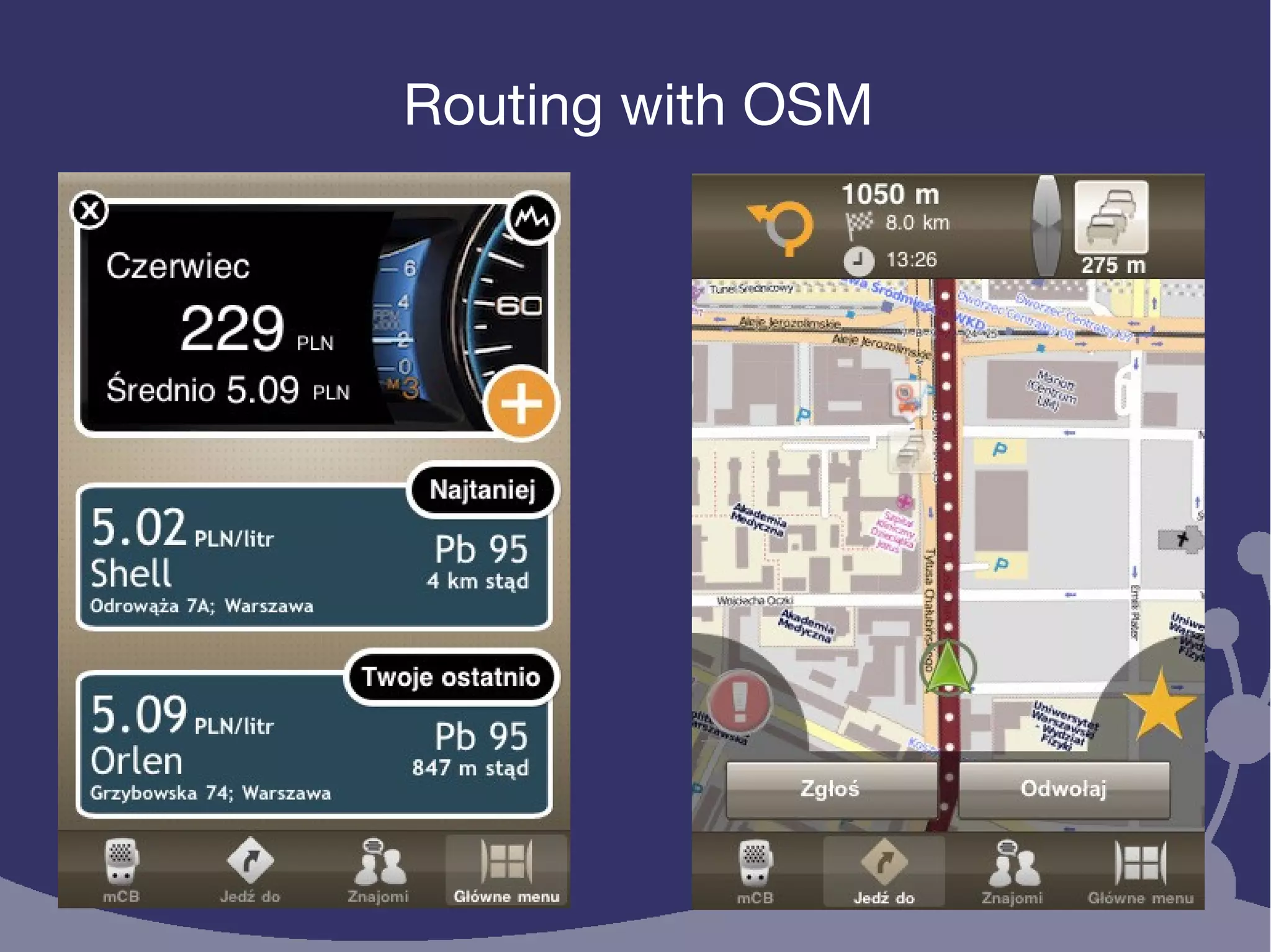
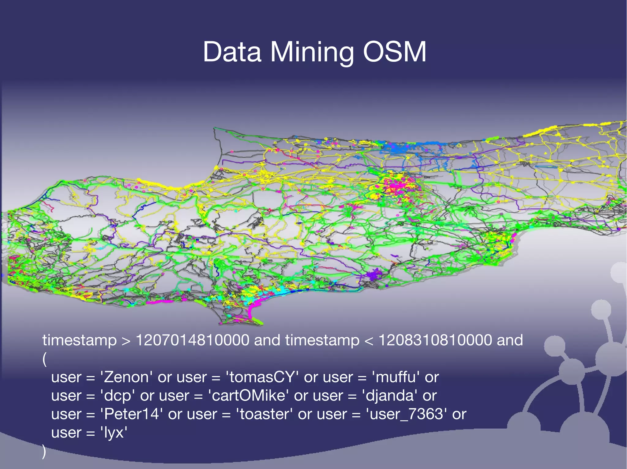


This document discusses using Neo4j-Spatial and OpenStreetMap to work with web map data. It provides an overview of Neo4j-Spatial's capabilities for spatial data including importing, querying, and exporting OpenStreetMap data. Examples are given of using Neo4j-Spatial to find locations near other points, perform routing queries on OSM data, and analyze contributions of individual OSM users.