Download to read offline

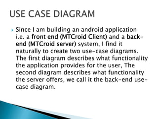
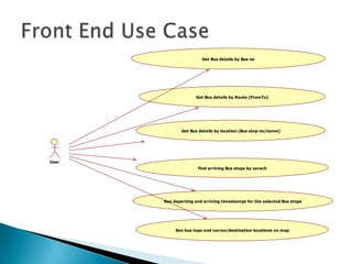
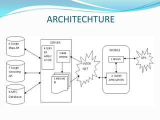


This document describes a proposed bus transportation information system called MTCroid. It includes use case diagrams describing the functionality provided to users by the mobile application and backend server. Key requirements for the system are that it provides real-time bus location and schedule information to users in a simple, ubiquitous interface. The proposed system architecture includes a mobile client application, RESTful web API backend server, and MTC route data database. The server is responsible for querying the database and generating resources with route information for the client.


![[IJET V2I2P22] Authors: Dr. Sanjeev S. Sannakki, Omkar Kotibhaskar, Namrata N...](https://cdn.slidesharecdn.com/ss_thumbnails/ijet-v2i2p22-160609043720-thumbnail.jpg?width=640&height=640&fit=bounds)


