Mockup mobile.map.geo.admin.ch
•
0 likes•813 views

Feature list of release 1 mobile mapping solution. Release date Q3 2011, mor info on www.geo.admin.ch
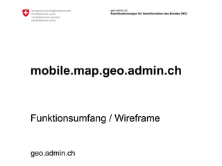
![Main Page ,[object Object],[object Object],[object Object],[object Object],[object Object],© swisstopo.ch Logo /favicon + text Home action: reloads page Swisstopo Copyrights Action: opens an URL Map ,[object Object],[object Object],[object Object],[object Object],[object Object],Scale](data:image/gif;base64,R0lGODlhAQABAIAAAAAAAP///yH5BAEAAAAALAAAAAABAAEAAAIBRAA7)
Recommended
Recommended
More Related Content
What's hot
What's hot (20)
Viewers also liked
Viewers also liked (9)
Similar to Mockup mobile.map.geo.admin.ch
Similar to Mockup mobile.map.geo.admin.ch (6)
More from geoportal of the federal authorities of the Swiss Confederation
More from geoportal of the federal authorities of the Swiss Confederation (20)
Recently uploaded
Recently uploaded (15)
Mockup mobile.map.geo.admin.ch
- 3. Search Action 1 2 Present the last used searches User searches and results appear with autocompletion Go back to the map by clicking on an item or clicking on map Search for a location Payerne last used Bottens last used Wabern last used S < map Pa Payerne Pacifico Pas à la maison S < map
- 4. Data Action 1 2 Present all the layers. User can scroll to navigate in all layers. User searches and a subselection appears dynamically. User can add a layer by clicking on the check box. Layer’s opacity can be changed Layers can be removed By clicking on i, a modal window appears with the layer info Search for a dataset Layer 1 Topic / Subtopic / small description S < map layer selection > i Layer 2 Topic / Subtopic / small description i Layer 3 Topic / Subtopic / small description i Layer 4 Topic / Subtopic / small description i Layer 4 Topic / Subtopic / small description i S < layer search map > Layer 1 Opacity: 100 % i X Layer 2 Opacity: 100 % i X Layer 3 Opacity: 100 % i X
- 6. Option Action If left, the function bar and the navigation bar goes on the left O < map Language: French Handedness: Right Background: Pixelmap Responsibilities and contacts Coordination : Coordinating agency for Federal geographical information (GCG) Operation : geo.admin.ch, c/o Federal Office of Topography swisstopo Overall data controller : The Confederation, represented by the relevant Federal Office Data management : Coordination, Geoinformation and Services (COGIS) Terms and Conditions geo.admin.ch is covered by the general conditions in accordance with www.disclaimer.admin.ch Icon for Hyperlink
- 7. Feedback Action Permalink Email validation Send: send the report and popup a thanks window F < map Thanks for providing your feedback: Your email: The following URL is transmitted: http://mobile.geo.admin.ch/#Y=60000&X=200000 Send