
Recommended
Recommended
More Related Content
More from buffydtesurina
More from buffydtesurina (20)
Recently uploaded
Recently uploaded (20)
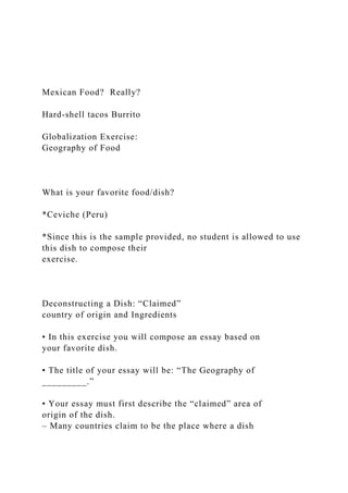
Mexican Food ReallyHard-shell tacos BurritoGlobaliz.docx
- 1. Mexican Food? Really? Hard-shell tacos Burrito Globalization Exercise: Geography of Food What is your favorite food/dish? *Ceviche (Peru) *Since this is the sample provided, no student is allowed to use this dish to compose their exercise. Deconstructing a Dish: “Claimed” country of origin and Ingredients • In this exercise you will compose an essay based on your favorite dish. • The title of your essay will be: “The Geography of _________.” • Your essay must first describe the “claimed” area of origin of the dish. – Many countries claim to be the place where a dish
- 2. originates; recipes are not the same. • Ceviche (lime-marinated raw fish/shelffish); • Arroz con pollo (chicken and rice). After selecting your dish… • Enumerate all the ingredients that are included in your recipe. – Your recipe must have at-least 10 ingredients. – Include the basic elements that make up your recipe and not any processed food. • Some examples: – Oil (i.e., olive, corn, etc.); – Sausages (i.e., beef, pork, turkey?); – Tomato paste; – Just include the name of the basic ingredient and in parenthesis its form. » For example: “tomato (paste)”; “corn (oil)”; “pork (sausage)”; etc. Area of Domestication • Next, you will find the area where each of these elements were domesticated.
- 3. • Use map “Centers of Plant and Animal Domestication” (next slide) as the main source of reference. • Note that most plants and animals that are used in many recipes have been domesticated in faraway regions where these recipes were developed. – For example, although arroz con pollo is a local favorite in many Latin American countries, chicken was domesticated in South and Southeast Asia and introduced to the Americas after the arrival of the European conquistadors (key definition: relocation diffusion). Centers of Plant and Animal Domestication Source: Getis, A., Getis, J. and J. Fellmann. 2008. Introduction to geography. New York: McGraw Hill. Native/Indigenous Ingredients • If it is an ingredient that is harvested locally, like a mineral (i.e., salt), or a native plant or animal species (i.e., fish, shellfish, etc.), these will be referred to as “native” or “indigenous.” • If your dish originates in a country that is part of a region of domestication, then all ingredients domesticated here must be noted as either native or using the name of the
- 4. region of domestication included, but not both. – This also applies to the first paragraph of this slide. Ingredients not Listed in the Map? • If some of the ingredients that are included in your recipe are not listed in this map, you can google it. • “Area of domestication of ________?” • However, I would highly recommend you to use the following website develop by Purdue University: http://www.hort.purdue.edu/newcrop/ • Here you can use their search engine to find the specific crops (plants only) that you are looking for: (go to) CropSearch. The Geography of Ceviche • “Claimed” country of origin: Peru • Ingredients: Region of origin: ? 1. Fish/Shellfish 2. Salt 3. Chili pepper 4. Garlic 5. Cilantro 6. Lime 7. Black pepper 8. Onion 9. Corn 10. Sweet potato
- 5. Centers of Plant and Animal Domestication Source: Getis, A., Getis, J. and J. Fellmann. 2008. Introduction to geography. New York: McGraw Hill. Table (25%) The Geography of Ceviche • “Claimed” country of origin: Peru • Ingredients: Region of origin: 1. Fish/Shellfish Native/Indigenous 2. Salt Native/Indigenous 3. Chili pepper Meso-America 4. Garlic Mediterranean 5. Cilantro Mediterranean 6. Lime South and Southwest Asia 7. Black pepper South and Southwest Asia 8.Onion Southwest Asia 9. Corn Meso-America 10. Sweet potato Meso-America Basic Stats • Ingredients (10) = 100%
- 6. • Native/Indigenous (2) = 20% • Meso-America (3) = 30% • Mediterranean (2) = 20% • South and Southeast Asia (2) = 20% • Southwest Asia (1) = 10% Making your Map (25%) Map Elements • A) Title: “The Geography of Ceviche” (top center). • B) Legend: in a box at the lower left (or right) corner. – This must include all symbols used in the map (flow lines/arrows using different colors for each region if you wish). • C) If the map you are using does not have the names of the regions were your ingredients originate, include them in the map using labels. • Your map must also include the shape of the regions of plant and animal domestication. • D) Orientation arrow pointing to the North (upper right hand side).
- 7. Line Symbols • Isoline maps – Lines of constant value • Flow-line maps – Portray linear movement between places Migration patterns in the US in the 1950s. Basic Stats • Ingredients (8) = 100% Legend • Native/Indigenous (2) = 20% • Meso-America (3) = 30% • Mediterranean (2) = 20% • South and SE Asia (2) = 20% • Southwest Asia (1) = 10% *Note that the width of the flow lines represents the contribution of each region of domestication (i.e., The flow line that represents Meso-America is 3 times larger that the one
- 8. form SW Asia). In the legend of your map include each of these symbols once only. Don’t forget to include these shapes for the areas of domestication Source: Getis, A., Getis, J. and J. Fellmann. 2008. Introduction to geography. New York: McGraw Hill. The Geography of Ceviche Peru Native Ingredients (2): 20% 1 Ingredient: 10% 2 Ingredients: 20% 3 Ingredients: 30% N Mediterranean Southwest Asia South and Southeast Asia Andean Uplands Meso-
- 9. America Essay (45%) and Bibliography (5%) • In this section you must de-construct and re- construct all the elements (ingredients) that are included in your dish, highlighting the area of origin of the ingredients, and the claimed area of origin of the dish. • This is an integral part of your work and must be as detailed as possible. Remember that this is a geography exercise and spatial distribution should be highlighted in your analysis. • Your essay must include comments of the number of ingredients that can be considered native (originated in the domestication region where the “claimed” country of origin if this is the case) and exotic (non-native/introduced species). Essay (45%) and Bibliography (5%) • In this section you will be evaluated in terms of the detail and thoroughness of the information you provide. This means that your analysis should be as descriptive and detailed as possible. – For example, you can start by making a basic statistical analysis commenting the contribution of each region of domestication using percentages.
- 10. • This essay should be at-least 800 words in length. • You must also demonstrate knowledge of the topic, using key definitions, and include at least one additional reference (textbook or a reputable website) that relates to your favorite dish. – This can include a source that describes the recipe you are using. You must include this reference in a separate page (Bibliography/Reference), making a full citation of this source. Bibliography (5%) • You must include at-least one pertinent reference in your essay portion making a notation (citation). – i.e., Quotation: “This dish defines what it means to be a true Cuban citizen” (Castro 2013: 55). – i.e., In your own words: According to some authors, this dish defines citizenship in Cuban culture (Castro 2013). • You must also include a full reference of this source in a separate page (Bibliography/References). – i.e., Castro, F. 2013. Ropa vieja: The true story. La Habana, Cuba: Fidelius Press. Essay (45%) • Any geographically-based essay must answer three broad questions: Where? Why? (and how?), and, So what? (or,
- 11. why is this important?). • For example, where is the center of domestication of these plants and animals? • Why (and how) were these ingredients introduced to the region where your recipe was developed? • In answering to the “So what?” or, in other words, “why is this important?” question, you must use the information you have included in the first two sections (Where? and Why?). This is an overview of the principle elements of your recipe and must include a conclusion’s paragraph of your analysis. • Do not include the preparation (recipe) of your dish in your essay. • This is irrelevant to the purpose of this exercise. • If you do so, you will lose points. Key Definition: Mobility: Relocation Diffusion new location carrying new ideas or practices with them. A prime example is the migration of Christianity with European settlers who came to America, or the introduction
- 12. of plants and animals. Key Definitions: The Columbian Exchange • The arrival of Europeans to the Americas brought two worlds previously isolated into contact. • This led to environmental changes that transformed the peoples, economies, and landscapes of both continents. • The “Columbian Exchange” resulted from the introduction of “exotic biological material” from both sides of the Atlantic (the Old and New worlds). • The exchange of plants is the most widespread and long- lasting impact of the “exchange”, affecting peoples and landscapes around the world (i.e., potatoes, manioc/cassava, corn, tomatoes, chilies, chocolate, tobacco). Transported European Landscape • Spaniards introduced horses, pigs, cattle, sheep, wheat, barely, olives, and grapes transforming the Latin American and Caribbean landscapes. – Sugarcane! • The two systems merged and altered each other in
- 13. different ways, changing the economic culture of both groups. Technical Aspects • Your paper must conform to the following formatting: • 12-point font (Arial, Times New Roman, Garamond, or Book Antiqua), • One-inch margins all around, • Double-spaced, and, • Number the pages. • Any exercise that does not follow this format will receive a 10% discount in the final grade for this assignment. The Checklist (Rubric) • In the course website you will find four items related to this Globalization Exercise: – The Instructions (word document). – This presentation (PPT). – The Checklist (Rubric).
- 14. – The Turnitin.com icon where you will upload your work. • The checklist (rubric) provides detail information about the requirements of each section and their weights. – Before submitting your work, go through this list to make sure your work is complete. Final Details • You must upload your work to the Turnitin.com icon located inside the Assignment Dropbox. • Late work will be accepted but will receive a 10- point discount for each week this is late. • No late work will be accepted after two weeks from the deadline. Plagiarism • For the exercises or any other written assignment, your answer must be your own, original thoughts. • If you plagiarize your thoughts from a website, journal, or any other source, not only you will be sad because you cannot write the small number of words of your own, but because you will earn a failing grade in this class.
- 15. It is not allowed to work in groups • Even if the information is presented on a graph, figure, map, etc., Turnitin.com can determine if there is any plagiarism issues. • I’ve seen these done before –plagiarizing a similar assignment. • Don’t do it! It can cost achieving your academic goals (and dreams). Any questions? Send me a message using the course website ASAP. 1 3. Scale and Projections Scale and projections are two fundamental features of maps that usually do not get the attention they deserve. Scale refers to how map units relate to real-world
- 16. units. Projections deal with the methods and challenges around turning a three-dimensional (and sort of lumpy) earth into a two- dimensional map. This section will introduce you to… measuring on the ground characteristics By the end of this chapter, you should be able read map scales and identify common projections along with their basic features and uses. 3.1 Scale The world is vast. The earth’s surface has an area of over 500 million km2 and any picture of the earth that you can easily carry can only show general outlines of continents and countries. When we visually represent a region of the world on a map, we must reduce its size to fit within the boundaries of the map. Map scale measures how much the features of the world are reduced to fit on a map; or more precisely, map scale shows the proportion of
- 17. a given distance on a map to the corresponding distance on the ground in the real world.1 Map scale is represented by a representative fraction, graphic scale, or verbal description. Representative fraction. The most commonly used measure of map scale is the representative fraction (RF), where map scale is shown as a ratio. With the numerator always set to 1, the denominator represents how much greater the distance is in the world. Figure 3a shows a topographic map with an RF of 1:24,000, which means that one unit on the map represents 24,000
- 18. units on the ground. The representative fraction is accurate regardless of which units are used; the RF can be measured as 1 centimeter to 24,000 centimeters, one inch to 24,000 inches, or any other unit. Figure 3a. Representative fraction and scale bars from a United States Geological Survey (USGS) topographic map 2 Graphic scale. Scale bars are graphical representations of distance on a map. Figure 3a has scale bars for 1 mile, 7000 feet, and 1 kilometer. One important advantage of graphic scales is that they remain true when maps are shrunk or magnified. Verbal description. Some maps, especially older ones, use a verbal description of scale. For
- 19. example, it is common to see “one inch represents one kilometer” or something similar written on a map to give map users an idea of the scale of the map. Map makers use scale to describe maps as being small-scale or large-scale. This description of map scale as large or small can seem counter-intuitive at first. A 3-meter by 5-meter map of the United States has a small map scale while a UMN campus map of the same size is large-scale. Scale descriptions using the RF provide one way of considering scale, since 1:1000 is larger than 1:1,000,000. Put differently, if we were to change the scale of the map with an RF of 1:100,000 so that a section of road was reduced from one unit to, say, 0.1 units in length, we would have created a smaller-scale map whose representative fraction is 1:1,000,000. When we talk about large- and small-scale maps and geographic data, then, we are talking about the relative sizes and levels of detail of the features represented in the data. In general, the larger the map scale, the more detail that is shown (Figure 3b).2
- 20. Figure 3b. These two satellite images depict the pyramids in Giza, Egypt. The image on the left is zoomed out or appears to be taken from far above the earth. This is a small-scale map. The map on the right is a larger-scale map. This distinction between larger-scale and smaller-scale is not intuitive, so here is an easy tool to remember it: if the buildings are larger, then the scale is larger. 3 3.2 Extent vs. Resolution The extent of a map describes the area visible on the map, while resolution describes the smallest unit that is mapped. You can think of extent as describing the region to which the map is zoomed. The extent of the map in Figure 3c is national as it encompasses the contiguous United States, while the resolution is the state, because states are the
- 21. finest level of spatial detail that we can see. Figure 3c. Map showing a national extent and a state resolution. 4 We often choose mapping resolutions intentionally to make the map easier to understand. For example, if we tried to display a map with a national extent at the resolution of census blocks, the level of detail would be so fine and the boundaries would be so small that it would be difficult to understand anything about the map. Balancing extent and resolution is often one of the most important and difficult decisions a cartographer must make. Figure 3d offers two more examples of the difference between extent and resolution. Figure 3d. Maps showing an extent of the Pacific Northwest, the left with a spatial resolution of county
- 22. and the right with a spatial resolution of census tracts 5 3.3 Projections This section will introduce you to projections, the term for turning a three-dimensional globe into a two- dimensional map. We will discuss the process of how objects on a 3-dimensional surface (the earth) come to be represented on a flat piece of paper or computer screen. Our emphasis will be on the properties that different projections distort or maintain – area, shape, and distance. Projection is the process of making a two-dimensional map from a three-dimensional globe. We can think of the earth as a sphere. In reality, it is more of an ellipsoid with a few bulges, but it is fine to think of it as a
- 23. sphere. To get a sense of how difficult this process can be, imagine peeling the skin from an orange and trying to lay the skin flat (Figure 3e). As you peel and flatten the skin, you will encounter several problems: – stretching the skin in one or more directions – causing the skin to separate ing – forcing the skin to bunch up and condense Cartographers face the same three issues when they try to transform the three-dimensional globe into a two dimensional map (Figure 3f). If you had a globe made of paper, you could carefully try to ‘peel’ it into a flat piece of paper, but you would have a big mess on your
- 24. hands. Instead, cartographers use projections to create useable two-dimensional maps. Figure 3e. Flattened orange peel 3 Figure 3f. Shearing, tearing, and compression on a globe. 6 3.4 Mechanics of Projection The term “map projection” refers to both the process and product of transforming spatial coordinates on a three-dimensional sphere to a two-dimensional plane. In terms of actual mechanics, most projections use mathematical functions that take as inputs locations on the sphere and translate them into locations on a two-dimensional surface. It is helpful to think about projections in physical terms (Figure
- 25. 3g). If you had a clear globe the size of a beach ball and placed a light inside this globe, it would cast shadows onto a surrounding surface. If this surface were a piece of paper that you wrapped around the globe, you could carefully trace these shadows onto the paper, then flatten out this piece of paper and have your projection! Figure 3g. Thinking of projections in physical terms – a clear globe, a light bulb, and tracing paper. 4 7 Most projections transform part of the globe to one of three “developable” surfaces, so called because they are flat or can be made flat: plane, cone, and cylinder. The resultant projections are called planar, conical, and cylindrical (as seen in Figure 3f). We use developable surfaces because they eliminate tearing, although they will produce shearing and compression. Of these
- 26. three problems, tearing is seen as the worst because you would be making maps with all sorts of holes in them! As we see below, however, there are times when you can create maps with tearing and they are quite useful. The place where the developable surface touches the globe is known as the tangent point or tangent line (Figure 3h). Maps will most accurately represent objects on the globe at these tangent points or lines, with distortion increasing as you move farther away due to shearing and compression. It is for this reason that cylinders are often used for areas near the equator, cones used to map the mid-latitudes, and planes used for polar regions. For beginning mapmakers, understanding the exact mechanics of projections doesn’t matter as much as knowing which map properties are maintained or lost with the choice of projection – the topic of the next section.
- 27. Figure 3h. Red marks the tangent line/point. The flat surface touches the globe and it is the point on the projected map which has the least distortion. 5 8 3.5 Types of Projections Projections must distort features on the surface of the globe during the process of making them flat because projection involves shearing, tearing, and compression. Since no projection can preserve all properties, it is up to the map maker to know which properties are most important for their purpose and to choose an appropriate projection. The properties we will focus on are: shape, area, and distance. Conformal
- 28. Conformal projections preserve shape and angle, but strongly distort area in the process. For example, with the Mercator projection (Figure 3i), the shapes of coastlines are accurate on all parts of the map, but countries near the poles appear much larger relative to countries near the equator than they actually are. For example, Greenland is only 7-percent the land area of Africa, but it appears to be just as large! Conformal projections should be used if the main purpose of the map involves measuring angles or representing the shapes of features. They are very useful for navigation, topography (elevation), and weather maps. Figure 3i. Mercator projection 9 Equal Area On equal-area projections, the size of any area on the map is in true proportion to its size on the earth. In other words, countries’ shapes may appear to be squished or stretched compared to
- 29. what they look like on a globe, but their land area will be accurate relative to other land masses. For example, in the Gall-Peters projection (Figure 3j), the shape of Greenland is significantly altered, but the size of its area is correct in comparison to Africa. This type of projection is important for quantitative thematic data, especially in mapping density (an attribute over an area). For example, it would be useful in comparing the density of Syrian refugees in the Middle East or the amount of cropland in production. Figure 3j. Gall-Peters projection 10 Equidistant Equidistant projections, as the name suggests, preserve distance. This is a bit misleading
- 30. because no projection can maintain relative distance between all places on the map. Equidistant maps are able, however, to preserve distances along a few clearly specified lines. For example, on the Azimuthal Equidistant projection (Figure 3k), all points are the proportionally correct distance and direction from the center point. This type of projection would be useful visualizing airplane flight paths from one city to several other cities or in mapping an earthquake epicenter. Figure 3k. Azimuthal Equidistant projection 11 Distortion and Developable Surfaces Note that distortion is not necessarily tied to the type of developable surface but rather to the way the transformation is done with that surface. It is possible to
- 31. preserve any one of the three properties using any of the developable surfaces, as Figure 3l shows when using a cone. Conformal Equal Area Equidistant
- 32. Figure 3l. Three maps created using a conic surface each of which preserves a different map property (Lambert conformal conic, Albers equal area conic, and Schjerning north polar equidistant conic)6 12 Compromise Projections Some projections, including the Robinson projection (Figure 3m), strike a balance between the different map properties. In other words, they do not preserve shape, area, or distance, but instead try to avoid extreme distortion of any of these properties. This type of projection would be useful for a general purpose world map.
- 33. Interrupted Projections Other projections deal with the challenge of making the 3D globe flat by tearing the earth in strategic places. Interrupted projections such as the Interrupted Homolographic (Figure 3n) represent the earth in lobes, reducing the amount of shape and area distortion near the poles. Figure 3m. Robinson Projection 7 Figure 3n. Interrupted Homolographic. Pseudocylindrical equal-area (National Geographic Society 1904) 13 Artistic projections
- 34. There are also a large number of projections that are interesting and beautiful, but not intended for navigation between places or to visualize data. Examples of these artistic projections include the heart-shaped Stabius-Werner projection (Figure 3o) and Waterman’s “Butterfly” projection (Figure 3p). Figure 3o. Stabius-Werner Projection (Pseudoconic equal area) 8 Figure 3p. Waterman’s “Butterfly” projection 9 3.6 Conclusion In this section, we have looked at some of the most frequently used projections. There are hundreds of projections, each which distorts the world in a slightly different way. Keep in mind that all maps have a scale and there a few important ways to
- 35. indicate this scale. All maps also use a projection that can be formed from a developable surface and can preserve one or two properties at most. 14 Resources: //giscommons.org/earth-and-map-preprocessing/ http://www.geo.hunter.cuny.edu/~jochen/gtech201/lectures/lec6 concepts/map%20coordi nate%20systems/how%20to%20choose%20a%20projection.htm es to projections: o http://www.csiss.org/map-projections/index.html o http://www.progonos.com/furuti/MapProj/Normal/ProjTbl/projT bl.html 1 Parts of this section are adapted from Campbell and Shin
- 36. (2011). Essentials of Geographic Information Systems. http://open.umn.edu/opentextbooks/BookDetail.aspx?bookId=67 2 Penn State Geog 482 “The Nature of Geographic Information” Ch.2.5 3 http://krygier.owu.edu/krygier_html/geog_222/geog_222_lo/geo g_222_lo13.html 4 http://www.geog.ucsb.edu/~dylan/mtpe/geosphere/topics/map/m ap1.html#proj 5 http://geokov.com/education/map-projection.aspx but © USGS 6 © 2013 Carlos A Furuti, http://www.progonos.com/furuti/MapProj/Normal/ProjCon/Proj ConNP/projConNP.html 7 http://kartograph.org/showcase/projections/#robinson 8 © 1997 Carlos A Furuti, http://www.progonos.com/furuti/MapProj/Normal/ProjPCon/pro jPCon.html#Werner1 9 © 1997 Carlos A Furuti, http://www.progonos.com/furuti/MapProj/Normal/ProjPoly/proj Poly2.html#gnoct http://giscommons.org/earth-and-map-preprocessing/ http://www.geo.hunter.cuny.edu/~jochen/gtech201/lectures/lec6 concepts/map%20coordinate%20systems/how%20to%20choose %20a%20projection.htm http://www.geo.hunter.cuny.edu/~jochen/gtech201/lectures/lec6 concepts/map%20coordinate%20systems/how%20to%20choose %20a%20projection.htm http://www.csiss.org/map-projections/index.html http://www.progonos.com/furuti/MapProj/Normal/ProjTbl/projT bl.html http://geokov.com/education/map-projection.aspx