
Recommended
Recommended
More Related Content
Similar to Major Project ppt.pptx
Similar to Major Project ppt.pptx (20)
Recently uploaded
Recently uploaded (20)
Major Project ppt.pptx
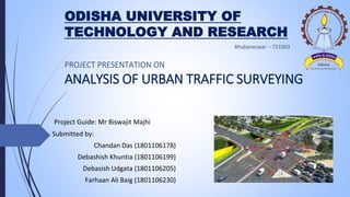
- 1. ODISHA UNIVERSITY OF TECHNOLOGY AND RESEARCH Project Guide: Mr Biswajit Majhi Submitted by: Chandan Das (1801106178) Debashish Khuntia (1801106199) Debasish Udgata (1801106205) Farhaan Ali Baig (1801106230) PROJECT PRESENTATION ON ANALYSIS OF URBAN TRAFFIC SURVEYING
- 2. INTRODUCTION • Traffic survey definition means to capture data that accurately reflects the real-world traffic situation in the area. It may be counting the number of vehicles using a road or collecting journey time information. • Traffic volume is the most important part while we are studying the traffic flow and capacity. According to traffic volume the design and planning of the road system has to plan. • Importance of traffic surveys arises when it comes to transport planning, an essential basic requirement is obtaining a sound understanding of the actual conditions on the ground in order to predict what the conditions would be in the future. • Traffic flow in India due to heterogeneous condition it is not possible that the vehicles movement in lane. Due to this India facing problem traffic due to heavy traffic volume, Measuring the traffic volume of a heterogeneous nature traffic is represented by transforming the types of vehicles corresponding to the conveying in terms of passenger car unit per hour.
- 3. • Measuring the traffic volume of a heterogeneous nature traffic is represented by transforming the types of vehicles corresponding to the conveying in terms of passenger car unit per hour.
- 4. OBJECTIVES OF STUDY The main objective of this research is to analysis the traffic volume and calculate the total number of vehicle flow at the intersection and study area. It is studied to known about the traffic conditions and required for further improvement which are required for smooth traffic flow. Some objectives are to be study which is given below: To analyze the traffic volume at different areas of Bhubaneswar and evaluate the total PCU of each areas. After analyze the traffic volume we are able to evaluate the factor that affect the congestion. To After the all suitable calculation we would like to suggest a design of our own to minimize the exiting factor affecting economical and environmental too.
- 5. A real time snapshot of the road while counting vehicles
- 6. RESEARCH METHODOLOGY FIELD WORK MEASURING THE ASPECTS COLLECT THE DATA ANALYSIS OF DATA EVOLUTION OF DATA CALCULATING TRAFFIC VOLUME
- 7. CASE STUDY Total area of Bhubaneswar city is 422 km² and the coordinates of the city is 20⁰17'45.8129" N and 85⁰49'28.3409" E and the elevation is 58m. The total number of registered vehicles in Bhubaneswar is approximately 1.4 million as per 2019 data. In this Project we have taken four different traffic region for our study 1. Kalpana Square 2. KIIT Square 3. Studio Chhawk 4. Master Canteen
- 8. 1. KALPANA SQUARE Kalpana square has 3 way traffic one towards RajMahal other towards BJB Nagar & another leads to Chinta Manishwar . It has high traffic during office hours 10-11AM & 5-6 PM , lengths & width of the road needs to be increased instantly. 2. KIIT SQUARE KIIT Square, it is another most important traffic of BBSR. IT has also 3 ways one leads to KIIT & KIIMS, another leads to Jaydev Vihar &, other to NandanKanan. Presence of University makes this Traffic too busy during College & Office timings specially 5 - 8 PM & 9 -11 AM is the busy hour. More traffic Volunter needed & although condition of Road is Good.
- 9. One of the most important traffic situation outskirt of the town. This is a four way traffic, one way leads to Khandagiri and other to Chandaka. One way leads to Sum hospital and other to rental colony. Being outskirt of the town it's an accident prone area so more awareness and volunteers needed. 3. STUDIO CHHAWK 4. MASTER CANTEEN The most important traffic in Bhubaneswar. It is a four way traffic. One way leads to railway station, other to lower PMG, one way leads to Rajmahal and the other one leads to Vani Vihar. It's one of the busiest route due to presence of railway station, thus rotary has been replaced with four way traffic recently. Widening of road is necessary and more volunteers needed for traffic volume control.
- 10. • We have surveyed these 4 important traffic systems for 5 days • We have collected data like – i. Length of the Traffic ii. Width of the traffic iii. Embankment of the road iv. Traffic Volume (For 7 days) 2 Wheelers 3 wheelers 4 wheelers Heavy commercial vehicle Light Commercial Vehicle • We don’t have an instrument so we will be using the manual method of counting the vehicles. I. Direct method. ii. Indirect method In this survey traffic volume data is collected on hourly basis for 5 hours everyday in 2 shifts for 5 consecutive days at different locations.
- 11. A real time snapshot while measuring the aspects of the road
- 12. • We have calculated the traffic volume at four different traffic points in the form of PCU(Passenger Car Unit) which is recommended by IRC. car 1.0 Motorcycle 0.5 Non – Motorised Vehicles 0.2 LCV 2.2 HCV 3.5 3 Wheeler 0.8 By the help of PCU we will analyse the traffic volume and purposed a new design for some case studies.
- 13. Some graphical representation of the data (time/pcu) 0 500 1000 1500 2000 2500 3000 PCU o Kalpana day 02 0 500 1000 1500 2000 2500 3000 PCU o KIIT day 03 0 500 1000 1500 2000 2500 PCU o Kalinga studio day 04 0 500 1000 1500 2000 2500 3000 PCU o Master Canteen 05
- 14. • We collect the data of vehicles at the peak time that’s why, we have taken highest no PCU as the traffic volume, which is Q, • We determine the no vehicles passing through a particular unit length which is known as density. • If you calculate the Q and density K then we can calculate the velocity V at that intersection area, and the relation is Q = K .V then V = Q/K • We apply the formula upon all the 4 study area. • After calculation we derived that the lowest velocity of study area. • We consider the lowest velocity of study area is the worst condition of that particular area
- 15. • After compilation of the calculation, we found there is a some serious traffic congestion. • We observed that : For Kalpana square the lowest velocity is 18.07 (day 02) For KIIT square the lowest velocity is 20.65 (day 05) For Kalinga studio square the lowest velocity is 19.45 (day 01) For Master canteen the lowest velocity is 20.17 (day 01) • Design speed of all the study area is same and that is = 40km/hr, because all the study area connected with National Highway no 5. • With the help of traffic flow analysis it shows that the traffic is too crowded when the velocity is low. Due to heavy traffic vehicles it increases heavy traffic congestion
- 16. Improvements for Kalpana square : • As per the observe data the traffic congestion is at its peak from 9.00 – 10.00AM in the morning and 6.00 – 7.00 PM in the evening. • Kalpana square is a 3 way traffic system and the highest PCU is less than 3000 So rotary cant be suggested here. • There is already a Flyover connected from AG – KALPANA , so suggestion of another flyover is illogical. • The only remaining option , We could suggest Widening of Pavement by 1.85 from both the sides. • The traffic volume in between the route (Laxmisagar – Odisha Museum) is very high so we need to provide that widening. • The road widening in Kalpana square will promote faster mobility, connectivity and reduce traffic congestion.
- 17. Improvements for KIIT Square • The observed traffic flow data denotes congestion in traffic volume specially during college hours i.e. 9:00-10:00 a.m. and 6:00 to 7:00 p.m. In these timings traffic volume rises and vehicular velocity decreases. • The calculated data shows peak PCU in traffic is less than 3000. It is 3 way traffic so rotary cannot be suggested. • Space for making a flyover is not sufficient so flyover is not also an option. Widening of road in this route includes along process of land acquisition of private entities and also not sustainable in long term because this Chandrasekharpur area is still growing and traffic in this region is gradually increasing. • The best option what we have observed here is to design and construct a new road from KIIT square to Fire station which will divert a decent traffic to Khorda route. It will be beneficial for a long time and long term problem solving than widening of road.
- 18. Kalinga studio Square We had measured the PCU as well as the lowest velocity but in further discussion we concluded that no improvement is necessary for the area. Actually it is the driver’s perception at what speed he/she can comfortably cross the crossings. Being located in the outskirts of the city, this traffic is more accident prone and localites here are unaware about traffic rules so more traffic volunteers and strict traffic rules implementation is suggested.
- 19. Master canteen ( A special case study) • The average peak PCU value in master canteen is equivalent to 2500. • Few years back rotary was designed here to maintain traffic flow at high PCU times. One side of the rotary got heavily jammed due to meeting points of three routes i.e. Railway station, reliance trends road and Rajmahal road which made this rotary more accident prone. As per our observation rotary design was successful in initial years but with growing traffic volume made this rotary more congested and accident prone. Also with the expansion of nearby shopping malls resulted in the reduction of outer radius of rotary. • Recently designed four way traffic proved to be a little ahead which made the traffic outflow strategically efficient. This four way traffic diverted the influx from the railway station which eventually is helpful in decrement of traffic volume. • Here we learnt that proper location of traffic post is very important for the traffic flow management.
- 20. CONCLUSION: Traffic Volume survey is no doubt not an easy task if you are doing it manually with a paper and pad in your hand. Traffic volume is the most delicate information to implement transportation planning, design and to start new transportation modes Traffic congestion is a global challenge in the development of sustainable and resilient traffic management systems. In this survey we have collected the real time data, computed the values, created graphical representation. We calculated the velocity of the traffic area by the help of traffic volume Q and the density K . Traffic congestion is a global challenge in the development of sustainable and resilient traffic management systems. In this survey we have collected the real time data, computed the values, created graphical representation. We calculated the velocity of the traffic area by the help of traffic volume Q and the density K . With the help of our suggestions these improvements should be possible : • It will save fuel consumption. • It will save the total journey time as well as traffic congestion will be minimal • Traffic will flow without any interruption, that will be help for economical growth of our country
- 21. THANK YOU