Lecture quran on clouds
•Download as PPTX, PDF•
0 likes•311 views

1) The document discusses how meteorologists have learned about the formation of cumulonimbus rain clouds through study, with clouds being pushed together and joining to form larger clouds that stack up as updrafts increase, allowing water and hail to form and fall as rain. 2) It notes that a verse from the Quran accurately describes this process of clouds moving and joining to form stacks that produce rain. 3) The document also discusses how the Quran accurately states that hail falls from cloud mountains and that hail plays a role in producing lightning through the process of electrification within thunderstorm clouds.

Recommended
Recommended
More Related Content
What's hot
What's hot (20)
Similar to Lecture quran on clouds
Similar to Lecture quran on clouds (20)
More from Amel Hope
More from Amel Hope (20)
Lecture quran on clouds
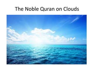
- 1. The Noble Quran on Clouds
- 2. • Scientists have studied cloud types and have realized that rain clouds are formed and shaped according to definite systems and certain steps connected with certain types of wind and clouds. • One kind of rain cloud is the cumulonimbus cloud. Meteorologists have studied how cumulonimbus clouds are formed and how they produce rain, hail, and lightning. • They have found that cumulonimbus clouds go through the following steps to produce rain:
- 3. • 1) The clouds are pushed by the wind:Cumulonimbus clouds begin to form when wind pushes some small pieces of clouds (cumulus clouds) to an area where these clouds converge (see figures 17 and 18).
- 4. Figure 17: • Figure 17: Satellite photo showing the clouds moving towards the convergence areas B, C, and D. The arrows indicate the directions of the wind. (The Use of Satellite Pictures in Weather Analysis and Forecasting, Anderson and others, p. 188.)
- 5. Figure 18 • Figure 18: Small pieces of clouds (cumulus clouds) moving towards a convergence zone near the horizon, where we can see a large cumulonimbus cloud. (Clouds and Storms, Ludlam, plate 7.4.)
- 6. • 2) Joining: Then the small clouds join together forming a larger cloud1 (see figures 18 and 19). • Figure 19: (A) Isolated small pieces of clouds (cumulus clouds). (B) When the small clouds join together, updrafts within the larger cloud increase, so the cloud is stacked up. Water drops are indicated by ·. (The Atmosphere, Anthes and others, p. 269.)
- 7. • 3) Stacking: When the small clouds join together, updrafts within the larger cloud increase. The updrafts near the center of the cloud are stronger than those near the edges.2 These updrafts cause the cloud body to grow vertically, so the cloud is stacked up (see figures 19 (B), 20, and 21). This vertical growth causes the cloud body to stretch into cooler regions of the atmosphere, where drops of water and hail formulate and begin to grow larger and larger. When these drops of water and hail become too heavy for the updrafts to support them, they begin to fall from the cloud as rain, hail, etc.3
- 8. • Figure 20: A cumulonimbus cloud. After the cloud is stacked up, rain comes out of it. (Weather and Climate, Bodin, p.123.)
- 9. • Figure 21: A cumulonimbus cloud. (A Colour Guide to Clouds, Scorer and Wexler, p. 23.)
- 10. • Allah has said in the Quran: • ((Have you not seen how God makes the clouds move gently, then joins them together, then makes them into a stack, and then you see the rain come out of it....)) (Quran, 24:43) • Meteorologists have only recently come to know these details of cloud formation, structure, and function by using advanced equipment like planes, satellites, computers, balloons, and other equipment, to study wind and its direction, to measure humidity and its variations, and to determine the levels and variations of atmospheric pressure.4
- 11. • The preceding verse, after mentioning clouds and rain, speaks about hail and lightning: • ((....And He sends down hail from mountains (clouds) in the sky, and He strikes with it whomever He wills, and turns it from whomever He wills. The vivid flash of its lightning nearly blinds the sight.)) (Quran, 24:43)
- 12. • Meteorologists have found that these cumulonimbus clouds, that shower hail, reach a height of 25,000 to 30,000 ft (4.7 to 5.7 miles),5 like mountains, as the Quran said,“...And He sends down hail from mountains (clouds) in the sky...” (see figure 21 above). • This verse may raise a question. Why does the verse say “its lightning” in a reference to the hail? Does this mean that hail is the major factor in producing lightning? Let us see what the book entitled Meteorology Today says about this. It says that a cloud becomes electrified as hail falls through a region in the cloud of supercooled droplets and ice crystals.
- 13. • As liquid droplets collide with a hailstone, they freeze on contact and release latent heat. This keeps the surface of the hailstone warmer than that of the surrounding ice crystals. When the hailstone comes in contact with an ice crystal, an important phenomenon occurs: electrons flow from the colder object toward the warmer object. Hence, the hailstone becomes negatively charged. The same effect occurs when supercooled droplets come in contact with a hailstone and tiny splinters of positively charged ice break off. These lighter positively charged particles are then carried to the upper part of the cloud by updrafts. The hail, left with a negative charge, falls towards the bottom of the cloud, thus the lower part of the cloud becomes negatively charged. These negative charges are then discharged as lightning.6 We conclude from this that hail is the major factor in producing lightning.
- 14. • This information on lightning was discovered recently. Until 1600 AD, Aristotle’s ideas on meteorology were dominant. For example, he said that the atmosphere contains two kinds of exhalation, moist and dry. He also said that thunder is the sound of the collision of the dry exhalation with the neighboring clouds, and lightning is the inflaming and burning of the dry exhalation with a thin and faint fire.7 These are some of the ideas on meteorology that were dominant at the time of the Quran’s revelation, fourteen centuries ago.
- 15. Footnotes • Footnotes: • (1) See The Atmosphere, Anthes and others, pp. 268-269, andElements of Meteorology, Miller and Thompson, p. 141. • (2) The updrafts near the center are stronger, because they are protected from the cooling effects by the outer portion of the cloud. • (3) See The Atmosphere, Anthes and others, p. 269, and Elements of Meteorology, Miller and Thompson, pp. 141-142. • (4) See Ee’jaz al-Quran al-Kareem fee Wasf Anwa’ al-Riyah, al-Sohob, al-Matar, Makky and others, p. 55. • (5) Elements of Meteorology, Miller and Thompson, p. 141. • (6) Meteorology Today, Ahrens, p. 437. • (7) The Works of Aristotle Translated into English: Meteorologica, vol. 3, Ross and others, pp. 369a-369b. • This presentation is taken from the website of: www.islam-guide.com