Laser Multicopter Presentazione Mil 26 01 10
•
1 like•509 views

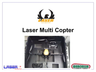
Some details about italian Multicopter UAV
![Laser Multi Copter Architettura di sistema: ,[object Object],[object Object],[object Object],[object Object],[object Object],[object Object],[object Object],[object Object],[object Object],[object Object],[object Object]](data:image/gif;base64,R0lGODlhAQABAIAAAAAAAP///yH5BAEAAAAALAAAAAABAAEAAAIBRAA7)
Recommended
More Related Content
Viewers also liked
Viewers also liked (14)
Similar to Laser Multicopter Presentazione Mil 26 01 10
Similar to Laser Multicopter Presentazione Mil 26 01 10 (20)
More from Roberto Navoni
More from Roberto Navoni (20)
Laser Multicopter Presentazione Mil 26 01 10
- 12. FOX IV
- 13. FOX IV
- 14. Impieghi operativi UAV - FOXIII
- 18. Sviluppi progetto UAV FOX-III e FOX-IV Individuazione tipologie impiego
- 19. PROGETTO FOX MULTICOTTERO UAV FOX Ambiente interno Ambiente esterno Microcottero FOX-III- Esa/ottocottero Mini FOX-III-6/8 Alacottero Mini FOX-IV-w Microcottero FOX-III-
- 20. Microcottero FOX-III- Il microcottero FOX-III-m è un UAV di dimensioni estremamente ridotte (ca.15/18 cm interasse) per operazioni locali. A bordo monta un’ elettronica di navigazione e controllo del volo molto efficace; è munito di comandi da palmare per consentire impiego / gestione del pay-load in modo semplice ed efficace. Il microcottero FOX-III- può essere impiegato in missioni con volo a vista o strumentale per una rapida e immediata acquisizione da parte delle unità operanti di informazioni real time relative alla situazione interna di obiettivi costituiti da edifici, con impiego e gestione di micro-telecamere e sensori e la possibilità di deporre e impiegare dispositivi e carichi utili di varia tipologia. Il microcottero FOX-III- può essere impiegato in missioni all’ esterno con volo a vista o strumentale per una rapida e immediata acquisizione di informazioni georeferenziate relative a obiettivi o alla zona di azione da parte di unità minori a livello di squadra / plotone durante lo svolgimento di missioni recon, o durante le fasi dell’azione con la possibilità di trasporto e impiego di sensori, dispositivi e ordigni esplosivi di dimensioni ridotte dispositivi di disturbo per diversivi
- 26. PROGETTO – FOX NCS FOX-V-HYDRO