
Recommended
More Related Content
What's hot
What's hot (20)
Similar to LAKE-.pptx
Similar to LAKE-.pptx (20)
Recently uploaded
Recently uploaded (20)
LAKE-.pptx
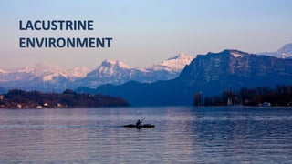
- 2. 1 2 Introduction lake is an inland body of water. Water from streams, groundwater feed lakes with water. The sediments deposited in lakes are called lacustrine deposits. Lakes cover about 1-2 percent of the Earth’s surface It is sometimes referred to as ‘inland seas’ but ‘inland seas’ have some exchange of water with open ocean whereas true lakes don’t. Formed where water is retained in a topographical depression. 4 6 5 3
- 3. The study of modern lakes is referred to as limnology Sediment accumulated in lakes are locally significant. Lake chemistry is sensitive to climatic conditions, making them useful indicators of past climates. Sand and mud are the most common components of lake deposits. Some lake deposits may also contain; 1.Economically significant quantities of oil shales, 2.evaporite minerals, limestone, uranium or iron 3.abundant fine organic matter that may be source material for petroleum or coal 7 8 9 10 11
- 6. LAKE FORMATION Endogenous Process Exogenous Process Tectonic Activity Volcanic Activity Glaciation Erosion & Deposition
- 7. TECTONIC ACTIVITY Rift and strike- slip basins are bounded by faults that cause parts of the land surface to subside relative to the surrounding area. With continued movement on the faults and hence continued subsidence, the lake may become hundreds of metres deep, and through time may accumulate hundreds or even thousands of metres of sediment. Depressions that are related to broad subsidence of the crust (sag basins) tend to be larger and shallower. Continental extension to generate rift Strike slip with continental crust Intracontinental Sag basins
- 8. VOLCANIC ACTIVITY Volcanic activity can also create large lakes by caldera collapse and explosive eruptions that remove large quantities of material from the Centre of a volcanic edifice, leaving a remnant rim within which a crater lake can form. The crust of a hollow lava flow may collapse. The subsidence leaves behind a wide and shallow depression in which a lake may form. In volcanic regions a stream of lava may flow across a valley, become solidified and thus dam the river forming a lake. Caldera Lakes Types Crater and Caldera Lakes Subsidence of a Volcanic Land Surface Lava- Blocked Lakes
- 9. GLACIATION Glaciers Create lakes by building of natural dams across a a valley floor through the formation of a terminal moraine. Glacier can scour more deeply into the valley, creating a depression in the valley floor & lakes creates. Types Cirque Lakes or Tarns Kettle Lakes Rock- Hollow Lakes Deposition of Glacial Drifts Morainic Damming of Valleys
- 10. EROSION AND DEPOSITION o Karst lakes are formed as the result of a collapse of caves, especially in water-soluble rocks such as limestone, gypsum and dolomite. o The deflating action of winds in deserts creates hollows. These may reach ground water which seeps out forming small, shallow lakes. Types Karst Lake Wind Deflated Lake Barrier lake Ox- Bow Lake
- 11. HUMAN AND BIOLOGICAL ACTIVITY Man Made lake o Animals like beavers are particularly interesting. They live in communities and construct dams across the rivers with timber. Such beaver dams are quite permanent and are found in North America. Lake Made by Animals o Besides the natural lakes, man has now created artificial lakes by erecting a concrete dam across a river valley so that the river water can be kept back to form reservoirs. Human activities (a lake made by constructing a a concrete dam across a a river valley) Dhebar lake
- 12. Lake Hydrology
- 13. 1 2 3 From Streams the sweet water can accumulate into lake and enrich the lake. It is Main source of water for lake. Rainfall contributes much low in lake water volume water. Only 6% of lake water enriched in rainfall. STREAMS RAINFALL Through Ground water seepage water can accumulate in lake basin. GROUND WATER Supply of Water in Lake
- 14. 2. Hydro-Geologically closed basin 1. Hydro-Geologically open basin 2 Based on inflow- outflow for basin
- 15. 1 2 water wont outflow until it reaches spill point Balanced Water supply into or out the basin Points to remember for Hydrogeologically Open Basin After reaching spill point, water level is constant and inflow- outflow takes place as its own 4 Due to constant inflow and outflow of sweet streamwater, ground and rainwater; salinity or dissolved salt level in this basin is so much low that other basins 3
- 16. Inflow into basin Spill point Outflow from basin Inflow = outflow Hydrogeologically open basin
- 17. 1 2 This type of basin known as endorheic lake. means the basin of internal drainage. points to remember for Hydrogeologically closed basin only inflow of basin takes place. There is no outflow of basin. only outflow of the basin is evaporation. Soluble ions weathered from rock and deposited in basin. As there in no outflow they start accumulating in basin increses basin salinity 4 evaporation rate is high and inflow is so low so there water level cannot reach spill point. 3
- 18. Inflow no out flow evapo-transporation rate (if we consider it not as outflow) > inflow Hydrogeologically closed basin
- 19. Effect of climate on lake salinity In arid dry environment mainly evaporation rate is high so here due to no outflow the closed basin waters have more salinity. In Humid and cold areas, the evaporation rate is very much low. so here basins are generally open basins and if it is closed the water in the basin is much less saline than the arid one.
- 20. Salt water lake Sweet water lake
- 21. PRECIPITAION CARVE so according to precipitation carve the precipitation sequence will be Calcite Gypsum Halite
- 22. NEAROCEAN LAKES Near Ocean when a waterbody partly isolated form Ocean. This are not actually Lake . This are Barred ocean but as they are isolated waterbody we will cover it. They are connected with seawater and seawater repeatedly replenish them. So they are deposited as salt giants. Production of thick succession Shallow water to Deep Basin Sallow water to Shallow basin Deep water to Deep basin
- 23. 1 Shallow water to Shallow Basin Here periodic overflow takes place. Due to this periodic overflow when saline water enter the basin and by evaporating it form a salt layer. then another saline water flow enter the basin . it forms another evaporite layering. so in this setting continuous subsidence of evaporite layer takes place.
- 24. 2 Shallow water to Deep Basin • Here, exists a basin which is well below sea level but is only partly filled with evaporating seawater, which is periodically replenished. • The deposits overlying the evaporites show deep marine characteristics such as turbidites.
- 25. 3 Deep water to Deep Basin • Is a basin in which evaporite sediments are formed at the shallow margins and are redeposited by gravity flows into deeper parts of the basin. • Normally graded beds generated by turbidites and poorly sorted deposits resulting from debris flows are evidence of redeposition.
- 26. Bull's eye pattern Denotes long time isolation from ocean
- 27. Teardrop pattern Denotes semi isolated Basin
- 28. Lake Types
- 30. 1.Freshwater Lake The majority of large modern lakes are freshwater. Low saline water, mainly hydrologically closed; hence low supply of dissolve ion. They occur at latitude ranging from equator to polar. Wular lake, Kashmir
- 31. 1.Freshwater Lake Hydrogeology of Freshwater lake Contrast in temperature, density and chemistry of upper and lower part of the water body forms LAKE WATER STRATIFICATION. Upper warmer water is known as Epilimnion Lower colder water body is known as Hypolimnion. They are separated by a surface, called Thermocline.
- 32. Freshwater Lake Hydrogeology of Freshwater lake Epilimnion is aerobic by contact with air, in contrast hypolimnion is anaerobic part. Organic matter deposited at lake floor, not subjected aerobic decomposition. Hence, good potential to form coal or source rock for oil and gas.
- 33. Lake Margin Clastic Deposit Lake delta: Where River enters intO lake, the water velOcity drOps abruptly, and a delta fOrms. Marshy envirOnment near the lake margin, referred tO as Palustrine envirOnment.
- 34. Deep Lake Facies Away from the margins, clastic sedimentation occurs as plumes of suspended sediment and transport by density currents. The suspended load will fall to the lake floor to form a layer of mud. Density currents provide mixtures of sediment and water brought in by a river or reworked from a lake delta may flow as a turbidity current. The deposits will be layers of sediment that grade from coarse material deposited from the current first to finer sediment that settles out last. Deep lake facies will consist of very finely laminated muds deposited from suspension alternating with thin graded turbidites forming a characteristic, thinly bedded succession.
- 36. Varve deposits A verve is a pair of sedimentary layers that is deposited over the course of a single year. They are most common in high latitude areas or high altitude lakes (i.e. glacial locations) where there is a strong contrast on seasonal conditions. During the spring and summer, coarse sediments are deposited into the lakes by the melt waters from nearby glaciers. During the winter, the lakes and rivers freeze. Only the fine sediments that settle from the water column is deposited on the lake bottom. These fine sediments are often rich in organic materials from decaying algae. Thus, they create a much darker layer. By counting the pairs of coarse-light layers and fine-dark layers. Geologist can determine how long it took for a particular sedimentary sequence to develop.
- 37. Saline Lake
- 38. Saline lakes are hydrologically close and perennial, supplied by rivers containing dissolved ions weathered from bedrock and in a climatic setting where there are relatively high rates of evaporation. About saline water lake
- 39. BRACKISH WATER SALINE WATER HYPERSALINE WATER The salinity may vary from 5 g/L of solutes, which is Brackish water. Saline, which is close to the concentration of salts in marine waters. Hyper saline waters, which have values well in excess of the concentrations in seawater.
- 40. Chemistry of Saline Lake water • The chemistry of saline lake waters is determined by the nature of the salts dissolved from the bedrock of the catchment area of the river systems that supply the lake. As the bedrock geology varies from placed to place so the chemical composition of every lake is therefore unique, unlike marine waters, Which all have the same composition of salts. • The types and proportions of evaporite minerals formed in saline lakes are therefore variable. • The main ions present in modern saline lake waters are the cations sodium, calcium and magnesium and the carbonate, chloride and sulphate anions.
- 41. Soda lake Sulphate lake Salt lakes or Chlorite lakes Soda lakes have brines with high concentrations of bicarbonate ions called Trona. And Sodium carbonate minerals such as Natron Brines have lower concentrations of bicarbonate but are relatively enriched in magnesium and calcium. Such as the Dead Sea are similar in mineral composition to marine evaporites. These minerals are not precipitated from marine waters and are therefore exclusive indicators of non-marine evaporite deposition. They precipitate mainly sulphate minerals such as gypsum and mirabilite.
- 43. Organisms in Saline Lake Blue-green algae and bacteria. Organic productivity may be high enough to result in sedimentary successions that contain both evaporite minerals and black organic-rich shale.
- 44. Ephemeral Lake
- 45. 1 Defination Ephemeral Lakes are large bodies of water that dry out periodically. 2 Formation Rate of evaporation outpaces rate of precipitation in such lakes. Types of Lakes 1. Perennial Brine bodies( Permanent saline lakes) 2. Ephemeral salt pans(Subjected to seasonal flooding) 3 4 Areas of Formation Mainly in desert areas ( Arid environment)
- 46. Alternative layer of Mud and Evaporites Water influx is periodic; suspension fall-out producing muddy layer during high water stage. With further evaporation the ion concentration in the water starts to increase to the point where precipitation of saline evaporitic minerals occurs. Desiccation Cracks Evaporation of the water body gradually reduces its volume and the area of the lake starts to shrink, leaving areas of margin exposed where desiccation cracks may form in the mud as it dries out. Inland Sabkhas and Desert rose Evaporite minerals form within the sediments surrounding the ephemeral lakes. 5 Depositional Freatures
- 47. CONTROLS ON LACUSTRINE DEPOSITION •Base level determining: A.Climate: Determining the water as well as sediment supply rates B. tectonism: Controls the size and depth of the lake and the type as well as rate of sediment supply Base level of lake Basin subsidence Initial base level Final base level • Accommodation space increases If, The accumulation of sediment is less than the basin subsidence. • Same effect will be there for uplift of the sill. Basin uplift Initial base level Final base level • Accommodation space decreases. with basin uplift with mass accumulation of sediment.
- 48. • The fluvial input is approximately balanced by the loss through evaporation. • Sensitive to climate. • Shoreline may shift towards the basin centre. • May develop structure like desiccation crack. • Shore line can shift towards the sill. • Facies exabits vertical fluctuation of lake level. • lake level rarely reaches threshold, as in ephemeral or saline lakes. • Cycle of climate change can be inferred from the alternation of dark coloured mudrock and ecvaporites deposits. • Hydrologically OPEN. • Generally in HUMID environment. • Deposition at the margin(deltas, beaches). • Deposition from suspension fall out and by turbidity current. • No fluctuation of water depth. LAKES Overfilled Lakes Balanced fill Lakes Underfilled Lakes
- 50. Recognition of Lacustrine Facies If the succession is entirely terrigenous clastic material, it is not always easy to distinguish between the deposits of a lake and those of a low energy marine environment such as a lagoon and deep ocean basin. The main criteria for distinguishing between lacustrine and marine facies are often the differences between the organisms and habitats that exist in these environments. There are a number of groups of organisms that are found only in fully marine environments: these include corals, echinoids, brachiopods, cephalopods, graptolites and foraminifers on the other hand the more reliable indicator of freshwater condition are algal and bacterial fossil form. The lack of mixing of the oxygenated surface water with the lower part of the water column results in anaerobic condition which create stratification with in the water column of the lake. It is an unique feature of the lake environment. The bottom water of the is devoid of animals Because of that anaerobic condition, for that reason most of the sedimentary feature’s are remain unharmed from the bioturbation but in marine environments is typically destroyed by burrowing organisms.
- 51. Recognition of Lacustrine Facies The anoxia also prevents the aerobic breakdown of organic material that settles on the lake floor, allowing the accumulation of organic-rich sediments. The deposits of saline and ephemeral lakes usually can be distinguished from marine facies by the chemistry of the evaporite minerals.
- 52. Life in lakes and fossils in lacustrine deposits Paleontological evidence is often a critical factor in the recognition of ancient lacustrine facies. Fauna commonly found in lake deposits include gastropods, bivalves, ostracods and arthropods, sometimes occurring in Monospecific assemblages, that is, all organisms belong to the same species. Algae and cyanobacteria are an important component of the ecology of lakes. A common organism found in lake deposits are Charophytes, algae belonging to the Chlorophyta which are seen in many ancient lacustrine sediments in the form of calcareous encrusted stems and spherical reproductive bodies. Charophytes are considered to be intolerant of high salinities. Cold, sediment-starved lakes in mountainous or polar environments may be sites of deposition of siliceous oozes, The origin of the silica is diatom Phytoplankton it is very abundant in glacial lakes. These deposits are typically bright white cherty beds that are called Diatomite's Images of Chara in the field Source: THE ECOLOGY OF CHAROPHYTE ALGAE (CHARALES)1Maximiliano Barbosa, Forrest Lefler, David E. Berthold, and H. Dail Laughinghouse IV 2
- 53. Cold, sediment-starved lakes in mountainous or polar environments may be sites of deposition of siliceous oozes, The origin of the silica is diatom Phytoplankton it is very abundant in glacial lakes. These deposits are typically bright white cherty beds that are called Diatomite's