This document discusses the classification of sandstones based on texture and composition. It summarizes Bokman's criticisms of Folk's previous classification scheme, which considered these properties separately. Folk argues that texture (maturity) is primarily determined by environmental factors, not tectonism as Bokman claimed. Folk also disagrees with Bokman's hypothesis that immature sediments must be rich in feldspar/metamorphic rock fragments, while mature sediments are quartz/chert-rich. Folk provides a table comparing his classification terms to Bokman's and defends considering texture and composition as separate properties that can independently vary.
The continental crust covers nearly a third of the Earth’s surface, extends vertically from the Earth’s surface to the Moho discontinuity.
It is less dense than oceanic crust.
Compositionally is dominating by silicate elements
Models for the differentiation of the continental crust shows when and how it was formed
Reconciling the sedimentary and igneous records indicates that it may take up to one billion years for a new crust to dominate the sedimentary record.
The continental crust of the Earth differs from the crust of other planets in the Solar System
Its formation modified the composition of the mantle and the atmosphere
It supports life
And it remains a sink for CO2
Evaluating the composition of new continental crust can provide important clues as to how and when it may have been generated. Which is required understanding the differentiation processes of igneous (granites) and sedimentary rocks
This document discusses various criteria that can be used to determine the top and bottom of sedimentary beds and identify the relative age of rock layers. Some key criteria mentioned include unconformities, fossils, ripple marks, cross-bedding, graded bedding, and the position of cleavage in folded rocks. Law of superposition, which states that older beds are deposited first and therefore located lower in the stratigraphic column, is also discussed. Together, these criteria can be used to deduce the order of deposition and effects of tilting, folding, or other deformation on sedimentary beds.
Unconformities represent gaps or missing time in the geologic record due to non-deposition or erosion. There are several types of unconformities that can form, such as angular unconformities, disconformities, and nonconformities. Unconformities are important as they provide information about periods of geologic activity, like folding or erosion of the land, and help place boundaries on geologic timescales. They can be identified in the field based on features like a lack of parallel bedding above and below the contact, presence of erosion surfaces, and fossils of widely different ages across the boundary.
Geologic relative age determination involves subdividing Earth's geologic history based on the stratigraphic position and fossil content of rock units. Absolute ages are obtained through radiometric dating and provide numerical ages in millions of years ago. Key principles for determining relative age include superposition, cross-cutting relationships, inclusions, and unconformities.
Grade 8 Integrated Science Chapter 12 Lesson 1 on relative-age dating of fossils and rock layers. This lesson explains how scientists use rock layers to determine a age of a rock or fossil compared to others. The goal of this lesson is for students to be able to correctly order rock layers by age and to know the different disconformities and nonconformities.
Structural geology is the study of the three-dimensional of the rock units with respect to their deformational histories, Structure is spatial and geometrical configuration of rock components.
Structures are classified into two types:
Primary structures.
Secondary structures
Primary structures
Structures that form during deposition or crystallization of the rock, are the result of two processes:
Settling of solid particles from fluid medium in which they have been suspended, in most of the sedimentary rocks.
Crystallization of mineral grains from a liquid in which they have been dissolved as in igneous rocks.
This document discusses sedimentary structures, which are geological features formed during or just after sediment deposition. There are two types of sedimentary structures: primary and secondary. Primary structures form during deposition and include graded bedding, ripple marks, rip-ups, pebble imbrication, and mud cracks. Secondary structures form after deposition through chemical or physical processes, such as Liesegang rings, cone-in-cone structures, flame structures, raindrop impressions, and slump structures. Examples of each type of structure are provided along with brief descriptions.
This document discusses key features found in marine sedimentary rocks and structures. It describes 10 primary features including ripple marks, cross bedding, mud cracks, graded bedding, worm tracks, leaf prints, rip ups, rain prints, volcanic clasts, and sole marks. Each feature is defined and examples are provided. The document also discusses the importance of field studies for examining geological features and interpreting the depositional environment.
Evidence is given that the ejecta blanket of the 35.5-Myr-old Chesapeake Bay Crater is still extant and covers ~5,000 km2 of the U.S. mid Atlantic Coastal plain
This document discusses the structural study of plutons and plugs. It defines plutons as large igneous rock bodies that formed below the Earth's surface as magma slowly cooled. Plutons can be of various sizes and shapes. The structural study of plutons involves examining their internal structure, shape and size, and structural relationship to surrounding rocks. Specific types of plutons discussed include batholiths, laccoliths, lopoliths, sills, dikes, and ring dikes. Plugs are described as volcanic necks eroded away at the root of volcanoes.
Primary sedimentary structures are features formed during deposition of sedimentary rocks that provide information about the depositional environment. Some key primary sedimentary structures mentioned in the document include stratification, cross-bedding, ripples, graded bedding, sole marks, fossils, rip-up clasts, rainprints, desiccation cracks, imbrication, flute casts, soft-sediment deformation structures like slump folds, flame structures and clastic dikes. These structures can be used to determine paleocurrent direction, relative age, top vs bottom of strata, and the environmental conditions during deposition.
This document discusses metamorphism and its relationship to plate tectonics. It describes the three types of metamorphism - contact, regional, and dynamic - and explains their association with different plate boundaries. Divergent boundaries experience greenschist facies metamorphism forming metabasalt. Convergent boundaries produce more complex, higher grade metamorphism including blueschist, migmatites, and ophiolites. Transform boundaries result in mylonites and fault breccias through shearing.
Paired metamorphic belts occur where zones of high-pressure low-temperature metamorphism are parallel to zones of low-pressure high-temperature metamorphism. They were first recognized in Japan and form due to subduction of oceanic crust beneath continental crust. Paired metamorphic belts support the theory of plate tectonics, as the contrasting pressure-temperature conditions in the two parallel belts can be explained by ocean-continent convergence. Examples of paired metamorphic belts are found throughout the basement rocks of the former Gondwanaland supercontinent.
Stratigraphy is the study of temporal relationships in sedimentary rock layers and reflects changes in the balance between the rates of space production and filling. Stratigraphy records past geological events and adds a temporal dimension to sedimentology. It preserves details of major geologic events like mountain building, sea level changes, and climate fluctuations through principles such as superposition, original horizontality, lateral continuity, and crosscutting relationships.
This document discusses stratigraphy and related geological concepts. It begins by outlining the contents of stratigraphy, including principles of sequence stratigraphy, sedimentary basins, models in sedimentary geology, and applied sedimentary geology. It then discusses key stratigraphic concepts like lithostratigraphy, chronostratigraphy, and biostratigraphy. Finally, it covers principles of correlation, criteria for stratigraphic classification, and elements of correlation like time units, rock units, and correlation methods involving lithological, biostratigraphic, and radioactive dating controls.
This document defines facies as a body of rock characterized by a particular combination of lithology, physical structures, and biological features that distinguish it from surrounding rock. Facies are determined at small scales based on characteristics like grain size, sedimentary structures, color, composition, and fossil content. Facies associations represent depositional environments through combinations of facies. Facies successions show progressive changes in properties that indicate lateral or vertical environmental changes. Facies analysis is used to interpret depositional environments and systems from rock characteristics.
The document discusses geologic time and methods for dating rocks. It introduces the concept of the geologic time scale, which places geologic events in chronological order. There are two main methods for dating rocks: relative dating and absolute dating. Relative dating involves determining the sequence of past events without specific numerical measurements, using principles like superposition, cross-cutting relationships, and fossil succession. Absolute dating provides specific numerical ages for rocks and fossils using radiometric dating techniques to measure the decay of radioactive elements. The principles of radiometric dating are also outlined.
Sedimentary structures provide important information about the depositional environment and post-depositional changes to sedimentary rocks. Key structures discussed include beds and bedding planes, laminations, graded bedding indicating changes in grain size over time, cross-bedding reflecting currents, load casts and flame structures from density differences, sole structures on bed bases indicating erosion, and trace fossils providing evidence of organism behavior and helping determine correct bed orientations. Together, an understanding of these sedimentary structures allows reconstruction of the depositional environment and testing of the law of superposition.
Geological structures- التراكيب الجيولوجيه
Geological Structures
What are Geologic Structures?
إيه هيا التراكيب الجيولوجيه؟
Division of Structures
تقسيم للتراكيب الجيولوجيه
A- Primary structures
Ripple marks
Mud cracks
Cross bedding
Graded bedding
Burrows
B- Secondary Structures
Folds
Faults
Joints
Unconformities
What are Geologic Structures?
إيه هيا التراكيب الجيولوجيه؟
Geologic structure is any feature in rocks that results from deformation, such as folds, joints, and faults.
اى شكل فى الصخر ينتج من خلال عملية التشويه مثل : الصدوع والطيات
هى التشققات والتصدعات الضخمة والالتواءات العنيفة التى تشوه صخور القشرة الارضية .
Geologic structures are usually the result of the powerful tectonic forces that occur within the earth. These forces fold and break rocks, form deep faults, and build mountains .
Division of Structures
• Primary (or sedimentary) structures: such as ripple marks, cross-bedding, and mud cracks form in sediments during or shortly after deposition.
هى التراكيب الناتجة من تدخل العمليات الخارجية أثناء الترسيب
• Secondary structures: is that structures formed after the formations of any kind of rocks, such as folds, faults, or unconformities.
Primary structures
They are any structures in sedimentary rock formed at or shortly after the time of deposition: such as:
هى الاشكال التى تتخلف بالصخور تحت تأثير عوامل مناخية وبيئية خاصة مثل الجفاف والحرارة وتأثير الرياح والتيارات المائية وغيرها وبدون أى تدخل من جانب القوى والحركات الارضية أمثلة ذلك:
Ripple marks
علامات النيم: هي تموجات رملية صغيرة تنشأ على سطح الطبقات الرسوبية بواسطة حركة الماء أو الهواء و تكون حروف علامات النيم متعامدة على اتجاه الحركة.
They are wavelike (undulating) structures produced in granular sediment such as sand by unidirectional wind and water currents or by oscillating wave currents.
Wind and current ripples. (Asymmetric
Wave ripples. (Symmetric
Mud cracks
التشققات فى الرواسب الطينية : حيث ينكمش سطح الرسوبيات الطينية مخلفة شقوقا مميزة فى فترات الجفاف
Mud crack is a crack in clay-rich sediment that has dried out.
Cross bedding
التطبق المتقاطع هو النمط الذي تسلكه الرسوبيات الجديدة المتراكمة عند تأثرها بأي من التيارات المائية أو الهوائية. عندما تستق
Introduction
Stratigraphy is the study of strata (sedimentary layers) in the Earth's crust, it is the relationship between rocks and time.
Stratigrapher are concerned with the observation, description and interpretation of direct and tangible evidence in rocks to determine the history of the Earth.
The combination of sedimentology and stratigraphy allows us to build up pictures of the Earth’s surface at different times in different places and relate them to each other through the relative ages of rocks
A more modern way of stating the same principle is that the laws of nature (laws of chemistry and physics) that have operated in the same way since the beginning of time.
And thus if we understand the physical and chemical principles by which nature operates, we can assume that nature operated the same way in the past.
Basic principles of stratigraphy
Principle of Uniformitarianism
Principle of Lateral Horizontality
Principle of Superposition
Principle of Cross-cutting Relations
Principle of Inclusions
Principle of Chilled Margins
Correlation
The document provides an overview of the structure and composition of the Earth's layers, including the crust, mantle, and core. It then discusses plate tectonics and evidence that supports the theory of continental drift, such as matching geological formations and fossil distributions between continents before they drifted apart. The development of the modern theory of plate tectonics to explain continental movement is also outlined.
Sedimentary facies refer to rock or sediment bodies that are distinguished by their composition, texture, structures and other features related to the depositional environment. Key aspects of facies include grain size, sorting, fossils and bedding. Individual facies represent specific depositional conditions. Multiple genetically-related facies comprise a facies association representing a depositional system. Facies successions occur at different scales from individual systems to basin-scale sequences reflecting changes in sea level over time.
Sedimentary bedding and structures provide information about depositional environments. Beds form layers and their thickness indicates the depositional process. Beds are often nested within each other. Bedding patterns include massive, tabular, wedge-shaped and lenticular beds. Bedforms like ripples, dunes and cross-bedding are produced by fluid flows and indicate flow conditions. Other structures provide evidence of channels, erosion and soft-sediment deformation. Together, these features preserve a record of Earth's surface history.
1. The document discusses plate tectonics and how evidence shows continents moving and rearranging over geological time, with landmasses originally forming the supercontinent Pangaea before breaking apart.
2. Plate tectonics involves the movement of tectonic plates via convection currents in the mantle, with plates interacting at boundaries where they diverge, converge, or move past each other.
3. Volcanic activity and mountain building are associated with plate tectonics, occurring at boundaries where plates are moving apart or colliding.
Geological time is extremely long, spanning billions of years. To conceptualize this vast timespan, one frame in a movie representing 100 years would show major events like the Declaration of Independence occurring only 1/16 of a second into a 6 hour movie depicting Earth's history. Relative dating methods like superposition and cross-cutting relationships are used to sequence geological events. Absolute dating using radioactive isotopes provides specific numerical ages by measuring decay of elements with known half-lives. Together, relative and absolute dating techniques allow geologists to construct detailed timescales showing the entire history of Earth.
This document discusses various geological processes that shape Earth's surface over long periods of time. It describes how stress and strain lead to folding and faulting in the crust. It also explains how volcanic activity, earthquakes, and plate tectonics result in mountain building and other surface features. Key points include how the principle of uniformity helps us understand slow, gradual changes versus sudden catastrophic events, and how different rock types respond to stress depending on temperature, pressure, and time.
The document discusses different types of intrusive igneous rock bodies, known as plutons. It describes concordant plutons, which include sills, laccoliths, lopoliths, phacoliths, and bysmaliths. Sills are thin, tabular bodies that spread parallel to bedding planes. Laccoliths have a flat floor and domed roof, causing folding of overlying rock layers. Lopoliths are large, basin-shaped bodies with nearly flat tops and convex bottoms. Phacoliths and bysmaliths are also concordant bodies that form along folded strata. The document provides diagrams and examples of each type of concordant
This document defines and describes various primary structures found in sedimentary and igneous rocks. Primary structures form during or shortly after the formation of a rock and include features like bedding, cross-bedding, graded bedding, ripple marks, mud cracks, and unconformities in sedimentary rocks. In igneous rocks, primary structures include intrusive features like dykes, sills, batholiths, and extrusive features like pillow lava, ropy lava, and pyroclastic flows. Secondary structures form after the rocks solidify due to tectonic forces and include folds, faults, joints, and lineations.
This document defines terminology used to describe the timing of porosity development in sedimentary carbonates. It discusses three main stages: predepositional, depositional, and postdepositional. The postdepositional stage is further divided into three substages based on burial depth: eogenetic (early burial), mesogenetic (deeper burial), and telogenetic (late stage erosion of long-buried carbonates). Primary porosity forms before or during deposition, while secondary porosity forms after deposition during the various postdepositional substages. The terminology aims to more precisely characterize the complex evolution of porosity over geologic timescales.
La Unión Europea ha acordado un paquete de sanciones contra Rusia por su invasión de Ucrania. Las sanciones incluyen restricciones a las transacciones con bancos rusos clave y la prohibición de la venta de aviones y equipos a Rusia. Los líderes de la UE esperan que las sanciones aumenten la presión económica sobre Rusia y la disuadan de continuar su agresión contra Ucrania.
The viscosity of silica nanoparticle dispersions in permeable media UO
This document discusses a study on the viscosity of silica nanoparticle dispersions flowing through different types of permeable media, including glass bead packs, sandpacks, sandstone cores, and limestone cores. The researchers measured the viscosity of the dispersions in the porous media and compared it to viscosity measurements from a rheometer. They found that at high permeability media with regular pore structures, the concept of effective maximum packing fraction could be used to describe the viscosity. However, at low permeability media, mechanical trapping of nanoparticles affected the viscosity. The study provides new insight into modeling nanoparticle transport and rheology in subsurface applications.
The document summarizes the geology of the Lambeth Group in the London Basin based on borehole data.
The environment of deposition was a barrier island lagoon or bar-built estuaries based on evidence of burrows, shells, and plant roots indicating alternating marine and terrestrial conditions.
The rock types change from east to west, with the westernmost borehole containing structureless sandstone and mudstone deposited by a river, becoming more marine and structured to the east where shells and burrows indicate a lagoon/estuary environment, and the easternmost boreholes containing coastal beach deposits.
Potential reservoir sandstones exist but are not sufficiently thick, with the thickest being only 7m
NATSCI-CH for high school students in everydayRaymond Mortel
This document provides an overview of geologic time and how geologists determine the age of rocks. It discusses key concepts like relative dating, which determines if a rock is older or younger than another rock, and absolute dating using radiometric techniques to determine a rock's exact age in years. It also explains principles of stratigraphy, unconformities, key figures in the development of geology like James Hutton, and how scientists developed the geologic time scale based on dating rock layers.
This document summarizes key concepts about sedimentary basins. It defines sedimentary basins as areas of the Earth's crust where sediments accumulate due to tectonic subsidence. Tectonics plays a crucial role in forming sedimentary basins and controlling sedimentation rates and environments. Data on sedimentary basins comes from surface mapping, core sampling, and seismic profiling, which can be used to reconstruct the evolution of basins through cross sections, isopach maps, and backstripping techniques. Paleocurrent measurements provide important clues about sediment dispersal patterns within basins.
This document discusses sedimentary basins, including their definition, formation, and analysis. Key points:
- Sedimentary basins form in low areas of the crust where sediments accumulate due to tectonic activity that creates relief. They range in size from hundreds of meters to ocean basins.
- Tectonics is the primary control on sedimentation, affecting factors like sediment supply and depositional environment. Sedimentation also influences tectonics by increasing lithospheric loading.
- Basins can be formed by processes including faulting, thermal subsidence of extended lithosphere, and flexural subsidence caused by loading of the lithosphere.
- Analyzing features of sedimentary
1) The origin of continental crust is explored, with early continents forming around 2.5 billion years ago from partial melts of oceanic crust and volcanic sediments.
2) Early sediments deposited on ocean floors were immature and rapidly transported, forming greenstone belts when oceans closed, while later Proterozoic sediments were more mature with evidence of evolved life and seas.
3) Stromatolites provide evidence of early life dating back 3.5 billion years ago, and the rise of oxygen-producing cyanobacteria fundamentally changed the composition of the atmosphere and oceans.
This document summarizes the key types of sedimentary rocks and the depositional basins in which they form. It discusses mudrocks, sandstones, and carbonate rocks, and the environments where each accumulates. It also describes the three main types of plate tectonic settings that produce sedimentary basins: divergent margins like rift valleys, convergent margins including trench-slope, forearc, and intra-arc basins, and strike-slip settings containing transtensional basins. The dominant factor controlling the preservation and distribution of sedimentary rocks globally is the high percentage of Earth's surface covered by oceans, which act as large sediment traps.
Advanced petrology ( tectonic and sedimentation).pptx
How the sedimentation where taken and the kind of transportation process is going on? The role of plate tectonic settings in sedimentation.
The document summarizes research on the Whanganui Basin in New Zealand. Stratigraphic layers at Ototoka Beach were analyzed to determine the depositional environments at different time periods. Analysis of fossils and dating techniques showed the layers alternated between terrestrial and marine environments due to glacial-eustatic sea level changes. Notable layers included the Lower Maxwell deposited in a swamp 1.78 Ma, the Pukekiwi Shell Sand in a marine environment at 1.75 Ma, and the Upper Maxwell in a swampy environment at 1.71 Ma, demonstrating the cyclical sea level changes. In total, the stratigraphic analysis allowed researchers to understand the glacial-interglacial cycle's impact
The document provides an overview of geology, describing the structure of the Earth and key concepts in the field. It begins with definitions of geology and discusses the four spheres that make up the Earth: the geosphere, hydrosphere, atmosphere, and biosphere. Key points about the layers of the Earth's interior and crust are summarized. The remainder of the document outlines principles of geology including plate tectonics, geological timescales, dating methods like radioactive decay, and the progression of life forms through different eras.
Were Most of Earth's Fossil-Bering Sedimentary Rock Layers Deposited by Noah'...Tim Helble
This presentation uses the Coconino Sandstone to evaluate the question of whether it is quantitatively reasonable for sedimentary formations to have been deposited by Noah's Flood.
1) The document discusses the geology of the Oaks Belt region, which contains volcanic, volcaniclastic, sedimentary, and intrusive rocks. Mafic volcanic rocks make up most of the stratigraphy, while intermediate and felsic volcaniclastic rocks are also present.
2) Chemical sedimentary rocks like iron formation and chert are found in the region. Massive sulfide deposits tend to occur in brecciated piles of tuff fragments near footwall contacts.
3) The document provides context about the types of rocks found in the Oaks Belt region and their stratigraphic relationships.
This thesis mapped and analyzed Cenozoic sedimentary and volcanic units in Huntington Valley, Nevada to understand the depositional history and crustal deformation in the hanging wall above the west-dipping detachment fault bounding the Ruby Mountains-East Humboldt Range metamorphic core complex. Deposition was minor from the Late Cretaceous to Eocene but accelerated in the Middle Miocene with rapid deposition of the Humboldt Formation. Significant westward tilting occurred between 36.8-31.1 Ma and 31.1-16 Ma, likely associated with normal faulting in the adjacent Piñon Range. The findings support recent work showing that major surface-breaking extension occurred in the Middle Miocene in this region rather
This document provides an undergraduate thesis on the geology of the Moine Thrust Zone on the eastern shores of Loch Eriboll in northwest Scotland. It describes the author's 29 days of field mapping and their observations and interpretations of the local geology. The thesis covers the regional geological setting and provides detailed descriptions of the local stratigraphy, including the Eriboll Formation, An t-Sron Formation, and Tor Liath Formation. It also discusses the structural geology, metamorphic geology, igneous rocks, and provides an interpretation of the geological history of the area.
The document discusses the history of the Earth and methods used to determine geological timescales. It describes how rocks form records of past events and processes. Early scientists estimated the age of the Earth to be between 24-100 million years based on studies of heat loss and sodium accumulation in oceans. The principle of uniformitarianism states that past and present geological processes were similar. Relative dating methods order events but do not provide absolute ages. Radiometric dating using radioactive isotopes provides absolute ages and was used to construct the geologic timescale in eras, periods, and epochs marked by significant events in Earth's history.
This document summarizes the geology of an area in northwestern Montana. It describes the pre-Cambrian metamorphic basement rocks and an unconformity between them and overlying Paleozoic sedimentary units. During the Paleozoic, the area experienced periods of marine transgression and regression corresponding to changes in sea level. Folds, faults, and tilting affected the units during later deformation events, likely associated with mountain building episodes like the Laramide orogeny. While questions remain, the study area provides insights into the formation and evolution of the North American craton over billions of years.
Journal Petroleum Geology. Northern and Central North Sea Aptian sands, lowstand systems tract. Sequence stratigraphy development, Logs and micropapaeontology. prospectivity
The document provides information about the geology of the Flin Flon area in Manitoba, Canada. It discusses the regional history and lithology of the Flin Flon greenstone belt and broader Trans-Hudson Orogen. Specifically, it focuses on map area 4 from a University of Saskatchewan field school in Flin Flon. It describes a rock sample from the area as a greenschist facies mafic metavolcanic rock that displays a porphyritic texture and subtle foliation from deformation.
This document provides an overview of key concepts in understanding Earth's history through studying rock layers and fossils. It describes how geologists use relative dating principles like superposition and cross-cutting relationships to determine the relative ages of stratified rocks. Absolute dating techniques like radiometric dating using radioactive isotopes are also discussed. Together, these methods were used to construct the geologic time scale which divides Earth's history into standardized eons, eras, periods, and epochs. Marker fossils are important for identifying specific time periods. Examples of past Earth environments, organisms, and geological changes are shown for different eras.
16. the astonishing genesis flood, part 3Ariel Roth
This document discusses additional evidence for the Genesis Flood described in the Bible. It presents three key pieces of evidence:
1) Many sedimentary rock formations are unusually widespread, covering areas much larger than could be explained by local flooding or erosion. Their widespread distribution is better explained by a global catastrophic flood.
2) The rate at which continents are currently being eroded by rivers and weathering is too fast if the continents are assumed to be billions of years old, as conventional geology proposes. The present rates of erosion suggest the continents could have been eroded away many times over.
3) Flat gaps known as paraconformities exist between sedimentary layers, with significant amounts of geologic time assumed to be
Similar to La textura y clasificación en las areniscas folk (20)
Problemas 615 y 625Problemas 615 y 625Problemas 615 y 625Problemas 615 y 625Problemas 615 y 625Problemas 615 y 625Problemas 615 y 625Problemas 615 y 625Problemas 615 y 625Problemas 615 y 625Problemas 615 y 625Problemas 615 y 625Problemas 615 y 625Problemas 615 y 625.
El documento discute la monocultura y la diversidad cultural. Explica que la monocultura es una sociedad homogénea con una cultura dominante, mientras que la diversidad cultural valora la expresión de múltiples culturas. También describe que la identidad cultural se ve afectada por la monocultura, ya que puede perderse la tradición de cada cultura individual.
Este documento define los términos relacionados con la porosidad en rocas sedimentarias de carbonato y describe las etapas de formación y modificación de la porosidad a través del tiempo. Define la porosidad primaria creada durante o antes de la deposición y la porosidad secundaria creada después de la deposición. También describe las etapas eogenética, mesogenética y telogenética de la porosidad, las cuales ocurren durante el enterramiento y diagénesis de las rocas.
Este documento describe los cambios en los valores sociales y estilos de vida debido a factores como la globalización, el consumismo y la tecnología. Se ha pasado de una vida más simple y enfocada en la familia a una influenciada por extraños a distancia. Los niños ahora pasan más tiempo adentro con pantallas en lugar de actividad física. Las mujeres han ganado más derechos e independencia. La educación también ha cambiado, con más universidades privadas. Los valores ahora son más subjetivos y flexibles que rígidamente definidos.
El documento habla sobre la sociedad de la información y la cumbre mundial sobre la información de 2003 en Ginebra. En la sociedad de la información se aprende a lo largo de toda la vida y no solo para la vida. La cumbre estableció que la sociedad de la información debe centrarse en las personas y permitir que todos puedan crear, consultar, utilizar y compartir información para promover un desarrollo sostenible y mejorar la calidad de vida. Además, define que las TIC son las tecnologías de la información y la comunicación
El documento describe la empresa globalizada, caracterizada por realizar operaciones en todo el mundo concibiéndolo como un solo mercado. También describe la división internacional del trabajo a fines del siglo XIX, donde los países industrializados se especializaron en bienes industriales mientras que los países en desarrollo se dedicaron a la producción primaria, dividiendo el mundo en áreas centrales e industriales. El documento finalmente señala que esta división tuvo un impacto social negativo como altas tasas de desempleo, mayor intensidad laboral, jornadas extendidas y sal
La soberanía alimentaria es el derecho de los pueblos a definir sus propias políticas agrarias y alimentarias para garantizar el acceso a alimentos nutritivos y culturalmente adecuados de forma sostenible. Surge como principio en 1996 para promover el comercio justo y los derechos de los consumidores. México depende cada vez más de importaciones de alimentos básicos debido a problemas como el cambio climático, lo que amenaza su soberanía alimentaria.
Este documento describe varios métodos para medir la presión capilar en rocas de yacimientos. La presión capilar se genera en los poros de la roca cuando hay interfaces entre fluidos no miscibles y afecta la saturación inicial de fluidos y la capacidad de sellado. Los métodos incluyen inyección de mercurio, placa porosa, gas-salmuera, aceite-salmuera, centrífugo y otros más avanzados. Cada método tiene ventajas e inconvenientes en cuanto a precisión, tiempo requerido y capacidad de simular condiciones
El documento describe la globalización, la sociedad y la cultura. Explica que la globalización es un proceso de interacción entre personas, empresas y gobiernos de diferentes naciones que afecta el medio ambiente, la cultura, la política y la economía. Define una sociedad como un grupo de personas sujetas a las mismas leyes y normas, y explica que la cultura incluye las costumbres y expresiones de una sociedad. Finalmente, destaca que la globalización cultural conecta experiencias culturales a través de la tecnología y los medios de comunicación
La presión capilar es una medida de la fuerza que atrae a un líquido a través de un tubo delgado o capilar. Existen cuatro parámetros clave relacionados con una curva de presión capilar: la saturación inicial de agua, la saturación residual de petróleo, la presión de desplazamiento y el tamaño del índice de distribución de poros. La presión capilar puede medirse en el laboratorio de varias maneras, como mediante el método de diagrama de poros, la inyección de mercurio, el mé
El Distrito San Tomé se extiende por parte de los estados Anzoátegui y Guárico en Venezuela, cubriendo un área de aproximadamente 24,000 km2. La Unidad de Explotación Extrapesados de PDVSA en esta región está conformada por los Campos Bare y Arecuna, ubicados en la Faja Petrolífera del Orinoco, un área rica en crudo extrapesado. El Campo Bare se encuentra a unos 40 km al sur de El Tigre, mientras que el Campo Arecuna está a 60 km al suroeste de
El documento discute si existe una verdadera democracia, libertad e igualdad en México. Argumenta que aunque la constitución garantiza estos derechos, en la práctica se excluyen a ciertos grupos de participar plenamente en el proceso político. Pone como ejemplo el caso de una mujer indígena que ganó una elección pero le negaron el cargo, y cómo los requisitos para ser funcionario público a menudo excluyen a independientes y favorecen a los partidos políticos dominantes.
El documento describe dos métodos de explotación subterránea: corte y relleno y cámaras y pilares. El método de corte y relleno involucra la extracción de franjas horizontales y verticales de mineral comenzando desde abajo de un tajo y avanzando verticalmente, rellenando cada franja extraída con estéril. El método de cámaras y pilares consiste en la explotación de cámaras separadas por pilares de sostenimiento, pudiendo recuperarse los pilares parcial o totalmente. Ambos métodos son adec
Este documento describe las propiedades mecánicas más importantes de los macizos rocosos que son relevantes para el diseño de estructuras de ingeniería: deformabilidad, resistencia y permeabilidad. Explica que la deformabilidad y resistencia se pueden medir mediante pruebas de esfuerzo-deformación, y que la permeabilidad depende de la porosidad, densidad del fluido y presión. También cubre conceptos clave como compresión, tensión, corte y elasticidad en relación con las propiedades mecánicas de las ro
La mecánica de rocas estudia el comportamiento de las masas rocosas bajo fuerzas naturales o impuestas por el hombre. Requiere conocer la deformabilidad, resistencia y estado de esfuerzos de los macizos rocosos. Se aplica en excavaciones, cimentaciones de presas y extracción de petróleo. Las propiedades índices de las rocas incluyen porosidad, alterabilidad y permeabilidad, mientras que las propiedades mecánicas predictivas son deformabilidad, resistencia a compresión y corte, y permeabilidad.
Proyecto final evaluación y administracion de proyectosUO
Este documento presenta la evaluación de un proyecto de inversión petrolera en el área de Samaria Terciario en Tabasco, México. Describe la ubicación geográfica y geológica del área de estudio, los antecedentes de producción petrolera en la región, y justifica la evaluación del play hipotético y las posibles volumetrías de petróleo. El objetivo es determinar la viabilidad económica del proyecto mediante el análisis de reservas probadas, probables y la perforación de 3 pozos prospectivos.
La presión de sobrecarga en una cuenca sedimentaria depende del espesor y densidad de las rocas sobre la profundidad específica. La presión de fractura de una roca depende de su resistencia a la tensión y los esfuerzos a los que está sometida, fracturándose perpendicularmente al esfuerzo mínimo ya sea de forma vertical u horizontal.
Este documento presenta una breve reseña histórica de la minería desde la Edad de Piedra hasta la actualidad, destacando hitos como la Era del Cobre, la Era del Bronce y la Era del Hierro. Explica las sinergias entre la minería, la metalurgia y el desarrollo tecnológico, como la relación entre la Revolución Industrial y la extracción de carbón. También describe la dependencia actual de la sociedad respecto a los recursos minerales a pesar del avance tecnológico.
Este documento describe los diferentes tipos de equipos de perforación para perforar pozos de petróleo y gas, incluidos los equipos terrestres, marinos y flotantes. Explica los principales sistemas de un equipo de perforación, como el sistema de potencia, levantamiento, rotación, circulación y seguridad. También incluye diagramas e ilustraciones de cada sistema y sus componentes.
Este documento presenta una discusión sobre la clasificación y nomenclatura de la porosidad en carbonatos sedimentarios. Explica que los sistemas porosos en carbonatos son generalmente complejos, con múltiples etapas en la evolución de la porosidad. Propone que el tiempo y lugar de creación o modificación de la porosidad son elementos importantes para clasificarla, así como el concepto de "selectividad de fábrica" para describir la relación entre los poros y los elementos estructurales de la roca.
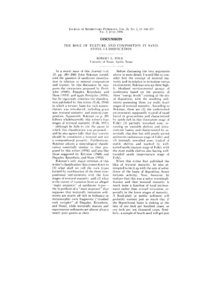
1. JOI:RNAL OF SE[nMENTAR~"PETRClI.OGY, VOL. 26, NO. 2, PP. 166 171
Fro. 1, Jq'xE. 1956
DISCUSSION
T H E ROI.E OF T E X T U R E A N D C O M P O S I T I O N IN S A N D -
STONE CLASSIFICATION
ROBERT L. FOLK
Univerity of Texas, Austin, Texas
In a recent issue of this Journal (voh Before discussing the two a r g u m e n t s
25, pp. 201-206) John Bokman consid- above in more detail, I would like to con-
ered the question of sandstone classifica- sider first the concept of textural ma
tion in relation to mineral composition turity and its relation to tectonism versus
and texture. In this discussion he sup- environment. Bokman sets up three high-
ports the viewpoints proposed by Petti- Iv idealized e n v i r o n m e n t a l groups of
john (1949), 1)al)ples, Krunll)ein. and sandstones based on the presence of
Sloss ( 1953), and again Pettijolm (1954) ; three "energy levels" existing at the site
but he vigorously criticizes the classifica- of deposition, with the resulting sedi
tion pul+lished by this writer (Folk, 1954) ments possessing three (or really four)
in ++hieh a ternary basis few rock nomen- stages of textural maturity. According to
clature was introduced, inchlding grain Bokman, these are (l) the undisturbed
size, textural maturily, and mineral con> enviroument, supl)osedly typical of rapid
position. Apparently" Boktnan on p, 201 burial in geosynclines and characterized
follows wholeheartedlv this writer's four by sands rich in clay (immature stage of
stages of textural m a t u r i t y (Folk, 1951) Folk); (2) partially reworked zone. oc-
- although he fails to cite the paper in curring on unstable s h e h e s and intra-
which this classification was proposed- cratonic basins, and characterized by es-
and he also agrees fully t h a t clay conlent sentially clay-free but still poorly-sorted
should be considered a textural and not sediments (submature stage of Folk) ; and
a compositional property. Furthernmre, (3) intensely reworked zone, typical of
Bokman adopts a mineralogical classifi- stable shelves and marked by well-
cation essentially similar to t h a t pro- sorted sands (mature stage of Folk), with
posed by this writer (1954), and also like the most stable shelves also having well-
those suggested t33" Krynine (1948) and rounded sands (stq)ermature stage of
Dapples. Krumbein, and Sloss (1953). Folk).
I?okman's only major criticism of this W h e n this writer first published the
writer's classification thus comes down tu idea of textural maturity, he also at-
(1) what shall we call the rock types t e m p t e d to tie it up with the rate of subsi-
formed by combination of the three com- dence of the basin of deposition, hence
positional end-members with the four tectonic activity. Now, however, he
stages of textural maturity, and (2) what reat[zes t h a t this was a naive oversimpli-
is the extent of variation from an alleged fication and t h a t textural m a t u r i t y is
" m a i n sequence" of sandstone types .... much more a function of local environ-
the hypothesis of a " m a i n sequence" t h a t m e n t r a t h e r than overall tectonism, es-
supposes t h a t texturally i m n m t u r e sedi- pecially in the lower stages of maturity.
ments are nearly all rich in feldspars or A flood-plain or neritic sediment u-ill
metamorphic rock fragments ("crushed probably contain jnst as much clay if
rock complex" of Dapples, Krnmbein, the depositional basin is sinking at the
and Sloss), while texturally mature and rate of one inch per hundred ?'ears, or
s u p e r m a t u r e sediments are almost ahvays one inch per ten thousand ?'ears. Simi-
nearly pure quartz or chert. larly, a sample of beach sand will get just
2. D [SC USSIOX 167
as well sorted in one hundred years (or stability beach sands will be a b u n d a n t in
even in a few weeks) as it will if given the section, and deltaic sediments scarce;
one hundred thousand years. Texas Gulf while during a period of intense geosyn-
coast beaches (and their buried Tertiary clinal deformation deltaic and neritic sed-
equivalents) have excellent sorting values, iments will be very a b u n d a n t and beach
with cr in the range of 0.25-0.35 ~; yet sands scarce. Yet beach sands deposited
[ daresav no one wonld call this region a in b o t h tectonic frameworks will have es-
"stable shelf." One swish of a miner's sentially similar sorting values, and neri-
pan does a p r e t t y good job of sorting tic sediments will be just as immature.
sand. and certainly of winnowing out Bokman also errs when he equates
clay: hence no hmg period of stability is clayey sandstones with the undisturbed
required to get well-sorted sediments, and (presumably deep-water) e n v i r o n m e n t
good sorilng eannot be equated with tec- "typical of the eugeosyncline." Admit-
tonic stability as I lokman has done tedly, clayey sands develop when very
noa, and as the ~ r i t e r did in 1951. Only little energy is expended on the sediment
in roundness does teeton[sm have much after its initial deposition, b u t this situa-
Io do with textural maturity, and even tion can happen in numerous ways. Not
here it has much less influence than com- only does it happen in deep waters, but
monly thought. Sands in the carbonate it also happens in mudflows, m a n y allu-
sequence of the Ellenlmrger group (Ordo- vial fans, flood plains, swamps, lagoons,
vician of sul3surface Vest Texas) slaow a deltas, and is probably characteristic of
repeated alternation of streaks of angular most neritie sands along normal coasts.
sands with beds of superlfly rounded Shall these all be glibly considered eugeo-
sands of the same grain size. all coming svnclinal deposits? Furthermore, on page
directly from the same primary granitic 2(12 he implies t h a t most of these clayey
and gneissic source area; if periods of tec- sands are deposited by t u r b i d i t y currents!
tonic stability are called upon to explain Until the precise mode of deposition of
the beds of well-rounded sand. then these clayey sands is supported by more con-
stable periods must have each covered crete d a t a from recent sediments, 1 con-
only a minute fraction of the Ordovician. tend t h a t most clayey floodplain and
Similar brief stable periods are indicated neritic sands in all but quite deep waters
for the Silurian sands of West Virginia, are simply deposited by ordinary sedi-
where beds of perfectly rounded grains mentation, where clay b r o u g h t out to sea
alternate with beds of angular grains, all by muddy rivers or set in motion by wave
coming (toni the sanle source area. In the turbulence simply settles by some quite
opinion of this writer, the alternations " n o r m a l " mechanism. By extension of
arc! caused bx llnct:uating environnients the overworked t u r b i d i t y current hy-
and arc' modified only slightly bv tec- pothesis, should we assume t h a t all clays
lonisnl, and shales are deposited by this process in
:lthough the environnlent of deposi- engeosynclinal loci? Of course n o t - - h e n c e
tion is a p p a r e n t l y the immediate con- if clays and shales can form by ordinary
trolling factor in textural maturity, the processes of deposition, then clayey sands
e n v i r o n m e n t s themselves are a function can also form this way.
of something much more basic. As Kry- My present feeling on m a t u r i t y is t h a t
nine (1951) has shown, the degree and (l) it depends chiefly on the a m o u n t of
type of techmic activity does determine energy applied to the sediment after it is
a certain preferred association of source b r o u g h t to the site of deposition, hence
area lithology and relief, geomorphic is almost entirely a function of environ-
processes, and rate of subsidence of the ment and is virtually i n d e p e n d e n t of tec-
deposilional area. These factors in turn tonism. Even in the most violently sub-
integrate u~ produce preferred associa- siding basins the rate of subsidence is so
tions of e n v i r o n m e n t s : during a period of slow in inches per year t h a t the environ-
3. 168 DISCUSSION
"FABLE l . - - S a n d s t o n e classification table based on the two parameters of textural maturity and
mineral composition. Folk's (1954) terms in ordinary type, corresponding terms of B o k m a n
(1955) in italics. A s t e r i s k s denote rock types not recognized by B o k m a n but considered
to be of great importance by Folk
State of Textural Feldspar-Rich Quartz- and Chert- Metamorphic- Rich
Maturity Sands Rich Sands Sands
Quartz grains well Supermature Supermature (Supermature
rounded, well sorted, Arkose Orthoquartzite Gravwacke)
no cla}" * * * * * Orthoquartzite * *" * * *
Grains well sorted, Mature Arkose Mature Orthoquartzlte Mature Gravwacke
no clay but not well * * * * * Orthoquartzite * * * +* *
rounded.
Very little or no clay, Submature Submature Submature
but grams poorly Arkose Orthoquartzite Graywacke
sorted. Arkose * * * * * Lithic Sandstone
Over S percent clay, hnmature Arkose Immature Orthoquartzite Immature Graywacke
poorly sorted, and Arkose * * * * * Lithic Sandstone
angutar.
Over 20 percent clay, Immature Arkose Immature Orthoquartzite ImmatureGraywacke
poorly sorted, and Feldspathic * * * * * Lithie Graywacke
angular. Gra ywaeke
ment has ample opportunity to modify tion that textural maturity and mineral
the detritus; (2) a surge of excess energy composition should be described in sepa-
can actualh" decrease the maturity of a rate terms to avoid confusion and over-
sediment (as when hurricane winds mix generalization. Bokman states on pp.
well-sorted beach sands with ahnost pure 201-202, t h a t "Composition and texture
lagoonal clays to form a very poorly are i n t e r d e p e n d e n t properties . . . conse-
sorted mixture, or when sudden moun- quently, they are not susceptible to sepa-
tain torrents shatter pebbles that were rate t r e a t m e n t " ; yet in the three para-
previously rounded by more gentle graphs immediately preeeding this state-
streams); and (3) stratigraphic forma- ment, he treats these properties inde-
tions all show a range in maturity on the pendently himself. The differences in the
individual sample level: hence, in many nomenclature are indicated in table 1
formations clayey sands alternate with with my terms in ordinary type and
well-sorted sands, l would hardly call Bokman's terms in italics. For brevity,
this an alternation between eugeosyn- only the e n d - m e m b e r s are shown here;
clinal and stable shelf conditions when the rocks rich in both metamorphic rock frag-
change soccur on the scale of a foot or so! ments and feldspars are omitted, as are
Bokman's first major eritleism of my transitional types between the ortho-
classification is in the names applied to quartzite and the two other end-mem-
the rocks resulting from the various bers. Thus Bokman's " p r o t o q u a r t z i t e "
combinations of textural maturity with oceupies the field on either side of the
mineral composition, l feel t h a t names orthoquartzite in the i m m a t u r e to sub-
should be subordinated to concepts, so mature range, and my "subarkose" and
that if the principles of formation are "subgraywacke" occur also on each side-
understood and the petrographer pub- of the orthoquartzite, but exist (in na-
lishes adequate detailed descriptions, ture as well as in theory) in all stages of
anyone is entitled tu give any name he textural maturity. The asterisks denote
pleases to the rock under consideration. rock types apparently not recognized or
lh~wever, I earnestly defend the proposi- specified by Bokman.
4. DISC USSION 169
C o n t r a r y to the s t a t e m e n t s of Bokman namely, t h a t i m m a t u r e a n d s u b m a t u r e
(as reflected also in his lack of a com- sediments must be rich in feldspars or
plete set of terms), all these "pigetm- m e t a m o r p h i c rock fragments, and t h a t
holes" are occupied by significant vol- m a t u r e and s u p e r m a t u r e sediments must
umes of rock in the stratigraphic section consist almost entirely of quartz a n d
with but one exception: the s u p e r m a t u r e chert. B o k m a n implies t h a t mineral con>
graywacke which may well be a non- position and textural m a t u r i t y are in-
existent type. The question of which capable of i n d e p e n d e n t variation, and
scheme is more logical should now be left t h a t no samples occur outside of this
to the j u d g e m e n t of time; I have previ- " m a i n sequence." To quote: " T o t r e a t
o u s h listed (Folk, 1954, pp. 352-356) [composition and texture separately] . . .
my reasons for objecting to the use of the leads to a classification which is meaning-
term graywacke as a s y n o n y m for a less in the sense t h a t m a n y of the 'pigeon-
clayey sandstone and will not go into holes' are unoccupied in a c t u a l i t y . . . . "
Ihose reasons again here. I contend t h a t the close linkage between
Two minor points which come up in composition and texture proposed by
allotting rock constituents to the Q, F, Dapples, Krumbein, and Sloss and re-
or M poles: (1) I st)ecitically excluded stated by Bokman is far too idealized to
clays from the mineralogical triangle in fit the actual situation. The)" a t t e m p t to
three separate s t a t e m e n t s (Folk. 1954, force sediments into a rigidly artificial
pp. 352. 353. 355). although Bokman on mold to which they simply will not con-
page 205 distinctly states t h a t I included form, as a n y examination of an a d e q u a t e
it with the m e t a m o r p h i c pole. I did in- thin-section collection will show. On
clude with the M pole all coarse-silt page 205 Bokman indirectly a t t a c k s
size grains of chlorite, sericite, and other Krynlne (without mentioning his name)
fine micas, for a very practical reason: for oversimplifying the linkage between
since micas are included with the M pole, tectonism and mineral composition, b u t
it is fatuous hairsplitting to draw an), t h r o u g h o u t his entire paper B o k m a n falls
distinct line between the finer micas and into the very same alleged error by as-
the silt-sized sericite or chlorite. Bokman suming a direct and vastly oversimplified
sidesteps this slight difficulty by not link between tectonic state, textural ma-
mentioning micas a t all in his classifica- turity, and mineral c o m p o s i t i o n - - a link-
tion. (2) In most good graywackes there age apparently so tenuous t h a t he pre-
is a complete transition between frag- sents no evidence, either from the
ments of schist, quartzose schist, mica- stratigraphic column or from recent sedi-
ceous metaquartzite, and " p u r e " meta- ment work, to back it up.
quartzite; here no one would question al- | agree t h a t most sediments do tend to
lotting stretched metaquartzite to the follow the main sequence--i.e, t h a t im-
M pole. If one is to be consistent, meta- m a t u r e graywackes, as they undergo
quartzite is a metamorphic rock frag- more and more abrasion, tend to pass up
ment and should be counted as such the scale of m a t u r i t y as they lose their
whether in a polar graywacke or an al- less durable m e t a m o r p h i c c o n s t i t u e n t s
most pure orthoquartzite. Rock descrip- and eventually pass t h r o u g h subgray-
tions should not be bent to conform to wackes into orthoquartzites. Similarly,
our preconceived notions of how the rock arkoses, either through abrasion or
should be classified. weathering, tend to lose their feldspar
B o k m a n ' s most f u n d a m e n t a l a r g u m e n t as they pass up the scale of m a t u r i t y and
against the classification of this writer is grade into subarkoses and ultimately
in the relationshi 1) between the two vari- orthoquartzites. Yet, the f u n d a m e n t a l
ables, textural m a t u r i t y and mineral difference is t h a t Bokman feels t h a t rocks
coml)osition. He assumes the same gross- falling on the main sequence are the only
Ix" overgeueralized hypothesis proposed ones worthy of classification, whereas l
by l)at)ples , Krumbein, and Sloss (1954): have examined (and c i t e d - - F o l k , 1954,
5. 170 D[SCUSSION
Percent F Percent M
5% ~
Supermature
Mature
,/ 4 !l :II
L 71 ,ol I
"~l:
I
/' /. l~'n.
I
I
', ql ,, ~1
I
Submalure ' I
:
,...,kay.,:/,
Immature I
• • " "''* "L'
~o oe
,> /
Arkose Subarkose Ortho- Subgroy- Graywacke
quartzite wacke
Fro. l.--Mineral composition plotted against textural maturity for several sandstone for-
mations. This diagram illustrates that almost any combination of the two variables may occnr.
According to other authors, sediments occur ahnost entirely on the "main sequence," exteading
in an inverted V-shaped trend from the immature arkose to the mature or supermature ortho-
quartzite, and back down to the imnlature graywacke. The "main sequence" hypothesis is
clearly, a profound oversimplification.
1. Lower Ordovican Beekmantown sands, Pennsylvania. Folk, manuscript in preparation.
This field also applies to Upper Cambrian, Pennsylvania.
2. Lower Ordovician Ellenburger sands, Texas. Folk, manuscript in preparation.
3. Upper Permian (?) Pierce Canyon formation, Texas and New Mexico. D. N. Miller,
Ph. D. Thesis, University of Texas, 19.55.
4. Triassic Newark Series, Connecticut- Krynine, 1950.
5. Recent Gulf Coastal sands, Texas. Folk, unpublished observations.
6. Upper Cambrian Potsdam sandstone, New York. Folk, unpublished observations.
7. Silurian System, West Virginia. Folk, research in progress.
8. Cretaceous Woodbine sand, Texas. A. S. Cotera, M. A. Thesis, University of Texas.
9. Pennsylvanian sandstones, central Texas. Folk, unpublished observations.
10. Recent Gulf Coastal sands, Mississippi and Alabama. Folk, unpublished observations.
11. Ordovlcian Juniata and Oswego formations, Pennsylvania. O. F. Turtle, M. S. Thesis,
The Pennsylvania State College, 1940. An essentially coexistent field is occupied by the
Devonian ;Fhird Bradford Sand, Krynine, 1940.
12. E~mene Carrizo and Newbv sands, Texas. T. W. Todd, M. A. Thesis, University of
Texas, 1955.
13. Penusylvanian sandstones, eastern Pennsylvania. Folk, unpublished observations.
14. Numerous scattered samples of Mesozoic sands, Texas and New Mexico. Folk, personal
observations.
6. D I S C {'SSIO N 171
p. 355, 357) a great many examples of terpreting such stellar types as red giants
rocks which fall off this main sequence: or in tracing the evolution of star clus-
perfectly rotmded, beautifully-sorted ar- ters. T h e ) do not ignore or fail to classify
koses from the Cambro-Ordovieian of stars t h a t fall off the main sequence;
the Appalachian area; well-sorted gray- these unusual ones are precisely the ones
wackes, rich in metamorphic rock frag- t h a t furnish the most valuable clues to
ments, from the Upper Paleozoic of the the origin of our universe!
Appalachians and Texas; poorly-sorted, Similarly, sedimentary petrographers
angular, clay-rich orthoquartzite sands obtain some of their most valuablein-
from the Pennsyh'anian of Texas, Si- formation from sandstones that fall off
lurian of West Virginia. and uther locali- the main ti'end. Thus well-sorted, well-
ties. These rock types are plotted in fig- rounded arkoses are believed to indicate
ure 1. These important and widespread aridity in the source area, for under al-
sandstone varieties occupy the " v a c a n t most any other climatic conditions the
pigeonholes" which Bokinan contends feldspar would have been destroyed by
are present in my c l a s s i f i c a t i o n - r o c k weathering before it had a chance to get
types recognized neither by him nor by rounded. The clayey, poorly-sorted or-
I)apples, Kruml)ein, and Slnss. Bok- thoquartzite-type sands also imply spe-
man's compilation of 6l literature cialized conditions: either fairly rapid
analyses (to which no references are erosion and deposition of sediments from
given) apparently was not sufficiently an area of older sedimentary rock out-
comprehensive to include these types. crops, or a mixture of several environ-
A fertile analogy nmy be drawn be- ments, e.g. well-sorted beach sands mixed
tween sandstone classification and the with lagoonal clays. To ignore these im-
classification of stars. Astronomers pos- portant rock types because the)- do not
sess a wonderful tool in a graph known follow the theoretical main sequence is to
as the Hertzsprung-Russell diagram, in view the complexities of sandstone types
which the magnitude (brightness) of a with rose-colored glasses. Bokman's con-
star is plotted against its color, just as I nection of tectonic state with textural
have plotted textural maturity against maturity may be an interesting theoreti-
composition in figure 1. On the Hertz- cal exercise, but there are so many ex-
sprung-Russell plot, most stars follow the ceptions t h a t I seriously question its
"inaiu sequence" iu that faint stars tend utility, and even question its ultimate
to be reddish and bright stars bluish, the scientific basis. His contention t h a t min-
magnitude verst,s color trend forming a eral composition is a direct function of
compressed band. But astronomers obtain textural maturity is also shown to be
some of their most vital information by erroneous and simplified beyond the
studying the departures from this trend, point of realism by the specific examples
thus using the diagram as a tool in in- I have cited.
REFERENCES
BOKMAN, JOItN, 195.5, Sandstone classilication: relation to composition and texture: Jour.
Sedimentary Petrology, v. 25, pp. 201 206.
DAPPLES, E. C., [~.RUMBEIN,~.'. C., AND SLOSS, L. L., 1953, Petrographic and lithologic attri-
butes of sandstones: Jour. Geology, v. 61, pp. 291-317.
FOLK, R. L., 1951, Stages of textural maturity in sedimentary rocks: Jour. Sedimentary Petro-
logy, v. 21, pp. 127-130.
, 1954, The distinction between grain size and mineral composition in sedimentary rock
nomenclature: Jour. Geology, v. 62, pp. 344 359.
KRYNINE, P. l)., 1948, The megascopic study and field classification of sedimentary rocks:
Jour. Geology, v. 56. pp. 130-165.
, 1951, A critique of geotectonie elements: Am. Geophys. Union Trans., v. 32, pp. 743-
748.
PE'rTIJOHN, F. J., 1940, S, edimentary rocks. Harper & Bros., New York. 526 pp.
, 1954, Classification of sandstones: Jour. Geology, v. 62, pp. 360-365.