Report
Share

Recommended
L4 unit 2 a and c lear
This document provides guidance on preparing for different types of questions that may appear on the geography exam. It distinguishes between part A, part B, and part C questions. For part A questions, it emphasizes describing features from stimulus materials like figures, maps, and data rather than providing case studies. Part B questions require longer answers drawing on fieldwork and research. Part C questions involve using examples or case studies to support responses. It also provides advice on managing time and practicing questions under timed conditions.
L5 benidorn ap fieldwork and research ap
This document discusses a case study of coastalisation in Benidorm, Spain. It outlines how Benidorm has grown as a tourist resort due to coastalisation, the growth of Spanish tourism along the Mediterranean coast. The document provides learning objectives on understanding coastalisation in Benidorm and suggests methods for measuring and studying the growth and development of coastal resorts through fieldwork, visitor surveys, and research.
Contrasting case studies
The document provides guidance for a quiz on capital cities and food security case studies. It advises using a conceptual approach of discussing causes rather than multiple examples of the same thing. Contrasting case studies from areas with and without food insecurity are recommended, such as politically stable areas with food banks versus unstable areas with widespread issues. Examples given include Australia, Haiti, UK food banks, Cuba, the Horn of Africa, Niger, and Spain. Details are then provided on Australia, noting factors contributing to its food security classification despite drought risks, such as stable government, water management projects, and economic development.
L6 possible q and structure
Food security can be defined as access by all people at all times to enough safe, nutritious food to maintain an active, healthy life. The document discusses factors that influence food supply and security at various geographic scales from local to global. It suggests models and frameworks to analyze these factors and inequalities in food supply that can lead to issues like famine and obesity. The document outlines a structure to discuss food supply issues comparing rural and urban areas and provides potential exam questions on related topics.
L9 minehead hard eng ap
This document provides instructions for a case study on hard coastal management techniques used in Minehead, Somerset. Students are asked to watch a video on the management approaches, read their textbook and a BBC news article on the case study, and create a poster explaining the three different coastal defense structures used at Minehead: sea walls, rock armor, and rock groynes.
L5 analysis b
Food security is achieved when all people have access to sufficient, safe, and nutritious food at all times to meet their dietary needs and preferences for an active and healthy life. There are four pillars of food security: availability, access, use, and stability. Food supply is an aspect of availability and is impacted by various socio-economic, environmental, and political factors. Case studies can illustrate how these factors affect food supply but need to be structured by the influencing factor rather than just describing locations. The document suggests structuring responses using models like the nutrition spectrum, tables comparing urban and rural areas, or triangle graphs.
L4 2015 earthquakes
This document discusses earthquakes, including what causes them, how they are measured, and key related concepts. Earthquakes are caused by the buildup of tension between tectonic plates in the Earth's crust until the rocks break, releasing energy in waves. They are measured using the Richter scale, which quantifies the magnitude of the earthquake based on the amplitude of the waves recorded by a seismograph. Other important terms discussed include the focus, which is where the rock initially breaks underground, and the epicenter, which is the point directly above the focus on the Earth's surface.
L10
This document provides a case study about land reclamation at Freiston Shore in the UK. It includes a video and photo about the area and asks students to note the differences between past and present landscapes. Students are also tasked with coming up with an acronym using the letters in "Freiston" to help them remember key aspects of the case study.
L3 water supply problems
Different countries face varying water supply problems based on factors like population density, rainfall levels, and infrastructure development. In the UK, imbalanced rainfall and an aging system challenge water access, while developing nations commonly struggle with untreated water, pollution, and low annual precipitation. The lesson explores how population maps, rainfall charts, and development levels relate to these international differences in water issues.
L2 consumption patterns
There are differences in water consumption between developed and developing countries. Developing countries use a high percentage of water for agriculture, around 88%, due to inefficient irrigation systems and widespread subsistence farming. Their water usage for industry is low at 2% as there is little large-scale manufacturing. Developed countries have a lower agricultural water usage rate of 9% as they employ modern irrigation techniques. Their industry water usage is high at 79% to support extensive manufacturing activities. Domestic water usage makes up 12% in developed nations but is rising in developing nations where access to piped water is limited.
L1 variety in supply ap
Freshwater availability varies globally due to its uneven distribution and factors like population growth, climate change, and development levels that impact supply and demand. Aquifers underground store freshwater, but some are being drained faster than replenished. While three percent of water is fresh, two thirds is frozen and one percent is available for human use.
L6 developing world cs
China faces significant challenges with sustainable water management due to having only 7% of the world's freshwater resources but over 19.5% of the global population. To address this, China is taking several steps including implementing more efficient irrigation techniques for agriculture, building new reservoirs and water transfer projects, treating more wastewater, and raising public awareness of water conservation issues.
L5 fresh water supply
The document discusses sustainable management and use of water. Over 80 million more people are added to the global population each year, placing increasing demands on water resources. Agriculture and increasing meat consumption in countries like China also impact water usage. Two million tons of human waste is dumped into rivers daily. Individuals can help by planting drought-tolerant plants and using water-efficient appliances. Organizations in places like Las Vegas recycle water from hotels through advanced filtration systems. The government implements initiatives around limiting outdoor watering and pricing to encourage conservation.
L4 attitudes and desal ap
1. Las Vegas gets 90% of its water from Lake Mead, but over the last 10 years the water level has dropped by half. One solution is to build a 500km pipeline to transfer water to the city.
2. Desalination is a technology that can resolve water shortages by removing salt from seawater to make it suitable for drinking. It involves reverse osmosis, where pressure is used to squeeze water molecules through a semi-permeable membrane, leaving salt behind. It is commonly used in dry, coastal regions like Spain, Australia, and Saudi Arabia.
3. Desalination has pros like providing a reliable water source, but cons such as high financial and energy costs.
L1 ap classification, exploitation and changes
The document defines and classifies natural resources. It distinguishes between biotic factors like living organisms and abiotic factors like non-living things. Resources are also classified as renewable like solar energy or non-renewable like fossil fuels. Humans exploit resources through activities like overgrazing, overfishing, deforestation, and overusing water. This causes changes like soil erosion, declining fish populations, loss of biodiversity, and depleted aquifers. Humans also exploit energy resources but burning fossil fuels pollutes the environment and contributes to issues like acid rain.
L2b uk distribution
This document provides information about the distribution of natural resources across the United Kingdom. It discusses the variety of soils and how they support different types of farming in different regions. It also outlines where forestry, fossil fuels, water supply and minerals are located in the UK, noting that forestry is concentrated in the north and west, coal was historically mined in places like South Wales, oil and gas come from offshore fields in the North Sea, and minerals are extracted from both land and under the sea.
Resource use and consumption
This document discusses global patterns of food, energy, and water use. It notes that developed countries consume far more resources per person than developing nations. For example, the average North American consumes around 90kg of resources daily compared to just 10kg for the average African. While the world produces enough food overall, it is unevenly distributed, leading to both obesity and famine. Developed nations like the U.S. consume a disproportionate amount of the world's energy and water resources despite having a small percentage of the global population. Patterns of consumption depend on development level and resource availability within each country.
L2a resource distribution
Global natural resources are distributed unevenly around the world based on climate and geography. Soil quality and types determine agricultural productivity and are best in areas with brown forest soil. Approximately 40% of Earth's surface is used for farming. Forests cover 30% of land, with concentration in Brazil, Canada, and the US. Fossil fuel reserves are highest in the Middle East, Venezuela, Canada, and Russia. Rock and mineral deposits are found worldwide, with certain areas rich in resources like diamonds, iron ore, or precious metals depending on their geological history. Water sources include rivers, rainfall, and desalination, but some populations face future shortages due to climate change and increasing demand. The distribution of these vital natural
L1 variety in supply ap
Freshwater availability varies globally due to its uneven distribution and factors like population growth, climate change, and development levels that impact supply and demand. Aquifers underground store freshwater, but some are being drained faster than replenished. While three percent of water is fresh, most is locked in ice or far from population centers.
L1 mexico city
Mexico City is located in central Mexico within the Valley of Mexico. Globally, it is situated in North America, while regionally it lies near the country's borders with the United States and the Gulf of Mexico. Mexico City serves as the capital and largest city of Mexico. The urban structure of Mexico City consists of a central business district surrounded by inner city, suburbs, and an urban rural fringe. Land use varies across these zones from services and high-cost housing in the center to informal settlements at the urban periphery.
L1 ap urbanisation over past 50 years
Over the past 50 years, developed countries experienced slowing urbanization while emerging and developing countries underwent rapid urbanization. Globally, more people now live in urban rather than rural areas, as shown by satellite images of the lit-up world at night. Urbanization increased in emerging and developing nations due to factors like industrialization, rural to urban migration, and economic development.
Inequality in mexico
1. There is significant inequality between the rich and poor in Mexico City. The poor often earn just enough to survive and cannot save, while many work in the informal sector without taxes or protections.
2. The poor typically live in crowded areas on the outskirts of the city that lack basic services, while the rich occupy wealthier neighborhoods near the center with amenities. Income, rural migration, political influence, and long work hours contribute to the differences in quality of life.
3. The main reasons for inequality are that the poor earn low and unstable incomes; many migrate from rural areas with nothing; the rich have more political power; and the poor often work longer hours.
Ap urban growth mexico
Mexico City's population has grown quickly due to rural-to-urban migration as people leave tough rural living for more economic opportunities in the city. This migration has been caused by both national and international factors as companies open new factories near Mexico City, drawing more people. Impacts of migration on Mexico City include the creation of ethnic enclaves, pressure on housing as migrants settle both near the city center and on the outskirts, and services straining to support Mexico City's young and growing population.
Ap solving mexico city problems
This document discusses different strategies for improving cities, specifically in Mexico City. It outlines top-down and bottom-up approaches.
The top-down approach involves large-scale developments led by the government, where officials make the major decisions. Examples given include a housing agency that provided millions of mortgages and private developers building large identical housing developments. Issues arose from a lack of infrastructure to support the new housing.
The bottom-up example provided is of Neza, a squatter settlement whose residents organized to gain land ownership. They raised funds collectively for schools and utilities. This led to a thriving community with less crime than other parts of Mexico City.
The document asks the reader to consider the advantages and
Lesson 7 ap sustainable cities
This document discusses ways that Birmingham, England works to make urban living more sustainable and improve quality of life. It defines sustainability as meeting present needs without compromising future generations' ability to meet their own needs, often considering social, economic, and environmental aspects of city living. The document outlines an activity for students where they will research in groups how Birmingham specifically addresses issues like recycling, employment, education, health, transport, affordable housing, and energy-efficient housing to promote sustainability.
Lesson 6 retail changes ap
The document summarizes the major changes in retailing that have impacted Birmingham over recent decades:
1. In the 1800s, suburbanization occurred as people moved from the crowded, polluted city center to spacious suburbs.
2. In the 1870s, industry began relocating from city centers to the suburbs.
3. In the 1980s, out-of-town shopping centers like Merry Hill opened, taking 12% of the city center's trade and offering free parking and large retailers.
4. Birmingham's city center fought back through redevelopments like the Bull Ring and Grand Central that improved pedestrian access and amenities.
5. Internet shopping has grown to 15% of
Lesson 5 inequality ap
The document discusses inequality within the city of Birmingham. It notes that while some areas like Moseley and Edgbaston have been commended for their quality of life, other inner-city areas suffer from multiple deprivation and economic decline related to the loss of manufacturing jobs. Deprived areas are identified using indices that measure factors like unemployment, income, health, education, and crime. The causes of inequality in Birmingham stem from deindustrialization that led to high unemployment and less money circulating in inner cities, creating a downward spiral of decline, while newer suburban areas benefit from positive economic multipliers.
L3b ap b'ham popn
Birmingham's population has experienced significant growth and changes since 1825.
1) Birmingham's population grew rapidly in the 19th century during the Industrial Revolution as people moved to the city for work in new industries.
2) The population peaked at around 1.15 million in 1950 before declining between 1950 and 2000 during a period of deindustrialization and globalization that closed factories and increased unemployment.
3) Since 2000, Birmingham's population has grown again due to new developments like the Bull Ring and improved transport links like High Speed 2 rail.
High-Quality IPTV Monthly Subscription for $15
Experience high-quality entertainment with our IPTV monthly subscription for just $15. Access a vast array of live TV channels, movies, and on-demand shows with crystal-clear streaming. Our reliable service ensures smooth, uninterrupted viewing at an unbeatable price. Perfect for those seeking premium content without breaking the bank. Start streaming today!
https://rb.gy/f409dk
Pro Tips for Effortless Contract Management
Tired of chasing down expiring contracts and drowning in paperwork? Mastering contract management can significantly enhance your business efficiency and productivity. This guide unveils expert secrets to streamline your contract management process. Learn how to save time, minimize risk, and achieve effortless contract management.
More Related Content
More from andypinks
L3 water supply problems
Different countries face varying water supply problems based on factors like population density, rainfall levels, and infrastructure development. In the UK, imbalanced rainfall and an aging system challenge water access, while developing nations commonly struggle with untreated water, pollution, and low annual precipitation. The lesson explores how population maps, rainfall charts, and development levels relate to these international differences in water issues.
L2 consumption patterns
There are differences in water consumption between developed and developing countries. Developing countries use a high percentage of water for agriculture, around 88%, due to inefficient irrigation systems and widespread subsistence farming. Their water usage for industry is low at 2% as there is little large-scale manufacturing. Developed countries have a lower agricultural water usage rate of 9% as they employ modern irrigation techniques. Their industry water usage is high at 79% to support extensive manufacturing activities. Domestic water usage makes up 12% in developed nations but is rising in developing nations where access to piped water is limited.
L1 variety in supply ap
Freshwater availability varies globally due to its uneven distribution and factors like population growth, climate change, and development levels that impact supply and demand. Aquifers underground store freshwater, but some are being drained faster than replenished. While three percent of water is fresh, two thirds is frozen and one percent is available for human use.
L6 developing world cs
China faces significant challenges with sustainable water management due to having only 7% of the world's freshwater resources but over 19.5% of the global population. To address this, China is taking several steps including implementing more efficient irrigation techniques for agriculture, building new reservoirs and water transfer projects, treating more wastewater, and raising public awareness of water conservation issues.
L5 fresh water supply
The document discusses sustainable management and use of water. Over 80 million more people are added to the global population each year, placing increasing demands on water resources. Agriculture and increasing meat consumption in countries like China also impact water usage. Two million tons of human waste is dumped into rivers daily. Individuals can help by planting drought-tolerant plants and using water-efficient appliances. Organizations in places like Las Vegas recycle water from hotels through advanced filtration systems. The government implements initiatives around limiting outdoor watering and pricing to encourage conservation.
L4 attitudes and desal ap
1. Las Vegas gets 90% of its water from Lake Mead, but over the last 10 years the water level has dropped by half. One solution is to build a 500km pipeline to transfer water to the city.
2. Desalination is a technology that can resolve water shortages by removing salt from seawater to make it suitable for drinking. It involves reverse osmosis, where pressure is used to squeeze water molecules through a semi-permeable membrane, leaving salt behind. It is commonly used in dry, coastal regions like Spain, Australia, and Saudi Arabia.
3. Desalination has pros like providing a reliable water source, but cons such as high financial and energy costs.
L1 ap classification, exploitation and changes
The document defines and classifies natural resources. It distinguishes between biotic factors like living organisms and abiotic factors like non-living things. Resources are also classified as renewable like solar energy or non-renewable like fossil fuels. Humans exploit resources through activities like overgrazing, overfishing, deforestation, and overusing water. This causes changes like soil erosion, declining fish populations, loss of biodiversity, and depleted aquifers. Humans also exploit energy resources but burning fossil fuels pollutes the environment and contributes to issues like acid rain.
L2b uk distribution
This document provides information about the distribution of natural resources across the United Kingdom. It discusses the variety of soils and how they support different types of farming in different regions. It also outlines where forestry, fossil fuels, water supply and minerals are located in the UK, noting that forestry is concentrated in the north and west, coal was historically mined in places like South Wales, oil and gas come from offshore fields in the North Sea, and minerals are extracted from both land and under the sea.
Resource use and consumption
This document discusses global patterns of food, energy, and water use. It notes that developed countries consume far more resources per person than developing nations. For example, the average North American consumes around 90kg of resources daily compared to just 10kg for the average African. While the world produces enough food overall, it is unevenly distributed, leading to both obesity and famine. Developed nations like the U.S. consume a disproportionate amount of the world's energy and water resources despite having a small percentage of the global population. Patterns of consumption depend on development level and resource availability within each country.
L2a resource distribution
Global natural resources are distributed unevenly around the world based on climate and geography. Soil quality and types determine agricultural productivity and are best in areas with brown forest soil. Approximately 40% of Earth's surface is used for farming. Forests cover 30% of land, with concentration in Brazil, Canada, and the US. Fossil fuel reserves are highest in the Middle East, Venezuela, Canada, and Russia. Rock and mineral deposits are found worldwide, with certain areas rich in resources like diamonds, iron ore, or precious metals depending on their geological history. Water sources include rivers, rainfall, and desalination, but some populations face future shortages due to climate change and increasing demand. The distribution of these vital natural
L1 variety in supply ap
Freshwater availability varies globally due to its uneven distribution and factors like population growth, climate change, and development levels that impact supply and demand. Aquifers underground store freshwater, but some are being drained faster than replenished. While three percent of water is fresh, most is locked in ice or far from population centers.
L1 mexico city
Mexico City is located in central Mexico within the Valley of Mexico. Globally, it is situated in North America, while regionally it lies near the country's borders with the United States and the Gulf of Mexico. Mexico City serves as the capital and largest city of Mexico. The urban structure of Mexico City consists of a central business district surrounded by inner city, suburbs, and an urban rural fringe. Land use varies across these zones from services and high-cost housing in the center to informal settlements at the urban periphery.
L1 ap urbanisation over past 50 years
Over the past 50 years, developed countries experienced slowing urbanization while emerging and developing countries underwent rapid urbanization. Globally, more people now live in urban rather than rural areas, as shown by satellite images of the lit-up world at night. Urbanization increased in emerging and developing nations due to factors like industrialization, rural to urban migration, and economic development.
Inequality in mexico
1. There is significant inequality between the rich and poor in Mexico City. The poor often earn just enough to survive and cannot save, while many work in the informal sector without taxes or protections.
2. The poor typically live in crowded areas on the outskirts of the city that lack basic services, while the rich occupy wealthier neighborhoods near the center with amenities. Income, rural migration, political influence, and long work hours contribute to the differences in quality of life.
3. The main reasons for inequality are that the poor earn low and unstable incomes; many migrate from rural areas with nothing; the rich have more political power; and the poor often work longer hours.
Ap urban growth mexico
Mexico City's population has grown quickly due to rural-to-urban migration as people leave tough rural living for more economic opportunities in the city. This migration has been caused by both national and international factors as companies open new factories near Mexico City, drawing more people. Impacts of migration on Mexico City include the creation of ethnic enclaves, pressure on housing as migrants settle both near the city center and on the outskirts, and services straining to support Mexico City's young and growing population.
Ap solving mexico city problems
This document discusses different strategies for improving cities, specifically in Mexico City. It outlines top-down and bottom-up approaches.
The top-down approach involves large-scale developments led by the government, where officials make the major decisions. Examples given include a housing agency that provided millions of mortgages and private developers building large identical housing developments. Issues arose from a lack of infrastructure to support the new housing.
The bottom-up example provided is of Neza, a squatter settlement whose residents organized to gain land ownership. They raised funds collectively for schools and utilities. This led to a thriving community with less crime than other parts of Mexico City.
The document asks the reader to consider the advantages and
Lesson 7 ap sustainable cities
This document discusses ways that Birmingham, England works to make urban living more sustainable and improve quality of life. It defines sustainability as meeting present needs without compromising future generations' ability to meet their own needs, often considering social, economic, and environmental aspects of city living. The document outlines an activity for students where they will research in groups how Birmingham specifically addresses issues like recycling, employment, education, health, transport, affordable housing, and energy-efficient housing to promote sustainability.
Lesson 6 retail changes ap
The document summarizes the major changes in retailing that have impacted Birmingham over recent decades:
1. In the 1800s, suburbanization occurred as people moved from the crowded, polluted city center to spacious suburbs.
2. In the 1870s, industry began relocating from city centers to the suburbs.
3. In the 1980s, out-of-town shopping centers like Merry Hill opened, taking 12% of the city center's trade and offering free parking and large retailers.
4. Birmingham's city center fought back through redevelopments like the Bull Ring and Grand Central that improved pedestrian access and amenities.
5. Internet shopping has grown to 15% of
Lesson 5 inequality ap
The document discusses inequality within the city of Birmingham. It notes that while some areas like Moseley and Edgbaston have been commended for their quality of life, other inner-city areas suffer from multiple deprivation and economic decline related to the loss of manufacturing jobs. Deprived areas are identified using indices that measure factors like unemployment, income, health, education, and crime. The causes of inequality in Birmingham stem from deindustrialization that led to high unemployment and less money circulating in inner cities, creating a downward spiral of decline, while newer suburban areas benefit from positive economic multipliers.
L3b ap b'ham popn
Birmingham's population has experienced significant growth and changes since 1825.
1) Birmingham's population grew rapidly in the 19th century during the Industrial Revolution as people moved to the city for work in new industries.
2) The population peaked at around 1.15 million in 1950 before declining between 1950 and 2000 during a period of deindustrialization and globalization that closed factories and increased unemployment.
3) Since 2000, Birmingham's population has grown again due to new developments like the Bull Ring and improved transport links like High Speed 2 rail.
More from andypinks (20)
Recently uploaded
High-Quality IPTV Monthly Subscription for $15
Experience high-quality entertainment with our IPTV monthly subscription for just $15. Access a vast array of live TV channels, movies, and on-demand shows with crystal-clear streaming. Our reliable service ensures smooth, uninterrupted viewing at an unbeatable price. Perfect for those seeking premium content without breaking the bank. Start streaming today!
https://rb.gy/f409dk
Pro Tips for Effortless Contract Management
Tired of chasing down expiring contracts and drowning in paperwork? Mastering contract management can significantly enhance your business efficiency and productivity. This guide unveils expert secrets to streamline your contract management process. Learn how to save time, minimize risk, and achieve effortless contract management.
一比一原版(lbs毕业证书)英国伦敦商学院毕业证如何办理
原版一模一样【微信:741003700 】【(lbs毕业证书)英国伦敦商学院毕业证成绩单】【微信:741003700 】学位证,留信认证(真实可查,永久存档)原件一模一样纸张工艺/offer、雅思、外壳等材料/诚信可靠,可直接看成品样本,帮您解决无法毕业带来的各种难题!外壳,原版制作,诚信可靠,可直接看成品样本。行业标杆!精益求精,诚心合作,真诚制作!多年品质 ,按需精细制作,24小时接单,全套进口原装设备。十五年致力于帮助留学生解决难题,包您满意。
本公司拥有海外各大学样板无数,能完美还原。
1:1完美还原海外各大学毕业材料上的工艺:水印,阴影底纹,钢印LOGO烫金烫银,LOGO烫金烫银复合重叠。文字图案浮雕、激光镭射、紫外荧光、温感、复印防伪等防伪工艺。材料咨询办理、认证咨询办理请加学历顾问Q/微741003700
【主营项目】
一.毕业证【q微741003700】成绩单、使馆认证、教育部认证、雅思托福成绩单、学生卡等!
二.真实使馆公证(即留学回国人员证明,不成功不收费)
三.真实教育部学历学位认证(教育部存档!教育部留服网站永久可查)
四.办理各国各大学文凭(一对一专业服务,可全程监控跟踪进度)
如果您处于以下几种情况:
◇在校期间,因各种原因未能顺利毕业……拿不到官方毕业证【q/微741003700】
◇面对父母的压力,希望尽快拿到;
◇不清楚认证流程以及材料该如何准备;
◇回国时间很长,忘记办理;
◇回国马上就要找工作,办给用人单位看;
◇企事业单位必须要求办理的
◇需要报考公务员、购买免税车、落转户口
◇申请留学生创业基金
留信网认证的作用:
1:该专业认证可证明留学生真实身份
2:同时对留学生所学专业登记给予评定
3:国家专业人才认证中心颁发入库证书
4:这个认证书并且可以归档倒地方
5:凡事获得留信网入网的信息将会逐步更新到个人身份内,将在公安局网内查询个人身份证信息后,同步读取人才网入库信息
6:个人职称评审加20分
7:个人信誉贷款加10分
8:在国家人才网主办的国家网络招聘大会中纳入资料,供国家高端企业选择人才
办理(lbs毕业证书)英国伦敦商学院毕业证【微信:741003700 】外观非常简单,由纸质材料制成,上面印有校徽、校名、毕业生姓名、专业等信息。
办理(lbs毕业证书)英国伦敦商学院毕业证【微信:741003700 】格式相对统一,各专业都有相应的模板。通常包括以下部分:
校徽:象征着学校的荣誉和传承。
校名:学校英文全称
授予学位:本部分将注明获得的具体学位名称。
毕业生姓名:这是最重要的信息之一,标志着该证书是由特定人员获得的。
颁发日期:这是毕业正式生效的时间,也代表着毕业生学业的结束。
其他信息:根据不同的专业和学位,可能会有一些特定的信息或章节。
办理(lbs毕业证书)英国伦敦商学院毕业证【微信:741003700 】价值很高,需要妥善保管。一般来说,应放置在安全、干燥、防潮的地方,避免长时间暴露在阳光下。如需使用,最好使用复印件而不是原件,以免丢失。
综上所述,办理(lbs毕业证书)英国伦敦商学院毕业证【微信:741003700 】是证明身份和学历的高价值文件。外观简单庄重,格式统一,包括重要的个人信息和发布日期。对持有人来说,妥善保管是非常重要的。
Easy Earnings Through Refer and Earn Apps Without KYC.pptx
Learn how to make extra money with refer and earn apps that don’t require KYC. Find out the advantages, top apps, and strategies to boost your earnings quickly and easily.
AI Transformation Playbook: Thinking AI-First for Your Business
I dive into how businesses can stay competitive by integrating AI into their core processes. From identifying the right approach to building collaborative teams and recognizing common pitfalls, this guide has got you covered. AI transformation is a journey, and this playbook is here to help you navigate it successfully.
Discover the Beauty and Functionality of The Expert Remodeling Service
Unlock your kitchen's true potential with expert remodeling services from O'Brien Group Inc. Transform your space into a functional, modern, and luxurious haven with their experienced professionals. From layout reconfiguration to high-end upgrades, they deliver stunning results tailored to your style and needs. Visit obriengroupinc.com to elevate your kitchen's beauty and functionality today.
欧洲杯投注-欧洲杯投注外围盘口-欧洲杯投注盘口app|【网址🎉ac22.net🎉】
【网址🎉ac22.net🎉】欧洲杯投注是体育博彩和在线赌场之一,得益于UKGC的三项许可。 成立之初是三名博彩公司将40家博彩商店的合并的结果,共同创建一家名为欧洲杯投注的公司。 欧洲杯投注在线赌场为游戏爱好者提供了300多种游戏,其中200多种老虎机,其他游戏包括二十一点,轮盘,真人荷官和真人赌场等。
Kalyan chart 6366249026 India satta Matta Matka 143 jodi fix
Kalyan chart 6366249026 India satta Matta Matka 143 jodi fixsatta Matta matka 143 Kalyan chart jodi 6366249026
63662490260Kalyan chart, satta matta matka 143, satta matka jodi fix , matka boss OTC 420, Indian Satta, India matka, matka ank, spbossmatka, online satta matka game play, live satta matka results, fix fix fix satta namber, free satta matka games, Kalyan matka jodi chart, Kalyan weekly final anl matka 420Enhancing Adoption of AI in Agri-food: Introduction
Introduction to the Panel on: Pathways and Challenges: AI-Driven Technology in Agri-Food, AI4Food, University of Guelph
“Enhancing Adoption of AI in Agri-food: a Path Forward”, 18 June 2024
Satta Matka Dpboss Kalyan Matka Results Kalyan Chart
SATTA MATKA DPBOSS KALYAN MATKA RESULTS KALYAN CHART KALYAN MATKA MATKA RESULT KALYAN MATKA TIPS SATTA MATKA MATKA COM MATKA PANA JODI TODAY BATTA SATKA MATKA PATTI JODI NUMBER MATKA RESULTS MATKA CHART MATKA JODI SATTA COM INDIA SATTA MATKA MATKA TIPS MATKA WAPKA ALL MATKA RESULT LIVE ONLINE MATKA RESULT KALYAN MATKA RESULT DPBOSS MATKA 143 MAIN MATKA KALYAN MATKA RESULTS KALYAN CHART
Adani Group Requests For Additional Land For Its Dharavi Redevelopment Projec...
It will bring about growth and development not only in Maharashtra but also in our country as a whole, which will experience prosperity. The project will also give the Adani Group an opportunity to rise above the controversies that have been ongoing since the Adani CBI Investigation.
Revolutionizing Surface Protection Xlcoatings Nano Based Solutions
Excelcoating Transforming surface protection with their cutting-edge, eco-friendly nano-based coatings. This presentation delves into their innovative product lineup, including Excel CoolCoat for roof cooling, Excel NanoSeal for cement surfaces, Excel StayCool for UV-filtering glass, Excel StayClean for solar panels, Excel CoolTile for heat-reflective tiles, and Excel InsulX for film insulation.
Satta Matka Dpboss Kalyan Matka Results Kalyan Chart
SATTA MATKA DPBOSS KALYAN MATKA RESULTS KALYAN CHART KALYAN MATKA MATKA RESULT KALYAN MATKA TIPS SATTA MATKA MATKA COM MATKA PANA JODI TODAY BATTA SATKA MATKA PATTI JODI NUMBER MATKA RESULTS MATKA CHART MATKA JODI SATTA COM INDIA SATTA MATKA MATKA TIPS MATKA WAPKA ALL MATKA RESULT LIVE ONLINE MATKA RESULT KALYAN MATKA RESULT DPBOSS MATKA 143 MAIN MATKA KALYAN MATKA RESULTS KALYAN CHART
Truck Loading Conveyor Manufacturers Chennai
https://conveyorManufacturersManufacturers.com/
#bangalore #hyderabad #cochin #chennai #munnar #ooty #mysore #alappuzha #pondicherry #madurai #karnataka #tirupati #visakhapatnam #coimbatore #kerala #thanjavur #thiruvananthapuram #andhra #telangana #tamilnadu #andamanandnicobar #lakshadweep #hubli #secunderabad #kozhikode #mangaluru #trichy #palakkad #dharwad #kurnool #kottayam #raichur #amravati #vijayawada #kanyakumari #rameshwaram #warangal #mahabalipuram #mumbai #pune #nashik
Satta Matka Dpboss Kalyan Matka Results Kalyan Chart
SATTA MATKA DPBOSS KALYAN MATKA RESULTS KALYAN CHART KALYAN MATKA MATKA RESULT KALYAN MATKA TIPS SATTA MATKA MATKA COM MATKA PANA JODI TODAY BATTA SATKA MATKA PATTI JODI NUMBER MATKA RESULTS MATKA CHART MATKA JODI SATTA COM INDIA SATTA MATKA MATKA TIPS MATKA WAPKA ALL MATKA RESULT LIVE ONLINE MATKA RESULT KALYAN MATKA RESULT DPBOSS MATKA 143 MAIN MATKA KALYAN MATKA RESULTS KALYAN CHART
Enabling Digital Sustainability by Jutta Eckstein
This is a New Zealand wide meetup event with meetup groups from Auckland, Wellington and Christchurch attending and open to anyone with an interest in digital sustainability or agile. All welcome. Joke, this is how it started. Jutta is now also available in Germany, i.e. hosted by Berlin/Brandenburg
According to the World Economic Forum, digital technologies can help reduce global carbon emissions by up to 15%. However, digitalization also comes with some challenges. Thus, if we want to make a positive impact by increasing sustainability, we need to address challenges like the digital divide, energy consumption of IT, or the rise of electronic waste. In this talk, I want to explore how Agile can help to leverage Digital Sustainability.
Recently uploaded (20)
Easy Earnings Through Refer and Earn Apps Without KYC.pptx
Easy Earnings Through Refer and Earn Apps Without KYC.pptx
AI Transformation Playbook: Thinking AI-First for Your Business
AI Transformation Playbook: Thinking AI-First for Your Business
Discover the Beauty and Functionality of The Expert Remodeling Service
Discover the Beauty and Functionality of The Expert Remodeling Service
Kalyan chart 6366249026 India satta Matta Matka 143 jodi fix
Kalyan chart 6366249026 India satta Matta Matka 143 jodi fix
Enhancing Adoption of AI in Agri-food: Introduction
Enhancing Adoption of AI in Agri-food: Introduction
Satta Matka Dpboss Kalyan Matka Results Kalyan Chart
Satta Matka Dpboss Kalyan Matka Results Kalyan Chart
Satta Matka Dpboss Kalyan Matka Results Kalyan Chart
Satta Matka Dpboss Kalyan Matka Results Kalyan Chart
Adani Group Requests For Additional Land For Its Dharavi Redevelopment Projec...
Adani Group Requests For Additional Land For Its Dharavi Redevelopment Projec...
Revolutionizing Surface Protection Xlcoatings Nano Based Solutions
Revolutionizing Surface Protection Xlcoatings Nano Based Solutions
Satta Matka Dpboss Kalyan Matka Results Kalyan Chart
Satta Matka Dpboss Kalyan Matka Results Kalyan Chart
Satta Matka Dpboss Kalyan Matka Results Kalyan Chart
Satta Matka Dpboss Kalyan Matka Results Kalyan Chart
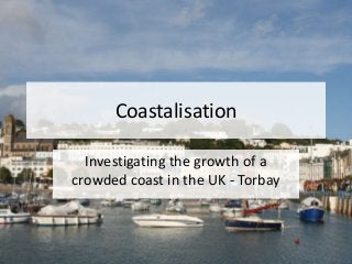
L4 torquay ap 2013
- 1. Coastalisation Investigating the growth of a crowded coast in the UK - Torbay
- 2. Memory game • From the video that was playing as you came in, can you brainstorm with the person next to you, what attractions you could see that would encourage tourists to come to this coastal area. LO: Coastalisation Case Study - Torquay
- 3. Coastalisation Case Study - Torquay • Torbay is in South Devon – you will visit this area on your fieldtrip… • Torbay is made up of three towns, Torquay, Paignton and Brixham • Torbay has a population of 134,000 – Torquay 60,000 • The local economy is heavily reliant on tourism • With over 40% of the workforce employed in the tourist industry • £3.8 million was spent by domestic tourists alone in 2005 LO: Coastalisation Case Study - Torquay
- 5. Why did Torquay grow as a coastal resort? LO: Coastalisation Case Study - Torquay
- 6. TASK: Copy out the table below, cut out the cards and then stick them into the appropriate place on your table. Environmental factors Economic factors Social factors Who decides???? LO: Coastalisation Case Study - Torquay
- 7. Natural Economic Social WHO decides? Mild climate – faces east 1848 Great Western Railway promoted area as the English Riviera. Victorians promoted it as a place for sick to visit. No industrial air pollution in Torquay unlike the cities. Great Western Railway Sheltered – faces east Railways opened up for middle classes, affordable. Fashionable – sign of wealth. Local Authority / Mayor 1 degree warmer than Exeter Tourists Sea – sandy beach Local Business / land owners LO: Coastalisation Case Study - Torquay
- 8. Can you add anything else….. Click here...
- 9. Where does Torquay fit on the Butler Model? Butlers Model: • Small village, local industry such as fishing, good climate, sheltered harbour, • Expanding Tourism. Shift from primary to tourism • Intensive Tourism. Tourism dominant function. Torquay now got Living Coast – flagship project. Harbour waterfront regenerated fort tourists. • Where Torquay is now. • NOW: option to continue to be profitable and successful or could crash and loose its popularity. • In order to keep popular with tourists, Torquay needs to attract people away from cheap flights abroad. LO: Coastalisation Case Study - Torquay
- 10. Task Produce a poster using the information from this lesson and your own research to explain why Torquay has experienced such rapid growth – coastalisation. • Investigate why Torquay has grown and chart the changes in their population and popularity over time. • Human and physical reasons why Torquay has grown. • Include a section on the general growth of UK seaside resorts and relate to the growth of Torquay. • Include a sketch map of the area. LO: Coastalisation Case Study - Torquay
- 11. Why has Toquay’s population grown exponentially? FACES EAST 1848 Great Western Railway promoted area as the English Riviera. LO: Coastalisation Case Study - Torquay