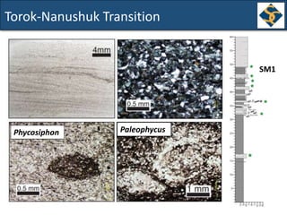
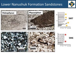
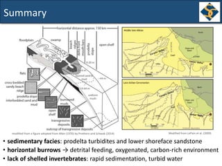
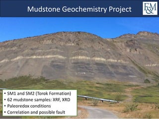
This document summarizes a study of the sedimentology and geochemistry of the Cretaceous Torok and Nanushuk Formations in northern Alaska. Key findings include:
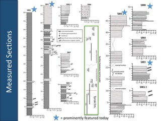
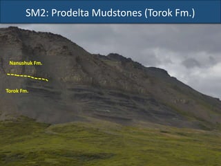
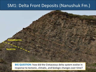
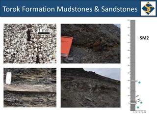
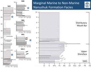
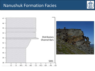
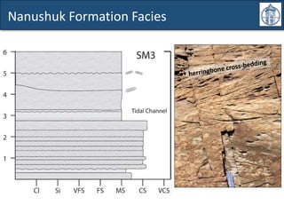
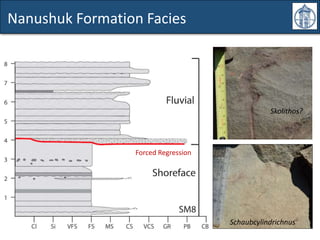
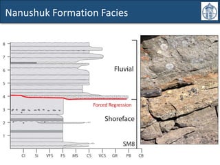
1) Detailed measurement and description of facies within the formations showed a progression from prodelta mudstones to delta front deposits.
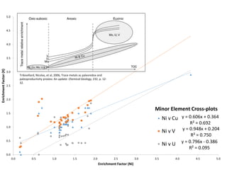
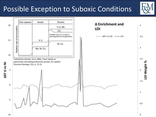
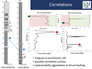
2) Geochemical analysis of mudstones indicated generally suboxic paleoredox conditions with some evidence of more oxic intervals.
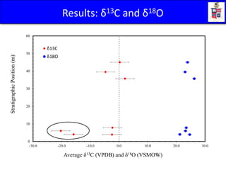
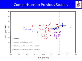
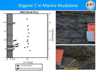
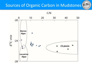
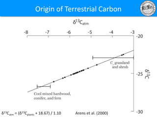
3) Isotopic data from carbonate nodules and bulk organic matter suggested a mixed source of terrestrial and marine organic carbon within the formations.