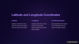
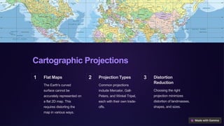
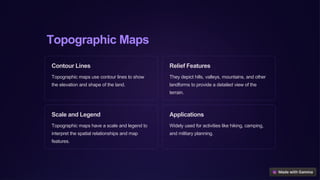
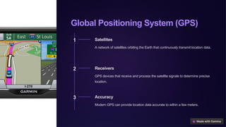
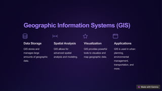
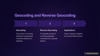
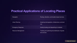
Introduction
to Locating
Places on
Earth
Accurately locating and mapping places on the Earth's surface is essential
for navigation, urban planning, resource management, and many other
applications. This presentation will explore the key concepts and
technologies used to locate and represent geographic locations.
by Edchel Espeña
Latitude and Longitude Coordinates
Latitude
Imaginary lines that run east-
west and measure the distance
north and south of the equator.
Longitude
Imaginary lines that run north-
south and measure the
distance east and west of the
prime meridian.
Coordinate System
By using latitude and longitude,
we can precisely locate any
point on the Earth's surface.
Cartographic Projections
1 Flat Maps
The Earth's curved
surface cannot be
accurately represented on
a flat 2D map. This
requires distorting the
map in various ways.
2 Projection Types
Common projections
include Mercator, Gall-
Peters, and Winkel Tripel,
each with their own trade-
offs.
3 Distortion
Reduction
Choosing the right
projection minimizes
distortion of landmasses,
shapes, and sizes.
Topographic Maps
Contour Lines
Topographic maps use contour lines to show
the elevation and shape of the land.
Relief Features
They depict hills, valleys, mountains, and other
landforms to provide a detailed view of the
terrain.
Scale and Legend
Topographic maps have a scale and legend to
interpret the spatial relationships and map
features.
Applications
Widely used for activities like hiking, camping,
and military planning.
Global Positioning System (GPS)
1 Satellites
A network of satellites orbiting the Earth that continuously transmit location data.
2 Receivers
GPS devices that receive and process the satellite signals to determine precise
location.
3 Accuracy
Modern GPS can provide location data accurate to within a few meters.
Geographic Information Systems (GIS)
Data Storage
GIS stores and
manages large
amounts of geographic
data.
Spatial Analysis
GIS allows for
advanced spatial
analysis and modeling.
Visualization
GIS provides powerful
tools to visualize and
map geographic data.
Applications
GIS is used in urban
planning,
environmental
management,
transportation, and
more.
Geocoding and Reverse Geocoding
Geocoding
The process of converting
addresses into geographic
coordinates (latitude and
longitude).
Reverse Geocoding
The opposite process of
converting geographic
coordinates into a physical
address.
Applications
Used in mapping, navigation,
and location-based services.
Practical Applications of Locating Places
Navigation Routing, directions, and location-based services.
Urban Planning Analyzing demographics, infrastructure, and land
use.
Emergency Response Quickly locating and dispatching to incidents.
Resource Management Tracking and optimizing the distribution of goods
and services.

Introduction-to-Locating-Places-on-Earth.pptx

  • 1.
    Introduction to Locating Places on Earth Accuratelylocating and mapping places on the Earth's surface is essential for navigation, urban planning, resource management, and many other applications. This presentation will explore the key concepts and technologies used to locate and represent geographic locations. by Edchel Espeña
  • 2.
    Latitude and LongitudeCoordinates Latitude Imaginary lines that run east- west and measure the distance north and south of the equator. Longitude Imaginary lines that run north- south and measure the distance east and west of the prime meridian. Coordinate System By using latitude and longitude, we can precisely locate any point on the Earth's surface.
  • 3.
    Cartographic Projections 1 FlatMaps The Earth's curved surface cannot be accurately represented on a flat 2D map. This requires distorting the map in various ways. 2 Projection Types Common projections include Mercator, Gall- Peters, and Winkel Tripel, each with their own trade- offs. 3 Distortion Reduction Choosing the right projection minimizes distortion of landmasses, shapes, and sizes.
  • 4.
    Topographic Maps Contour Lines Topographicmaps use contour lines to show the elevation and shape of the land. Relief Features They depict hills, valleys, mountains, and other landforms to provide a detailed view of the terrain. Scale and Legend Topographic maps have a scale and legend to interpret the spatial relationships and map features. Applications Widely used for activities like hiking, camping, and military planning.
  • 5.
    Global Positioning System(GPS) 1 Satellites A network of satellites orbiting the Earth that continuously transmit location data. 2 Receivers GPS devices that receive and process the satellite signals to determine precise location. 3 Accuracy Modern GPS can provide location data accurate to within a few meters.
  • 6.
    Geographic Information Systems(GIS) Data Storage GIS stores and manages large amounts of geographic data. Spatial Analysis GIS allows for advanced spatial analysis and modeling. Visualization GIS provides powerful tools to visualize and map geographic data. Applications GIS is used in urban planning, environmental management, transportation, and more.
  • 7.
    Geocoding and ReverseGeocoding Geocoding The process of converting addresses into geographic coordinates (latitude and longitude). Reverse Geocoding The opposite process of converting geographic coordinates into a physical address. Applications Used in mapping, navigation, and location-based services.
  • 8.
    Practical Applications ofLocating Places Navigation Routing, directions, and location-based services. Urban Planning Analyzing demographics, infrastructure, and land use. Emergency Response Quickly locating and dispatching to incidents. Resource Management Tracking and optimizing the distribution of goods and services.