SlideShare a Scribd company logo
1 of 55
What is Geography?
Geography is a representation of the whole known
world together with the phenomena which are
contained therein.
Ptolemy, Geographia 2nd Century A.D.
Geography is the science of place. Its vision is
grand, its view panoramic. It sweeps the surface of
the Earth, charting the physical, organic and cultural
terrain, their areal differentiation, and their
ecological dynamics with humankind. Its foremost
tool is the map.
Leonard Krishtalka, Carnegie Museum of Natural
History, 20th Century A.D.
What is Geography?
Geography is the study of
WHAT IS WHERE, HOW IT GOT
THERE, and WHY WE CARE?
Five “Key Spatial Themes” of
Geography
1. Location – specific location, where?
2. Place – unique properties of a place
3. Movement – diffusion, communications
4. Region – an area’s uniform characteristics
5. Human-Earth Relationships –
human interaction with an
environment
What is Physical Geography?
Geography is a bridge between the natural and social sciences.
Geography is a holistic and synthesizing science.
Physical Geography
Natural Science Human Geography
Rocks and Minerals Population
Landforms Settlements
Soils Economic Activities
Animals Transportation
Plants Recreational Activities
Water Religion
Atmosphere Political Systems
Rivers and Other Water Bodies Social Traditions
Environment Human Migration
Climate and Weather Agricultural Systems
Geotechniques
GIS, GPS, Remote-Sensing, Cartography
Fields of Physical Geography
Geomorphology - studies the various landforms on the
Earth's surface.
Pedology - is concerned with the study of soils and their
relationship to vegetation and farming.
Biogeography - is the science that investigates the spatial
relationships of plants and animals.
Climatology - studies the effects of weather on life and
examines the circulation of the atmosphere over longer
time spans.
Cartography - the art and science of making maps.
Cartography:
The Art and Science of Mapmaking
(Click for more info)
REMOTE SENSING
(click here for more info)
Aerial Photos
of GCC (click)
Geographic Information Science (GIS)
GIS is "an organized collection of computer hardware, software,
geographic data, and personnel designed to efficiently capture,
store, update, manipulate, analyze, and display all forms of
geographically referenced information."
Click on the map above to use the National Atlas of the United States.
La Conchita Landslide, January 2005
REMOTE SENSING
Geographic Information
Systems (GIS) – click for info
• Latest World Earthquakes Map
• National Atlas of the United States
Jobs in Geography
Aerial Photo Interpreter Facilities Planner Land Developer
Site Researcher Agricultural Extension Agent Forestry Technician
Land Economist Soil Conservationist Air/Water Quality Control Manager
Geographer Land-Use Analyst Surveyor
Cartographer Geographic Area Specialist Location Expert
Systems Analyst Cartography Compiler Geographic Attache'
Map Analyst Teacher Climatologist
Geographic Information Systems Map Curator/Librarian Traffic Manager
Coastal Zone Manager Geophysics Assistant Map Editor
Transportation Analyst Community Developer Hazardous Waste Planner
Market Research Analyst Transportation Manager Computer Mapper
Health Services Planner Natural Resources Spec. Travel Agent/Specialist
Computer Programmer Health Services Organization Manager Outdoor Guide
Urban/Regional Planner Demographer Hydrologist
Park Ranger Weather Forecaster Earth Scientist
Industrial Developer Peace Corp Volunteer Wildlife Manager
Ecologist Industrial Planner Property Manager
Writer/Author Editor Intelligence Agent
Public Utilities Specialist Zoning Investigator Env. Impact Analyst
International Business Rep Real Estate Agent/Broker/Appraiser Environmental Quality Specialist
International Investment Analyst Remote Sensing Analyst College/University Professor
Famous Geography Students
Mother Teresa - Taught
Geography and History in
Calcutta for 15 Years
Prince William of Wales – Majored in
Geography at University of Saint
Andrews, Scotland
Michael Jordan – Majored in
Cultural Geography at
University of North Carolina,
Chapel Hill
Immanuel Kant – the famous
philosopher also taught everything
from geography to physics and
anthropology.
Fieldwork: Geographers as
Modern Explorers and Observers
My Personal Travels
http://www.glendale.edu/geo/reed/general/personal.htm
Introduction to the Earth
•The Location, Size, and Shape of the Earth
•The Environmental Spheres
•The Geographic Grid
The Solar System
Mercury
Venus
Mars
Uranus
Jupiter
Saturn
Neptune
Earth
The Environmental Spheres
Lithosphere - describes the solid inorganic portion of the
Earth (composed of rocks, minerals and elements). It can
be regarded as the outer surface and interior of the solid
Earth.
The Environmental Spheres
Atmosphere - is the vast gaseous envelope of air that
surrounds the Earth. Its boundaries are not easily defined.
The atmosphere contains a complex system of gases and
suspended particles that behave in many ways like fluids.
Many of its constituents are derived from the Earth by way
of chemical and biochemical reactions.
The Environmental Spheres
Hydrosphere - describes the waters of the Earth (see the
hydrologic cycle). Water exists on the Earth in various
stores, including the atmosphere, oceans, lakes, rivers,
soils, glaciers, and groundwater. Water moves from one
store to another by way of: evaporation, condensation,
runoff, precipitation, infiltration and groundwater flow.
The Environmental Spheres
Biosphere - consists of all living things, plant and animal.
This zone is characterized by life in profusion, diversity,
and ingenious complexity. Cycling of matter in this sphere
involves not only metabolic reactions in organisms, but
also many abiotic chemical reactions.
All of these spheres are interrelated by dynamic
interactions (biogeochemical cycling)
The Size and Shape of the Earth
Earth Dimensions
diameter: 8,000 miles (12,900 km)
circumference = ¶ d or 3.14 x 8,000 =
25,000 miles
Dead Sea – 1378 ft. below sea level
Mt. Everest – 29035 ft.
Seen from space, the earth is
essentially completely smooth.
In fact, if the radius of earth
was a 30 story building, Mt.
Everest would be only a single
brick in height.
The Size and Shape of the Earth
Pythagorous (ca. 580 - 500 B.C., Greek), the first to note earth’s
shape, assumed spherical perfection. Sir Isaac Newton (1687)
reasoned that sphere not possible since earth rotation is maximized at
the equator and this should produce a ‘bulge.’ He called earth an
oblate spheroid (think of spinning water balloon; Jupiter is egg-shaped
enough to be noticeable through inexpensive telescope).
7900
miles
7927
miles
N
The Equator divides the
world into Northern and
Southern Hemispheres.
In the Western world, sailors have traditionally
undergone sometimes brutal initiation ceremonies
when first crossing the equator. The rituals often
include dressing in drag.
The Geographic Grid
Latitude - angular measurement of distance north or
south of the Equator.
Range: 0 - 90
degrees N or S
1o
latitude =
approx. 69 miles
(25,000 mi. /360o
).
Important Parallels
Parallels of Latitude - Imaginary lines that connect points of equal
latitude, thus slicing the earth into equal “layers” like on a wedding cake.
The seven
latitudes noted at
right represent
parallels where
the sun’s rays
strike the earth in
unique and
important ways
on specific days
of the year.
The Geographic Grid
Longitude the angular measurement of distance
east or west of the Prime Meridian or Greenwich
Meridian.
Maximum value
reached at
International Date
Line (180O E or W)
The Prime Meridian, the
zero measure of longitude,
is a meridian that passes
through the North Pole,
South Pole, and
Greenwich, England.
The Geographic Grid
Longitude the angular measurement of distance east or
west of the Prime Meridian.
Range: 0o
- 180o
E or W
East-west width of 1O
longitude for selected
western North American cities:
San Diego (32.5 N) = 57 miles
San Francisco (38 N) = 54 miles
Seattle (48 N) = 46 miles
Anchorage (60 N) = 35 miles
North Pole (90 N) = ?
Length of a Degree of
Longitude
Los Angeles County: 34o
N, 118o
W
Each degree is divided in 60 minutes(‘), thus we
can locate Glendale at: 34o
10’ N, 118o
14’ W
Each minute is further divided into 60 seconds(‘’),
thus we locate Glendale College at:
34o
10’ 03” N, 118o
13’ 41” W
At this point we are accurate to within 100 ft2
.
Degrees, Minutes, Seconds
Geographic Names Information Server
Earth-Sun Relationships
The Reasons for the Seasons
Solar Radiation
• The earth intercepts less than one two-billionth of
the energy given off by the sun.
• However, the radiation is sufficient to provide
99.9% of the energy that heats the earth / drives
our climate.
• Photosynthesis provides the energy for nearly all
earth processes.
Radiation Receipt
• Solar radiation is received as
parallel rays of energy (“line of
sight, speed of light”)
– Earth’s diameter is 12,765 km
– Sun’s diameter is 1,390,000
km
(over 100 times that of the
Earth)
So is the receipt of radiation the same
everywhere on Earth?
Why is it hot in the tropics
and cold at the poles?
The Earth is curved and this
cause differing angles of
incidence.
Intensity of incoming solar radiation
(insolation) is related to angle of incidence.
Higher angles = higher intensity.
Does our distance from the sun
throughout the year cause
seasons?
The line marking the shortest distance between the Sun and Earth's orbit is called the
perihelion and is 91,500,000 miles long. The line marking the greatest distance between
the Sun and Earth's orbit is called the aphelion and is 94,500,000 miles long.
Rotation of the Earth
• Rotate west to east or
‘counter-clockwise’ (when
viewed from the North Pole)
– sunset and sunrise
• Rotation period is 24 hours
per solar day
(23 hours 56 minutes with
respect to other stars)
• Axis points to Polaris
Tilt of the earth on its axis.
• The earth is tilted 23.5º from perpendicular to the plane of the
ecliptic.
• Tilt is currently constantly toward Polaris
What causes the seasons?
• 23.5 O
tilt of the earth axis from
perpendicular to the plane of the ecliptic
• revolution of the earth around the sun
• polarity (axial parallelism)
Tilt of the earth on its axis.
• The earth is tilted 23.5º from perpendicular to the plane of the
ecliptic.
• Tilt is currently constantly toward Polaris
SOLSTICES
SUMMER, JUNE 21
WINTER, DECEMBER 21
Where are the overhead rays
of the sun on these days?
Which parts of the earth are in
darkness and light? For how
long?
Solstice -when the sun reaches its
highest or lowest point in the sky at
noon, marked by the longest and
shortest days.
EQUINOXES - the time or date (twice each year) at
which the sun crosses the celestial equator, when day and night are of
equal length VERNAL, MARCH 21 AUTUMNAL,
SEPTEMBER 21
Effects of the Seasons
• Changes in solar altitude
• Changes in day length
• Changes in apparent solar intensity
• Changes in temperature
All of these changes are most extreme
at high latitudes and minimized at the
equator.
90o
N
E W
N
Of
W
N
of
E
S
of
W
S
of
E
Annual Change in Noontime
Solar Altitude
1 of 2
What is the change in height from the solstice to the equinox?
The total annual change?
Summer
Solstice
Winter
Solstice
Equinox
E W
N
of
E
S
of
E
Annual Change in Noontime
Solar Altitude
2 of 2
23.5O
23.5O
Summer
Solstice
Winter
Solstice
Equinox
Total annual change:
47O
sunrise sunset
S
of
W
N
of
W
Thought question:
How high in the sky
will the sun be in
Glendale at noon on
December 21?
E NN
Annual Change in Noontime
Solar Altitude Total annual change: 47O
sunrise sunset
This diagram was created for
Memphis, Tennessee (350
N).
How would it be different for
Glendale, California?
How about Quito, Ecuador?
And what about Fairbanks, Alaska
(650
N)?
Effects of the Seasons
• Changes in solar angle
• Changes in day length
All of the above lead to:
• Changes in temperature
• Changes in apparent solar intensity
All of these changes are most extreme
at high latitudes and minimized at the
equator.
Key Points
• Size and Shape of Earth
• Latitude and Longitude
• Explain the basic earth-sun relationships
• Equinoxes, solstices and the relationship among
– seasons
– the latitude of the sun’s direct rays, and
– the intensity of solar radiation received
– changes in Daylight and Darkness

More Related Content

What's hot

The Sun, Moon, and Earth
The Sun, Moon, and Earth The Sun, Moon, and Earth
The Sun, Moon, and Earth vanpr1jl
 
Physical geography
Physical geographyPhysical geography
Physical geographymgdean
 
Moon Characteristics and Motion
Moon Characteristics and MotionMoon Characteristics and Motion
Moon Characteristics and Motiondwinter1
 
Layers of the earth
Layers of the earthLayers of the earth
Layers of the earthmarcelo_a87
 
Akk earth's processes (ch 1 rcc)
Akk earth's processes (ch 1 rcc)Akk earth's processes (ch 1 rcc)
Akk earth's processes (ch 1 rcc)rmendgle
 
The Moon... physical characteristics (teach)
 The Moon... physical characteristics  (teach) The Moon... physical characteristics  (teach)
The Moon... physical characteristics (teach)Moira Whitehouse
 
Upsc salient features of world's physical geography
Upsc   salient features of world's physical geographyUpsc   salient features of world's physical geography
Upsc salient features of world's physical geographyGautam Kumar
 
Oldest rocks on earth rsz gf2018
Oldest rocks on earth rsz gf2018Oldest rocks on earth rsz gf2018
Oldest rocks on earth rsz gf2018ILOAHawaii
 
5 themes of geography
 5 themes of geography 5 themes of geography
5 themes of geographyRoi Fernandez
 
5 Themes Of Geography 07
5 Themes Of Geography 075 Themes Of Geography 07
5 Themes Of Geography 07Mr.J
 
Chapter Two, Section 2
Chapter Two, Section 2Chapter Two, Section 2
Chapter Two, Section 2Mr. Philen
 

What's hot (20)

The Sun, Moon, and Earth
The Sun, Moon, and Earth The Sun, Moon, and Earth
The Sun, Moon, and Earth
 
Physical geography
Physical geographyPhysical geography
Physical geography
 
Moon Characteristics and Motion
Moon Characteristics and MotionMoon Characteristics and Motion
Moon Characteristics and Motion
 
Layers of the earth
Layers of the earthLayers of the earth
Layers of the earth
 
Akk earth's processes (ch 1 rcc)
Akk earth's processes (ch 1 rcc)Akk earth's processes (ch 1 rcc)
Akk earth's processes (ch 1 rcc)
 
The Moon... physical characteristics (teach)
 The Moon... physical characteristics  (teach) The Moon... physical characteristics  (teach)
The Moon... physical characteristics (teach)
 
Moon's Properties and Characteristics
Moon's Properties and CharacteristicsMoon's Properties and Characteristics
Moon's Properties and Characteristics
 
Upsc salient features of world's physical geography
Upsc   salient features of world's physical geographyUpsc   salient features of world's physical geography
Upsc salient features of world's physical geography
 
ENV 101 Ch01 lecture ppt_a
ENV 101 Ch01 lecture ppt_aENV 101 Ch01 lecture ppt_a
ENV 101 Ch01 lecture ppt_a
 
Unit 1. PLANET EARTH
Unit 1. PLANET EARTHUnit 1. PLANET EARTH
Unit 1. PLANET EARTH
 
Oldest rocks on earth rsz gf2018
Oldest rocks on earth rsz gf2018Oldest rocks on earth rsz gf2018
Oldest rocks on earth rsz gf2018
 
5 themes of geography
 5 themes of geography 5 themes of geography
5 themes of geography
 
shape of earth
shape of earthshape of earth
shape of earth
 
Unit 1. Planet Earth
Unit 1. Planet EarthUnit 1. Planet Earth
Unit 1. Planet Earth
 
Unit 1. Planet Earth
Unit 1. Planet EarthUnit 1. Planet Earth
Unit 1. Planet Earth
 
Earth's Moon
Earth's MoonEarth's Moon
Earth's Moon
 
Chapter 1
Chapter 1 Chapter 1
Chapter 1
 
5 Themes Of Geography 07
5 Themes Of Geography 075 Themes Of Geography 07
5 Themes Of Geography 07
 
Chapter Two, Section 2
Chapter Two, Section 2Chapter Two, Section 2
Chapter Two, Section 2
 
The earth system
The earth systemThe earth system
The earth system
 

Similar to What is Geography

Similar to What is Geography (20)

Ch 1esnew
Ch 1esnewCh 1esnew
Ch 1esnew
 
Chapter 2 Earth As Planet
Chapter 2 Earth As PlanetChapter 2 Earth As Planet
Chapter 2 Earth As Planet
 
Earth science slides one shot
Earth science slides one shotEarth science slides one shot
Earth science slides one shot
 
Sun Observation Grid Report
Sun Observation Grid ReportSun Observation Grid Report
Sun Observation Grid Report
 
Moon
MoonMoon
Moon
 
Basic geography
Basic geographyBasic geography
Basic geography
 
Unit 1.
Unit 1.Unit 1.
Unit 1.
 
Unit 1. Planet Earth
Unit 1. Planet EarthUnit 1. Planet Earth
Unit 1. Planet Earth
 
-geomorphology.pptx
-geomorphology.pptx-geomorphology.pptx
-geomorphology.pptx
 
Summary 0f the earth system, origin...
Summary 0f the earth system, origin...Summary 0f the earth system, origin...
Summary 0f the earth system, origin...
 
Unit 1.
Unit 1.Unit 1.
Unit 1.
 
GHSGT-World-Geography.ppsx
GHSGT-World-Geography.ppsxGHSGT-World-Geography.ppsx
GHSGT-World-Geography.ppsx
 
1st term answer key
1st term answer key1st term answer key
1st term answer key
 
Unit 1.
Unit 1.Unit 1.
Unit 1.
 
2 Earth_and_Life_Science-Earth Subsystem.pptx
2 Earth_and_Life_Science-Earth Subsystem.pptx2 Earth_and_Life_Science-Earth Subsystem.pptx
2 Earth_and_Life_Science-Earth Subsystem.pptx
 
Intro to Earth System Science
Intro to Earth System ScienceIntro to Earth System Science
Intro to Earth System Science
 
World geography
World geographyWorld geography
World geography
 
Earth
EarthEarth
Earth
 
Week 2_Introduction to Physical Geography.pptx
Week 2_Introduction to Physical Geography.pptxWeek 2_Introduction to Physical Geography.pptx
Week 2_Introduction to Physical Geography.pptx
 
MASciEd206_Report_NerissaRueda.pptx
MASciEd206_Report_NerissaRueda.pptxMASciEd206_Report_NerissaRueda.pptx
MASciEd206_Report_NerissaRueda.pptx
 

Recently uploaded

Orientation, design and principles of polyhouse
Orientation, design and principles of polyhouseOrientation, design and principles of polyhouse
Orientation, design and principles of polyhousejana861314
 
STERILITY TESTING OF PHARMACEUTICALS ppt by DR.C.P.PRINCE
STERILITY TESTING OF PHARMACEUTICALS ppt by DR.C.P.PRINCESTERILITY TESTING OF PHARMACEUTICALS ppt by DR.C.P.PRINCE
STERILITY TESTING OF PHARMACEUTICALS ppt by DR.C.P.PRINCEPRINCE C P
 
Nightside clouds and disequilibrium chemistry on the hot Jupiter WASP-43b
Nightside clouds and disequilibrium chemistry on the hot Jupiter WASP-43bNightside clouds and disequilibrium chemistry on the hot Jupiter WASP-43b
Nightside clouds and disequilibrium chemistry on the hot Jupiter WASP-43bSérgio Sacani
 
NAVSEA PEO USC - Unmanned & Small Combatants 26Oct23.pdf
NAVSEA PEO USC - Unmanned & Small Combatants 26Oct23.pdfNAVSEA PEO USC - Unmanned & Small Combatants 26Oct23.pdf
NAVSEA PEO USC - Unmanned & Small Combatants 26Oct23.pdfWadeK3
 
Spermiogenesis or Spermateleosis or metamorphosis of spermatid
Spermiogenesis or Spermateleosis or metamorphosis of spermatidSpermiogenesis or Spermateleosis or metamorphosis of spermatid
Spermiogenesis or Spermateleosis or metamorphosis of spermatidSarthak Sekhar Mondal
 
Analytical Profile of Coleus Forskohlii | Forskolin .pdf
Analytical Profile of Coleus Forskohlii | Forskolin .pdfAnalytical Profile of Coleus Forskohlii | Forskolin .pdf
Analytical Profile of Coleus Forskohlii | Forskolin .pdfSwapnil Therkar
 
Nanoparticles synthesis and characterization​ ​
Nanoparticles synthesis and characterization​  ​Nanoparticles synthesis and characterization​  ​
Nanoparticles synthesis and characterization​ ​kaibalyasahoo82800
 
Luciferase in rDNA technology (biotechnology).pptx
Luciferase in rDNA technology (biotechnology).pptxLuciferase in rDNA technology (biotechnology).pptx
Luciferase in rDNA technology (biotechnology).pptxAleenaTreesaSaji
 
VIRUSES structure and classification ppt by Dr.Prince C P
VIRUSES structure and classification ppt by Dr.Prince C PVIRUSES structure and classification ppt by Dr.Prince C P
VIRUSES structure and classification ppt by Dr.Prince C PPRINCE C P
 
Scheme-of-Work-Science-Stage-4 cambridge science.docx
Scheme-of-Work-Science-Stage-4 cambridge science.docxScheme-of-Work-Science-Stage-4 cambridge science.docx
Scheme-of-Work-Science-Stage-4 cambridge science.docxyaramohamed343013
 
Traditional Agroforestry System in India- Shifting Cultivation, Taungya, Home...
Traditional Agroforestry System in India- Shifting Cultivation, Taungya, Home...Traditional Agroforestry System in India- Shifting Cultivation, Taungya, Home...
Traditional Agroforestry System in India- Shifting Cultivation, Taungya, Home...jana861314
 
Is RISC-V ready for HPC workload? Maybe?
Is RISC-V ready for HPC workload? Maybe?Is RISC-V ready for HPC workload? Maybe?
Is RISC-V ready for HPC workload? Maybe?Patrick Diehl
 
All-domain Anomaly Resolution Office U.S. Department of Defense (U) Case: “Eg...
All-domain Anomaly Resolution Office U.S. Department of Defense (U) Case: “Eg...All-domain Anomaly Resolution Office U.S. Department of Defense (U) Case: “Eg...
All-domain Anomaly Resolution Office U.S. Department of Defense (U) Case: “Eg...Sérgio Sacani
 
Analytical Profile of Coleus Forskohlii | Forskolin .pptx
Analytical Profile of Coleus Forskohlii | Forskolin .pptxAnalytical Profile of Coleus Forskohlii | Forskolin .pptx
Analytical Profile of Coleus Forskohlii | Forskolin .pptxSwapnil Therkar
 
GFP in rDNA Technology (Biotechnology).pptx
GFP in rDNA Technology (Biotechnology).pptxGFP in rDNA Technology (Biotechnology).pptx
GFP in rDNA Technology (Biotechnology).pptxAleenaTreesaSaji
 
PossibleEoarcheanRecordsoftheGeomagneticFieldPreservedintheIsuaSupracrustalBe...
PossibleEoarcheanRecordsoftheGeomagneticFieldPreservedintheIsuaSupracrustalBe...PossibleEoarcheanRecordsoftheGeomagneticFieldPreservedintheIsuaSupracrustalBe...
PossibleEoarcheanRecordsoftheGeomagneticFieldPreservedintheIsuaSupracrustalBe...Sérgio Sacani
 
Animal Communication- Auditory and Visual.pptx
Animal Communication- Auditory and Visual.pptxAnimal Communication- Auditory and Visual.pptx
Animal Communication- Auditory and Visual.pptxUmerFayaz5
 
Grafana in space: Monitoring Japan's SLIM moon lander in real time
Grafana in space: Monitoring Japan's SLIM moon lander  in real timeGrafana in space: Monitoring Japan's SLIM moon lander  in real time
Grafana in space: Monitoring Japan's SLIM moon lander in real timeSatoshi NAKAHIRA
 
Boyles law module in the grade 10 science
Boyles law module in the grade 10 scienceBoyles law module in the grade 10 science
Boyles law module in the grade 10 sciencefloriejanemacaya1
 
Bentham & Hooker's Classification. along with the merits and demerits of the ...
Bentham & Hooker's Classification. along with the merits and demerits of the ...Bentham & Hooker's Classification. along with the merits and demerits of the ...
Bentham & Hooker's Classification. along with the merits and demerits of the ...Nistarini College, Purulia (W.B) India
 

Recently uploaded (20)

Orientation, design and principles of polyhouse
Orientation, design and principles of polyhouseOrientation, design and principles of polyhouse
Orientation, design and principles of polyhouse
 
STERILITY TESTING OF PHARMACEUTICALS ppt by DR.C.P.PRINCE
STERILITY TESTING OF PHARMACEUTICALS ppt by DR.C.P.PRINCESTERILITY TESTING OF PHARMACEUTICALS ppt by DR.C.P.PRINCE
STERILITY TESTING OF PHARMACEUTICALS ppt by DR.C.P.PRINCE
 
Nightside clouds and disequilibrium chemistry on the hot Jupiter WASP-43b
Nightside clouds and disequilibrium chemistry on the hot Jupiter WASP-43bNightside clouds and disequilibrium chemistry on the hot Jupiter WASP-43b
Nightside clouds and disequilibrium chemistry on the hot Jupiter WASP-43b
 
NAVSEA PEO USC - Unmanned & Small Combatants 26Oct23.pdf
NAVSEA PEO USC - Unmanned & Small Combatants 26Oct23.pdfNAVSEA PEO USC - Unmanned & Small Combatants 26Oct23.pdf
NAVSEA PEO USC - Unmanned & Small Combatants 26Oct23.pdf
 
Spermiogenesis or Spermateleosis or metamorphosis of spermatid
Spermiogenesis or Spermateleosis or metamorphosis of spermatidSpermiogenesis or Spermateleosis or metamorphosis of spermatid
Spermiogenesis or Spermateleosis or metamorphosis of spermatid
 
Analytical Profile of Coleus Forskohlii | Forskolin .pdf
Analytical Profile of Coleus Forskohlii | Forskolin .pdfAnalytical Profile of Coleus Forskohlii | Forskolin .pdf
Analytical Profile of Coleus Forskohlii | Forskolin .pdf
 
Nanoparticles synthesis and characterization​ ​
Nanoparticles synthesis and characterization​  ​Nanoparticles synthesis and characterization​  ​
Nanoparticles synthesis and characterization​ ​
 
Luciferase in rDNA technology (biotechnology).pptx
Luciferase in rDNA technology (biotechnology).pptxLuciferase in rDNA technology (biotechnology).pptx
Luciferase in rDNA technology (biotechnology).pptx
 
VIRUSES structure and classification ppt by Dr.Prince C P
VIRUSES structure and classification ppt by Dr.Prince C PVIRUSES structure and classification ppt by Dr.Prince C P
VIRUSES structure and classification ppt by Dr.Prince C P
 
Scheme-of-Work-Science-Stage-4 cambridge science.docx
Scheme-of-Work-Science-Stage-4 cambridge science.docxScheme-of-Work-Science-Stage-4 cambridge science.docx
Scheme-of-Work-Science-Stage-4 cambridge science.docx
 
Traditional Agroforestry System in India- Shifting Cultivation, Taungya, Home...
Traditional Agroforestry System in India- Shifting Cultivation, Taungya, Home...Traditional Agroforestry System in India- Shifting Cultivation, Taungya, Home...
Traditional Agroforestry System in India- Shifting Cultivation, Taungya, Home...
 
Is RISC-V ready for HPC workload? Maybe?
Is RISC-V ready for HPC workload? Maybe?Is RISC-V ready for HPC workload? Maybe?
Is RISC-V ready for HPC workload? Maybe?
 
All-domain Anomaly Resolution Office U.S. Department of Defense (U) Case: “Eg...
All-domain Anomaly Resolution Office U.S. Department of Defense (U) Case: “Eg...All-domain Anomaly Resolution Office U.S. Department of Defense (U) Case: “Eg...
All-domain Anomaly Resolution Office U.S. Department of Defense (U) Case: “Eg...
 
Analytical Profile of Coleus Forskohlii | Forskolin .pptx
Analytical Profile of Coleus Forskohlii | Forskolin .pptxAnalytical Profile of Coleus Forskohlii | Forskolin .pptx
Analytical Profile of Coleus Forskohlii | Forskolin .pptx
 
GFP in rDNA Technology (Biotechnology).pptx
GFP in rDNA Technology (Biotechnology).pptxGFP in rDNA Technology (Biotechnology).pptx
GFP in rDNA Technology (Biotechnology).pptx
 
PossibleEoarcheanRecordsoftheGeomagneticFieldPreservedintheIsuaSupracrustalBe...
PossibleEoarcheanRecordsoftheGeomagneticFieldPreservedintheIsuaSupracrustalBe...PossibleEoarcheanRecordsoftheGeomagneticFieldPreservedintheIsuaSupracrustalBe...
PossibleEoarcheanRecordsoftheGeomagneticFieldPreservedintheIsuaSupracrustalBe...
 
Animal Communication- Auditory and Visual.pptx
Animal Communication- Auditory and Visual.pptxAnimal Communication- Auditory and Visual.pptx
Animal Communication- Auditory and Visual.pptx
 
Grafana in space: Monitoring Japan's SLIM moon lander in real time
Grafana in space: Monitoring Japan's SLIM moon lander  in real timeGrafana in space: Monitoring Japan's SLIM moon lander  in real time
Grafana in space: Monitoring Japan's SLIM moon lander in real time
 
Boyles law module in the grade 10 science
Boyles law module in the grade 10 scienceBoyles law module in the grade 10 science
Boyles law module in the grade 10 science
 
Bentham & Hooker's Classification. along with the merits and demerits of the ...
Bentham & Hooker's Classification. along with the merits and demerits of the ...Bentham & Hooker's Classification. along with the merits and demerits of the ...
Bentham & Hooker's Classification. along with the merits and demerits of the ...
 

What is Geography

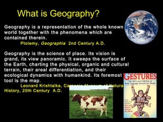
  • 1. What is Geography? Geography is a representation of the whole known world together with the phenomena which are contained therein. Ptolemy, Geographia 2nd Century A.D. Geography is the science of place. Its vision is grand, its view panoramic. It sweeps the surface of the Earth, charting the physical, organic and cultural terrain, their areal differentiation, and their ecological dynamics with humankind. Its foremost tool is the map. Leonard Krishtalka, Carnegie Museum of Natural History, 20th Century A.D.
  • 2. What is Geography? Geography is the study of WHAT IS WHERE, HOW IT GOT THERE, and WHY WE CARE?
  • 3. Five “Key Spatial Themes” of Geography 1. Location – specific location, where? 2. Place – unique properties of a place 3. Movement – diffusion, communications 4. Region – an area’s uniform characteristics 5. Human-Earth Relationships – human interaction with an environment
  • 4. What is Physical Geography? Geography is a bridge between the natural and social sciences. Geography is a holistic and synthesizing science. Physical Geography Natural Science Human Geography Rocks and Minerals Population Landforms Settlements Soils Economic Activities Animals Transportation Plants Recreational Activities Water Religion Atmosphere Political Systems Rivers and Other Water Bodies Social Traditions Environment Human Migration Climate and Weather Agricultural Systems Geotechniques GIS, GPS, Remote-Sensing, Cartography
  • 5. Fields of Physical Geography Geomorphology - studies the various landforms on the Earth's surface. Pedology - is concerned with the study of soils and their relationship to vegetation and farming. Biogeography - is the science that investigates the spatial relationships of plants and animals. Climatology - studies the effects of weather on life and examines the circulation of the atmosphere over longer time spans. Cartography - the art and science of making maps.
  • 6. Cartography: The Art and Science of Mapmaking (Click for more info)
  • 7. REMOTE SENSING (click here for more info) Aerial Photos of GCC (click)
  • 8. Geographic Information Science (GIS) GIS is "an organized collection of computer hardware, software, geographic data, and personnel designed to efficiently capture, store, update, manipulate, analyze, and display all forms of geographically referenced information." Click on the map above to use the National Atlas of the United States.
  • 9. La Conchita Landslide, January 2005 REMOTE SENSING
  • 10. Geographic Information Systems (GIS) – click for info • Latest World Earthquakes Map • National Atlas of the United States
  • 11. Jobs in Geography Aerial Photo Interpreter Facilities Planner Land Developer Site Researcher Agricultural Extension Agent Forestry Technician Land Economist Soil Conservationist Air/Water Quality Control Manager Geographer Land-Use Analyst Surveyor Cartographer Geographic Area Specialist Location Expert Systems Analyst Cartography Compiler Geographic Attache' Map Analyst Teacher Climatologist Geographic Information Systems Map Curator/Librarian Traffic Manager Coastal Zone Manager Geophysics Assistant Map Editor Transportation Analyst Community Developer Hazardous Waste Planner Market Research Analyst Transportation Manager Computer Mapper Health Services Planner Natural Resources Spec. Travel Agent/Specialist Computer Programmer Health Services Organization Manager Outdoor Guide Urban/Regional Planner Demographer Hydrologist Park Ranger Weather Forecaster Earth Scientist Industrial Developer Peace Corp Volunteer Wildlife Manager Ecologist Industrial Planner Property Manager Writer/Author Editor Intelligence Agent Public Utilities Specialist Zoning Investigator Env. Impact Analyst International Business Rep Real Estate Agent/Broker/Appraiser Environmental Quality Specialist International Investment Analyst Remote Sensing Analyst College/University Professor
  • 12. Famous Geography Students Mother Teresa - Taught Geography and History in Calcutta for 15 Years Prince William of Wales – Majored in Geography at University of Saint Andrews, Scotland Michael Jordan – Majored in Cultural Geography at University of North Carolina, Chapel Hill Immanuel Kant – the famous philosopher also taught everything from geography to physics and anthropology.
  • 13. Fieldwork: Geographers as Modern Explorers and Observers My Personal Travels http://www.glendale.edu/geo/reed/general/personal.htm
  • 16. Introduction to the Earth •The Location, Size, and Shape of the Earth •The Environmental Spheres •The Geographic Grid
  • 18.
  • 19. Earth
  • 20. The Environmental Spheres Lithosphere - describes the solid inorganic portion of the Earth (composed of rocks, minerals and elements). It can be regarded as the outer surface and interior of the solid Earth.
  • 21. The Environmental Spheres Atmosphere - is the vast gaseous envelope of air that surrounds the Earth. Its boundaries are not easily defined. The atmosphere contains a complex system of gases and suspended particles that behave in many ways like fluids. Many of its constituents are derived from the Earth by way of chemical and biochemical reactions.
  • 22. The Environmental Spheres Hydrosphere - describes the waters of the Earth (see the hydrologic cycle). Water exists on the Earth in various stores, including the atmosphere, oceans, lakes, rivers, soils, glaciers, and groundwater. Water moves from one store to another by way of: evaporation, condensation, runoff, precipitation, infiltration and groundwater flow.
  • 23. The Environmental Spheres Biosphere - consists of all living things, plant and animal. This zone is characterized by life in profusion, diversity, and ingenious complexity. Cycling of matter in this sphere involves not only metabolic reactions in organisms, but also many abiotic chemical reactions. All of these spheres are interrelated by dynamic interactions (biogeochemical cycling)
  • 24. The Size and Shape of the Earth Earth Dimensions diameter: 8,000 miles (12,900 km) circumference = ¶ d or 3.14 x 8,000 = 25,000 miles Dead Sea – 1378 ft. below sea level Mt. Everest – 29035 ft. Seen from space, the earth is essentially completely smooth. In fact, if the radius of earth was a 30 story building, Mt. Everest would be only a single brick in height.
  • 25. The Size and Shape of the Earth Pythagorous (ca. 580 - 500 B.C., Greek), the first to note earth’s shape, assumed spherical perfection. Sir Isaac Newton (1687) reasoned that sphere not possible since earth rotation is maximized at the equator and this should produce a ‘bulge.’ He called earth an oblate spheroid (think of spinning water balloon; Jupiter is egg-shaped enough to be noticeable through inexpensive telescope). 7900 miles 7927 miles N
  • 26.
  • 27. The Equator divides the world into Northern and Southern Hemispheres. In the Western world, sailors have traditionally undergone sometimes brutal initiation ceremonies when first crossing the equator. The rituals often include dressing in drag.
  • 28. The Geographic Grid Latitude - angular measurement of distance north or south of the Equator. Range: 0 - 90 degrees N or S 1o latitude = approx. 69 miles (25,000 mi. /360o ).
  • 29. Important Parallels Parallels of Latitude - Imaginary lines that connect points of equal latitude, thus slicing the earth into equal “layers” like on a wedding cake. The seven latitudes noted at right represent parallels where the sun’s rays strike the earth in unique and important ways on specific days of the year.
  • 30. The Geographic Grid Longitude the angular measurement of distance east or west of the Prime Meridian or Greenwich Meridian. Maximum value reached at International Date Line (180O E or W)
  • 31. The Prime Meridian, the zero measure of longitude, is a meridian that passes through the North Pole, South Pole, and Greenwich, England.
  • 32. The Geographic Grid Longitude the angular measurement of distance east or west of the Prime Meridian. Range: 0o - 180o E or W
  • 33. East-west width of 1O longitude for selected western North American cities: San Diego (32.5 N) = 57 miles San Francisco (38 N) = 54 miles Seattle (48 N) = 46 miles Anchorage (60 N) = 35 miles North Pole (90 N) = ? Length of a Degree of Longitude
  • 34. Los Angeles County: 34o N, 118o W Each degree is divided in 60 minutes(‘), thus we can locate Glendale at: 34o 10’ N, 118o 14’ W Each minute is further divided into 60 seconds(‘’), thus we locate Glendale College at: 34o 10’ 03” N, 118o 13’ 41” W At this point we are accurate to within 100 ft2 . Degrees, Minutes, Seconds Geographic Names Information Server
  • 36. Solar Radiation • The earth intercepts less than one two-billionth of the energy given off by the sun. • However, the radiation is sufficient to provide 99.9% of the energy that heats the earth / drives our climate. • Photosynthesis provides the energy for nearly all earth processes.
  • 37. Radiation Receipt • Solar radiation is received as parallel rays of energy (“line of sight, speed of light”) – Earth’s diameter is 12,765 km – Sun’s diameter is 1,390,000 km (over 100 times that of the Earth) So is the receipt of radiation the same everywhere on Earth?
  • 38. Why is it hot in the tropics and cold at the poles?
  • 39. The Earth is curved and this cause differing angles of incidence.
  • 40. Intensity of incoming solar radiation (insolation) is related to angle of incidence. Higher angles = higher intensity.
  • 41. Does our distance from the sun throughout the year cause seasons? The line marking the shortest distance between the Sun and Earth's orbit is called the perihelion and is 91,500,000 miles long. The line marking the greatest distance between the Sun and Earth's orbit is called the aphelion and is 94,500,000 miles long.
  • 42. Rotation of the Earth • Rotate west to east or ‘counter-clockwise’ (when viewed from the North Pole) – sunset and sunrise • Rotation period is 24 hours per solar day (23 hours 56 minutes with respect to other stars) • Axis points to Polaris
  • 43. Tilt of the earth on its axis. • The earth is tilted 23.5º from perpendicular to the plane of the ecliptic. • Tilt is currently constantly toward Polaris
  • 44. What causes the seasons? • 23.5 O tilt of the earth axis from perpendicular to the plane of the ecliptic • revolution of the earth around the sun • polarity (axial parallelism)
  • 45. Tilt of the earth on its axis. • The earth is tilted 23.5º from perpendicular to the plane of the ecliptic. • Tilt is currently constantly toward Polaris
  • 46. SOLSTICES SUMMER, JUNE 21 WINTER, DECEMBER 21 Where are the overhead rays of the sun on these days? Which parts of the earth are in darkness and light? For how long? Solstice -when the sun reaches its highest or lowest point in the sky at noon, marked by the longest and shortest days.
  • 47. EQUINOXES - the time or date (twice each year) at which the sun crosses the celestial equator, when day and night are of equal length VERNAL, MARCH 21 AUTUMNAL, SEPTEMBER 21
  • 48. Effects of the Seasons • Changes in solar altitude • Changes in day length • Changes in apparent solar intensity • Changes in temperature All of these changes are most extreme at high latitudes and minimized at the equator.
  • 49. 90o N
  • 50.
  • 51. E W N Of W N of E S of W S of E Annual Change in Noontime Solar Altitude 1 of 2 What is the change in height from the solstice to the equinox? The total annual change? Summer Solstice Winter Solstice Equinox
  • 52. E W N of E S of E Annual Change in Noontime Solar Altitude 2 of 2 23.5O 23.5O Summer Solstice Winter Solstice Equinox Total annual change: 47O sunrise sunset S of W N of W Thought question: How high in the sky will the sun be in Glendale at noon on December 21?
  • 53. E NN Annual Change in Noontime Solar Altitude Total annual change: 47O sunrise sunset This diagram was created for Memphis, Tennessee (350 N). How would it be different for Glendale, California? How about Quito, Ecuador? And what about Fairbanks, Alaska (650 N)?
  • 54. Effects of the Seasons • Changes in solar angle • Changes in day length All of the above lead to: • Changes in temperature • Changes in apparent solar intensity All of these changes are most extreme at high latitudes and minimized at the equator.
  • 55. Key Points • Size and Shape of Earth • Latitude and Longitude • Explain the basic earth-sun relationships • Equinoxes, solstices and the relationship among – seasons – the latitude of the sun’s direct rays, and – the intensity of solar radiation received – changes in Daylight and Darkness

Editor's Notes

  1. the time or date (twice each year) at which the sun crosses the celestial equator, when day and night are of equal length (about 22 September and 20 March).