SlideShare a Scribd company logo
1 of 12
Download to read offline
MICRO LEVELAQUIFER MAPPING OF PALMAKULA-KOTUR
WATERSHED,RANGA REDDY DISTRICT,ANDHRA PRADESH
IGU-49thAnnualConvention&Seminar
The Aquifer Geometry Varies
in X-Y direction-(Spatial Variation)
with depth (Vertical Variation)
& Ground water Resources availability varies With Time
Historical data to be considered for Modelling provides the Temporal variation &
Management aspects
Hydrogeological – Exploration & Well Inventory
Methods
Geo-Physical - VES Surveys
Hydro-meterological – Rainfall
Generation of 2D Layers GIS /Contour Layers
Generation of 3-D Layers
Ground Water Modelling
MICRO LEVELAQUIFER MAPPING OF PALMAKULA-KOTUR
WATERSHED,RANGA REDDY DISTRICT,ANDHRA PRADESH
IGU-49thAnnualConvention&Seminar
To decipher the
1. Spatial & Vertical disposition of aquifers/aquifer geometry.
2. Generation of 2D & 3D GIS layers/Micro level Aquifer Maps.
3. Ground water resources & yield characteristics of the aquifers.
4. Ground water planning & management of ground water Resources-watershed wise and
Village wise.
Objectives
AQUIFER MAPPING OF PALMAKUL WATERSHED
IGU-49thAnnualConvention&Seminar
AQUIFER MAPPING OF PALMAKUL WATERSHEDIGU-49thAnnualConvention&Seminar
DATA COLLECTION/SAMPLING POINTS
IGU-49thAnnualConvention&Seminar
CONTOURS SHOWING SUBSURFACE DISPOSITION OF
AQUIFER
IGU-49thAnnualConvention&Seminar
SUBSURFACE AQUIFER GEOMETRY
Third Aquifer
Second Aquifer
First Aquifer
First Aquifer
Second Aquifer
Third Aquifer
IGU-49thAnnualConvention&Seminar
SUBSURFACE AQUIFER GEOMETRY
Subsurface Aquifer Geometry Cross Section In X-Direction
(Front View)
Subsurface Aquifer Geometry Cross Section In Y-Direction
(Lateral View)
IGU-49thAnnualConvention&Seminar
PREPARATION OF MICRO LEVELAQUIFER MAPS
(A1) (A2)
(B1)
(B2)
(C1) (C2)
(D1) (D2)
(A) (B)
(C) (D)
IGU-49thAnnualConvention&Seminar
First Layer Second Layer Third Layer
CONTOURS SHOWING HEADS DISPOSITION FLOW
DIRECTION OF AQUIFERS
IGU-49thAnnualConvention&Seminar
4. Model Simulation and Development for Management Plan for Ground Water Resource
Management
1. Different Hydro-Geomorphological units are demarcated with integration of Remote
Sensing and GIS data to field data.
2. With the Systematic vertical electrical sounding (VES) data 3-D water level map is
been created.
3. The Ground Water prospect has been determined through both the approach and
results are correlated to improve the ground water prospect Zonation .
IGU-49thAnnualConvention&Seminar
RESULTS
Micro level aquifer mapping of Palmakul watershed

More Related Content

What's hot

Surface Water modelling using Remote Sensing
Surface Water modelling using Remote SensingSurface Water modelling using Remote Sensing
Surface Water modelling using Remote SensingArk Arjun
 
Application of RS and GIS in Groundwater Prospects Zonation
Application of RS and GIS in Groundwater Prospects ZonationApplication of RS and GIS in Groundwater Prospects Zonation
Application of RS and GIS in Groundwater Prospects ZonationVishwanath Awati
 
Application of GIS and MODFLOW to Ground Water Hydrology- A Review
Application of GIS and MODFLOW to Ground Water Hydrology- A ReviewApplication of GIS and MODFLOW to Ground Water Hydrology- A Review
Application of GIS and MODFLOW to Ground Water Hydrology- A ReviewIJERA Editor
 
Groundwater modelling (an Introduction)
Groundwater modelling (an Introduction)Groundwater modelling (an Introduction)
Groundwater modelling (an Introduction)Putika Ashfar Khoiri
 
Assessing the ability of SWAT as a water quality model in the Lake Victoria b...
Assessing the ability of SWAT as a water quality model in the Lake Victoria b...Assessing the ability of SWAT as a water quality model in the Lake Victoria b...
Assessing the ability of SWAT as a water quality model in the Lake Victoria b...Timo Brussée
 
Application of remote sensing and gis for groundwater
Application of remote sensing and gis for groundwaterApplication of remote sensing and gis for groundwater
Application of remote sensing and gis for groundwaterRamodh Jayawardena
 
Water quality mapping for solapur district using gis
Water quality mapping for solapur district using gisWater quality mapping for solapur district using gis
Water quality mapping for solapur district using gisadsulprashantr
 
Hydrologic Assessment in a Middle Narmada Basin, India using SWAT Model
Hydrologic Assessment in a Middle Narmada Basin, India using SWAT ModelHydrologic Assessment in a Middle Narmada Basin, India using SWAT Model
Hydrologic Assessment in a Middle Narmada Basin, India using SWAT ModelSumant Diwakar
 
Easter Desert Project
Easter Desert ProjectEaster Desert Project
Easter Desert ProjectIwl Pcu
 
Scale-dependency and Sensitivity of Hydrological Estimations to Land Use and ...
Scale-dependency and Sensitivity of Hydrological Estimations to Land Use and ...Scale-dependency and Sensitivity of Hydrological Estimations to Land Use and ...
Scale-dependency and Sensitivity of Hydrological Estimations to Land Use and ...Beniamino Murgante
 
The Development of a Catchment Management Modelling System for the Googong Re...
The Development of a Catchment Management Modelling System for the Googong Re...The Development of a Catchment Management Modelling System for the Googong Re...
The Development of a Catchment Management Modelling System for the Googong Re...GavanThomas
 
Groundwater Modelling Application for Waterworks
Groundwater Modelling Application for WaterworksGroundwater Modelling Application for Waterworks
Groundwater Modelling Application for WaterworksTapesh Ajmera
 

What's hot (20)

72.gis in water resources
72.gis in water resources72.gis in water resources
72.gis in water resources
 
Surface Water modelling using Remote Sensing
Surface Water modelling using Remote SensingSurface Water modelling using Remote Sensing
Surface Water modelling using Remote Sensing
 
Application of RS and GIS in Groundwater Prospects Zonation
Application of RS and GIS in Groundwater Prospects ZonationApplication of RS and GIS in Groundwater Prospects Zonation
Application of RS and GIS in Groundwater Prospects Zonation
 
Ground water prospects map
Ground water prospects mapGround water prospects map
Ground water prospects map
 
Application of GIS and MODFLOW to Ground Water Hydrology- A Review
Application of GIS and MODFLOW to Ground Water Hydrology- A ReviewApplication of GIS and MODFLOW to Ground Water Hydrology- A Review
Application of GIS and MODFLOW to Ground Water Hydrology- A Review
 
Groundwater modelling (an Introduction)
Groundwater modelling (an Introduction)Groundwater modelling (an Introduction)
Groundwater modelling (an Introduction)
 
GROUNDWATER MODELING SYSTEM
GROUNDWATER MODELING SYSTEMGROUNDWATER MODELING SYSTEM
GROUNDWATER MODELING SYSTEM
 
Assessing the ability of SWAT as a water quality model in the Lake Victoria b...
Assessing the ability of SWAT as a water quality model in the Lake Victoria b...Assessing the ability of SWAT as a water quality model in the Lake Victoria b...
Assessing the ability of SWAT as a water quality model in the Lake Victoria b...
 
Hydrologic modeling
Hydrologic modelingHydrologic modeling
Hydrologic modeling
 
Application of remote sensing and gis for groundwater
Application of remote sensing and gis for groundwaterApplication of remote sensing and gis for groundwater
Application of remote sensing and gis for groundwater
 
Groundwater Modeling and GIS
Groundwater Modeling and GISGroundwater Modeling and GIS
Groundwater Modeling and GIS
 
Water quality mapping for solapur district using gis
Water quality mapping for solapur district using gisWater quality mapping for solapur district using gis
Water quality mapping for solapur district using gis
 
9 greg mc carty-svi_choptank
9   greg mc carty-svi_choptank9   greg mc carty-svi_choptank
9 greg mc carty-svi_choptank
 
Hydrologic Assessment in a Middle Narmada Basin, India using SWAT Model
Hydrologic Assessment in a Middle Narmada Basin, India using SWAT ModelHydrologic Assessment in a Middle Narmada Basin, India using SWAT Model
Hydrologic Assessment in a Middle Narmada Basin, India using SWAT Model
 
Poster GSA 2015
Poster GSA 2015Poster GSA 2015
Poster GSA 2015
 
Easter Desert Project
Easter Desert ProjectEaster Desert Project
Easter Desert Project
 
Scale-dependency and Sensitivity of Hydrological Estimations to Land Use and ...
Scale-dependency and Sensitivity of Hydrological Estimations to Land Use and ...Scale-dependency and Sensitivity of Hydrological Estimations to Land Use and ...
Scale-dependency and Sensitivity of Hydrological Estimations to Land Use and ...
 
The Development of a Catchment Management Modelling System for the Googong Re...
The Development of a Catchment Management Modelling System for the Googong Re...The Development of a Catchment Management Modelling System for the Googong Re...
The Development of a Catchment Management Modelling System for the Googong Re...
 
Hydrological modelling i5
Hydrological modelling i5Hydrological modelling i5
Hydrological modelling i5
 
Groundwater Modelling Application for Waterworks
Groundwater Modelling Application for WaterworksGroundwater Modelling Application for Waterworks
Groundwater Modelling Application for Waterworks
 

Viewers also liked

McShin CEO has ‘the right stuff’ - Richmond Times-Dispatch- Bill Lohmann
McShin CEO has ‘the right stuff’ - Richmond Times-Dispatch- Bill LohmannMcShin CEO has ‘the right stuff’ - Richmond Times-Dispatch- Bill Lohmann
McShin CEO has ‘the right stuff’ - Richmond Times-Dispatch- Bill LohmannHonesty Liller
 
Trabajo en clase tutorias
Trabajo en clase tutoriasTrabajo en clase tutorias
Trabajo en clase tutorias4473387232
 
StockSense Inventory Management Solution
StockSense Inventory Management SolutionStockSense Inventory Management Solution
StockSense Inventory Management SolutionOzan Can Köseley
 
BARTENDAZ_RIO-BRAZIL 2016_Sponsorship Package_POST
BARTENDAZ_RIO-BRAZIL 2016_Sponsorship Package_POSTBARTENDAZ_RIO-BRAZIL 2016_Sponsorship Package_POST
BARTENDAZ_RIO-BRAZIL 2016_Sponsorship Package_POSTPatra Afrika
 
EL MEDICO VETERINARIO COMO GESTOR DE INNOVACION
EL MEDICO VETERINARIO COMO GESTOR DE INNOVACIONEL MEDICO VETERINARIO COMO GESTOR DE INNOVACION
EL MEDICO VETERINARIO COMO GESTOR DE INNOVACIONFernando Delacruz Sihuay
 
Tugas ICT (Power Point Pembelajaran Matematika)
Tugas ICT (Power Point Pembelajaran Matematika)Tugas ICT (Power Point Pembelajaran Matematika)
Tugas ICT (Power Point Pembelajaran Matematika)PPS Universitas Sriwijaya
 
ESTUDIO DE MERCADO
ESTUDIO DE MERCADOESTUDIO DE MERCADO
ESTUDIO DE MERCADOMaria Martha
 
10 Great Examples of Powerpoint Presentations for Inspiration: Minimal Style
10 Great Examples of Powerpoint Presentations for Inspiration: Minimal Style10 Great Examples of Powerpoint Presentations for Inspiration: Minimal Style
10 Great Examples of Powerpoint Presentations for Inspiration: Minimal StylePowerpointIsNotDead
 
13 things to know to succeed in digital
13 things to know to succeed in digital13 things to know to succeed in digital
13 things to know to succeed in digitalCedric Tortel
 
Zoonosis, transmisión animal
Zoonosis, transmisión animalZoonosis, transmisión animal
Zoonosis, transmisión animalAlexis Hernandez
 

Viewers also liked (12)

Noord Negentig
Noord NegentigNoord Negentig
Noord Negentig
 
McShin CEO has ‘the right stuff’ - Richmond Times-Dispatch- Bill Lohmann
McShin CEO has ‘the right stuff’ - Richmond Times-Dispatch- Bill LohmannMcShin CEO has ‘the right stuff’ - Richmond Times-Dispatch- Bill Lohmann
McShin CEO has ‘the right stuff’ - Richmond Times-Dispatch- Bill Lohmann
 
Trabajo en clase tutorias
Trabajo en clase tutoriasTrabajo en clase tutorias
Trabajo en clase tutorias
 
StockSense Inventory Management Solution
StockSense Inventory Management SolutionStockSense Inventory Management Solution
StockSense Inventory Management Solution
 
BARTENDAZ_RIO-BRAZIL 2016_Sponsorship Package_POST
BARTENDAZ_RIO-BRAZIL 2016_Sponsorship Package_POSTBARTENDAZ_RIO-BRAZIL 2016_Sponsorship Package_POST
BARTENDAZ_RIO-BRAZIL 2016_Sponsorship Package_POST
 
EL MEDICO VETERINARIO COMO GESTOR DE INNOVACION
EL MEDICO VETERINARIO COMO GESTOR DE INNOVACIONEL MEDICO VETERINARIO COMO GESTOR DE INNOVACION
EL MEDICO VETERINARIO COMO GESTOR DE INNOVACION
 
Tugas ICT (Power Point Pembelajaran Matematika)
Tugas ICT (Power Point Pembelajaran Matematika)Tugas ICT (Power Point Pembelajaran Matematika)
Tugas ICT (Power Point Pembelajaran Matematika)
 
UAS FILSAFAT 2015
UAS FILSAFAT 2015UAS FILSAFAT 2015
UAS FILSAFAT 2015
 
ESTUDIO DE MERCADO
ESTUDIO DE MERCADOESTUDIO DE MERCADO
ESTUDIO DE MERCADO
 
10 Great Examples of Powerpoint Presentations for Inspiration: Minimal Style
10 Great Examples of Powerpoint Presentations for Inspiration: Minimal Style10 Great Examples of Powerpoint Presentations for Inspiration: Minimal Style
10 Great Examples of Powerpoint Presentations for Inspiration: Minimal Style
 
13 things to know to succeed in digital
13 things to know to succeed in digital13 things to know to succeed in digital
13 things to know to succeed in digital
 
Zoonosis, transmisión animal
Zoonosis, transmisión animalZoonosis, transmisión animal
Zoonosis, transmisión animal
 

Similar to Micro level aquifer mapping of Palmakul watershed

Morphometric Analysis and prioritization of watersheds of Mahanadi River Basi...
Morphometric Analysis and prioritization of watersheds of Mahanadi River Basi...Morphometric Analysis and prioritization of watersheds of Mahanadi River Basi...
Morphometric Analysis and prioritization of watersheds of Mahanadi River Basi...RINKU MEENA
 
DSD-SEA 2018 RIBASIM Applied For Subak Irrigation Schemes In Yeh Ho River Bas...
DSD-SEA 2018 RIBASIM Applied For Subak Irrigation Schemes In Yeh Ho River Bas...DSD-SEA 2018 RIBASIM Applied For Subak Irrigation Schemes In Yeh Ho River Bas...
DSD-SEA 2018 RIBASIM Applied For Subak Irrigation Schemes In Yeh Ho River Bas...Deltares
 
A REVIEW ON RESERVOIR SEDIMENTATION STUDIES USING SATELLITE REMOTE SENSING TE...
A REVIEW ON RESERVOIR SEDIMENTATION STUDIES USING SATELLITE REMOTE SENSING TE...A REVIEW ON RESERVOIR SEDIMENTATION STUDIES USING SATELLITE REMOTE SENSING TE...
A REVIEW ON RESERVOIR SEDIMENTATION STUDIES USING SATELLITE REMOTE SENSING TE...ijiert bestjournal
 
Runoff modelling using hec hms for rural watershed
Runoff modelling using hec hms for rural watershedRunoff modelling using hec hms for rural watershed
Runoff modelling using hec hms for rural watershedEditorIJAERD
 
Assesment of groundwater_potential_zones_for_bruhat_bangalore_mahanagara_pali...
Assesment of groundwater_potential_zones_for_bruhat_bangalore_mahanagara_pali...Assesment of groundwater_potential_zones_for_bruhat_bangalore_mahanagara_pali...
Assesment of groundwater_potential_zones_for_bruhat_bangalore_mahanagara_pali...Mohammed Badiuddin Parvez
 
Groundwater Data Requirement and Analysis
Groundwater Data Requirement and AnalysisGroundwater Data Requirement and Analysis
Groundwater Data Requirement and AnalysisC. P. Kumar
 
Watershed management: Role of Geospatial Technology
Watershed management: Role of Geospatial TechnologyWatershed management: Role of Geospatial Technology
Watershed management: Role of Geospatial Technologyamritpaldigra30
 
C2VSim Workshop 1 - Introduction
C2VSim Workshop 1 - IntroductionC2VSim Workshop 1 - Introduction
C2VSim Workshop 1 - IntroductionCharlie Brush
 
Application of GIS and RS in Watershed Management
Application of GIS and RS in Watershed ManagementApplication of GIS and RS in Watershed Management
Application of GIS and RS in Watershed Managementholegajendra
 
Presentation of GIS Works by Adil Latif
Presentation of GIS Works by Adil LatifPresentation of GIS Works by Adil Latif
Presentation of GIS Works by Adil LatifAdil Latif
 
Polly use of remote sensing products for local water
Polly use of remote sensing products for local waterPolly use of remote sensing products for local water
Polly use of remote sensing products for local waterGeCo in the Rockies
 
Polly use of remote sensing products for local water
Polly use of remote sensing products for local waterPolly use of remote sensing products for local water
Polly use of remote sensing products for local waterGeCo in the Rockies
 
Aquifer Mapping, Moni-ppt.pptx
Aquifer Mapping, Moni-ppt.pptxAquifer Mapping, Moni-ppt.pptx
Aquifer Mapping, Moni-ppt.pptxTejasKadam44
 
Modelling of runoff response in a semi-arid coastal watershed using SWAT
Modelling of runoff response in a semi-arid coastal watershed using SWATModelling of runoff response in a semi-arid coastal watershed using SWAT
Modelling of runoff response in a semi-arid coastal watershed using SWATIJERA Editor
 
Operational Remote sensing Applications
Operational Remote sensing ApplicationsOperational Remote sensing Applications
Operational Remote sensing ApplicationsTushar Dholakia
 
Applications of Integrated Models to Watershed and Sub-Watershed Scale Analys...
Applications of Integrated Models to Watershed and Sub-Watershed Scale Analys...Applications of Integrated Models to Watershed and Sub-Watershed Scale Analys...
Applications of Integrated Models to Watershed and Sub-Watershed Scale Analys...Dirk Kassenaar M.Sc. P.Eng.
 

Similar to Micro level aquifer mapping of Palmakul watershed (20)

Morphometric Analysis and prioritization of watersheds of Mahanadi River Basi...
Morphometric Analysis and prioritization of watersheds of Mahanadi River Basi...Morphometric Analysis and prioritization of watersheds of Mahanadi River Basi...
Morphometric Analysis and prioritization of watersheds of Mahanadi River Basi...
 
DSD-SEA 2018 RIBASIM Applied For Subak Irrigation Schemes In Yeh Ho River Bas...
DSD-SEA 2018 RIBASIM Applied For Subak Irrigation Schemes In Yeh Ho River Bas...DSD-SEA 2018 RIBASIM Applied For Subak Irrigation Schemes In Yeh Ho River Bas...
DSD-SEA 2018 RIBASIM Applied For Subak Irrigation Schemes In Yeh Ho River Bas...
 
50120140501011
5012014050101150120140501011
50120140501011
 
A REVIEW ON RESERVOIR SEDIMENTATION STUDIES USING SATELLITE REMOTE SENSING TE...
A REVIEW ON RESERVOIR SEDIMENTATION STUDIES USING SATELLITE REMOTE SENSING TE...A REVIEW ON RESERVOIR SEDIMENTATION STUDIES USING SATELLITE REMOTE SENSING TE...
A REVIEW ON RESERVOIR SEDIMENTATION STUDIES USING SATELLITE REMOTE SENSING TE...
 
Runoff modelling using hec hms for rural watershed
Runoff modelling using hec hms for rural watershedRunoff modelling using hec hms for rural watershed
Runoff modelling using hec hms for rural watershed
 
Poster Presentation
Poster PresentationPoster Presentation
Poster Presentation
 
Assesment of groundwater_potential_zones_for_bruhat_bangalore_mahanagara_pali...
Assesment of groundwater_potential_zones_for_bruhat_bangalore_mahanagara_pali...Assesment of groundwater_potential_zones_for_bruhat_bangalore_mahanagara_pali...
Assesment of groundwater_potential_zones_for_bruhat_bangalore_mahanagara_pali...
 
Groundwater Data Requirement and Analysis
Groundwater Data Requirement and AnalysisGroundwater Data Requirement and Analysis
Groundwater Data Requirement and Analysis
 
Watershed management: Role of Geospatial Technology
Watershed management: Role of Geospatial TechnologyWatershed management: Role of Geospatial Technology
Watershed management: Role of Geospatial Technology
 
C2VSim Workshop 1 - Introduction
C2VSim Workshop 1 - IntroductionC2VSim Workshop 1 - Introduction
C2VSim Workshop 1 - Introduction
 
Application of GIS and RS in Watershed Management
Application of GIS and RS in Watershed ManagementApplication of GIS and RS in Watershed Management
Application of GIS and RS in Watershed Management
 
Presentation of GIS Works by Adil Latif
Presentation of GIS Works by Adil LatifPresentation of GIS Works by Adil Latif
Presentation of GIS Works by Adil Latif
 
Polly use of remote sensing products for local water
Polly use of remote sensing products for local waterPolly use of remote sensing products for local water
Polly use of remote sensing products for local water
 
Polly use of remote sensing products for local water
Polly use of remote sensing products for local waterPolly use of remote sensing products for local water
Polly use of remote sensing products for local water
 
Aquifer Mapping, Moni-ppt.pptx
Aquifer Mapping, Moni-ppt.pptxAquifer Mapping, Moni-ppt.pptx
Aquifer Mapping, Moni-ppt.pptx
 
Modelling of runoff response in a semi-arid coastal watershed using SWAT
Modelling of runoff response in a semi-arid coastal watershed using SWATModelling of runoff response in a semi-arid coastal watershed using SWAT
Modelling of runoff response in a semi-arid coastal watershed using SWAT
 
Operational Remote sensing Applications
Operational Remote sensing ApplicationsOperational Remote sensing Applications
Operational Remote sensing Applications
 
Aquifer Mapping Programme
Aquifer Mapping ProgrammeAquifer Mapping Programme
Aquifer Mapping Programme
 
Applications of Integrated Models to Watershed and Sub-Watershed Scale Analys...
Applications of Integrated Models to Watershed and Sub-Watershed Scale Analys...Applications of Integrated Models to Watershed and Sub-Watershed Scale Analys...
Applications of Integrated Models to Watershed and Sub-Watershed Scale Analys...
 
Ijetr042178
Ijetr042178Ijetr042178
Ijetr042178
 

Micro level aquifer mapping of Palmakul watershed

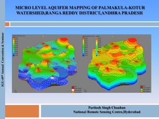
  • 1. MICRO LEVELAQUIFER MAPPING OF PALMAKULA-KOTUR WATERSHED,RANGA REDDY DISTRICT,ANDHRA PRADESH IGU-49thAnnualConvention&Seminar
  • 2. The Aquifer Geometry Varies in X-Y direction-(Spatial Variation) with depth (Vertical Variation) & Ground water Resources availability varies With Time Historical data to be considered for Modelling provides the Temporal variation & Management aspects Hydrogeological – Exploration & Well Inventory Methods Geo-Physical - VES Surveys Hydro-meterological – Rainfall Generation of 2D Layers GIS /Contour Layers Generation of 3-D Layers Ground Water Modelling MICRO LEVELAQUIFER MAPPING OF PALMAKULA-KOTUR WATERSHED,RANGA REDDY DISTRICT,ANDHRA PRADESH IGU-49thAnnualConvention&Seminar
  • 3. To decipher the 1. Spatial & Vertical disposition of aquifers/aquifer geometry. 2. Generation of 2D & 3D GIS layers/Micro level Aquifer Maps. 3. Ground water resources & yield characteristics of the aquifers. 4. Ground water planning & management of ground water Resources-watershed wise and Village wise. Objectives AQUIFER MAPPING OF PALMAKUL WATERSHED IGU-49thAnnualConvention&Seminar
  • 4. AQUIFER MAPPING OF PALMAKUL WATERSHEDIGU-49thAnnualConvention&Seminar
  • 6. CONTOURS SHOWING SUBSURFACE DISPOSITION OF AQUIFER IGU-49thAnnualConvention&Seminar
  • 7. SUBSURFACE AQUIFER GEOMETRY Third Aquifer Second Aquifer First Aquifer First Aquifer Second Aquifer Third Aquifer IGU-49thAnnualConvention&Seminar
  • 8. SUBSURFACE AQUIFER GEOMETRY Subsurface Aquifer Geometry Cross Section In X-Direction (Front View) Subsurface Aquifer Geometry Cross Section In Y-Direction (Lateral View) IGU-49thAnnualConvention&Seminar
  • 9. PREPARATION OF MICRO LEVELAQUIFER MAPS (A1) (A2) (B1) (B2) (C1) (C2) (D1) (D2) (A) (B) (C) (D) IGU-49thAnnualConvention&Seminar
  • 10. First Layer Second Layer Third Layer CONTOURS SHOWING HEADS DISPOSITION FLOW DIRECTION OF AQUIFERS IGU-49thAnnualConvention&Seminar
  • 11. 4. Model Simulation and Development for Management Plan for Ground Water Resource Management 1. Different Hydro-Geomorphological units are demarcated with integration of Remote Sensing and GIS data to field data. 2. With the Systematic vertical electrical sounding (VES) data 3-D water level map is been created. 3. The Ground Water prospect has been determined through both the approach and results are correlated to improve the ground water prospect Zonation . IGU-49thAnnualConvention&Seminar RESULTS