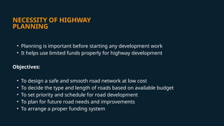
NECESSITY OF HIGHWAY
PLANNING
•Planning is important before starting any development work
• It helps use limited funds properly for highway development
Objectives:
• To design a safe and smooth road network at low cost
• To decide the type and length of roads based on available budget
• To set priority and schedule for road development
• To plan for future road needs and improvements
• To arrange a proper funding system
3.
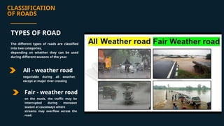
CLASSIFICATION
OF ROADS
All -weather road
Fair - weather road
on the roads, the traffic may be
interrupted during monsoon
season at causeways where
streams may overflow across the
road.
TYPES OF ROAD
The different types of roads are classified
into two categories,
depending on whether they can be used
during different seasons of the year.
negotiable during all weather,
except at major river crossing
4.
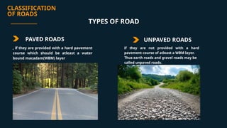
CLASSIFICATION
OF ROADS
PAVED ROADSUNPAVED ROADS
if they are not provided with a hard
pavement course of atleast a WBM layer.
Thus earth roads and gravel roads may be
called unpaved roads.
TYPES OF ROAD
, if they are provided with a hard pavement
course which should be atleast a water
bound macadam(WBM) layer
5.
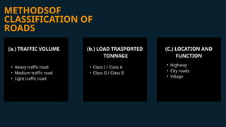
METHODSOF
CLASSIFICATION OF
ROADS
(a.) TRAFFICVOLUME
• Heavy traffic road
• Medium traffic road
• Light traffic road
(b.) LOAD TRASPORTED
TONNAGE
• Class I / Class A
• Class II / Class B
(C.) LOCATION AND
FUNCTION
• Highway
• City roads
• Village
6.
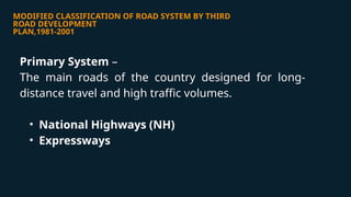
MODIFIED CLASSIFICATION OFROAD SYSTEM BY THIRD
ROAD DEVELOPMENT
PLAN,1981-2001
Primary System –
The main roads of the country designed for long-
distance travel and high traffic volumes.
• National Highways (NH)
• Expressways
7.
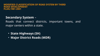
MODIFIED CLASSIFICATION OFROAD SYSTEM BY THIRD
ROAD DEVELOPMENT
PLAN,1981-2001
Secondary System –
Roads that connect districts, important towns, and
major centers within a state.
• State Highways (SH)
• Major District Roads (MDR)
8.
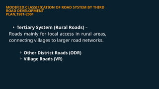
MODIFIED CLASSIFICATION OFROAD SYSTEM BY THIRD
ROAD DEVELOPMENT
PLAN,1981-2001
• Tertiary System (Rural Roads) –
Roads mainly for local access in rural areas,
connecting villages to larger road networks.
⚬ Other District Roads (ODR)
⚬ Village Roads (VR)
9.
CLASSIFICATION OF URBANROADS
Urban roads are managed by local authorities and are not included in the national road
development targets. Roads in urban areas, excluding expressways, are classified into four types:
• Arterial Roads: Main streets for through traffic on a continuous route, handling high traffic
volumes.
• Sub-Arterial Roads: Similar to arterials but with lower traffic mobility, connecting to arterial
roads.
• Collector Streets: Roads that collect and distribute traffic from local streets to arterials and sub-
arterials.
• Local Streets: Provide direct access to properties, serving the immediate neighborhood and
feeding traffic into collector streets.
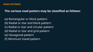
ROAD PATTERNS
The variousroad patters may be classified as follows:
(a) Rectangular or block pattern
(b) Radial or star and block pattern
(c) Radial or star and circular pattern
(d) Radial or star and grid pattern
(e) Hexagonal pattern
(f) Minimum travel pattern
12.
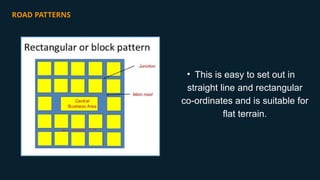
ROAD PATTERNS
• Thisis easy to set out in
straight line and rectangular
co-ordinates and is suitable for
flat terrain.
13.
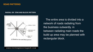
ROAD PATTERNS
The entirearea is divided into a
network of roads radiating from
the business outwardly. in
between radiating main roads the
build up area may be planned with
rectangular block.
RADIAL OR STAR AND BLOCK PATTERN
14.
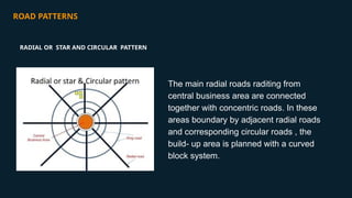
ROAD PATTERNS
The mainradial roads raditing from
central business area are connected
together with concentric roads. In these
areas boundary by adjacent radial roads
and corresponding circular roads , the
build- up area is planned with a curved
block system.
RADIAL OR STAR AND CIRCULAR PATTERN
15.
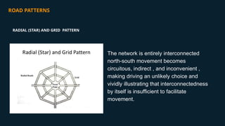
ROAD PATTERNS
The networkis entirely interconnected
north-south movement becomes
circuitous, indirect , and inconvenient ,
making driving an unlikely choice and
vividly illustrating that interconnectedness
by itself is insufficient to facilitate
movement.
RADIAL (STAR) AND GRID PATTERN
16.
ROAD PATTERNS
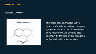
The entirearea is provided with a
network of roads formatting hexagonal
figures. At each corner of the hexagon ,
three roads meet the build up area
boundary by the side of the hexagon if
further divided in suitable sizes.
HEXAGONAL PATTERN
17.
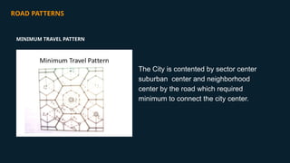
ROAD PATTERNS
The Cityis contented by sector center
suburban center and neighborhood
center by the road which required
minimum to connect the city center.
MINIMUM TRAVEL PATTERN