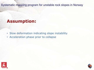
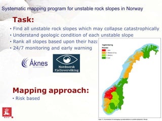
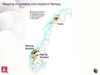
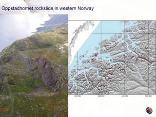
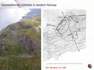
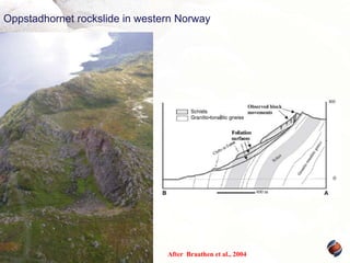
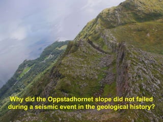
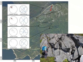
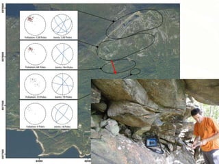
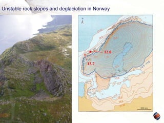
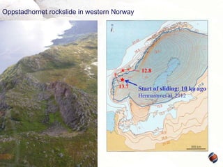
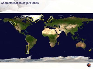
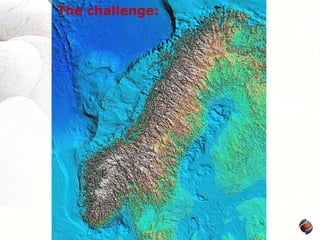
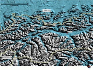
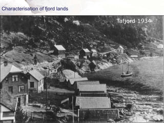
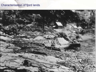
This document summarizes research on understanding long-term slope deformation and stability assessment of rock slopes, using the case study of the Oppstadhornet rockslide in Norway. It describes Norway's systematic mapping program to identify unstable rock slopes, characterizes fjord lands prone to rockslides, and details the geology and slip history of the Oppstadhornet rockslide which began moving 14,000 years ago as the glacier receded. Long-term low slip rates are important for detecting acceleration that could lead to failure, and many unstable slopes in Norway may be moving slowly since deglaciation.
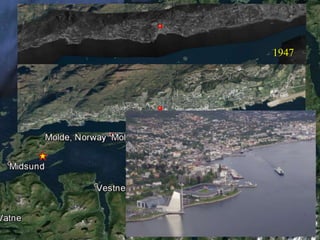
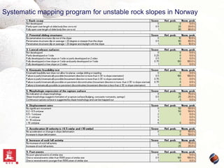
![Certain fjellskred events
Name
Tjelle
Tafjordulykka
Skafjellet
Lausneset
Loenulykke 1
Loenulykke 3
Pollfjellet
County
Møre og Romsdal
Møre og Romsdal
Møre og Romsdal
Møre og Romsdal
Sogn og Fjordane
Sogn og Fjordane
Troms
Municipality
Nesset
Norddal
Stranda
Stranda
Stryn
Stryn
Lyngen
Year
1756
1934
1731
1300
1905
1936
1810
Municipality
Sande
Stranda
Stranda
Norddal
Gaular
Årdal
Year
1700
1749
1938
1811
1786
1983
Volume
Displaceme
[Mm3]
Lives
nt wave
15.0
32
Yes
3.0
40
Yes
6.0
17
Yes
0
Yes
0.4
61
Yes
1.0
74
Yes
14
Yes
Uncertain fjellskred events
Name
Storefonna
Geirangerfjorden
Skafjellet
Arnafjord
Hestadfjorden
Årdalsfjorden
County
Møre og Romsdal
Møre og Romsdal
Møre og Romsdal
Sogn og Fjordane
Sogn og Fjordane
Sogn og Fjordane
Volume
[Mm3]
0.1
0.4
0.2
Lives
0
0
0
45
0
0
Displaceme
nt wave
Yes
Yes
Yes
Yes
Yes
Yes](https://image.slidesharecdn.com/3hermannsunderstandinglongtermslope-131031073505-phpapp02/85/Hermanns-understanding-long-term-slope-10-320.jpg)