
Recommended
Recommended
More Related Content
What's hot
What's hot (20)
Viewers also liked
Viewers also liked (19)
Similar to H0321046052
Similar to H0321046052 (20)
Recently uploaded
Recently uploaded (20)
H0321046052
- 1. The International Journal Of Engineering And Science (IJES) ||Volume||3 ||Issue|| 2||Pages|| 46-52||2014|| ISSN(e): 2319 – 1813 ISSN(p): 2319 – 1805 An Assessment of the Impact of Plot Standard on Physical Development: The Case Study of Kano Metropolis, Nigeria 1 1,2 Orekan, 2Atinuke Adebimpe Department of Estate Management, College of Environmental Sciences, Bells University of Technology, Ota, Ogun State. ----------------------------------------------------------------ABSTRACT------------------------------------------------------Kano State is one of the thirty- six (36) states in Nigeria offering good opportunity for human settlement due to its attractive terrain and adequate land space. Kano metropolis is congested consequent upon concentration of infrastructure and physical development. The aim of this paper is to assess the impact of plot standard on physical development in Kano Metropolis. To attain this aim, questionnaires were administered to a sample population of 650 property owners selected from six Local Government Areas that form the component of the study area. 460 (71%) copies of the questionnaire were retrieved. Interviews were also conducted among the property owners and staff of Kano State Ministry of Land and Physical Planning, and the Kano State Urban Planning and Development Authority (KNUPDA). It found that various approved plot sizes and unauthorised plot subdivisions are major factors aiding congestion in the study area and retarding physical development. It is recommended that government should strictly enforce the law that regulates physical development. KEYWORDS: plot size, metropolis, urban planning, physical development, Kano --------------------------------------------------------------------------------------------------------------------------------------Date of Submission: 06 November 2013 Date of Acceptance: 10 February 2014 --------------------------------------------------------------------------------------------------------------------------------------- I. INTRODUCTION Land is the ultimate resource, for without it, life on earth cannot be sustained. Land is both a physical commodity and an abstract concept in that the rights to own or use it are as much a part of the land as the objects rooted in its soil. Good stewardship of land is essential for present and future generation (UN-ECE, 2000). The role of land in the economy of nations may not be obvious, but it is of great significance. Without proper planning and making best use of this scarce resource, there can be no sustainable development. In seeking to create efficiency of the land market, land management affects value, and the type of land use is determined by physical characteristics and planning laws amongst other factors. By 1894, only Lagos territory was covered by the Land Registration Law while the Registration Ordinance No.2 was applicable in other parts of Nigeria. The Land tenure system was replaced by the “Land and Native Rights Proclamation” law introduced in the colony of Lagos and Southern protectorate in 1900 and in the Northern Protectorate in 1901. The two laws differ in content as a result of political interest. Under the Land Tenure Law, customary, freehold and statutory law were permissible in Lagos and other Southern part of the country while exclusive leasehold (statutory) was operated in the Northern part (Ukaejiofo, 2007). Before the amalgamation of the North and South, the colonial Government operated two different land tenure laws in the country but at the advent of amalgamation, Nigeria was divided namely North, West and Southern regions. Crown Land Act of 1918 was introduced. The Law was meant to cover the administration of Land and Native Proclamation Law which later became the Tenure Law of 1962 that governed land administration in the Northern region. The law in the North was used in the nationalisation of all lands in the country. These have made it possible for land in Kano State (one of the states in the northern part) to have a registered land title apart from the ones that were carved out and subdivided informally. The Crown Land Act covered only public lands in Lagos and the southern regions but did not cover the freehold interests. Historical evidences revealed that there had been in existence some towns like Gano, Debbi, etc, some years before Bagauda (a legendry founder of Kano). The concentration of settlements on hills, the sources of iron which the inhabitants melted and fabricated by the mid-fourteen century are responsible for the extension of building within Kano City mainly to the south east. www.theijes.com The IJES Page 46
- 2. An Assessment of the Impact of Plot Standard... The present Kano which was said to be formerly a sacred grove was used for sacrifices. The market established on the site formed the focus of the city. It enjoyed trade relations extending to the Mediterranean coast. A journey from Kano to Tripoli was along a route which used to take a year. Kano State borders Katsina State to the North- West, Jigawa State to the North east, Bauchi State to the South-east and Kaduna State to the South - West (Kano Year Book, 1999). Illegal plot sub-division is a matter which Government has to look into to assist in the physical development of Kano State. Subdivision is a situation where title is partitioned into individual unit holdings. Applicants seeking sub-division of plot are expected to submit on prescribed form with necessary enclosures, addressed to the Commissioner for Lands stating how a particular plot is to be subdivided. According to Imam (2011), plot sizes that were located to people in early 70’s to middle of 80’s in Kano State were 150ft x 100ft (45m x 30m) in the low density areas, 75ft x 50ft (22.5m x 50m) in the medium density area and 50ft x50ft (15m x15m) in the high density area. With rapid growth of cities due to urbanisation, there were unauthorised land developments or informal sub-divisions on the urban fringes or the centrally located areas to enable them have access to the Central Business District and places of work. With this, many government allotees of low density area informally subdivided the official plot sizes into smaller units. Later on, this spread to other areas in the high density areas like Dorayi Quarters, Gadan Kaya Quarters, Naibawa, Kawaji, Yankaba and Hotoro. II. LITERATURE REVIEW An unequal distribution of function of physical development have led to shortages of open and green spaces and reduction in the quality of urban development which could also be as a result of uncontrolled construction of buildings in cities. Lack of proper distribution and allocation of land has also led to land fragmentation. This normally results to low level of agricultural productivity (Mafi et al, 2012).To date, there has been no available information concerning Kano with regards to attempt at defining the effects of physical development as regards to plot standard and understanding the channels through which these effects operate. Unequal and substandard plot allocation may have adverse effect on land productivity. This is expected to be found out by this research. The process along with the fragmentation through succession from one generation to the next has drastically reduced size of land holdings of farmers and might have a negative impact on productivity and yield. According to oduwaye (2009), there are eight programmes required to achieve sustainable physical development in the less developed world. Some of these are promotion of land use planning and management; promotion of settlement planning and management in disaster –prone areas; promotion of sustainable construction Industry activities; and promotion of human resources development capacity building for human development. As physical development occurs in a particular state, it has effects on land, water resources and even on the atmosphere. Thus, the need to take advance action to prevent potential damage is necessary. Planning of a settlement, like other areas of specialisation has a credible role to play if sustainable physical development is to be achieved by any society. The Physical Planning Authority has a major central role in achieving sustainable physical development as regards plot standard and allocation, not just for the immediate development but also for generation yet unborn. Their judgement will strongly have effect on planning strategies and programmes. It is expected that a plan-document is used for physical development of human habitat. Oduwaye (2009) mentioned that by implication, urban planning provides the lead system for “building” the environment which is fundamental for attainment of sustained control and development. A proper physical development, city growth, city expansion depend greatly on the proper allocation processes and management of human settlement. This process involves the reconciliation of land uses, control development, provision of facilities services, protection of rules and laws and preservation of heritage amongst others. With proper monitoring and execution of duties by the physical planning authorities, it is hoped that there will occur positive achievement of sustainable development of cities. Jha (2005) reported that in developing economics land reform in particular, land re-distribution has occupied a major role in debates about poverty, especially chronic poverty alleviation in rural areas. If it were accepted that land distribution could alleviate poverty, the enthusiasm for such re-distribution needs to be tempered with the consideration of potential efficiency effects of land fragmentation. In seeking to create a strong economy, every country must implement strategies for planning and development so as to improve infrastructure and create a better environment. It is also the process of allocating resources, particularly land in order to achieve maximum efficiency while respecting the nature of the environment. In this respect, the Land Administration Guideline (2003) provided that land registration must operate in conjunction with physical planning, since it involves measures that create new sub-divisions of land and new pattern of land use, while www.theijes.com The IJES Page 47
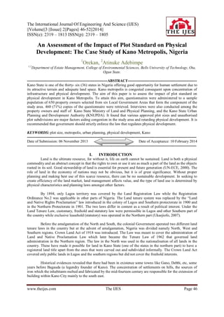
- 3. An Assessment of the Impact of Plot Standard... land policy and physical planning should involve detailed maps in implementing development of plans and also knowledge about ownership rights and other rights in land. III. THE STUDY AREA Kano is the commercial nerve centre of the North-Western part of Nigeria, covering land size of 20,131km2. The study area covers 499km2 and according to the 2006 Population Census, Kano State has a population of 9,383,682 with 44 Local Government Areas (Wikipedia, 2012). Kano city offers good opportunity for human settlement. It is a dry plain agriculture land that provides opportunity for grazing, accessibility and mobility of people and materials. Dala Hill is the most featured around the ancient city around which a nucleus of temporal and spatial patterns of settlements are formed growing into notable modern areas as shown in Fig. 1 Figure 1: Kano Metropolis Source: GIS Lab, Bayero University Kano According to Olofin (1987), the dating of man-made relics suggested that the earlier settlers engaged in iron smelting culture at about 320-380AD. This implies that people must have been there for more than one thousand years to develop such skills of iron smelting. Development of settlement is said to criss-cross centuries starting as isolated groups of hunters on and around the hills- Dala, Goron dutse, Magwan, Bompai and Panisau all in the present day kano Metropolitan. Kano city had survived as far back as the 11 th and 12th century during the period of Sarki Jusa, when the first phase of city wall construction project finished (Kano Year Book, 2010).Liman and Adamu (2003) opined that by the time Lord Luggard took over the administration of Northern Nigeria, he estimated forty walled towns within 30miles radius of Kano city and a total of 170 walled towns in the whole province. As at the early days of Colonial rule, Kano cosmopolitan nature had increased remarkably sequel to the economic and political windows of opportunity coming to its ways. It also increases the nationalities and ethnic groups in Kano, like the Fulani, Yorubas, Arabs (Lebanese, Egyptians, Saudis, Yemen and Syrian), Nupes, Ghanaians, and Senegalese etc. These people prefer to stay at the Government Reserved Areas, where they are entitled to the basic facilities. The Yorubas and Igbos settled in Sabo Gari area of the metropolis.In the 50’s, the layout for the colonial Administrators were called European Residential Areas (ERA) before they were renamed Government Residential Area (GRA) after attaining independence in 1960. The haphazard growth of Kano City is due to lack of developmental control by the planning authority. The planning authority approves 50ftx50ft (15.24m x15.24m) as standard plot sizes, and plots with bigger size is usually sub-divided informally into smaller sizes. IV. RESEARCH METHOD Field survey method was used for data generation and it included the design, pre-test and administration of self-administered questionnaires to land/property owners. A multi-stage sampling technique was used to administer questionnaires to six hundred and fifty (650) property owners in six (6) Local Government Areas that form the component parts of the study area. Out of the total number of questionnaires, four hundred and sixty were retrieved (representing 71% response rate). www.theijes.com The IJES Page 48
- 4. An Assessment of the Impact of Plot Standard... In addition, oral interview was conducted amongst the property owners and civil servants at Kano State Ministry of Land and Physical Planning, and Kano State Urban Planning and Development Authority (KNUPDA). The questionnaire to private owners prompted for answers to issues relating to duration of ownership, reason for choice of location, and owner’s educational background. Data were analysed using microsoft excel to enable comparison of variables which the study requires. The relationship between property titles, property location, and plot sizes were analysed. In respect of the interview with civil servants, the focus was on approved plot standards by the government for sub-division of plots, carve-outs and impact of the State Ministry of Land and KNUPDA on un-authorised plot sub-division. Descriptive statistics in form of tables and theoretical analysis were adopted for data that are not numerical in nature. V. ANALYSIS AND RESEARCH FINDINGS Out of 460 returned questionnaires, 344(representing 75%) were male. Table 1: Respondents’ characteristics: Sex Respondent Percentage Male 344 Female 116 25 460 Total S/ No 1. 75 Table 2, shows the reasons for ownership within the metropolis. Table 2: Reasons for ownership of land within the metropolis: Options Respondents Percentage Concentration of 167 36 Infrastructures 2. Accessibility to CBD 134 29 3. Constant power supply 96 21 4. Adequate Security 63 14 460 100 Total From Table 2, at least 167(36%) choose to be in the metropolis due to infrastructures within the metropolis, 134(29%) respondent stayed due to accessibility to the CBD. This table revealed that Infrastructural facilities are mainly concentrated within the metropolis. Because of this, illegal plot sub-division in the metropolis will be on the increase as people will continue to compete for land. In determining the level of education of the respondents and establishing the relationship between this and decision to acquire plots of land, the available educational Institutions offering literacy options were considered as shown in Table 2. Table 3: Duration of Property Ownership: S/ No Duration (year) Respondents 1. Less than 1 57 2. 1- 5 72 3. 6- 10 109 4. 11-15 101 5. More than15 121 Total 460 Percentage 12 16 24 22 26 100 From Table 3, at least 331(72%) had owned the property for more than six years, while only129 (28%) had been owners for up to five years. This revealed that a majority of the property owners had owned property in the metropolis in Kano State for many years. This could also be as a result of the availability of basic facilities within the metropolis. www.theijes.com The IJES Page 49
- 5. An Assessment of the Impact of Plot Standard... In determining the level of education of the respondents and establishing the relationship between this and decision to acquire plots of land, the available educational Institutions offering literacy options were considered as shown in Table 2. Table 4: Educational Background S/No Background Respondent 1. Quranic School 164 2. Primary School 91 3. Secondary School 76 4. Higher Education 129 Total 460 Percentage 36 20 16 28 100 164 (36%) of the respondents had Quranic education; 91(20%) had primary education; and 205 (44%) had secondary and higher education. The percentage number of owners with higher education is significant and they also partake in acquiring plots of different sizes which may likely have impact on the development pattern of the study area. From the field survey, property owners have different property titles which were detailed out in table 4. Table 5: Types of Property Title S/No. Option 1. Letter of grant 2. Certificate of Occupancy 3. Certificate of occupancy Sub-divided 4. Carve-out 5. No title document (Unauthorised sub-division) Total Respondents 68 130 59 48 Percentage 15 28 13 10 155 460 37 100 Table 4 revealed that the number of respondents with certificate of occupancy is 130 (28%); the number of people that formally sub-divide their title paper is 59(13%). This implies that the number of authorised subdivision plots is small. Owners with no title documents are significant; they are 155(37%). This will result to people acquiring plots with no standard size. Plots will be sub-divided into any sizes that suit their purpose. Table 6 indicates the areas affected with authorised and unauthorised title documents. Table 6: Location of Property and Property Titles S/No. Location *(C. of. O) (C.of.O (Letter of grants) (carve-out) (No title document) Subdivided) 1. Nassarawa 28 12 7 11 41 2. Gwale 13 11 3. Municipal 31 4 4. Dala 15 8 5. Tarauni 17 21 6. Fagge 26 3 *C.of.O—certificate of occupancy 10 15 13 11 12 5 2 6 10 14 29 14 31 21 19 From Table 6, Nassarawa, Gwale and Municipal areas, 72 (55%) had title document (certificate of occupancy), registered by the government. The population of respondents with unauthorised titles is 84(54%), this is close with the ones having registered title and it is across the study area.In confirming the plot sizes acquired by owners in the study area, it was detailed out in Table 7. www.theijes.com The IJES Page 50
- 6. An Assessment of the Impact of Plot Standard... Table 7: Plot sizes and Population of Owners S/No. Area/sqm Respondent 1. 1,350 60 2. 450 113 3. 337.50 105 4. 225 79 5. 56.25 and less 103 Total 460 Percentage 13 25 23 17 22 Table 7 revealed that about 60(13%) had plots which are approximately 1,350sqm in size. 218 properties have between 337sqm and 450sqm plot sizes. These could be considered as medium sized plots. 183 properties have approximately between 56sqm and 225sqm sizes of plots. These are small, fragmented plots. Looking at the three categories of properties noted above, (that is large, medium and small plots) the properties in the large and medium categories stand the chance of being sub-divided by their owners, judging by the experiences attested to by the officials of the Ministry for Land and Physical Planning of Kano State. The study went further to identify some other reasons why the property owners sub-divide plots into smaller sizes. This is detailed out in Table 8. Table 8: Other reasons for Plot Sub-division Challenges Ranking 1. Financial incapability 125 2. Lack of rigid Government law to plot subdivision 94 3. High cost of land 101 4. Family size 25 5. Competition with other property owners 38 6. Closeness to friend & Relatives 77 460 Apart from concentration of infrastructure that was revealed in table 2 as one of the main reasons why owners will want to acquire plots of land in the metropolis, financial incapability is also ranked as one of the reasons why owners will want to purchase smaller plots of land. Some of them are low income earners (salary earner), so they believe they can only go for smaller plots with reduced prices. No Government law monitoring development and plot acquisition within the metropolis. Owners are left to sub-divide informally without any check. VII. RECOMMENDATION AND CONCLUSION From this study it was revealed that all the options listed in table 2 and table 8 have impact in the development of Kano metropolis. Apart from plots that were carved-out by the Ministry of Land, any other subdivision of plots that does not pass through Kano State Planning Authority is illegal. In seeking strong economy, every country must implement strategies for planning and development so as to improve infrastructure and create better environment. One would expect that the basic amenities are extended through the state and not the metropolis alone. Kano State is known to be an old city and physical development should have been circulated. A concerted effort according to Imam, 2011 by both the government and people to eradicate the practice of abusing set plans like the layouts through effective awareness raising campaigns should be encouraged. Government has a lot to do in ensuring that physical development extends outside the metropolis to encourage growth and development in Kano State. The officials of the State Ministry of Land and Physical Planning and the Kano State Urban planning and Development Authority representing government in plot allocation should be empowered to stop any allottee from subdividing his plot, even though he is required to apply formally to the ministry before undertaking such action. Development control has to abide by the Land Use Act of 1979 which vests all major decisions on the State Governor. Thus, development control officials can only issue warnings to an errant developer. Kano state government in collaboration with the ministries in charge should standardise building plots and control the number of people acquiring plots in a particular area. Shehu,(2004) opined that the number of people who should reside in a unit area and how many buildings could be built on a given size or area of land should be controlled. Land policies should be such that they are regulated and structured to ensure that land rights and interests remain in a politically, socially and economically acceptable balance for the state to develop. With the understanding of the culture of the people known to have large families, bigger plot sizes will really assist in the physical development of the state and prevent over-crowding and insecurity in the state. www.theijes.com The IJES Page 51
- 7. An Assessment of the Impact of Plot Standard... Also it was deduced from this research that Kano State Urban Planning Authority with collaboration of the Ministry of Land and Survey are enablers to transform land management and development in Kano State to meet global demand such as urbanisation and environmental management. With this, Kano can crawl out of its single city state syndrome to a more developed state, taking into consideration social, legal, cultural and economic circumstances. Accessibility of layouts should be improved so that allotees would be motivated to develop and reside outside the metropolis, while simplified process and procedures involved in the formal or authorised subdivisions should be established by government to prevent corruption. Kano state Urban Planning Authority should aim at enriching the economic potentials of the people by the formation of partnership by all other professionals such as town-planners, estate surveyors & valuers, architects, and lawyers coming together to form environmental advocates groups and consultants.In conclusion, since Kano State has vast land, a policy could be made by the government dictating a standard size of at least 150ftx150ft for Industrial, Commercial areas and 100ftx75ft for residential plots; this will assist the growth of the areas outside the Kano metropolis. REFERENCES [1] [2] [3] [4] [5] [6] [7] [8] [9] [10] [11] [12] [13] [14] Imam, M. Z. (2011). The Impact of Unauthorised Subdivisions of Residential Plots in Gadan Kaya, Kano City. Malaysia Journal of Society and Space 7(2) 1-10. Jha et al (2005). Land Fragmentation and its Implication for Productivity: Evidence from Southern India. Australia South Asia Research Center Working Paper 2005/01Jianquan. C, Ottens. H, Masser I. Understanding urban growth system: the theories and methods. (cited 5/08/2012), available on www.itc.eu/library/papers Oduwaye.L. Challenges of Sustainable Physical Planning & Development in Metropolitan Lagos (2012). Journal of Sustainable Development, Vol.2, No1, March, 2009, Pg.160-163 Kano Year Book (1999), http://kano.gov.ng/new, accessed on Oct, 2012. Liman, M. A. and Adamu, Y.M (2003). Kano in Time and Space: From City to a Metropolis in Perspectives of Kano-British Relations.Kano: Hambolu M.A. GIDAN Museum Mabogunje, A. L. (2009). Land Reform in Nigeria: Progress, Problems and Prospect. A Technical Report as Chairman Presidential Technical Committee for Land Reform. Mafi .E, Roshami. P, Hassani. A, Ali.S, Poul.H (2012.), Analysing of Reduction Process of Urban Open Spaces in Process of Cities Development with Emphasis on Crisis Management in Tehran Metropolis. International Journal of Applied Science and Technology. Olofin, E. A. (1987). Some AspectS of the Physical Geography of Kano Region and Related Human Responses. Departmental Lecture Notes Series No. 1, Geography Department, Bayero University, Kano. Oduwaye, L. (2009). Challenges of Sustainable Physical Planning and Development in Metropolitan Lagos. Journal of Sustainable Development, 2(1), PP Ukaejiofo, A. N. (2007). The Future of Land Administration in Nigeria. A paper presented at the Cambridge Conference held at St. John’s College, Cambridge UK, July15-20, 2007. UN-ECE(2000), Land administration guidelines, UN-ECE, Geneva. Shehu A (2004) Fragmentation of plots in Government Residential Areas (GRA) of Kano Metropolis (MSc thesis). Department of Geography, Bayero University Kano, Nigeria. www.theijes.com The IJES Page 52