The Columbia Tap Trail in Houston, which is a 4-mile hike and bike path, has reopened after being closed for construction of METRO's Southeast light-rail line. METRO has made improvements to the trail including new landscaping and irrigation. The light-rail line is expected to open in 2014 and will connect downtown Houston to local universities. METRO worked to reopen the trail as quickly as possible while maintaining access for bicyclists during construction of the nearby light-rail project.
Modes of transportation and its importance
Classification of roads
Types of pavements
Cross sections of road and railway
Causes of damage to roads
Traffic signs and signals
Significance of transportation in nation's development
Role of engineers in transportation.
Detailed presentation of Arch and cable stayed bridge connecting bandra to worli in Mumbai.One of the traffic decongestion efforts by Municipal corporation of Bombay.
Lee Highway, U.S. Route 29 Phase III WideningFairfax County
This project consisted of construction of a box culvert extension, concrete sidewalk, asphalt trail, curb and gutter, 24-inch water line relocation, 8,650 feet of additional asphalt pavement, two bio-retention filters, five signalized intersections, and other related items.
Innovation in Civil Engineering and their Impact on Communities .
Civil Engineering Innovations,. in the Bandra - Worli Sea Link Project , Mumbai .Technical Instances of the Duttabad Constraint .
Case Study #5 for UTCM Report #08-14-03 "Making Mobility Improvements a Community Asset: Transportation Improvements Using Context-Sensitive Solutions"
"West Houston (TX): An introduction to the plan that links people, places and communities."
Read along: http://www.energycorridor.org/…/med…/parks/WHTMP-8-Pager.pdf
Photo credit: The Energy Corridor, Houston TX.
LYNX Blue Line Extension Construction UpdateLeslie Blaser
This public meeting will inform the community about the progress of the light rail extension, answer questions, and share the overall vision for the Blue Line Extension alignment.
Supported by The Rockefeller Foundation, this ebook highlights a dozen of CityLab's favorite stories from the 2014 series on how Americans will travel tomorrow.
Hastings Way Redevelopment by Jeremy Gragert volumeone
Way back in 2006, Eau Claire citizen Jeremy Gragert created a proposal to increase bicycle/pedestrian access along and across Hastings Way, add area beautification, and increase general safety. He focused on the stretch between Birch Street and East Clairemont Avenue. This is the PowerPoint presentation he used while speaking to various local groups.
Streetcars in Portland, Maine is a presentation created by David A. Marshall. The slideshow as first presented in September 2012 at the event, "Green Evolution: Streetcars in the 21st Century in Maine" at the Maine Irish Heritage Center. Marshall a City Councilor in Portland, Maine and the Chair of the Transportation, Sustainability, and Energy
GuidryNews.com_Columbia Tap Hike and Bike Trail 2011
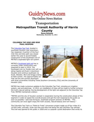
1. Transportation
Metropolitan Transit Authority of Harris
County
News Release
Wednesday, December 21, 2011
COLUMBIA TAP HIKE AND BIKE
TRAIL REOPENS
The Columbia Tap Trail, located in
southeast Houston near downtown,
has reopened. A portion of the four-
mile hike and bike path was closed
earlier this year to accommodate
construction of the Southeast Line of
METRO’s expanded light-rail system.
METRO’s Southeast light-rail line is
currently under construction and
expected to open in 2014. The
Southeast Line (or Purple Line) will run
along Capitol and Rusk in downtown
Houston and continue southeast via
Scott, Wheeler, MLK and Griggs ending
at Palm Center. The approximately six-
mile rail line will connect downtown
with local universities including Texas Southern University (TSU) and the University of
Houston (UH).
METRO has made numerous updates to the Columbia Tap Trail, including an irrigation
system, sod and plantings. In 2012, an installation of trees will be made to further enhance
the trail’s natural setting. During development of the light-rail adjacent to the Columbia Tap
Trail, METRO maintained a detour.
“METRO and the city of Houston worked in cooperation during the construction phase of this
segment in order to speed the overall process and get the trail reopened to the public as
soon as possible,” said Jose Enriquez, southeast program director at METRO. “The
community can once again enjoy the trail’s access, natural beauty and rich history.”
The Columbia Tap Trail is a “Rails-to-Trails” conversion project made up of four miles of a
10-foot wide, concrete, multi-use hike and bike trail along the old Columbia Tap railroad.
The trail was opened to the public in 2009 and is a popular cyclist destination that winds its
2. way through Houston’s Third Ward, the city’s oldest and most historic African-American
community.
“It is essential that all large-scale transportation improvement projects address pedestrian-
bicyclist safety and mobility, not only in the design of the project, but during its construction
as well. We applaud METRO for developing and maintaining the bicyclist detour while
expediting the completion of this segment of the rail project and restoring this important
segment of the Columbia Tap Trail,” said Dan Raine, Bicyclist - Pedestrian Coordinator,
Public Works and Engineering Department, city of Houston.
About the Columbia Tap Trail
The Columbia Tap Trail connects the neighborhoods along the tap with the bikeway network's
existing designated Polk bike lanes, McGowan and Alabama bike routes, Brays Bayou Trail, and
the Dixie bike route which includes a bicycle and pedestrian bridge across Highway 288. These
bikeways add east and west connections to the greenway adding to its transportation benefits.
The Columbia Tap Trail extends from Dixie Drive past Polk Street and into downtown, along the
former Union Pacific Railroad right-of-way creating a greenway corridor in the Third Ward and
downtown area. It is bound by Dowling Street on the west and Scott Street on the east.
About gometrorail.org
GOMETRORail.org is a website that provides helpful information about METRORail’s
expansion project in Houston. Visitors can find a full list of businesses along the rail lines
that are under construction. With 40,000 passengers per day, Houston’s METRORail Red
Line is the nation’s most heavily traveled light rail line, based on boardings per-track mile.
There are three additional lines under construction and two more planned for the future.
- See more at:
http://www.guidrynews.com/story.aspx?id=1000039825#sthash.qp4ESqxv.dpuf